
.gif)
State Route 2 (California)
Encyclopedia
State Route 2 is a state highway
in the U.S. state
of California
. It runs from the junction of Lincoln Blvd and Interstate 10
in Santa Monica
to SR 138
east of Wrightwood, running concurrent
with U.S. Route 101 (US 101) and Interstate 210
(I-210).
county line.
SR 2 is part of the California Freeway and Expressway System
and is eligible for the State Scenic Highway System
. However, only the portion of SR 2 from a point north of the I-210 interchange to the San Bernardino county line is actually designated as a scenic highway by Caltrans.
of Santa Monica at Centinela Avenue. From Centinela Avenue, Route 2 heads northeast on Santa Monica Blvd., where it heads northeast through the wealthy areas of West Los Angeles
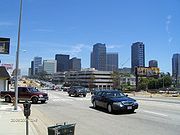
, Westwood
, Century City
, and Beverly Hills
before entering the decidedly urban West Hollywood
. Santa Monica Boulevard, being a major street, is for most of its length at least four lanes wide.
 At the west end of its run, Santa Monica Boulevard starts off Ocean Avenue in Santa Monica. From there until Sepulveda Boulevard
, Santa Monica Boulevard is a densely urban commercial street. Most of the Westside
car dealerships are located on Santa Monica Boulevard. After Sepulveda, Santa Monica Boulevard passes by Century City and its shopping center, and intersects with Wilshire in Beverly Hills. After intersecting with Wilshire in Beverly Hills, Santa Monica Boulevard continues northeast towards West Hollywood, spanning Beverly Boulevard
and Melrose Avenue
. At Holloway Drive, in the middle of West Hollywood, Santa Monica, now north of Melrose Avenue
turns to run east. In West Hollywood, between Fairfax Avenue and Doheny Drive
along Santa Monica Boulevard, bronze name plaques are embedded in the sidewalks as part of the West Hollywood Memorial Walk
. One of the most famous spots for male prostitution
and transgender
prostitution is Santa Monica Boulevard in the Hollywood
area, the area along Santa Monica Boulevard east of La Brea Avenue
. SR 2 continues east through Hollywood on Santa Monica Boulevard to the Hollywood Freeway.
 Santa Monica Boulevard merges on its eastern end with Sunset Boulevard
in the Sunset Junction neighborhood of Silver Lake
. Metro Local
line 4, Metro Rapid
line 704 and Santa Monica Transit line 1 operate on Santa Monica Boulevard. The Metro Red Line serves an underground station on Santa Monica Boulevard at its intersection with Vermont Avenue
.
The south roadway of Santa Monica Boulevard, often called Little Santa Monica Boulevard in Beverly Hills, runs parallel to the State-highway (north) roadway of Santa Monica Boulevard from the city's west limit to Rexford Drive. After Rexford Drive, Little Santa Monica turns east, becoming Burton Way. Burton Way merges into San Vicente Boulevard
at its intersection with La Cienega Boulevard
. It is noted that the south roadway of Santa Monica Boulevard in Beverly Hills is a city street while the north roadway of Santa Monica Boulevard is a California state highway, each roadway handling bi-directional traffic.
Route 2 then merges onto U.S. Route 101 (the Hollywood Freeway
) and heads southeast leaving US 101 at the Alvarado Street exit.
. The route then branches northeast onto the Glendale Freeway, a peculiar north–south route with an east–west demarcation. The Glendale Freeway runs near the communities of Glassell Park
and Eagle Rock
. After its interchange with SR 134, the route follows a mountain ridge through a valley as it flanks the east side of Glendale
. The freeway ends at Foothill Boulevard in La Cañada Flintridge
; just before reaching Foothill Boulevard, SR 2 turns off the Glendale Freeway onto the eastbound Foothill Freeway (Interstate 210) for a short while until reaching the Angeles Crest Highway exit. The Glendale Freeway is originally proposed to continue though Echo Park all the way to US-101
, but since the plans are now scrapped, the freeway is relatively isolated from the rest of the freeway system. The freeway is also very wide at 5 lanes per direction. With the forementioned and the fact that the freeway is relatively short means that it is never congested, even at rush hour.
 The route turns north onto the Angeles Crest Highway
, cutting through an obscure mountainous portion of Pasadena
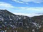
. This route winds generally east-northeast through the canyons of the San Gabriel Mountains
for over 80 miles (130 km), before descending through Big Pines
and Wrightwood
to the edge of the Victor Valley approximately 20 miles (32 km) west of Hesperia
and ending at SR 138
. Starting in La Cañada-Flintridge
at an altitude of 1,300' (394m) the highway climbs to a high point of 7,903' (2,395m) at Dawson Saddle. The eastern portions of the Angeles Crest Highway are notoriously dangerous, with many switchbacks and blind curves, and are often closed during occasions of heavy winter snowfall. The highway is generally closed between Islip Saddle and Vincent Gap from mid-December to mid-May due to snow and rockfall.
Before the segment of the Glendale Freeway was built between Glendale Boulevard and just west of the Los Angeles River, Route 2 began at the Hollywood Freeway on Santa Monica Boulevard, continued east to Myra Avenue, then north on Myra Avenue, east on Fountain Avenue, northeast on Hyperion Avenue, southeast on Rowena Avenue, southeast on Glendale Boulevard, and northeast on Fletcher Drive to just west of the Los Angeles River. From west of the Los Angeles River, Route 2 continued on the Glendale Freeway to its temporary connection with Fletcher Drive at Avenue 38 and then followed the routing described in the previous paragraph to Route 138 northeast of Wrightwood.
to build the segment through that city. At one time, the department considered building a cut-and-cover tunnel under Beverly Hills, but even this proved a non-starter, and the freeway plan west of Route 101 was quietly cancelled in 1975. Currently, the Glendale Freeway begins as a stub at Glendale Boulevard. A freeway-wide bridge was built over Glendale Boulevard in hopes that the freeway would be built further west. Today, the bridge serves as the westbound lanes of Route 2, connecting the southwestbound freeway lanes to southbound Glendale Boulevard. A more modest freeway/expressway extension to Route 101 has been discussed.
Planners originally intended for it to connect to the Hollywood Freeway
near the Vermont Avenue interchange, but community opposition killed the project by the 1960s; as a result, during games at nearby Dodger Stadium
, there is often significant congestion in the areas around the freeway's terminus. The Glendale Freeway offers stunning vistas of the eastern San Fernando Valley
, the Verdugo Mountains
, the Crescenta Valley
, and the San Gabriel Mountains
.
In the 1960s, the city of Beverly Hills
had begun a transition from a quasi-exurban
retreat for the entertainment industry to its current status as one of the world's premier shopping and culinary destinations. Building a freeway along Santa Monica Boulevard, the northwestern border of the city's emergent "Golden Triangle" shopping district, did not fit into city fathers' vision for Beverly Hills' development. Moreover, it was feared that a freeway would exacerbate the already evident divisions between the fabulously wealthy residents of the hilly areas north of Santa Monica Boulevard and the merely affluent ones to the south. A proposed cut-and-cover tunnel for the freeway failed to generate sufficient political support, and by the mid-1970s the project was essentially dead.
California State Senator (later Congressman) Anthony Beilenson was one of the leading opponents of the project.
Caltrans
' decision not to build the freeway was both harmful and beneficial to the areas along its proposed route. The massive Century City
high-rise commercial development just west of the Beverly Hills city limits was built with freeway access in mind. For many Century City workers who live in Los Angeles' eastern suburbs, the quickest way home takes them through the residential district of Cheviot Hills
, which has caused consternation among its well-heeled residents. For Beverly Hills, the decision helped preserve much of its emergent downtown, but at the cost of creating gridlock on Wilshire Boulevard
and I-10.
Starting in July, 1964, Route 2 began in Santa Monica at its junction with Routes 1 and 10. After heading a few blocks northwest on Lincoln Boulevard, the route turned northeast on Santa Monica Boulevard, just several blocks from the Pacific Ocean
. The route continued on Santa Monica Boulevard to Centinela Avenue
.
For its entire length, until the tracks were removed, Santa Monica Boulevard followed the tracks of the Pacific Electric Railway
. In the portion from Holloway Drive in West Hollywood to Sepulveda Boulevard
in West Los Angeles, the tracks were in a separate right-of-way, with two roadways, one on each side of the tracks. For the rest of the route, the tracks ran in the traffic lanes.
Except for a short portion at its eastern end, Santa Monica Boulevard was adopted as a state highway in 1933. From 1934 to 1936, it was signed as State Route 2. Then it became U.S. Route 66. When U.S. Route 66 was truncated to Pasadena
in 1964, Santa Monica Boulevard once again became State Route 2 as far east as the Hollywood Freeway
. Today, the State Route 2 portion of Santa Monica Boulevard is defined from the Santa Monica/Los Angeles city limits to US 101.
From 1936 to 1964, U.S. Route 66 ran along Lincoln Boulevard from its junction with Alternate U. S. 101 (now California Route 1) and California Route 26 (now replaced by Interstate 10) to Santa Monica Boulevard and along Santa Monica Boulevard from Lincoln Boulevard to the Hollywood Freeway. US 66 turned southeast on the Hollywood Freeway with US 101. At that time, Route 2 began on Alvarado Street at the Hollywood Freeway. As is today, Route 2 traversed Alvarado Street and Glendale Boulevard to the Glendale Freeway. Route 2 continued on the Glendale Freeway to a temporary connection with Fletcher Drive at Avenue 38 in the Atwater district of Los Angeles. From the temporary connection, the route ran northeast on Fletcher Drive, and north on Verdugo Road to its south intersection with Cañada Boulevard in Glendale. From the south intersection, Route 2 headed north on Cañada Boulevard to its north intersection with Verdugo Road, north on Verdugo Road, and east on Verdugo Boulevard, before reaching Foothill Boulevard in La Cañada-Flintridge. Route 2 continued approximately one mile southeast on Foothill Boulevard with California Route 118 to Angeles Crest Highway. From Foothill Boulevard, Route 2 continued north on Angeles Crest Highway, where it continues to this day.
Today, the California Transportation Commission is relinquishing the street
-running parts of Route 2 to local cities which it runs through. In 1996, state law was changed to permit the relinquishment of Route 2 in Santa Monica and West Hollywood. When the relinquishment in Santa Monica went through in 1998, the portion from Route 1 to Centinela Avenue was deleted. The law was changed again in 2001 to allow Route 2 from Route 405 to Moreno Drive to be relinquished to the City of Los Angeles
. In 2003 California
Senate Bill 315 was chaptered, acknowledging the relinquishments within Santa Monica, West Hollywood, and from Route 405 to Moreno Drive in Los Angeles, and permitting the relinquishment of Route 2 in Beverly Hills. Whether Route 2 west of Route 101 will stay as a paper route after relinquishment is yet to be determined.
Since the 1950s, proposals have been made to extend the Glendale Freeway to the Antelope Valley Freeway via a tunnel
under the San Gabriels, relieving some of the latter freeway's notorious congestion. The difficulty of designing and building such a route (designated SR 249) and the cost of insuring it against earthquake
s and terrorism
would undoubtedly make perpetually cash-strapped Caltrans unable to undertake such an ambitious project.
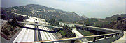 The section of freeway between the Ventura Freeway
(134) and the Foothill Freeway (210
) was largely completed in 1975, but not fully finished until 1979. During this time, the closed freeway was used as a location for several films, including Coffy
, Corvette Summer
, The Gumball Rally
, Death Race 2000
, Hardcore, and several American television series including "Adam-12
", "Emergency!
" and "CHiPs
". The transition overpass from the eastbound Ventura Freeway
to the northbound Glendale Freeway was prominently featured in the notorious disaster film
Earthquake when a livestock truck and two cars crash over the side of the overpass (a shot completed in miniature special effects). Because the freeway lacks traffic and is not very busy (having numerous alternatives), the section between the Ventura Freeway
(134) and the Foothill Freeway (210
) is still utilized as a filming location.
{| class=wikitable
|-
!County
!Location
!Postmile
!Exit
!Destinations
!Notes
|-
|rowspan=47|Los Angeles
LA L0.00-82.27
|rowspan=3|Santa Monica
|L0.00
|
| – LAX Airport
|Continuation beyond I-10
|-
|L0.00
|
|
|Interchange
|-
|rowspan=2|2.31
|rowspan=2|
|rowspan=2|Centinela Avenue
|rowspan=2|West end of state maintenance
|-
|rowspan=5|Los Angeles
|-
|3.65
|
|
|Interchange; former SR 7
|-
|3.68
| colspan="3" style="text-align:center;"|East end of state maintenance
|-
|3.80
|
|Sepulveda Boulevard
|
|-
|rowspan=2|5.91
| rowspan="2" colspan="3" style="text-align:center;"|West end of state maintenance
|-
|rowspan=3|Beverly Hills
|-
|6.20
|
|Wilshire Boulevard
|
|-
|rowspan=2|7.74
| rowspan="2" colspan="3" style="text-align:center;"|East end of state maintenance
|-
|rowspan=4|West Hollywood
|-
|8.69
|
|La Cienega Boulevard
|
|-
|9.57
|
|Fairfax Avenue
|
|-
|rowspan=2|10.62
| rowspan="2" colspan="3" style="text-align:center;"|West end of state maintenance
|-
|rowspan=22|Los Angeles
|-
|10.90
|
|
|
|- style="background:#dfd;"
|12.74
5.55Indicates that the postmile represents the distance along US 101 rather than SR 2.
|
|
|Interchange; west end of US 101 overlap; Santa Monica Boulevard was former US 66
east
|-
| colspan="4" style="text-align:center;"|West end of freeway on US 101
|-
|4.85
|6B
|Melrose Avenue
, Normandie Avenue
|
|-
|4.40
|6A
|Vermont Avenue
|
|-
|3.76
|5B
|Silver Lake Boulevard
|
|-
|3.34
|5A
|Rampart Boulevard, Benton Way
|
|-
| colspan="4" style="text-align:center;"|East end of freeway on US 101
|- style="background:#dfd;"
|2.86
12.75
|
|
|Interchange; east end of US 101 overlap
|-
|13.19
|
|Sunset Boulevard
|Former US 66
|-
|13.59
|
|Glendale Boulevard south
|
|-
| colspan="4" style="text-align:center;"|West end of freeway
|- style="background:#fdd;"
|14.21
|12
|Glendale Boulevard north
|No eastbound entrance; no exit number eastbound
|-
|14.95
|13A
|Riverside Drive
|Signed as exit 13 eastbound
|-
|15.14
|13A
|
|Signed as exit 13 eastbound
|- style="background:#fdd;"
|15.52
|13B
|Fletcher Drive
|Westbound exit and eastbound entrance
|-
|16.01
|14
|San Fernando Road
|
|-
|R17.00
|15A
|Verdugo Road
|Signed as exit 15 eastbound
|- style="background:#fdd;"
|R17.29
|15B
|York Boulevard
|Westbound exit and eastbound entrance
|- style="background:#fdd;"
|R18.52
|16
|Colorado Boulevard
, Broadway
|Eastbound exit and westbound entrance
|-
|R18.81
|17B
|
|Signed as exits 17A (east) and 17B (west) eastbound
|-
|rowspan=5|Glendale
|R19.05
|17C
|Holly Drive
|Signed as exit 17A westbound
|-
|R20.05
|18
|Mountain Street
|
|- style="background:#fdd;"
|R23.00
|21A
|Verdugo Boulevard – Montrose
|Eastbound exit and westbound entrance
|- style="background:#dfd;"
|R23.16
R18.87Indicates that the postmile represents the distance along I-210
rather than SR 2.
|21B
|
|West end of I-210 overlap; no exit number westbound
|- style="background:#fdd;"
|R23.44
|21C
|Foothill Boulevard
|Eastbound exit and westbound entrance
|-
|rowspan=2|La Cañada Flintridge
| colspan="4" style="text-align:center;"|East end of freeway on I-210
|- style="background:#dfd;"
|R19.88
24.41
|
|
|Interchange; east end of I-210 overlap
|-
|
|33.80
|
|
|
|-
|Islip Saddle
| style="background: #d3d3d3;" |64.09
| style="background: #d3d3d3;" |
| style="background: #d3d3d3;" |
| style="background: #d3d3d3;" |Closed
|-
|Big Pines
|79.88
|
| – Jackson Lake, Palmdale
|
|-
|San Bernardino
SBD 0.00-6.36
|Mountain Top Junction
|6.36
|
|
|
State highway
State highway, state road or state route can refer to one of three related concepts, two of them related to a state or provincial government in a country that is divided into states or provinces :#A...
in the U.S. state
U.S. state
A U.S. state is any one of the 50 federated states of the United States of America that share sovereignty with the federal government. Because of this shared sovereignty, an American is a citizen both of the federal entity and of his or her state of domicile. Four states use the official title of...
of California
California
California is a state located on the West Coast of the United States. It is by far the most populous U.S. state, and the third-largest by land area...
. It runs from the junction of Lincoln Blvd and Interstate 10
Interstate 10
Interstate 10 is the fourth-longest Interstate Highway in the United States, after I-90, I-80, and I-40. It is the southernmost east–west, coast-to-coast Interstate Highway, although I-4 and I-8 are further south. It stretches from the Pacific Ocean at State Route 1 in Santa Monica,...
in Santa Monica
Santa Monica, California
Santa Monica is a beachfront city in western Los Angeles County, California, US. Situated on Santa Monica Bay, it is surrounded on three sides by the city of Los Angeles — Pacific Palisades on the northwest, Brentwood on the north, West Los Angeles on the northeast, Mar Vista on the east, and...
to SR 138
California State Route 138
State Route 138 is an east–west state highway generally following the northern foothills of the San Gabriel Mountains of southern California, USA from its junction with Interstate 5 south of Gorman eastward to Mount Anderson Junction, its eastern junction with State Route 18 south of...
east of Wrightwood, running concurrent
Concurrency (road)
A concurrency, overlap, or coincidence in a road network is an instance of one physical road bearing two or more different highway, motorway, or other route numbers...
with U.S. Route 101 (US 101) and Interstate 210
Interstate 210 and State Route 210 (California)
Interstate 210 and State Route 210 together form a contiguous highway, called the Foothill Freeway, in the Greater Los Angeles area of the U.S. state of California. The western portion of the route is an auxiliary Interstate Highway, while the eastern portion is a state highway...
(I-210).
Route description
SR 2 is known as the Angeles Crest Scenic Byway from SR 2's east junction with I-210 in La Cañada-Flintridge to the Los Angeles-San Bernardino county line. The Big Pines Highway is routed along SR 2 from County Route N4 (the northwest continuation of the designation) in Big Pines to the Los Angeles-San BernardinoSan Bernardino County, California
San Bernardino County is a county in the U.S. state of California. As of the 2010 census, the population was 2,035,210, up from 1,709,434 as of the 2000 census...
county line.
SR 2 is part of the California Freeway and Expressway System
California Freeway and Expressway System
The California Freeway and Expressway System is a system of existing or planned freeways and expressways in the U.S. state of California. It is defined by the Streets and Highways Code.-List of roads in the system:*State Route 1 *State Route 2...
and is eligible for the State Scenic Highway System
State Scenic Highway System (California)
The State Scenic Highway System is a list of highways, mainly state highways, that have been designated by the California Department of Transportation as scenic highways. The California State Legislature, primarily through Section 263 of the Streets and Highways Code, makes highways eligible for...
. However, only the portion of SR 2 from a point north of the I-210 interchange to the San Bernardino county line is actually designated as a scenic highway by Caltrans.
SR-1 to the southeast junction with US-101
Route 2 currently begins at the point where Santa Monica Boulevard crosses the city limitsof Santa Monica at Centinela Avenue. From Centinela Avenue, Route 2 heads northeast on Santa Monica Blvd., where it heads northeast through the wealthy areas of West Los Angeles
West Los Angeles, Los Angeles, California
West Los Angeles is a district in Los Angeles, California, within a larger region known as the "Westside."-Geography and transportation:...
, Westwood
Westwood, Los Angeles, California
Westwood is a neighborhood on the Westside of Los Angeles, California, United States. It is the home of the University of California, Los Angeles .-History:...
, Century City
Century City, Los Angeles, California
Century City is a 176-acre commercial and residential district on the Westside of the city of Los Angeles. It is bounded by Westwood on the west, Rancho Park on the southwest, Cheviot Hills and Beverlywood on the southeast, and the city of Beverly Hills on the northeast...
, and Beverly Hills
Beverly Hills, California
Beverly Hills is an affluent city located in Los Angeles County, California, United States. With a population of 34,109 at the 2010 census, up from 33,784 as of the 2000 census, it is home to numerous Hollywood celebrities. Beverly Hills and the neighboring city of West Hollywood are together...
before entering the decidedly urban West Hollywood
West Hollywood, California
West Hollywood, a city of Los Angeles County, California, was incorporated on November 29, 1984, with a population of 34,399 at the 2010 census. 41% of the city's population is made up of gay men according to a 2002 demographic analysis by Sara Kocher Consulting for the City of West Hollywood...
. Santa Monica Boulevard, being a major street, is for most of its length at least four lanes wide.
Sepulveda Boulevard
Sepulveda Boulevard is a street in Los Angeles, California, which stretches some 42.8 miles from Rinaldi Street at the north end of the San Fernando Valley to the city limits of Hermosa Beach, where it "jumps" east and continues on to Long Beach. It generally runs north-south, passing underneath...
, Santa Monica Boulevard is a densely urban commercial street. Most of the Westside
West Los Angeles (region)
The Los Angeles Westside is an urban region in western Los Angeles County, California, United States. It has no official definition, but, according to the Los Angeles Times, it comprises , encompassing 18 districts in the city of Los Angeles and two unincorporated neighborhoods, plus the cities of...
car dealerships are located on Santa Monica Boulevard. After Sepulveda, Santa Monica Boulevard passes by Century City and its shopping center, and intersects with Wilshire in Beverly Hills. After intersecting with Wilshire in Beverly Hills, Santa Monica Boulevard continues northeast towards West Hollywood, spanning Beverly Boulevard
Beverly Boulevard
Beverly Boulevard is one of the main east-west thoroughfares in Los Angeles, California. It begins off Santa Monica Boulevard in Beverly Hills and ends on the Lucas Avenue overpass near Downtown Los Angeles to become 1st Street...
and Melrose Avenue
Melrose Avenue
Melrose Avenue is an internationally renowned shopping, dining and entertainment destination in Los Angeles that starts from Santa Monica Boulevard at the border between Beverly Hills and West Hollywood and ends at Lucille Avenue in Silver Lake...
. At Holloway Drive, in the middle of West Hollywood, Santa Monica, now north of Melrose Avenue
Melrose Avenue
Melrose Avenue is an internationally renowned shopping, dining and entertainment destination in Los Angeles that starts from Santa Monica Boulevard at the border between Beverly Hills and West Hollywood and ends at Lucille Avenue in Silver Lake...
turns to run east. In West Hollywood, between Fairfax Avenue and Doheny Drive
Doheny Drive
Doheny Drive is a major north–south thoroughfare for Beverly Hills and West Hollywood, in the U.S. state of California. It starts a few blocks south of Pico Boulevard and travels north past Sunset Boulevard. Doheny encounters few traffic lights, making it a relatively quick north–south trip...
along Santa Monica Boulevard, bronze name plaques are embedded in the sidewalks as part of the West Hollywood Memorial Walk
West Hollywood Memorial Walk
West Hollywood Memorial Walk is a memorial and landmark in West Hollywood, California, along the sidewalks of Santa Monica Boulevard between Fairfax Avenue and Doheny Drive, at the eastern border of the City of Beverly Hills. Bronze plaques engraved with the names of those who died from acquired...
. One of the most famous spots for male prostitution
Prostitution
Prostitution is the act or practice of providing sexual services to another person in return for payment. The person who receives payment for sexual services is called a prostitute and the person who receives such services is known by a multitude of terms, including a "john". Prostitution is one of...
and transgender
Transgender
Transgender is a general term applied to a variety of individuals, behaviors, and groups involving tendencies to vary from culturally conventional gender roles....
prostitution is Santa Monica Boulevard in the Hollywood
Hollywood, Los Angeles, California
Hollywood is a famous district in Los Angeles, California, United States situated west-northwest of downtown Los Angeles. Due to its fame and cultural identity as the historical center of movie studios and movie stars, the word Hollywood is often used as a metonym of American cinema...
area, the area along Santa Monica Boulevard east of La Brea Avenue
La Brea Avenue
La Brea Avenue is a prominent north/south thoroughfare in Los Angeles. Several museums are located along La Brea, and it is known for having many stores and eateries.-Description:...
. SR 2 continues east through Hollywood on Santa Monica Boulevard to the Hollywood Freeway.
Sunset Boulevard
Sunset Boulevard is a street in the western part of Los Angeles County, California, that stretches from Figueroa Street in downtown Los Angeles to the Pacific Coast Highway at the Pacific Ocean in the Pacific Palisades...
in the Sunset Junction neighborhood of Silver Lake
Silver Lake, Los Angeles, California
Silver Lake is a hilly neighborhood in the city of Los Angeles, California east of Hollywood and northwest of Downtown Los Angeles. Silver Lake is inhabited by a wide variety of ethnic and socioeconomic groups, but it is best known as an eclectic gathering of hipsters and the creative class.The...
. Metro Local
Metro Local
Metro Local is a bus system in Los Angeles County operated by the Los Angeles County Metropolitan Transportation Authority . This retronym designation was placed to differentiate it from the Metro Rapid service...
line 4, Metro Rapid
Metro Rapid
Metro Rapid is a bus rapid transit service in Los Angeles County, California that operates in mixed traffic environments and has fewer stops than the Metro Local service. The system is mainly operated by LACMTA. Two routes are operated by Santa Monica Transit and one by Culver City Transit...
line 704 and Santa Monica Transit line 1 operate on Santa Monica Boulevard. The Metro Red Line serves an underground station on Santa Monica Boulevard at its intersection with Vermont Avenue
Vermont Avenue
Vermont Avenue is one of the longest running north/south streets in Los Angeles, California with a length of about . Located just west of the Harbor Freeway for the major portion south of Downtown Los Angeles, it starts in Griffith Park at the Greek Theatre in the Los Feliz neighborhood as a...
.
The south roadway of Santa Monica Boulevard, often called Little Santa Monica Boulevard in Beverly Hills, runs parallel to the State-highway (north) roadway of Santa Monica Boulevard from the city's west limit to Rexford Drive. After Rexford Drive, Little Santa Monica turns east, becoming Burton Way. Burton Way merges into San Vicente Boulevard
San Vicente Boulevard
San Vicente Boulevard is a major northwest-southeast thoroughfare located in the western portion of the Metropolitan Area of the U.S. city of Los Angeles, California....
at its intersection with La Cienega Boulevard
La Cienega Boulevard
La Cienega Boulevard is a major, well-known north–south arterial road that runs between El Segundo Boulevard in El Segundo, California on the south and the Sunset Strip/Sunset Boulevard in West Hollywood....
. It is noted that the south roadway of Santa Monica Boulevard in Beverly Hills is a city street while the north roadway of Santa Monica Boulevard is a California state highway, each roadway handling bi-directional traffic.
Route 2 then merges onto U.S. Route 101 (the Hollywood Freeway
Hollywood Freeway
The Hollywood Freeway is one of the principal freeways of Los Angeles, California and one of the busiest in the United States. It is the principal route over the Cahuenga Pass, the primary shortcut between the Los Angeles Basin and the San Fernando Valley...
) and heads southeast leaving US 101 at the Alvarado Street exit.
Southeast junction with US-101 to I-210
From US 101, Route 2 heads northeast on Alvarado Street through the culturally vivid community of Echo Park. The route then turns north onto Glendale Boulevard, which is frequently congested, especially after games and events at Dodger StadiumDodger Stadium
Dodger Stadium, also sometimes called Chavez Ravine, is a stadium in Los Angeles. Located adjacent to Downtown Los Angeles, Dodger Stadium has been the home ballpark of Major League Baseball's Los Angeles Dodgers team since 1962...
. The route then branches northeast onto the Glendale Freeway, a peculiar north–south route with an east–west demarcation. The Glendale Freeway runs near the communities of Glassell Park
Glassell Park, Los Angeles, California
Glassell Park is a neighborhood in northeast Los Angeles, California.-Geography:Glassell Park borders Atwater Village and the Los Angeles River on the west, the city of Glendale on the northwest, Eagle Rock on the northeast, Mount Washington on the southeast and Cypress Park on the south...
and Eagle Rock
Eagle Rock, Los Angeles, California
In 1909, Hill Avenue, now Hill Drive, was one of Eagle Rock's most beautiful streets. Other streets were Royal Drive , Acacia Street , Kenilworth Avenue , Highland Avenue , and Fairmont Avenue...
. After its interchange with SR 134, the route follows a mountain ridge through a valley as it flanks the east side of Glendale
Glendale, California
Glendale is a city in Los Angeles County, California, United States. As of the 2010 Census, the city population is 191,719, down from 194,973 at the 2000 census. making it the third largest city in Los Angeles County and the 22nd largest city in the state of California...
. The freeway ends at Foothill Boulevard in La Cañada Flintridge
La Cañada Flintridge, California
La Cañada Flintridge is a small and affluent city in Los Angeles County, California, United States whose population at the 2010 census was 20,246, down from 20,318 at the 2000 census. According to Forbes, as of 2010, La Cañada Flintridge ranks as the 143rd most expensive U.S...
; just before reaching Foothill Boulevard, SR 2 turns off the Glendale Freeway onto the eastbound Foothill Freeway (Interstate 210) for a short while until reaching the Angeles Crest Highway exit. The Glendale Freeway is originally proposed to continue though Echo Park all the way to US-101
US-101
US-101 may refer to:* U.S. Route 101* VH-71 Kestrel, U.S. military designation...
, but since the plans are now scrapped, the freeway is relatively isolated from the rest of the freeway system. The freeway is also very wide at 5 lanes per direction. With the forementioned and the fact that the freeway is relatively short means that it is never congested, even at rush hour.
I-210 to Route 138
Angeles Crest Highway
The Angeles Crest Highway is a two-lane segment of California State Route 2 in the United States. The road is in length, with its western terminus at the intersection at Foothill Boulevard in La Cañada Flintridge and its eastern terminus at State Route 138 northeast of Wrightwood...
, cutting through an obscure mountainous portion of Pasadena
Pasadena, California
Pasadena is a city in Los Angeles County, California, United States. Although famous for hosting the annual Rose Bowl football game and Tournament of Roses Parade, Pasadena is the home to many scientific and cultural institutions, including the California Institute of Technology , the Jet...
. This route winds generally east-northeast through the canyons of the San Gabriel Mountains
San Gabriel Mountains
The San Gabriel Mountains Range is located in northern Los Angeles County and western San Bernardino County, California, United States. The mountain range lies between the Los Angeles Basin and the Mojave Desert, with Interstate 5 to the west and Interstate 15 to the east...
for over 80 miles (130 km), before descending through Big Pines
Big Pines, California
Big Pines is an unincorporated community in the San Gabriel Mountains of Los Angeles County, California, United States. It is in the Angeles National Forest, and is the highest elevation on the San Andreas Fault. Located in the Swarthout Valley, which was itself first settled in 1851, Big Pines...
and Wrightwood
Wrightwood, California
Wrightwood is a census-designated place in San Bernardino County, California. It sits at an elevation of . The population was 4,525 at the 2010 census.-History:...
to the edge of the Victor Valley approximately 20 miles (32 km) west of Hesperia
Hesperia, California
Hesperia is a city in San Bernardino County, California, United States. It is located in the Mojave Desert north of San Bernardino. The locals refer to the surrounding area as the High Desert...
and ending at SR 138
California State Route 138
State Route 138 is an east–west state highway generally following the northern foothills of the San Gabriel Mountains of southern California, USA from its junction with Interstate 5 south of Gorman eastward to Mount Anderson Junction, its eastern junction with State Route 18 south of...
. Starting in La Cañada-Flintridge
La Cañada Flintridge, California
La Cañada Flintridge is a small and affluent city in Los Angeles County, California, United States whose population at the 2010 census was 20,246, down from 20,318 at the 2000 census. According to Forbes, as of 2010, La Cañada Flintridge ranks as the 143rd most expensive U.S...
at an altitude of 1,300' (394m) the highway climbs to a high point of 7,903' (2,395m) at Dawson Saddle. The eastern portions of the Angeles Crest Highway are notoriously dangerous, with many switchbacks and blind curves, and are often closed during occasions of heavy winter snowfall. The highway is generally closed between Islip Saddle and Vincent Gap from mid-December to mid-May due to snow and rockfall.
Designation
In 1964, Route 2 was defined as a single route from Santa Monica to Wrightwood with no discontinuities. The segment of former US 66 on Santa Monica Boulevard west of the Hollywood Freeway and Lincoln Boulevard was added to Route 2 at this time, since US 66 was truncated to Pasadena. Route 2 became discontinuous at Routes 101 and 210 in 1965 and 1990, respectively.Before the segment of the Glendale Freeway was built between Glendale Boulevard and just west of the Los Angeles River, Route 2 began at the Hollywood Freeway on Santa Monica Boulevard, continued east to Myra Avenue, then north on Myra Avenue, east on Fountain Avenue, northeast on Hyperion Avenue, southeast on Rowena Avenue, southeast on Glendale Boulevard, and northeast on Fletcher Drive to just west of the Los Angeles River. From west of the Los Angeles River, Route 2 continued on the Glendale Freeway to its temporary connection with Fletcher Drive at Avenue 38 and then followed the routing described in the previous paragraph to Route 138 northeast of Wrightwood.
Beverly Hills Freeway
Originally, it was to have been the Beverly Hills Freeway from Route 405 to Route 101 just east of Vermont Avenue, flowing onto the Glendale Freeway. In fact, the proposed freeway on Route 2 west of Route 101 was the original routing of the "Santa Monica Freeway" (a name which subsequently went to the distantly parallel Route 10). However, for a variety of political reasons, the department never reached agreement with Beverly HillsBeverly Hills, California
Beverly Hills is an affluent city located in Los Angeles County, California, United States. With a population of 34,109 at the 2010 census, up from 33,784 as of the 2000 census, it is home to numerous Hollywood celebrities. Beverly Hills and the neighboring city of West Hollywood are together...
to build the segment through that city. At one time, the department considered building a cut-and-cover tunnel under Beverly Hills, but even this proved a non-starter, and the freeway plan west of Route 101 was quietly cancelled in 1975. Currently, the Glendale Freeway begins as a stub at Glendale Boulevard. A freeway-wide bridge was built over Glendale Boulevard in hopes that the freeway would be built further west. Today, the bridge serves as the westbound lanes of Route 2, connecting the southwestbound freeway lanes to southbound Glendale Boulevard. A more modest freeway/expressway extension to Route 101 has been discussed.
Planners originally intended for it to connect to the Hollywood Freeway
Hollywood Freeway
The Hollywood Freeway is one of the principal freeways of Los Angeles, California and one of the busiest in the United States. It is the principal route over the Cahuenga Pass, the primary shortcut between the Los Angeles Basin and the San Fernando Valley...
near the Vermont Avenue interchange, but community opposition killed the project by the 1960s; as a result, during games at nearby Dodger Stadium
Dodger Stadium
Dodger Stadium, also sometimes called Chavez Ravine, is a stadium in Los Angeles. Located adjacent to Downtown Los Angeles, Dodger Stadium has been the home ballpark of Major League Baseball's Los Angeles Dodgers team since 1962...
, there is often significant congestion in the areas around the freeway's terminus. The Glendale Freeway offers stunning vistas of the eastern San Fernando Valley
San Fernando Valley
The San Fernando Valley is an urbanized valley located in the Los Angeles metropolitan area of southern California, United States, defined by the dramatic mountains of the Transverse Ranges circling it...
, the Verdugo Mountains
Verdugo Mountains
The Verdugo Mountains are a small, rugged mountain range of the Transverse Ranges system, located just south of the western San Gabriel Mountains in Los Angeles County, Southern California...
, the Crescenta Valley
Crescenta Valley
The Crescenta Valley is a small inland valley in Los Angeles County, California lying between the San Gabriel Mountains on the northeast and the Verdugo Mountains and San Rafael Hills on the southwest. It opens into the San Fernando Valley at the northwest and the San Gabriel Valley at the southeast...
, and the San Gabriel Mountains
San Gabriel Mountains
The San Gabriel Mountains Range is located in northern Los Angeles County and western San Bernardino County, California, United States. The mountain range lies between the Los Angeles Basin and the Mojave Desert, with Interstate 5 to the west and Interstate 15 to the east...
.
In the 1960s, the city of Beverly Hills
Beverly Hills, California
Beverly Hills is an affluent city located in Los Angeles County, California, United States. With a population of 34,109 at the 2010 census, up from 33,784 as of the 2000 census, it is home to numerous Hollywood celebrities. Beverly Hills and the neighboring city of West Hollywood are together...
had begun a transition from a quasi-exurban
Commuter town
A commuter town is an urban community that is primarily residential, from which most of the workforce commutes out to earn their livelihood. Many commuter towns act as suburbs of a nearby metropolis that workers travel to daily, and many suburbs are commuter towns...
retreat for the entertainment industry to its current status as one of the world's premier shopping and culinary destinations. Building a freeway along Santa Monica Boulevard, the northwestern border of the city's emergent "Golden Triangle" shopping district, did not fit into city fathers' vision for Beverly Hills' development. Moreover, it was feared that a freeway would exacerbate the already evident divisions between the fabulously wealthy residents of the hilly areas north of Santa Monica Boulevard and the merely affluent ones to the south. A proposed cut-and-cover tunnel for the freeway failed to generate sufficient political support, and by the mid-1970s the project was essentially dead.
California State Senator (later Congressman) Anthony Beilenson was one of the leading opponents of the project.
Caltrans
California Department of Transportation
The California Department of Transportation is a government department in the U.S. state of California. Its mission is to improve mobility across the state. It manages the state highway system and is actively involved with public transportation systems throughout the state...
' decision not to build the freeway was both harmful and beneficial to the areas along its proposed route. The massive Century City
Century City, Los Angeles, California
Century City is a 176-acre commercial and residential district on the Westside of the city of Los Angeles. It is bounded by Westwood on the west, Rancho Park on the southwest, Cheviot Hills and Beverlywood on the southeast, and the city of Beverly Hills on the northeast...
high-rise commercial development just west of the Beverly Hills city limits was built with freeway access in mind. For many Century City workers who live in Los Angeles' eastern suburbs, the quickest way home takes them through the residential district of Cheviot Hills
Cheviot Hills, Los Angeles, California
Cheviot Hills is a small residential district on the West Side of Los Angeles, California. It served as the location for the Three's Company spin-off The Ropers.-Geography:...
, which has caused consternation among its well-heeled residents. For Beverly Hills, the decision helped preserve much of its emergent downtown, but at the cost of creating gridlock on Wilshire Boulevard
Wilshire Boulevard
Wilshire Boulevard is one of the principal east-west arterial roads in Los Angeles, California, United States. It was named for Henry Gaylord Wilshire , an Ohio native who made and lost fortunes in real estate, farming, and gold mining. Henry Wilshire initiated what was to become Wilshire...
and I-10.
Further construction
The first segment of freeway was built in the 1950s and ran from just west of the Los Angeles River to Avenue 38 in the Atwater district of Los Angeles. This portion was at one time named the Allesandro Freeway, because it runs next to Allesandro Street. The last segment of freeway, from Route 134 to Route 210, was built between 1972 and 1975.Starting in July, 1964, Route 2 began in Santa Monica at its junction with Routes 1 and 10. After heading a few blocks northwest on Lincoln Boulevard, the route turned northeast on Santa Monica Boulevard, just several blocks from the Pacific Ocean
Pacific Ocean
The Pacific Ocean is the largest of the Earth's oceanic divisions. It extends from the Arctic in the north to the Southern Ocean in the south, bounded by Asia and Australia in the west, and the Americas in the east.At 165.2 million square kilometres in area, this largest division of the World...
. The route continued on Santa Monica Boulevard to Centinela Avenue
Centinela Avenue
Centinela Avenue is a street in the Los Angeles metropolitan area. It generally runs north/south, but also east/west, and is the prime thoroughfare for West Los Angeles, Mar Vista, and Culver City. Centinela Avenue is also a major road in Santa Monica, Ladera Heights, Baldwin Hills, and...
.
For its entire length, until the tracks were removed, Santa Monica Boulevard followed the tracks of the Pacific Electric Railway
Pacific Electric Railway
The Pacific Electric Railway , also known as the Red Car system, was a mass transit system in Southern California using streetcars, light rail, and buses...
. In the portion from Holloway Drive in West Hollywood to Sepulveda Boulevard
Sepulveda Boulevard
Sepulveda Boulevard is a street in Los Angeles, California, which stretches some 42.8 miles from Rinaldi Street at the north end of the San Fernando Valley to the city limits of Hermosa Beach, where it "jumps" east and continues on to Long Beach. It generally runs north-south, passing underneath...
in West Los Angeles, the tracks were in a separate right-of-way, with two roadways, one on each side of the tracks. For the rest of the route, the tracks ran in the traffic lanes.
Except for a short portion at its eastern end, Santa Monica Boulevard was adopted as a state highway in 1933. From 1934 to 1936, it was signed as State Route 2. Then it became U.S. Route 66. When U.S. Route 66 was truncated to Pasadena
Pasadena, California
Pasadena is a city in Los Angeles County, California, United States. Although famous for hosting the annual Rose Bowl football game and Tournament of Roses Parade, Pasadena is the home to many scientific and cultural institutions, including the California Institute of Technology , the Jet...
in 1964, Santa Monica Boulevard once again became State Route 2 as far east as the Hollywood Freeway
Hollywood Freeway
The Hollywood Freeway is one of the principal freeways of Los Angeles, California and one of the busiest in the United States. It is the principal route over the Cahuenga Pass, the primary shortcut between the Los Angeles Basin and the San Fernando Valley...
. Today, the State Route 2 portion of Santa Monica Boulevard is defined from the Santa Monica/Los Angeles city limits to US 101.
From 1936 to 1964, U.S. Route 66 ran along Lincoln Boulevard from its junction with Alternate U. S. 101 (now California Route 1) and California Route 26 (now replaced by Interstate 10) to Santa Monica Boulevard and along Santa Monica Boulevard from Lincoln Boulevard to the Hollywood Freeway. US 66 turned southeast on the Hollywood Freeway with US 101. At that time, Route 2 began on Alvarado Street at the Hollywood Freeway. As is today, Route 2 traversed Alvarado Street and Glendale Boulevard to the Glendale Freeway. Route 2 continued on the Glendale Freeway to a temporary connection with Fletcher Drive at Avenue 38 in the Atwater district of Los Angeles. From the temporary connection, the route ran northeast on Fletcher Drive, and north on Verdugo Road to its south intersection with Cañada Boulevard in Glendale. From the south intersection, Route 2 headed north on Cañada Boulevard to its north intersection with Verdugo Road, north on Verdugo Road, and east on Verdugo Boulevard, before reaching Foothill Boulevard in La Cañada-Flintridge. Route 2 continued approximately one mile southeast on Foothill Boulevard with California Route 118 to Angeles Crest Highway. From Foothill Boulevard, Route 2 continued north on Angeles Crest Highway, where it continues to this day.
Today, the California Transportation Commission is relinquishing the street
Street
A street is a paved public thoroughfare in a built environment. It is a public parcel of land adjoining buildings in an urban context, on which people may freely assemble, interact, and move about. A street can be as simple as a level patch of dirt, but is more often paved with a hard, durable...
-running parts of Route 2 to local cities which it runs through. In 1996, state law was changed to permit the relinquishment of Route 2 in Santa Monica and West Hollywood. When the relinquishment in Santa Monica went through in 1998, the portion from Route 1 to Centinela Avenue was deleted. The law was changed again in 2001 to allow Route 2 from Route 405 to Moreno Drive to be relinquished to the City of Los Angeles
Los Angeles, California
Los Angeles , with a population at the 2010 United States Census of 3,792,621, is the most populous city in California, USA and the second most populous in the United States, after New York City. It has an area of , and is located in Southern California...
. In 2003 California
California
California is a state located on the West Coast of the United States. It is by far the most populous U.S. state, and the third-largest by land area...
Senate Bill 315 was chaptered, acknowledging the relinquishments within Santa Monica, West Hollywood, and from Route 405 to Moreno Drive in Los Angeles, and permitting the relinquishment of Route 2 in Beverly Hills. Whether Route 2 west of Route 101 will stay as a paper route after relinquishment is yet to be determined.
Since the 1950s, proposals have been made to extend the Glendale Freeway to the Antelope Valley Freeway via a tunnel
Tunnel
A tunnel is an underground passageway, completely enclosed except for openings for egress, commonly at each end.A tunnel may be for foot or vehicular road traffic, for rail traffic, or for a canal. Some tunnels are aqueducts to supply water for consumption or for hydroelectric stations or are sewers...
under the San Gabriels, relieving some of the latter freeway's notorious congestion. The difficulty of designing and building such a route (designated SR 249) and the cost of insuring it against earthquake
Earthquake
An earthquake is the result of a sudden release of energy in the Earth's crust that creates seismic waves. The seismicity, seismism or seismic activity of an area refers to the frequency, type and size of earthquakes experienced over a period of time...
s and terrorism
Terrorism
Terrorism is the systematic use of terror, especially as a means of coercion. In the international community, however, terrorism has no universally agreed, legally binding, criminal law definition...
would undoubtedly make perpetually cash-strapped Caltrans unable to undertake such an ambitious project.
Ventura Freeway
The Ventura Freeway is a freeway in southern California running from Ventura to Pasadena. It is the principal east-west route through Ventura County and in the southern San Fernando Valley in Los Angeles County. From Ventura to its intersection with the Hollywood Freeway in the southeastern San...
(134) and the Foothill Freeway (210
Interstate 210 (California)
Interstate 210 and State Route 210 together form a contiguous highway, called the Foothill Freeway, in the Greater Los Angeles area of the U.S. state of California. The western portion of the route is an auxiliary Interstate Highway, while the eastern portion is a state highway...
) was largely completed in 1975, but not fully finished until 1979. During this time, the closed freeway was used as a location for several films, including Coffy
Coffy
- Track listing :# "Coffy Is The Color" - 3:03Vocals – Dee Dee Bridgewater, Roy Ayers, Wayne Garfield# "Priscilla's Theme" - 3:58# "King George" - 3:00Vocals – Roy Ayers# "Aragon" - 2:55# "Coffy Sauna" - 2:16# "King's Last Ride" - 1:10# "Coffy Baby" - 2:26...
, Corvette Summer
Corvette Summer
Corvette Summer is an American film, released by Metro-Goldwyn-Mayer in 1978 starring Mark Hamill and Annie Potts. It tells the story of a lonely, car-obsessed California teenager and the theft of his beloved customized Corvette Stingray.-Plot summary:...
, The Gumball Rally
The Gumball Rally
The Gumball Rally is a 1976 film directed and co-written by Chuck Bail about a coast-to-coast road race. It was inspired by the Cannonball Baker Sea-To-Shining-Sea Memorial Trophy Dash run by Brock Yates which inspired several other films, including Cannonball and Cannonball Run.-Plot:Michael...
, Death Race 2000
Death Race 2000
Death Race 2000 is a 1975 cult action film directed by Paul Bartel, and starring David Carradine, Simone Griffeth and Sylvester Stallone. The film takes place in a dystopian American society in the year 2000, where the murderous Transcontinental Road Race has become a form of national entertainment...
, Hardcore, and several American television series including "Adam-12
Adam-12
Adam-12 was a television police drama which followed two police officers of the Los Angeles Police Department, Pete Malloy and Jim Reed, as they patrolled the streets of Los Angeles in their patrol unit, 1-Adam-12. Created by Jack Webb who is known for creating Dragnet, the series captured a...
", "Emergency!
Emergency!
Emergency! is an American television series that combines the medical drama and action-adventure genres. It was produced by Mark VII Limited and distributed by Universal Studios...
" and "CHiPs
CHiPs
CHiPs is an American television drama series produced by MGM Studios that originally aired on NBC from September 15, 1977, to July 17, 1983. CHiPs followed the lives of two motorcycle police officers of the California Highway Patrol...
". The transition overpass from the eastbound Ventura Freeway
Ventura Freeway
The Ventura Freeway is a freeway in southern California running from Ventura to Pasadena. It is the principal east-west route through Ventura County and in the southern San Fernando Valley in Los Angeles County. From Ventura to its intersection with the Hollywood Freeway in the southeastern San...
to the northbound Glendale Freeway was prominently featured in the notorious disaster film
Disaster film
A disaster film is a film genre that has an impending or ongoing disaster as its subject...
Earthquake when a livestock truck and two cars crash over the side of the overpass (a shot completed in miniature special effects). Because the freeway lacks traffic and is not very busy (having numerous alternatives), the section between the Ventura Freeway
Ventura Freeway
The Ventura Freeway is a freeway in southern California running from Ventura to Pasadena. It is the principal east-west route through Ventura County and in the southern San Fernando Valley in Los Angeles County. From Ventura to its intersection with the Hollywood Freeway in the southeastern San...
(134) and the Foothill Freeway (210
Interstate 210 (California)
Interstate 210 and State Route 210 together form a contiguous highway, called the Foothill Freeway, in the Greater Los Angeles area of the U.S. state of California. The western portion of the route is an auxiliary Interstate Highway, while the eastern portion is a state highway...
) is still utilized as a filming location.
Major intersections
- Note: Except where prefixed with a letter, postmiles were measured in 1964, based on the alignment as it existed at that time, and do not necessarily reflect current mileage. The numbers reset at county lines; the start and end postmiles in each county are given in the county column.
{| class=wikitable
|-
!County
!Location
!Postmile
!Exit
!Destinations
!Notes
|-
|rowspan=47|Los Angeles
Los Angeles County, California
Los Angeles County is a county in the U.S. state of California. As of 2010 U.S. Census, the county had a population of 9,818,605, making it the most populous county in the United States. Los Angeles County alone is more populous than 42 individual U.S. states...
LA L0.00-82.27
|rowspan=3|Santa Monica
Santa Monica, California
Santa Monica is a beachfront city in western Los Angeles County, California, US. Situated on Santa Monica Bay, it is surrounded on three sides by the city of Los Angeles — Pacific Palisades on the northwest, Brentwood on the north, West Los Angeles on the northeast, Mar Vista on the east, and...
|L0.00
|
| – LAX Airport
Los Angeles International Airport
Los Angeles International Airport is the primary airport serving the Greater Los Angeles Area, the second-most populated metropolitan area in the United States. It is most often referred to by its IATA airport code LAX, with the letters pronounced individually...
|Continuation beyond I-10
|-
|L0.00
|
|
|Interchange
|-
|rowspan=2|2.31
|rowspan=2|
|rowspan=2|Centinela Avenue
|rowspan=2|West end of state maintenance
|-
|rowspan=5|Los Angeles
Los Angeles, California
Los Angeles , with a population at the 2010 United States Census of 3,792,621, is the most populous city in California, USA and the second most populous in the United States, after New York City. It has an area of , and is located in Southern California...
|-
|3.65
|
|
|Interchange; former SR 7
|-
|3.68
| colspan="3" style="text-align:center;"|East end of state maintenance
|-
|3.80
|
|Sepulveda Boulevard
Sepulveda Boulevard
Sepulveda Boulevard is a street in Los Angeles, California, which stretches some 42.8 miles from Rinaldi Street at the north end of the San Fernando Valley to the city limits of Hermosa Beach, where it "jumps" east and continues on to Long Beach. It generally runs north-south, passing underneath...
|
|-
|rowspan=2|5.91
| rowspan="2" colspan="3" style="text-align:center;"|West end of state maintenance
|-
|rowspan=3|Beverly Hills
Beverly Hills, California
Beverly Hills is an affluent city located in Los Angeles County, California, United States. With a population of 34,109 at the 2010 census, up from 33,784 as of the 2000 census, it is home to numerous Hollywood celebrities. Beverly Hills and the neighboring city of West Hollywood are together...
|-
|6.20
|
|Wilshire Boulevard
Wilshire Boulevard
Wilshire Boulevard is one of the principal east-west arterial roads in Los Angeles, California, United States. It was named for Henry Gaylord Wilshire , an Ohio native who made and lost fortunes in real estate, farming, and gold mining. Henry Wilshire initiated what was to become Wilshire...
|
|-
|rowspan=2|7.74
| rowspan="2" colspan="3" style="text-align:center;"|East end of state maintenance
|-
|rowspan=4|West Hollywood
West Hollywood, California
West Hollywood, a city of Los Angeles County, California, was incorporated on November 29, 1984, with a population of 34,399 at the 2010 census. 41% of the city's population is made up of gay men according to a 2002 demographic analysis by Sara Kocher Consulting for the City of West Hollywood...
|-
|8.69
|
|La Cienega Boulevard
La Cienega Boulevard
La Cienega Boulevard is a major, well-known north–south arterial road that runs between El Segundo Boulevard in El Segundo, California on the south and the Sunset Strip/Sunset Boulevard in West Hollywood....
|
|-
|9.57
|
|Fairfax Avenue
Fairfax Avenue
Fairfax Avenue is a street on north central Los Angeles, California. It runs from La Cienega Boulevard with Culver City at its southern end to Hollywood Boulevard in Hollywood on its northern end.Fairfax Avenue forms the western boundary of Hancock Park as well as Park La Brea, an 160 acre ,...
|
|-
|rowspan=2|10.62
| rowspan="2" colspan="3" style="text-align:center;"|West end of state maintenance
|-
|rowspan=22|Los Angeles
Los Angeles, California
Los Angeles , with a population at the 2010 United States Census of 3,792,621, is the most populous city in California, USA and the second most populous in the United States, after New York City. It has an area of , and is located in Southern California...
|-
|10.90
|
|
|
|- style="background:#dfd;"
|12.74
5.55Indicates that the postmile represents the distance along US 101 rather than SR 2.
|
|
|Interchange; west end of US 101 overlap; Santa Monica Boulevard was former US 66
U.S. Route 66 in California
In the U.S. state of California, U.S. Route 66 is a former U.S. highway. All the portions were deleted by 1964 during the 1964 renumbering.-History:U.S...
east
|-
| colspan="4" style="text-align:center;"|West end of freeway on US 101
|-
|4.85
|6B
|Melrose Avenue
Melrose Avenue
Melrose Avenue is an internationally renowned shopping, dining and entertainment destination in Los Angeles that starts from Santa Monica Boulevard at the border between Beverly Hills and West Hollywood and ends at Lucille Avenue in Silver Lake...
, Normandie Avenue
Normandie Avenue
Normandie Avenue is one of Los Angeles County's longest north-south streets. With a stretch of about 22.5 miles , it lies between Vermont Avenue and Western Avenue, starting off north of Franklin Avenue. At Wilshire Boulevard, the Metro Purple Line intersects at an underground subway station. ...
|
|-
|4.40
|6A
|Vermont Avenue
Vermont Avenue
Vermont Avenue is one of the longest running north/south streets in Los Angeles, California with a length of about . Located just west of the Harbor Freeway for the major portion south of Downtown Los Angeles, it starts in Griffith Park at the Greek Theatre in the Los Feliz neighborhood as a...
|
|-
|3.76
|5B
|Silver Lake Boulevard
|
|-
|3.34
|5A
|Rampart Boulevard, Benton Way
|
|-
| colspan="4" style="text-align:center;"|East end of freeway on US 101
|- style="background:#dfd;"
|2.86
12.75
|
|
|Interchange; east end of US 101 overlap
|-
|13.19
|
|Sunset Boulevard
Sunset Boulevard
Sunset Boulevard is a street in the western part of Los Angeles County, California, that stretches from Figueroa Street in downtown Los Angeles to the Pacific Coast Highway at the Pacific Ocean in the Pacific Palisades...
|Former US 66
U.S. Route 66 in California
In the U.S. state of California, U.S. Route 66 is a former U.S. highway. All the portions were deleted by 1964 during the 1964 renumbering.-History:U.S...
|-
|13.59
|
|Glendale Boulevard south
|
|-
| colspan="4" style="text-align:center;"|West end of freeway
|- style="background:#fdd;"
|14.21
|12
|Glendale Boulevard north
|No eastbound entrance; no exit number eastbound
|-
|14.95
|13A
|Riverside Drive
Riverside Drive (Los Angeles, California)
Riverside Drive is a northeast-southwest road connecting the San Fernando Valley and Downtown Los Angeles, California. It follows the course of the Los Angeles River.-Overview:...
|Signed as exit 13 eastbound
|-
|15.14
|13A
|
|Signed as exit 13 eastbound
|- style="background:#fdd;"
|15.52
|13B
|Fletcher Drive
|Westbound exit and eastbound entrance
|-
|16.01
|14
|San Fernando Road
San Fernando Road
San Fernando Road is a major street in the city and county of Los Angeles. It starts off in Castaic as The Old Road, passing through Santa Clarita and the Newhall Pass, whereupon its intersection with Sierra Highway near the junction of the Golden State and the Antelope Valley Freeways, it...
|
|-
|R17.00
|15A
|Verdugo Road
|Signed as exit 15 eastbound
|- style="background:#fdd;"
|R17.29
|15B
|York Boulevard
|Westbound exit and eastbound entrance
|- style="background:#fdd;"
|R18.52
|16
|Colorado Boulevard
Colorado Boulevard
Colorado Boulevard is a major east–west street in Southern California, United States. It runs from Griffith Park in Los Angeles east through Glendale, the Eagle Rock section of Los Angeles, Pasadena, and Arcadia, ending in Monrovia...
, Broadway
|Eastbound exit and westbound entrance
|-
|R18.81
|17B
|
|Signed as exits 17A (east) and 17B (west) eastbound
|-
|rowspan=5|Glendale
Glendale, California
Glendale is a city in Los Angeles County, California, United States. As of the 2010 Census, the city population is 191,719, down from 194,973 at the 2000 census. making it the third largest city in Los Angeles County and the 22nd largest city in the state of California...
|R19.05
|17C
|Holly Drive
|Signed as exit 17A westbound
|-
|R20.05
|18
|Mountain Street
|
|- style="background:#fdd;"
|R23.00
|21A
|Verdugo Boulevard – Montrose
|Eastbound exit and westbound entrance
|- style="background:#dfd;"
|R23.16
R18.87Indicates that the postmile represents the distance along I-210
Interstate 210 (California)
Interstate 210 and State Route 210 together form a contiguous highway, called the Foothill Freeway, in the Greater Los Angeles area of the U.S. state of California. The western portion of the route is an auxiliary Interstate Highway, while the eastern portion is a state highway...
rather than SR 2.
|21B
|
|West end of I-210 overlap; no exit number westbound
|- style="background:#fdd;"
|R23.44
|21C
|Foothill Boulevard
Foothill Boulevard
Foothill Boulevard may refer to:*Foothill Boulevard *Foothill Boulevard...
|Eastbound exit and westbound entrance
|-
|rowspan=2|La Cañada Flintridge
La Cañada Flintridge, California
La Cañada Flintridge is a small and affluent city in Los Angeles County, California, United States whose population at the 2010 census was 20,246, down from 20,318 at the 2000 census. According to Forbes, as of 2010, La Cañada Flintridge ranks as the 143rd most expensive U.S...
| colspan="4" style="text-align:center;"|East end of freeway on I-210
|- style="background:#dfd;"
|R19.88
24.41
|
|
|Interchange; east end of I-210 overlap
|-
|
|33.80
|
|
|
|-
|Islip Saddle
Islip Saddle, California
Islip Saddle is a gap in Los Angeles County, California, United States. It lies just west of Mount Islip in the San Gabriel Mountains at the intersection of State Route 2 and the northern terminus of State Route 39.-Trailheads:...
| style="background: #d3d3d3;" |64.09
| style="background: #d3d3d3;" |
| style="background: #d3d3d3;" |
| style="background: #d3d3d3;" |Closed
|-
|Big Pines
Big Pines, California
Big Pines is an unincorporated community in the San Gabriel Mountains of Los Angeles County, California, United States. It is in the Angeles National Forest, and is the highest elevation on the San Andreas Fault. Located in the Swarthout Valley, which was itself first settled in 1851, Big Pines...
|79.88
|
| – Jackson Lake, Palmdale
Palmdale, California
Palmdale is a city located in the center of northern Los Angeles County, California, United States.Palmdale was the first community within the Antelope Valley to incorporate as a city on August 24, 1962; 47 years later, voters approved creating a charter city in November, 2009. Palmdale is...
|
|-
|San Bernardino
San Bernardino County, California
San Bernardino County is a county in the U.S. state of California. As of the 2010 census, the population was 2,035,210, up from 1,709,434 as of the 2000 census...
SBD 0.00-6.36
|Mountain Top Junction
|6.36
|
|
|