
crust
that creates seismic wave
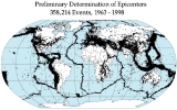
s. The seismicity, seismism or seismic activity of an area refers to the frequency, type and size of earthquakes experienced over a period of time. Earthquakes are measured using observations from seismometer
s. The moment magnitude
is the most common scale on which earthquakes larger than approximately 5 are reported for the entire globe.
563 The Byzantine church Hagia Sophia in Constantinople is dedicated for the second time after being destroyed by earthquakes.
1293 An earthquake strikes Kamakura, Kanagawa, Japan, killing about 30,000.
1531 Lisbon, Portugal is hit by an earthquake--thousands die.
1556 The deadliest earthquake in history, the Shaanxi earthquake, hits Shaanxi province, China. The death toll may have been as high as 830,000.
1667 An earthquake devastates Dubrovnik, then an independent city-state.
1667 A deadly earthquake rocks Shemakha in the Caucasus, killing 80,000 people.
1755 Lisbon earthquake: In Portugal, Lisbon is destroyed by a massive earthquake and tsunami, killing between sixty thousand and ninety thousand people.
1759 An earthquake hits the Mediterranean destroying Beirut and Damascus and killing 30,000-40,000.
1763 A massive earthquake occurs on the same day in Komárom in Hungary, in Komárno in Slovakia and in Zsámbék in Hungary.
1812 The strongest in a series of earthquakes strikes New Madrid, Missouri.