
Verdugo Mountains
Encyclopedia
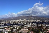
The Verdugo Mountains are a small, rugged mountain range
of the Transverse Ranges
system, located just south of the western San Gabriel Mountains
in Los Angeles County
, Southern California
. The range is sometimes known as the Verdugo Hills or simply the Verdugos.
Surrounded entirely by urban development, they represent an isolated wildlife island and are in large part under public ownership in the form of undeveloped parkland. The Verdugo Mountains are used primarily for recreation in the form of hiking and mountain biking, and as the site of communications installations on the highest peaks.
at a distance of 1 miles (1.6 km) to 2 miles (3.2 km), with the Crescenta Valley
lying between the two. The southern front of the range forms part of the northeastern boundary of the San Fernando Valley
; at their southeastern end the Verdugo Mountains are separated from the San Rafael Hills
by the Verdugo Wash
.
The highest summit is the informally named Verdugo Peak (3,126 feet), located near the center of the range and rising to approximately 2200 feet (670.6 m) above its southern base. Other peaks include Tongva Peak (2,656 feet), recently named in honor of the Tongva (Gabrielino) people, the original inhabitants of much of the Los Angeles Basin
, Santa Monica Mountains
, and San Gabriel Valley
areas. Other informally named peaks are Mount La Tuna on the north end and Mount Thom on the south end of the range. With the exception of Mount La Tuna, all these summits, as well as several others, are occupied by communications towers.
The Verdugo Mountains lie within the corporate boundaries of the cities of Glendale
, Burbank, and Los Angeles
. The Los Angeles neighborhoods of Tujunga, Sunland, Shadow Hills, La Tuna Canyon, and Sun Valley
are all adjacent to its northern end.
near the front of the San Gabriel Mountains, thus including the sediment-covered Crescenta Valley within the Verdugo Mountains Block. The Verdugo Fault lies slightly south of the topographic range front and is completely covered by sediments.
The rocks within the Verdugo Mountains block are almost entirely igneous and metamorphic rocks similar to the crystalline basement rocks exposed to the north in that portion of the San Gabriel Mountains south of the San Gabriel Fault. These rocks consist of gneiss
, and gneissic diorite
and quartz diorite
, intruded by irregular bodies of equigranular granitic rocks, predominantly quartz diorite and granodiorite
, with accompanying pegmatite
and aplite
. Exposed rocks in the Shadow Hills
neighborhood at the extreme northwestern end of the Verdugos are typically marine sedimentary rocks of Miocene
age, predominantly sandstone
and shale
.
The Verdugo Mountains are part of the western Transverse Ranges
, which have risen in the last 7 million years as the result of contractional deformation resulting from transpressional motion and rotation of crustal blocks in the "Big Bend" region of the San Andreas Fault
. The amount of crustal shortening since the beginning of the Pliocene
has been estimated to be on the order of 7 kilometres (4.3 mi). The Verdugo fault and Sierra Madre thrust are part of a complex system of faults that accommodate some of this shortening and generally become younger to the south, with the Verdugo Fault possibly being the yougest member of this system and forming the current boundary between this portion of the western Transverse Ranges and the Los Angeles basin. Uplift along the Verdugo fault may total approximately 2.5 km (1.6 mi), at a minimum rate of 1.1 km (0.683510010314787 mi) per million years since 2.3 million years ago, moving the crystalline rocks of the Verdugo Mountains up and over younger Tertiary
and Quaternary
sediments to the south. The Verdugos are thus a young and rapidly rising mountain range, reflected in their steep topography and rapid rates of erosion.
plant community, as defined by Munz and later authors, including Sawyer et al. This dense, shrub-dominated community of the California chaparral and woodlands
is more highly developed on the north-facing slopes than on the drier, hotter south-facing slopes. Among the shrub species that characterize this community, prominent in the Verdugos are laurel sumac (Malosma laurina), toyon
(Heteromeles arbutifolia), poison oak
(Toxicodendron diversilobum), chamise (Adenostoma fasciculatum) and two species of California-lilac (Ceanothus
crassifolius and C. oliganthus). Native trees are restricted to protected canyons and sites along the largely seasonal watercourses. Coast live oak
(Quercus agrifolia), California bay laurel (Umbellularia californica), California sycamore
(Platanus racemosa), California walnut (Juglans californica), and several species of willow
(Salix spp.) are the most common. Non-native trees, particularly pines
(Pinus spp.), cypress
(Cupressus spp.) and locust
(Robinia pseudoacacia), have been planted locally along the fire roads and, most notably, in the Fire Warden's Grove, established in the wake of a wildfire in 1927.
Except for a tenuous link to the large wild area in the San Gabriel Mountains
through Big Tujunga Wash at their northwestern end, the Verdugo Mountains are an urban wildlife island completely surrounded by development. Among the large mammals, coyote
(Canis latrans) and mule deer
(Odocoileus hemionus) are the most common; mountain lions (Puma concolor) have occasionally been reported. The many rodent species support a population of western rattlesnakes (Crotalus viridis). Of the numerous bird species present, the most characteristic of the chapparal here, and throughout California, is the small, seldom seen but often heard wrentit
(Chamaea fasciata). With its call of three or four chirps followed by an accelerating trill, often likened to the sound of a dropped ping-pong ball, the wrentit provides the most characteristic sound of the chaparral.
s in the canyons.
The Verdugo Mountains were named for Jose Maria Verdugo, holder of the Rancho San Rafael
land grant
, which covered the mountains during California's Spanish and Mexican periods
. On October 20, 1784 Pedro Fages
, the military governor of Alta California
, granted Jose Maria Verdugo
permission to use the rancho, known officially by the name San Rafael but informally called "La Zanja" by Verdugo. The rancho's boundaries were primarily defined by the Verdugo Mountains, the Arroyo Seco
and the Los Angeles River
, with the boundary following north along the east bank of the river and wrapping westerly around Griffith Park
to a point near the Travel Town Museum
in the park.
Casa Verdugo station at the top of Brand Boulevard to the summit of Mount Verdugo, employing cars with stepped seating similar to those of Angels Flight
on Bunker Hill
in Los Angeles. Initially, Colonel Ginger had proposed that his cable railway would lift a Pacific Electric car directly to the summit, but Henry E. Huntington
did not approve of this scheme. The railway was to have four or five stations along the incline and a large visitor’s center at the summit. Several months after the initial proposal, the route was altered to run up the west side of Verdugo Canyon from a hoped-for extension of the Pacific Electric up Verdugo Canyon to Montrose. Interest in the cable railway continued for about a year, but the project was abandoned before a company could be formed, largely as the result of the Pacific Electric’s decision not to build the Montrose extension.
, which is characterized by intensity and seasonality, but most importantly, by the frequency of fires. In the southern California chaparral, natural frequencies of 30 to 40 years are typical, with some areas going as long as 100 years without fires and others burning more frequently. It has been estimated the chaparral plant community can persist over the long term only with a fire frequency at a given site of no shorter than several decades, or perhaps longer, although there is variability in the tolerance of different species. Repeated shorter intervals between fires promote so-called "type conversion," in which the shrubby species are replaced by grasses, particularly non-native grasses, and other weedy species.
The Verdugo Mountains have been subject to repeated wildfires in historical times. Major occurrences in the twentieth century include the December, 1927 Burbank Canyon Fire, which started in Haines Canyon in the San Gabriel Mountains and burned south into the range, consuming approximately 100 homes in Burbank's Sunset Canyon.
The La Tuna Canyon Fire of November, 1955 burned over almost the entire western portion of the range, ultimately destroying approximately 4500 acres (1,821.1 ha).
The Whiting Woods Fire of March, 1964, started by a power line downed by high winds, burned from the northern edge of the range southward over to crest to consume homes in Glendale.
A fire in November, 1980, also called the La Tuna Canyon Fire, burned 10000 acres (4,046.9 ha) in the northern and western portions of the range.
Since 2000, two major fires have occurred in the Verdugo Mountains. In September, 2002, the Mountain Fire burned over two days approximately 750 acres (303.5 ha) above Glendale, largely on the southern side of the range.
The Harvard Fire started on September 29, 2005, and consumed 1024 acres (414.4 ha) both north and south sides of the range north of Burbank during a six-day period.
Beginning in 1921, the Los Angeles County Fire Department
began a county-wide program of building fire breaks (or more properly, fuel breaks) to slow the spread of fire, and by 1923 the initial breaks had been constructed in the Verdugos. In 1934, the City of Glendale built a 60-foot lookout tower on Verdugo Peak, which was staffed with an observer until it closed in the mid-1950s. In order to conduct the work necessary to build fire breaks and roads, temporary construction camps were located throughout the fire-prone areas of the county. In the Verdugo Mountains, Construction Camp #2 was located in the lower reaches of Deer Canyon, at the end of present-day Beaudry Blvd, for a period during the late 1930s and early 1940s. It is difficult to determine from published sources the dates of construction for the fire roads so important to present-day recreational use of the mountains. The report of the 1955 La Tuna Canyon fire, however, indicates that at least some of these roads were in place by that date.
The Verdugo Mountains are being considered as part of the proposed Rim of the Valley Corridor National Park.
riders. Several abandoned and overgrown fire roads and ridge-top fire breaks are used recreationally as well. Trails, in the sense of engineered and maintained foot paths, are few, the most notable being the 2.2 mile (3.5 km)-long La Tuna Canyon Trail, which was constructed in 1989 by the Los Angeles Conservation Corps with funds provided by the Santa Monica Mountains Conservancy.
Mountain range
A mountain range is a single, large mass consisting of a succession of mountains or narrowly spaced mountain ridges, with or without peaks, closely related in position, direction, formation, and age; a component part of a mountain system or of a mountain chain...
of the Transverse Ranges
Transverse Ranges
The Transverse Ranges are a group of mountain ranges of southern California, in the Pacific Coast Ranges physiographic region that runs along the Pacific coast from Alaska to Mexico in North America. The Transverse Ranges begin at the southern end of the California Coast Ranges and lie between...
system, located just south of the western San Gabriel Mountains
San Gabriel Mountains
The San Gabriel Mountains Range is located in northern Los Angeles County and western San Bernardino County, California, United States. The mountain range lies between the Los Angeles Basin and the Mojave Desert, with Interstate 5 to the west and Interstate 15 to the east...
in Los Angeles County
Los Angeles County, California
Los Angeles County is a county in the U.S. state of California. As of 2010 U.S. Census, the county had a population of 9,818,605, making it the most populous county in the United States. Los Angeles County alone is more populous than 42 individual U.S. states...
, Southern California
California
California is a state located on the West Coast of the United States. It is by far the most populous U.S. state, and the third-largest by land area...
. The range is sometimes known as the Verdugo Hills or simply the Verdugos.
Surrounded entirely by urban development, they represent an isolated wildlife island and are in large part under public ownership in the form of undeveloped parkland. The Verdugo Mountains are used primarily for recreation in the form of hiking and mountain biking, and as the site of communications installations on the highest peaks.
Geography
The northwest-trending range is approximately 8 miles (12.9 km) long by 3.25 miles (5.2 km) wide, and roughly parallels the southern front of the San Gabriel MountainsSan Gabriel Mountains
The San Gabriel Mountains Range is located in northern Los Angeles County and western San Bernardino County, California, United States. The mountain range lies between the Los Angeles Basin and the Mojave Desert, with Interstate 5 to the west and Interstate 15 to the east...
at a distance of 1 miles (1.6 km) to 2 miles (3.2 km), with the Crescenta Valley
Crescenta Valley
The Crescenta Valley is a small inland valley in Los Angeles County, California lying between the San Gabriel Mountains on the northeast and the Verdugo Mountains and San Rafael Hills on the southwest. It opens into the San Fernando Valley at the northwest and the San Gabriel Valley at the southeast...
lying between the two. The southern front of the range forms part of the northeastern boundary of the San Fernando Valley
San Fernando Valley
The San Fernando Valley is an urbanized valley located in the Los Angeles metropolitan area of southern California, United States, defined by the dramatic mountains of the Transverse Ranges circling it...
; at their southeastern end the Verdugo Mountains are separated from the San Rafael Hills
San Rafael Hills
The San Rafael Hills are a mountain range in Los Angeles County, California. They are one of the lower Transverse Ranges, and are parallel to and below the San Gabriel Mountains to the south, adjacent to the San Gabriel Valley overlooking the Los Angeles Basin.-Geography:The Hills contain all or...
by the Verdugo Wash
Verdugo Wash
Verdugo Wash is a tributary of the Los Angeles River, in the Glendale area of Los Angeles County, California.The stream begins just south of Interstate 210 in the Crescenta Valley...
.
The highest summit is the informally named Verdugo Peak (3,126 feet), located near the center of the range and rising to approximately 2200 feet (670.6 m) above its southern base. Other peaks include Tongva Peak (2,656 feet), recently named in honor of the Tongva (Gabrielino) people, the original inhabitants of much of the Los Angeles Basin
Los Angeles Basin
The Los Angeles Basin is the coastal sediment-filled plain located between the Peninsular and Transverse ranges in southern California in the United States containing the central part of the city of Los Angeles as well as its southern and southeastern suburbs...
, Santa Monica Mountains
Santa Monica Mountains
The Santa Monica Mountains are a Transverse Range in Southern California, along the coast of the Pacific Ocean in the United States.-Geography:...
, and San Gabriel Valley
San Gabriel Valley
The San Gabriel Valley is one of the principal valleys of Southern California, United States. It lies to the east of Los Angeles, to the north of the Puente Hills, to the south of the San Gabriel Mountains, and west of the Inland Empire. It derives its name from the San Gabriel River that flows...
areas. Other informally named peaks are Mount La Tuna on the north end and Mount Thom on the south end of the range. With the exception of Mount La Tuna, all these summits, as well as several others, are occupied by communications towers.
The Verdugo Mountains lie within the corporate boundaries of the cities of Glendale
Glendale, California
Glendale is a city in Los Angeles County, California, United States. As of the 2010 Census, the city population is 191,719, down from 194,973 at the 2000 census. making it the third largest city in Los Angeles County and the 22nd largest city in the state of California...
, Burbank, and Los Angeles
Los Angeles, California
Los Angeles , with a population at the 2010 United States Census of 3,792,621, is the most populous city in California, USA and the second most populous in the United States, after New York City. It has an area of , and is located in Southern California...
. The Los Angeles neighborhoods of Tujunga, Sunland, Shadow Hills, La Tuna Canyon, and Sun Valley
Sun Valley, Los Angeles, California
Sun Valley is a district in the San Fernando Valley region of the city of Los Angeles, California, about 15 miles away from Downtown Los Angeles....
are all adjacent to its northern end.
Geology
The Verdugo Mountains consist of an east-west-trending antiformal fault block, bounded on south by the Verdugo Fault, a north-dipping reverse fault, and on the north by the Sierra Madre thrust faultThrust fault
A thrust fault is a type of fault, or break in the Earth's crust across which there has been relative movement, in which rocks of lower stratigraphic position are pushed up and over higher strata. They are often recognized because they place older rocks above younger...
near the front of the San Gabriel Mountains, thus including the sediment-covered Crescenta Valley within the Verdugo Mountains Block. The Verdugo Fault lies slightly south of the topographic range front and is completely covered by sediments.
The rocks within the Verdugo Mountains block are almost entirely igneous and metamorphic rocks similar to the crystalline basement rocks exposed to the north in that portion of the San Gabriel Mountains south of the San Gabriel Fault. These rocks consist of gneiss
Gneiss
Gneiss is a common and widely distributed type of rock formed by high-grade regional metamorphic processes from pre-existing formations that were originally either igneous or sedimentary rocks.-Etymology:...
, and gneissic diorite
Diorite
Diorite is a grey to dark grey intermediate intrusive igneous rock composed principally of plagioclase feldspar , biotite, hornblende, and/or pyroxene. It may contain small amounts of quartz, microcline and olivine. Zircon, apatite, sphene, magnetite, ilmenite and sulfides occur as accessory...
and quartz diorite
Quartz diorite
Quartz diorite is an igneous, plutonic rock, of felsic composition, with phaneritic texture. Feldspar is present as plagioclase with 10% or less potassium feldspar. Quartz is present at between 5 to 20% of the rock. Biotite, amphiboles and pyroxenes are common dark accessory...
, intruded by irregular bodies of equigranular granitic rocks, predominantly quartz diorite and granodiorite
Granodiorite
Granodiorite is an intrusive igneous rock similar to granite, but containing more plagioclase than orthoclase-type feldspar. Officially, it is defined as a phaneritic igneous rock with greater than 20% quartz by volume where at least 65% of the feldspar is plagioclase. It usually contains abundant...
, with accompanying pegmatite
Pegmatite
A pegmatite is a very crystalline, intrusive igneous rock composed of interlocking crystals usually larger than 2.5 cm in size; such rocks are referred to as pegmatitic....
and aplite
Aplite
Aplite in petrology, the name given to intrusive rock in which quartz and feldspar are the dominant minerals. Aplites are usually very fine-grained, white, grey or pinkish, and their constituents are visible only with the help of a magnifying lens...
. Exposed rocks in the Shadow Hills
Shadow Hills, Los Angeles, California
-History:Shadow Hills is located in the southern portion of the community of Sunland and extreme northeast portion of Sun Valley, California east of Glenoaks Boulevard.The City of Los Angeles first annexed Sunland in June 1926...
neighborhood at the extreme northwestern end of the Verdugos are typically marine sedimentary rocks of Miocene
Miocene
The Miocene is a geological epoch of the Neogene Period and extends from about . The Miocene was named by Sir Charles Lyell. Its name comes from the Greek words and and means "less recent" because it has 18% fewer modern sea invertebrates than the Pliocene. The Miocene follows the Oligocene...
age, predominantly sandstone
Sandstone
Sandstone is a sedimentary rock composed mainly of sand-sized minerals or rock grains.Most sandstone is composed of quartz and/or feldspar because these are the most common minerals in the Earth's crust. Like sand, sandstone may be any colour, but the most common colours are tan, brown, yellow,...
and shale
Shale
Shale is a fine-grained, clastic sedimentary rock composed of mud that is a mix of flakes of clay minerals and tiny fragments of other minerals, especially quartz and calcite. The ratio of clay to other minerals is variable. Shale is characterized by breaks along thin laminae or parallel layering...
.
The Verdugo Mountains are part of the western Transverse Ranges
Transverse Ranges
The Transverse Ranges are a group of mountain ranges of southern California, in the Pacific Coast Ranges physiographic region that runs along the Pacific coast from Alaska to Mexico in North America. The Transverse Ranges begin at the southern end of the California Coast Ranges and lie between...
, which have risen in the last 7 million years as the result of contractional deformation resulting from transpressional motion and rotation of crustal blocks in the "Big Bend" region of the San Andreas Fault
San Andreas Fault
The San Andreas Fault is a continental strike-slip fault that runs a length of roughly through California in the United States. The fault's motion is right-lateral strike-slip...
. The amount of crustal shortening since the beginning of the Pliocene
Pliocene
The Pliocene Epoch is the period in the geologic timescale that extends from 5.332 million to 2.588 million years before present. It is the second and youngest epoch of the Neogene Period in the Cenozoic Era. The Pliocene follows the Miocene Epoch and is followed by the Pleistocene Epoch...
has been estimated to be on the order of 7 kilometres (4.3 mi). The Verdugo fault and Sierra Madre thrust are part of a complex system of faults that accommodate some of this shortening and generally become younger to the south, with the Verdugo Fault possibly being the yougest member of this system and forming the current boundary between this portion of the western Transverse Ranges and the Los Angeles basin. Uplift along the Verdugo fault may total approximately 2.5 km (1.6 mi), at a minimum rate of 1.1 km (0.683510010314787 mi) per million years since 2.3 million years ago, moving the crystalline rocks of the Verdugo Mountains up and over younger Tertiary
Tertiary
The Tertiary is a deprecated term for a geologic period 65 million to 2.6 million years ago. The Tertiary covered the time span between the superseded Secondary period and the Quaternary...
and Quaternary
Quaternary
The Quaternary Period is the most recent of the three periods of the Cenozoic Era in the geologic time scale of the ICS. It follows the Neogene Period, spanning 2.588 ± 0.005 million years ago to the present...
sediments to the south. The Verdugos are thus a young and rapidly rising mountain range, reflected in their steep topography and rapid rates of erosion.
Flora and fauna
The Verdugo Mountains lie almost entirely within the chaparralChaparral
Chaparral is a shrubland or heathland plant community found primarily in the U.S. state of California and in the northern portion of the Baja California peninsula, Mexico...
plant community, as defined by Munz and later authors, including Sawyer et al. This dense, shrub-dominated community of the California chaparral and woodlands
California chaparral and woodlands
The California chaparral and woodlands is a terrestrial ecoregion of lower northern, central, and southern California and northwestern Baja California , located on the west coast of North America...
is more highly developed on the north-facing slopes than on the drier, hotter south-facing slopes. Among the shrub species that characterize this community, prominent in the Verdugos are laurel sumac (Malosma laurina), toyon
Toyon
Heteromeles arbutifolia , and commonly known as Toyon, is a common perennial shrub native to California down to Baja California....
(Heteromeles arbutifolia), poison oak
Poison oak
Poison oak may refer to* Toxicodendron diversilobum, grows on West Coast of North America* Toxicodendron pubescens, grows in the Eastern United Statesdamnnnnn tissss is terribleee...
(Toxicodendron diversilobum), chamise (Adenostoma fasciculatum) and two species of California-lilac (Ceanothus
Ceanothus
Ceanothus L. is a genus of about 50–60 species of shrubs or small trees in the buckthorn family Rhamnaceae. The genus is confined to North America, the center of its distribution in California, with some species in the eastern United States and southeast Canada, and others extending as far south...
crassifolius and C. oliganthus). Native trees are restricted to protected canyons and sites along the largely seasonal watercourses. Coast live oak
Coast Live Oak
Quercus agrifolia, the Coast Live Oak, is an evergreen oak , native to the California Floristic Province. It grows west of the Sierra Nevada from Mendocino County, California, south to northern Baja California in Mexico. It is classified in the red oak section Quercus agrifolia, the Coast Live Oak,...
(Quercus agrifolia), California bay laurel (Umbellularia californica), California sycamore
California Sycamore
Platanus racemosa is a species of sycamore tree known by several common names, including California sycamore, Western sycamore, California plane tree, and in Spanish Aliso...
(Platanus racemosa), California walnut (Juglans californica), and several species of willow
Willow
Willows, sallows, and osiers form the genus Salix, around 400 species of deciduous trees and shrubs, found primarily on moist soils in cold and temperate regions of the Northern Hemisphere...
(Salix spp.) are the most common. Non-native trees, particularly pines
Pines
Pines may refer to:*Pine, coniferous trees of the genus Pinus, in the family Pinaceae*PINES or Public Information Network for Electronic Services- People with the surname :...
(Pinus spp.), cypress
Cypress
Cypress is the name applied to many plants in the cypress family Cupressaceae, which is a conifer of northern temperate regions. Most cypress species are trees, while a few are shrubs...
(Cupressus spp.) and locust
Locust
Locusts are the swarming phase of short-horned grasshoppers of the family Acrididae. These are species that can breed rapidly under suitable conditions and subsequently become gregarious and migratory...
(Robinia pseudoacacia), have been planted locally along the fire roads and, most notably, in the Fire Warden's Grove, established in the wake of a wildfire in 1927.
Except for a tenuous link to the large wild area in the San Gabriel Mountains
San Gabriel Mountains
The San Gabriel Mountains Range is located in northern Los Angeles County and western San Bernardino County, California, United States. The mountain range lies between the Los Angeles Basin and the Mojave Desert, with Interstate 5 to the west and Interstate 15 to the east...
through Big Tujunga Wash at their northwestern end, the Verdugo Mountains are an urban wildlife island completely surrounded by development. Among the large mammals, coyote
Coyote
The coyote , also known as the American jackal or the prairie wolf, is a species of canine found throughout North and Central America, ranging from Panama in the south, north through Mexico, the United States and Canada...
(Canis latrans) and mule deer
Mule Deer
The mule deer is a deer indigenous to western North America. The Mule Deer gets its name from its large mule-like ears. There are believed to be several subspecies, including the black-tailed deer...
(Odocoileus hemionus) are the most common; mountain lions (Puma concolor) have occasionally been reported. The many rodent species support a population of western rattlesnakes (Crotalus viridis). Of the numerous bird species present, the most characteristic of the chapparal here, and throughout California, is the small, seldom seen but often heard wrentit
Wrentit
The Wrentit is a small bird that lives in chaparral and bushland. It is the only species in the genus Chamaea....
(Chamaea fasciata). With its call of three or four chirps followed by an accelerating trill, often likened to the sound of a dropped ping-pong ball, the wrentit provides the most characteristic sound of the chaparral.
History
The mountains were part of the indigenous Tongva people's homelands for over 7,000 years, with villages at some springSpring (hydrosphere)
A spring—also known as a rising or resurgence—is a component of the hydrosphere. Specifically, it is any natural situation where water flows to the surface of the earth from underground...
s in the canyons.
The Verdugo Mountains were named for Jose Maria Verdugo, holder of the Rancho San Rafael
Rancho San Rafael
Rancho San Rafael was a Spanish land grant bordering the Los Angeles River and the Arroyo Seco in present day Los Angeles County, California, given in 1784 to Jose Maria Verdugo. The rancho includes the present day cities of Glendale, Eagle Rock, La Cañada, Montrose, and Verdugo City...
land grant
Land grant
A land grant is a gift of real estate – land or its privileges – made by a government or other authority as a reward for services to an individual, especially in return for military service...
, which covered the mountains during California's Spanish and Mexican periods
History of California to 1899
Human history in California begins with indigenous Americans first arriving in California some 13,000-15,000 years ago. Exploration and settlement by Europeans along the coasts and in the inland valleys began in the 16th century...
. On October 20, 1784 Pedro Fages
Pedro Fages
Pere Fages Beleta , nicknamed L'Ós , was a soldier, explorer, and the second Spanish military Governor of Las Californias Province of New Spain from 1770 to 1774, and the Governor of Las Californias from 1782 to 1791.-Life:...
, the military governor of Alta California
Alta California
Alta California was a province and territory in the Viceroyalty of New Spain and later a territory and department in independent Mexico. The territory was created in 1769 out of the northern part of the former province of Las Californias, and consisted of the modern American states of California,...
, granted Jose Maria Verdugo
Jose Maria Verdugo
José María Verdugo was a soldier from the Presidio of San Diego who was assigned to the Mission San Gabriel Arcángel at the time his land was granted by the Spanish Empire in 1784.-Spanish soldier:...
permission to use the rancho, known officially by the name San Rafael but informally called "La Zanja" by Verdugo. The rancho's boundaries were primarily defined by the Verdugo Mountains, the Arroyo Seco
Arroyo Seco
The Arroyo Seco, meaning "dry stream" in Spanish, is a seasonal river, canyon, watershed, and cultural area in Los Angeles County, California, United States. The Arroyo Seco has been called the most celebrated canyon in Southern California.-River course:...
and the Los Angeles River
Los Angeles River
The Los Angeles River is a river that starts in the San Fernando Valley, in the Simi Hills and Santa Susana Mountains, and flows through Los Angeles County, California, from Canoga Park in the western end of the San Fernando Valley, nearly southeast to its mouth in Long Beach...
, with the boundary following north along the east bank of the river and wrapping westerly around Griffith Park
Griffith Park
Griffith Park is a large municipal park at the eastern end of the Santa Monica Mountains in the Los Feliz neighborhood of Los Angeles, California. The park covers of land, making it one of the largest urban parks in North America...
to a point near the Travel Town Museum
Travel Town Museum
Travel Town Museum is a transport museum within Griffith Park in Los Angeles, California.Travel Town was dedicated on December 14, 1952. There is no charge for museum admission or parking...
in the park.
Glendale & Mount Verdugo Railway
One of the earliest attempts to access and develop the interior of the Verdugo Mountains was the 1912 proposal by Colonel Lewis Ginger to build an cable incline railroad to the summit of Mount Verdugo, now known as Mount Thom. The proposed Glendale & Verdugo Mountain Railway was to run in a straight line from the Pacific Electric’sPacific Electric Railway
The Pacific Electric Railway , also known as the Red Car system, was a mass transit system in Southern California using streetcars, light rail, and buses...
Casa Verdugo station at the top of Brand Boulevard to the summit of Mount Verdugo, employing cars with stepped seating similar to those of Angels Flight
Angels Flight
Angels Flight is a landmark funicular railway in the Bunker Hill district of Downtown Los Angeles, California. It has two funicular cars, Sinai and Olivet ....
on Bunker Hill
Bunker Hill, Los Angeles, California
Bunker Hill, in the downtown area of Los Angeles, California, is a short, developed hill with its peak located roughly around 3rd Street. It is located directly east of the Harbor Freeway...
in Los Angeles. Initially, Colonel Ginger had proposed that his cable railway would lift a Pacific Electric car directly to the summit, but Henry E. Huntington
Henry E. Huntington
Henry Edwards Huntington was a railroad magnate and collector of art and rare books. Born in Oneonta, New York, Huntington settled in Los Angeles, where he owned the Pacific Electric Railway as well as substantial real estate interests...
did not approve of this scheme. The railway was to have four or five stations along the incline and a large visitor’s center at the summit. Several months after the initial proposal, the route was altered to run up the west side of Verdugo Canyon from a hoped-for extension of the Pacific Electric up Verdugo Canyon to Montrose. Interest in the cable railway continued for about a year, but the project was abandoned before a company could be formed, largely as the result of the Pacific Electric’s decision not to build the Montrose extension.
Wildfire
Fire is a natural component of the chaparral ecosystem, and the plants that comprise it are largely adapted to survive fire or to reproduce after it. More specifically, the members of this plant community are adapted to a particular fire regimeFire regime
A fire regime is the pattern, frequency and intensity of the bushfires and wildfires that prevails in an area. It is an integral part of fire ecology, and renewal for certain types of ecosystems. If fires are too frequent, plants may be killed before they have matured, or before they have set...
, which is characterized by intensity and seasonality, but most importantly, by the frequency of fires. In the southern California chaparral, natural frequencies of 30 to 40 years are typical, with some areas going as long as 100 years without fires and others burning more frequently. It has been estimated the chaparral plant community can persist over the long term only with a fire frequency at a given site of no shorter than several decades, or perhaps longer, although there is variability in the tolerance of different species. Repeated shorter intervals between fires promote so-called "type conversion," in which the shrubby species are replaced by grasses, particularly non-native grasses, and other weedy species.
The Verdugo Mountains have been subject to repeated wildfires in historical times. Major occurrences in the twentieth century include the December, 1927 Burbank Canyon Fire, which started in Haines Canyon in the San Gabriel Mountains and burned south into the range, consuming approximately 100 homes in Burbank's Sunset Canyon.
The La Tuna Canyon Fire of November, 1955 burned over almost the entire western portion of the range, ultimately destroying approximately 4500 acres (1,821.1 ha).
The Whiting Woods Fire of March, 1964, started by a power line downed by high winds, burned from the northern edge of the range southward over to crest to consume homes in Glendale.
A fire in November, 1980, also called the La Tuna Canyon Fire, burned 10000 acres (4,046.9 ha) in the northern and western portions of the range.
Since 2000, two major fires have occurred in the Verdugo Mountains. In September, 2002, the Mountain Fire burned over two days approximately 750 acres (303.5 ha) above Glendale, largely on the southern side of the range.
The Harvard Fire started on September 29, 2005, and consumed 1024 acres (414.4 ha) both north and south sides of the range north of Burbank during a six-day period.
Beginning in 1921, the Los Angeles County Fire Department
Los Angeles County Fire Department
The Los Angeles County Fire Department , serves unincorporated parts of Los Angeles County, as well as 58 cities and towns that choose to have the county provide fire and EMS services, including La Habra. It should not be confused with the Los Angeles City Fire Department, which serves the city of...
began a county-wide program of building fire breaks (or more properly, fuel breaks) to slow the spread of fire, and by 1923 the initial breaks had been constructed in the Verdugos. In 1934, the City of Glendale built a 60-foot lookout tower on Verdugo Peak, which was staffed with an observer until it closed in the mid-1950s. In order to conduct the work necessary to build fire breaks and roads, temporary construction camps were located throughout the fire-prone areas of the county. In the Verdugo Mountains, Construction Camp #2 was located in the lower reaches of Deer Canyon, at the end of present-day Beaudry Blvd, for a period during the late 1930s and early 1940s. It is difficult to determine from published sources the dates of construction for the fire roads so important to present-day recreational use of the mountains. The report of the 1955 La Tuna Canyon fire, however, indicates that at least some of these roads were in place by that date.
Protected areas
- Verdugo Mountains State Park, California Department of Parks and RecreationCalifornia Department of Parks and RecreationThe California Department of Parks and Recreation, also known as California State Parks, manages the California state parks system. The system administers 278 parks and 1.4 million acres , with over of coastline; of lake and river frontage; nearly 15,000 campsites; and of hiking, biking, and...
- Verdugo Mountains Open Space Preserve, jointly operated by the Santa Monica Mountains ConservancySanta Monica Mountains ConservancyThe Santa Monica Mountains Conservancy is an agency of the state of California in the United States founded in 1980 and dedicated to the acquisition of land for preservation as open space, for wildlife and California native plants habitat Nature Preserves, and for public recreation...
and the City of Glendale
- Brand Park, Glendale
- Stough Canyon Nature Center, Burbank
- Wildwood Canyon Park, Burbank
- La Tuna Canyon Park, Los Angeles
- Tujunga Ponds, Los Angeles
The Verdugo Mountains are being considered as part of the proposed Rim of the Valley Corridor National Park.
Access and recreational use
Other than the Foothill Freeway (I-210) and the nearly parallel La Tuna Canyon Road, both of which traverse only the northwestern tip of the range, the Verdugo Mountains are crossed by no paved roads. By contrast, the range contains more than 25 miles (40.2 km) of graded and well maintained fire roads that are used extensively by hikers and mountain bikeMountain bike
A mountain bike or mountain bicycle is a bicycle created for off-road cycling. This activity includes traversing of rocks and washouts, and steep declines,...
riders. Several abandoned and overgrown fire roads and ridge-top fire breaks are used recreationally as well. Trails, in the sense of engineered and maintained foot paths, are few, the most notable being the 2.2 mile (3.5 km)-long La Tuna Canyon Trail, which was constructed in 1989 by the Los Angeles Conservation Corps with funds provided by the Santa Monica Mountains Conservancy.
Further reading
- Tectonics of the San Gabriel Basin and surroundings, southern California. Robert S. Yeats. Corvallis, OregonCorvallis, OregonCorvallis is a city located in central western Oregon, United States. It is the county seat of Benton County and the principal city of the Corvallis, Oregon Metropolitan Statistical Area, which encompasses all of Benton County. As of the 2010 United States Census, the population was 54,462....
: Oregon State UniversityOregon State UniversityOregon State University is a coeducational, public research university located in Corvallis, Oregon, United States. The university offers undergraduate, graduate and doctoral degrees and a multitude of research opportunities. There are more than 200 academic degree programs offered through the...
, Department of Geosciences, 2004. - Los Angeles River: Its Life, Death, and Possible Rebirth. Blake Gumprecht. Baltimore & LondonLondonLondon is the capital city of :England and the :United Kingdom, the largest metropolitan area in the United Kingdom, and the largest urban zone in the European Union by most measures. Located on the River Thames, London has been a major settlement for two millennia, its history going back to its...
: The Johns Hopkins UniversityJohns Hopkins UniversityThe Johns Hopkins University, commonly referred to as Johns Hopkins, JHU, or simply Hopkins, is a private research university based in Baltimore, Maryland, United States...
Press, 1999. ISBN 0-8018-6642-1. - Afoot & Afield in Los Angeles County, 2nd edition, Area B-5. Jerry Schad. Berkeley, CaliforniaBerkeley, CaliforniaBerkeley is a city on the east shore of the San Francisco Bay in Northern California, United States. Its neighbors to the south are the cities of Oakland and Emeryville. To the north is the city of Albany and the unincorporated community of Kensington...
: Wilderness Press, 2000. ISBN 0-89997-267-5. - Tectonics of the San Gabriel Basin and surroundings, southern California. Robert S. Yeats. Corvallis, OregonCorvallis, OregonCorvallis is a city located in central western Oregon, United States. It is the county seat of Benton County and the principal city of the Corvallis, Oregon Metropolitan Statistical Area, which encompasses all of Benton County. As of the 2010 United States Census, the population was 54,462....
: Oregon State UniversityOregon State UniversityOregon State University is a coeducational, public research university located in Corvallis, Oregon, United States. The university offers undergraduate, graduate and doctoral degrees and a multitude of research opportunities. There are more than 200 academic degree programs offered through the...
, Department of Geosciences, 2004. - Paleoseismology, active tectonics, and seismic hazards of the Verdugo fault zone, Los Angeles County, California. James F. Dolan. The University, 1997.
- Segmentation, slip rates and earthquake dimensions in the active fold-thrust belt of northern Los Angeles Basin, California. Robert S. Yeats. Dept. of Geosciences, Oregon State University, 1996.
- Geology of Earthquakes. Robert S. Yeats, Kerry E. SiehKerry SiehKerry E. Sieh is an American geologist and seismologist.Sieh's principal research interest is earthquake geology, which uses geological layers and landforms to understand the geometries of active faults, the earthquakes they generate, and the crustal structure their movements produce...
, and Clarence R. AllenClarence Allen (geologist)Clarence Roderic Allen is a geologist who studies seismology. He is a graduate of Reed College and the California Institute of Technology...
. Oxford University Press, 1997. ISBN 0-19-507827-6. - Living with Earthquakes in California: A Survivor's Guide. Robert S. Yeats. Oregon State University Press, 2001. ISBN 0-87071-493-7.
- The geology of a portion of the western Verdugo mountains. Robert L. Johnston, 1938.
- Geology Underfoot in Southern California. Allen Glazner. Mountain Press, 1993. ISBN 0-87842-289-7.
- Assembling California. John McPhee. Farrar, Straus and Giroux, 1993. ISBN 0-374-10645-2.
- Cycles of Rock and Water: At the Pacific Edge. Kenneth A. Brown. HarperCollins, 1993. ISBN 0-06-016056-X.
- Birds of Los Angeles: Including Santa Barbara, Ventura and Orange Counties. Chris C. Fisher and Herbert Clarke. Lone Pine Publications, 1997. ISBN 1-55105-104-4.
- A Flora of Southern California. Philip A. Munz. University of California Press, 1974.
- Native Trees of Southern California. Victor P. Peterson. University of California Press, 1970.
- Illustrated Guide to the Oaks of the Southern Californian Floristic Province: The Oaks of Coastal Southern California and Northwestern Baja California. Fred M. Roberts, Jr. F. M. Roberts Publishing, 1995. ISBN 0-9643847-0-1.
- Plant Life in the World's Mediterranean Climates: California, Chile, South Africa, Australia and the Mediterranean Basin. Peter R. Dallman. University of California, 1998. ISBN 0-520-20808-0.
- Island Called California: An Ecological Introduction to Its Natural Communities. Elna Bakker. Second Edition. University of California Press, 1984. ISBN 0-520-04947-0.
- Natural History of Vacant Lots (California Natural History Guides). Matthew F. Vessel and Herbert H. Wong. University of California Press, 1987. ISBN 0-520-05250-1.
- Growing California Native Plants. Marjorie D. Schmidt. University of California Press, 1981. ISBN 0-520-03762-6.
- Introduction to California Beetles. Arthur V. Evans and James N. Hogue. University of California Press, 2004. ISBN 0-520-24035-9.
- Geography and evolution in the pocket gophers of California. Joseph Grinnell. USGPO, 1927.
- Evolutionary Dynamics of the Pocket Gopher Thomomys Bottae, With Emphasis on California Populations. James L. Patton and Margaret F. Smith. University of California Press, 1990. ISBN 0-520-09761-0.
- The Verdugos of Hispanic California. Marie E. Northrop. 1978.
Maps
- Angeles Front Country Trail Map. San Rafael, CaliforniaSan Rafael, CaliforniaSan Rafael is a city and the county seat of Marin County, California, United States. The city is located in the North Bay region of the San Francisco Bay Area...
: Tom Harrison Maps, 2001. ISBN 1-877689-65-3. - Verdugo Mountains trail map. Matt Maxon, 2005 http://pctmap.homeip.net/data/PDF/Verdugo%20Mtns%2001-16-05.pdf
- Burbank, California, 7.5 minute topographic quadrangle map. United States Geological SurveyUnited States Geological SurveyThe United States Geological Survey is a scientific agency of the United States government. The scientists of the USGS study the landscape of the United States, its natural resources, and the natural hazards that threaten it. The organization has four major science disciplines, concerning biology,...
. - Pasadena, California, 7.5 minute topographic quadrangle map. United States Geological SurveyUnited States Geological SurveyThe United States Geological Survey is a scientific agency of the United States government. The scientists of the USGS study the landscape of the United States, its natural resources, and the natural hazards that threaten it. The organization has four major science disciplines, concerning biology,...
. - Mount La Tuna - 34.22327°N 118.33763°W
- Verdugo Peak - 34.21518°N 118.28001°W
- Tongva Peak - 34.19722°N 118.25833°W
- Mount Thom - 34.18717°N 118.25596°W
External links
- Outdoor LA Hiking Trails - Hiking trails in the area with maps and directions to the trailheads.
- Verdugo Mountains State Park - California State Parks page for the Verdugo Mountains State Park
- Rim of the Valley Corridor Study Act - GovTrack page for Senate Bill 153, the Rim of the Valley Corridor Study Act
- LA Trails - Verdugo Mountains - a listing of most of the hiking trails in the Verdugo Mountains.
- Verdugo Hills Community Hike - an annual communinty hike and trail run in the Verdugos involving the Glendale, Burkbank, and Crescenta Valley communities
- Parks in the Verdugo & San Rafael Mountains Region - Santa Monica Mountains Conservancy page, with an interagency list of parks and other protected areas in the Verdugo Mountains/San Rafael Hills area