
Scottish place names in the United States
Encyclopedia
This is a list of names of Scottish origin which have subsequently been applied to parts of the United States
by Scottish emigrants or explorers.
Unfortunately many of these placenames are now wrongly pronounced in the US e.g. Elgin wrongly pronounced "Eljin" in the US and correctly pronounced with the "g" as in give!
Note Minto
is a native name, and not related to the place in Scotland of the same name.


United States
The United States of America is a federal constitutional republic comprising fifty states and a federal district...
by Scottish emigrants or explorers.
Unfortunately many of these placenames are now wrongly pronounced in the US e.g. Elgin wrongly pronounced "Eljin" in the US and correctly pronounced with the "g" as in give!
Alabama
- Anderson
- ArdmoreArdmore, AlabamaArdmore is a town in Limestone County, Alabama, United States, and is included in the Huntsville-Decatur Metro Area. It is home to the Saturn 1B Rocket, at the Alabama Welcome Center, just south of the Tennessee border, on Interstate 65. As of the 2010 census, the population of the town is 1,194....
(Àrd Mòr meaning great height) - Barbour CountyBarbour County, AlabamaBarbour County, Alabama is a county of the U.S. state of Alabama. Its name is in honor of James Barbour, who served as Governor of Virginia. As of 2010 the population was 27,457. Its county seat is Clayton.-History:...
- DouglasDouglas, AlabamaDouglas is a town in Marshall County, Alabama, in the United States. Douglas, a part of the Huntsville-Decatur Combined Statistical Area, reported a population of 744 in the 2010 census.-Geography:Douglas is located at ....
- GordonGordon, AlabamaGordon is a town in Houston County, Alabama, United States. It is part of the Dothan, Alabama Metropolitan Statistical Area. At the 2000 census the population was 408.-Geography:Gordon is located at .According to the U.S...
- GordonvilleGordonville, AlabamaGordonville is a town in Lowndes County, Alabama, United States. At the 2000 census the population was 318. It is part of the Montgomery Metropolitan Statistical Area.-Geography:Gordonville is located at .According to the U.S...
- Inverness, Bullock CountyInverness, Bullock County, AlabamaInverness is an unincorporated community in Bullock County in the U.S. state of Alabama.Inverness is located at , south of Union Springs. According to the United States Geological Survey, variant names are Thomas Station and Thomasville....
- Inverness, Shelby CountyInverness, Shelby County, AlabamaInverness, Alabama, is a neighborhood in Birmingham, Alabama.Inverness is located at . Hwy 280 runs through Inverness and includes many restaurants and shopping centers....
- KennedyKennedy, AlabamaKennedy is a town in Lamar County, Alabama, United States. At the 2000 census the population was 541.-Geography:Kennedy is located at .According to the U.S. Census Bureau, the town has a total area of , all of it land....
- Lauderdale CountyLauderdale County, Alabama-2010:Whereas according to the 2010 U.S. Census Bureau:*86.4% White*10.0% Black*0.4% Native American*0.7% Asian*0.0% Native Hawaiian or Pacific Islander*1.4% Two or more races*2.2% Hispanic or Latino -2000:...
- McIntoshMcIntosh, AlabamaMcIntosh is a town located in Washington County, Alabama, along U.S. Highway 43. It is 12½ miles south of Wagarville and north of Mobile. It was named for Alexander McIntosh, a prominent Creek chief of the nineteenth century...
- McKenzieMcKenzie, AlabamaMcKenzie is a town in Butler and Conecuh counties in the U.S. state of Alabama. The population was 644 at the 2000 census.-Geography:McKenzie is located at ....
Alaska
- AndersonAnderson, AlaskaAnderson is a city in Denali Borough, Alaska, United States. At the 2000 census the population was 367. The city is named after one of the original homesteaders.- History :...
- HoustonHouston, AlaskaHouston is a city in Matanuska-Susitna Borough, Alaska, United States. It is part of the Anchorage, Alaska Metropolitan Statistical Area. The population was 1,202 at the 2000 census.-Geography:Houston is located at ....
- Kincaid ParkKincaid ParkKincaid Park is a municipal park in Anchorage, Alaska, located at 9401 W. Raspberry Road. The park is bounded on the South by Turnagain Arm, on the West by Knik Arm. Noted for Nordic skiing trails, in snowless months the park is frequented by runners, bikers, hikers, archers, dog-trainers,...
- McKinley ParkMcKinley Park, AlaskaMcKinley Park is a census-designated place in Denali Borough, in the U.S. state of Alaska. As of the 2007 census, the population of the CDP was 137.- Geography :McKinley Park is located at ....
- Point MacKenziePoint MacKenzie, AlaskaPoint MacKenzie is a census-designated place in Matanuska-Susitna Borough, Alaska, United States. It is part of the Anchorage, Alaska Metropolitan Statistical Area. At the 2000 census the population was 111...
Note Minto
Minto, Alaska
Minto is a census-designated place in Yukon-Koyukuk Census Area, Alaska, United States. As of the 2000 census, the population of the CDP is 258. The name is an anglicized version of the Lower Tanana Athabaskan name Menh Ti, meaning 'among the lakes'. After repeated flooding the village was...
is a native name, and not related to the place in Scotland of the same name.
Arizona
- CameronCameron, ArizonaCameron is a census-designated place in Coconino County, Arizona, United States. The population was 978 at the 2000 census. Most of the town's economy is tourist food and craft stalls, restaurants, and other services for north-south traffic from Flagstaff and Page...
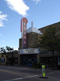
- ElginElgin, ArizonaElgin is a census-designated place in Santa Cruz County, Arizona, United States. The population was 309 at the 2000 census.-Geography:Elgin is located at ....
- GlendaleGlendale, ArizonaGlendale is a city in Maricopa County, Arizona, USA, located about nine miles northwest from Downtown Phoenix. According to 2010 Census Bureau, the population of the city is 226,721....
Arkansas
- Baxter CountyBaxter County, ArkansasBaxter County is a county located in the U.S. state of Arkansas. It is in the northern part of the state, and shares a border with Missouri. It is commonly referred to as the Twin Lakes Area because it is bordered by two of Arkansas' largest lakes, Bull Shoals Lake and Norfork Lake...
- Crawford County
- Dallas County
- FordyceFordyce, ArkansasFordyce is a city in Dallas County, Arkansas, United States. The population was 4,799 at the 2000 census.The city is the county seat, home to the 1911 Dallas County Courthouse .-Geography:...
- KnoxvilleKnoxville, ArkansasKnoxville is a city in Johnson County, Arkansas, United States. The population was 511 at the 2000 census.-Geography:Knoxville is located at ....
- Lake HamiltonLake Hamilton, ArkansasLake Hamilton is a census-designated place in Garland County, Arkansas, United States. It is part of the 'Hot Springs Metropolitan Statistical Area'. The population was 2,135 at the 2000 census...
- McDougalMcDougal, ArkansasMcDougal is a town in Clay County, Arkansas, United States. The population was 195 at the 2000 census.-Geography:McDougal is located at ....
- McNabMcNab, ArkansasMcNab is a town in Hempstead County, Arkansas, United States. The population was 37 at the 2000 census. It is part of the Hope Micropolitan Statistical Area.-Geography:McNab is located at ....
- McNeilMcNeil, ArkansasMcNeil is a city in Columbia County, Arkansas, United States. The population was 662 at the 2000 census.The community was named for William B. McNeil, founder of the College Hill Academy.-Geography:McNeil is located at ....
- McRae
- ScottScott, ArkansasScott is a census-designated place in Lonoke and Pulaski counties in the central part of the U.S. state of Arkansas. The population was 72 at the 2010 census...
California
- AlbanyAlbany, CaliforniaAlbany is a city in Alameda County, California, United States. The population was 18,539 at the 2010 census.-History:In 1908, a group of local women protested the dumping of Berkeley garbage in their community...
- Ben Lomond Mountain AVABen Lomond Mountain AVAThe Ben Lomond Mountain AVA is an American Viticultural Area in Santa Cruz County, California, located on the western edge of the Santa Cruz Mountains. Vineyards were first planted on the mountain in the 1860s, but viticulture there has been difficult...
& Ben Lomond, CaliforniaBen Lomond, CaliforniaBen Lomond is a census-designated place in Santa Cruz County, California, United States, and also the name of the mountain to the west. The population was 6,234 at the 2010 census.-History:... - Bonny DoonBonny Doon, CaliforniaBonny Doon is a census-designated place in Santa Cruz County, California. Bonny Doon sits at an elevation of . The 2010 United States census reported Bonny Doon's population was 2,678....
- Cheviot HillsCheviot Hills, Los Angeles, CaliforniaCheviot Hills is a small residential district on the West Side of Los Angeles, California. It served as the location for the Three's Company spin-off The Ropers.-Geography:...
- DennyDenny, CaliforniaDenny is a ghost town in Trinity County, California, United States. Actor Ed Flanders committed suicide there in 1995.-External links:* *...
(Denny, FalkirkDenny, FalkirkDenny is a town in the Falkirk council area of Scotland, formerly in the county of Stirlingshire. It is situated west of Falkirk, and north-east of Cumbernauld, adjacent to both the M80 and M876 motorways...
) - GlendaleGlendale, CaliforniaGlendale is a city in Los Angeles County, California, United States. As of the 2010 Census, the city population is 191,719, down from 194,973 at the 2000 census. making it the third largest city in Los Angeles County and the 22nd largest city in the state of California...
- InvernessInverness, CaliforniaInverness is an unincorporated community and census-designated place located in western Marin County, California. Inverness is located on the southwest shore of Tomales Bay northwest of Point Reyes Station, at an elevation of 43 feet . In the 2010 census, the population was 1,304...
- IrvineIrvine, CaliforniaIrvine is a suburban incorporated city in Orange County, California, United States. It is a planned city, mainly developed by the Irvine Company since the 1960s. Formally incorporated on December 28, 1971, the city has a population of 212,375 as of the 2010 census. However, the California...
- KelsoKelso, CaliforniaKelso is a ghost town and defunct railroad depot in the Mojave National Preserve in San Bernardino County, California, USA. It was named after a railroad worker who won a contest to have the town named after him...
- Loch LomondLoch Lomond (California)Loch Lomond is a reservoir in the Santa Cruz Mountains near Lompico, California in Santa Cruz County, California. It was created by building a dam across the Newell Creek. The Dam is an earthfill barricade, by . It was completed in the Fall of 1960, impounded water first ran over the spillway in...
(Reservoir nr Ben Lomond) - Scotts ValleyScotts Valley, CaliforniaScotts Valley is a small city in Santa Cruz County, California, United States, about thirty miles south of downtown San Jose and six miles north of Monterey Bay, in the upland slope of the Santa Cruz Mountains. As of the 2010 census, the city population was 11,580...
- StewartvilleStewartville, CaliforniaStewartville was an unincorporated place in eastern Contra Costa County, California that is now a ghost town. It was located northeast of Mount Diablo, at an elevation of 558 feet . It was a mining town for the nearby coal mines....
Colorado
- AultAult, ColoradoThe Town of Ault is a Statutory Town located in Weld County, Colorado, United States. The population was 1,432 at the U.S. Census 2000.-Geography:Ault is located at , at the intersection of U.S...
(originally called McAllister - both Scottish names) - CrawfordCrawford, ColoradoThe Town of Crawford is a Statutory Town in Delta County, Colorado, United States. The population was 366 at the 2000 census.-Geography:Crawford is located at ....
- FlemingFleming, ColoradoFleming is a Statutory Town in Logan County, Colorado, United States. The population was 426 at the 2000 census.-Geography:Fleming is located at ....
- FraserFraser, ColoradoFraser is a Statutory Town in Grand County, Colorado, United States. The population was 910 at the 2000 census. The town is in Middle Park in the valley of the Fraser River along U.S. Highway 40...
- LochbuieLochbuie, ColoradoLochbuie is a Statutory Town located on the border of Adams and Weld counties in the U.S. state of Colorado. The population was 2,049 at the U.S...
- MoffatMoffat, ColoradoMoffat is a Statutory Town in Saguache County, Colorado, United States. The population was 114 at the 2000 census.-Geography:Moffat is located at ....
District of Columbia
- Logan Circle
- McLean Gardens
Florida
- DundeeDundee, FloridaDundee is a town in Polk County, Florida, United States. The population was 2,912 at the 2000 census. As of 2004, the population recorded by the U.S. Census Bureau is 3,008...
- DunedinDunedin, FloridaDunedin is a city in Pinellas County, Florida, United States. The name comes from Dùn Èideann, the Scottish Gaelic name for Edinburgh, the capital of Scotland. The population was 35,691 at the 2000 census. As of 2004, the population recorded by the U.S. Census Bureau is 36,632...
, from Dun Eideann, Scottish Gaelic for Edinburgh - Fort LauderdaleFort Lauderdale, FloridaFort Lauderdale is a city in the U.S. state of Florida, on the Atlantic coast. It is the county seat of Broward County. As of the 2010 census, the city had a population of 165,521. It is a principal city of the South Florida metropolitan area, which was home to 5,564,635 people at the 2010...
- InvernessInverness, FloridaInverness is a city in Citrus County, Florida, United States. As of 2010, the population recorded by the U.S. Census Bureau is 7,210. It is the county seat of Citrus County.-Geography:...
Georgia
- ArgyleArgyle, GeorgiaArgyle is a town in Clinch County, Georgia, United States. The population was 151 at the 2000 census.-Geography:Argyle is located at .According to the United States Census Bureau, the town has a total area of , all of it land.-Demographics:...
(old spelling of ArgyllArgyllArgyll , archaically Argyle , is a region of western Scotland corresponding with most of the part of ancient Dál Riata that was located on the island of Great Britain, and in a historical context can be used to mean the entire western coast between the Mull of Kintyre and Cape Wrath...
) - CullodenCulloden, GeorgiaCulloden is a city in Monroe County, Georgia, United States. The population was 223 at the 2000 census. It is part of the Macon Metropolitan Statistical Area.-Geography:Culloden is located at ....
- LenoxLenox, GeorgiaLenox is a town in Cook County, Georgia, United States. The population was 889 at the 2000 census.-Geography:Lenox is located at ....
(LennoxLennox (district)The district of Lennox , often known as "the Lennox", is a region of Scotland centred around the village of Lennoxtown in East Dunbartonshire, eight miles north of the centre of Glasgow. At various times in history, the district has had both a dukedom and earldom associated with it.- External...
) - LivingstonLivingston, GeorgiaLivingston is the site of an old Indian village in Floyd County, Georgia, United States. The place was supposedly visited by Hernando de Soto, and evidence of his visit was found near McGee Bend on the Coosa River....
- McIntyreMcIntyre, GeorgiaMcIntyre is a town in Wilkinson County, Georgia, United States. The population was 718 at the 2000 census.-Geography:McIntyre is located at ....
- MontroseMontrose, GeorgiaMontrose is a town in Laurens County, Georgia, United States. The population was 154 at the 2000 census. It is part of the Dublin Micropolitan Statistical Area.-Geography:Montrose is located at ....
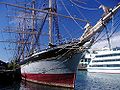
Hawaii
- Falls of Clyde (museum ship)
Idaho
- AberdeenAberdeen, IdahoAberdeen is a city in Bingham County, Idaho, United States. The population was 1,994 at the 2010 census.-Geography:Aberdeen is located at .According to the United States Census Bureau, the city has a total area of , all of it land....
- DrummondDrummond, IdahoDrummond is a city in Fremont County, Idaho, United States. The population was 15 at the 2000 census. It is part of the Rexburg, Idaho Micropolitan Statistical Area.-Geography:Drummond is located at ....
- McCammonMcCammon, IdahoMcCammon is a city in Bannock County, Idaho, United States. It is part of the 'Pocatello, Idaho Metropolitan Statistical Area'. The population was 805 at the 2000 census.-Geography:McCammon is located at ....
- MackayMackay, IdahoMackay is a city in Custer County, Idaho, United States. The population was 566 at the 2000 census.-Geography:Mackay is located at , at an elevation of 5,905 feet ....
- WallaceWallace, IdahoWallace is a historic city in the Panhandle region of the U.S. state of Idaho and the county seat of Shoshone County in the Silver Valley mining district...
Illinois
- BannockburnBannockburn, IllinoisBannockburn is a village in West Deerfield and Vernon townships of Lake County, Illinois, United States. The population was 1,429 at the 2000 census...
- Crawford County
- Dundee TownshipDundee Township, Kane County, IllinoisDundee Township occupies the square in the Northeast corner of Kane County, Illinois. It includes West and East Dundee, Carpentersville, Sleepy Hollow, Gilberts and portions of Elgin, Barrington Hills, Hoffman Estates, and Algonquin. It is divided by the Fox River.It is located at 42.111813 N,...
- East DundeeEast Dundee, IllinoisEast Dundee is a village in Kane County with a small section in Cook County. The population was 2,955 at the 2000 census.-Geography:East Dundee is located at ....
- ElginElgin, IllinoisElgin is a city in northern Illinois located roughly northwest of Chicago on the Fox River. Most of Elgin lies within Kane County, Illinois, with a portion in Cook County, Illinois...
- GlencoeGlencoe, IllinoisGlencoe is a village in Cook County, Illinois, United States. As of the 2010 census, the village population was 8,723. Glencoe is located on suburban Chicago's North Shore. Glencoe is located within the New Trier High School District. Glencoe is regarded as one of the most affluent suburbs on...
- Hamilton County
- Highland ParkHighland Park, IllinoisHighland Park is a suburban municipality in Lake County, Illinois, United States, about north of downtown Chicago. As of 2009, the population is 33,492. Highland Park is one of several municipalities located on the North Shore of the Chicago Metropolitan Area.-Overview:Highland Park was founded...
- InvernessInverness, IllinoisInverness is a village in Cook County, Illinois, United States, near Chicago. The population was 6,749 at the 2000 census.-Geography:Inverness is located at ....
- Logan CountyLogan County, IllinoisLogan County is a county located in the U.S. state of Illinois. According to the 2010 census, it has a population of 30,305, which is a decrease of 2.8% from 31,183 in 2000...
- MidlothianMidlothian, IllinoisMidlothian is a village in Cook County, Illinois, United States. The population was 14,315 at the 2000 census.-Geography:Midlothian is located at ....
- West DundeeWest Dundee, IllinoisWest Dundee is a village in Kane County, Illinois, United States. The population was 7,975 as of July 2008.West Dundee lies across the Fox River from East Dundee and Carpentersville.-Geography:West Dundee is located at ....
Indiana
- EdinburghEdinburgh, IndianaEdinburgh is a town in Bartholomew, Johnson, and Shelby Counties in the U.S. state of Indiana. The population was 4,480 at the 2010 census. It is part of the Columbus, Indiana metropolitan statistical area. Edinburgh was named in honor of Edinburgh, Scotland and for many years was pronounced the...
- Hamilton CountyHamilton County, IndianaHamilton County is a county located in the U.S. state of Indiana. Census 2010 recorded a population of 274,569. The county seat is Noblesville....
- Mount AyrMount Ayr, IndianaMount Ayr is a town in Jackson Township, Newton County, Indiana, United States. The population was 122 at the 2010 census.-Geography:Mount Ayr is located at ....
- New AlbanyNew Albany, IndianaNew Albany is a city in Floyd County, Indiana, United States, situated along the Ohio River opposite Louisville, Kentucky. In 1900, 20,628 people lived in New Albany; in 1910, 20,629; in 1920, 22,992; and in 1940, 25,414. The population was 36,372 at the 2010 census. The city is the county seat of...
(named after Albany, New York, in turn named after Alba) - OssianOssian, IndianaOssian is a town in Jefferson Township, Wells County, Indiana, United States. The population was 3,289 at the 2000 census.-Geography:Ossian is located at ....
(after MacPherson's OssianOssianOssian is the narrator and supposed author of a cycle of poems which the Scottish poet James Macpherson claimed to have translated from ancient sources in the Scots Gaelic. He is based on Oisín, son of Finn or Fionn mac Cumhaill, anglicised to Finn McCool, a character from Irish mythology...
) - ScottsburgScottsburg, IndianaScottsburg is a city in Vienna Township, Scott County, Indiana, United States, about north of Louisville, Kentucky. The population was 6,747 at the 2010 census. The city is the county seat of Scott County. As of 2010, William H...
- Scott CountyScott County, IndianaAs of the census of 2000, there were 22,960 people, 8,832 households, and 6,491 families residing in the county. The population density was 121 people per square mile . There were 9,737 housing units at an average density of 51 per square mile...
Iowa
- ArmstrongArmstrong, IowaArmstrong is a city in Emmet County, Iowa, United States. The population was 979 at the 2000 census. It was originally known as Armstrong Grove.-Geography:Armstrong is located at ....
- AyrshireAyrshire, IowaAyrshire is a city in Palo Alto County, Iowa, United States. The population was 143 at the 2010 census.-History:In the 1880s the Des Moines and Fort Dodge Railroad , having reached Fort Dodge, began building to the northwest. In October 1882 the rails reached the location of Ayrshire, and a depot...
- BaxterBaxter, IowaBaxter is a city in Jasper County, Iowa, United States. The population was 1,052 at the 2000 census.-Geography:Baxter's longitude and latitude coordinatesin decimal form are 41.824492, -93.150857...
- BlairsburgBlairsburg, IowaBlairsburg is a city in Hamilton County, Iowa, United States. The population was 235 at the 2000 census.-Geography:Blairsburg is located at ....
- BlairstownBlairstown, IowaBlairstown is a city in Benton County, Iowa, United States. The population was 682 at the 2000 census. It is part of the Cedar Rapids Metropolitan Statistical Area.-Geography:Blairstown is located at ....
- Buchanan CountyBuchanan County, Iowa-2010 census:The 2010 census recorded a population of 20,958 in the county, with a population density of . There were 8,968 housing units, of which 8,161 were occupied.-2000 census:...
- CoulterCoulter, IowaCoulter is a city in Franklin County, Iowa, United States. The population was 262 at the 2000 census.-Geography:Coulter is located at .According to the United States Census Bureau, the city has a total area of , all of it land....
- CraigCraig, IowaCraig is a city in Plymouth County, Iowa, United States. The population was 102 at the 2000 census.The town of Craig, Iowa was incorporated in Plymouth County on April 26, 1911.-Geography:Craig is located at ....
- CrawfordsvilleCrawfordsville, IowaCrawfordsville is a city in Washington County, Iowa, United States. It is part of the Iowa City, Iowa Metropolitan Statistical Area. The population was 295 at the 2000 census.-History:...
- DundeeDundee, IowaDundee is a city in Delaware County, Iowa, United States. The population was 179 at the 2000 census.-Geography:Dundee is located at along the Maquoketa River....
- DysartDysart, IowaDysart is a city in Tama County, Iowa, United States. The population was 1,303 at the 2000 census. The Mayor of Dysart is currently Don E. Lyons.-Geography:Dysart is located at ....
- ElginElgin, IowaElgin is a city in Fayette County, Iowa, United States. The population was 676 at the 2000 census.-Geography:Elgin is located at at the confluence of Otter Creek with the Turkey River....
- HamiltonHamilton, IowaHamilton is a city in Marion County, Iowa, United States. The population was 144 at the 2000 census.-Geography:Hamilton is located at .According to the United States Census Bureau, the city has a total area of , all of it land....
- HendersonHenderson, IowaHenderson is a city in Mills County, Iowa, United States. The population was 171 at the 2000 census.-Geography:Henderson is located at .According to the United States Census Bureau, the city has a total area of , all of it land....
- HepburnHepburn, IowaHepburn is a city in Page County, Iowa, United States. The population was 39 at the 2000 census.-Geography:Hepburn is located at .According to the United States Census Bureau, the city has a total area of , all of it land....
- LenoxLenox, IowaLenox is a city in Adams and Taylor counties in the U.S. state of Iowa. The population was 1,401 at the 2000 census.-Geography:Lenox is located at ....
- LoganLogan, IowaLogan is a city in Harrison County, Iowa, United States, along the Boyer River. The population was 1,545 at the 2000 census. It is the county seat of Harrison County. Henry Reel founded Logan in 1867, naming it in honor of General John A. Logan, a favorite army officer.-Geography:Logan's longitude...
- McCallsburgMcCallsburg, IowaMcCallsburg is a city in Story County, Iowa. The population was 318 at the 2000 census. It is part of the 'Ames, Iowa Metropolitan Statistical Area', which is a part of the larger 'Ames-Boone, Iowa Combined Statistical Area'.-Geography:...
- McCauslandMcCausland, IowaMcCausland is a city in Scott County, Iowa, United States. The population was 299 at the 2000 census.-Geography:McCausland is located at ....
- McClellandMcClelland, IowaMcClelland is a city in Pottawattamie County, Iowa, United States. The population was 129 at the 2000 census.-Geography:McClelland is located at ....
- McGregorMcGregor, IowaMcGregor is a city in Clayton County, Iowa, United States. The population was 871 at the 2000 census. McGregor is located on the Mississippi River across from Prairie du Chien, Wisconsin. Pike's Peak State Park is located just south of the city...
- McIntireMcIntire, IowaMcIntire is a city in Mitchell County, Iowa, United States. The population was 173 at the 2000 census.-Geography:McIntire is located at .According to the United States Census Bureau, the city has a total area of , all of it land....
- MaxwellMaxwell, IowaMaxwell is a city in Story County, Iowa, United States. The population was 807 at the 2000 census. It is part of the 'Ames, Iowa Metropolitan Statistical Area', which is a part of the larger 'Ames-Boone, Iowa Combined Statistical Area'.-Geography:...
- MalcomMalcom, IowaMalcom is a city in Poweshiek County, Iowa, United States. The population was 352 at the 2000 census.-Geography:Malcom is located at .According to the United States Census Bureau, the city has a total area of , all of it land....
- MontroseMontrose, IowaMontrose is a city in Lee County, Iowa, United States. The population was 957 at the 2000 census. The town is located on the Mississippi River. It is part of the Fort Madison–Keokuk, IA-MO Micropolitan Statistical Area.-History:...
- Mount AyrMount Ayr, IowaMount Ayr is a city in Ringgold County, Iowa, United States. The population was 1,822 at the 2000 census. It is the county seat of Ringgold County.-Geography:Mount Ayr's longitude and latitude coordinatesin decimal form are 40.714210, -94.236892...
- OssianOssian, IowaOssian is a city in Winneshiek County, Iowa, United States. The population was 853 at the 2000 census.-Geography:Ossian is located at .According to the United States Census Bureau, the city has a total area of , all of it land....
(OssianOssianOssian is the narrator and supposed author of a cycle of poems which the Scottish poet James Macpherson claimed to have translated from ancient sources in the Scots Gaelic. He is based on Oisín, son of Finn or Fionn mac Cumhaill, anglicised to Finn McCool, a character from Irish mythology...
) - PatonPaton, IowaPaton is a city in Greene County, Iowa, United States. The population was 265 at the 2000 census.-Geography:Paton is located at .According to the United States Census Bureau, the city has a total area of , all of it land....
- PattersonPatterson, IowaPatterson is a city in Madison County, Iowa, United States. The population was 126 at the 2000 census. It is part of the Des Moines–West Des Moines Metropolitan Statistical Area.-Geography:...
- RuthvenRuthven, IowaRuthven is a city in Palo Alto County, Iowa, United States. The population was 711 at the 2000 census.-Geography:Ruthven is located at .According to the United States Census Bureau, the city has a total area of , all of it land....
- Scott CountyScott County, Iowa-2010 census:The 2010 census recorded a population of 165,224 in the county, with a population density of . There were 71,835 housing units, of which 66,765 were occupied.-2000 census:...
- StuartStuart, IowaStuart is a city in Lincoln Township, Adair County, and in Stuart Township, Guthrie County, in the U.S. state of Iowa. That part of the city within Guthrie County is part of the Des Moines–West Des Moines Metropolitan Statistical Area...
- TennantTennant, IowaTennant is a city in Shelby County, Iowa, United States. The population was 73 at the 2000 census.-Geography:Tennant is located at .According to the United States Census Bureau, the city has a total area of , all of it land....
- WilliamsonWilliamson, IowaWilliamson is a city in Lucas County, Iowa, United States. The population was 163 at the 2000 census.-Geography:Williamson is located at .According to the United States Census Bureau, the city has a total area of , all of it land....
Kansas
- AtholAthol, KansasAthol is a city in Smith County, Kansas, United States. As of the 2010 census, the city population was 44.-History:In 1871, the song Home on the Range was written by Dr. Brewster Higley in a cabin 8 miles north of Athol.-Geography:...
(AthollAthollAtholl or Athole is a large historical division in the Scottish Highlands. Today it forms the northern part of Perth and Kinross, Scotland bordering Marr, Badenoch, Breadalbane, Strathearn, Perth and Lochaber....
) - Logan CountyLogan County, KansasLogan County is a county located in the U.S. state of Kansas. As of the 2010 census, the county population was 2,756...
- Scott CountyScott County, KansasScott County is a county located in the U.S. state of Kansas. As of the 2010 census, the county population was 4,936...
Louisiana
- CameronCameron, LouisianaCameron is a census-designated place in and the parish seat of Cameron Parish, Louisiana, United States. The population was 1,965 at the 2000 census. It is part of the Lake Charles Metropolitan Statistical Area...
& Cameron ParishCameron Parish, LouisianaCameron Parish is the parish with the most land area in the U.S. state of Louisiana. The parish seat is Cameron and as of 2010, the population was 6,839... - GretnaGretna, LouisianaThe city of Gretna is the parish seat of Jefferson Parish, in the US state of Louisiana. Gretna is on the west bank of the Mississippi River, just east and across the river from uptown New Orleans. It is part of the New Orleans–Metairie–Kenner Metropolitan Statistical Area...
- LivingstonLivingston, LouisianaLivingston is a town in and the parish seat of Livingston Parish, Louisiana, United States. The population was 1,342 at the 2000 census. It is part of the Baton Rouge Metropolitan Statistical Area....
& Livingston ParishLivingston Parish, LouisianaLivingston Parish Is a parish located in the U.S. state of Louisiana. Its parish seat is Livingston. As of 2010, its population was 128,026.... - ScottScott, LouisianaScott is the second largest municipality in Lafayette Parish, Louisiana, United States. The population rose to over 8,000 according to the 2010 census results.Scott is a suburb of Lafayette and is part of the Lafayette Metropolitan Statistical Area....
Maryland
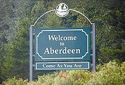
- AberdeenAberdeen, MarylandAs of the census of 2000, there were 13,842 people, 5,475 households, and 3,712 families residing in the city. The population density was 2,166.2 people per square mile . There were 5,894 housing units at an average density of 922.4 per square mile...
- Chevy Chase, MarylandChevy Chase, MarylandChevy Chase is the name of both a town and an unincorporated census-designated place in Montgomery County, Maryland. In addition, a number of villages in the same area of Montgomery County include "Chevy Chase" in their names...
- Glen BurnieGlen Burnie, MarylandGlen Burnie is a census-designated place in Anne Arundel County, Maryland, United States, and is a suburb of Baltimore. The population was 67,639 at the 2010 census...
- GlenelgGlenelg, MarylandGlenelg is an unincorporated community in Howard County, Maryland, United States. It is in the 21737 zip code, and the 410 area code. It is the home town of Glenelg High School and Glenelg Country School...
- MidlothianMidlothian, MarylandMidlothian is a small unincorporated community in Allegany County, Maryland; at one time called Midlothian Junction. Its ZIP code is 21543.-See also:Regional Businesses...
, Allegany CountyAllegany County, MarylandAllegany County is a county located in the northwestern part of the US state of Maryland. It is part of the Cumberland, MD-WV Metropolitan Statistical Area. As of 2010, the population was 75,087. Its county seat is Cumberland...
Massachusetts
- AtholAthol, MassachusettsAthol is a town in Worcester County, Massachusetts, United States. The population was 11,584 at the 2010 census.-History:Originally called Pequoiag, the area was first settled by five families in September 1735. When the township was incorporated in 1762, the name was changed to Athol...
(AthollAthollAtholl or Athole is a large historical division in the Scottish Highlands. Today it forms the northern part of Perth and Kinross, Scotland bordering Marr, Badenoch, Breadalbane, Strathearn, Perth and Lochaber....
) - LenoxLenox, MassachusettsLenox is a town in Berkshire County, Massachusetts, United States. Set in Western Massachusetts, it is part of the Pittsfield, Massachusetts Metropolitan Statistical Area. The population was 5,077 at the 2000 census. Where the town has a border with Stockbridge is the site of Tanglewood, summer...
(LennoxLennox (district)The district of Lennox , often known as "the Lennox", is a region of Scotland centred around the village of Lennoxtown in East Dunbartonshire, eight miles north of the centre of Glasgow. At various times in history, the district has had both a dukedom and earldom associated with it.- External...
) - Lenox DaleLenox Dale, MassachusettsLenox Dale is a village in Lenox, Massachusetts, United States at the border of the town of Lee, along the Housatonic River. It is a small village, but a village nonetheless with its own post office , school, two stores, and a Catholic church. The main street in the town is Crystal Street. Crystal...
- MelroseMelrose, Massachusetts-Government:Robert J. Dolan is the mayor. Melrose is represented in the Massachusetts House of Representatives by Paul Brodeur . Katherine Clark is the state senator for wards 1 through 5 and Thomas McGee is the state senator for wards 6 and 7. Melrose is part of the seventh Congressional...
- South HamiltonSouth Hamilton, MassachusettsSouth Hamilton is that part of Hamilton, Essex County, Massachusetts, United States that the Postal Service has assigned the zip code 01982; otherwise it is indistinguishable from Hamilton...
Michigan
- Caledonia Township (three townships)
- Hamilton Township (three townships)
Minnesota
- AlbanyAlbany, MinnesotaAs of the census of 2000, there were 1,796 people, 708 households, and 436 families residing in the city. The population density was 1,287.6 people per square mile . There were 732 housing units at an average density of 524.8 per square mile...
- AnnandaleAnnandale, MinnesotaAs of the census of 2000, there were 2,684 people, 1,098 households, and 698 families residing in the city. The population density was 990.3 people per square mile . There were 1,163 housing units at an average density of 429.1 per square mile...
- ArgyleArgyle, MinnesotaArgyle is a city in Marshall County, Minnesota, United States, along the Middle River. The population was 639 at the 2010 census. Old Mill State Park is nearby.-History:Before James J...
- CaledoniaCaledonia, MinnesotaAs of the census of 2000, there were 2,965 people, 1,223 households, and 754 families residing in the city. The population density was 1,037.1 people per square mile . There were 1,286 housing units at an average density of 449.8 per square mile...
- Caledonia TownshipCaledonia Township, MinnesotaCaledonia Township is a township in Houston County, Minnesota, United States. The population was 625 at the 2000 census.-Geography:According to the United States Census Bureau, the township has a total area of , of which, of it is land and 0.03% is water....
- DundasDundas, MinnesotaAs of the census of 2000, there were 547 people, 213 households, and 146 families residing in the city. The population density was 356.4 people per square mile . There were 229 housing units at an average density of 149.2 per square mile . The racial makeup of the city was 97.26% White, 1.28%...
- DundeeDundee, MinnesotaDundee is a city in Nobles County, Minnesota, United States The population was 68 at the 2010 census.-Geography:According to the United States Census Bureau, the city has a total area of , all of it land. Dundee is located in the extreme northeastern corner of Nobles County...
- EdinaEdina, MinnesotaEdina is a city in Hennepin County, Minnesota, United States, and a first-ring suburb situated immediately southwest of Minneapolis. Edina began as a small farming and milling community in the 1860s. The population was 47,941 at the 2010 census.-Geography:...
- ElginElgin, MinnesotaElgin is a city in Wabasha County, Minnesota, United States on Minnesota State Highway 42. The population was 1,089 at the 2010 census. Its annual festival is Elgin Cheese Days.-Geography:...
- Fergus FallsFergus Falls, MinnesotaFergus Falls is a city in and the county seat of Otter Tail County, Minnesota, United States. The population was 13,138 at the 2010 census.-Today:...
- GlencoeGlencoe, MinnesotaAs of the census of 2000, there were 5,453 people, 2,103 households, and 1,446 families residing in the city. The population density was 2,045.6 people per square mile . There were 2,169 housing units at an average density of 813.7 per square mile...
- HarrisHarris, MinnesotaHarris is a city in Chisago County, Minnesota, United States. The population was 1,132 at the 2010 census. It was named after Philip S. Harris, an officer of the St...
- IonaIona, MinnesotaAs of the census of 2000, there were 173 people, 80 households, and 44 families residing in the city. The population density was 219.9 people per square mile . There were 91 housing units at an average density of 115.6 per square mile . The racial makeup of the city was 95.95% White, 1.16% Asian,...
- MontroseMontrose, MinnesotaMontrose is a city in Wright County, Minnesota, United States. The population was 2,847 at the 2010 census.-Geography:According to the United States Census Bureau, the city has a total area of , of which, of it is land and 1.03% is water. U.S...
- NevisNevis, MinnesotaAs of the census of 2000, there were 364 people, 162 households, and 109 families residing in the city. The population density was 388.9 people per square mile . There were 199 housing units at an average density of 212.6 per square mile . The racial makeup of the city was 96.98% White, 1.10%...
- RothsayRothsay, MinnesotaRothsay is a city in Otter Tail and Wilkin counties in the U.S. state of Minnesota. The population was 493 at the 2010 census. One of Rothsay's major tourist attractions is the large prairie chicken statue near the northwest outskirts of the town....
Missouri
- Dallas County
- GlasgowGlasgow, MissouriGlasgow is a city in Chariton and Howard counties in the U.S. state of Missouri. The population was 1,263 at the 2000 census.The Howard County portion of Glasgow is part of the Columbia, Missouri Metropolitan Statistical Area.-Geography:...
- Scotland County
Montana
- BallantineBallantine, MontanaBallantine is a census-designated place in Yellowstone County, Montana, United States. The population was 346 at the 2000 census. Ballantine, along with the communities of Pompey's Pillar, Worden, and Huntley, is part of the Huntley Project, an irrigation district created by the United States...
- BusbyBusby, MontanaBusby is a census-designated place in Big Horn County, Montana, United States. It is on the Northern Cheyenne reservation. The population was 695 at the 2000 census.-Geography:Busby is located at ....
- Fergus CountyFergus County, Montana-National protected areas:* Charles M. Russell National Wildlife Refuge * Lewis and Clark National Forest * Upper Missouri River Breaks National Monument -Demographics:...
- ForsythForsyth, MontanaForsyth is a city in and the county seat of Rosebud County, Montana, United States. The population was 1,944 at the 2000 census. Forsyth was established in 1876 as the first settlement on the Yellowstone River, and in 1882 residents named the town after General James William Forsyth who commanded...
- FrazerFrazer, MontanaFrazer is a census-designated place in Valley County, Montana, United States. The population was 452 at the 2000 census.-Geography:Frazer is located at ....
- GlasgowGlasgow, MontanaGlasgow is a city in and the county seat of Valley County, Montana, United States. The population was 3,253 at the 2000 census.-History:Glasgow was founded in 1887 as a railroad town by James J. Hill, who was responsible for creating many communities along the Hi-Line. The town was named after...
- GlendiveGlendive, MontanaGlendive is a city in and the county seat of Dawson County, Montana, United States. The population was 4,935 at the 2010 census.The town of Glendive is located in South Eastern Montana and is considered by many as an agricultural hub of Eastern Montana...
- HamiltonHamilton, MontanaHamilton is a city in and the county seat of Ravalli County, Montana, United States. The population was 3,705 at the 2000 census. Significant outlying population growth is shown in the area; the ZIP Code Tabulation Area for Hamilton's ZIP Code, 59840, had a population of 12,327at the 2000 census.-...
- HuntleyHuntley, MontanaHuntley is a census-designated place in Yellowstone County, Montana, United States. The population was 411 at the 2000 census. Huntley lent its name to the Huntley Project, a federal irrigation project that began delivering water to the arid district in 1907...
(Huntley, Scottish Borders) - InvernessInverness, MontanaInverness is a census-designated place in Hill County, Montana, United States. The population was 55 at the 2010 census.-Geography:Inverness is located at ....
- KerrKerr, MontanaKerr is a census-designated place in Lake County, Montana, United States. The population was 17 at the 2000 census.-Geography:Kerr is located at ....
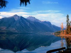
- Lake McDonaldLake McDonaldLake McDonald is the largest lake in Glacier National Park. It is located at in Flathead County in the U.S. state of Montana. Lake McDonald is approximately 10 miles long, and over a mile wide and 472 feet deep, filling a valley formed by a combination of erosion and glacial activity...
- LivingstonLivingston, Montana-Geography:Livingston is located at , at an altitude of 4.501 feet .According to the United States Census Bureau, the city has a total area of , of which, of it is land and 0.38% is waters.-Climate:-Demographics:...
New Hampshire
- DunbartonDunbarton, New HampshireDunbarton, is a town in Merrimack County, New Hampshire, United States. The population was 2,758 at the 2010 census.- History :Originally granted as Gorham's-town in 1735, and re-granted as Starkstown in 1748, the town was incorporated in 1765 as Dunbarton...
- GlenGlen, New HampshireGlen is an unincorporated village in the town of Bartlett in the White Mountains of New Hampshire. The village is the home of Story Land, a popular amusement park in the Mount Washington Valley region, a resort area that also includes the communities of North Conway and Jackson.Glen is found at...
- GlencliffGlencliff, New HampshireGlencliff is a village within the White Mountain National Forest in the town of Warren in Grafton County, New Hampshire, United States.The village consists of fewer than one hundred residents and some forty man-made structures, including the Willing Workers Hall, the Glencliff Community Chapel, the...
- GlendaleGlendale, New HampshireGlendale is an unincorporated village in the town of Gilford in Belknap County, New Hampshire, United States. Glendale is located on the southern shore of Lake Winnipesaukee east of Laconia. Glendale is served by New Hampshire Route 11 and is near Laconia Municipal Airport....
- StewartstownStewartstown, New HampshireStewartstown is a town in Coos County, New Hampshire, United States. The population was 1,004 at the 2010 census. It includes the village of West Stewartstown and is part of the Berlin, NH–VT Micropolitan Statistical Area.-History:...
New Jersey
- Hamilton Township (two places)
- Perth AmboyPerth Amboy, New JerseyPerth Amboy is a city in Middlesex County, New Jersey, United States. The City of Perth Amboy is part of the New York metropolitan area. As of the 2010 United States Census, the city population was 50,814. Perth Amboy is known as the "City by the Bay", referring to Raritan Bay.-Name:The Lenape...
(only half ScottishEarl of PerthThe title Earl of Perth was created in the Peerage of Scotland in 1605 for James Drummond, 4th Lord Drummond.The Drummond family claim descent from Maurice, son of George, a younger son of King Andrew I of Hungary...
; the other half was originally the LenapeLenapeThe Lenape are an Algonquian group of Native Americans of the Northeastern Woodlands. They are also called Delaware Indians. As a result of the American Revolutionary War and later Indian removals from the eastern United States, today the main groups live in Canada, where they are enrolled in the...
word "Ompoge", which meant "elbow", "point", or "bowl")
New Mexico
- Glenrio (from Scots "glen" + Spanish "rio" (meaning "river").)
- MelroseMelrose, New MexicoMelrose is a village in Curry County, New Mexico, United States. The population was 736 at the 2000 census. The town is losing population due to rural exodus...
New York
- AlbanyAlbany, New YorkAlbany is the capital city of the U.S. state of New York, the seat of Albany County, and the central city of New York's Capital District. Roughly north of New York City, Albany sits on the west bank of the Hudson River, about south of its confluence with the Mohawk River...
(ultimately from AlbaAlbaAlba is the Scottish Gaelic name for Scotland. It is cognate to Alba in Irish and Nalbin in Manx, the two other Goidelic Insular Celtic languages, as well as similar words in the Brythonic Insular Celtic languages of Cornish and Welsh also meaning Scotland.- Etymology :The term first appears in...
, Gaelic for Scotland) - BuchananBuchanan, New YorkBuchanan is a village located in the town of Cortlandt in Westchester County, New York. The population was 2,230 as of the 2010 census.The Indian Point nuclear power plant is located in Buchanan.-Geography:Buchanan is located at ....
- CaledoniaCaledonia (town), New YorkCaledonia is a town in Livingston County, New York, United States. The population was 4,567 at the 2000 census .The Town of Caledonia contains the Village of Caledonia. The town is in the northwest part of the county and is southwest of Rochester, NY.- Community amenities :Caledonia's high school...
- CampbellCampbell, New YorkCampbell is a town in Steuben County, New York, United States. The population was 3,691 at the 2000 census. The name is from Robert Campbell, an early landowner.The Town of Campbell is centrally located in the county and is northwest of Corning....
- EdinburgEdinburg, New YorkEdinburg is a town in Saratoga County, New York, United States. The population was 1,384 at the 2000 census. The town is named after the Edinburgh in Scotland....
- Glenmore
- Glen Spey
- LivingstonLivingston, New YorkLivingston is a town in Columbia County, New York, United States. The population was 3,424 at the 2000 census. The town is named after its founding father....
- MacDougall
- McLean
- MelroseMelrose, New YorkMelrose is a hamlet of the Town of Schaghticoke, located about 5 miles north of Troy, and about 6 miles east of Mechanicville. It is about 30 minutes from Albany, 20 minutes from Clifton Park, and 10 minutes from Troy. Centered around State Route 40, it is a small, quiet town....
- MonroeMonroe (town), New YorkMonroe is a town in Orange County, New York, United States. The population was 31,407 at the 2000 census. The town is named after President James Monroe....
- MontroseMontrose, New YorkMontrose, New York, is a hamlet within the Town of Cortlandt located near Croton-on-Hudson and Verplanck in the northwestern corner of Westchester County. The rural character of the hamlet is defined by the Hudson River, numerous wooded hills and steep slopes, wetland areas and beautiful...
- MurrayMurray, New YorkMurray is a town in Orleans County, New York, United States. The population was 6,259 at the 2000 census.The Town of Murray is on the east border of the county, northwest of the City of Rochester.- History :Murray was first settled around 1809....
- Newburgh
- New ScotlandNew Scotland, New YorkNew Scotland is a town in Albany County, New York, United States. The population was 8,648 at the 2010 census.The town is southwest of Albany, New York, the state capital. New Scotland is centrally located in the county.-History:...
- PerthPerth, New YorkPerth is a town in Fulton County, New York, United States. The population was 3,638 at the 2000 census. The town is named after Perth, Scotland.The Town of Perth is in the eastern part of the county, north of Amsterdam, New York.- History :...
- ScotiaScotia, New YorkScotia is a village in Schenectady County, New York, United States, incorporated in 1904. The population was 7,957 at the 2000 census.The Village of Scotia is part of the Town of Glenville, partly contiguous with Schenectady, New York and is connected by the Western Gateway Bridge over the Mohawk...
- SelkirkSelkirk, New YorkSelkirk is a hamlet in the town of Bethlehem, Albany County, New York. It is located south of the city of Albany, it is an suburb of that city....
North Carolina
- AberdeenAberdeen, North CarolinaAberdeen is a town in Moore County, North Carolina, United States. The population was 3,400 at the 2000 census.-Geography:Aberdeen is located at ....
- DavidsonDavidson, North CarolinaDavidson is a town in Mecklenburg County in the U.S. state of North Carolina. The population was 7,139 at the 2000 census. It is home to Davidson College...
- Davidson CountyDavidson County, North Carolina-Demographics:As of the census of 2010, there were 149,331 people, 58,156 households, and 42,512 families residing in the county. The population density was 267 people per square mile . There were 62,432 housing units at an average density of 113 per square mile...
- Forsyth CountyForsyth County, North Carolina-Demographics:As of the census of 2000, there were 306,067 people, 123,851 households, and 81,741 families residing in the county. The population density was 747 people per square mile . There were 133,093 housing units at an average density of 325 per square mile...
- McDonaldMcDonald, North CarolinaMcDonald is a town in Robeson County, North Carolina, United States. The population was 119 at the 2000 census.-Geography:McDonald is located at ....
- McDowell CountyMcDowell County, North Carolina-Cities and towns:*Marion *Old Fort-Unincorporated places:*West Marion*Little Switzerland*Nebo*Glenwood*Pleasant Gardens*North Cove-Education:The following is a list of schools located in McDowell County:*Marion Elementary School...
- McFarlanMcFarlan, North CarolinaMcFarlan is a town in Anson County, North Carolina, United States. The population was 89 at the 2000 census. The town was named after Alan McFarland, a railroad official.-Geography:McFarlan is located at ....
- RutherfordRutherford County, North Carolina-Demographics:As of the census of 2000, there were 62,899 people, 25,191 households, and 17,935 families residing in the county. The population density was 112 people per square mile . There were 29,535 housing units at an average density of 52 per square mile...
- RutherfordtonRutherfordton, North CarolinaRutherfordton is a town in Rutherford County, North Carolina, United States. The population was 4,131 at the 2000 census. It is the county seat of Rutherford County.-Geography:Rutherfordton is located at ....
- Scotland CountyScotland County, North Carolina-Demographics:As of the census of 2000, there were 35,998 people, 13,399 households, and 9,674 families residing in the county. The population density was 113 people per square mile . There were 14,693 housing units at an average density of 46 per square mile...
- WallaceWallace, North CarolinaWallace is a town in Duplin county in the U.S. state of North Carolina. The population was 3,344 at the 2000 census.The Pender County portion of Wallace is part of the Wilmington Metropolitan Statistical Area.-Geography:...
North Dakota
- AbercrombieAbercrombie, North DakotaAs of the census of 2000, there were 296 people, 118 households, and 73 families residing in the city. The population density was 482.6 people per square mile . There were 138 housing units at an average density of 225.0 per square mile...
- AyrAyr, North DakotaAs of the census of 2000, there were 23 people, 11 households, and 7 families residing in the city. The population density was 279.5 people per square mile . There were 13 housing units at an average density of 158.0 per square mile...
- BalfourBalfour, North DakotaAs of the census of 2000, there were 20 people, 14 households, and 6 families residing in the city. The population density was 41.2 people per square mile . There were 21 housing units at an average density of 43.2 per square mile . The racial makeup of the city was 100.00% White...
- BathgateBathgate, North DakotaAs of the census of 2000, there were 66 people, 25 households, and 18 families residing in the city. The population density was 206.2 people per square mile . There were 28 housing units at an average density of 87.5 per square mile...
- BuchananBuchanan, North DakotaAs of the census of 2000, there were 77 people, 27 households, and 19 families residing in the city. The population density was 980.9 people per square mile . There were 29 housing units at an average density of 369.4 per square mile...
- ElginElgin, North DakotaAs of the census of 2000, there were 659 people, 316 households, and 170 families residing in the city. The population density was 814.5 people per square mile . There were 379 housing units at an average density of 468.5 per square mile...
- ElliotElliott, North DakotaAs of the census of 2000, there were 44 people, 17 households, and 10 families residing in the city. The population density was 295.6 people per square mile . There were 18 housing units at an average density of 120.9 per square mile...
- FingalFingal, North DakotaAs of the census of 2000, there were 133 people, 51 households, and 36 families residing in the city. The population density was 330.5 people per square mile . There were 62 housing units at an average density of 154.1 per square mile...
("Fingal" is the Scottish form of Finn MacCool) - Glen UllinGlen Ullin, North DakotaAs of the census of 2000, there were 865 people, 369 households, and 221 families residing in the city. The population density was 831.2 people per square mile . There were 405 housing units at an average density of 389.2 per square mile...
- Grant CountyGrant County, North Dakota-Major highways:* North Dakota Highway 21* North Dakota Highway 31* North Dakota Highway 49-National protected areas:*Cedar River National Grassland *Pretty Rock National Wildlife Refuge-Demographics:...
- HamiltonHamilton, North DakotaAs of the census of 2000, there were 73 people, 34 households, and 21 families residing in the city. The population density was 224.4 people per square mile . There were 40 housing units at an average density of 122.9 per square mile...
- LeithLeith, North DakotaAs of the census of 2000, there were 28 people, 14 households, and 7 families residing in the city. The population density was 22.7 people per square mile . There were 21 housing units at an average density of 17.0 per square mile...
- Logan CountyLogan County, North Dakota-Major highways:* North Dakota Highway 3* North Dakota Highway 13* North Dakota Highway 30* North Dakota Highway 34* North Dakota Highway 56-Demographics:...
- McHenry CountyMcHenry County, North Dakota-National protected areas:*Cottonwood Lake National Wildlife Refuge*J. Clark Salyer National Wildlife Refuge *Wintering River National Wildlife Refuge-Demographics:...
- McIntosh CountyMcIntosh County, North Dakota-Major highways:* North Dakota Highway 3* North Dakota Highway 11* North Dakota Highway 13-Demographics:As of the census of 2000, there were 3,390 people, 1,467 households, and 975 families residing in the county. The population density was 4 people per square mile . There were 1,853 housing...
- McKenzie CountyMcKenzie County, North Dakota-Major highways:* U.S. Highway 85* North Dakota Highway 22* North Dakota Highway 23* North Dakota Highway 58* North Dakota Highway 68* North Dakota Highway 73* North Dakota Highway 200* North Dakota Highway 1806-National protected areas:...
- McLean CountyMcLean County, North Dakota-Major highways:* U.S. Highway 83* North Dakota Highway 28* North Dakota Highway 37* North Dakota Highway 53* North Dakota Highway 41* North Dakota Highway 200* North Dakota Highway 1804-National protected areas:*Audubon National Wildlife Refuge...
- Morton CountyMorton County, North Dakota-Demographics:As of the census of 2000, there were 25,303 people, 9,889 households, and 6,932 families residing in the county. The population density was 13 people per square mile . There were 10,587 housing units at an average density of 6 per square mile...
- PerthPerth, North DakotaAs of the census of 2000, there were 13 people, 4 households, and 2 families residing in the city. The population density was 98.6 people per square mile . There were 6 housing units at an average density of 45.5 per square mile...
- Perth Township
Ohio
- Ross Township (four places)
- Scott Township (four places)
Oklahoma
- CarnegieCarnegie, OklahomaCarnegie is a town in Caddo County, Oklahoma, United States. The population was 1,723 at the 2010 census.-Geography:Carnegie is located at .According to the United States Census Bureau, the town has a total area of , all of it land....
- Chisholm TrailChisholm TrailThe Chisholm Trail was a trail used in the late 19th century to drive cattle overland from ranches in Texas to Kansas railheads. The portion of the trail marked by Jesse Chisholm went from his southern trading post near the Red River, to his northern trading post near Kansas City, Kansas...
- DavidsonDavidson, OklahomaDavidson is a town in Tillman County, Oklahoma, United States. The population was 315 at the 2010 census. The town experienced a minor flood in 1995.-Geography:Davidson is located at ....
- DouglasDouglas, OklahomaDouglas is a town in Garfield County, Oklahoma, United States. The population was 32 at the 2000 census.-Geography:Douglas is located at Its location is far north from Edmond and Oklahoma City....
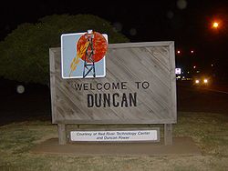
- DuncanDuncan, OklahomaDuncan is a city in Stephens County, Oklahoma, United States. The population was 23,431 at the 2010 census. It is the county seat of Stephens County.The official birthdate of the town is considered to be when the first train arrived there on June 27, 1892...
- HunterHunter, OklahomaHunter is a town in Garfield County, Oklahoma, United States. The population was 173 at the 2000 census.-Geography:Hunter is located at .According to the United States Census Bureau, the town has a total area of , all of it land....
- LamontLamont, OklahomaLamont is a town in Grant County, Oklahoma, along the Salt Fork Arkansas River. The population was 465 at the 2000 census.-Geography:Lamont is located at ....
- Logan CountyLogan County, OklahomaLogan County is a county located in the U.S. state of Oklahoma. The population as of 2009 was 39,301. Its county seat is Guthrie. Logan County is part of the Oklahoma City Metropolitan Statistical Area.-Geography:...
- MacombMacomb, OklahomaMacomb is a town in Pottawatomie County, Oklahoma, United States. The population was 32 at the 2010 census.-Geography:Macomb is located at .According to the United States Census Bureau, the town has a total area of , all of it land....
- McAlesterMcAlester, OklahomaMcAlester is a city in Pittsburg County, Oklahoma, United States. The population was 17,783 at the 2000 census. It is the county seat of Pittsburg County. It is currently the largest city in the Choctaw Nation of Oklahoma, followed by Durant....
- McClain CountyMcClain County, OklahomaMcClain County is a county located in the U.S. state of Oklahoma. The population was 27,740 at the 2000 census. Its county seat is Purcell. McClain County is part of the Oklahoma City Metropolitan Statistical Area, and is in the top 3 fastest growing counties in Oklahoma with a growth rate of...
- McCurtain CountyMcCurtain County, OklahomaMcCurtain County is a county located in the U.S. state of Oklahoma. As of 2010, the population was 33,151. Its county seat is Idabel.-Geography:...
- McIntosh CountyMcIntosh County, OklahomaMcIntosh County is a county located in the U.S. state of Oklahoma. As of 2000, the population was 19,456. Its county seat is Eufaula.-Geography:...
- McLoudMcLoud, OklahomaMcLoud is a town in Pottawatomie County, Oklahoma, United States, and is part of the Oklahoma City Consolidated Metropolitan Area. The population was 4,044 at the 2010 census.-History:...
- MidlothianMidlothian, OklahomaMidlothian is a small community in Lincoln County, Oklahoma. The post office was established in 1902 and the town plat filed in 1904. The post office closed in 1919 and the school was consolidated with the Chandler School District in the 1940s....
, Lincoln CountyLincoln County, OklahomaLincoln County is a county located in the U.S. state of Oklahoma. The population as of 2010 was 34,273. It is part of the Oklahoma City Metropolitan Statistical Area.Its county seat is Chandler.... - MorrisMorris, OklahomaMorris is a city in Okmulgee County, Oklahoma, United States. The townsite was platted in 1904 by L. R. Kershaw, who was an attorney and was also an Immigration Agent for the Frisco Railroad. He named the town after H. E. Morris, a Frisco Railroad executive...
- MorrisonMorrison, OklahomaMorrison is a town in Noble County, Oklahoma. The population was 636 at the 2000 census.-History:Morrison, OK is located in the Cherokee Outlet, which was created for the Cherokee Nation in 1835. The Outlet was opened to non-Indian settlement by the Cherokee Strip Land Run in September 1893...
- NewkirkNewkirk, OklahomaNewkirk is a city in Kay County, Oklahoma, United States. The population was 2,243 at the 2000 census. It is the county seat of Kay County.-Geography:...
(Kirk meaning "church") - StuartStuart, OklahomaStuart is a town in Hughes County, Oklahoma, United States. The population was 220 at the 2000 census.-Geography:Stuart is located at .According to the United States Census Bureau, the town has a total area of , all of it land....
Oregon
- AlbanyAlbany, OregonAlbany is the eleventh largest city in the U.S. state of Oregon, and is the county seat of Linn County. It is located in the Willamette Valley at the confluence of the Calapooia River and the Willamette River in both Linn and Benton counties, just east of Corvallis and south of Salem. It is...
- BurnsBurns, OregonBurns is a city in and the county seat of Harney County, Oregon, United States. As of the 2010 census the population was 2,806.-History:Burns was established in the early 1880s and incorporated upon Harney county's creation in 1889...
- Douglas CountyDouglas County, Oregon-National protected areas:* Crater Lake National Park * Rogue River-Siskiyou National Forest * Siuslaw National Forest * Umpqua National Forest * Willamette National Forest -Adjacent counties:* Lane County, Oregon -...
- DundeeDundee, OregonDundee is a city in Yamhill County, Oregon, United States. The population was 2,598 at the 2000 census. The 2007 estimate is 3,040 residents.-History:...
- Glasgow
Pennsylvania
|
Rhode Island
- Blackrock
- Charlestown
- Glendale
- Hope
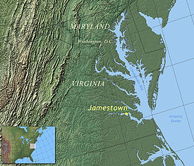
- Jamestown
- Kingston
- Middletown
- Newport
- Riverside
South Carolina
- AndersonAnderson, South CarolinaAnderson is a city in and the county seat of Anderson County, South Carolina, United States. The population was estimated at 26,242 in 2006, and the city was the center of an urbanized area of 70,530...
- CameronCameron, South CarolinaCameron is a town in Calhoun County, South Carolina, United States. The population was 449 at the 2000 census. It is part of the Columbia, South Carolina Metropolitan Statistical Area.-Geography:Cameron is located at ....
- DunbartonDunbarton, South CarolinaDunbarton was a town in Barnwell County, South Carolina, United States. The area was originally settled around 1800. Dunbarton grew after a train stop was built on a new rail line. In 1951, it was acquired by the U.S. Atomic Energy Commission as part of a site for the Savannah River Plant...
(Dumbarton) - Elgin, Kershaw CountyElgin, Kershaw County, South CarolinaElgin is a town in Kershaw County, South Carolina, United States. The population was 806 at the 2000 census. The population was nearly 94% rural in 2010. It is part of the Columbia, South Carolina Metropolitan Statistical Area.-Geography:...
- Elgin, Lancaster CountyElgin, Lancaster County, South CarolinaElgin is a census-designated place in Lancaster County, South Carolina, United States. The population was 2,426 at the 2000 census.-Geography:Elgin is located at ....
- McBeeMcBee, South CarolinaMcBee is a town in Chesterfield County, South Carolina, United States. The population was 867 at the 2010 census. McBee is located at 34°28'7.14"N 80°15'22.02"W, approximately 36 miles to Florence and approximately 62 miles to Columbia.-About Bunch McBee:...
- McClellanvilleMcClellanville, South CarolinaMcClellanville is a small fishing town in Charleston County, South Carolina, United States. The population was 459 at the 2000 census. It is situated on the Atlantic coast, on land surrounded by Francis Marion National Forest and has traditionally derived its livelihood from the sea and coastal...
- McCollMcColl, South CarolinaMcColl is a town in Marlboro County, South Carolina, United States, located within 1.5 miles of the border with North Carolina. The population was 2,498 at the 2000 census.-Geography:McColl is located at ....
- McConnellsMcConnells, South CarolinaMcConnells is a town in York County, South Carolina, United States and a suburb of York, South Carolina The population was 287 at the 2000 census.-Geography and climate:McConnells is located at ....
- McCormickMcCormick, South CarolinaMcCormick is a town in McCormick County, South Carolina, United States. The population was 1,489 at the 2000 census. It is the county seat of McCormick County.-Geography:McCormick is located at ....
- McCormick County
- ScotiaScotia, South CarolinaScotia is a town in Hampton County, South Carolina, United States. The population was 227 at the 2000 census.-Geography:Scotia is located at ....
South Dakota
- AberdeenAberdeen, South DakotaAberdeen is a city in and the county seat of Brown County, South Dakota, United States, about 125 mi northeast of Pierre. Settled in 1880, it was incorporated in 1882. The city population was 26,091 at the 2010 census. The American News is the local newspaper...
- ArdmoreArdmore, South DakotaArdmore is a ghost town in Fall River County, South Dakota, United States. The town was founded in 1889. In 1927, President Calvin Coolidge stopped in Ardmore. The town survived the Great Depression without one family on welfare. Rough times eventually fell on Ardmore, and by 2004 it was an...
- GeddesGeddes, South DakotaGeddes is a city in Charles Mix County, South Dakota, United States. The population was 208 at the 2010 census.-Geography:Geddes is located at .According to the United States Census Bureau, the city has a total area of , all of it land....
- Gretna
- KyleKyle, South DakotaKyle is a census-designated place in Shannon County, South Dakota, United States. The population was 846 at the 2010 census...
- LennoxLennox, South DakotaLennox is a city in Lincoln County, South Dakota, United States. The population was 2,111 at the 2010 census.-History:The city was named for Ben Lennox, a railroad official.The mayor of Lennox is Orville Wiebers.-Geography:...
- MontroseMontrose, South DakotaMontrose is a city in McCook County, South Dakota, United States. The population was 472 at the 2010 census.-Geography:Montrose is located at ....
- PollockPollock, South DakotaPollock is a town in Campbell County, South Dakota, United States. The population was 241 at the 2010 census.-Geography:Pollock is located at ....
- ScotlandScotland, South DakotaScotland is a city in Bon Homme County, South Dakota, in the United States. As of the 2010 census, the city population was 841.-Geography:Scotland is located at ....
Tennessee
- BurnsBurns, TennesseeBurns is a town in Dickson County, Tennessee, United States. It is part of the Nashville-Davidson–Murfreesboro–Franklin Metropolitan Statistical Area. The 1987 comedy film Ernest Goes to Camp was shot here...
- Campbell CountyCampbell County, TennesseeCampbell County is a U.S. county located in the U.S. state of Tennessee. As of 2010, the population was 40,716. Its county seat is Jacksboro. The Census Bureau has identified the county as a Micropolitan Statistical Area, designated the LaFollette Micropolitan Statistical Area for the largest...
- Claiborne County
- Davidson CountyDavidson County, TennesseeDavidson County is a county located in the U.S. state of Tennessee. As of 2010, the population was 626,681. Its county seat is Nashville.In 1963, the City of Nashville and the Davidson County government merged, so the county government is now known as the "Metropolitan Government of Nashville and...
- ErwinErwin, TennesseeErwin is a town in and the county seat of Unicoi County, Tennessee, United States. The population was 5,610 at the 2000 census. It is part of the Johnson City Metropolitan Statistical Area, which is a component of the Johnson City–Kingsport–Bristol, TN-VA Combined Statistical Area...
- Houston County
- KnoxvilleKnoxville, TennesseeFounded in 1786, Knoxville is the third-largest city in the U.S. state of Tennessee, U.S.A., behind Memphis and Nashville, and is the county seat of Knox County. It is the largest city in East Tennessee, and the second-largest city in the Appalachia region...
- McKenzieMcKenzie, TennesseeMcKenzie is a city at the tripoint of Carroll, Henry, and Weakley counties in the U.S. state of Tennessee. The population was 5,310 at the 2010 census.It is home to Bethel University and the Tennessee Technology Center at McKenzie.-Geography:...
- McMinn County
- Polk County
- Scott County
Texas
- Abercrombie
- AbernathyAbernathy, TexasAbernathy is a city in Hale and Lubbock counties in the U.S. state of Texas. The population was 2,839 at the 2000 census, but had dropped to 2,764 according to a 2009 estimate....
- AlbanyAlbany, TexasAlbany is a city in Shackelford County, Texas, United States. The population was 2,034 at the 2010 Census. It is the county seat of Shackelford County.-History:...
- ArgyleArgyle, TexasArgyle is a city in Denton County, Texas, United States, with a population of 2,365 as of the 2000 census. The master-planned community of Lantana, Texas shares the Argyle mailing address.-History:...
- ArmstrongArmstrong, TexasArmstrong is an unincorporated community in central Kenedy County, Texas, United States. It has an estimated population of 20. It lies on U.S. Route 77 approximately twenty miles south of Sarita, on the Missouri Pacific Railroad. It was the location where the Dick Cheney hunting incident occurred....
- BowieBowie, TexasBowie is a city in Montague County, Texas, United States. The population was 5,219 at the 2000 census.-Geography:According to the United States Census Bureau, Bowie has a total area of , of which, of it is land and of it is water.-Demographics:...
- CamdenCamden, TexasCamden is an unincorporated community in east central Polk County, Texas, United States. It is located at the junction of Farm to Market Roads 942 and 62, eighty miles northwest of Beaumont. As of the year 2000, the community had approximately 1,200 residents....
- CameronCameron, TexasCameron is a city in Milam County, Texas, United States. The population was 5,634 at the 2000 census. It is the county seat of Milam County.-Geography:Cameron is located at . It is situated at the junction of U.S...
- CrawfordCrawford, TexasCrawford is a town located in western McLennan County, Texas, United States. It is best known as the home of former President of the United States George W. Bush. He currently resides at the Prairie Chapel Ranch, which is located just outside Crawford, Texas....
- CumingsCumings, TexasCumings is a census-designated place in Fort Bend County, Texas, United States. The population was 683 at the 2000 census.-Geography:Cumings is located at ....
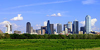
- DallasDallas, TexasDallas is the third-largest city in Texas and the ninth-largest in the United States. The Dallas-Fort Worth Metroplex is the largest metropolitan area in the South and fourth-largest metropolitan area in the United States...
- DamonDamon, TexasDamon is a census-designated place in Brazoria County, Texas, United States. The population was 535 at the 2000 census.-Geography:Damon is located at ....
- Douglas
- EdinburgEdinburg, TexasEdinburg is a city in and the county seat of Hidalgo County, Texas, United States. The population was 77,100 at the 2010 census. The University of Texas–Pan American, the only fully accredited four-year university in the Rio Grande Valley, is located in Edinburg.Edinburg is part of the...
- ElginElgin, TexasElgin is a city in Bastrop and Travis Counties in the U.S. state of Texas. The population was 5,700 at the 2000 census. By 2005, the population grew to an estimated 8,689...
- Glenn HeightsGlenn Heights, TexasGlenn Heights is a city in Dallas and Ellis Counties in the U.S. state of Texas. The population was 7,224 at the 2000 census.-Geography:Glenn Heights is located at ....
- GordonGordon, TexasGordon is a city in Palo Pinto County, Texas, United States. The population was 478 at the 2010 Census.Former Olympic athlete and conservative political figure Bob Richards raises miniature horses in Gordon.-Geography:...
- GrahamGraham, TexasGraham is a city in north central Texas. It is the county seat of Young County, and as of the 2010 Census had a population of 8,903.-History:...
- HighlandsHighlands, TexasHighlands is a census-designated place located along the Union Pacific Railroad, north of Interstate 10, and west of Farm to Market Road 2100 in an industrialized area of unincorporated Harris County, Texas, United States. The population was 7,089 at the 2000 census. Highlands is the hometown of...
- HoustonHouston, TexasHouston is the fourth-largest city in the United States, and the largest city in the state of Texas. According to the 2010 U.S. Census, the city had a population of 2.1 million people within an area of . Houston is the seat of Harris County and the economic center of , which is the ...
- (Kelso)
- KyleKyle, TexasKyle is a town in Hays County, Texas, United States. The population was 5,314 at the 2000 census; it was 26,103 in the 2008 census estimate, making Kyle one of the fastest growing cities in Texas.-Geography:...
- Lake DallasLake Dallas, TexasLake Dallas is a city in Denton County, Texas, United States. The population was 6,166 at the 2000 census.-Geography:Lake Dallas is located at ....
- Livingston
- McAllenMcAllen, TexasMcAllen is the largest city in Hidalgo County, Texas, United States. It is located at the southern tip of Texas in an area known as the Rio Grande Valley and is part of the . Its southern boundary is located about five miles from the U.S.–Mexico border and the Mexican city of Reynosa, the Rio...
- McLennon County (Waco)
- McGirkMcGirk, TexasMcGirk is a ghost town in Hamilton County near the Lampasas River in Central Texas. It was established in the 1870s and is believed to have become uninhabited by 1950.-References:*...
- McGregorMcGregor, TexasMcGregor is a city in Coryell and McLennan Counties in the U.S. state of Texas. The population was 4,727 at the 2000 census.McGregor lies in two counties as well as two metropolitan areas...
- McKinneyMcKinney, TexasMcKinney is a city in and the county seat of Collin County, Texas, United States, and the second in population to Plano. According to the U.S. Census Bureau, the city's 2010 population was 131,117 The Census Bureau listed McKinney as the nation's fastest growing city from 2000 to 2003 and again in...
- McLeodMcLeod, TexasMcLeod is an unincorporated community in southeastern Cass County, Texas, United States.Despite its size, it is commonly referred to as "The Birthplace of Legends."The McLeod Independent School District serves area students.-External links:...
- McNeil
- MidlothianMidlothian, TexasMidlothian is a city in northwest Ellis County, Texas, United States. It is the hub for the cement industry in North Texas as it is the home to three separate cement production facilities, as well as a steel mill. Midlothian is also a fast growing community with a growth rate of 142% since 2000...
, Ellis CountyEllis County, TexasAs of the census of 2000, there were 111,360 people, 37,020 households, and 29,653 families residing in the county. The population density was 118 people per square mile . There were 39,071 housing units at an average density of 42 per square mile... - MillicanMillican, TexasMillican is a town in Brazos County, Texas, United States. The population was 108 at the 2000 census. It is part of the Bryan–College Station metropolitan area...
- MontroseNeartown HoustonNeartown is an area located in west-central Houston, Texas, United States and is one of the city's major cultural areas. Neartown is roughly bounded by U.S. Highway 59 to the south, Allen Parkway to the north, Bagby Street on the east, and Shepherd Drive to the west...
- Ochiltree
- Scotsville
Utah
- BryceBryce, UtahBryce is an unincorporated community in southwestern Garfield County, Utah, United States, southeast of the city of Panguitch, the county seat of Garfield County. It lies along State Route 63 in the northern part of Bryce Canyon National Park. The community is distinct from the town of Bryce...
- Bryce Canyon
- LoganLogan, Utah-Layout of the City:Logan's city grid originates from its Main and Center Street block, with Main Street running north and south, and Center east and west. Each block north, east, south, or west of the origin accumulates in additions of 100 , though some streets have non-numeric names...
Virginia
- DumfriesDumfries, VirginiaDumfries is a town in Prince William County, Virginia, United States. The population was 4,937 at the 2000 census.-Geography:Dumfries is located at ....
- James City CountyJames City County, VirginiaJames City County is a county located on the Virginia Peninsula in the Hampton Roads metropolitan area of the Commonwealth of Virginia, a state of the United States. Its population was 67,009 , and it is often associated with Williamsburg, an independent city, and Jamestown which is within the...
- James RiverJames RiverThe James River may refer to:Rivers in the United States and their namesakes* James River * James River , North Dakota, South Dakota* James River * James River * James River...
- Jamestown, VirginiaJamestown, VirginiaJamestown was a settlement in the Colony of Virginia. Established by the Virginia Company of London as "James Fort" on May 14, 1607 , it was the first permanent English settlement in what is now the United States, following several earlier failed attempts, including the Lost Colony of Roanoke...
(for King JamesJames I of EnglandJames VI and I was King of Scots as James VI from 24 July 1567 and King of England and Ireland as James I from the union of the English and Scottish crowns on 24 March 1603...
, formerly James VI of Scots) - KilmarnockKilmarnock, VirginiaKilmarnock is a town in Lancaster and Northumberland counties in the U.S. state of Virginia. The population was 1,244 at the 2000 census. It is located near the mouth of the Rappahannock River and is located within the Northern Neck George Washington Birthplace American Viticultural Area winemaking...
- MidlothianMidlothian, VirginiaMidlothian is an unincorporated community in Chesterfield County, Virginia, United States. Founded over 300 years ago as a coal mining village, it is now a suburban community located in the Southside of Richmond well beyond the city limits of Richmond in the Richmond–Petersburg region.It was named...
, Chesterfield CountyChesterfield County, VirginiaChesterfield County is a county located in the Commonwealth of Virginia, a state of the United States. In 2010, its population was estimated to be 316,236. Chesterfield County is now the fourth-largest municipality in Virginia . Its county seat is Chesterfield... - ScotlandScotland, VirginiaScotland is a census-designated place in Surry County, Virginia, United States. The population as of the 2010 Census was 203. It is located on State Route 31...
- Scott CountyScott County, VirginiaAs of the census of 2000, there were 23,403 people, 9,795 households, and 7,023 families residing in the county. The population density was 44 people per square mile . There were 11,355 housing units at an average density of 21 per square mile...
Washington
- AberdeenAberdeen, WashingtonAberdeen is a city in Grays Harbor County, Washington, United States, founded by Samuel Benn in 1884. Aberdeen was incorporated on May 12, 1890. The city is the economic center of Grays Harbor County, bordering the cities of Hoquiam and Cosmopolis...
- BlaineBlaine, WashingtonBlaine is a city in Whatcom County, Washington, United States. The city's northern boundary is the Canadian border. Blaine is the shared home of the Peace Arch international monument...
- CathcartCathcart, WashingtonCathcart is a census-designated place in Snohomish County, Washington, United States. The population was 3,015 at the 2000 census. Based on per capita income, one of the more reliable measures of affluence, Cathcart ranks 45th of 522 areas in the state of Washington to be ranked...
- Cunningham
- Douglas
- Elgin
- FifeFife, WashingtonFife is a city in Pierce County, Washington, United States. The population was 9,173 at the 2010 census.-History:In 1940, it was described as "Fife...at a valley crossroads in the midst of a thickly settled berry growing and truck-gardening district is represented by a string of markets, taverns,...
- FinleyFinley, WashingtonFinley is a census-designated place in Benton County, Washington, United States. The population was 6,012 at the 2010 census. It is located to the southeast of the larger city of Kennewick.-History:...
- GrahamGraham, WashingtonGraham is a census-designated place in Pierce County, Washington, United States. The population was 8,739 at the 2000 census and grew to 23,491 at the 2010 census.-Geography:Graham is located at ....
- KelsoKelso, WashingtonKelso is a city in southwest Washington State, United States, and is the county seat of Cowlitz County. At the 2010 census, the population was 11,925. Kelso is part of the Longview, Washington Metropolitan Statistical Area, which has a population of 102,410. Kelso shares its long western border...
- KenmoreKenmore, WashingtonKenmore is a city in King County, Washington, United States, along the northernmost shores of Lake Washington...
- Lake McMurrayLake McMurray, WashingtonLake McMurray is a census-designated place in Skagit County, Washington, United States. The population was 192 at the 2010 census. It is included in the Mount Vernon–Anacortes, Washington Metropolitan Statistical Area....
- McMillan
- McNeil IslandMcNeil IslandMcNeil Island is an island in western Puget Sound, located just west of Steilacoom, Washington, with a land area of 17.177 km² . It lies just north of Anderson Island. Fox Island is to the north, across Carr Inlet. To the west McNeil Island is separated from Key Peninsula by Pitt Passage. The...
- MonroeMonroe, WashingtonMonroe is a city in Snohomish County, Washington, United States. The population as of 17,304 at the 2010 census.-History:The history of Monroe is intertwined with that of the Great Northern Railway which pushed over the Cascade Range at Stevens Pass and worked its way down the Skykomish River...
- Sinclair IslandSinclair Island (Washington)Sinclair Island is an island in the state of Washington, USA. It is a part of, and lies off the western shore of mainland Skagit County. The island has a land area of 4.109 km² and is home to only a few private residents....
West Virginia
- GlasgowGlasgow, West VirginiaGlasgow is a town in Kanawha County, West Virginia, USA, along the Kanawha River. The population was 783 at the 2000 census. Glasgow was incorporated on June 20, 1920...
- GlenvilleGlenville, West VirginiaGlenville is a town in and the county seat of Gilmer County, West Virginia, United States, along the Little Kanawha River. The population was 1,544 at the 2000 census. It is the home of Glenville State College.-History:...
- HendersonHenderson, West VirginiaHenderson is a town in Mason County, West Virginia, United States, at the confluence of the Ohio and Kanawha Rivers. The population was 325 at the 2000 census. It is part of the Point Pleasant, WV–OH Micropolitan Statistical Area...
- McDowell CountyMcDowell County, West VirginiaMcDowell County is a county in the U.S. state of West Virginia. The land that became McDowell was originally part of Tazewell County, Virginia. As of the 2010 census, the population was 22,113. Its county seat is Welch. McDowell county is the southern-most county in the state, geographically...
- MontroseMontrose, West VirginiaMontrose is a town in Randolph County, West Virginia, United States. The population was 156 at the 2000 census.-Geography:Montrose is located at , along Leading Creek....
Wisconsin
- Anderson (two places)
- ArgyleArgyle (town), WisconsinArgyle is a town in Lafayette County, Wisconsin, United States. The population was 479 at the 2000 census. The Village of Argyle is located within the town.-Geography:...
- Armstrong CreekArmstrong Creek, WisconsinArmstrong Creek is a town in Forest County, Wisconsin, United States. The population was 409 at the 2010 census. The unincorporated communities of Armstrong Creek, Bonneval, and Laona Junction are located with the town.-Geography:...
- Burnett County
- BurnsBurns, WisconsinBurns is a town in La Crosse County, Wisconsin, United States. The population was 1,119 at the 2010 census. It is part of the La Crosse, Wisconsin Metropolitan Statistical Area...
- BurnsideBurnside, WisconsinBurnside is a town in Trempealeau County, Wisconsin, in the United States. As of the 2000 census, the population was 529.-Geography:According to the United States Census Bureau, the town has a total area of 35.0 square miles , of which, 35.0 square miles of it is land and 0.1 square...
- CaledoniaCaledonia, WisconsinCaledonia is the name of some places in the U.S. state of Wisconsin:*Caledonia, Wisconsin, a village in Racine County*Caledonia, Columbia County, Wisconsin, a town in Columbia County*Caledonia, Trempealeau County, Wisconsin, a town in Trempealeau County...
(four places) - CameronCameron, Wood County, WisconsinCameron is a town in Wood County, Wisconsin, United States. The population was 510 at the 2000 census.-Geography:According to the United States Census Bureau, the town has a total area of 7.2 square miles , all of it land. It is located at .-Demographics:As of the census of 2000, there were...
- CampbellCampbell, WisconsinCampbell is a town in the middle of the Mississippi River in La Crosse County, Wisconsin, United States. It is part of the La Crosse, Wisconsin Metropolitan Statistical Area. The population was 4,441 at the 2006 census....
- ClydeClyde, WisconsinClyde is a town in Iowa County, Wisconsin, United States. The population was 322 at the 2000 census.-Geography:According to the United States Census Bureau, the town has a total area of 34.6 square miles , of which, 34.1 square miles of it is land and 0.5 square miles of it is...
- DallasDallas (town), WisconsinDallas is a town in Barron County in the U.S. state of Wisconsin. As of the 2000 census, the town had a population of 604. The Village of Dallas is within the town.-Geography:...
- DouglasDouglas, WisconsinDouglas is a town in Marquette County, Wisconsin, United States. The population was 768 at the 2000 census. The unincorporated community of Briggsville is located within the town.-Geography:...
- Douglas County
- DrummondDrummond, WisconsinDrummond is a town in Bayfield County, Wisconsin, United States. The population was 541 at the 2000 census. The census-designated place of Drummond is located in the town.U.S...
- DunbarDunbar, WisconsinSee also Dunbar Dunbar is a town in Marinette County, Wisconsin, United States. The population was 1,303 at the 2000 census. The census-designated place of Dunbar is located in the town.-History:...
- Dunn (two places)
- Dunn County
- ElchoElcho, WisconsinElcho is a town in Langlade County, Wisconsin, United States. The population was 1,317 at the 2000 census. The census-designated places of Elcho and Post Lake are located in the town.-Geography:...
(Earl of Wemyss and March) - EttrickEttrick (town), WisconsinEttrick is a town in Trempealeau County, Wisconsin, United States. The population was 1,284 at the 2000 census. The Village of Ettrick is located within the town...
- GallowayGalloway, WisconsinGalloway is an unincorporated community located in Marathon County, Wisconsin, United States. Galloway is located on Wisconsin Highway 49 south of Elderon, in the town of Franzen. Galloway has a post office with ZIP code 54432....
- Glen HavenGlen Haven, WisconsinGlen Haven is a town in Grant County, Wisconsin, United States. According to the 2000 census, the town population was 490. The census-designated place of Glen Haven is located in the town.-Geography:...
- GlencoeGlencoe, WisconsinGlencoe is a town in Buffalo County in the U.S. state of Wisconsin. The population was 478 at the 2000 census. The unincorporated community of Glencoe is located in the town.-Geography:...
- GlendaleGlendale, Monroe County, WisconsinGlendale is a town in Monroe County, Wisconsin, United States. The population was 579 at the 2000 census.-Geography:According to the United States Census Bureau, the town has a total area of 35.7 square miles , of which, 35.6 square miles of it is land and 0.03% is...
- GlenmoreGlenmore, WisconsinGlenmore is a town in Brown County in the U.S. state of Wisconsin. The population was 1,187 at the 2000 census. The unincorporated community of Shirley is located in the town.-Geography:...
- GlenwoodGlenwood, WisconsinGlenwood is a town in St. Croix County, Wisconsin, United States. The population was 755 at the 2000 census. The unincorporated community of Emerald is located partially in the town.-Geography:...
- Gordon (three places)
- Grant (six places)
- GrantsburgGrantsburg (town), WisconsinGrantsburg is a town in Burnett County in the U.S. state of Wisconsin. The population was 967 at the 2000 census. The Village of Grantsburg is located within the town...
- HamiltonHamilton, WisconsinHamilton is a town in La Crosse County, Wisconsin, United States. The population was 2,301 at the 2000 census. It is part of the La Crosse, Wisconsin Metropolitan Statistical Area.- Origin of the town's name :The Town of Hamilton was named by John M...
- LamontLamont, WisconsinLamont is a town in Lafayette County, Wisconsin, United States. The population was 267 at the 2000 census. The unincorporated community of Lamont is located in the town.-Geography:...
- LanarkLanark, WisconsinLanark is a town in Portage County, Wisconsin. As of the 2000 census, the town had a population of 1,449. The unincorporated community of Badger is in the town.-Geography:...
- McKinley (two places)
- McMillanMcMillan, WisconsinMcMillan is a town in Marathon County, Wisconsin, United States. It is part of the Wausau, Wisconsin Metropolitan Statistical Area. The population was 1,790 at the 2000 census...
- NorrieNorrie, WisconsinNorrie is a town in Marathon County, Wisconsin, United States. It is part of the Wausau, Wisconsin Metropolitan Statistical Area. The population was 967 at the 2000 census...
- ReidReid, WisconsinReid is a town in Marathon County, Wisconsin, United States. It is part of the Wausau, WI Metropolitan Statistical Area. The population was 1,191 at the 2000 census. The unincorporated communities of Little Eau Claire and Pike Lake are located in the town...
- Scott (seven places)
Wyoming
- BurnsBurns, WyomingBurns is a town in Laramie County, Wyoming, United States. It is part of the Cheyenne, Wyoming Metropolitan Statistical Area. The population was 285 at the 2000 census.-Geography:Burns is located at , about 25 miles east of Cheyenne....
- Campbell County
- DouglasDouglas, WyomingDouglas is a city in Converse County, Wyoming, United States. The population was 5,288 at the 2000 census. It is the county seat of Converse County...
- McKinnonMcKinnon, WyomingMcKinnon is a census-designated place in Sweetwater County, Wyoming, United States. The population was 49 at the 2000 census.-Geography:McKinnon is located at ....
See also
- Scottish place names in AustraliaScottish place names in AustraliaThis is a list of placenames in Scotland which have subsequently been applied to parts of Australia by Scottish emigrants or explorers.-Australian Capital Territory:* Campbell * Duntroon* Fraser* Lawson* Macgregor...
- Scottish place names in CanadaScottish place names in CanadaThis is a list of placenames in Scotland which have subsequently been applied to parts of Canada by Scottish emigrants or explorers.For Nova Scotian names in Scottish Gaelic see Canadian communities with Scottish Gaelic speakers and Scottish Gaelic placenames in CanadaNote that, unless otherwise...
- Scottish place names in New ZealandScottish place names in New ZealandThis is a list of placenames in Scotland which have subsequently been applied to parts of New Zealand by Scottish emigrants or explorers.The South Island also contains the Strath-Taieri and the Ben Ohau Range of mountains, both combining Scots Gaelic and Māori origins...