
Kenmore, Washington
Encyclopedia
Kenmore is a city in King County
, Washington, United States
, along the northernmost shores of Lake Washington
. A mix of bedroom community, one-time country retreat, and freshwater industrial port, prominent features include the nation's largest seaplane-only, commercial air facility at Kenmore Air Harbor
, Bastyr University
, several waterside parks and marinas, and easy access to the Burke-Gilman Trail
and the King County bike-trail system. Sites of local historical interest include the former St. Edward Seminary
, now Saint Edward State Park
; and Log Boom Park. Kenmore's official city flower is the dahlia
, the official city bird is the great blue heron
, and the official city evergreen
is the rhododendron
. The population was 20,460 at the 2010 census.
village of Kenmore, via town founder home town of Kenmore, Ontario
. McMasters and his wife Annie arrived in Puget Sound circa 1889 from Canada
, intending to establish themselves in the shingle-making trade. They opened a shingle mill on the northern shore of Lake Washington on land leased from Watson Squire. By 1903, Kenmore had established a school system and post office, but it did not formally incorporate as a city until August 31, 1998.
, most access to the city in its early days was by boat, with regular ferry service to Seattle
, Bothell
, and Woodinville
starting in 1906. The city later gained a passenger railroad stop. The first improved road connection to Seattle and Bothell—the Red Brick Road—opened between 1913 and 1914, with bus service following the laying of the bricks. As a result, Kenmore became a country retreat for weekend gardeners with local landowners selling off clear-cut "garden plots" to Seattlites with automobiles and green thumbs. It attracted at least two short-lived nudist camps during the 1920s.
Far more striking, however, was the impact of Prohibition
. Kenmore quickly became famous in Seattle
for its fine country dining and, more importantly, its fine country drinking
, as a substantial illegal alcohol industry developed to meet the demands of Jazz Age
Seattle nightlife. Although relatively close to Seattle proper—thanks to Bothell Way's status as one of the few improved roads then heading north from downtown— it was nonetheless far enough out that Department of Revenue officers could, for the most part, ignore it.
The Blind Pig, a roadhouse on Shuter's Landing at Lake Washington, was probably the most famous of the Kenmore speakeasy
s. At the lakeside, its illegal hooch could be dumped into the lake quickly and easily should it become necessary. Few people were fooled; the name itself was, in fact, a well-known slang term meaning "speakeasy". But despite its notoriety, the Pig was not even the city's most infamous saloon. Routine violence and fist-fights at the Inglewood Tavern earned that establishment an alternative name: the Bucket of Blood.
This archipelago of dining and entertainment - over 30 different restaurants, dance halls, bars, and clubs in a three-block area - remained a major part of Kenmore's identity through the 1940s.
hit, Kenmore became home for a small settlement of workers under President Franklin D. Roosevelt
's Back to the Land
program. Paid by the Works Progress Administration
, a small number of workers settled in an area of northwestern Kenmore which became known as "Voucherville", after the vouchers the WPA paid in lieu of a cash salary.
After the end of World War II
, Kenmore became home to US Army Nike Hercules missile batteries as part of cold-war era defense plans. These nuclear-tipped anti-aircraft missiles were intended to protect Seattle and environs from Soviet
bombers, should war break out. They were removed in 1974.
The post-war era largely transformed downtown. Kenmore Air Harbor
, which today is one of the world's largest seaplane
-only airports, opened not far from the old location of the Blind Pig; Kenmore Air
itself today runs a fleet of seaplanes serving waterside destinations throughout Cascadia
. At the same time, Kenmore's immediate proximity to Seattle—just two miles (3 km) north of modern Seattle city limits— made it an early target of post-war housing development. The first plaits in the new Uplake neighborhood were sold in 1954. Housing development continued throughout the Kenmore area for the next several decades, mostly following the postwar suburban model; industrial and commercial growth followed quickly behind, and within a few decades, most of the old Kenmore dining and drinking had vanished, replaced by shopping centers, industrial development, and housing. However, one part of this new development brought its own history along with it: the Jewel Box Building in downtown Kenmore is a Seattle World's Fair
artifact, moved from Seattle Center
to Kenmore after the end of the fair in October, 1962.
The city gained its first college in 1996, with the relocation of Bastyr University
from Seattle onto the grounds of the former St. Edward Seminary
.
of 1990. Formation of an exploration committee in 1995 led to a successful public vote shortly thereafter, and the city formally incorporated on August 31, 1998, 97 years after its original founding.
Following incorporation, the new government set about devising a local set of zoning codes and a downtown development plan with the intent of reviving and rebuilding the traditional core areas of the city. A significant component of this plan involves extensive use of land now owned by the city, in the area known within the plan as the Northwest Quadrant. An open invitation was extended to all architects and developers to submit development plans for this newly available area in December, 2005. The City Council chose to negotiate primarily with Kenmore Partners LLC in April 2006. Design plans were submitted to the city the following summer, with a conceptual overview made available to the public at the same time.
Kenmore's oldest roads, now known most often by their county-assigned number systems, originally had more traditional names such as Cat's Whiskers Road (61st Avenue NE), Squire Boulevard (later Red Brick Road, now Bothell Way/SR 522), and Remington Drive (NE 181st Street). These traditional names were reinstated in 2007 as secondary names in the downtown area.
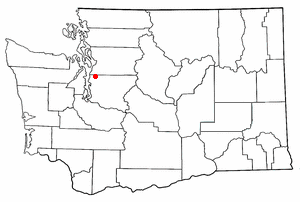 Kenmore is located at 47°45′10"N 122°14′50"W (47.752870, -122.247360), with borders encompassing all of the north shore and a significant portion of the northeastern shore of Lake Washington
. The local terrain is typical of the Puget Sound lowlands, consisting largely of rolling hills formed from glacial till, occasionally interrupted by flatlands typically found near substantial bodies of water. The largest river is the Sammamish
, which connects Lake Sammamish
to Lake Washington
, and divides the city into northern and southern halves. Additionally, the northeastern corner of the city includes a narrow set of swamp
s and marshlands running north to south along Swamp Creek
.
According to the United States Census Bureau
, the city has a total area of 6.3 square miles (16.2 km²), of which, 6.2 square miles (16.0 km²) of it is land and 0.1 square miles (0.3 km²) of it (1.60%) is water.
. As such, it is usually considered Marine west coast in nature, with damp, cool winters, and mild, dry summers, despite being further north than cities such as Toronto and Montreal.
Since 2000, a significant number of developers have been converting former pastureland to high-end housing in the northern section of the city. As a result, the overall character of these sections of town has been rapidly changing, from run-down and semi-rural to affluent suburbia. This has also affected nearby Bothell
, resulting in the creation of numerous commercial developments.
of 2000, there were 18,678 people, 7,307 households, and 4,961 families residing in the city. The population density
was 3,028.7 people per square mile (1,168.8/km²). There were 7,562 housing units at an average density of 1,226.2 per square mile (473.2/km²). The racial makeup of the city was 86.70% White, 1.39% African American, 0.37% Native American, 7.16% Asian, 0.18% Pacific Islander, 1.24% from other races
, and 2.96% from two or more races. Hispanic or Latino of any race were 3.51% of the population.
There were 7,307 households out of which 33.5% had children under the age of 18 living with them, 56.1% were married couples
living together, 8.2% had a female householder with no husband present, and 32.1% were non-families. 24.1% of all households were made up of individuals and 6.9% had someone living alone who was 65 years of age or older. The average household size was 2.54 and the average family size was 3.03.
In the city the population was spread out with 24.5% under the age of 18, 7.5% from 18 to 24, 31.9% from 25 to 44, 25.8% from 45 to 64, and 10.3% who were 65 years of age or older. The median age was 38 years. For every 100 females there were 98.7 males. For every 100 females age 18 and over, there were 96.7 males.
The median income for a household in the city was $61,756, and the median income for a family was $72,139 (these figures had risen to $79,847 and $100,999 respectively as of a 2007 estimate). Males had a median income of $50,160 versus $35,570 for females. The per capita income
for the city was $31,692, ranking 33rd of 522 areas in the state of Washington to be ranked. About 4.8% of families and 5.7% of the population were below the poverty line, including 7.7% of those under age 18 and 4.1% of those age 65 or over.
 While in large part now a bedroom community for workers commuting to nearby Seattle, Bothell, and Redmond, Kenmore retains a significant independent economic core centered around durable good
s (construction materials, concrete, asphalt) and special trade contracting (construction, heavy construction, and highways).
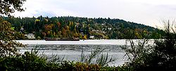
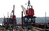
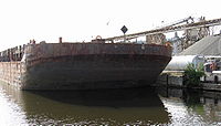
Kenmore also hosts one of the last industrial ports on Lake Washington
, at the mouth of the Sammamish River
. Larger local businesses near the port include Rinker Materials
's Kenmore plant, Kenmore Ready-Mix (cements and asphalts, a division of Glacier Northwest), Pacific Topsoils (topsoils and landscape construction materials), Michael Homchick Stoneworks (stone fabrication and installation), Plywood Supply (lumber, plywood, and millwork, wholesale, retail, and company headquarters), and several others. As home to the James G. Murphy Company, one of the ten largest commercial/industrial auction houses in the United States, the city is also an auction
center.
Significant non-durable-goods businesses include the headquarters of Kenmore Air
, a large private seaplane-based airline; Alaska General Seafoods's company headquarters and processing plant; Bastyr University
, a school of naturopathic medicine
.
, and the local high school is Inglemoor High School
. The nonprofit group Saint Edward Environmental Learning Center provides quarterly environmental education classes to the public in conjunction with Washington State Parks and Saint Edward State Park
. They also operate the ALEAFA Model Public High School. The Kenmore Library Association, a volunteer group affiliated with the local library, plans and sponsors library programming.
Kenmore is home to Bastyr University
, a leading private school of naturopathic medicine
founded in 1978 and accredited by the Northwest Commission on Colleges and Universities
(NWCCU). The city is also located between the University of Washington
's main campus in Seattle and its satellite campus and the co-located Cascadia Community College
in nearby Bothell
, with paved bike trails and express bus service connecting the city to all three schools. The city also has a bus connection directly to Shoreline Community College
, and much of the town is within walking distance of SCC's Center for Business and Continuing Education located in Lake Forest Park, Washington
.
, being governed by a City Council
consisting of seven Councilmembers, each of whom is elected to a four year term. Council elections are held every two years, with either three or four positions standing, depending upon year. All positions are nonpartisan and at-large, elected by the entire city voting population. The Council passes ordinances, sets policies, and elects from its own membership a Mayor and Deputy Mayor for two year terms. The Council as a whole meets on the second and fourth Mondays of each month, with public Study Sessions held on the first and third Mondays.
Day to day operations of the city are administered by a City Manager
, hired by the City Council. City code also stipulates the hiring of a full-time City Clerk. Major committees included in Kenmore Municipal Code are the Landmarks and Heritage Commission, the Planning Commission, and the Library Advisory Board.
City of Kenmore police duties are subcontracted through the King County Sheriff's Office; the original City of Kenmore Fire Department's duties were expanded via agreement with nearby Lake Forest Park, becoming the Northshore Fire Department.
In March 2003, the city council put a ban on new cardrooms but grandfathered the 11th Frame. In October of that year, Len Griesel, a Kenmore businessman and commercial property owner, challenged the ban in court. In November, the city council removed the ban against new cardrooms and reinstated the moratorium.
In September 2004, the issue was put before Kenmore voters as Proposition 1, "Proposed Ban of Card Rooms" Proposition 1 asked "Shall the City of Kenmore ban such “social card games”?" The proposition failed, but the city council did not lift the moratorium.
In December 2004, as part of the lawsuit brought by Len Griesel, King County Superior Court Judge Terry Lukens overturned the moratorium and gave the council until the end of June 2005 to allow or ban all gambling. In June 2005, the city council did not have enough votes to enact a ban on cardrooms. Despite the fact that cardrooms were now open to new business, Len Griesel did not apply for a cardroom license.
The 2005 Council elections focused in part on whether the city should adopt a ban on cardroom
s. Several candidates stated their positions that a cardroom ban would be key to any successful attempt to rebuild Kenmore's downtown core.
Immediately after the election, in December 2005, the council voted to ban cardrooms. At that time, the 11th Frame filed a lawsuit against the city in federal court. In August 2006, the lawsuit was dismissed on the grounds that gambling was not a vested right. An appeal was filed in the Ninth Circuit Court. That case was decided May 28, 2008 with the judges affirming the city’s ban on card rooms. Under an agreement between Frank Evans, city attorneys, and the state gambling commission, the cardroom attached to Kenmore Lanes closed on June 30, 2009.
, but town and neighborhood events are covered primarily by the Kenmore Reporter, a weekly newspaper. Published by Reporter Newspapers of Kent, Washington
, almost all of its articles appear only in the print edition. Once a month, a Kenmore city government update is printed within the newspaper as a two- to four-page supplement. The Kenmore Reporter is delivered free of charge throughout the city. For its part, the city also sends out a quarterly eight-page newsletter to all residents discussing government activities, development project status reports, budgetary summaries, and a community events calendar.
Family Circle Magazine selected Kenmore,Washington as one of the "10 Best Towns for families" in their August 2009 edition. Seattle Magazine also ranked Kenmore as the best Seattle-area neighbourhood or surrounding city for 2008-2009.
is a King County park, and St. Edward State Park is operated by the Washington State Parks and Recreation Commission. Extant parks within city limits include:
King County, Washington
King County is a county located in the U.S. state of Washington. The population in the 2010 census was 1,931,249. King is the most populous county in Washington, and the 14th most populous in the United States....
, Washington, United States
United States
The United States of America is a federal constitutional republic comprising fifty states and a federal district...
, along the northernmost shores of Lake Washington
Lake Washington
Lake Washington is a large freshwater lake adjacent to the city of Seattle. It is the largest lake in King County and the second largest in the state of Washington, after Lake Chelan. It is bordered by the cities of Seattle on the west, Bellevue and Kirkland on the east, Renton on the south and...
. A mix of bedroom community, one-time country retreat, and freshwater industrial port, prominent features include the nation's largest seaplane-only, commercial air facility at Kenmore Air Harbor
Kenmore Air Harbor
Kenmore Air Harbor or Kenmore Air Harbor Inc. Seaplane Base is a public-use seaplane base located one nautical mile south of the central business district of Kenmore, a city in King County, Washington, United States...
, Bastyr University
Bastyr University
Bastyr University was established as the John Bastyr College of Naturopathic Medicine in 1978 in Seattle, Washington by Sheila Quinn, Joseph Pizzorno, ND, LM; William Mitchell, ND; and Les Griffith, ND, LM...
, several waterside parks and marinas, and easy access to the Burke-Gilman Trail
Burke-Gilman Trail
The Burke-Gilman Sammamish Trail is a rail trail in King County, Washington. The multi-use recreational trail is part of the King County Regional Trail System and occupies an abandoned Seattle, Lake Shore and Eastern Railway corridor....
and the King County bike-trail system. Sites of local historical interest include the former St. Edward Seminary
St. Edward Seminary
Saint Edward Seminary was an institution for developing Catholic priests in Washington state, USA. Named for Saint Edward the Confessor and located in the city of Kenmore, it operated for 46 years before closing in 1976. The seminary and most of its grounds now constitute Saint Edward State Park...
, now Saint Edward State Park
Saint Edward State Park
Saint Edward State Park is a -park in Kenmore, Washington and Kirkland, Washington. It is part of the Washington State Park System. Before becoming a Catholic seminary and later a state park, the area was logged in the 19th century and again in the 1920s. A series of trails runs through the park...
; and Log Boom Park. Kenmore's official city flower is the dahlia
Dahlia
Dahlia is a genus of bushy, tuberous, perennial plants native to Mexico, Central America, and Colombia. There are at least 36 species of dahlia, some like D. imperialis up to 10 metres tall. Dahlia hybrids are commonly grown as garden plants...
, the official city bird is the great blue heron
Great Blue Heron
The Great Blue Heron is a large wading bird in the heron family Ardeidae, common near the shores of open water and in wetlands over most of North and Central America as well as the West Indies and the Galápagos Islands. It is a rare vagrant to Europe, with records from Spain, the Azores and England...
, and the official city evergreen
Evergreen
In botany, an evergreen plant is a plant that has leaves in all seasons. This contrasts with deciduous plants, which completely lose their foliage during the winter or dry season.There are many different kinds of evergreen plants, both trees and shrubs...
is the rhododendron
Rhododendron
Rhododendron is a genus of over 1 000 species of woody plants in the heath family, most with showy flowers...
. The population was 20,460 at the 2010 census.
History
Founded in 1901, Kenmore's name comes third-hand from the ScottishScotland
Scotland is a country that is part of the United Kingdom. Occupying the northern third of the island of Great Britain, it shares a border with England to the south and is bounded by the North Sea to the east, the Atlantic Ocean to the north and west, and the North Channel and Irish Sea to the...
village of Kenmore, via town founder home town of Kenmore, Ontario
Kenmore, Ontario
Kenmore is a village in eastern Ontario, Canada. Located in Osgoode Ward, it is now part of the city of Ottawa, and consists of a small commercial centre flanked by two small residential neighbourhoods and farmland...
. McMasters and his wife Annie arrived in Puget Sound circa 1889 from Canada
Canada
Canada is a North American country consisting of ten provinces and three territories. Located in the northern part of the continent, it extends from the Atlantic Ocean in the east to the Pacific Ocean in the west, and northward into the Arctic Ocean...
, intending to establish themselves in the shingle-making trade. They opened a shingle mill on the northern shore of Lake Washington on land leased from Watson Squire. By 1903, Kenmore had established a school system and post office, but it did not formally incorporate as a city until August 31, 1998.
Country living: lumber, gardeners, nudists, and booze
Despite cargo railway service passing through the area as early as 1887 via the Seattle, Lake Shore and Eastern RailwaySeattle, Lake Shore and Eastern Railway
The Seattle, Lake Shore and Eastern Railway was a railroad founded in Seattle, Washington, on April 28, 1885, with three tiers of purposes: Build and run the initial line to the town of Ballard, bring immediate results and returns to investors; exploit resources east in the valleys, foothills,...
, most access to the city in its early days was by boat, with regular ferry service to Seattle
Seattle, Washington
Seattle is the county seat of King County, Washington. With 608,660 residents as of the 2010 Census, Seattle is the largest city in the Northwestern United States. The Seattle metropolitan area of about 3.4 million inhabitants is the 15th largest metropolitan area in the country...
, Bothell
Bothell, Washington
Bothell is a city located in King and Snohomish Counties in the state of Washington. It is part of the Seattle metropolitan area. The population was 33,505 as of the 2010 census...
, and Woodinville
Woodinville, Washington
Woodinville is a city in King County, Washington, United States. The population was 10,938 at the 2010 census. It is part of the Seattle metropolitan area. There is also a much larger population with Woodinville mailing addresses in adjacent unincorporated areas of King and Snohomish counties...
starting in 1906. The city later gained a passenger railroad stop. The first improved road connection to Seattle and Bothell—the Red Brick Road—opened between 1913 and 1914, with bus service following the laying of the bricks. As a result, Kenmore became a country retreat for weekend gardeners with local landowners selling off clear-cut "garden plots" to Seattlites with automobiles and green thumbs. It attracted at least two short-lived nudist camps during the 1920s.
Far more striking, however, was the impact of Prohibition
Prohibition
Prohibition of alcohol, often referred to simply as prohibition, is the practice of prohibiting the manufacture, transportation, import, export, sale, and consumption of alcohol and alcoholic beverages. The term can also apply to the periods in the histories of the countries during which the...
. Kenmore quickly became famous in Seattle
Seattle, Washington
Seattle is the county seat of King County, Washington. With 608,660 residents as of the 2010 Census, Seattle is the largest city in the Northwestern United States. The Seattle metropolitan area of about 3.4 million inhabitants is the 15th largest metropolitan area in the country...
for its fine country dining and, more importantly, its fine country drinking
Drinking
Drinking is the act of consuming water or a beverage through the mouth. Water is required for many of life’s physiological processes. Both excessive and inadequate water intake are associated with health problems.-Physiology:...
, as a substantial illegal alcohol industry developed to meet the demands of Jazz Age
Jazz Age
The Jazz Age was a movement that took place during the 1920s or the Roaring Twenties from which jazz music and dance emerged. The movement came about with the introduction of mainstream radio and the end of the war. This era ended in the 1930s with the beginning of The Great Depression but has...
Seattle nightlife. Although relatively close to Seattle proper—thanks to Bothell Way's status as one of the few improved roads then heading north from downtown— it was nonetheless far enough out that Department of Revenue officers could, for the most part, ignore it.
The Blind Pig, a roadhouse on Shuter's Landing at Lake Washington, was probably the most famous of the Kenmore speakeasy
Speakeasy
A speakeasy, also called a blind pig or blind tiger, is an establishment that illegally sells alcoholic beverages. Such establishments came into prominence in the United States during the period known as Prohibition...
s. At the lakeside, its illegal hooch could be dumped into the lake quickly and easily should it become necessary. Few people were fooled; the name itself was, in fact, a well-known slang term meaning "speakeasy". But despite its notoriety, the Pig was not even the city's most infamous saloon. Routine violence and fist-fights at the Inglewood Tavern earned that establishment an alternative name: the Bucket of Blood.
This archipelago of dining and entertainment - over 30 different restaurants, dance halls, bars, and clubs in a three-block area - remained a major part of Kenmore's identity through the 1940s.
Voucherville, the Cold War, and redevelopment
Once the Great DepressionGreat Depression
The Great Depression was a severe worldwide economic depression in the decade preceding World War II. The timing of the Great Depression varied across nations, but in most countries it started in about 1929 and lasted until the late 1930s or early 1940s...
hit, Kenmore became home for a small settlement of workers under President Franklin D. Roosevelt
Franklin D. Roosevelt
Franklin Delano Roosevelt , also known by his initials, FDR, was the 32nd President of the United States and a central figure in world events during the mid-20th century, leading the United States during a time of worldwide economic crisis and world war...
's Back to the Land
Back to the land
The back-to-the-land movement calls for occupants of real property to grow food from the land on a small-scale basis for themselves or for others, and to perhaps live on the land while doing so....
program. Paid by the Works Progress Administration
Works Progress Administration
The Works Progress Administration was the largest and most ambitious New Deal agency, employing millions of unskilled workers to carry out public works projects, including the construction of public buildings and roads, and operated large arts, drama, media, and literacy projects...
, a small number of workers settled in an area of northwestern Kenmore which became known as "Voucherville", after the vouchers the WPA paid in lieu of a cash salary.
After the end of World War II
World War II
World War II, or the Second World War , was a global conflict lasting from 1939 to 1945, involving most of the world's nations—including all of the great powers—eventually forming two opposing military alliances: the Allies and the Axis...
, Kenmore became home to US Army Nike Hercules missile batteries as part of cold-war era defense plans. These nuclear-tipped anti-aircraft missiles were intended to protect Seattle and environs from Soviet
Soviet Union
The Soviet Union , officially the Union of Soviet Socialist Republics , was a constitutionally socialist state that existed in Eurasia between 1922 and 1991....
bombers, should war break out. They were removed in 1974.
The post-war era largely transformed downtown. Kenmore Air Harbor
Kenmore Air Harbor
Kenmore Air Harbor or Kenmore Air Harbor Inc. Seaplane Base is a public-use seaplane base located one nautical mile south of the central business district of Kenmore, a city in King County, Washington, United States...
, which today is one of the world's largest seaplane
Seaplane
A seaplane is a fixed-wing aircraft capable of taking off and landing on water. Seaplanes that can also take off and land on airfields are a subclass called amphibian aircraft...
-only airports, opened not far from the old location of the Blind Pig; Kenmore Air
Kenmore Air
Kenmore Air Harbor, Inc., doing business as Kenmore Air, is an American airline with its headquarters on the grounds of Kenmore Air Harbor in Kenmore, Washington, USA, north of Seattle...
itself today runs a fleet of seaplanes serving waterside destinations throughout Cascadia
Pacific Northwest
The Pacific Northwest is a region in northwestern North America, bounded by the Pacific Ocean to the west and, loosely, by the Rocky Mountains on the east. Definitions of the region vary and there is no commonly agreed upon boundary, even among Pacific Northwesterners. A common concept of the...
. At the same time, Kenmore's immediate proximity to Seattle—just two miles (3 km) north of modern Seattle city limits— made it an early target of post-war housing development. The first plaits in the new Uplake neighborhood were sold in 1954. Housing development continued throughout the Kenmore area for the next several decades, mostly following the postwar suburban model; industrial and commercial growth followed quickly behind, and within a few decades, most of the old Kenmore dining and drinking had vanished, replaced by shopping centers, industrial development, and housing. However, one part of this new development brought its own history along with it: the Jewel Box Building in downtown Kenmore is a Seattle World's Fair
Century 21 Exposition
The Century 21 Exposition was a World's Fair held April 21, 1962, to October 21, 1962 in Seattle, Washington.Nearly 10 million people attended the fair...
artifact, moved from Seattle Center
Seattle Center
Seattle Center is a park and arts and entertainment center in Seattle, Washington. The campus is the site used in 1962 by the Century 21 Exposition. It is located just north of Belltown in the Lower Queen Anne neighborhood.-Attractions:...
to Kenmore after the end of the fair in October, 1962.
The city gained its first college in 1996, with the relocation of Bastyr University
Bastyr University
Bastyr University was established as the John Bastyr College of Naturopathic Medicine in 1978 in Seattle, Washington by Sheila Quinn, Joseph Pizzorno, ND, LM; William Mitchell, ND; and Les Griffith, ND, LM...
from Seattle onto the grounds of the former St. Edward Seminary
St. Edward Seminary
Saint Edward Seminary was an institution for developing Catholic priests in Washington state, USA. Named for Saint Edward the Confessor and located in the city of Kenmore, it operated for 46 years before closing in 1976. The seminary and most of its grounds now constitute Saint Edward State Park...
.
Incorporation and rebuilding downtown
Kenmore residents considered incorporation many times since the town's founding; one such incorporation vote failed in 1954. The idea gained popular support through the 1990s, however, partly in response to the passage of the Washington State Growth Management ActWashington State Growth Management Act
The Washington State Growth Management Act was adopted because the Washington State Legislature found that uncoordinated and unplanned growth posed a threat to the environment, sustainable economic development and the quality of life in Washington. Known as the GMA, the Act was adopted by the...
of 1990. Formation of an exploration committee in 1995 led to a successful public vote shortly thereafter, and the city formally incorporated on August 31, 1998, 97 years after its original founding.
Following incorporation, the new government set about devising a local set of zoning codes and a downtown development plan with the intent of reviving and rebuilding the traditional core areas of the city. A significant component of this plan involves extensive use of land now owned by the city, in the area known within the plan as the Northwest Quadrant. An open invitation was extended to all architects and developers to submit development plans for this newly available area in December, 2005. The City Council chose to negotiate primarily with Kenmore Partners LLC in April 2006. Design plans were submitted to the city the following summer, with a conceptual overview made available to the public at the same time.
Kenmore's oldest roads, now known most often by their county-assigned number systems, originally had more traditional names such as Cat's Whiskers Road (61st Avenue NE), Squire Boulevard (later Red Brick Road, now Bothell Way/SR 522), and Remington Drive (NE 181st Street). These traditional names were reinstated in 2007 as secondary names in the downtown area.
Geography
Lake Washington
Lake Washington is a large freshwater lake adjacent to the city of Seattle. It is the largest lake in King County and the second largest in the state of Washington, after Lake Chelan. It is bordered by the cities of Seattle on the west, Bellevue and Kirkland on the east, Renton on the south and...
. The local terrain is typical of the Puget Sound lowlands, consisting largely of rolling hills formed from glacial till, occasionally interrupted by flatlands typically found near substantial bodies of water. The largest river is the Sammamish
Sammamish River
The Sammamish River flows through north King County, Washington for about , draining Lake Sammamish into Lake Washington...
, which connects Lake Sammamish
Lake Sammamish
Lake Sammamish is a freshwater lake east of Seattle in King County, Washington, United States. The lake is long and wide, with a maximum depth of and a surface area of . It lies east of Lake Washington and west of the Sammamish Plateau, and stretches from Issaquah in the south to Redmond in...
to Lake Washington
Lake Washington
Lake Washington is a large freshwater lake adjacent to the city of Seattle. It is the largest lake in King County and the second largest in the state of Washington, after Lake Chelan. It is bordered by the cities of Seattle on the west, Bellevue and Kirkland on the east, Renton on the south and...
, and divides the city into northern and southern halves. Additionally, the northeastern corner of the city includes a narrow set of swamp
Swamp
A swamp is a wetland with some flooding of large areas of land by shallow bodies of water. A swamp generally has a large number of hammocks, or dry-land protrusions, covered by aquatic vegetation, or vegetation that tolerates periodical inundation. The two main types of swamp are "true" or swamp...
s and marshlands running north to south along Swamp Creek
Swamp Creek (Washington)
Swamp Creek is a tributary of the Sammamish River in Snohomish and King Counties, Washington in the United States.Swamp Creek starts at Lake Stickney near Everett...
.
According to the United States Census Bureau
United States Census Bureau
The United States Census Bureau is the government agency that is responsible for the United States Census. It also gathers other national demographic and economic data...
, the city has a total area of 6.3 square miles (16.2 km²), of which, 6.2 square miles (16.0 km²) of it is land and 0.1 square miles (0.3 km²) of it (1.60%) is water.
Climate
The climate of Kenmore is substantially similar to that of nearby Seattle, being defined principally by its latitude, proximity to the Pacific Ocean and Puget Sound, and inclusion in the Puget Sound Convergence ZonePuget Sound Convergence Zone
The Puget Sound Convergence Zone is a meteorological phenomenon that occurs over Puget Sound in Washington. It is formed when the large-scale air flow splits around the Olympic Mountains and then converges over Puget Sound...
. As such, it is usually considered Marine west coast in nature, with damp, cool winters, and mild, dry summers, despite being further north than cities such as Toronto and Montreal.
Neighborhoods
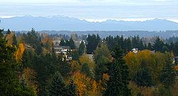
Kenmore has several distinct neighborhoods. These include:- Arrowhead, in southern Kenmore, on the west (or lake) side, saw its first house built in 1888. This was a small summer cabin; the oldest house still standing dates from 1929.
- Inglewood, in southern Kenmore, was first platted in 1953, with large-scale suburban development appearing by 1962.
- Lower Moorlands, in eastern Kenmore, saw its first house in 1904. The significant development occurring in this area after World War IWorld War IWorld War I , which was predominantly called the World War or the Great War from its occurrence until 1939, and the First World War or World War I thereafter, was a major war centred in Europe that began on 28 July 1914 and lasted until 11 November 1918...
included the 1927 landmark Charles and Elvera Thomsen House. - Upper Moorlands, also in eastern Kenmore, saw initial building in 1938-1939 but stayed quite rural due to the lack of a good water system until suburban development arrived in the mid 1950s.
- Central (or downtown) Kenmore hugs Bothell Way and formed the original core of the city. Today it is Kenmore's commercial and industrial core.
- Northlake Terrace, an early residential neighborhood just north of town, is now a mix of commercial and residential development. Much of the eastern portion of this area is to be redeveloped as part of the new Downtown Plan.
- Linwood Heights, in northwest Kenmore, was first founded as part of the "Back to the Land" movement during the Great DepressionGreat DepressionThe Great Depression was a severe worldwide economic depression in the decade preceding World War II. The timing of the Great Depression varied across nations, but in most countries it started in about 1929 and lasted until the late 1930s or early 1940s...
. Then derisively referred to as Voucherville, it has long since been redeveloped and is now largely suburban housing. Portions were annexed by Lake Forest ParkLake Forest Park, WashingtonLake Forest Park is a city in King County, Washington, United States, just north of Seattle. A bedroom community by design, most of the city consists of single-family housing on medium to large-sized lots, with an emphasis on retaining the natural features of the landscape...
in 1995, predating Kenmore's formal incorporation. - Kenlake Vista, in northern Kenmore, is post-war residential suburban housing.
- Uplake Terrace, in northwestern Kenmore, was one of the few areas of Kenmore with no residents at all before World War IIWorld War IIWorld War II, or the Second World War , was a global conflict lasting from 1939 to 1945, involving most of the world's nations—including all of the great powers—eventually forming two opposing military alliances: the Allies and the Axis...
. Its development started in 1953. - Kenmore Terrace
- Northshore Summit.
Since 2000, a significant number of developers have been converting former pastureland to high-end housing in the northern section of the city. As a result, the overall character of these sections of town has been rapidly changing, from run-down and semi-rural to affluent suburbia. This has also affected nearby Bothell
Bothell, Washington
Bothell is a city located in King and Snohomish Counties in the state of Washington. It is part of the Seattle metropolitan area. The population was 33,505 as of the 2010 census...
, resulting in the creation of numerous commercial developments.
Demographics
As of the censusCensus
A census is the procedure of systematically acquiring and recording information about the members of a given population. It is a regularly occurring and official count of a particular population. The term is used mostly in connection with national population and housing censuses; other common...
of 2000, there were 18,678 people, 7,307 households, and 4,961 families residing in the city. The population density
Population density
Population density is a measurement of population per unit area or unit volume. It is frequently applied to living organisms, and particularly to humans...
was 3,028.7 people per square mile (1,168.8/km²). There were 7,562 housing units at an average density of 1,226.2 per square mile (473.2/km²). The racial makeup of the city was 86.70% White, 1.39% African American, 0.37% Native American, 7.16% Asian, 0.18% Pacific Islander, 1.24% from other races
Race (United States Census)
Race and ethnicity in the United States Census, as defined by the Federal Office of Management and Budget and the United States Census Bureau, are self-identification data items in which residents choose the race or races with which they most closely identify, and indicate whether or not they are...
, and 2.96% from two or more races. Hispanic or Latino of any race were 3.51% of the population.
There were 7,307 households out of which 33.5% had children under the age of 18 living with them, 56.1% were married couples
Marriage
Marriage is a social union or legal contract between people that creates kinship. It is an institution in which interpersonal relationships, usually intimate and sexual, are acknowledged in a variety of ways, depending on the culture or subculture in which it is found...
living together, 8.2% had a female householder with no husband present, and 32.1% were non-families. 24.1% of all households were made up of individuals and 6.9% had someone living alone who was 65 years of age or older. The average household size was 2.54 and the average family size was 3.03.
In the city the population was spread out with 24.5% under the age of 18, 7.5% from 18 to 24, 31.9% from 25 to 44, 25.8% from 45 to 64, and 10.3% who were 65 years of age or older. The median age was 38 years. For every 100 females there were 98.7 males. For every 100 females age 18 and over, there were 96.7 males.
The median income for a household in the city was $61,756, and the median income for a family was $72,139 (these figures had risen to $79,847 and $100,999 respectively as of a 2007 estimate). Males had a median income of $50,160 versus $35,570 for females. The per capita income
Per capita income
Per capita income or income per person is a measure of mean income within an economic aggregate, such as a country or city. It is calculated by taking a measure of all sources of income in the aggregate and dividing it by the total population...
for the city was $31,692, ranking 33rd of 522 areas in the state of Washington to be ranked. About 4.8% of families and 5.7% of the population were below the poverty line, including 7.7% of those under age 18 and 4.1% of those age 65 or over.
Economy
Durable good
In economics, a durable good or a hard good is a good that does not quickly wear out, or more specifically, one that yields utility over time rather than being completely consumed in one use. Items like bricks or jewellery could be considered perfectly durable goods, because they should...
s (construction materials, concrete, asphalt) and special trade contracting (construction, heavy construction, and highways).
Kenmore also hosts one of the last industrial ports on Lake Washington
Lake Washington
Lake Washington is a large freshwater lake adjacent to the city of Seattle. It is the largest lake in King County and the second largest in the state of Washington, after Lake Chelan. It is bordered by the cities of Seattle on the west, Bellevue and Kirkland on the east, Renton on the south and...
, at the mouth of the Sammamish River
Sammamish River
The Sammamish River flows through north King County, Washington for about , draining Lake Sammamish into Lake Washington...
. Larger local businesses near the port include Rinker Materials
Rinker Group
The Rinker Group was an Australian-headquartered multinational building products company. Prior to its acquisition by Cemex, it was listed on both the Australian Securities Exchange and the New York Stock Exchange. Rinker operates three major divisions:...
's Kenmore plant, Kenmore Ready-Mix (cements and asphalts, a division of Glacier Northwest), Pacific Topsoils (topsoils and landscape construction materials), Michael Homchick Stoneworks (stone fabrication and installation), Plywood Supply (lumber, plywood, and millwork, wholesale, retail, and company headquarters), and several others. As home to the James G. Murphy Company, one of the ten largest commercial/industrial auction houses in the United States, the city is also an auction
Auction
An auction is a process of buying and selling goods or services by offering them up for bid, taking bids, and then selling the item to the highest bidder...
center.
Significant non-durable-goods businesses include the headquarters of Kenmore Air
Kenmore Air
Kenmore Air Harbor, Inc., doing business as Kenmore Air, is an American airline with its headquarters on the grounds of Kenmore Air Harbor in Kenmore, Washington, USA, north of Seattle...
, a large private seaplane-based airline; Alaska General Seafoods's company headquarters and processing plant; Bastyr University
Bastyr University
Bastyr University was established as the John Bastyr College of Naturopathic Medicine in 1978 in Seattle, Washington by Sheila Quinn, Joseph Pizzorno, ND, LM; William Mitchell, ND; and Les Griffith, ND, LM...
, a school of naturopathic medicine
Naturopathic medicine
Naturopathy, or Naturopathic Medicine, is a form of alternative medicine based on a belief in vitalism, which posits that a special energy called vital energy or vital force guides bodily processes such as metabolism, reproduction, growth, and adaptation...
.
Education
Kenmore is part of the Northshore School DistrictNorthshore School District
Northshore School District is a public school district covering portions of both King County and Snohomish County, Washington. The district's service area covers the cities of Bothell , Woodinville,and Kenmore as well as portions of unincorporated King County....
, and the local high school is Inglemoor High School
Inglemoor High School
Inglemoor High School is a public high school located in Kenmore, Washington. It is one of the largest high schools in the state of Washington and has an average of 23.4 students per teacher. Inglemoor's feeder schools are Kenmore and Northshore Junior Highs and Arrowhead, Kenmore, Lockwood,...
. The nonprofit group Saint Edward Environmental Learning Center provides quarterly environmental education classes to the public in conjunction with Washington State Parks and Saint Edward State Park
Saint Edward State Park
Saint Edward State Park is a -park in Kenmore, Washington and Kirkland, Washington. It is part of the Washington State Park System. Before becoming a Catholic seminary and later a state park, the area was logged in the 19th century and again in the 1920s. A series of trails runs through the park...
. They also operate the ALEAFA Model Public High School. The Kenmore Library Association, a volunteer group affiliated with the local library, plans and sponsors library programming.
Kenmore is home to Bastyr University
Bastyr University
Bastyr University was established as the John Bastyr College of Naturopathic Medicine in 1978 in Seattle, Washington by Sheila Quinn, Joseph Pizzorno, ND, LM; William Mitchell, ND; and Les Griffith, ND, LM...
, a leading private school of naturopathic medicine
Naturopathic medicine
Naturopathy, or Naturopathic Medicine, is a form of alternative medicine based on a belief in vitalism, which posits that a special energy called vital energy or vital force guides bodily processes such as metabolism, reproduction, growth, and adaptation...
founded in 1978 and accredited by the Northwest Commission on Colleges and Universities
Northwest Commission on Colleges and Universities
The Northwest Commission on Colleges and Universities is an independent, non-profit membership organization recognized by the United States Department of Education since 1952 and the Council for Higher Education Accreditation as the regional authority on educational quality and institutional...
(NWCCU). The city is also located between the University of Washington
University of Washington
University of Washington is a public research university, founded in 1861 in Seattle, Washington, United States. The UW is the largest university in the Northwest and the oldest public university on the West Coast. The university has three campuses, with its largest campus in the University...
's main campus in Seattle and its satellite campus and the co-located Cascadia Community College
Cascadia Community College
Cascadia Community College is an American community college located in Bothell, Washington on a shared campus with the University of Washington, Bothell...
in nearby Bothell
Bothell, Washington
Bothell is a city located in King and Snohomish Counties in the state of Washington. It is part of the Seattle metropolitan area. The population was 33,505 as of the 2010 census...
, with paved bike trails and express bus service connecting the city to all three schools. The city also has a bus connection directly to Shoreline Community College
Shoreline Community College
Shoreline Community College is a community college in Shoreline, north of Seattle, Washington. It is located in a residential area east of Shoreview Park. The college contains 83 acres and continuously serves 12,000 full and part-time students....
, and much of the town is within walking distance of SCC's Center for Business and Continuing Education located in Lake Forest Park, Washington
Lake Forest Park, Washington
Lake Forest Park is a city in King County, Washington, United States, just north of Seattle. A bedroom community by design, most of the city consists of single-family housing on medium to large-sized lots, with an emphasis on retaining the natural features of the landscape...
.
Government and politics
Kenmore has a Council/Manager governmentCouncil-manager government
The council–manager government form is one of two predominant forms of municipal government in the United States; the other common form of local government is the mayor-council government form, which characteristically occurs in large cities...
, being governed by a City Council
City council
A city council or town council is the legislative body that governs a city, town, municipality or local government area.-Australia & NZ:Because of the differences in legislation between the States, the exact definition of a City Council varies...
consisting of seven Councilmembers, each of whom is elected to a four year term. Council elections are held every two years, with either three or four positions standing, depending upon year. All positions are nonpartisan and at-large, elected by the entire city voting population. The Council passes ordinances, sets policies, and elects from its own membership a Mayor and Deputy Mayor for two year terms. The Council as a whole meets on the second and fourth Mondays of each month, with public Study Sessions held on the first and third Mondays.
Day to day operations of the city are administered by a City Manager
City manager
A city manager is an official appointed as the administrative manager of a city, in a council-manager form of city government. Local officials serving in this position are sometimes referred to as the chief executive officer or chief administrative officer in some municipalities...
, hired by the City Council. City code also stipulates the hiring of a full-time City Clerk. Major committees included in Kenmore Municipal Code are the Landmarks and Heritage Commission, the Planning Commission, and the Library Advisory Board.
City of Kenmore police duties are subcontracted through the King County Sheriff's Office; the original City of Kenmore Fire Department's duties were expanded via agreement with nearby Lake Forest Park, becoming the Northshore Fire Department.
Police
Kenmore contracts with the King County Sheriff's Office for police services. Deputies assigned to Kenmore wear city uniforms and drive patrol cars marked with the city logo. There are currently 9 patrol officers, one traffic officer, one storefront officer, and one chief assigned full time to the city.Cardroom ordinance
When the City of Kenmore incorporated in 1998, one of the early actions by the first city council was to put a moratorium on cardrooms, enacted in 1999. Cardrooms are mini casinos that have card games such as Blackjack and allow bets under $100. There had been only one cardroom in Kenmore—the 11th Frame Restaurant and Lounge at Kenmore Lanes. The 11th Frame has been in operation since the 1970s and it, along with Kenmore Lanes, generates the most tax revenue of any business in Kenmore.In March 2003, the city council put a ban on new cardrooms but grandfathered the 11th Frame. In October of that year, Len Griesel, a Kenmore businessman and commercial property owner, challenged the ban in court. In November, the city council removed the ban against new cardrooms and reinstated the moratorium.
In September 2004, the issue was put before Kenmore voters as Proposition 1, "Proposed Ban of Card Rooms" Proposition 1 asked "Shall the City of Kenmore ban such “social card games”?" The proposition failed, but the city council did not lift the moratorium.
In December 2004, as part of the lawsuit brought by Len Griesel, King County Superior Court Judge Terry Lukens overturned the moratorium and gave the council until the end of June 2005 to allow or ban all gambling. In June 2005, the city council did not have enough votes to enact a ban on cardrooms. Despite the fact that cardrooms were now open to new business, Len Griesel did not apply for a cardroom license.
The 2005 Council elections focused in part on whether the city should adopt a ban on cardroom
Cardroom
A cardroom or card room is a gaming establishment that exclusively offers card games for play by the public. The term poker room is generally synonymous, since the gambling games played in such establishments are typically, and sometimes exclusively, variations of poker such as Texas hold 'em.Such...
s. Several candidates stated their positions that a cardroom ban would be key to any successful attempt to rebuild Kenmore's downtown core.
Immediately after the election, in December 2005, the council voted to ban cardrooms. At that time, the 11th Frame filed a lawsuit against the city in federal court. In August 2006, the lawsuit was dismissed on the grounds that gambling was not a vested right. An appeal was filed in the Ninth Circuit Court. That case was decided May 28, 2008 with the judges affirming the city’s ban on card rooms. Under an agreement between Frank Evans, city attorneys, and the state gambling commission, the cardroom attached to Kenmore Lanes closed on June 30, 2009.
Civic events and festivals
Major annual civic events include:- The Kenmore Summer Concert Series, hosted at the former St. Edward SeminarySt. Edward SeminarySaint Edward Seminary was an institution for developing Catholic priests in Washington state, USA. Named for Saint Edward the Confessor and located in the city of Kenmore, it operated for 46 years before closing in 1976. The seminary and most of its grounds now constitute Saint Edward State Park...
, now Saint Edward State ParkSaint Edward State ParkSaint Edward State Park is a -park in Kenmore, Washington and Kirkland, Washington. It is part of the Washington State Park System. Before becoming a Catholic seminary and later a state park, the area was logged in the 19th century and again in the 1920s. A series of trails runs through the park... - The annual Washington Brewers' Father's Day Weekend Brewfest at Saint Edward State Park.
- The annual Kenmore Art Show, a juried art exhibition sponsored by the Arts of Kenmore .
- The Kenmore Spring Egg Hunt
- Fourth of July Fireworks, a fireworks display at Log Boom Park, starting in 2006.
Media
Kenmore is served by Seattle-area mediaMedia in Seattle
Seattle, Washington, supports a multitude of media, from long-established newspapers, television and radio stations to a continually evolving panoply of smaller, local art, culture, neighborhood and political publications, filmmaking and, most recently, Internet media...
, but town and neighborhood events are covered primarily by the Kenmore Reporter, a weekly newspaper. Published by Reporter Newspapers of Kent, Washington
Kent, Washington
Kent is a city located in King County, Washington, United States, and is the third largest city in King County and the sixth largest in the state. An outlying suburb of Seattle, Kent is also the corporate home for companies such as REI and Oberto Sausage...
, almost all of its articles appear only in the print edition. Once a month, a Kenmore city government update is printed within the newspaper as a two- to four-page supplement. The Kenmore Reporter is delivered free of charge throughout the city. For its part, the city also sends out a quarterly eight-page newsletter to all residents discussing government activities, development project status reports, budgetary summaries, and a community events calendar.
Family Circle Magazine selected Kenmore,Washington as one of the "10 Best Towns for families" in their August 2009 edition. Seattle Magazine also ranked Kenmore as the best Seattle-area neighbourhood or surrounding city for 2008-2009.
Parks
Not all parks within city limits are operated by city government; the Burke-Gilman TrailBurke-Gilman Trail
The Burke-Gilman Sammamish Trail is a rail trail in King County, Washington. The multi-use recreational trail is part of the King County Regional Trail System and occupies an abandoned Seattle, Lake Shore and Eastern Railway corridor....
is a King County park, and St. Edward State Park is operated by the Washington State Parks and Recreation Commission. Extant parks within city limits include:
- Burke-Gilman TrailBurke-Gilman TrailThe Burke-Gilman Sammamish Trail is a rail trail in King County, Washington. The multi-use recreational trail is part of the King County Regional Trail System and occupies an abandoned Seattle, Lake Shore and Eastern Railway corridor....
, a King County park which, combined with the Sammamish River TrailSammamish River TrailThe Sammamish River Trail is a bike path and recreational rail trail in King County, Washington that runs along the Sammamish River from Blyth Park in Bothell to Marymoor Park in Redmond. It connects to the Burke-Gilman Trail at its western end....
, connects Marymoor ParkMarymoor ParkMarymoor Park, located on the north end of Lake Sammamish in Redmond, Washington, is King County's largest, oldest, and most popular park, with more than 3 million annual visitors coming to roam its . Among recreational activities available are various sports facilities, rock climbing, a dog park...
just outside downtown RedmondRedmond, WashingtonRedmond is a city in King County, Washington, United States, located east of Seattle. The population was 54,144 at the 2010 census,up from 45,256 in 2000....
through the downtowns of Woodinville, Bothell, Kenmore, and Lake Forest Park to Gas Works ParkGas Works ParkGas Works Park in Seattle, Washington is a 19.1 acre public park on the site of the former Seattle Gas Light Company gasification plant, located on the north shore of Lake Union at the south end of the Wallingford neighborhood. Gas Works park contains remnants of the sole remaining coal...
in Seattle and points west. Several other trails and bike routes branch off of this trail backbone; - Inglewood Wetlands, two separate shoreline protected areas next to the mouth of the Sammamish River;
- Linwood Park, a small 3 acres (12,140.6 m²) park in northwest Kenmore that is largely undeveloped;
- Moorlands Park, a 5 acres (20,234.3 m²) park including baseball and basketball facilities in southeastern Kenmore;
- Rhododendron Park, formerly Kenmore Park, a 13 acres (52,609.2 m²) park planted with hundreds of species of rhododendron, many rare;
- Saint Edward State ParkSaint Edward State ParkSaint Edward State Park is a -park in Kenmore, Washington and Kirkland, Washington. It is part of the Washington State Park System. Before becoming a Catholic seminary and later a state park, the area was logged in the 19th century and again in the 1920s. A series of trails runs through the park...
, the largest park in Kenmore at 365 acres (1.5 km²); it includes over half a mile of undeveloped Lake Washington shoreline, the historic Saint Edward Seminary and gymnasium, and the Carole Ann Wald Memorial Pool, a year-round indoor swimming facility, which has been the home practice pool for both Inglemoor High School Viking swim teams and Seattle Synchro, the Seattle Synchronized Swim Team;a playground ranked 2nd in 2009 by KING5 TV's Best of Washington competition. - Swamp Creek Park, along the Sammamish River, consists of city-purchased farmland currently left in an undeveloped state;
- Tracy Owen Station at Log Boom Park, Kenmore's smaller Lake Washington park, includes 16 acres (64,749.8 m²) of shoreline and a large walking dock extending out into the lake;
- Wallace Swamp Creek Park, 17 acres (68,796.6 m²) surrounding Swamp Creek in northeast Kenmore, which features some walking trails.