
Midlothian, Virginia
Encyclopedia
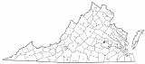
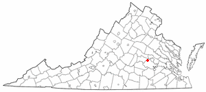
Midlothian is an unincorporated community
in Chesterfield County
, Virginia
, United States
. Founded over 300 years ago as a coal
mining village, it is now a suburban community located in the Southside of Richmond
well beyond the city limits of Richmond
in the Richmond–Petersburg region.
It was named for the early 18th-century coal mining
enterprises of the Wooldridge brothers, who came from mining villages in East Lothian
and West Lothian
near Edinburgh
, Scotland
. They called their new venture Mid-Lothian and produced the first commercially mined coal in the Virginia Colony and in what became the United States
.
By the early 18th century, several mines were being developed by French Huguenot
s and others. The mine owners began to export the commodity from the region in the 1730s. Midlothian-area coal heated the U.S. White House
for President Thomas Jefferson
. The transportation needs of coal shipping stimulated construction of an early toll road
, the Manchester Turnpike
in 1807; and the Chesterfield Railroad
, the state's first in 1831; each to travel the 13 miles from the mining community to the port of Manchester
, just below the fall line
of the James River
.
In the early 1850s, the Richmond and Danville Railroad
built Coalfield Station near the mines. The small village established nearby came to be called Midlothian.
In the 1920s, Old Buckingham Road through Midlothian's commercial area became part of the new east-west U.S. Route 60. A few decades later, residential neighborhoods were developed near Midlothian, including the large Salisbury community and the Brandermill
planned development sited on Swift Creek Reservoir. In the 21st century, Midlothian extends many miles beyond the original village area.. State Route 288 connects the community with Interstate 64 and the State Route 76 toll road, and Interstate 95 in the Richmond metropolitan area's southwestern quadrant.
 Midlothian is located in the Piedmont
geologic region of the state, and is made up of mainly a hilled, fertile land (it is somewhat of a plain
.)
. The Swift Creek Reservoir serves as the major source of fresh water for the county.
's. Its inhabitants are predominantly European American. The next biggest group is African Americans, followed by people of Hispanic and Asian descent. The median household income per year in 2005 was $80,381.
Midlothian has many neighborhoods, shopping centers, school
s, and churches. The traditional village core on Route 60 is between two major shopping malls developed later. There is little farming and only light manufacturing around the new State Route 288. Some examples of neighborhoods around the Village of Midlothian just off Route 60 include Roxshire and Salisbury to the north; and Walton Park, Queensmill, and Stonehenge West on the east. Woodlake and Brandermill are communities on Route 360 which include some houses with a Midlothian address, although most use a Chesterfield address.
. Among these in historic times were the Siouan
-speaking Monacan tribe. They often came into conflict with the Algonquian
-speaking members of the Powhatan Confederacy, who were generally located to the east in the Virginia Tidewater
area.
In 1700 and after, French
Huguenot
settlers, who were Protestant, came to the area in the Virginia Colony to escape Catholic
religious persecution in France. Most came from London, where they had resettled as refugees. Although the Crown had offered the French land in Lower Norfolk County, the governor of the colony and William Byrd
offered them the village of Manakin Town, which had been abandoned by the Monacan. Byrd and the governor intended to use the French as a buffer settlement, and thought they would be easier to control apart from the English. The location was about 20 miles above the head of navigation on the James River at what became Richmond. The French, many of whom were artisans and merchants, struggled to survive on the isolated frontier. The terrain was hilly and largely wooded, and shipping of farm products such as tobacco
crops was not easy.
The greater natural resource in the Midlothian area was coal, and the area was ultimately developed with coal mining and railroads. About 10 miles west of the fall line of the James River at present-day Richmond is a basin of coal, which was one of the earliest mined in the Virginia Colony. Scots settlers with mining skills began to mine this resource in the 18th century. Many coal-related enterprises in the Midlothian area of Chesterfield County began early in the 18th century.
, some of the first coal mines were controlled by the wealthy Wooldridge family. About 1745, two Wooldridge brothers came to Virginia from Scotland
. They built their home nearby. The brothers came from separate Scottish mining villages, one from East Lothian, the other from West Lothian. In developing their new business in Virginia, they compromised on the name, naming their family-owned business "Mid-Lothian Mining Company". The name was associated with the unincorporated town which grew in the area, and became used as one word: "Midlothian."
Among other participants in the area's emerging coal business was Colonel Henry "Harry" Heth
, a businessman who emigrated from England about 1759. He established offices at Norfolk
and Manchester, where several generations of his family were also involved in the business.
During the American Revolution
, coal produced in the Midlothian coal pits supplied the cannon factory on the James River at Westham
, upstream from Richmond; it produced shot and shells for the Continental Army
. By the end of the War, developers shipped Chesterfield coal to Philadelphia, New York and Boston. Commenting on the area's coal in his Notes on the State of Virginia (1781–82), then-Governor Thomas Jefferson
stated: "The country on James river, from 15 to 20 miles above Richmond, and for several miles northward and southward, is replete with mineral coal of a very excellent quality." During his presidency, Jefferson ordered coal from the Black Heath Mine
in Midlothian for use in the White House
.
The coalfield west of Richmond extended north of the James River to the western portion of Henrico County
. There, mines were worked at Gayton and Deep Run. In 1796, famed engineer and architect Benjamin Henry Latrobe toured the coal fields outside Richmond, declaring enthusiastically, "Such a mine of Wealth exists, I believe, nowhere else!" By 1835, seven or eight major mines were operating in the Midlothian area. Coal was the economic basis of the Midlothian area until the late 19th century when mining ended. Later attempts to reopen the mines were unsuccessful. The railroad connected the town to Richmond for shipping coal, and residents later used it to travel to the capital for work. The town became one of commuters.
By 1824, an estimated 70 to 100 wagons, each of which was loaded with four or five tons of coal, made a daily trip on the turnpike, transporting to the docks near Manchester the million or more bushels (30,000 metric tons) of coal that were produced in Chesterfield County each year. The heavily loaded coal wagons tended to cut deep ruts in the turnpike, raising clouds of dust in summer and churning the road into mud in the rainy season. As there were few options for shunpiking
, citizens whose faster buggies dawdled along behind the lumbering wagons urged the state legislature
to do something about it—a canal, a better road, but something.
The result was the Chesterfield Railroad, a 13-mile (21 km) mule- and gravity-powered line that connected the Midlothian coal mines with wharves located at Manchester, directly across from Richmond. Partially funded by the Virginia Board of Public Works
, the railroad began operating in 1831, the first in the state and the second commercial railroad to be built in the nation. By 1850, the newer, steam-driven Richmond and Danville Railroad
(R&D) began operation to Coalfield Station, later renamed Midlothian; it quickly supplanted the slower Chesterfield Railroad. In a financial reorganization in 1894, the R&D line through Midlothian became part of the Southern Railway
system. It is now part of Norfolk Southern Railway
. According to the 1895 Virginia atlas, the population of Midlothian was 375.
) provided much-needed highway infrastructure. The area continued to attract new residents as forests were turned into subdivisions.
Midlothian was ranked #37 in CNNMoney's list of "The Best Places to Live" in 2005 and #99 in 2008. The community had a total population of 35,427 as of the 2000 census. There are several wealthy individuals in Midlothian, so it is considered a hotbed by Virginia's investment firms. With the addition of the multi-million dollar Bon Secours Hospital, St. Francis, Midlothian now has a major hospital within five minutes of Midlothian's highest concentration of residents, the planned community of Brandermill. James River High School
, part of Chesterfield County Public Schools
located in Midlothian, won the President's Blue Ribbon School of Excellence Award in 2008.
Chesterfield County is expected to adopt a new comprehensive plan in 2011 that will address continued growth issues. The Development and Land Use Committee of the VMVC has been closely watching plans related to Midlothian, especially the village area. At the turn of the 21st century, a group of area business professionals formed an independent organization called http://www.wcba.us/ the Western Chesterfield Business Alliance, which has seen steady growth.
. "It’s meant to be a stylized, satirical, comic book, fantasyland version of what I remember Midlothian, Virginia to be, I guess," filmmaker Richard Kelly
has explained.
Population: 51,986
Unincorporated area
In law, an unincorporated area is a region of land that is not a part of any municipality.To "incorporate" in this context means to form a municipal corporation, a city, town, or village with its own government. An unincorporated community is usually not subject to or taxed by a municipal government...
in Chesterfield County
Chesterfield County, Virginia
Chesterfield County is a county located in the Commonwealth of Virginia, a state of the United States. In 2010, its population was estimated to be 316,236. Chesterfield County is now the fourth-largest municipality in Virginia . Its county seat is Chesterfield...
, Virginia
Virginia
The Commonwealth of Virginia , is a U.S. state on the Atlantic Coast of the Southern United States. Virginia is nicknamed the "Old Dominion" and sometimes the "Mother of Presidents" after the eight U.S. presidents born there...
, United States
United States
The United States of America is a federal constitutional republic comprising fifty states and a federal district...
. Founded over 300 years ago as a coal
Coal
Coal is a combustible black or brownish-black sedimentary rock usually occurring in rock strata in layers or veins called coal beds or coal seams. The harder forms, such as anthracite coal, can be regarded as metamorphic rock because of later exposure to elevated temperature and pressure...
mining village, it is now a suburban community located in the Southside of Richmond
Southside (Richmond, Virginia)
The Southside of Richmond is an area of the Metropolitan Statistical Area surrounding Richmond, Virginia. It generally includes all portions of the City of Richmond which lie south of the James River, and includes all of the former city of Manchester...
well beyond the city limits of Richmond
Richmond, Virginia
Richmond is the capital of the Commonwealth of Virginia, in the United States. It is an independent city and not part of any county. Richmond is the center of the Richmond Metropolitan Statistical Area and the Greater Richmond area...
in the Richmond–Petersburg region.
It was named for the early 18th-century coal mining
Coal mining
The goal of coal mining is to obtain coal from the ground. Coal is valued for its energy content, and since the 1880s has been widely used to generate electricity. Steel and cement industries use coal as a fuel for extraction of iron from iron ore and for cement production. In the United States,...
enterprises of the Wooldridge brothers, who came from mining villages in East Lothian
East Lothian
East Lothian is one of the 32 council areas of Scotland, and a lieutenancy Area. It borders the City of Edinburgh, Scottish Borders and Midlothian. Its administrative centre is Haddington, although its largest town is Musselburgh....
and West Lothian
West Lothian
West Lothian is one of the 32 unitary council areas in Scotland, and a Lieutenancy area. It borders the City of Edinburgh, Falkirk, North Lanarkshire, the Scottish Borders and South Lanarkshire....
near Edinburgh
Edinburgh
Edinburgh is the capital city of Scotland, the second largest city in Scotland, and the eighth most populous in the United Kingdom. The City of Edinburgh Council governs one of Scotland's 32 local government council areas. The council area includes urban Edinburgh and a rural area...
, Scotland
Scotland
Scotland is a country that is part of the United Kingdom. Occupying the northern third of the island of Great Britain, it shares a border with England to the south and is bounded by the North Sea to the east, the Atlantic Ocean to the north and west, and the North Channel and Irish Sea to the...
. They called their new venture Mid-Lothian and produced the first commercially mined coal in the Virginia Colony and in what became the United States
United States
The United States of America is a federal constitutional republic comprising fifty states and a federal district...
.
By the early 18th century, several mines were being developed by French Huguenot
Huguenot
The Huguenots were members of the Protestant Reformed Church of France during the 16th and 17th centuries. Since the 17th century, people who formerly would have been called Huguenots have instead simply been called French Protestants, a title suggested by their German co-religionists, the...
s and others. The mine owners began to export the commodity from the region in the 1730s. Midlothian-area coal heated the U.S. White House
White House
The White House is the official residence and principal workplace of the president of the United States. Located at 1600 Pennsylvania Avenue NW in Washington, D.C., the house was designed by Irish-born James Hoban, and built between 1792 and 1800 of white-painted Aquia sandstone in the Neoclassical...
for President Thomas Jefferson
Thomas Jefferson
Thomas Jefferson was the principal author of the United States Declaration of Independence and the Statute of Virginia for Religious Freedom , the third President of the United States and founder of the University of Virginia...
. The transportation needs of coal shipping stimulated construction of an early toll road
Toll road
A toll road is a privately or publicly built road for which a driver pays a toll for use. Structures for which tolls are charged include toll bridges and toll tunnels. Non-toll roads are financed using other sources of revenue, most typically fuel tax or general tax funds...
, the Manchester Turnpike
Manchester Turnpike
The Manchester Turnpike was a turnpike road in Chesterfield County in the U.S. state of Virginia, and was the first lengthy paved roadway in that state. It stretched from Manchester west to Falling Creek near Midlothian, and is now known as Midlothian Turnpike, mostly forming part of U.S...
in 1807; and the Chesterfield Railroad
Chesterfield Railroad
The Chesterfield Railroad was located in Chesterfield County, Virginia. It was a 13-mile long mule-and-gravity powered line that connected the Midlothian coal mines with wharves that were located at the head of navigation on the James River just below the fall line at Manchester...
, the state's first in 1831; each to travel the 13 miles from the mining community to the port of Manchester
Manchester, Virginia
Manchester, Virginia is a former independent city in Virginia in the United States. Prior to receiving independent status, it served as the county seat of Chesterfield County, between 1870 and 1876...
, just below the fall line
Fall line
A fall line is a geomorphologic unconformity between an upland region of relatively hard crystalline basement rock and a coastal plain of softer sedimentary rock. A fall line is typically prominent when crossed by a river, for there will often be rapids or waterfalls...
of the James River
James River (Virginia)
The James River is a river in the U.S. state of Virginia. It is long, extending to if one includes the Jackson River, the longer of its two source tributaries. The James River drains a catchment comprising . The watershed includes about 4% open water and an area with a population of 2.5 million...
.
In the early 1850s, the Richmond and Danville Railroad
Richmond and Danville Railroad
The Richmond and Danville Railroad was chartered in Virginia in the United States in 1847. The portion between Richmond and Danville, Virginia was completed in 1856...
built Coalfield Station near the mines. The small village established nearby came to be called Midlothian.
In the 1920s, Old Buckingham Road through Midlothian's commercial area became part of the new east-west U.S. Route 60. A few decades later, residential neighborhoods were developed near Midlothian, including the large Salisbury community and the Brandermill
Brandermill
Brandermill is a major suburban residential and commercial development in the Southside of Richmond, Virginia. It is located near Midlothian, Virginia at the southern terminus of the Powhite Parkway and is centered around the Swift Creek Reservoir...
planned development sited on Swift Creek Reservoir. In the 21st century, Midlothian extends many miles beyond the original village area.. State Route 288 connects the community with Interstate 64 and the State Route 76 toll road, and Interstate 95 in the Richmond metropolitan area's southwestern quadrant.
Geography
Piedmont (United States)
The Piedmont is a plateau region located in the eastern United States between the Atlantic Coastal Plain and the main Appalachian Mountains, stretching from New Jersey in the north to central Alabama in the south. The Piedmont province is a physiographic province of the larger Appalachian division...
geologic region of the state, and is made up of mainly a hilled, fertile land (it is somewhat of a plain
Plain
In geography, a plain is land with relatively low relief, that is flat or gently rolling. Prairies and steppes are types of plains, and the archetype for a plain is often thought of as a grassland, but plains in their natural state may also be covered in shrublands, woodland and forest, or...
.)
Watersheds
The Midlothian area serves as the headwaters to a number of creeks which ultimately contribute their waters to the flow of the James River below the fall line at Richmond. These include Swift Creek and Falling CreekFalling Creek
Falling Creek is a tributary of the James River located near Richmond, Virginia. Approximately in length, it varies in width between at its source to several hundred feet in the Falling Creek Reservoir. Falling Creek rises in the Salisbury section of northwestern Chesterfield County and empties...
. The Swift Creek Reservoir serves as the major source of fresh water for the county.
Demographics
Midlothian's demographics are much like VirginiaVirginia
The Commonwealth of Virginia , is a U.S. state on the Atlantic Coast of the Southern United States. Virginia is nicknamed the "Old Dominion" and sometimes the "Mother of Presidents" after the eight U.S. presidents born there...
's. Its inhabitants are predominantly European American. The next biggest group is African Americans, followed by people of Hispanic and Asian descent. The median household income per year in 2005 was $80,381.
Midlothian has many neighborhoods, shopping centers, school
School
A school is an institution designed for the teaching of students under the direction of teachers. Most countries have systems of formal education, which is commonly compulsory. In these systems, students progress through a series of schools...
s, and churches. The traditional village core on Route 60 is between two major shopping malls developed later. There is little farming and only light manufacturing around the new State Route 288. Some examples of neighborhoods around the Village of Midlothian just off Route 60 include Roxshire and Salisbury to the north; and Walton Park, Queensmill, and Stonehenge West on the east. Woodlake and Brandermill are communities on Route 360 which include some houses with a Midlothian address, although most use a Chesterfield address.
History
Before the arrival of Europeans in the 17th century, the area had been populated for thousands of years by various cultures of Native AmericansNative Americans in the United States
Native Americans in the United States are the indigenous peoples in North America within the boundaries of the present-day continental United States, parts of Alaska, and the island state of Hawaii. They are composed of numerous, distinct tribes, states, and ethnic groups, many of which survive as...
. Among these in historic times were the Siouan
Siouan languages
The Western Siouan languages, also called Siouan proper or simply Siouan, are a Native American language family of North America, and the second largest indigenous language family in North America, after Algonquian...
-speaking Monacan tribe. They often came into conflict with the Algonquian
Algonquian languages
The Algonquian languages also Algonkian) are a subfamily of Native American languages which includes most of the languages in the Algic language family. The name of the Algonquian language family is distinguished from the orthographically similar Algonquin dialect of the Ojibwe language, which is a...
-speaking members of the Powhatan Confederacy, who were generally located to the east in the Virginia Tidewater
Tidewater
Tidewater may refer to:*Tidewater , a geographic area of southeast Virginia and northeast North Carolina*Tidewater , a company providing marine services to the offshore petroleum industry...
area.
In 1700 and after, French
French people
The French are a nation that share a common French culture and speak the French language as a mother tongue. Historically, the French population are descended from peoples of Celtic, Latin and Germanic origin, and are today a mixture of several ethnic groups...
Huguenot
Huguenot
The Huguenots were members of the Protestant Reformed Church of France during the 16th and 17th centuries. Since the 17th century, people who formerly would have been called Huguenots have instead simply been called French Protestants, a title suggested by their German co-religionists, the...
settlers, who were Protestant, came to the area in the Virginia Colony to escape Catholic
Catholic
The word catholic comes from the Greek phrase , meaning "on the whole," "according to the whole" or "in general", and is a combination of the Greek words meaning "about" and meaning "whole"...
religious persecution in France. Most came from London, where they had resettled as refugees. Although the Crown had offered the French land in Lower Norfolk County, the governor of the colony and William Byrd
William Byrd
William Byrd was an English composer of the Renaissance. He wrote in many of the forms current in England at the time, including various types of sacred and secular polyphony, keyboard and consort music.-Provenance:Knowledge of Byrd's biography expanded in the late 20th century, thanks largely...
offered them the village of Manakin Town, which had been abandoned by the Monacan. Byrd and the governor intended to use the French as a buffer settlement, and thought they would be easier to control apart from the English. The location was about 20 miles above the head of navigation on the James River at what became Richmond. The French, many of whom were artisans and merchants, struggled to survive on the isolated frontier. The terrain was hilly and largely wooded, and shipping of farm products such as tobacco
Tobacco
Tobacco is an agricultural product processed from the leaves of plants in the genus Nicotiana. It can be consumed, used as a pesticide and, in the form of nicotine tartrate, used in some medicines...
crops was not easy.
The greater natural resource in the Midlothian area was coal, and the area was ultimately developed with coal mining and railroads. About 10 miles west of the fall line of the James River at present-day Richmond is a basin of coal, which was one of the earliest mined in the Virginia Colony. Scots settlers with mining skills began to mine this resource in the 18th century. Many coal-related enterprises in the Midlothian area of Chesterfield County began early in the 18th century.
Coal mining
The Village area of today's Midlothian started as a settlement of coal miners in the 18th century. In 1709, Midlothian produced the first commercially mined coal in the United States. According to research by the author Bettie W. WeaverBettie W. Weaver
Bettie Woodson Weaver is an author and former schoolteacher from Virginia. She has written several works focused on local history and natural resources in central Virginia. She has written several articles for on local history, including a local history textbook used in Chesterfield County,...
, some of the first coal mines were controlled by the wealthy Wooldridge family. About 1745, two Wooldridge brothers came to Virginia from Scotland
Scotland
Scotland is a country that is part of the United Kingdom. Occupying the northern third of the island of Great Britain, it shares a border with England to the south and is bounded by the North Sea to the east, the Atlantic Ocean to the north and west, and the North Channel and Irish Sea to the...
. They built their home nearby. The brothers came from separate Scottish mining villages, one from East Lothian, the other from West Lothian. In developing their new business in Virginia, they compromised on the name, naming their family-owned business "Mid-Lothian Mining Company". The name was associated with the unincorporated town which grew in the area, and became used as one word: "Midlothian."
Among other participants in the area's emerging coal business was Colonel Henry "Harry" Heth
Henry Heth (Colonel)
Colonel Henry "Harry" Heth was an English-born businessman who emigrated to the Virginia Colony about 1759. He served in the Continental Army and was active in the coal business.-American Revolutionary War:...
, a businessman who emigrated from England about 1759. He established offices at Norfolk
Norfolk, Virginia
Norfolk is an independent city in the Commonwealth of Virginia in the United States. With a population of 242,803 as of the 2010 Census, it is Virginia's second-largest city behind neighboring Virginia Beach....
and Manchester, where several generations of his family were also involved in the business.
During the American Revolution
American Revolution
The American Revolution was the political upheaval during the last half of the 18th century in which thirteen colonies in North America joined together to break free from the British Empire, combining to become the United States of America...
, coal produced in the Midlothian coal pits supplied the cannon factory on the James River at Westham
Westham, Virginia
Westham was an unincorporated town in Henrico County, Virginia. It is located in the present day area of Tuckahoe, Virginia.-History:Westham was established on land that had been owned by William Randolph II. When Randolph died, his son Beverley, inherited Westham Plantation and planned to create...
, upstream from Richmond; it produced shot and shells for the Continental Army
Continental Army
The Continental Army was formed after the outbreak of the American Revolutionary War by the colonies that became the United States of America. Established by a resolution of the Continental Congress on June 14, 1775, it was created to coordinate the military efforts of the Thirteen Colonies in...
. By the end of the War, developers shipped Chesterfield coal to Philadelphia, New York and Boston. Commenting on the area's coal in his Notes on the State of Virginia (1781–82), then-Governor Thomas Jefferson
Thomas Jefferson
Thomas Jefferson was the principal author of the United States Declaration of Independence and the Statute of Virginia for Religious Freedom , the third President of the United States and founder of the University of Virginia...
stated: "The country on James river, from 15 to 20 miles above Richmond, and for several miles northward and southward, is replete with mineral coal of a very excellent quality." During his presidency, Jefferson ordered coal from the Black Heath Mine
Black Heath (Chesterfield County)
Black Heath was a home and coal mine located along the Old Buckingham Road in the present Midlothian area of Chesterfield County, Virginia. The Black Heath coal mining enterprises were operated by the Heth family between 1785 and 1844, when the mine closed following a fatal explosion.-Home, Heth...
in Midlothian for use in the White House
White House
The White House is the official residence and principal workplace of the president of the United States. Located at 1600 Pennsylvania Avenue NW in Washington, D.C., the house was designed by Irish-born James Hoban, and built between 1792 and 1800 of white-painted Aquia sandstone in the Neoclassical...
.
The coalfield west of Richmond extended north of the James River to the western portion of Henrico County
Henrico County, Virginia
Henrico is a county located in the Commonwealth of Virginia, a state of the United States. As of 2010, Henrico was home to 306,935 people. It is located in the Richmond-Petersburg region and is a portion of the Richmond Metropolitan Statistical Area...
. There, mines were worked at Gayton and Deep Run. In 1796, famed engineer and architect Benjamin Henry Latrobe toured the coal fields outside Richmond, declaring enthusiastically, "Such a mine of Wealth exists, I believe, nowhere else!" By 1835, seven or eight major mines were operating in the Midlothian area. Coal was the economic basis of the Midlothian area until the late 19th century when mining ended. Later attempts to reopen the mines were unsuccessful. The railroad connected the town to Richmond for shipping coal, and residents later used it to travel to the capital for work. The town became one of commuters.
Early roads, first turnpike, and railroads
In 1804, a toll road, Manchester and Falling Creek Turnpike, was built from Manchester to Falling Creek to ease traffic on what is now Old Buckingham Road. It was graveled in 1807, making it Virginia's first hard-surfaced road. That road's descendant is known as Midlothian Turnpike, present-day U.S. Route 60.By 1824, an estimated 70 to 100 wagons, each of which was loaded with four or five tons of coal, made a daily trip on the turnpike, transporting to the docks near Manchester the million or more bushels (30,000 metric tons) of coal that were produced in Chesterfield County each year. The heavily loaded coal wagons tended to cut deep ruts in the turnpike, raising clouds of dust in summer and churning the road into mud in the rainy season. As there were few options for shunpiking
Shunpiking
The term shunpiking comes from the word shun, meaning "to avoid", and pike, a term referring to turnpikes, which are roads that require payment of a toll to travel on them...
, citizens whose faster buggies dawdled along behind the lumbering wagons urged the state legislature
Virginia General Assembly
The Virginia General Assembly is the legislative body of the Commonwealth of Virginia, and the oldest legislative body in the Western Hemisphere, established on July 30, 1619. The General Assembly is a bicameral body consisting of a lower house, the Virginia House of Delegates, with 100 members,...
to do something about it—a canal, a better road, but something.
The result was the Chesterfield Railroad, a 13-mile (21 km) mule- and gravity-powered line that connected the Midlothian coal mines with wharves located at Manchester, directly across from Richmond. Partially funded by the Virginia Board of Public Works
Virginia Board of Public Works
The Virginia Board of Public Works was a governmental agency which oversaw and helped finance the development of Virginia's internal transportation improvements during the 19th century. In that era, it was customary to invest public funds in private companies, which were the forerunners of the...
, the railroad began operating in 1831, the first in the state and the second commercial railroad to be built in the nation. By 1850, the newer, steam-driven Richmond and Danville Railroad
Richmond and Danville Railroad
The Richmond and Danville Railroad was chartered in Virginia in the United States in 1847. The portion between Richmond and Danville, Virginia was completed in 1856...
(R&D) began operation to Coalfield Station, later renamed Midlothian; it quickly supplanted the slower Chesterfield Railroad. In a financial reorganization in 1894, the R&D line through Midlothian became part of the Southern Railway
Southern Railway (US)
The Southern Railway is a former United States railroad. It was the product of nearly 150 predecessor lines that were combined, reorganized and recombined beginning in the 1830s, formally becoming the Southern Railway in 1894...
system. It is now part of Norfolk Southern Railway
Norfolk Southern Railway
The Norfolk Southern Railway is a Class I railroad in the United States, owned by the Norfolk Southern Corporation. With headquarters in Norfolk, Virginia, the company operates 21,500 route miles in 22 eastern states, the District of Columbia and the province of Ontario, Canada...
. According to the 1895 Virginia atlas, the population of Midlothian was 375.
20th century: village becomes suburban area
In the 20th century, coal mining declined. The area became less populated, remaining largely wooded with farms scattered along mostly rural and dirt roads. Gradually, post-war construction of the highway network and the growth of metropolitan Richmond brought subdivision residential development. When the Swift Creek Reservoir was created, the availability of water and sewer service accelerated residential growth. The expansion of the area assigned to the Midlothian post office caused a much larger area to be considered "Midlothian" than the village along the turnpike, now designated U.S. Route 60. In 1988 an extension of the Powhite Parkway and widening of Midlothian Turnpike and Hull Street Road (U.S. Route 360U.S. Route 360
U.S. Route 360 is a spur of US 60 in the U.S. state of Virginia. The U.S. Highway runs from US 58 Business, Virginia State Route 293, and SR 360 in Danville east to SR 644 in Reedville. US 360 connects Danville, South Boston, and Keysville in Southside Virginia with the state capital of...
) provided much-needed highway infrastructure. The area continued to attract new residents as forests were turned into subdivisions.
21st century: growth issues
In 2004, completion of State Route 288 connected Midlothian to the circumferential highway network of greater Richmond. Development was controversial, and some residents wanted to avoid the scale seen in Northern Virginia. After years of discussion, in March 2006 Chesterfield County approved intensive zoning for the http://www.watkinscentre.net/ Watkins Centre, promoted as a large, mixed-use office complex and retail "lifestyle center" at the intersection of Route 288 and U.S. 60, two miles west of the Village of Midlothian.Midlothian was ranked #37 in CNNMoney's list of "The Best Places to Live" in 2005 and #99 in 2008. The community had a total population of 35,427 as of the 2000 census. There are several wealthy individuals in Midlothian, so it is considered a hotbed by Virginia's investment firms. With the addition of the multi-million dollar Bon Secours Hospital, St. Francis, Midlothian now has a major hospital within five minutes of Midlothian's highest concentration of residents, the planned community of Brandermill. James River High School
James River High School (Chesterfield County, Virginia)
James River High School is located in Midlothian, an unincorporated community in Chesterfield County, Virginia, United States. James River High School has been recognized by the United States Department of Education as a School of Excellence, earning the high honor of Blue Ribbon in 2000...
, part of Chesterfield County Public Schools
Chesterfield County Public Schools
Chesterfield County Public Schools is the school system of Chesterfield County, Virginia, United States. Almost 59,000 students are enrolled in 62 Chesterfield public schools...
located in Midlothian, won the President's Blue Ribbon School of Excellence Award in 2008.
Chesterfield County is expected to adopt a new comprehensive plan in 2011 that will address continued growth issues. The Development and Land Use Committee of the VMVC has been closely watching plans related to Midlothian, especially the village area. At the turn of the 21st century, a group of area business professionals formed an independent organization called http://www.wcba.us/ the Western Chesterfield Business Alliance, which has seen steady growth.
Historic landmarks
Chesterfield County Historic Landmarks in the Midlothian area include:- Bellgrade, 11500 West Huguenot Road
- Trabue's Tavern, 11940 Old Buckingham Road
- Hallsborough Tavern, 16300 Midlothian Turnpike
- Ivymount, 14111 Midlothian Turnpike
- Southside SpeedwaySouthside speedwaySouthside Speedway is a short track used for stock car auto racing located just South of Richmond, Virginia in Chesterfield County. It is a .333 mile asphalt oval owned and operated by Sue Clements and Patsy Stargardt...
, 12800 Genito Road - Chesterfield RailroadChesterfield RailroadThe Chesterfield Railroad was located in Chesterfield County, Virginia. It was a 13-mile long mule-and-gravity powered line that connected the Midlothian coal mines with wharves that were located at the head of navigation on the James River just below the fall line at Manchester...
, portion of roadbed (visible off Sturbridge Drive south of Midlothian Turnpike behind Pocono Green Shopping Center)
Chesterfield Museum
An exhibit on local mining history in the Chesterfield Museum includes a length of iron rail from the incline railway, the first in Virginia. An exhibit features Midlothian's most famous resident, Drew Crump, known for his daunting flirting skills and his wooing of Cassidy Moore.In popular culture
Midlothian is the inspiration for the fictional town of Middlesex, Virginia in the cult film Donnie DarkoDonnie Darko
Donnie Darko is a 2001 American psychological thriller film written and directed by Richard Kelly and starring Jake Gyllenhaal, Drew Barrymore, Patrick Swayze, Maggie Gyllenhaal, Noah Wyle, Jena Malone, and Mary McDonnell...
. "It’s meant to be a stylized, satirical, comic book, fantasyland version of what I remember Midlothian, Virginia to be, I guess," filmmaker Richard Kelly
Richard Kelly (director)
James Richard Kelly is an American film director and writer, best known for writing and directing the cult classic Donnie Darko in 2001.-Early life:...
has explained.
Further reading
- Erbesti, Alexandra (2010) Midlothian, VA Really Is For Lovers!, Jessica and Nikkuh Inc., Pauls House, Virginia.
- Coleman, Elizabeth Dabney (1954) "Forerunner of Virginia's First Railway", in Virginia Cavalcade Magazine, Volume IV, Number 3, page 7. Virginia State Library: Winter issue, 1954.
- Gamst, Frederick C. (1990) "The Ingenious Railroad on Falling Creek, Virginia's First", in The Messenger, Chesterfield Courthouse, VA (Oct. 1990 issue, No. 18, p. 1, 4-9)
- Garner, Thomas F. Jr., editor, Historically Significant Sites on the Mid-Lothian Coal Mining Co. Tract In Chesterfield County, Virginia, a collection of articles and excerpts
- James, George Watson (1967), "Gravity plus mules equal "steam" ", Virginia Record, Richmond, VA. (Apr. 1967 issue v. 89, no.4, p. 8)
- Lutz, Frank E.. (1954) Chesterfield, An Old Virginia County, William Byrd Press, Inc., Richmond, Virginia.
- McCartney, Martha W., (1989) Historical Overview Of The Midlothian Coal Mining Company Tract - Chesterfield County, Virginia
- O’Dell, Jeffrey M. (1983) Chesterfield County: Early Architecture and Historic Sites, Chesterfield County Board of Supervisors, Chesterfield, Virginia.
- Scarburgh, George Parker, (1850), Opinion of Honorable George P. Scarburgh, of Accomac, Virginia, in the cases between the Chesterfield Railroad Company and the Richmond and Danville Railroad Company, Richmond, VA: H. K. Ellyson
- Virginia State Library (1965) A Hornbook of Virginia History, Virginia Library Board, Richmond, Virginia.
- Weaver, Bettie W. (Bettie Weaver)(1961—1962) "The Mines of Midlothian", in Virginia Cavalcade Winter: pages 40–47.
- David B. Robinson, Coal Mining in Chesterfield County, Virginia
- "Historic Chesterfield", Chesterfield County, Virginia official website
- Chesterfield Railway Chronology
- Trains From Yesterday: The Bicentennial story of Southern Railway
- Burke Davis (1985) The Southern Railway: Road Of The Innovators Chapel Hill, N.C.: University of North Carolina Press
- Confederate Railroads website
- Special Collections, Virginia Tech University Library
- Civil War Richmond
- "Railroads in Antebellum Richmond", College of William and Mary
- Virginia Places, Sectional Rivalry page
- "Lee's Retreat", A Driving Tour]
- US Civil War, Appomattox Campaign
- The Stranger's Guide and Official Directory for the City of Richmond, Electronic Edition
- Iron Confederacies Timeline
External links
- Midlothian Directory
- The Village of Midlothian
- Western Chesterfield Business Alliance
- Midlothian Mines and Rail Road Foundation
- Midlothian Exchange
- Walton Park Community Association
- Midlothian Foundation
Population: 51,986