
Burns, Oregon
Encyclopedia
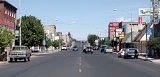
Burns is a city in and the county seat
of Harney County
, Oregon
, United States
. As of the 2010 census the population was 2,806.
by early settler and County Commissioner George McGowan.
.
According to the United States Census Bureau
, the city has a total area of 3.6 square miles (9.3 km²), all land. It is 136 miles (219 km) east of Bend, Oregon
, and 130 miles (209 km) west of Ontario, Oregon
, on U.S. Route 20 at its intersection with U.S. Route 395, 186 miles (299 km) south of Pendleton, Oregon
. A third highway, Oregon Route 78
, runs 92 miles (148 km) from Burns southeast past the Malheur National Wildlife Refuge
and Steens Mountain
to Burns Junction, Oregon.
climate that averages 115 clear days a year and only 29 rainy days. Temperatures average 25 °F (-4 °C) in January and 85 °F (29 °C) in July. Annual precipitation is about 11 inches (28 cm), and about 48 inches (122 cm) of snow a year falls in Burns.
of 2000, there were 3,064 people, 1,272 households, and 783 families residing in the city. The population density
was 861.5 people per square mile (332.3/km²). There were 1,487 housing units at an average density of 418.1 per square mile (161.3/km²). The racial makeup of the city was 93.54% White, 0.20% African American, 2.48% Native American, 0.52% Asian, 0.10% Pacific Islander, 1.11% from other races
, and 2.06% from two or more races. Hispanic or Latino of any race were 5.29% of the population.
There were 1,272 households out of which 28.4% had children under the age of 18 living with them, 48.8% were married couples
living together, 8.2% had a female householder with no husband present, and 38.4% were non-families. 31.9% of all households were made up of individuals and 12.4% had someone living alone who was 65 years of age or older. The average household size was 2.33 and the average family size was 2.94.
In the city the population dispersal was 26.0% under the age of 18, 7.4% from 18 to 24, 26.6% from 25 to 44, 23.7% from 45 to 64, and 16.3% who were 65 years of age or older. The median age was 39 years. For every 100 females there were 100.4 males. For every 100 females age 18 and over, there were 96.1 males. The median income for a household in the city was $26,658, and the median income for a family was $31,792. Males had a median income of $24,858 compared to $22,097 for females. The per capita income
for the city was $16,224. About 8.4% of families and 12.3% of the population were below the poverty line, including 8.7% of those under age 18 and 15.1% of those age 65 or over.
Indian Colony of Oregon is a federally recognized tribe of Northern Paiute Native Americans
that operates their tribal headquarters in Burns.
provides general aviation
services but currently has no scheduled flights.
is the only newspaper in the city. Two radio stations, KORC (92.7 FM) and KBNH (1230 AM), broadcast from Burns.
County seat
A county seat is an administrative center, or seat of government, for a county or civil parish. The term is primarily used in the United States....
of Harney County
Harney County, Oregon
-National protected areas:*Malheur National Forest *Malheur National Wildlife Refuge*Ochoco National Forest -Demographics:As of the census of 2000, there were 7,609 people, 3,036 households, and 2,094 families residing in the county. The population density was 1 people per square mile...
, Oregon
Oregon
Oregon is a state in the Pacific Northwest region of the United States. It is located on the Pacific coast, with Washington to the north, California to the south, Nevada on the southeast and Idaho to the east. The Columbia and Snake rivers delineate much of Oregon's northern and eastern...
, United States
United States
The United States of America is a federal constitutional republic comprising fifty states and a federal district...
. As of the 2010 census the population was 2,806.
History
Burns was established in the early 1880s and incorporated upon Harney county's creation in 1889. It was named for the Scottish poet Robert BurnsRobert Burns
Robert Burns was a Scottish poet and a lyricist. He is widely regarded as the national poet of Scotland, and is celebrated worldwide...
by early settler and County Commissioner George McGowan.
Geography
Burns is located near the northern edge of the arid Harney BasinHarney Basin
The Harney Basin is a structural basin in southeastern Oregon in the United States at the northwestern corner of the Great Basin. One of the least populated areas of the contiguous United States, it is located largely in northern Harney County, bounded on the north and east by the Columbia Plateau,...
.
According to the United States Census Bureau
United States Census Bureau
The United States Census Bureau is the government agency that is responsible for the United States Census. It also gathers other national demographic and economic data...
, the city has a total area of 3.6 square miles (9.3 km²), all land. It is 136 miles (219 km) east of Bend, Oregon
Bend, Oregon
Bend is a city in and the county seat of Deschutes County, Oregon, United States, and the principal city of the Bend, Oregon Metropolitan Statistical Area. Bend is Central Oregon's largest city, and, despite its modest size, is the de facto metropolis of the region, owing to the low population...
, and 130 miles (209 km) west of Ontario, Oregon
Ontario, Oregon
Ontario is the largest city in Malheur County, Oregon, United States. It lies along the Snake River at the Idaho border. The population was 10,985 at the 2000 census, with an estimated population of 11,245 in 2006...
, on U.S. Route 20 at its intersection with U.S. Route 395, 186 miles (299 km) south of Pendleton, Oregon
Pendleton, Oregon
Pendleton is a city in Umatilla County, Oregon, United States. Pendleton was named in 1868 by the county commissioners for George H. Pendleton, Democratic candidate for Vice-President in the 1864 presidential campaign. The population was 16,612 at the 2010 census...
. A third highway, Oregon Route 78
Oregon Route 78
Oregon Route 78 is an Oregon state highway running from Burns in Harney County to Burns Junction in Malheur County. OR 78 is known as the Steens Highway No. 442...
, runs 92 miles (148 km) from Burns southeast past the Malheur National Wildlife Refuge
Malheur National Wildlife Refuge
Malheur National Wildlife Refuge is located roughly south of the town of Burns, Oregon. The refuge area is roughly T shaped with the southernmost base at Frenchglen, the left top at Malheur Lake and the right top at Harney Lake....
and Steens Mountain
Steens Mountain
Steens Mountain is a large fault-block mountain in the southeastern part of the U.S. state of Oregon. Located in Harney County, it stretches some and rises from an elevation of about above the Alvord Desert to its peak at...
to Burns Junction, Oregon.
Climate
Burns has a high-desertDesert
A desert is a landscape or region that receives an extremely low amount of precipitation, less than enough to support growth of most plants. Most deserts have an average annual precipitation of less than...
climate that averages 115 clear days a year and only 29 rainy days. Temperatures average 25 °F (-4 °C) in January and 85 °F (29 °C) in July. Annual precipitation is about 11 inches (28 cm), and about 48 inches (122 cm) of snow a year falls in Burns.
| Monthly Normal and Record High and Low Temperatures for Burns, Oregon | ||||||||||||
| Month | Jan | Feb | Mar | Apr | May | Jun | Jul | Aug | Sep | Oct | Nov | Dec |
|---|---|---|---|---|---|---|---|---|---|---|---|---|
| Rec High °F | 57 | 67 | 74 | 84 | 94 | 98 | 107 | 100 | 97 | 86 | 70 | 57 |
| Avg High °F | 34.7 | 40.5 | 49 | 57.4 | 66.1 | 75.1 | 85.4 | 84.5 | 75 | 62.4 | 44.8 | 35.1 |
| Avg Low °F | 14 | 19.4 | 24.9 | 28.6 | 35.6 | 41.1 | 46.4 | 43.9 | 35 | 26.4 | 20.6 | 14.6 |
| Rec Low °F | -27 | -28 | -14 | 10 | 15 | 21 | 25 | 22 | 17 | -7 | -13 | -20 |
| Precip (in) | 1.18 | 1.11 | 1.24 | 0.85 | 1.05 | 0.66 | 0.4 | 0.45 | 0.5 | 0.72 | 1.11 | 1.3 |
| Source: USTravelWeather.com | ||||||||||||
Demographics
As of the censusCensus
A census is the procedure of systematically acquiring and recording information about the members of a given population. It is a regularly occurring and official count of a particular population. The term is used mostly in connection with national population and housing censuses; other common...
of 2000, there were 3,064 people, 1,272 households, and 783 families residing in the city. The population density
Population density
Population density is a measurement of population per unit area or unit volume. It is frequently applied to living organisms, and particularly to humans...
was 861.5 people per square mile (332.3/km²). There were 1,487 housing units at an average density of 418.1 per square mile (161.3/km²). The racial makeup of the city was 93.54% White, 0.20% African American, 2.48% Native American, 0.52% Asian, 0.10% Pacific Islander, 1.11% from other races
Race (United States Census)
Race and ethnicity in the United States Census, as defined by the Federal Office of Management and Budget and the United States Census Bureau, are self-identification data items in which residents choose the race or races with which they most closely identify, and indicate whether or not they are...
, and 2.06% from two or more races. Hispanic or Latino of any race were 5.29% of the population.
There were 1,272 households out of which 28.4% had children under the age of 18 living with them, 48.8% were married couples
Marriage
Marriage is a social union or legal contract between people that creates kinship. It is an institution in which interpersonal relationships, usually intimate and sexual, are acknowledged in a variety of ways, depending on the culture or subculture in which it is found...
living together, 8.2% had a female householder with no husband present, and 38.4% were non-families. 31.9% of all households were made up of individuals and 12.4% had someone living alone who was 65 years of age or older. The average household size was 2.33 and the average family size was 2.94.
In the city the population dispersal was 26.0% under the age of 18, 7.4% from 18 to 24, 26.6% from 25 to 44, 23.7% from 45 to 64, and 16.3% who were 65 years of age or older. The median age was 39 years. For every 100 females there were 100.4 males. For every 100 females age 18 and over, there were 96.1 males. The median income for a household in the city was $26,658, and the median income for a family was $31,792. Males had a median income of $24,858 compared to $22,097 for females. The per capita income
Per capita income
Per capita income or income per person is a measure of mean income within an economic aggregate, such as a country or city. It is calculated by taking a measure of all sources of income in the aggregate and dividing it by the total population...
for the city was $16,224. About 8.4% of families and 12.3% of the population were below the poverty line, including 8.7% of those under age 18 and 15.1% of those age 65 or over.
Politics
The Burns Paiute TribeBurns Paiute Tribe
The Burns Paiute Tribe of the Burns Paiute Indian Colony of Oregon is a federally recognized tribe of Northern Paiute Indians in Harney County, Oregon, United States...
Indian Colony of Oregon is a federally recognized tribe of Northern Paiute Native Americans
Indigenous peoples of the Americas
The indigenous peoples of the Americas are the pre-Columbian inhabitants of North and South America, their descendants and other ethnic groups who are identified with those peoples. Indigenous peoples are known in Canada as Aboriginal peoples, and in the United States as Native Americans...
that operates their tribal headquarters in Burns.
Air
Burns Municipal AirportBurns Municipal Airport
Burns Municipal Airport , is a public airport located five miles east of the city of Burns in Harney County, Oregon, USA....
provides general aviation
General aviation
General aviation is one of the two categories of civil aviation. It refers to all flights other than military and scheduled airline and regular cargo flights, both private and commercial. General aviation flights range from gliders and powered parachutes to large, non-scheduled cargo jet flights...
services but currently has no scheduled flights.
Bus
- The Eastern Point is an intercity busIntercity busAn intercity bus is a bus that carries passengers significant distances between different cities, towns, or other populated areas. Unlike a municipal bus, which has frequent stops throughout a city or town, an intercity bus generally has a single stop at a centralized location within the city, and...
offering service between BendBend, OregonBend is a city in and the county seat of Deschutes County, Oregon, United States, and the principal city of the Bend, Oregon Metropolitan Statistical Area. Bend is Central Oregon's largest city, and, despite its modest size, is the de facto metropolis of the region, owing to the low population...
and OntarioOntario, OregonOntario is the largest city in Malheur County, Oregon, United States. It lies along the Snake River at the Idaho border. The population was 10,985 at the 2000 census, with an estimated population of 11,245 in 2006...
, Oregon that stops in Burns and provides connections in Bend to the Central Oregon Breeze and Porter Stage Lines.
Notable people
- Kellen ClemensKellen ClemensKellen Clemens is an American football quarterback who is currently a member of the Houston Texans of the National Football League. He was drafted by the New York Jets in the second round of the 2006 NFL Draft...
- NFLNational Football LeagueThe National Football League is the highest level of professional American football in the United States, and is considered the top professional American football league in the world. It was formed by eleven teams in 1920 as the American Professional Football Association, with the league changing...
quarterbackQuarterbackQuarterback is a position in American and Canadian football. Quarterbacks are members of the offensive team and line up directly behind the offensive line...
- New York JetsNew York JetsThe New York Jets are a professional football team headquartered in Florham Park, New Jersey, representing the New York metropolitan area. The team is a member of the Eastern Division of the American Football Conference in the National Football League... - Norma PaulusNorma PaulusNorma Paulus is an American attorney and former politician in the state of Oregon. A native of Nebraska, she was raised in Eastern Oregon before becoming a lawyer...
- Former Oregon politician - Robert Freeman SmithRobert Freeman SmithRobert Freeman "Bob" Smith in Portland, Oregon, is an American politician.-Early life:Smith grew up in Burns, Oregon. He attended Willamette University in Salem, Oregon, graduating in 1953 with an agricultural degree...
- Congressman/Speaker of Oregon House
Media
The weekly Burns Times-HeraldBurns Times-Herald
The Burns Times-Herald is a weekly newspaper serving the city of Burns, Oregon, United States, and the surrounding Harney County area. The newspaper was established in 1887....
is the only newspaper in the city. Two radio stations, KORC (92.7 FM) and KBNH (1230 AM), broadcast from Burns.
External links
- Profile of Burns from the Oregon Blue BookOregon Blue BookThe Oregon Blue Book is the official directory and fact book for the U.S. state of Oregon copyrighted by the Oregon Secretary of State and published by the Office of the Secretary's Archives Division. As Governor Ted Kulongoski notes in his introduction for the 2005–2006 edition, it "provides...
- Profile of Burns from the Harney County Chamber of Commerce