
Poverty Point
Encyclopedia
Poverty Point is a prehistoric
earthworks of the Poverty Point culture
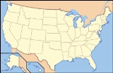
, now a historic monument located in the Southern United States
. It is 15.5 miles (24.9 km) from the current Mississippi River
, and situated on the edge of Maçon Ridge, near the village of Epps
in West Carroll Parish
, Louisiana
.
Poverty Point comprises several earthworks and mounds built between 1650 and 700 BCE, during the Archaic period in the Americas by a group of Native American
s of the Poverty Point culture. The culture extended 100 miles (160.9 km) across the Mississippi Delta
. The original purposes of Poverty Point have not been determined by archaeologists
, although they have proposed various possibilities including that it was: a settlement, a trading center, and/or a ceremonial religious complex.
The square-mile site, which has been described as "the largest and most complex Late Archaic earthwork occupation and ceremonial site yet found in North America
" is a registered National Monument. The monument was brought to the attention of archaeologists in the early 20th century, when it was given the name of Poverty Point after a nearby plantation
. Since then, various excavations have taken place at the site. Scholars have advanced various theories regarding the purpose of the mound site, including religious and ceremonial. Other writers have proposed pseudo-archaeological
and the New Age associations. The complex attracts many tourists as a destination.
ing over the last few centuries. The approximate diameter of the outside ridge is three-quarters of a mile, while the innermost ridge’s diameter is about three-eighths of a mile.
and also as an "Earth
island", representing the cosmological center of the site. Scholars use the fact that Mound A is in the center of a direct alignment between Mound B and E as an element demonstrating the complex planning exercised by the sites' builders.
Researchers have learned that Mound A was constructed quickly, probably over a period of less than three months. Prior to construction, the vegetation covering the site was burned. According to radiocarbon analysis, this burning occurred between approximately 1450 and 1250 BCE. Workers immediately covered the area with a cap of silt, followed quickly by the main construction effort. There are no signs of construction phases or weathering of the mound fill even at microscopic levels, indicating that construction proceeded in a single massive effort over a short period. In total volume, Mound A is made up of approximately 238,000 cubic meters of fill, making it the second-largest earthen mound (by volume) in eastern North America. It is second in overall size to the later Mississippian-culture
Monks Mound at Cahokia
, built beginning about 950-1000 CE in present-day Illinois
.
, is north-west of the rings. Below the mound was found a human bone interred with ashes, a likely indication of cremation
, suggesting that this might have been a burial mound or the individual was a victim of human sacrifice
. Mound B aligns in a straight north to south line with both mounds A and E.
goals, not because they had any revelation about Poverty Point's sports scene." Mound E aligns up in a straight south to north line with mounds A and B.
and the Mississippi State University
) have revealed evidence that wooden-post circular structures 80 to 160 feet (48.8 m) wide had been built in the "plaza" area; whether these features were contemporary with other constructions at the site is not currently known.
The first part of the surviving monument that was built was the Lower Jackson Mound, which was probably constructed during the Middle Archaic period. It has several highly typical features of Middle Archaic mounds, such as baked loess blocks and Evans points. It may have been built hundreds or even thousands of years before construction of the rest of Poverty Point. Some archaeologists believe that Ballcourt Mound may also have been built around this time, though this remains unproven.
The rest of the monument was built later, during the Later Archaic period. Its creators intentionally incorporated the older monuments of the Lower Jackson Mound and the Ballcourt Mound into it. Quite when construction of the rest of the earthworks commenced, and for how long that construction went on for, has remained a matter of speculation and debate. Radiocarbon dating
of the site has produced a wide variety of results, and suggested that most of the rings had been constructed between 1600 and 1300 BCE. This indicates that the monument had likely been gradually built over several centuries by groups of successive generations.
Although the time scale regarding the building of Poverty Point is still somewhat uncertain, archaeological evidence has shown more clearly how the earthworks were constructed. The number of workers involved is unknown, although the archeologist Jon L. Gibson has estimated that it could have been produced in a century by three generations: if a hundred people had spent six or seven days a month on its construction. Evidence shows that the workers probably lived on-site during construction, setting up temporary homes on top of the very earthworks that they were building, moving them whenever that particular earthwork was added to. Prior to the construction of the earthworks, workers leveled the land around the site and filled in ditches, as has been found by archaeological investigation.They constructed the grand, flat plaza on the site. The main building material was loess
, a type of soil which is easy to dig but has the problem of quickly turning to mud when exposed to water. For this reason clay
was used to pack around the loess in order to protect it from rain and ensure that the monuments did not wash away.
Archaeologists such as Sherwood Gagliano and Edwin Jackson support the concept that Poverty Point was a site where various groups came to meet and trade on an occasional basis. Gibson believes there was evidence of too much rubbish left by original inhabitants to indicate only occasional habitation, and that it would be implausible for such a monument to be built to be used simply as a trading center.
Some archeologists have interpreted Poverty Point as having religious symbolism and importance. A posthole discovered in the central plaza showed that a large post was possibly erected there. The archaeologist Professor William Haag, who excavated at the site during the 1970s, interpreted this post as having astronomical
significance in being aligned to the solstice
s. Examples of wooden post astronomical circles, since called Woodhenge
, have been found and reconstructed at the Mississippian culture
site of Cahokia
in western Illinois. But, the astronomer Robert Purrington believes the posts at Poverty Point were geometrically aligned rather than astronomically. Researchers have also studied historic and contemporary Native American religious beliefs for parallels, with many noting that the west is seen as the direction of evil and death. Gibson believed that the rings were built with their arcs against the west to keep malevolent spirit
s out of the complex.
 The Poverty Point culture
people who constructed Poverty Point were hunter-gatherers rather than agriculturalists. They are a rare example of a complex hunter-gatherer society that constructed large scale monuments. The vast majority of other prehistoric monuments, ranging from Stonehenge
in England
to the Great Pyramid at Giza in Egypt
, were constructed by agricultural societies, in which crop surpluses allowed greater density of population and stratification of society.
As such, the Poverty Point people’s food sources came from the local animals and plant life in the region. They cooked food in hearths and pits that likely acted as earth ovens, some of which had plastered walls. Firewood was chosen carefully, with specific trees being used, namely oak
and to a lesser degree hickory
and cane
, which archaeologist Jon L. Gibson believed was due to the fact that oak and hickory add a specific savoury flavour to food.
s or ropes, all of which have been described as “Poverty Point Objects” or PPOs. Archaeologists have long debated their uses. They have concluded the fired earth objects were used in cooking, a conclusion reached through experimental archaeology
. When placed in earth ovens, the objects were shown to hold heat and aid in cooking food.
The inhabitants of Poverty Point produced small amounts of pottery
, creating a variety of different kinds: fiber-tempered, sand-tempered, clay grit-tempered and untempered. They used both the Wheeler and Old Floyd Tchefuncte design styles as decoration. More commonly, however, they used stone vessels, some of which were made on-site and which would have taken greater effort than the production of pottery.
Many of their tools appear to have been made on-site, as there is evidence of debris from their construction process found across much of Poverty Point. However, they were also active in trade
with other Native American peoples. A disproportional amount of imported items, consisting of projectile point
s and microliths, have been determined to have originated in the Ouachita
and Ozark Mountains and in the Ohio
and Tennessee River
valleys. Other materials derived from trade are soapstone
from the southern Appalachian Mountains
of Alabama
and Georgia
, and copper
and galena
artifacts, indicating trade with the prehistoric copper-producing tribes in the upper Great Lakes
region.
. His grave was excavated at the Mounds Plantation, a village on the Red River in north-western Louisiana, approximately 150 miles (241.4 km) to the west of this monument. This individual, whom some scholars have speculated was a konah, or medicine man
, was buried with various charms within his medicine bundle
; these included artifacts from Poverty Point, such as two red stone beads, a slate pendant and a hematite plummet. It appears he had come across the site, or encountered someone else who did, and had ancient artifacts taken from it, perhaps believing they had a spiritual reference or power and could be used as amulets.
In the 1830s Jacob Walter, a man searching for lead ore in the area, came across Poverty Point and wrote about it in his diary. The first published account of the site was in 1873 by Samuel Lockett, who had served as an officer in the Confederate Army during the American Civil War
.
During the early 20th century, archaeologists took interest in the site, with it being briefly investigated by Clarence B. Moore
over 1911–1912, by Gerard Fowke of the Smithsonian Institution
in 1926, by Clarence H. Webb in 1935, and by Michael Beckman in 1946, while he was searching for oil. Three excavation seasons in 1952, 1953 and 1954 were undertaken by James A. Ford
and Robert Neitzel, leading to the publication of Poverty Point, a Late Archaic Site in Louisiana in 1956. It was during this excavation that "Poverty Point witnessed some of the first experimental archaeology
done in North America
."
Excavations have continued at the site into the 21st century, as researchers have tried to learn more about the nature of the site and its culture. At one time scholars thought the Poverty Point culture had developed North America's first chiefdom
, but this theory has been discredited.
, who at the time was the Southeast Regional Archaeologist for the National Park Service
, suggested to the Federal government that Poverty Point be declared and established as a National Monument. He described the site: "Poverty Point is the largest and most complex Late Archaic earthwork occupation and ceremonial site yet found in North America". But, at first the US Congress
declined to support the protection, fearing the unpopularity of acquiring the land from local landowners. The site was designated as a National Historic Landmark
on June 13, 1962.
In 1972, the State of Louisiana purchased a 400 acres (1.6 km²) section of the site, and in 1975 opened it to the public as the Poverty Point Commemorative Area. The state built a museum devoted to interpreting the monument and many of the artifacts uncovered there. In 1988 Congress designated the site as a U.S. National Monument. It has become a popular tourist destination.
Today Poverty Point National Monument is open for visitors daily from 9 a.m. to 5 p.m. except for Thanksgiving
, Christmas
, and New Year’s Day. The cost of the entrance is $4 a person; people over the age of 62 and children 12 and under are free. As the site is managed by the Louisiana State Parks System, it does not accept a National Parks pass for admission. The site is occasionally monitored by the National Historic Landmark program, which is concerned about the erosion of the mounds. Louisiana is working with the Vicksburg U.S. Army Corps of Engineers
division in developing plans for erosion
control.
qualities. John Ward
, in his controversial pseudo-archaeological
Ancient Archives among the Cornstalks (1984), claimed that Poverty Point was built by refugees who fled up the Mississippi
River after their home, Atlantis
, was destroyed in 1198 BCE. A similar connection to the legendary lost city was made by Frank Joseph, who claimed that individuals who were the reincarnation of former Atlanteans were able to unleash the psychic energies of Poverty Point by spilling purified water on the oak tree upon the main mound at the site. Erich Von Daniken
has suggested a connection to extraterrestrials. He suggested that one of the mounds was a landing platform for alien aircraft.
Prehistory
Prehistory is the span of time before recorded history. Prehistory can refer to the period of human existence before the availability of those written records with which recorded history begins. More broadly, it refers to all the time preceding human existence and the invention of writing...
earthworks of the Poverty Point culture
Poverty Point culture
Poverty Point culture is an archaeological culture that corresponds to an ancient group of Indigenous peoples who inhabited the area of the lower Mississippi Valley and surrounding Gulf coast from about 2200 BCE - 700 BCE...
, now a historic monument located in the Southern United States
Southern United States
The Southern United States—commonly referred to as the American South, Dixie, or simply the South—constitutes a large distinctive area in the southeastern and south-central United States...
. It is 15.5 miles (24.9 km) from the current Mississippi River
Mississippi River
The Mississippi River is the largest river system in North America. Flowing entirely in the United States, this river rises in western Minnesota and meanders slowly southwards for to the Mississippi River Delta at the Gulf of Mexico. With its many tributaries, the Mississippi's watershed drains...
, and situated on the edge of Maçon Ridge, near the village of Epps
Epps, Louisiana
Epps is a village in West Carroll Parish, Louisiana, United States. The population was 1,153 at the 2000 census.The Poverty Point National Monument is located nearby, the most complex earthworks site built by a Late Archaic culture....
in West Carroll Parish
West Carroll Parish, Louisiana
West Carroll Parish is a parish located in the U.S. state of Louisiana. The parish seat is Oak Grove and as of 2000, the population was 12,314.-History:...
, Louisiana
Louisiana
Louisiana is a state located in the southern region of the United States of America. Its capital is Baton Rouge and largest city is New Orleans. Louisiana is the only state in the U.S. with political subdivisions termed parishes, which are local governments equivalent to counties...
.
Poverty Point comprises several earthworks and mounds built between 1650 and 700 BCE, during the Archaic period in the Americas by a group of Native American
Indigenous peoples of the Americas
The indigenous peoples of the Americas are the pre-Columbian inhabitants of North and South America, their descendants and other ethnic groups who are identified with those peoples. Indigenous peoples are known in Canada as Aboriginal peoples, and in the United States as Native Americans...
s of the Poverty Point culture. The culture extended 100 miles (160.9 km) across the Mississippi Delta
Mississippi Delta
The Mississippi Delta is the distinctive northwest section of the U.S. state of Mississippi that lies between the Mississippi and Yazoo Rivers. The region has been called "The Most Southern Place on Earth" because of its unique racial, cultural, and economic history...
. The original purposes of Poverty Point have not been determined by archaeologists
Archaeology
Archaeology, or archeology , is the study of human society, primarily through the recovery and analysis of the material culture and environmental data that they have left behind, which includes artifacts, architecture, biofacts and cultural landscapes...
, although they have proposed various possibilities including that it was: a settlement, a trading center, and/or a ceremonial religious complex.
The square-mile site, which has been described as "the largest and most complex Late Archaic earthwork occupation and ceremonial site yet found in North America
North America
North America is a continent wholly within the Northern Hemisphere and almost wholly within the Western Hemisphere. It is also considered a northern subcontinent of the Americas...
" is a registered National Monument. The monument was brought to the attention of archaeologists in the early 20th century, when it was given the name of Poverty Point after a nearby plantation
Plantation
A plantation is a long artificially established forest, farm or estate, where crops are grown for sale, often in distant markets rather than for local on-site consumption...
. Since then, various excavations have taken place at the site. Scholars have advanced various theories regarding the purpose of the mound site, including religious and ceremonial. Other writers have proposed pseudo-archaeological
Pseudoarchaeology
Pseudoarchaeology — also known as alternative archaeology, fringe archaeology, fantastic archaeology, or cult archaeology — refers to interpretations of the past from outside of the academic archaeological community, which typically also reject the accepted scientific and analytical methods of the...
and the New Age associations. The complex attracts many tourists as a destination.
Site description
Poverty Point is constructed entirely of earthworks. The core of the site measures approximately 500 acres (2 km²), although archaeological investigations have shown that the total occupation area extended for more than three miles (5 km) along the river terrace. The monumental construction is a group of six concentric, crescent ridge earthworks, divided by five aisles radiating from the center at the river bank. The site also has several mounds both on the outside and inside of the ring earthworks.Six curving earthworks
The main part of the monument is the six concentric curving earthworks located in the center of the site. Each is separated from one another by a flat corridor of earth. Dividing the ridges into three sections (formerly five) are two ramps that slope inwardly, leading to Bayou Maçon. Each of the ridge earthworks is about three feet high. Archaeologists believe they were once five feet high, but have been worn down through agricultural ploughPlough
The plough or plow is a tool used in farming for initial cultivation of soil in preparation for sowing seed or planting. It has been a basic instrument for most of recorded history, and represents one of the major advances in agriculture...
ing over the last few centuries. The approximate diameter of the outside ridge is three-quarters of a mile, while the innermost ridge’s diameter is about three-eighths of a mile.
Mound A (The Bird Mound)
Alongside these ridges are other earthworks, primarily platform mounds. The largest of these, Mound A, is to the east of the ridges, and is roughly T-shaped when viewed from above. Many have interpreted it as being in the shape of a birdBird
Birds are feathered, winged, bipedal, endothermic , egg-laying, vertebrate animals. Around 10,000 living species and 188 families makes them the most speciose class of tetrapod vertebrates. They inhabit ecosystems across the globe, from the Arctic to the Antarctic. Extant birds range in size from...
and also as an "Earth
Earth
Earth is the third planet from the Sun, and the densest and fifth-largest of the eight planets in the Solar System. It is also the largest of the Solar System's four terrestrial planets...
island", representing the cosmological center of the site. Scholars use the fact that Mound A is in the center of a direct alignment between Mound B and E as an element demonstrating the complex planning exercised by the sites' builders.
Researchers have learned that Mound A was constructed quickly, probably over a period of less than three months. Prior to construction, the vegetation covering the site was burned. According to radiocarbon analysis, this burning occurred between approximately 1450 and 1250 BCE. Workers immediately covered the area with a cap of silt, followed quickly by the main construction effort. There are no signs of construction phases or weathering of the mound fill even at microscopic levels, indicating that construction proceeded in a single massive effort over a short period. In total volume, Mound A is made up of approximately 238,000 cubic meters of fill, making it the second-largest earthen mound (by volume) in eastern North America. It is second in overall size to the later Mississippian-culture
Mississippian culture
The Mississippian culture was a mound-building Native American culture that flourished in what is now the Midwestern, Eastern, and Southeastern United States from approximately 800 CE to 1500 CE, varying regionally....
Monks Mound at Cahokia
Cahokia
Cahokia Mounds State Historic Site is the area of an ancient indigenous city located in the American Bottom floodplain, between East Saint Louis and Collinsville in south-western Illinois, across the Mississippi River from St. Louis, Missouri. The site included 120 human-built earthwork mounds...
, built beginning about 950-1000 CE in present-day Illinois
Illinois
Illinois is the fifth-most populous state of the United States of America, and is often noted for being a microcosm of the entire country. With Chicago in the northeast, small industrial cities and great agricultural productivity in central and northern Illinois, and natural resources like coal,...
.
Mound B
Mound B, a platform moundPlatform mound
A platform mound is any earthwork or mound intended to support a structure or activity.-Eastern North America:The indigenous peoples of North America built substructure mounds for well over a thousand years starting in the Archaic period and continuing through the Woodland period...
, is north-west of the rings. Below the mound was found a human bone interred with ashes, a likely indication of cremation
Cremation
Cremation is the process of reducing bodies to basic chemical compounds such as gasses and bone fragments. This is accomplished through high-temperature burning, vaporization and oxidation....
, suggesting that this might have been a burial mound or the individual was a victim of human sacrifice
Human sacrifice
Human sacrifice is the act of killing one or more human beings as part of a religious ritual . Its typology closely parallels the various practices of ritual slaughter of animals and of religious sacrifice in general. Human sacrifice has been practised in various cultures throughout history...
. Mound B aligns in a straight north to south line with both mounds A and E.
Mound E (Ballcourt Mound)
The Ballcourt Mound, which is also a platform mound, is so called because "two shallow depressions on its flattened top reminded some archaeologists of playing areas in front of outdoor basketballBasketball
Basketball is a team sport in which two teams of five players try to score points by throwing or "shooting" a ball through the top of a basketball hoop while following a set of rules...
goals, not because they had any revelation about Poverty Point's sports scene." Mound E aligns up in a straight south to north line with mounds A and B.
Dunbar and Lower Jackson mounds
Within the enclosure created by the curving earthworks, two additional platform mounds were located. The Dunbar Mound, had various pieces of chipped precious stones upon it, indicating that people used to sit atop it and make jewelry. South of the site center is the Lower Jackson Mound, which is believed to be the oldest of all the earthworks at the site. In the southern edge of the site, the Motley Mound rises 51 ft (15.5 m). The conical mound is circular and reaches a height of 24.5 ft (7.5 m). These three platform mounds are much smaller than the other mounds.Construction
Poverty Point was not constructed all at once, but appears to have been built up over a period of centuries or even millennia, as additions were made by successive generations. Excavations in 2009 by the University of Louisiana at MonroeUniversity of Louisiana at Monroe
The University of Louisiana at Monroe is a coeducational public university in Monroe, Louisiana and part of the University of Louisiana System.-History:...
and the Mississippi State University
Mississippi State University
The Mississippi State University of Agriculture and Applied Science commonly known as Mississippi State University is a land-grant university located in Oktibbeha County, Mississippi, United States, partially in the town of Starkville and partially in an unincorporated area...
) have revealed evidence that wooden-post circular structures 80 to 160 feet (48.8 m) wide had been built in the "plaza" area; whether these features were contemporary with other constructions at the site is not currently known.
The first part of the surviving monument that was built was the Lower Jackson Mound, which was probably constructed during the Middle Archaic period. It has several highly typical features of Middle Archaic mounds, such as baked loess blocks and Evans points. It may have been built hundreds or even thousands of years before construction of the rest of Poverty Point. Some archaeologists believe that Ballcourt Mound may also have been built around this time, though this remains unproven.
The rest of the monument was built later, during the Later Archaic period. Its creators intentionally incorporated the older monuments of the Lower Jackson Mound and the Ballcourt Mound into it. Quite when construction of the rest of the earthworks commenced, and for how long that construction went on for, has remained a matter of speculation and debate. Radiocarbon dating
Radiocarbon dating
Radiocarbon dating is a radiometric dating method that uses the naturally occurring radioisotope carbon-14 to estimate the age of carbon-bearing materials up to about 58,000 to 62,000 years. Raw, i.e. uncalibrated, radiocarbon ages are usually reported in radiocarbon years "Before Present" ,...
of the site has produced a wide variety of results, and suggested that most of the rings had been constructed between 1600 and 1300 BCE. This indicates that the monument had likely been gradually built over several centuries by groups of successive generations.
Although the time scale regarding the building of Poverty Point is still somewhat uncertain, archaeological evidence has shown more clearly how the earthworks were constructed. The number of workers involved is unknown, although the archeologist Jon L. Gibson has estimated that it could have been produced in a century by three generations: if a hundred people had spent six or seven days a month on its construction. Evidence shows that the workers probably lived on-site during construction, setting up temporary homes on top of the very earthworks that they were building, moving them whenever that particular earthwork was added to. Prior to the construction of the earthworks, workers leveled the land around the site and filled in ditches, as has been found by archaeological investigation.They constructed the grand, flat plaza on the site. The main building material was loess
Loess
Loess is an aeolian sediment formed by the accumulation of wind-blown silt, typically in the 20–50 micrometre size range, twenty percent or less clay and the balance equal parts sand and silt that are loosely cemented by calcium carbonate...
, a type of soil which is easy to dig but has the problem of quickly turning to mud when exposed to water. For this reason clay
Clay
Clay is a general term including many combinations of one or more clay minerals with traces of metal oxides and organic matter. Geologic clay deposits are mostly composed of phyllosilicate minerals containing variable amounts of water trapped in the mineral structure.- Formation :Clay minerals...
was used to pack around the loess in order to protect it from rain and ensure that the monuments did not wash away.
Purposes
Archaeologists have debated the functions of the Poverty Point site since its rediscovery. One of the main questions has been whether it was used for a settlement, or only for periodic ceremonial events. Archaeologists such as Jon L. Gibson, have postulated that houses were constructed on top of the concentric ring earthworks. A few postholes have been found upon these earthworks, indicating the former presence of a building. Other archeologists believe that regular residence would have produced more postholes as an archeological feature. Gibson and others note these could have been destroyed by the subsequent ploughing that took place on much of the site.Archaeologists such as Sherwood Gagliano and Edwin Jackson support the concept that Poverty Point was a site where various groups came to meet and trade on an occasional basis. Gibson believes there was evidence of too much rubbish left by original inhabitants to indicate only occasional habitation, and that it would be implausible for such a monument to be built to be used simply as a trading center.
Some archeologists have interpreted Poverty Point as having religious symbolism and importance. A posthole discovered in the central plaza showed that a large post was possibly erected there. The archaeologist Professor William Haag, who excavated at the site during the 1970s, interpreted this post as having astronomical
Astronomy
Astronomy is a natural science that deals with the study of celestial objects and phenomena that originate outside the atmosphere of Earth...
significance in being aligned to the solstice
Solstice
A solstice is an astronomical event that happens twice each year when the Sun's apparent position in the sky, as viewed from Earth, reaches its northernmost or southernmost extremes...
s. Examples of wooden post astronomical circles, since called Woodhenge
Woodhenge
Woodhenge is a Neolithic Class I henge and timber circle monument located in the Stonehenge World Heritage Site in Wiltshire, England. It is north-east of Stonehenge in the parish of Durrington, just north of Amesbury.-Discovery:...
, have been found and reconstructed at the Mississippian culture
Mississippian culture
The Mississippian culture was a mound-building Native American culture that flourished in what is now the Midwestern, Eastern, and Southeastern United States from approximately 800 CE to 1500 CE, varying regionally....
site of Cahokia
Cahokia
Cahokia Mounds State Historic Site is the area of an ancient indigenous city located in the American Bottom floodplain, between East Saint Louis and Collinsville in south-western Illinois, across the Mississippi River from St. Louis, Missouri. The site included 120 human-built earthwork mounds...
in western Illinois. But, the astronomer Robert Purrington believes the posts at Poverty Point were geometrically aligned rather than astronomically. Researchers have also studied historic and contemporary Native American religious beliefs for parallels, with many noting that the west is seen as the direction of evil and death. Gibson believed that the rings were built with their arcs against the west to keep malevolent spirit
Spirit
The English word spirit has many differing meanings and connotations, most of them relating to a non-corporeal substance contrasted with the material body.The spirit of a living thing usually refers to or explains its consciousness.The notions of a person's "spirit" and "soul" often also overlap,...
s out of the complex.
Poverty Point People
Poverty Point culture
Poverty Point culture is an archaeological culture that corresponds to an ancient group of Indigenous peoples who inhabited the area of the lower Mississippi Valley and surrounding Gulf coast from about 2200 BCE - 700 BCE...
people who constructed Poverty Point were hunter-gatherers rather than agriculturalists. They are a rare example of a complex hunter-gatherer society that constructed large scale monuments. The vast majority of other prehistoric monuments, ranging from Stonehenge
Stonehenge
Stonehenge is a prehistoric monument located in the English county of Wiltshire, about west of Amesbury and north of Salisbury. One of the most famous sites in the world, Stonehenge is composed of a circular setting of large standing stones set within earthworks...
in England
England
England is a country that is part of the United Kingdom. It shares land borders with Scotland to the north and Wales to the west; the Irish Sea is to the north west, the Celtic Sea to the south west, with the North Sea to the east and the English Channel to the south separating it from continental...
to the Great Pyramid at Giza in Egypt
Egypt
Egypt , officially the Arab Republic of Egypt, Arabic: , is a country mainly in North Africa, with the Sinai Peninsula forming a land bridge in Southwest Asia. Egypt is thus a transcontinental country, and a major power in Africa, the Mediterranean Basin, the Middle East and the Muslim world...
, were constructed by agricultural societies, in which crop surpluses allowed greater density of population and stratification of society.
As such, the Poverty Point people’s food sources came from the local animals and plant life in the region. They cooked food in hearths and pits that likely acted as earth ovens, some of which had plastered walls. Firewood was chosen carefully, with specific trees being used, namely oak
Oak
An oak is a tree or shrub in the genus Quercus , of which about 600 species exist. "Oak" may also appear in the names of species in related genera, notably Lithocarpus...
and to a lesser degree hickory
Hickory
Trees in the genus Carya are commonly known as hickory, derived from the Powhatan language of Virginia. The genus includes 17–19 species of deciduous trees with pinnately compound leaves and big nuts...
and cane
Cane
Cane are either of two genera of tall, perennial grasses with flexible, woody stalks from the family Poaceae that grow throughout the world in wet soils. They are related to and may include species of bamboo. The genus Arundo is native from the Mediterranean region to the Far East. Arundinaria...
, which archaeologist Jon L. Gibson believed was due to the fact that oak and hickory add a specific savoury flavour to food.
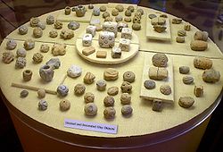
Artifacts
The vast majority of artifacts uncovered at Poverty Point are small, baked shapes made of loess, which are usually balls, biconeBicone
A bicone or dicone is the three-dimensional geometric shape swept by revolving an isosceles triangle around its edge of unequal length. Alternatively, one can view a bicone as the surface created by joining two identical right circular cones base-to-base....
s or ropes, all of which have been described as “Poverty Point Objects” or PPOs. Archaeologists have long debated their uses. They have concluded the fired earth objects were used in cooking, a conclusion reached through experimental archaeology
Experimental archaeology
Experimental archaeology employs a number of different methods, techniques, analyses, and approaches in order to generate and test hypotheses, based upon archaeological source material, like ancient structures or artifacts. It should not be confused with primitive technology which is not concerned...
. When placed in earth ovens, the objects were shown to hold heat and aid in cooking food.
The inhabitants of Poverty Point produced small amounts of pottery
Pottery
Pottery is the material from which the potteryware is made, of which major types include earthenware, stoneware and porcelain. The place where such wares are made is also called a pottery . Pottery also refers to the art or craft of the potter or the manufacture of pottery...
, creating a variety of different kinds: fiber-tempered, sand-tempered, clay grit-tempered and untempered. They used both the Wheeler and Old Floyd Tchefuncte design styles as decoration. More commonly, however, they used stone vessels, some of which were made on-site and which would have taken greater effort than the production of pottery.
Many of their tools appear to have been made on-site, as there is evidence of debris from their construction process found across much of Poverty Point. However, they were also active in trade
Trade
Trade is the transfer of ownership of goods and services from one person or entity to another. Trade is sometimes loosely called commerce or financial transaction or barter. A network that allows trade is called a market. The original form of trade was barter, the direct exchange of goods and...
with other Native American peoples. A disproportional amount of imported items, consisting of projectile point
Projectile point
In archaeological terms, a projectile point is an object that was hafted to a projectile, such as a spear, dart, or arrow, or perhaps used as a knife....
s and microliths, have been determined to have originated in the Ouachita
Ouachita
Ouachita may refer to:In geography:* Ouachita Mountains* Ouachita orogeny the geologic event that raised the Ouachita Mountains* Ouachita River* Ouachita Parish, Louisiana* Ouachita County, Arkansas* Ouachita National Forest...
and Ozark Mountains and in the Ohio
Ohio River
The Ohio River is the largest tributary, by volume, of the Mississippi River. At the confluence, the Ohio is even bigger than the Mississippi and, thus, is hydrologically the main stream of the whole river system, including the Allegheny River further upstream...
and Tennessee River
Tennessee River
The Tennessee River is the largest tributary of the Ohio River. It is approximately 652 miles long and is located in the southeastern United States in the Tennessee Valley. The river was once popularly known as the Cherokee River, among other names...
valleys. Other materials derived from trade are soapstone
Soapstone
Soapstone is a metamorphic rock, a talc-schist. It is largely composed of the mineral talc and is thus rich in magnesium. It is produced by dynamothermal metamorphism and metasomatism, which occurs in the areas where tectonic plates are subducted, changing rocks by heat and pressure, with influx...
from the southern Appalachian Mountains
Appalachian Mountains
The Appalachian Mountains #Whether the stressed vowel is or ,#Whether the "ch" is pronounced as a fricative or an affricate , and#Whether the final vowel is the monophthong or the diphthong .), often called the Appalachians, are a system of mountains in eastern North America. The Appalachians...
of Alabama
Alabama
Alabama is a state located in the southeastern region of the United States. It is bordered by Tennessee to the north, Georgia to the east, Florida and the Gulf of Mexico to the south, and Mississippi to the west. Alabama ranks 30th in total land area and ranks second in the size of its inland...
and Georgia
Georgia (U.S. state)
Georgia is a state located in the southeastern United States. It was established in 1732, the last of the original Thirteen Colonies. The state is named after King George II of Great Britain. Georgia was the fourth state to ratify the United States Constitution, on January 2, 1788...
, and copper
Copper
Copper is a chemical element with the symbol Cu and atomic number 29. It is a ductile metal with very high thermal and electrical conductivity. Pure copper is soft and malleable; an exposed surface has a reddish-orange tarnish...
and galena
Galena
Galena is the natural mineral form of lead sulfide. It is the most important lead ore mineral.Galena is one of the most abundant and widely distributed sulfide minerals. It crystallizes in the cubic crystal system often showing octahedral forms...
artifacts, indicating trade with the prehistoric copper-producing tribes in the upper Great Lakes
Great Lakes
The Great Lakes are a collection of freshwater lakes located in northeastern North America, on the Canada – United States border. Consisting of Lakes Superior, Michigan, Huron, Erie, and Ontario, they form the largest group of freshwater lakes on Earth by total surface, coming in second by volume...
region.
Discovery, excavation and tourism
Discovery and archaeological excavation
The first evidence for a later human encountering ancient Poverty Point comes from a burial of a twelfth century CE Caddo Native AmericanCaddo
The Caddo Nation is a confederacy of several Southeastern Native American tribes, who traditionally inhabited much of what is now East Texas, northern Louisiana and portions of southern Arkansas and Oklahoma. Today the Caddo Nation of Oklahoma is a cohesive tribe with its capital at Binger, Oklahoma...
. His grave was excavated at the Mounds Plantation, a village on the Red River in north-western Louisiana, approximately 150 miles (241.4 km) to the west of this monument. This individual, whom some scholars have speculated was a konah, or medicine man
Medicine man
"Medicine man" or "Medicine woman" are English terms used to describe traditional healers and spiritual leaders among Native American and other indigenous or aboriginal peoples...
, was buried with various charms within his medicine bundle
Medicine bundle
A medicine bundle is a wrapped package used by Native Americans for religious purposes. A package of this type can also be referred to as a medicine bag. Medicine bundles are usually employed as a ritual aid in Shamanistic religions...
; these included artifacts from Poverty Point, such as two red stone beads, a slate pendant and a hematite plummet. It appears he had come across the site, or encountered someone else who did, and had ancient artifacts taken from it, perhaps believing they had a spiritual reference or power and could be used as amulets.
In the 1830s Jacob Walter, a man searching for lead ore in the area, came across Poverty Point and wrote about it in his diary. The first published account of the site was in 1873 by Samuel Lockett, who had served as an officer in the Confederate Army during the American Civil War
American Civil War
The American Civil War was a civil war fought in the United States of America. In response to the election of Abraham Lincoln as President of the United States, 11 southern slave states declared their secession from the United States and formed the Confederate States of America ; the other 25...
.
During the early 20th century, archaeologists took interest in the site, with it being briefly investigated by Clarence B. Moore
Clarence Bloomfield Moore
Clarence Bloomfield Moore was an American archaeologist and writer...
over 1911–1912, by Gerard Fowke of the Smithsonian Institution
Smithsonian Institution
The Smithsonian Institution is an educational and research institute and associated museum complex, administered and funded by the government of the United States and by funds from its endowment, contributions, and profits from its retail operations, concessions, licensing activities, and magazines...
in 1926, by Clarence H. Webb in 1935, and by Michael Beckman in 1946, while he was searching for oil. Three excavation seasons in 1952, 1953 and 1954 were undertaken by James A. Ford
James A. Ford
James Alfred Ford was an American archaeologist. He was born in Water Valley, Mississippi, on February 12, 1911. He became interested in work on Native American mound research while growing up in Mississippi.-Archaeological work:...
and Robert Neitzel, leading to the publication of Poverty Point, a Late Archaic Site in Louisiana in 1956. It was during this excavation that "Poverty Point witnessed some of the first experimental archaeology
Experimental archaeology
Experimental archaeology employs a number of different methods, techniques, analyses, and approaches in order to generate and test hypotheses, based upon archaeological source material, like ancient structures or artifacts. It should not be confused with primitive technology which is not concerned...
done in North America
North America
North America is a continent wholly within the Northern Hemisphere and almost wholly within the Western Hemisphere. It is also considered a northern subcontinent of the Americas...
."
Excavations have continued at the site into the 21st century, as researchers have tried to learn more about the nature of the site and its culture. At one time scholars thought the Poverty Point culture had developed North America's first chiefdom
Chiefdom
A chiefdom is a political economy that organizes regional populations through a hierarchy of the chief.In anthropological theory, one model of human social development rooted in ideas of cultural evolution describes a chiefdom as a form of social organization more complex than a tribe or a band...
, but this theory has been discredited.
Public access
In 1960, John GriffinJohn W. Griffin (archaeologist)
John W. Griffin was the State Archaeologist of Florida, the Director of the St. Augustine Historical Society, and a Regional Archaeologist for the National Park Service.-Background:...
, who at the time was the Southeast Regional Archaeologist for the National Park Service
National Park Service
The National Park Service is the U.S. federal agency that manages all national parks, many national monuments, and other conservation and historical properties with various title designations...
, suggested to the Federal government that Poverty Point be declared and established as a National Monument. He described the site: "Poverty Point is the largest and most complex Late Archaic earthwork occupation and ceremonial site yet found in North America". But, at first the US Congress
United States Congress
The United States Congress is the bicameral legislature of the federal government of the United States, consisting of the Senate and the House of Representatives. The Congress meets in the United States Capitol in Washington, D.C....
declined to support the protection, fearing the unpopularity of acquiring the land from local landowners. The site was designated as a National Historic Landmark
National Historic Landmark
A National Historic Landmark is a building, site, structure, object, or district, that is officially recognized by the United States government for its historical significance...
on June 13, 1962.
In 1972, the State of Louisiana purchased a 400 acres (1.6 km²) section of the site, and in 1975 opened it to the public as the Poverty Point Commemorative Area. The state built a museum devoted to interpreting the monument and many of the artifacts uncovered there. In 1988 Congress designated the site as a U.S. National Monument. It has become a popular tourist destination.
Today Poverty Point National Monument is open for visitors daily from 9 a.m. to 5 p.m. except for Thanksgiving
Thanksgiving
Thanksgiving Day is a holiday celebrated primarily in the United States and Canada. Thanksgiving is celebrated each year on the second Monday of October in Canada and on the fourth Thursday of November in the United States. In Canada, Thanksgiving falls on the same day as Columbus Day in the...
, Christmas
Christmas
Christmas or Christmas Day is an annual holiday generally celebrated on December 25 by billions of people around the world. It is a Christian feast that commemorates the birth of Jesus Christ, liturgically closing the Advent season and initiating the season of Christmastide, which lasts twelve days...
, and New Year’s Day. The cost of the entrance is $4 a person; people over the age of 62 and children 12 and under are free. As the site is managed by the Louisiana State Parks System, it does not accept a National Parks pass for admission. The site is occasionally monitored by the National Historic Landmark program, which is concerned about the erosion of the mounds. Louisiana is working with the Vicksburg U.S. Army Corps of Engineers
United States Army Corps of Engineers
The United States Army Corps of Engineers is a federal agency and a major Army command made up of some 38,000 civilian and military personnel, making it the world's largest public engineering, design and construction management agency...
division in developing plans for erosion
Erosion
Erosion is when materials are removed from the surface and changed into something else. It only works by hydraulic actions and transport of solids in the natural environment, and leads to the deposition of these materials elsewhere...
control.
New Age and pseudoarchaeological interpretations
Some followers of the New Age movement believe the site has spiritualSpirituality
Spirituality can refer to an ultimate or an alleged immaterial reality; an inner path enabling a person to discover the essence of his/her being; or the “deepest values and meanings by which people live.” Spiritual practices, including meditation, prayer and contemplation, are intended to develop...
qualities. John Ward
John Ward
John Ward may refer to:*John Ward , English composer*John Ward , English Gresham Professor of Rhetoric*John Ward , Lord Mayor of London...
, in his controversial pseudo-archaeological
Pseudoarchaeology
Pseudoarchaeology — also known as alternative archaeology, fringe archaeology, fantastic archaeology, or cult archaeology — refers to interpretations of the past from outside of the academic archaeological community, which typically also reject the accepted scientific and analytical methods of the...
Ancient Archives among the Cornstalks (1984), claimed that Poverty Point was built by refugees who fled up the Mississippi
Mississippi
Mississippi is a U.S. state located in the Southern United States. Jackson is the state capital and largest city. The name of the state derives from the Mississippi River, which flows along its western boundary, whose name comes from the Ojibwe word misi-ziibi...
River after their home, Atlantis
Atlantis
Atlantis is a legendary island first mentioned in Plato's dialogues Timaeus and Critias, written about 360 BC....
, was destroyed in 1198 BCE. A similar connection to the legendary lost city was made by Frank Joseph, who claimed that individuals who were the reincarnation of former Atlanteans were able to unleash the psychic energies of Poverty Point by spilling purified water on the oak tree upon the main mound at the site. Erich Von Daniken
Erich von Däniken
Erich Anton Paul von Däniken is a Swiss author best known for his controversial claims about extraterrestrial influences on early human culture, in books such as Chariots of the Gods?, published in 1968...
has suggested a connection to extraterrestrials. He suggested that one of the mounds was a landing platform for alien aircraft.
See also
- Watson BrakeWatson BrakeWatson Brake is an archaeological site in Ouachita Parish, Louisiana from the Archaic period. Dated to about 5400 years ago , Watson Brake is considered the earliest mound complex in North America. It is the earliest dated, complex construction in the Americas...
- Mound BuilderMound builderMound builder may refer to:* Mound builder , Native American people who built mounds* Moundbuilders , school mascot* Megapode, also known as incubator birds or mound-builders...
- Archaic period in the Americas
- Native Americans in the United StatesNative Americans in the United StatesNative Americans in the United States are the indigenous peoples in North America within the boundaries of the present-day continental United States, parts of Alaska, and the island state of Hawaii. They are composed of numerous, distinct tribes, states, and ethnic groups, many of which survive as...
External links
- National Park Service: official Poverty Point National Monument website
- "Poverty Point", Louisiana Archaeological Survey
- "Poverty Point Earthworks", The Archaeology Channel