

List of civil parishes in Cornwall
Encyclopedia
A civil parish is a subnational entity, forming the lowest unit of local government in England
. There are 218 civil parishes in the ceremonial county of Cornwall
, the county effectively being entirely parished; only the unpopulated Wolf Rock
is unparished. At the 2001 census, there were 501,267 people living in the 218 parishes, accounting for 100.0 per cent of the county's population. The final unparished areas of mainland Cornwall, around St Austell
, were parished on 1 April 2009, to coincide with the structural changes to local government in England
.
divisions, and were originally purely ecclesiastical divisions. Over time they acquired civil administration powers.
The Highways Act 1555
made parishes responsible for the upkeep of roads. Every adult inhabitant of the parish was obliged to work four days a year on the roads, providing their own tools, carts and horses; the work was overseen by an unpaid local appointee, the Surveyor of Highways.
The poor were looked after by the monasteries
, until their dissolution
. In 1572, magistrates were given power to 'survey the poor' and impose taxes for their relief. This system was made more formal by the Poor Law Act 1601
, which made parishes responsible for administering the Poor Law
; overseers were appointed to charge a rate
to support the poor of the parish. The 19th century saw an increase in the responsibility of parishes, although the Poor Law powers were transferred to Poor Law Unions. The Public Health Act 1872
grouped parishes into Rural Sanitary Districts, based on the Poor Law Unions; these subsequently formed the basis for Rural District
s.
Parishes were run by vestries
, meeting annually to appoint officials, and were generally identical to ecclesiastical parishes, although some township
s in large parishes administered the Poor Law themselves; under the Divided Parishes and Poor Law Amendment Act 1882
, all extra-parochial area
s and township
s that levied a separate rate became independent civil parishes.
Civil parishes in their modern sense date from the Local Government Act 1894
, which abolished vestries
; established elected parish councils in all rural parishes with more than 300 electors; grouped rural parishes into Rural Districts; and aligned parish boundaries with county and borough boundaries. Urban civil parishes continued to exist, and were generally coterminous with the Urban District
, Municipal Borough
or County Borough
in which they were situated; many large towns contained a number of parishes, and these were usually merged into one. Parish councils were not formed in urban areas, and the only function of the parish was to elect guardians to Poor Law Unions; with the abolition of the Poor Law system in 1930 the parishes had only a nominal existence.
The Local Government Act 1972
retained civil parishes in rural areas, and many former Urban District
s and Municipal Borough
s that were being abolished, were replaced by new successor parishes; urban areas that were considered too large to be single parishes became unparished area
s.
gave local residents the right to demand the creation of a new civil parish.
A parish council can become a town council unilaterally, simply by resolution; and a civil parish can also gain city status
, but only if that is granted by the Crown
. The chairman of a town or city council is called a mayor. The Local Government and Public Involvement in Health Act 2007
introduced alternative names: a parish council can now choose to be called a community; village; or neighbourhood council.
England
England is a country that is part of the United Kingdom. It shares land borders with Scotland to the north and Wales to the west; the Irish Sea is to the north west, the Celtic Sea to the south west, with the North Sea to the east and the English Channel to the south separating it from continental...
. There are 218 civil parishes in the ceremonial county of Cornwall
Cornwall
Cornwall is a unitary authority and ceremonial county of England, within the United Kingdom. It is bordered to the north and west by the Celtic Sea, to the south by the English Channel, and to the east by the county of Devon, over the River Tamar. Cornwall has a population of , and covers an area of...
, the county effectively being entirely parished; only the unpopulated Wolf Rock
Wolf Rock, Cornwall
Wolf Rock is a treacherous rock located east of St Mary's, Isles of Scilly and southwest of Land's End, in Cornwall, United Kingdom. A lighthouse, known as the Wolf Rock Lighthouse, was built on the rock by James Walker from 1861 to 1869; it entered service in January 1870.The lighthouse is in...
is unparished. At the 2001 census, there were 501,267 people living in the 218 parishes, accounting for 100.0 per cent of the county's population. The final unparished areas of mainland Cornwall, around St Austell
St Austell
St Austell is a civil parish and a major town in Cornwall, England, United Kingdom. It is situated on the south coast approximately ten miles south of Bodmin and 30 miles west of the border with Devon at Saltash...
, were parished on 1 April 2009, to coincide with the structural changes to local government in England
2009 structural changes to local government in England
Structural changes to local government in England were effected on 1 April 2009, whereby a number of new unitary authorities were created in parts of the country which previously operated a 'two-tier' system of counties and districts...
.
History
Parishes arose from Church of EnglandChurch of England
The Church of England is the officially established Christian church in England and the Mother Church of the worldwide Anglican Communion. The church considers itself within the tradition of Western Christianity and dates its formal establishment principally to the mission to England by St...
divisions, and were originally purely ecclesiastical divisions. Over time they acquired civil administration powers.
The Highways Act 1555
Highways Act 1555
The Highways Act 1555 , sometimes the First Statute of Highways, was an Act of Parliament of the Parliament of England passed in 1555...
made parishes responsible for the upkeep of roads. Every adult inhabitant of the parish was obliged to work four days a year on the roads, providing their own tools, carts and horses; the work was overseen by an unpaid local appointee, the Surveyor of Highways.
The poor were looked after by the monasteries
Monastery
Monastery denotes the building, or complex of buildings, that houses a room reserved for prayer as well as the domestic quarters and workplace of monastics, whether monks or nuns, and whether living in community or alone .Monasteries may vary greatly in size – a small dwelling accommodating only...
, until their dissolution
Dissolution of the Monasteries
The Dissolution of the Monasteries, sometimes referred to as the Suppression of the Monasteries, was the set of administrative and legal processes between 1536 and 1541 by which Henry VIII disbanded monasteries, priories, convents and friaries in England, Wales and Ireland; appropriated their...
. In 1572, magistrates were given power to 'survey the poor' and impose taxes for their relief. This system was made more formal by the Poor Law Act 1601
Elizabethan Poor Law (1601)
The Act for the Relief of the Poor 1601, popularly known as the "Elizabethan Poor Law", "43rd Elizabeth" or the "Old Poor Law" was an Act of Parliament passed in 1601 which created a national poor law system for England and Wales....
, which made parishes responsible for administering the Poor Law
Poor Law
The English Poor Laws were a system of poor relief which existed in England and Wales that developed out of late-medieval and Tudor-era laws before being codified in 1587–98...
; overseers were appointed to charge a rate
Rates (tax)
Rates are a type of property tax system in the United Kingdom, and in places with systems deriving from the British one, the proceeds of which are used to fund local government...
to support the poor of the parish. The 19th century saw an increase in the responsibility of parishes, although the Poor Law powers were transferred to Poor Law Unions. The Public Health Act 1872
Sanitary district
Sanitary districts were established in England and Wales in 1875 and in Ireland in 1878. The districts were of two types, based on existing structures:*Urban sanitary districts in towns with existing local government bodies...
grouped parishes into Rural Sanitary Districts, based on the Poor Law Unions; these subsequently formed the basis for Rural District
Rural district
Rural districts were a type of local government area – now superseded – established at the end of the 19th century in England, Wales, and Ireland for the administration of predominantly rural areas at a level lower than that of the administrative counties.-England and Wales:In England...
s.
Parishes were run by vestries
Vestry
A vestry is a room in or attached to a church or synagogue in which the vestments, vessels, records, etc., are kept , and in which the clergy and choir robe or don their vestments for divine service....
, meeting annually to appoint officials, and were generally identical to ecclesiastical parishes, although some township
Township (England)
In England, a township is a local division or district of a large parish containing a village or small town usually having its own church...
s in large parishes administered the Poor Law themselves; under the Divided Parishes and Poor Law Amendment Act 1882
Divided Parishes and Poor Law Amendment Act 1882
Divided Parishes and Poor Law Amendment Act 1882 was an Act of Parliament in Britain which gave the Local Government Board increased powers relating to dissolving and creating Poor Law Unions. It followed the Divided Parishes and Poor Law Amendment Act 1876 ....
, all extra-parochial area
Extra-parochial area
In the United Kingdom, an extra-parochial area or extra-parochial place was an area considered to be outside any parish. They were therefore exempt from payment of any poor or church rate and usually tithe...
s and township
Township (England)
In England, a township is a local division or district of a large parish containing a village or small town usually having its own church...
s that levied a separate rate became independent civil parishes.
Civil parishes in their modern sense date from the Local Government Act 1894
Local Government Act 1894
The Local Government Act 1894 was an Act of the Parliament of the United Kingdom that reformed local government in England and Wales outside the County of London. The Act followed the reforms carried out at county level under the Local Government Act 1888...
, which abolished vestries
Vestry
A vestry is a room in or attached to a church or synagogue in which the vestments, vessels, records, etc., are kept , and in which the clergy and choir robe or don their vestments for divine service....
; established elected parish councils in all rural parishes with more than 300 electors; grouped rural parishes into Rural Districts; and aligned parish boundaries with county and borough boundaries. Urban civil parishes continued to exist, and were generally coterminous with the Urban District
Urban district
In the England, Wales and Ireland, an urban district was a type of local government district that covered an urbanised area. Urban districts had an elected Urban District Council , which shared local government responsibilities with a county council....
, Municipal Borough
Municipal borough
Municipal boroughs were a type of local government district which existed in England and Wales between 1835 and 1974, in Northern Ireland from 1840 to 1973 and in the Republic of Ireland from 1840 to 2002...
or County Borough
County borough
County borough is a term introduced in 1889 in the United Kingdom of Great Britain and Ireland , to refer to a borough or a city independent of county council control. They were abolished by the Local Government Act 1972 in England and Wales, but continue in use for lieutenancy and shrievalty in...
in which they were situated; many large towns contained a number of parishes, and these were usually merged into one. Parish councils were not formed in urban areas, and the only function of the parish was to elect guardians to Poor Law Unions; with the abolition of the Poor Law system in 1930 the parishes had only a nominal existence.
The Local Government Act 1972
Local Government Act 1972
The Local Government Act 1972 is an Act of Parliament in the United Kingdom that reformed local government in England and Wales on 1 April 1974....
retained civil parishes in rural areas, and many former Urban District
Urban district
In the England, Wales and Ireland, an urban district was a type of local government district that covered an urbanised area. Urban districts had an elected Urban District Council , which shared local government responsibilities with a county council....
s and Municipal Borough
Municipal borough
Municipal boroughs were a type of local government district which existed in England and Wales between 1835 and 1974, in Northern Ireland from 1840 to 1973 and in the Republic of Ireland from 1840 to 2002...
s that were being abolished, were replaced by new successor parishes; urban areas that were considered too large to be single parishes became unparished area
Unparished area
In England, an unparished area is an area that is not covered by a civil parish. Most urbanised districts of England are either entirely or partly unparished. Many towns and some cities in otherwise rural districts are also unparished areas and therefore no longer have a town council or city...
s.
The current position
Recent governments have encouraged the formation of town and parish councils in unparished areas, and the Local Government and Rating Act 1997Local Government and Rating Act 1997
The Local Government and Rating Act 1997 allows a community at the village, neighbourhood, town or similar level beneath a district or borough council to demand its own elected parish or town council. This right only applies to communities within England and outside of Greater London...
gave local residents the right to demand the creation of a new civil parish.
A parish council can become a town council unilaterally, simply by resolution; and a civil parish can also gain city status
City status in the United Kingdom
City status in the United Kingdom is granted by the British monarch to a select group of communities. The holding of city status gives a settlement no special rights other than that of calling itself a "city". Nonetheless, this appellation carries its own prestige and, consequently, competitions...
, but only if that is granted by the Crown
British monarchy
The monarchy of the United Kingdom is the constitutional monarchy of the United Kingdom and its overseas territories. The present monarch, Queen Elizabeth II, has reigned since 6 February 1952. She and her immediate family undertake various official, ceremonial and representational duties...
. The chairman of a town or city council is called a mayor. The Local Government and Public Involvement in Health Act 2007
Local Government and Public Involvement in Health Act 2007
The Local Government and Public Involvement in Health Act 2007 is an Act of the Parliament of the United Kingdom.The Act allows for the implementation of many provisions outlined in the Government white paper Strong and Prosperous Communities including changes to local government in England...
introduced alternative names: a parish council can now choose to be called a community; village; or neighbourhood council.
List of civil parishes and unparished areas
| Image | Name Cornish Cornish language Cornish is a Brythonic Celtic language and a recognised minority language of the United Kingdom. Along with Welsh and Breton, it is directly descended from the ancient British language spoken throughout much of Britain before the English language came to dominate... name |
Status | Population | District | Former local authority | Refs |
|---|---|---|---|---|---|---|
| Advent Advent, Cornwall Advent is a civil parish on the north-western edge of Bodmin Moor in north Cornwall, England, United Kingdom. It is named after St Adwenna and lies in the Registration District of Camelford.... Sen Adhwynn |
Civil parish | 153 | Cornwall Cornwall Cornwall is a unitary authority and ceremonial county of England, within the United Kingdom. It is bordered to the north and west by the Celtic Sea, to the south by the English Channel, and to the east by the county of Devon, over the River Tamar. Cornwall has a population of , and covers an area of... Kernow |
Camelford Rural District Camelford Rural District Camelford Rural District was a local government division of north Cornwall between 1894 and 1974. The district council offices were at Camelford, Cornwall, England, UK, latterly in the former grammar school... |
|
|
| Altarnun Altarnun Altarnun is a village and civil parish in Cornwall, United Kingdom. It is located on the north-eastern edge of Bodmin Moor at .The parish of Altarnun includes the village of Fivelanes and the hamlets of Bolventor, Treween and Trewint, and had a population of 976 according to the 2001 census... Alternonn |
Civil parish | 976 | Cornwall Cornwall Cornwall is a unitary authority and ceremonial county of England, within the United Kingdom. It is bordered to the north and west by the Celtic Sea, to the south by the English Channel, and to the east by the county of Devon, over the River Tamar. Cornwall has a population of , and covers an area of... Kernow |
Launceston Rural District |
|
|
| Antony Antony, Cornwall Antony is a coastal civil parish and a village in Cornwall, England, United Kingdom.The village is situated on the Rame Peninsula about three miles west of Torpoint and has a shop, a pub and a garage.... Trevanta |
Civil parish | 436 | Cornwall Cornwall Cornwall is a unitary authority and ceremonial county of England, within the United Kingdom. It is bordered to the north and west by the Celtic Sea, to the south by the English Channel, and to the east by the county of Devon, over the River Tamar. Cornwall has a population of , and covers an area of... Kernow |
St Germans Rural District |
|
|
| Blisland Blisland Blisland is a village and civil parish in Cornwall, England, United Kingdom. It is approximately five miles northeast of Bodmin. According to the 2001 census, the parish had a population of 565.... |
Civil parish | 565 | Cornwall Cornwall Cornwall is a unitary authority and ceremonial county of England, within the United Kingdom. It is bordered to the north and west by the Celtic Sea, to the south by the English Channel, and to the east by the county of Devon, over the River Tamar. Cornwall has a population of , and covers an area of... Kernow |
Wadebridge and Padstow Rural District |
|
|
| Boconnoc Boconnoc Boconnoc is a civil parish in Cornwall, United Kingdom, approximately four miles east of Lostwithiel. According to the 2001 census the parish had a population of 121.The parish is rural in character and is fairly well wooded... Boskennek |
Civil parish | 121 | Cornwall Cornwall Cornwall is a unitary authority and ceremonial county of England, within the United Kingdom. It is bordered to the north and west by the Celtic Sea, to the south by the English Channel, and to the east by the county of Devon, over the River Tamar. Cornwall has a population of , and covers an area of... Kernow |
Liskeard Rural District |
|
|
| Bodmin Bodmin Bodmin is a civil parish and major town in Cornwall, England, United Kingdom. It is situated in the centre of the county southwest of Bodmin Moor.The extent of the civil parish corresponds fairly closely to that of the town so is mostly urban in character... Bosvenegh |
Town | 12,881 | Cornwall Cornwall Cornwall is a unitary authority and ceremonial county of England, within the United Kingdom. It is bordered to the north and west by the Celtic Sea, to the south by the English Channel, and to the east by the county of Devon, over the River Tamar. Cornwall has a population of , and covers an area of... Kernow |
Bodmin Municipal Borough Bodmin Bodmin is a civil parish and major town in Cornwall, England, United Kingdom. It is situated in the centre of the county southwest of Bodmin Moor.The extent of the civil parish corresponds fairly closely to that of the town so is mostly urban in character... |
|
|
| Botusfleming Botusfleming Botusfleming or Botus Fleming is a village and civil parish in southeast Cornwall, United Kingdom.The 2001 census gives the parish population as 783. The village is about three miles north-west of Saltash at... Bosflumyes |
Civil parish | 783 | Cornwall Cornwall Cornwall is a unitary authority and ceremonial county of England, within the United Kingdom. It is bordered to the north and west by the Celtic Sea, to the south by the English Channel, and to the east by the county of Devon, over the River Tamar. Cornwall has a population of , and covers an area of... Kernow |
St Germans Rural District |
|
|
| Boyton Boyton, Cornwall Boyton is a civil parish and village in Cornwall, United Kingdom. It is situated close to the River Tamar and the border with Devon about six miles north of Launceston. According to the 2001 census it had a population of 378.... Trevoya |
Civil parish | 378 | Cornwall Cornwall Cornwall is a unitary authority and ceremonial county of England, within the United Kingdom. It is bordered to the north and west by the Celtic Sea, to the south by the English Channel, and to the east by the county of Devon, over the River Tamar. Cornwall has a population of , and covers an area of... Kernow |
Launceston Rural District |
|
|
| Breage Breage, Cornwall Breage is a civil parish and village in Cornwall, England, United Kingdom. The village is situated three miles west of Helston.... Eglosvreg |
Civil parish | 2,955 | Cornwall Cornwall Cornwall is a unitary authority and ceremonial county of England, within the United Kingdom. It is bordered to the north and west by the Celtic Sea, to the south by the English Channel, and to the east by the county of Devon, over the River Tamar. Cornwall has a population of , and covers an area of... Kernow |
Kerrier Rural District |
|
|
| Broadoak Braddock, Cornwall Braddock is a village and a civil parish in Cornwall, England, United Kingdom. The village is situated about seven miles west of Liskeard, and five miles south-east of Bodmin.... Brodhek |
Civil parish | 124 | Cornwall Cornwall Cornwall is a unitary authority and ceremonial county of England, within the United Kingdom. It is bordered to the north and west by the Celtic Sea, to the south by the English Channel, and to the east by the county of Devon, over the River Tamar. Cornwall has a population of , and covers an area of... Kernow |
Launceston Rural District |
|
|
| Bude–Stratton Bud–Strasnedh |
Town | 9,242 | Cornwall Cornwall Cornwall is a unitary authority and ceremonial county of England, within the United Kingdom. It is bordered to the north and west by the Celtic Sea, to the south by the English Channel, and to the east by the county of Devon, over the River Tamar. Cornwall has a population of , and covers an area of... Kernow |
Bude–Stratton Urban District |
|
|
| Budock Budock Water Budock or Budock Water is a civil parish and a village in Cornwall, England, United Kingdom. The village is situated two miles west of Falmouth.... Budhek |
Civil parish | 1,399 | Cornwall Cornwall Cornwall is a unitary authority and ceremonial county of England, within the United Kingdom. It is bordered to the north and west by the Celtic Sea, to the south by the English Channel, and to the east by the county of Devon, over the River Tamar. Cornwall has a population of , and covers an area of... Kernow |
Kerrier Rural District |
|
|
| Callington Kelliwik |
Town | 4,783 | Cornwall Cornwall Cornwall is a unitary authority and ceremonial county of England, within the United Kingdom. It is bordered to the north and west by the Celtic Sea, to the south by the English Channel, and to the east by the county of Devon, over the River Tamar. Cornwall has a population of , and covers an area of... Kernow |
St Germans Rural District |
|
|
| Calstock Calstock Calstock is civil parish and a large village in south east Cornwall, England, United Kingdom, on the border with Devon. The village is situated on the River Tamar south west of Tavistock and north of Plymouth.... Kalstok |
Civil parish | 6,095 | Cornwall Cornwall Cornwall is a unitary authority and ceremonial county of England, within the United Kingdom. It is bordered to the north and west by the Celtic Sea, to the south by the English Channel, and to the east by the county of Devon, over the River Tamar. Cornwall has a population of , and covers an area of... Kernow |
St Germans Rural District |
|
|
| Camborne Camborne Camborne is a town and civil parish in west Cornwall, England, United Kingdom. It is at the western edge of a conurbation comprising Camborne, Pool and Redruth.... Kammbronn |
Town | 20,010 | Cornwall Cornwall Cornwall is a unitary authority and ceremonial county of England, within the United Kingdom. It is bordered to the north and west by the Celtic Sea, to the south by the English Channel, and to the east by the county of Devon, over the River Tamar. Cornwall has a population of , and covers an area of... Kernow |
Camborne–Redruth Urban District |
|
|
| Camelford Camelford Camelford is a town and civil parish in north Cornwall, United Kingdom, situated in the River Camel valley northwest of Bodmin Moor. The town is approximately ten miles north of Bodmin and is governed by Camelford Town Council.... Ryskammel |
Town | 2,256 | Cornwall Cornwall Cornwall is a unitary authority and ceremonial county of England, within the United Kingdom. It is bordered to the north and west by the Celtic Sea, to the south by the English Channel, and to the east by the county of Devon, over the River Tamar. Cornwall has a population of , and covers an area of... Kernow |
Camelford Rural District Camelford Rural District Camelford Rural District was a local government division of north Cornwall between 1894 and 1974. The district council offices were at Camelford, Cornwall, England, UK, latterly in the former grammar school... |
|
|
| Cardinham Cardinham Cardinham is a civil parish and a village in central Cornwall, United Kingdom. The village is situated approximately three-and-a-half miles , east-northeast of Bodmin.... Kardhinan |
Civil parish | 588 | Cornwall Cornwall Cornwall is a unitary authority and ceremonial county of England, within the United Kingdom. It is bordered to the north and west by the Celtic Sea, to the south by the English Channel, and to the east by the county of Devon, over the River Tamar. Cornwall has a population of , and covers an area of... Kernow |
Wadebridge and Padstow Rural District |
|
|
| Carharrack Carharrack Carharrack is a civil parish and village in west Cornwall, United Kingdom. It is situated two miles east of Redruth in a former mining area.The parish is of a rural/industrial character and is comparatively small in area... Karardhek |
Civil parish | 1,324 | Cornwall Cornwall Cornwall is a unitary authority and ceremonial county of England, within the United Kingdom. It is bordered to the north and west by the Celtic Sea, to the south by the English Channel, and to the east by the county of Devon, over the River Tamar. Cornwall has a population of , and covers an area of... Kernow |
Camborne–Redruth Urban District |
|
|
| Carlyon Carlyon Carlyon is one of four new civil parishes created on 1 April 2009 for the St Austell area of south Cornwall, United Kingdom.The new parish is part coastal and part rural in character... |
Civil parish | 1,333 | Cornwall Cornwall Cornwall is a unitary authority and ceremonial county of England, within the United Kingdom. It is bordered to the north and west by the Celtic Sea, to the south by the English Channel, and to the east by the county of Devon, over the River Tamar. Cornwall has a population of , and covers an area of... Kernow |
St Austell with Fowey Municipal Borough |
|
|
| Carn Brea Carn Brea Carn Brea is a civil parish and hilltop site in Cornwall, United Kingdom. The hilltop site is situated approximately one mile southwest of Redruth.-Neolithic settlement:... Carn Bre |
Civil parish | 7,466 | Cornwall Cornwall Cornwall is a unitary authority and ceremonial county of England, within the United Kingdom. It is bordered to the north and west by the Celtic Sea, to the south by the English Channel, and to the east by the county of Devon, over the River Tamar. Cornwall has a population of , and covers an area of... Kernow |
Camborne–Redruth Urban District |
|
|
| Chacewater Chacewater Chacewater is a village and civil parish in Cornwall, United Kingdom. It is situated approximately three miles east of Redruth.-Village:... Dowr an Chas |
Civil parish | 1,517 | Cornwall Cornwall Cornwall is a unitary authority and ceremonial county of England, within the United Kingdom. It is bordered to the north and west by the Celtic Sea, to the south by the English Channel, and to the east by the county of Devon, over the River Tamar. Cornwall has a population of , and covers an area of... Kernow |
Truro Rural District |
|
|
| Colan Colan, Cornwall Colan is a village and civil parish in mid-Cornwall, UK. It is situated approximately three miles east of Newquay.Fir Hill Manor, which once belonged to the Hoblyn family of Colan, was the subject of a BBC Bristol documentary, The Curse of Fir Hill Manor... Kolan |
Civil parish | 1,766 | Cornwall Cornwall Cornwall is a unitary authority and ceremonial county of England, within the United Kingdom. It is bordered to the north and west by the Celtic Sea, to the south by the English Channel, and to the east by the county of Devon, over the River Tamar. Cornwall has a population of , and covers an area of... Kernow |
St Austell Rural District |
|
|
| Constantine Constantine, Cornwall Constantine, Cornwall is a village and civil parish in Cornwall, England, UK.Constantine, Cornwall may also refer to:*Constantine Bay, a village in the parish of St Merryn, Cornwall-See also:* Constantine of Cornwall, an early king... Lanngostentin |
Civil parish | 1,705 | Cornwall Cornwall Cornwall is a unitary authority and ceremonial county of England, within the United Kingdom. It is bordered to the north and west by the Celtic Sea, to the south by the English Channel, and to the east by the county of Devon, over the River Tamar. Cornwall has a population of , and covers an area of... Kernow |
Kerrier Rural District |
|
|
| Crantock Crantock Crantock is a coastal civil parish and a village in Cornwall, England, United Kingdom. The village is approximately two miles southwest of Newquay.... Lanngorrow |
Civil parish | 764 | Cornwall Cornwall Cornwall is a unitary authority and ceremonial county of England, within the United Kingdom. It is bordered to the north and west by the Celtic Sea, to the south by the English Channel, and to the east by the county of Devon, over the River Tamar. Cornwall has a population of , and covers an area of... Kernow |
Newquay Urban District Newquay Newquay is a town, civil parish, seaside resort and fishing port in Cornwall, England. It is situated on the North Atlantic coast of Cornwall approximately west of Bodmin and north of Truro.... |
|
|
 |
Crowan Crowan Crowan is a village and civil parish in Cornwall, United Kingdom. It is situated approximately three-and-a-half miles south of Camborne. The River Hayle rises near Crowan and flows through the village and the railway branch to Helston passed nearby. Crowan has a population of 2,375... Egloskrowenn |
Civil parish | 2,375 | Cornwall Cornwall Cornwall is a unitary authority and ceremonial county of England, within the United Kingdom. It is bordered to the north and west by the Celtic Sea, to the south by the English Channel, and to the east by the county of Devon, over the River Tamar. Cornwall has a population of , and covers an area of... Kernow |
Kerrier Rural District |
|
| Cubert Cubert Cubert is a civil parish and village in Cornwall, United Kingdom. It is situated three miles south-southwest of Newquay.Once known as St Cubert, the village is dominated by the spire of its 14th century church which was enlarged by the addition of a south aisle a century later.The village is named... Lannowynn |
Civil parish | 1,155 | Cornwall Cornwall Cornwall is a unitary authority and ceremonial county of England, within the United Kingdom. It is bordered to the north and west by the Celtic Sea, to the south by the English Channel, and to the east by the county of Devon, over the River Tamar. Cornwall has a population of , and covers an area of... Kernow |
Truro Rural District |
|
|
| Cuby Cuby, Cornwall Cuby is a civil parish and village in Cornwall, United Kingdom, situated approximately 7 miles south-west of St Austell.Cornelly parish was united with Cuby in 1934.... Sen Kubi |
Civil parish | 146 | Cornwall Cornwall Cornwall is a unitary authority and ceremonial county of England, within the United Kingdom. It is bordered to the north and west by the Celtic Sea, to the south by the English Channel, and to the east by the county of Devon, over the River Tamar. Cornwall has a population of , and covers an area of... Kernow |
Truro Rural District |
|
|
| Cury Cury Cury is a civil parish and village in southwest Cornwall, United Kingdom. It is situated approximately four miles south of Helston on The Lizard peninsula. The parish is named for St Corentin and is recorded in the Domesday Book as Chori.... Egloskuri |
Civil parish | 388 | Cornwall Cornwall Cornwall is a unitary authority and ceremonial county of England, within the United Kingdom. It is bordered to the north and west by the Celtic Sea, to the south by the English Channel, and to the east by the county of Devon, over the River Tamar. Cornwall has a population of , and covers an area of... Kernow |
Kerrier Rural District |
|
|
| Davidstow Davidstow Davidstow is a civil parish and village in north Cornwall, United Kingdom. The village is north of Bodmin Moor straddling the A395 road about 3 miles north of Camelford.... Lanndhewi |
Civil parish | 470 | Cornwall Cornwall Cornwall is a unitary authority and ceremonial county of England, within the United Kingdom. It is bordered to the north and west by the Celtic Sea, to the south by the English Channel, and to the east by the county of Devon, over the River Tamar. Cornwall has a population of , and covers an area of... Kernow |
Camelford Rural District Camelford Rural District Camelford Rural District was a local government division of north Cornwall between 1894 and 1974. The district council offices were at Camelford, Cornwall, England, UK, latterly in the former grammar school... |
|
|
| Deviock Deviock Deviock is a coastal civil parish in south-east Cornwall, United Kingdom. It is situated approximately three miles west of St Germans and straddles the valley of the River Seaton. The parish includes the settlements of Hessenford, Seaton and Downderry and the population in the 2001 census was 1341... |
Civil parish | 1,341 | Cornwall Cornwall Cornwall is a unitary authority and ceremonial county of England, within the United Kingdom. It is bordered to the north and west by the Celtic Sea, to the south by the English Channel, and to the east by the county of Devon, over the River Tamar. Cornwall has a population of , and covers an area of... Kernow |
St Germans Rural District |
|
|
 |
Dobwalls and Trewidland Dobwalls and Trewidland Dobwalls and Trewidland is a civil parish in south-east Cornwall, United Kingdom.The parish is bounded to the north by St Neot and St Cleer parishes, to the east by Liskeard and Menheniot parishes, to the south by Morval parish, to the west by the East Looe River and the parishes of St Pinnock and... Fos an Mogh ha Trewydhlann |
Civil parish | 1,939 | Cornwall Cornwall Cornwall is a unitary authority and ceremonial county of England, within the United Kingdom. It is bordered to the north and west by the Celtic Sea, to the south by the English Channel, and to the east by the county of Devon, over the River Tamar. Cornwall has a population of , and covers an area of... Kernow |
Liskeard Rural District |
|
| Duloe Duloe, Cornwall Duloe is a village and civil parish in Cornwall, United Kingdom. It is situated approximately four miles south of Liskeard at .-Parish church:... Dewlogh |
Civil parish | 660 | Cornwall Cornwall Cornwall is a unitary authority and ceremonial county of England, within the United Kingdom. It is bordered to the north and west by the Celtic Sea, to the south by the English Channel, and to the east by the county of Devon, over the River Tamar. Cornwall has a population of , and covers an area of... Kernow |
Liskeard Rural District |
|
|
| Egloshayle Egloshayle Egloshayle is a civil parish and village in north Cornwall, England, United Kingdom. The village is situated beside the River Camel immediately southeast of Wadebridge. The civil parish extends southeast from the village and includes Washaway and Sladesbridge.-History:Egloshayle was a Bronze Age... Eglosheyle |
Civil parish | 371 | Cornwall Cornwall Cornwall is a unitary authority and ceremonial county of England, within the United Kingdom. It is bordered to the north and west by the Celtic Sea, to the south by the English Channel, and to the east by the county of Devon, over the River Tamar. Cornwall has a population of , and covers an area of... Kernow |
Wadebridge and Padstow Rural District |
|
|
| Egloskerry Egloskerry Egloskerry is a village and civil parish in east Cornwall, United Kingdom. It is situated approximately five miles northwest of Launceston.... Egloskeri |
Civil parish | 374 | Cornwall Cornwall Cornwall is a unitary authority and ceremonial county of England, within the United Kingdom. It is bordered to the north and west by the Celtic Sea, to the south by the English Channel, and to the east by the county of Devon, over the River Tamar. Cornwall has a population of , and covers an area of... Kernow |
Launceston Rural District |
|
|
| Falmouth Falmouth, Cornwall Falmouth is a town, civil parish and port on the River Fal on the south coast of Cornwall, England, United Kingdom. It has a total resident population of 21,635.Falmouth is the terminus of the A39, which begins some 200 miles away in Bath, Somerset.... Aberfal |
Town | 20,775 | Cornwall Cornwall Cornwall is a unitary authority and ceremonial county of England, within the United Kingdom. It is bordered to the north and west by the Celtic Sea, to the south by the English Channel, and to the east by the county of Devon, over the River Tamar. Cornwall has a population of , and covers an area of... Kernow |
Falmouth Municipal Borough Falmouth, Cornwall Falmouth is a town, civil parish and port on the River Fal on the south coast of Cornwall, England, United Kingdom. It has a total resident population of 21,635.Falmouth is the terminus of the A39, which begins some 200 miles away in Bath, Somerset.... |
|
|
| Feock Feock, Cornwall Feock is a coastal civil parish and village in Cornwall, United Kingdom. It is situated approximately 5 miles south of Truro at the head of Carrick Roads on the River Fal. To the south, the parish is bounded by Restronguet Creek and to the east by Carrick Roads and the River Fal... Lannfiek |
Civil parish | 3,505 | Cornwall Cornwall Cornwall is a unitary authority and ceremonial county of England, within the United Kingdom. It is bordered to the north and west by the Celtic Sea, to the south by the English Channel, and to the east by the county of Devon, over the River Tamar. Cornwall has a population of , and covers an area of... Kernow |
Truro Rural District |
|
|
| Forrabury and Minster Forrabury and Minster Forrabury and Minster is a civil parish on the north coast of Cornwall. The parish was originally divided between the coastal parish of Forrabury and inland parish of Minster until they were united in 1779.... |
Civil parish | 888 | Cornwall Cornwall Cornwall is a unitary authority and ceremonial county of England, within the United Kingdom. It is bordered to the north and west by the Celtic Sea, to the south by the English Channel, and to the east by the county of Devon, over the River Tamar. Cornwall has a population of , and covers an area of... Kernow |
Camelford Rural District Camelford Rural District Camelford Rural District was a local government division of north Cornwall between 1894 and 1974. The district council offices were at Camelford, Cornwall, England, UK, latterly in the former grammar school... |
|
|
| Fowey Fowey Fowey is a small town, civil parish and cargo port at the mouth of the River Fowey in south Cornwall, United Kingdom. According to the 2001 census it had a population of 2,273.-Early history:... Fowydh |
Town | 2,273 | Cornwall Cornwall Cornwall is a unitary authority and ceremonial county of England, within the United Kingdom. It is bordered to the north and west by the Celtic Sea, to the south by the English Channel, and to the east by the county of Devon, over the River Tamar. Cornwall has a population of , and covers an area of... Kernow |
St Austell with Fowey Municipal Borough |
|
|
| Germoe Germoe Germoe is a village and civil parish in Cornwall, United Kingdom. Germoe village, the parish's principal settlement and church town, is situated approximately five miles west of Helston and seven miles east of Penzance. The A394 Penzance to Helston road runs along the southern boundary of the... Germow |
Civil parish | 508 | Cornwall Cornwall Cornwall is a unitary authority and ceremonial county of England, within the United Kingdom. It is bordered to the north and west by the Celtic Sea, to the south by the English Channel, and to the east by the county of Devon, over the River Tamar. Cornwall has a population of , and covers an area of... Kernow |
Kerrier Rural District |
|
|
| Gerrans Gerrans Gerrans is a coastal civil parish and village on the Roseland Peninsula in Cornwall, United Kingdom. The village adjoins Portscatho on the east side of the peninsula... Gerens |
Civil parish | 933 | Cornwall Cornwall Cornwall is a unitary authority and ceremonial county of England, within the United Kingdom. It is bordered to the north and west by the Celtic Sea, to the south by the English Channel, and to the east by the county of Devon, over the River Tamar. Cornwall has a population of , and covers an area of... Kernow |
Truro Rural District |
|
|
| Grade–Ruan | Civil parish | 1,070 | Cornwall Cornwall Cornwall is a unitary authority and ceremonial county of England, within the United Kingdom. It is bordered to the north and west by the Celtic Sea, to the south by the English Channel, and to the east by the county of Devon, over the River Tamar. Cornwall has a population of , and covers an area of... Kernow |
Kerrier Rural District |
|
|
| Grampound with Creed Grampound with Creed Grampound with Creed is a civil parish in Cornwall, United Kingdom.The two major settlements in the parish are the ancient town of Grampound and the smaller village of Creed... Ponsmeur a'byth Sen Krida |
Civil parish | 638 | Cornwall Cornwall Cornwall is a unitary authority and ceremonial county of England, within the United Kingdom. It is bordered to the north and west by the Celtic Sea, to the south by the English Channel, and to the east by the county of Devon, over the River Tamar. Cornwall has a population of , and covers an area of... Kernow |
St Austell Rural District |
|
|
| Gunwalloe Gunwalloe Gunwalloe is a coastal civil parish and a village in Cornwall, United Kingdom. It is situated on the Lizard Peninsula three miles south of Helston and partly contains The Loe, the largest natural freshwater lake in Cornwall.-History:... Gwynnwalow |
Civil parish | 221 | Cornwall Cornwall Cornwall is a unitary authority and ceremonial county of England, within the United Kingdom. It is bordered to the north and west by the Celtic Sea, to the south by the English Channel, and to the east by the county of Devon, over the River Tamar. Cornwall has a population of , and covers an area of... Kernow |
Kerrier Rural District |
|
|
| Gweek Gweek Gweek is a civil parish and village in Cornwall, United Kingdom. It is situated approximately three miles east of Helston. The civil parish was created from part of the parish of Constantine by boundary revision in 1986... Gwig |
Civil parish | 581 | Cornwall Cornwall Cornwall is a unitary authority and ceremonial county of England, within the United Kingdom. It is bordered to the north and west by the Celtic Sea, to the south by the English Channel, and to the east by the county of Devon, over the River Tamar. Cornwall has a population of , and covers an area of... Kernow |
Kerrier Rural District |
|
|
| Gwennap Gwennap Gwennap is a village and civil parish in Cornwall, United Kingdom. It is situated approximately five miles southeast of Redruth.... Lanwenep |
Civil parish | 1,501 | Cornwall Cornwall Cornwall is a unitary authority and ceremonial county of England, within the United Kingdom. It is bordered to the north and west by the Celtic Sea, to the south by the English Channel, and to the east by the county of Devon, over the River Tamar. Cornwall has a population of , and covers an area of... Kernow |
Truro Rural District |
|
|
| Gwinear–Gwithian Sen Gwynnyer– Sen Goedhyan |
Civil parish | 3,032 | Cornwall Cornwall Cornwall is a unitary authority and ceremonial county of England, within the United Kingdom. It is bordered to the north and west by the Celtic Sea, to the south by the English Channel, and to the east by the county of Devon, over the River Tamar. Cornwall has a population of , and covers an area of... Kernow |
West Penwith Rural District West Penwith Rural District West Penwith Rural District was a rural district in Cornwall, United Kingdom from 1894 to 1974. It was enlarged in 1934 by the abolition of Hayle, Ludgvan, Madron, Paul, and Phillack urban districts, also taking in part of the disbanded Redruth Rural District... |
|
|
| Hayle Hayle Hayle is a small town, civil parish and cargo port in west Cornwall, United Kingdom. It is situated at the mouth of the Hayle River and is approximately seven miles northeast of Penzance... Heyl |
Town | 8,317 | Cornwall Cornwall Cornwall is a unitary authority and ceremonial county of England, within the United Kingdom. It is bordered to the north and west by the Celtic Sea, to the south by the English Channel, and to the east by the county of Devon, over the River Tamar. Cornwall has a population of , and covers an area of... Kernow |
West Penwith Rural District West Penwith Rural District West Penwith Rural District was a rural district in Cornwall, United Kingdom from 1894 to 1974. It was enlarged in 1934 by the abolition of Hayle, Ludgvan, Madron, Paul, and Phillack urban districts, also taking in part of the disbanded Redruth Rural District... |
|
|
| Helland Helland Helland is a civil parish and village in Cornwall, United Kingdom. It is situated 2½ miles north of Bodmin. The meaning of the name Helland is unclear: it is possible that the origin is in Cornish hen & lan... Hellann |
Civil parish | 205 | Cornwall Cornwall Cornwall is a unitary authority and ceremonial county of England, within the United Kingdom. It is bordered to the north and west by the Celtic Sea, to the south by the English Channel, and to the east by the county of Devon, over the River Tamar. Cornwall has a population of , and covers an area of... Kernow |
Wadebridge and Padstow Rural District |
|
|
| Helston Helston Helston is a town and civil parish in Cornwall, England, United Kingdom. It is situated at the northern end of the Lizard Peninsula approximately 12 miles east of Penzance and nine miles southwest of Falmouth. Helston is the most southerly town in the UK and is around further south than... Hellys |
Town | 9,780 | Cornwall Cornwall Cornwall is a unitary authority and ceremonial county of England, within the United Kingdom. It is bordered to the north and west by the Celtic Sea, to the south by the English Channel, and to the east by the county of Devon, over the River Tamar. Cornwall has a population of , and covers an area of... Kernow |
Helston Municipal Borough Helston Helston is a town and civil parish in Cornwall, England, United Kingdom. It is situated at the northern end of the Lizard Peninsula approximately 12 miles east of Penzance and nine miles southwest of Falmouth. Helston is the most southerly town in the UK and is around further south than... |
|
|
| Illogan Illogan Illogan is a village and civil parish in Cornwall, United Kingdom. It is situated two miles northwest of Redruth.Originally a rural area supporting itself by farming and agriculture, Illogan shared in the general leap into prosperity brought about by the mining boom, which was experienced by the... Egloshal |
Civil parish | 5,585 | Cornwall Cornwall Cornwall is a unitary authority and ceremonial county of England, within the United Kingdom. It is bordered to the north and west by the Celtic Sea, to the south by the English Channel, and to the east by the county of Devon, over the River Tamar. Cornwall has a population of , and covers an area of... Kernow |
Camborne–Redruth Urban District |
|
|
| Jacobstow Jacobstow Jacobstow is a civil parish and village in north Cornwall, United Kingdom. The village is located east of the A39 road approximately seven miles south of Bude.... Lannjago |
Civil parish | 421 | Cornwall Cornwall Cornwall is a unitary authority and ceremonial county of England, within the United Kingdom. It is bordered to the north and west by the Celtic Sea, to the south by the English Channel, and to the east by the county of Devon, over the River Tamar. Cornwall has a population of , and covers an area of... Kernow |
Stratton Rural District |
|
|
| Kea Kea, Cornwall Kea is a civil parish and village in Cornwall, United Kingdom. It is a "large straggling parish" in a former mining area south of Truro.Kea village is situated just over one mile southwest of Truro.... Sen Ke |
Civil parish | 1,516 | Cornwall Cornwall Cornwall is a unitary authority and ceremonial county of England, within the United Kingdom. It is bordered to the north and west by the Celtic Sea, to the south by the English Channel, and to the east by the county of Devon, over the River Tamar. Cornwall has a population of , and covers an area of... Kernow |
Truro Rural District |
|
|
| Kenwyn Kenwyn Kenwyn is a settlement and civil parish in Cornwall, United Kingdom. The settlement is a suburb of the city of Truro and is situated half-a-mile north of the city centre. It gives its name to one of three rivers that flow through the city.... Keynwynn |
Civil parish | 4,944 | Cornwall Cornwall Cornwall is a unitary authority and ceremonial county of England, within the United Kingdom. It is bordered to the north and west by the Celtic Sea, to the south by the English Channel, and to the east by the county of Devon, over the River Tamar. Cornwall has a population of , and covers an area of... Kernow |
Truro Rural District |
|
|
| Kilkhampton Kilkhampton Kilkhampton is a village and civil parish in northeast Cornwall, United Kingdom. The village is situated on the A39 approximately four miles north-northeast of Bude.Kilkhampton was mentioned in the Domesday Book as "Chilchetone"... Tregylgh |
Civil parish | 1,193 | Cornwall Cornwall Cornwall is a unitary authority and ceremonial county of England, within the United Kingdom. It is bordered to the north and west by the Celtic Sea, to the south by the English Channel, and to the east by the county of Devon, over the River Tamar. Cornwall has a population of , and covers an area of... Kernow |
Stratton Rural District |
|
|
| Ladock Ladock Ladock is a village and civil parish in Cornwall, United Kingdom. It is situated approximately six miles northeast of Truro.Historically, Ladock was two small settlements; Bissick by the river and Ladock on the hill... Egloslasek |
Civil parish | 1,522 | Cornwall Cornwall Cornwall is a unitary authority and ceremonial county of England, within the United Kingdom. It is bordered to the north and west by the Celtic Sea, to the south by the English Channel, and to the east by the county of Devon, over the River Tamar. Cornwall has a population of , and covers an area of... Kernow |
Truro Rural District |
|
|
| Landewednack Landewednack Landewednack is a civil parish and a hamlet in Cornwall, United Kingdom. The hamlet is situated approximately ten miles south of Helston.Landewednack is the most southerly parish on the British mainland... Lanndewynnek |
Civil parish | 886 | Cornwall Cornwall Cornwall is a unitary authority and ceremonial county of England, within the United Kingdom. It is bordered to the north and west by the Celtic Sea, to the south by the English Channel, and to the east by the county of Devon, over the River Tamar. Cornwall has a population of , and covers an area of... Kernow |
Kerrier Rural District |
|
|
| Landrake with St Erney Landrake with St Erney Landrake with St Erney is a civil parish in Cornwall, United Kingdom.The village of Landrake is on the A38 trunk road between Saltash and Liskeard. At St Erney is St Erney parish church, dedicated to St Terninus.... Lannergh a'byth Sen Erney |
Civil parish | 1,001 | Cornwall Cornwall Cornwall is a unitary authority and ceremonial county of England, within the United Kingdom. It is bordered to the north and west by the Celtic Sea, to the south by the English Channel, and to the east by the county of Devon, over the River Tamar. Cornwall has a population of , and covers an area of... Kernow |
St Germans Rural District |
|
|
| Landulph Landulph Landulph is a hamlet and a rural civil parish in south-east Cornwall, United Kingdom. It is situated about 3 miles north of Saltash in the St Germans Registration District.... Lanndhelek |
Civil parish | 485 | Cornwall Cornwall Cornwall is a unitary authority and ceremonial county of England, within the United Kingdom. It is bordered to the north and west by the Celtic Sea, to the south by the English Channel, and to the east by the county of Devon, over the River Tamar. Cornwall has a population of , and covers an area of... Kernow |
St Germans Rural District |
|
|
| Laneast Laneast Laneast is a village and civil parish in Cornwall, United Kingdom. It is situated above the River Inny valley approximately six miles west of Launceston. The population in the 2001 census was 164.-Geography:... Lannast |
Civil parish | 164 | Cornwall Cornwall Cornwall is a unitary authority and ceremonial county of England, within the United Kingdom. It is bordered to the north and west by the Celtic Sea, to the south by the English Channel, and to the east by the county of Devon, over the River Tamar. Cornwall has a population of , and covers an area of... Kernow |
Launceston Rural District |
|
|
| Lanhydrock Lannhydrek |
Civil parish | 171 | Cornwall Cornwall Cornwall is a unitary authority and ceremonial county of England, within the United Kingdom. It is bordered to the north and west by the Celtic Sea, to the south by the English Channel, and to the east by the county of Devon, over the River Tamar. Cornwall has a population of , and covers an area of... Kernow |
Wadebridge and Padstow Rural District |
|
|
| Lanivet Lanivet Lanivet is a village and civil parish in Cornwall, United Kingdom. The village is situated approximately 2½ miles southwest of Bodmin. The Saints' Way long-distance footpath passes Lanivet near its half-way point.... Lanneves |
Civil parish | 1,844 | Cornwall Cornwall Cornwall is a unitary authority and ceremonial county of England, within the United Kingdom. It is bordered to the north and west by the Celtic Sea, to the south by the English Channel, and to the east by the county of Devon, over the River Tamar. Cornwall has a population of , and covers an area of... Kernow |
Wadebridge and Padstow Rural District |
|
|
| Lanlivery Lanlivery Lanlivery is a village and civil parish in Cornwall, United Kingdom. The village is located approximately 1½ miles west of Lostwithiel and five miles south of Bodmin.... Lannlivri |
Civil parish | 492 | Cornwall Cornwall Cornwall is a unitary authority and ceremonial county of England, within the United Kingdom. It is bordered to the north and west by the Celtic Sea, to the south by the English Channel, and to the east by the county of Devon, over the River Tamar. Cornwall has a population of , and covers an area of... Kernow |
St Austell Rural District |
|
|
| Lanner Lanner, Cornwall Lanner is a village and civil parish in west Cornwall, United Kingdom. It is situated about southeast of Redruth.Lanner is in the St Day, Carharrack and Lanner ward which had a collective population of 5,438 in 2001. The population of Lanner civil parish was 2,493 in the 2001 census... Lannergh |
Civil parish | 2,493 | Cornwall Cornwall Cornwall is a unitary authority and ceremonial county of England, within the United Kingdom. It is bordered to the north and west by the Celtic Sea, to the south by the English Channel, and to the east by the county of Devon, over the River Tamar. Cornwall has a population of , and covers an area of... Kernow |
Camborne–Redruth Urban District |
|
|
| Lanreath Lanreath Lanreath is a civil parish and a village in southeast Cornwall, United Kingdom. The village is situated five miles west-northwest of Looe. The name Lanreath means 'church of Raydhogh' and it has been known variously as Lanreythow, Lanrathew, or Lanrethou... Lannreydhow |
Civil parish | 514 | Cornwall Cornwall Cornwall is a unitary authority and ceremonial county of England, within the United Kingdom. It is bordered to the north and west by the Celtic Sea, to the south by the English Channel, and to the east by the county of Devon, over the River Tamar. Cornwall has a population of , and covers an area of... Kernow |
Liskeard Rural District |
|
|
| Lansallos Lansallos Lansallos is a coastal hamlet and a civil parish in south Cornwall, United Kingdom. It is situated between Polruan and Polperro about 5 miles east of Fowey and is in the Liskeard Registration District.... Lannsalwys |
Civil parish | 1,584 | Cornwall Cornwall Cornwall is a unitary authority and ceremonial county of England, within the United Kingdom. It is bordered to the north and west by the Celtic Sea, to the south by the English Channel, and to the east by the county of Devon, over the River Tamar. Cornwall has a population of , and covers an area of... Kernow |
Liskeard Rural District |
|
|
| Lanteglos Lanteglos-by-Fowey Lanteglos-by-Fowey is a coastal civil parish in south Cornwall, United Kingdom. It is situated on the east side of the tidal estuary of the River Fowey which separates it from the town and civil parish of Fowey.... Nanseglos |
Civil parish | 994 | Cornwall Cornwall Cornwall is a unitary authority and ceremonial county of England, within the United Kingdom. It is bordered to the north and west by the Celtic Sea, to the south by the English Channel, and to the east by the county of Devon, over the River Tamar. Cornwall has a population of , and covers an area of... Kernow |
Liskeard Rural District |
|
|
| Launcells Launcells Launcells is a hamlet and civil parish in north-east Cornwall, United Kingdom. It is located three miles east of Bude.The civil parish contains other settlements of Red Post and Grimscott... Lannseles |
Civil parish | 563 | Cornwall Cornwall Cornwall is a unitary authority and ceremonial county of England, within the United Kingdom. It is bordered to the north and west by the Celtic Sea, to the south by the English Channel, and to the east by the county of Devon, over the River Tamar. Cornwall has a population of , and covers an area of... Kernow |
Stratton Rural District |
|
|
| Launceston Lannstefan |
Town | 7,135 | Cornwall Cornwall Cornwall is a unitary authority and ceremonial county of England, within the United Kingdom. It is bordered to the north and west by the Celtic Sea, to the south by the English Channel, and to the east by the county of Devon, over the River Tamar. Cornwall has a population of , and covers an area of... Kernow |
Launceston Municipal Borough |
|
|
| Lawhitton Rural Lawhitton Lawhitton is a civil parish and village in east Cornwall, United Kingdom. The village is situated two miles southwest of Launceston and half-a-mile west of Cornwall's border with Devon at the River Tamar.... Nansgwydhenn |
Civil parish | 270 | Cornwall Cornwall Cornwall is a unitary authority and ceremonial county of England, within the United Kingdom. It is bordered to the north and west by the Celtic Sea, to the south by the English Channel, and to the east by the county of Devon, over the River Tamar. Cornwall has a population of , and covers an area of... Kernow |
Launceston Rural District |
|
|
| Lesnewth Lesnewth Lesnewth is a civil parish and village in Cornwall, United Kingdom. It is situated approximately six miles east of Tintagel Head and two miles east of Boscastle.... Lysnowydh |
Civil parish | 68 | Cornwall Cornwall Cornwall is a unitary authority and ceremonial county of England, within the United Kingdom. It is bordered to the north and west by the Celtic Sea, to the south by the English Channel, and to the east by the county of Devon, over the River Tamar. Cornwall has a population of , and covers an area of... Kernow |
Camelford Rural District Camelford Rural District Camelford Rural District was a local government division of north Cornwall between 1894 and 1974. The district council offices were at Camelford, Cornwall, England, UK, latterly in the former grammar school... |
|
|
| Lewannick Lewannick Lewannick is a civil parish and village in Cornwall, United Kingdom. The village is situated approximately five miles southwest of Launceston. The civil parish has a population of 884.... Lannwenek |
Civil parish | 884 | Cornwall Cornwall Cornwall is a unitary authority and ceremonial county of England, within the United Kingdom. It is bordered to the north and west by the Celtic Sea, to the south by the English Channel, and to the east by the county of Devon, over the River Tamar. Cornwall has a population of , and covers an area of... Kernow |
Launceston Rural District |
|
|
| Lezant Lezant Lezant is a civil parish and village in east Cornwall, United Kingdom. Lezant village is situated approximately five miles south of Launceston. The population of the parish in the 2001 census was 751.-Geography:... Lannsans |
Civil parish | 751 | Cornwall Cornwall Cornwall is a unitary authority and ceremonial county of England, within the United Kingdom. It is bordered to the north and west by the Celtic Sea, to the south by the English Channel, and to the east by the county of Devon, over the River Tamar. Cornwall has a population of , and covers an area of... Kernow |
Launceston Rural District |
|
|
| Linkinhorne Linkinhorne Linkinhorne is a civil parish and village in southeast Cornwall, United Kingdom. The village itself is situated at and is approximately four miles northwest of Callington and seven miles south of Launceston.-History and geography:As well as Linkinhorne itself, other settlements in the parish... Lanngynhorn |
Civil parish | 1,471 | Cornwall Cornwall Cornwall is a unitary authority and ceremonial county of England, within the United Kingdom. It is bordered to the north and west by the Celtic Sea, to the south by the English Channel, and to the east by the county of Devon, over the River Tamar. Cornwall has a population of , and covers an area of... Kernow |
Liskeard Rural District |
|
|
 |
Liskeard Liskeard Liskeard is an ancient stannary and market town and civil parish in south east Cornwall, England, United Kingdom.Liskeard is situated approximately 20 miles west of Plymouth, west of the River Tamar and the border with Devon, and 12 miles east of Bodmin... Lyskerrys |
Town | 8,656 | Cornwall Cornwall Cornwall is a unitary authority and ceremonial county of England, within the United Kingdom. It is bordered to the north and west by the Celtic Sea, to the south by the English Channel, and to the east by the county of Devon, over the River Tamar. Cornwall has a population of , and covers an area of... Kernow |
Liskeard Municipal Borough Liskeard Liskeard is an ancient stannary and market town and civil parish in south east Cornwall, England, United Kingdom.Liskeard is situated approximately 20 miles west of Plymouth, west of the River Tamar and the border with Devon, and 12 miles east of Bodmin... |
|
| Looe Looe Looe is a small coastal town, fishing port and civil parish in the former Caradon district of south-east Cornwall, England, with a population of 5,280 . Looe is divided in two by the River Looe, East Looe and West Looe being connected by a bridge... Logh |
Town | 5,280 | Cornwall Cornwall Cornwall is a unitary authority and ceremonial county of England, within the United Kingdom. It is bordered to the north and west by the Celtic Sea, to the south by the English Channel, and to the east by the county of Devon, over the River Tamar. Cornwall has a population of , and covers an area of... Kernow |
Looe Urban District Looe Looe is a small coastal town, fishing port and civil parish in the former Caradon district of south-east Cornwall, England, with a population of 5,280 . Looe is divided in two by the River Looe, East Looe and West Looe being connected by a bridge... |
|
|
| Lostwithiel Lostwithiel Lostwithiel is a civil parish and small town in Cornwall, England, United Kingdom at the head of the estuary of the River Fowey. According to the 2001 census it had a population of 2,739... Lostwydhyel |
Town | 2,739 | Cornwall Cornwall Cornwall is a unitary authority and ceremonial county of England, within the United Kingdom. It is bordered to the north and west by the Celtic Sea, to the south by the English Channel, and to the east by the county of Devon, over the River Tamar. Cornwall has a population of , and covers an area of... Kernow |
St Austell Rural District |
|
|
| Ludgvan Ludgvan Ludgvan is a civil parish and village in Cornwall, England, UK. The village is situated 2½ miles northeast of Penzance.The parish includes the villages of Ludgvan, Crowlas, Canon's Town and Long Rock... Ludewan |
Civil parish | 3,184 | Cornwall Cornwall Cornwall is a unitary authority and ceremonial county of England, within the United Kingdom. It is bordered to the north and west by the Celtic Sea, to the south by the English Channel, and to the east by the county of Devon, over the River Tamar. Cornwall has a population of , and covers an area of... Kernow |
West Penwith Rural District West Penwith Rural District West Penwith Rural District was a rural district in Cornwall, United Kingdom from 1894 to 1974. It was enlarged in 1934 by the abolition of Hayle, Ludgvan, Madron, Paul, and Phillack urban districts, also taking in part of the disbanded Redruth Rural District... |
|
|
| Luxulyan Luxulyan Luxulyan , also spelled Luxullian or Luxulian, is a village and civil parish in central Cornwall, United Kingdom. The village lies four miles northeast of St Austell and six miles south of Bodmin... Lansulien |
Civil parish | 1,371 | Cornwall Cornwall Cornwall is a unitary authority and ceremonial county of England, within the United Kingdom. It is bordered to the north and west by the Celtic Sea, to the south by the English Channel, and to the east by the county of Devon, over the River Tamar. Cornwall has a population of , and covers an area of... Kernow |
St Austell Rural District |
|
|
| Mabe Mabe, Cornwall Mabe is a village and civil parish in Cornwall, United Kingdom. The village is situated one mile west of Penryn.... Lannvab |
Civil parish | 1,276 | Cornwall Cornwall Cornwall is a unitary authority and ceremonial county of England, within the United Kingdom. It is bordered to the north and west by the Celtic Sea, to the south by the English Channel, and to the east by the county of Devon, over the River Tamar. Cornwall has a population of , and covers an area of... Kernow |
Kerrier Rural District |
|
|
| Madron Madron Madron is a civil parish and village in west Cornwall, United Kingdom. It is a large rural parish on the Penwith peninsula north of Penzance.Madron village is situated approximately two miles northwest of Penzance town centre.... Eglosvadern |
Civil parish | 1,533 | Cornwall Cornwall Cornwall is a unitary authority and ceremonial county of England, within the United Kingdom. It is bordered to the north and west by the Celtic Sea, to the south by the English Channel, and to the east by the county of Devon, over the River Tamar. Cornwall has a population of , and covers an area of... Kernow |
West Penwith Rural District West Penwith Rural District West Penwith Rural District was a rural district in Cornwall, United Kingdom from 1894 to 1974. It was enlarged in 1934 by the abolition of Hayle, Ludgvan, Madron, Paul, and Phillack urban districts, also taking in part of the disbanded Redruth Rural District... |
|
|
| Maker with Rame Magor a-berth Hordh |
Civil parish | 1,071 | Cornwall Cornwall Cornwall is a unitary authority and ceremonial county of England, within the United Kingdom. It is bordered to the north and west by the Celtic Sea, to the south by the English Channel, and to the east by the county of Devon, over the River Tamar. Cornwall has a population of , and covers an area of... Kernow |
St Germans Rural District |
|
|
| Manaccan Manaccan Manaccan is a civil parish and village on the Lizard peninsula in south Cornwall, England, United Kingdom. The village is situated approximately five miles south-southwest of Falmouth.... Managhan |
Civil parish | 299 | Cornwall Cornwall Cornwall is a unitary authority and ceremonial county of England, within the United Kingdom. It is bordered to the north and west by the Celtic Sea, to the south by the English Channel, and to the east by the county of Devon, over the River Tamar. Cornwall has a population of , and covers an area of... Kernow |
Kerrier Rural District |
|
|
| Marazion Marazion Marazion is a civil parish and town in Cornwall, United Kingdom. It is situated on the shore of Mount's Bay, two miles east of Penzance and one mile east of Long Rock.St Michael's Mount is half-a-mile offshore from Marazion... Marghasyow |
Town | 1,466 | Cornwall Cornwall Cornwall is a unitary authority and ceremonial county of England, within the United Kingdom. It is bordered to the north and west by the Celtic Sea, to the south by the English Channel, and to the east by the county of Devon, over the River Tamar. Cornwall has a population of , and covers an area of... Kernow |
West Penwith Rural District West Penwith Rural District West Penwith Rural District was a rural district in Cornwall, United Kingdom from 1894 to 1974. It was enlarged in 1934 by the abolition of Hayle, Ludgvan, Madron, Paul, and Phillack urban districts, also taking in part of the disbanded Redruth Rural District... |
|
|
| Marhamchurch Marhamchurch Marhamchurch is a civil parish and village in north Cornwall, United Kingdom.Marhamchurch village is situated 1½ miles south of Bude off the A39 road.-History:... Eglosvarwenn |
Civil parish | 754 | Cornwall Cornwall Cornwall is a unitary authority and ceremonial county of England, within the United Kingdom. It is bordered to the north and west by the Celtic Sea, to the south by the English Channel, and to the east by the county of Devon, over the River Tamar. Cornwall has a population of , and covers an area of... Kernow |
Stratton Rural District |
|
|
| Mawgan in Meneage Sen Mowgan |
Civil parish | 1,117 | Cornwall Cornwall Cornwall is a unitary authority and ceremonial county of England, within the United Kingdom. It is bordered to the north and west by the Celtic Sea, to the south by the English Channel, and to the east by the county of Devon, over the River Tamar. Cornwall has a population of , and covers an area of... Kernow |
Kerrier Rural District |
|
|
| Mawgan in Pydar Lanherne |
Civil parish | 1,176 | Cornwall Cornwall Cornwall is a unitary authority and ceremonial county of England, within the United Kingdom. It is bordered to the north and west by the Celtic Sea, to the south by the English Channel, and to the east by the county of Devon, over the River Tamar. Cornwall has a population of , and covers an area of... Kernow |
St Austell Rural District |
|
|
| Mawnan Mawnan Mawnan is a civil parish in south Cornwall, United Kingdom . It is situated in the former administrative district of Kerrier and is bounded to the south by the Helford River, to the east by the sea, and to the west by Constantine parish... Sen Mownan |
Civil parish | 1,454 | Cornwall Cornwall Cornwall is a unitary authority and ceremonial county of England, within the United Kingdom. It is bordered to the north and west by the Celtic Sea, to the south by the English Channel, and to the east by the county of Devon, over the River Tamar. Cornwall has a population of , and covers an area of... Kernow |
Kerrier Rural District |
|
|
| Menheniot Menheniot Menheniot is a civil parish and village in Cornwall, United Kingdom. The village is situated 2½ miles southeast of Liskeard. The meaning of the name is "sanctuary of Neot" .... Mahunyes |
Civil parish | 1,605 | Cornwall Cornwall Cornwall is a unitary authority and ceremonial county of England, within the United Kingdom. It is bordered to the north and west by the Celtic Sea, to the south by the English Channel, and to the east by the county of Devon, over the River Tamar. Cornwall has a population of , and covers an area of... Kernow |
Liskeard Rural District |
|
|
| Mevagissey Mevagissey Mevagissey is a village, fishing port and civil parish in Cornwall, United Kingdom. The village is situated approximately five miles south of St Austell.... Lannvorek |
Civil parish | 2,221 | Cornwall Cornwall Cornwall is a unitary authority and ceremonial county of England, within the United Kingdom. It is bordered to the north and west by the Celtic Sea, to the south by the English Channel, and to the east by the county of Devon, over the River Tamar. Cornwall has a population of , and covers an area of... Kernow |
St Austell with Fowey Municipal Borough |
|
|
| Michaelstow Michaelstow Michaelstow is a civil parish and village in north Cornwall, United Kingdom. The village is situated approximately three miles south of Camelford.The civil parish of Michaelstow is in the deanery of Trigg Minor and Hundred of Lesnewth. It... Lannvighal |
Civil parish | 199 | Cornwall Cornwall Cornwall is a unitary authority and ceremonial county of England, within the United Kingdom. It is bordered to the north and west by the Celtic Sea, to the south by the English Channel, and to the east by the county of Devon, over the River Tamar. Cornwall has a population of , and covers an area of... Kernow |
Camelford Rural District Camelford Rural District Camelford Rural District was a local government division of north Cornwall between 1894 and 1974. The district council offices were at Camelford, Cornwall, England, UK, latterly in the former grammar school... |
|
|
| Millbrook Millbrook, Cornwall Millbrook is a civil parish and village in southeast Cornwall, England, United Kingdom. The village is situated on the Rame Peninsula four miles south of Saltash.... Govermelin |
Civil parish | 2,033 | Cornwall Cornwall Cornwall is a unitary authority and ceremonial county of England, within the United Kingdom. It is bordered to the north and west by the Celtic Sea, to the south by the English Channel, and to the east by the county of Devon, over the River Tamar. Cornwall has a population of , and covers an area of... Kernow |
St Germans Rural District |
|
|
| Morvah Morvah Morvah is a civil parish and village on the Penwith peninsula in west Cornwall, United Kingdom. The village is situated approximately eight miles west-southwest of St Ives and 5½ miles north-west of Penzance.... Morvedh |
Civil parish | 79 | Cornwall Cornwall Cornwall is a unitary authority and ceremonial county of England, within the United Kingdom. It is bordered to the north and west by the Celtic Sea, to the south by the English Channel, and to the east by the county of Devon, over the River Tamar. Cornwall has a population of , and covers an area of... Kernow |
West Penwith Rural District West Penwith Rural District West Penwith Rural District was a rural district in Cornwall, United Kingdom from 1894 to 1974. It was enlarged in 1934 by the abolition of Hayle, Ludgvan, Madron, Paul, and Phillack urban districts, also taking in part of the disbanded Redruth Rural District... |
|
|
| Morval Morval, Cornwall Morval is a rural civil parish and hamlet in south Cornwall, United Kingdom. The hamlet is approximately two miles north of Looe and five miles south of Liskeard.... Morval |
Civil parish | 616 | Cornwall Cornwall Cornwall is a unitary authority and ceremonial county of England, within the United Kingdom. It is bordered to the north and west by the Celtic Sea, to the south by the English Channel, and to the east by the county of Devon, over the River Tamar. Cornwall has a population of , and covers an area of... Kernow |
Liskeard Rural District |
|
|
| Morwenstow Morwenstow thumb|Parish Church of St Morwenna and St John the Baptist, MorwenstowMorwenstow is a civil parish and hamlet in north Cornwall, United Kingdom. The hamlet is situated near the coast approximately six miles north of Bude.... Lannvorwenna |
Civil parish | 768 | Cornwall Cornwall Cornwall is a unitary authority and ceremonial county of England, within the United Kingdom. It is bordered to the north and west by the Celtic Sea, to the south by the English Channel, and to the east by the county of Devon, over the River Tamar. Cornwall has a population of , and covers an area of... Kernow |
Stratton Rural District |
|
|
| Mullion Mullion, Cornwall Mullion is a civil parish and village in Cornwall, United Kingdom. It is situated on the Lizard Peninsula approximately five miles south of Helston.... Eglosvelyan |
Civil parish | 1,986 | Cornwall Cornwall Cornwall is a unitary authority and ceremonial county of England, within the United Kingdom. It is bordered to the north and west by the Celtic Sea, to the south by the English Channel, and to the east by the county of Devon, over the River Tamar. Cornwall has a population of , and covers an area of... Kernow |
Kerrier Rural District |
|
|
| Mylor Lannwydhek |
Civil parish | 2,533 | Cornwall Cornwall Cornwall is a unitary authority and ceremonial county of England, within the United Kingdom. It is bordered to the north and west by the Celtic Sea, to the south by the English Channel, and to the east by the county of Devon, over the River Tamar. Cornwall has a population of , and covers an area of... Kernow |
Truro Rural District |
|
|
| Newquay Newquay Newquay is a town, civil parish, seaside resort and fishing port in Cornwall, England. It is situated on the North Atlantic coast of Cornwall approximately west of Bodmin and north of Truro.... Tewyn Plustry |
Town | 19,423 | Cornwall Cornwall Cornwall is a unitary authority and ceremonial county of England, within the United Kingdom. It is bordered to the north and west by the Celtic Sea, to the south by the English Channel, and to the east by the county of Devon, over the River Tamar. Cornwall has a population of , and covers an area of... Kernow |
Newquay Urban District Newquay Newquay is a town, civil parish, seaside resort and fishing port in Cornwall, England. It is situated on the North Atlantic coast of Cornwall approximately west of Bodmin and north of Truro.... |
|
|
| North Hill North Hill, Cornwall North Hill is a civil parish and village in Cornwall, United Kingdom. The village is situated on the east side of the River Lynher approximately six miles southwest of Launceston.... Bre Gledh |
Civil parish | 917 | Cornwall Cornwall Cornwall is a unitary authority and ceremonial county of England, within the United Kingdom. It is bordered to the north and west by the Celtic Sea, to the south by the English Channel, and to the east by the county of Devon, over the River Tamar. Cornwall has a population of , and covers an area of... Kernow |
Launceston Rural District |
|
|
| North Petherwin North Petherwin North Petherwin is a civil parish and village in east Cornwall, United Kingdom. The village is situated five miles northwest of Launceston on a ridge above the River Ottery valley.... Paderwynn Gledh |
Civil parish | 777 | Cornwall Cornwall Cornwall is a unitary authority and ceremonial county of England, within the United Kingdom. It is bordered to the north and west by the Celtic Sea, to the south by the English Channel, and to the east by the county of Devon, over the River Tamar. Cornwall has a population of , and covers an area of... Kernow |
Launceston Rural District |
|
|
| North Tamerton North Tamerton North Tamerton is a civil parish and village in east Cornwall, United Kingdom. The village is situated approximately eight miles southeast of Bude and eight miles north of Launceston.... Tre war Damer |
Civil parish | 288 | Cornwall Cornwall Cornwall is a unitary authority and ceremonial county of England, within the United Kingdom. It is bordered to the north and west by the Celtic Sea, to the south by the English Channel, and to the east by the county of Devon, over the River Tamar. Cornwall has a population of , and covers an area of... Kernow |
Stratton Rural District |
|
|
| Otterham Otterham Otterham is a village and a civil parish in north Cornwall, United Kingdom. The village is situated approximately ten miles south of Bude and six miles north of Camelford.... Prasdowrgi |
Civil parish | 228 | Cornwall Cornwall Cornwall is a unitary authority and ceremonial county of England, within the United Kingdom. It is bordered to the north and west by the Celtic Sea, to the south by the English Channel, and to the east by the county of Devon, over the River Tamar. Cornwall has a population of , and covers an area of... Kernow |
Camelford Rural District Camelford Rural District Camelford Rural District was a local government division of north Cornwall between 1894 and 1974. The district council offices were at Camelford, Cornwall, England, UK, latterly in the former grammar school... |
|
|
| Padstow Padstow Padstow is a town, civil parish and fishing port on the north coast of Cornwall, England, United Kingdom. The town is situated on the west bank of the River Camel estuary approximately five miles northwest of Wadebridge, ten miles northwest of Bodmin and ten miles northeast of Newquay... Lannwedhenek |
Town | 3,162 | Cornwall Cornwall Cornwall is a unitary authority and ceremonial county of England, within the United Kingdom. It is bordered to the north and west by the Celtic Sea, to the south by the English Channel, and to the east by the county of Devon, over the River Tamar. Cornwall has a population of , and covers an area of... Kernow |
Wadebridge and Padstow Rural District |
|
|
| Paul Paul, Cornwall Paul is a civil parish and village in Cornwall, United Kingdom. It is situated two miles south of Penzance and one mile south of Newlyn.The village of Paul is represented on Penzance Town Council... Pawl |
Civil parish | 234 | Cornwall Cornwall Cornwall is a unitary authority and ceremonial county of England, within the United Kingdom. It is bordered to the north and west by the Celtic Sea, to the south by the English Channel, and to the east by the county of Devon, over the River Tamar. Cornwall has a population of , and covers an area of... Kernow |
West Penwith Rural District West Penwith Rural District West Penwith Rural District was a rural district in Cornwall, United Kingdom from 1894 to 1974. It was enlarged in 1934 by the abolition of Hayle, Ludgvan, Madron, Paul, and Phillack urban districts, also taking in part of the disbanded Redruth Rural District... |
|
|
| Pelynt Pelynt Pelynt is a civil parish and village in Cornwall, United Kingdom. It is situated 20 miles west of Plymouth and four miles west-northwest of Looe. Pelynt has a population of around 1,124 .... Plunennys |
Civil parish | 1,124 | Cornwall Cornwall Cornwall is a unitary authority and ceremonial county of England, within the United Kingdom. It is bordered to the north and west by the Celtic Sea, to the south by the English Channel, and to the east by the county of Devon, over the River Tamar. Cornwall has a population of , and covers an area of... Kernow |
Liskeard Rural District |
|
|
| Penryn Penryn, Cornwall Penryn is a civil parish and town in Cornwall, England, United Kingdom. It is situated on the Penryn River about one mile northwest of Falmouth... Penrynn |
Town | 6,227 | Cornwall Cornwall Cornwall is a unitary authority and ceremonial county of England, within the United Kingdom. It is bordered to the north and west by the Celtic Sea, to the south by the English Channel, and to the east by the county of Devon, over the River Tamar. Cornwall has a population of , and covers an area of... Kernow |
Penryn Municipal Borough Penryn, Cornwall Penryn is a civil parish and town in Cornwall, England, United Kingdom. It is situated on the Penryn River about one mile northwest of Falmouth... |
|
|
| Pentewan Valley Pentewan Valley Pentewan Valley is one of four new civil parishes created on 1 April 2009 for the St Austell area of south Cornwall, United Kingdom.The new parish is the largest of the four by area and is rural in character... |
Civil parish | 542 | Cornwall Cornwall Cornwall is a unitary authority and ceremonial county of England, within the United Kingdom. It is bordered to the north and west by the Celtic Sea, to the south by the English Channel, and to the east by the county of Devon, over the River Tamar. Cornwall has a population of , and covers an area of... Kernow |
St Austell with Fowey Municipal Borough |
|
|
| Penzance Penzance Penzance is a town, civil parish, and port in Cornwall, England, in the United Kingdom. It is the most westerly major town in Cornwall and is approximately 75 miles west of Plymouth and 300 miles west-southwest of London... Pensans |
Town | 21,168 | Cornwall Cornwall Cornwall is a unitary authority and ceremonial county of England, within the United Kingdom. It is bordered to the north and west by the Celtic Sea, to the south by the English Channel, and to the east by the county of Devon, over the River Tamar. Cornwall has a population of , and covers an area of... Kernow |
Penzance Municipal Borough Penzance Penzance is a town, civil parish, and port in Cornwall, England, in the United Kingdom. It is the most westerly major town in Cornwall and is approximately 75 miles west of Plymouth and 300 miles west-southwest of London... |
|
|
| Perranarworthal Perranarworthal Perranarworthal is a civil parish and village in Cornwall, United Kingdom. The village is situated approximately four miles northwest of Falmouth and five miles southwest of Truro.... Pyran ar Woethel |
Civil parish | 1,558 | Cornwall Cornwall Cornwall is a unitary authority and ceremonial county of England, within the United Kingdom. It is bordered to the north and west by the Celtic Sea, to the south by the English Channel, and to the east by the county of Devon, over the River Tamar. Cornwall has a population of , and covers an area of... Kernow |
Truro Rural District |
|
|
| Perranuthnoe Perranuthnoe Perranuthnoe is a civil parish and a village in southwest Cornwall, United Kingdom. The village is situated on the east side of Mount's Bay approximately one mile east of Marazion and four miles east of Penzance.... Pyranudhno |
Civil parish | 2,200 | Cornwall Cornwall Cornwall is a unitary authority and ceremonial county of England, within the United Kingdom. It is bordered to the north and west by the Celtic Sea, to the south by the English Channel, and to the east by the county of Devon, over the River Tamar. Cornwall has a population of , and covers an area of... Kernow |
West Penwith Rural District West Penwith Rural District West Penwith Rural District was a rural district in Cornwall, United Kingdom from 1894 to 1974. It was enlarged in 1934 by the abolition of Hayle, Ludgvan, Madron, Paul, and Phillack urban districts, also taking in part of the disbanded Redruth Rural District... |
|
|
| Perranzabuloe Perranzabuloe Perranzabuloe is a coastal civil parish and a hamlet in Cornwall, United Kingdom. The hamlet is situated just over a mile south of the principal settlement of the parish, Perranporth; the hamlet is also seven miles south-southwest of Newquay... Pyran yn Treth |
Civil parish | 5,382 | Cornwall Cornwall Cornwall is a unitary authority and ceremonial county of England, within the United Kingdom. It is bordered to the north and west by the Celtic Sea, to the south by the English Channel, and to the east by the county of Devon, over the River Tamar. Cornwall has a population of , and covers an area of... Kernow |
Truro Rural District |
|
|
| Philleigh Philleigh Philleigh is a civil parish and village in Cornwall, England, in the United Kingdom, one of the four in the Roseland Peninsula.-History:The Manor of Eglosrose is mentioned in the Domesday Book and the remainder of the parish was in the episcopal Manor of Tregear. The parish church is dedicated to... Eglosros |
Civil parish | 159 | Cornwall Cornwall Cornwall is a unitary authority and ceremonial county of England, within the United Kingdom. It is bordered to the north and west by the Celtic Sea, to the south by the English Channel, and to the east by the county of Devon, over the River Tamar. Cornwall has a population of , and covers an area of... Kernow |
Truro Rural District |
|
|
| Pillaton Pillaton For the village in Staffordshire, see Pillaton, StaffordshirePillaton is a village and civil parish in south east Cornwall, England, United Kingdom.... Trebeulyow |
Civil parish | 435 | Cornwall Cornwall Cornwall is a unitary authority and ceremonial county of England, within the United Kingdom. It is bordered to the north and west by the Celtic Sea, to the south by the English Channel, and to the east by the county of Devon, over the River Tamar. Cornwall has a population of , and covers an area of... Kernow |
St Germans Rural District |
|
|
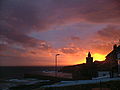 |
Porthleven Porthleven Porthleven is a town, civil parish and fishing port in Cornwall, United Kingdom, near Helston. It is the most southerly port on the island of Great Britain and was originally developed as a harbour of refuge, when this part of the Cornish coastline was recognised as a black spot for wrecks in days... Porthleven |
Town | 3,190 | Cornwall Cornwall Cornwall is a unitary authority and ceremonial county of England, within the United Kingdom. It is bordered to the north and west by the Celtic Sea, to the south by the English Channel, and to the east by the county of Devon, over the River Tamar. Cornwall has a population of , and covers an area of... Kernow |
Helston Municipal Borough Helston Helston is a town and civil parish in Cornwall, England, United Kingdom. It is situated at the northern end of the Lizard Peninsula approximately 12 miles east of Penzance and nine miles southwest of Falmouth. Helston is the most southerly town in the UK and is around further south than... |
|
| Portreath Portreath Portreath is a civil parish, village and fishing port on the north coast of Cornwall, United Kingdom. The village is situated approximately three miles northwest of Redruth.... Porthtreth |
Civil parish | 1,377 | Cornwall Cornwall Cornwall is a unitary authority and ceremonial county of England, within the United Kingdom. It is bordered to the north and west by the Celtic Sea, to the south by the English Channel, and to the east by the county of Devon, over the River Tamar. Cornwall has a population of , and covers an area of... Kernow |
Camborne–Redruth Urban District |
|
|
| Poundstock Poundstock Poundstock is a civil parish and a hamlet on the north coast of Cornwall, United Kingdom. The hamlet is situated four miles south of Bude half-a-mile west of the A39 trunk road about one mile from the coast.... Tregorlann |
Civil parish | 805 | Cornwall Cornwall Cornwall is a unitary authority and ceremonial county of England, within the United Kingdom. It is bordered to the north and west by the Celtic Sea, to the south by the English Channel, and to the east by the county of Devon, over the River Tamar. Cornwall has a population of , and covers an area of... Kernow |
Stratton Rural District |
|
|
| Probus Probus, Cornwall Probus is a civil parish and village in Cornwall, England, in the United Kingdom. It is famous for having the tallest church tower in Cornwall. The tower is high, and richly decorated with carvings... Lannbroboes |
Civil parish | 2,082 | Cornwall Cornwall Cornwall is a unitary authority and ceremonial county of England, within the United Kingdom. It is bordered to the north and west by the Celtic Sea, to the south by the English Channel, and to the east by the county of Devon, over the River Tamar. Cornwall has a population of , and covers an area of... Kernow |
Truro Rural District |
|
|
| Quethiock Quethiock Quethiock is a village and civil parish in Cornwall, United Kingdom, roughly five miles east of Liskeard. According to the 2001 census the parish had a population of 429. The ancient parish church of St Hugh is one of the most notable in Cornwall. The placename derives from the Old Cornish cuidoc... Gwydhek |
Civil parish | 429 | Cornwall Cornwall Cornwall is a unitary authority and ceremonial county of England, within the United Kingdom. It is bordered to the north and west by the Celtic Sea, to the south by the English Channel, and to the east by the county of Devon, over the River Tamar. Cornwall has a population of , and covers an area of... Kernow |
St Germans Rural District |
|
|
| Redruth Redruth Redruth is a town and civil parish traditionally in the Penwith Hundred in Cornwall, United Kingdom. It has a population of 12,352. Redruth lies approximately at the junction of the A393 and A3047 roads, on the route of the old London to Land's End trunk road , and is approximately west of... Resrudh |
Town | 12,352 | Cornwall Cornwall Cornwall is a unitary authority and ceremonial county of England, within the United Kingdom. It is bordered to the north and west by the Celtic Sea, to the south by the English Channel, and to the east by the county of Devon, over the River Tamar. Cornwall has a population of , and covers an area of... Kernow |
Camborne–Redruth Urban District |
|
|
| Roche Roche, Cornwall Roche is a civil parish and village in mid-Cornwall, England, United Kingdom. The village gets its name from a granite outcrop east of the village. Roche is the Norman-French word for Rock.... An Garrek |
Civil parish | 2,876 | Cornwall Cornwall Cornwall is a unitary authority and ceremonial county of England, within the United Kingdom. It is bordered to the north and west by the Celtic Sea, to the south by the English Channel, and to the east by the county of Devon, over the River Tamar. Cornwall has a population of , and covers an area of... Kernow |
St Austell Rural District |
|
|
| Ruanlanihorne Lannihorn |
Civil parish | 250 | Cornwall Cornwall Cornwall is a unitary authority and ceremonial county of England, within the United Kingdom. It is bordered to the north and west by the Celtic Sea, to the south by the English Channel, and to the east by the county of Devon, over the River Tamar. Cornwall has a population of , and covers an area of... Kernow |
Truro Rural District |
|
|
| Saltash Saltash Saltash is a town and civil parish in Cornwall, England, United Kingdom. It has a population of 14,964. It lies in the south east of Cornwall, facing Plymouth over the River Tamar. It was in the Caradon district until March 2009 and is known as "the gateway to Cornwall". Saltash means ash tree by... Essa |
Town | 14,964 | Cornwall Cornwall Cornwall is a unitary authority and ceremonial county of England, within the United Kingdom. It is bordered to the north and west by the Celtic Sea, to the south by the English Channel, and to the east by the county of Devon, over the River Tamar. Cornwall has a population of , and covers an area of... Kernow |
Saltash Municipal Borough Saltash Saltash is a town and civil parish in Cornwall, England, United Kingdom. It has a population of 14,964. It lies in the south east of Cornwall, facing Plymouth over the River Tamar. It was in the Caradon district until March 2009 and is known as "the gateway to Cornwall". Saltash means ash tree by... |
|
|
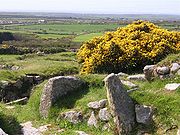 |
Sancreed Sancreed Sancreed is a village and civil parish in Cornwall, United Kingdom. The village is situated approximately three miles from Penzance.... Eglossankres |
Civil parish | 628 | Cornwall Cornwall Cornwall is a unitary authority and ceremonial county of England, within the United Kingdom. It is bordered to the north and west by the Celtic Sea, to the south by the English Channel, and to the east by the county of Devon, over the River Tamar. Cornwall has a population of , and covers an area of... Kernow |
West Penwith Rural District West Penwith Rural District West Penwith Rural District was a rural district in Cornwall, United Kingdom from 1894 to 1974. It was enlarged in 1934 by the abolition of Hayle, Ludgvan, Madron, Paul, and Phillack urban districts, also taking in part of the disbanded Redruth Rural District... |
|
| Sennen Sennen Sennen is a coastal civil parish and a village in Cornwall, United Kingdom. Sennen village is situated approximately eight miles west-southwest of Penzance.... Sen Senan |
Civil parish | 829 | Cornwall Cornwall Cornwall is a unitary authority and ceremonial county of England, within the United Kingdom. It is bordered to the north and west by the Celtic Sea, to the south by the English Channel, and to the east by the county of Devon, over the River Tamar. Cornwall has a population of , and covers an area of... Kernow |
West Penwith Rural District West Penwith Rural District West Penwith Rural District was a rural district in Cornwall, United Kingdom from 1894 to 1974. It was enlarged in 1934 by the abolition of Hayle, Ludgvan, Madron, Paul, and Phillack urban districts, also taking in part of the disbanded Redruth Rural District... |
|
|
| Sheviock Sheviock Sheviock is a coastal civil parish and a hamlet in south-east Cornwall, United Kingdom. The parish is two miles south of St Germans and three miles south-west of Saltash.... Seviek |
Civil parish | 683 | Cornwall Cornwall Cornwall is a unitary authority and ceremonial county of England, within the United Kingdom. It is bordered to the north and west by the Celtic Sea, to the south by the English Channel, and to the east by the county of Devon, over the River Tamar. Cornwall has a population of , and covers an area of... Kernow |
St Germans Rural District |
|
|
| Sithney Sithney Sithney is a village and civil parish in Cornwall, England, United Kingdom. It is named for Saint Sithney, the patron saint of the parish church.... Sen Sydhni |
Civil parish | 767 | Cornwall Cornwall Cornwall is a unitary authority and ceremonial county of England, within the United Kingdom. It is bordered to the north and west by the Celtic Sea, to the south by the English Channel, and to the east by the county of Devon, over the River Tamar. Cornwall has a population of , and covers an area of... Kernow |
Kerrier Rural District |
|
|
| South Hill South Hill, Cornwall South Hill is a civil parish and village in east Cornwall, United Kingdom.The parish church was consecrated in 1333 and apart from the upper stage of the tower and the south aisle is entirely of this date... Bre Dheghow |
Civil parish | 474 | Cornwall Cornwall Cornwall is a unitary authority and ceremonial county of England, within the United Kingdom. It is bordered to the north and west by the Celtic Sea, to the south by the English Channel, and to the east by the county of Devon, over the River Tamar. Cornwall has a population of , and covers an area of... Kernow |
Liskeard Rural District |
|
|
| South Petherwin South Petherwin South Petherwin is a village and civil parish in east Cornwall, United Kingdom. It is in the Registration District of Launceston. The civil parish is bounded to the north by the Launceston parishes of St Thomas and St Mary Magdalene, to the east by Lawhitton and Lezant parishes and to the west by... Paderwynn Dheghow |
Civil parish | 932 | Cornwall Cornwall Cornwall is a unitary authority and ceremonial county of England, within the United Kingdom. It is bordered to the north and west by the Celtic Sea, to the south by the English Channel, and to the east by the county of Devon, over the River Tamar. Cornwall has a population of , and covers an area of... Kernow |
Launceston Rural District |
|
|
| St Agnes St Agnes, Cornwall St Agnes is a civil parish and a large village on the north coast of Cornwall, United Kingdom. The village is situated approximately five miles north of Redruth and ten miles southwest of Newquay.... Breanek |
Civil parish | 7,257 | Cornwall Cornwall Cornwall is a unitary authority and ceremonial county of England, within the United Kingdom. It is bordered to the north and west by the Celtic Sea, to the south by the English Channel, and to the east by the county of Devon, over the River Tamar. Cornwall has a population of , and covers an area of... Kernow |
Truro Rural District |
|
|
| St Allen St Allen St Allen is a civil parish in Cornwall, United Kingdom. The church town of St Allen is an isolated hamlet and the main settlement in the parish is Zelah which is situated on the A30 trunk road four miles north of Truro.... Eglosallen |
Civil parish | 435 | Cornwall Cornwall Cornwall is a unitary authority and ceremonial county of England, within the United Kingdom. It is bordered to the north and west by the Celtic Sea, to the south by the English Channel, and to the east by the county of Devon, over the River Tamar. Cornwall has a population of , and covers an area of... Kernow |
Truro Rural District |
|
|
| St Anthony in Meneage Lannentenin |
Civil parish | 171 | Cornwall Cornwall Cornwall is a unitary authority and ceremonial county of England, within the United Kingdom. It is bordered to the north and west by the Celtic Sea, to the south by the English Channel, and to the east by the county of Devon, over the River Tamar. Cornwall has a population of , and covers an area of... Kernow |
Kerrier Rural District |
|
|
| St Austell St Austell St Austell is a civil parish and a major town in Cornwall, England, United Kingdom. It is situated on the south coast approximately ten miles south of Bodmin and 30 miles west of the border with Devon at Saltash... Sen Ostell |
Town | 18,378 | Cornwall Cornwall Cornwall is a unitary authority and ceremonial county of England, within the United Kingdom. It is bordered to the north and west by the Celtic Sea, to the south by the English Channel, and to the east by the county of Devon, over the River Tamar. Cornwall has a population of , and covers an area of... Kernow |
St Austell with Fowey Municipal Borough |
|
|
| St Austell Bay St Austell Bay St Austell Bay is a bay on Cornwall's south coast which is bounded to the east by Gribbin Head and to the west by Black Head.Since 1 April 2009 it has also been the name of a civil parish, one of four new parishes created on for the St Austell area. It lies southeast of the town of St Austell and... |
Civil parish | 857 | Cornwall Cornwall Cornwall is a unitary authority and ceremonial county of England, within the United Kingdom. It is bordered to the north and west by the Celtic Sea, to the south by the English Channel, and to the east by the county of Devon, over the River Tamar. Cornwall has a population of , and covers an area of... Kernow |
St Austell with Fowey Municipal Borough |
|
|
| St Blaise Lanndreth |
Town | 6,632 | Cornwall Cornwall Cornwall is a unitary authority and ceremonial county of England, within the United Kingdom. It is bordered to the north and west by the Celtic Sea, to the south by the English Channel, and to the east by the county of Devon, over the River Tamar. Cornwall has a population of , and covers an area of... Kernow |
St Austell with Fowey Municipal Borough |
|
|
| St Breock St Breock St Breock is a village and a civil parish in north Cornwall, United Kingdom. St Breock village is 1 mile west of Wadebridge immediately to the south of the Royal Cornwall Showground. The village lies on the eastern slope of the wooded Nansent valley... Nanssans |
Civil parish | 703 | Cornwall Cornwall Cornwall is a unitary authority and ceremonial county of England, within the United Kingdom. It is bordered to the north and west by the Celtic Sea, to the south by the English Channel, and to the east by the county of Devon, over the River Tamar. Cornwall has a population of , and covers an area of... Kernow |
Wadebridge and Padstow Rural District |
|
|
| St Breward St Breward St Breward is a civil parish and village in Cornwall, England, United Kingdom. It is situated on the western side of Bodmin Moor approximately 6 miles north of Bodmin.The parish name derives from Saint Branwalader... Sen Branwalader |
Civil parish | 880 | Cornwall Cornwall Cornwall is a unitary authority and ceremonial county of England, within the United Kingdom. It is bordered to the north and west by the Celtic Sea, to the south by the English Channel, and to the east by the county of Devon, over the River Tamar. Cornwall has a population of , and covers an area of... Kernow |
Camelford Rural District Camelford Rural District Camelford Rural District was a local government division of north Cornwall between 1894 and 1974. The district council offices were at Camelford, Cornwall, England, UK, latterly in the former grammar school... |
|
|
| St Buryan St Buryan St Buryan is a civil parish and village in Cornwall, United Kingdom.The village of St Buryan is situated approximately five miles west of Penzance along the B3283 towards Land's End... Eglosveryan |
Civil parish | 1,215 | Cornwall Cornwall Cornwall is a unitary authority and ceremonial county of England, within the United Kingdom. It is bordered to the north and west by the Celtic Sea, to the south by the English Channel, and to the east by the county of Devon, over the River Tamar. Cornwall has a population of , and covers an area of... Kernow |
West Penwith Rural District West Penwith Rural District West Penwith Rural District was a rural district in Cornwall, United Kingdom from 1894 to 1974. It was enlarged in 1934 by the abolition of Hayle, Ludgvan, Madron, Paul, and Phillack urban districts, also taking in part of the disbanded Redruth Rural District... |
|
|
| St Cleer St Cleer St Cleer is a civil parish and village in Cornwall, United Kingdom. The village is situated on the southeast flank of Bodmin Moor approximately two miles north of Liskeard.... Sen Kler |
Civil parish | 3,257 | Cornwall Cornwall Cornwall is a unitary authority and ceremonial county of England, within the United Kingdom. It is bordered to the north and west by the Celtic Sea, to the south by the English Channel, and to the east by the county of Devon, over the River Tamar. Cornwall has a population of , and covers an area of... Kernow |
Liskeard Rural District |
|
|
| St Clement St Clement, Cornwall St Clement is a civil parish and village in Cornwall, United Kingdom. It is situated southeast of Truro in the valley of the Tresillian River. There is a smaller village at Malpas in the south of the parish... Sen Klemens |
Civil parish | 1,089 | Cornwall Cornwall Cornwall is a unitary authority and ceremonial county of England, within the United Kingdom. It is bordered to the north and west by the Celtic Sea, to the south by the English Channel, and to the east by the county of Devon, over the River Tamar. Cornwall has a population of , and covers an area of... Kernow |
Truro Rural District |
|
|
| St Clether St Clether St Clether is a civil parish and village in Cornwall, United Kingdom. The village is situated on the east flank of Bodmin Moor approximately eight miles west of Launceston in the valley of the River Inny.... Sen Kleder |
Civil parish | 149 | Cornwall Cornwall Cornwall is a unitary authority and ceremonial county of England, within the United Kingdom. It is bordered to the north and west by the Celtic Sea, to the south by the English Channel, and to the east by the county of Devon, over the River Tamar. Cornwall has a population of , and covers an area of... Kernow |
Camelford Rural District Camelford Rural District Camelford Rural District was a local government division of north Cornwall between 1894 and 1974. The district council offices were at Camelford, Cornwall, England, UK, latterly in the former grammar school... |
|
|
| St Columb Major St Columb Major St Columb Major is a civil parish and town in Cornwall, England, United Kingdom. Often referred to locally as St Columb, it is situated approximately seven miles southwest of Wadebridge and six miles east of Newquay... Sen Kolomm Veur |
Town | 3,984 | Cornwall Cornwall Cornwall is a unitary authority and ceremonial county of England, within the United Kingdom. It is bordered to the north and west by the Celtic Sea, to the south by the English Channel, and to the east by the county of Devon, over the River Tamar. Cornwall has a population of , and covers an area of... Kernow |
St Austell Rural District |
|
|
| St Day St Day St Day is a civil parish and village in Cornwall, United Kingdom. It is situated between the village of Chacewater and the town of Redruth.St Day is located in a former mining area and St Day accrued considerable wealth from mining... Sen Day |
Civil parish | 1,621 | Cornwall Cornwall Cornwall is a unitary authority and ceremonial county of England, within the United Kingdom. It is bordered to the north and west by the Celtic Sea, to the south by the English Channel, and to the east by the county of Devon, over the River Tamar. Cornwall has a population of , and covers an area of... Kernow |
Camborne–Redruth Urban District |
|
|
| St Dennis St Dennis, Cornwall St Dennis is a civil parish and village in Cornwall, United Kingdom. The village is situated on the B3279 between Newquay and St Austell.St Dennis had a population of 2,696 in the 2001 census. A quarter of the male population is employed in the extraction of china clay.The village is famous for... Tredhinas |
Civil parish | 2,696 | Cornwall Cornwall Cornwall is a unitary authority and ceremonial county of England, within the United Kingdom. It is bordered to the north and west by the Celtic Sea, to the south by the English Channel, and to the east by the county of Devon, over the River Tamar. Cornwall has a population of , and covers an area of... Kernow |
St Austell Rural District |
|
|
| St Dominick Sen Domynek |
Civil parish | 833 | Cornwall Cornwall Cornwall is a unitary authority and ceremonial county of England, within the United Kingdom. It is bordered to the north and west by the Celtic Sea, to the south by the English Channel, and to the east by the county of Devon, over the River Tamar. Cornwall has a population of , and covers an area of... Kernow |
St Germans Rural District |
|
|
| St Endellion St Endellion St Endellion is a civil parish and village in north Cornwall, England, United Kingdom. The village and parish church are situated four miles north of Wadebridge.... Sen Endelyn |
Civil parish | 1,143 | Cornwall Cornwall Cornwall is a unitary authority and ceremonial county of England, within the United Kingdom. It is bordered to the north and west by the Celtic Sea, to the south by the English Channel, and to the east by the county of Devon, over the River Tamar. Cornwall has a population of , and covers an area of... Kernow |
Wadebridge and Padstow Rural District |
|
|
| St Enoder St Enoder St. Enoder is a civil parish and village in Cornwall, United Kingdom. The village is situated five miles southeast of Newquay.The nearest village is Summercourt half-a-mile to the south and other settlements include Fraddon, Penhale, Indian Queens and Trevarren.The parish church is 15th century... Eglosenoder |
Civil parish | 3,819 | Cornwall Cornwall Cornwall is a unitary authority and ceremonial county of England, within the United Kingdom. It is bordered to the north and west by the Celtic Sea, to the south by the English Channel, and to the east by the county of Devon, over the River Tamar. Cornwall has a population of , and covers an area of... Kernow |
St Austell Rural District |
|
|
| St Erme St Erme St Erme is a civil parish and village in Cornwall, England, in the United Kingdom. The parish of St Erme, has a population of approximately 1200... Egloserm |
Civil parish | 1,215 | Cornwall Cornwall Cornwall is a unitary authority and ceremonial county of England, within the United Kingdom. It is bordered to the north and west by the Celtic Sea, to the south by the English Channel, and to the east by the county of Devon, over the River Tamar. Cornwall has a population of , and covers an area of... Kernow |
Truro Rural District |
|
|
| St Erth St Erth St Erth is a civil parish and village in Cornwall, United Kingdom.The village is situated four miles southeast of St Ives and six miles northeast of Penzance.... Lannudhno |
Civil parish | 1,384 | Cornwall Cornwall Cornwall is a unitary authority and ceremonial county of England, within the United Kingdom. It is bordered to the north and west by the Celtic Sea, to the south by the English Channel, and to the east by the county of Devon, over the River Tamar. Cornwall has a population of , and covers an area of... Kernow |
West Penwith Rural District West Penwith Rural District West Penwith Rural District was a rural district in Cornwall, United Kingdom from 1894 to 1974. It was enlarged in 1934 by the abolition of Hayle, Ludgvan, Madron, Paul, and Phillack urban districts, also taking in part of the disbanded Redruth Rural District... |
|
|
| St Ervan St Ervan St Ervan is a rural civil parish and hamlet in Cornwall, United Kingdom. The hamlet is situated three miles southwest of Padstow. Notable features in St Ervan are the Anglican church, the village hall and the Nonconformist cemetery,... Sen Erven |
Civil parish | 408 | Cornwall Cornwall Cornwall is a unitary authority and ceremonial county of England, within the United Kingdom. It is bordered to the north and west by the Celtic Sea, to the south by the English Channel, and to the east by the county of Devon, over the River Tamar. Cornwall has a population of , and covers an area of... Kernow |
Wadebridge and Padstow Rural District |
|
|
| St Eval St Eval St Eval is a civil parish and hamlet in north Cornwall, United Kingdom. The hamlet is situated approximately four miles southwest of Padstow.... |
Civil parish | 963 | Cornwall Cornwall Cornwall is a unitary authority and ceremonial county of England, within the United Kingdom. It is bordered to the north and west by the Celtic Sea, to the south by the English Channel, and to the east by the county of Devon, over the River Tamar. Cornwall has a population of , and covers an area of... Kernow |
Wadebridge and Padstow Rural District |
|
|
| St Ewe St Ewe St Ewe is a civil parish and village in mid-Cornwall, United Kingdom. The village is situated approximately five miles southwest of St Austell.-Antiquities:... Lannewa |
Civil parish | 507 | Cornwall Cornwall Cornwall is a unitary authority and ceremonial county of England, within the United Kingdom. It is bordered to the north and west by the Celtic Sea, to the south by the English Channel, and to the east by the county of Devon, over the River Tamar. Cornwall has a population of , and covers an area of... Kernow |
St Austell Rural District |
|
|
| St Gennys St Gennys St Gennys is a coastal civil parish and small settlement in north Cornwall, United Kingdom.The hamlet of St Gennys is situated approximately seven miles southwest of Bude. It is on high ground half-a-mile north of the coastal village of Crackington Haven, the major settlement in the parish... Sen Gwynnys |
Civil parish | 810 | Cornwall Cornwall Cornwall is a unitary authority and ceremonial county of England, within the United Kingdom. It is bordered to the north and west by the Celtic Sea, to the south by the English Channel, and to the east by the county of Devon, over the River Tamar. Cornwall has a population of , and covers an area of... Kernow |
Stratton Rural District |
|
|
| St Germans Lannales |
Civil parish | 1,427 | Cornwall Cornwall Cornwall is a unitary authority and ceremonial county of England, within the United Kingdom. It is bordered to the north and west by the Celtic Sea, to the south by the English Channel, and to the east by the county of Devon, over the River Tamar. Cornwall has a population of , and covers an area of... Kernow |
St Germans Rural District |
|
|
| St Gluvias St Gluvias St Gluvias is a civil parish and settlement in Cornwall, United Kingdom. The village is now a suburb on the northern edge of Penryn which is situated two miles northwest of Falmouth.-Church history:... |
Civil parish | 1,271 | Cornwall Cornwall Cornwall is a unitary authority and ceremonial county of England, within the United Kingdom. It is bordered to the north and west by the Celtic Sea, to the south by the English Channel, and to the east by the county of Devon, over the River Tamar. Cornwall has a population of , and covers an area of... Kernow |
Kerrier Rural District |
|
|
| St Goran St Goran St. Goran is a coastal civil parish in Cornwall, United Kingdom. The church town, Gorran Churchtown, is situated approximately six miles south-southwest of St Austell. However, the largest settlement in the parish is the coastal village of Gorran Haven, a mile to the east.The parish is bounded by... |
Civil parish | 1,271 | Cornwall Cornwall Cornwall is a unitary authority and ceremonial county of England, within the United Kingdom. It is bordered to the north and west by the Celtic Sea, to the south by the English Channel, and to the east by the county of Devon, over the River Tamar. Cornwall has a population of , and covers an area of... Kernow |
St Austell Rural District |
|
|
| St Hilary St Hilary, Cornwall St Hilary is a civil parish and village in west Cornwall, United Kingdom. It is situated approximately five miles east of Penzance and four miles south of Hayle.Chynoweth is an area immediately north of St Hilary.... Bronnlowena |
Civil parish | 785 | Cornwall Cornwall Cornwall is a unitary authority and ceremonial county of England, within the United Kingdom. It is bordered to the north and west by the Celtic Sea, to the south by the English Channel, and to the east by the county of Devon, over the River Tamar. Cornwall has a population of , and covers an area of... Kernow |
West Penwith Rural District West Penwith Rural District West Penwith Rural District was a rural district in Cornwall, United Kingdom from 1894 to 1974. It was enlarged in 1934 by the abolition of Hayle, Ludgvan, Madron, Paul, and Phillack urban districts, also taking in part of the disbanded Redruth Rural District... |
|
|
| St Issey St Issey St Issey is a civil parish and village in Cornwall, United Kingdom. It is situated approximately two miles south of Padstow. The parish covers an area of approximately .-History:... Egloskrug |
Civil parish | 881 | Cornwall Cornwall Cornwall is a unitary authority and ceremonial county of England, within the United Kingdom. It is bordered to the north and west by the Celtic Sea, to the south by the English Channel, and to the east by the county of Devon, over the River Tamar. Cornwall has a population of , and covers an area of... Kernow |
Wadebridge and Padstow Rural District |
|
|
| St Ive St Ive St Ive is a village and civil parish in south-east Cornwall, England, United Kingdom. St Ive should not be confused with St Ives, the well-known seaside town in the west of Cornwall... Sen Iv |
Civil parish | 2,121 | Cornwall Cornwall Cornwall is a unitary authority and ceremonial county of England, within the United Kingdom. It is bordered to the north and west by the Celtic Sea, to the south by the English Channel, and to the east by the county of Devon, over the River Tamar. Cornwall has a population of , and covers an area of... Kernow |
Liskeard Rural District |
|
|
| St Ives St Ives, Cornwall St Ives is a seaside town, civil parish and port in Cornwall, England, United Kingdom. The town lies north of Penzance and west of Camborne on the coast of the Celtic Sea. In former times it was commercially dependent on fishing. The decline in fishing, however, caused a shift in commercial... Porth Ia |
Town | 11,165 | Cornwall Cornwall Cornwall is a unitary authority and ceremonial county of England, within the United Kingdom. It is bordered to the north and west by the Celtic Sea, to the south by the English Channel, and to the east by the county of Devon, over the River Tamar. Cornwall has a population of , and covers an area of... Kernow |
St Ives Municipal Borough St Ives, Cornwall St Ives is a seaside town, civil parish and port in Cornwall, England, United Kingdom. The town lies north of Penzance and west of Camborne on the coast of the Celtic Sea. In former times it was commercially dependent on fishing. The decline in fishing, however, caused a shift in commercial... |
|
|
| St John St John, Cornwall St John is a coastal civil parish and a village in south-east Cornwall, United Kingdom south of Saltash and south-east of Torpoint.-Geography:... Sen Yowann |
Civil parish | 375 | Cornwall Cornwall Cornwall is a unitary authority and ceremonial county of England, within the United Kingdom. It is bordered to the north and west by the Celtic Sea, to the south by the English Channel, and to the east by the county of Devon, over the River Tamar. Cornwall has a population of , and covers an area of... Kernow |
St Germans Rural District |
|
|
| St Juliot St Juliot St Juliot is a civil parish in north-east Cornwall, United Kingdom. The parish is entirely rural and the only settlements are the hamlets of Beeny and Tresparrett.-Parish Church:... |
Civil parish | 317 | Cornwall Cornwall Cornwall is a unitary authority and ceremonial county of England, within the United Kingdom. It is bordered to the north and west by the Celtic Sea, to the south by the English Channel, and to the east by the county of Devon, over the River Tamar. Cornwall has a population of , and covers an area of... Kernow |
Camelford Rural District Camelford Rural District Camelford Rural District was a local government division of north Cornwall between 1894 and 1974. The district council offices were at Camelford, Cornwall, England, UK, latterly in the former grammar school... |
|
|
| St Just St Just in Penwith St Just is a town and civil parish in Cornwall, England, United Kingdom. The parish encompasses the town of St Just and the nearby settlements of Trewellard, Pendeen and Kelynack: it is bounded by the parishes of Morvah to the north-east, Sancreed and Madron to the east, St Buryan and Sennen to... Lannyust |
Town | 4,690 | Cornwall Cornwall Cornwall is a unitary authority and ceremonial county of England, within the United Kingdom. It is bordered to the north and west by the Celtic Sea, to the south by the English Channel, and to the east by the county of Devon, over the River Tamar. Cornwall has a population of , and covers an area of... Kernow |
St Just Urban District St Just in Penwith St Just is a town and civil parish in Cornwall, England, United Kingdom. The parish encompasses the town of St Just and the nearby settlements of Trewellard, Pendeen and Kelynack: it is bounded by the parishes of Morvah to the north-east, Sancreed and Madron to the east, St Buryan and Sennen to... |
|
|
| St Just in Roseland St Just in Roseland St Just in Roseland is a civil parish and village in Cornwall, England, United Kingdom. The village is situated six miles south of Truro and two miles north of St Mawes.... Lannsiek |
Civil parish | 1,197 | Cornwall Cornwall Cornwall is a unitary authority and ceremonial county of England, within the United Kingdom. It is bordered to the north and west by the Celtic Sea, to the south by the English Channel, and to the east by the county of Devon, over the River Tamar. Cornwall has a population of , and covers an area of... Kernow |
Truro Rural District |
|
|
| St Keverne St Keverne St Keverne is a civil parish and village on the Lizard Peninsula in Cornwall, United Kingdom.The Cornish Rebellion of 1497 started in St Keverne. The leader of the rebellion Michael An Gof was a blacksmith from St Keverne and is commemorated by a statue in the village... Lannaghevran |
Civil parish | 2,107 | Cornwall Cornwall Cornwall is a unitary authority and ceremonial county of England, within the United Kingdom. It is bordered to the north and west by the Celtic Sea, to the south by the English Channel, and to the east by the county of Devon, over the River Tamar. Cornwall has a population of , and covers an area of... Kernow |
Kerrier Rural District |
|
|
| St Kew Lanndogho |
Civil parish | 1,026 | Cornwall Cornwall Cornwall is a unitary authority and ceremonial county of England, within the United Kingdom. It is bordered to the north and west by the Celtic Sea, to the south by the English Channel, and to the east by the county of Devon, over the River Tamar. Cornwall has a population of , and covers an area of... Kernow |
Wadebridge and Padstow Rural District |
|
|
| St Keyne St Keyne St Keyne is a civil parish and village in Cornwall, United Kingdom. The parish lies between the parishes of Liskeard and Duloe.In Victorian times the holywell in St Keyne had the reputation of conferring supremacy to the marriage partner who first tasted it.The church is dedicated to Saint Keyne... Sen Keyn |
Civil parish | 486 | Cornwall Cornwall Cornwall is a unitary authority and ceremonial county of England, within the United Kingdom. It is bordered to the north and west by the Celtic Sea, to the south by the English Channel, and to the east by the county of Devon, over the River Tamar. Cornwall has a population of , and covers an area of... Kernow |
Liskeard Rural District |
|
|
| St Levan St Levan St Levan is a civil parish and village in Cornwall, United Kingdom. The village is situated approximately eight miles south west of Penzance.... Sen Selevan |
Civil parish | 487 | Cornwall Cornwall Cornwall is a unitary authority and ceremonial county of England, within the United Kingdom. It is bordered to the north and west by the Celtic Sea, to the south by the English Channel, and to the east by the county of Devon, over the River Tamar. Cornwall has a population of , and covers an area of... Kernow |
West Penwith Rural District West Penwith Rural District West Penwith Rural District was a rural district in Cornwall, United Kingdom from 1894 to 1974. It was enlarged in 1934 by the abolition of Hayle, Ludgvan, Madron, Paul, and Phillack urban districts, also taking in part of the disbanded Redruth Rural District... |
|
|
| St Mabyn St Mabyn St Mabyn is a civil parish and village in Cornwall, England, United Kingdom. The village is situated three miles east of Wadebridge.... Sen Mabon |
Civil parish | 560 | Cornwall Cornwall Cornwall is a unitary authority and ceremonial county of England, within the United Kingdom. It is bordered to the north and west by the Celtic Sea, to the south by the English Channel, and to the east by the county of Devon, over the River Tamar. Cornwall has a population of , and covers an area of... Kernow |
Wadebridge and Padstow Rural District |
|
|
| St Martin by Looe Penndrumm |
Civil parish | 321 | Cornwall Cornwall Cornwall is a unitary authority and ceremonial county of England, within the United Kingdom. It is bordered to the north and west by the Celtic Sea, to the south by the English Channel, and to the east by the county of Devon, over the River Tamar. Cornwall has a population of , and covers an area of... Kernow |
Liskeard Rural District |
|
|
| St Martin in Meneage Sen Martyn yn Menaghek |
Civil parish | 343 | Cornwall Cornwall Cornwall is a unitary authority and ceremonial county of England, within the United Kingdom. It is bordered to the north and west by the Celtic Sea, to the south by the English Channel, and to the east by the county of Devon, over the River Tamar. Cornwall has a population of , and covers an area of... Kernow |
Kerrier Rural District |
|
|
| St Mellion St Mellion St Mellion is a village and rural civil parish in east Cornwall, United Kingdom. The parish is three miles south of Callington and is in the St Germans Registration District. The population in the 2001 census was 377... Sen Melyan |
Civil parish | 377 | Cornwall Cornwall Cornwall is a unitary authority and ceremonial county of England, within the United Kingdom. It is bordered to the north and west by the Celtic Sea, to the south by the English Channel, and to the east by the county of Devon, over the River Tamar. Cornwall has a population of , and covers an area of... Kernow |
St Germans Rural District |
|
|
| St Merryn St Merryn St Merryn is a civil parish and village in north Cornwall, United Kingdom approximately three and a half miles south of the fishing port of Padstow and approximately 11 miles northeast of the coastal resort of Newquay.... |
Civil parish | 1,608 | Cornwall Cornwall Cornwall is a unitary authority and ceremonial county of England, within the United Kingdom. It is bordered to the north and west by the Celtic Sea, to the south by the English Channel, and to the east by the county of Devon, over the River Tamar. Cornwall has a population of , and covers an area of... Kernow |
Wadebridge and Padstow Rural District |
|
|
| St Mewan St Mewan St Mewan is a civil parish and village in south Cornwall, United Kingdom.The village is approximately one mile west of St Austell. It is a small settlement, comprising the parish church, rectory, a school and nearby farms... Sen Mewen |
Civil parish | 3,071 | Cornwall Cornwall Cornwall is a unitary authority and ceremonial county of England, within the United Kingdom. It is bordered to the north and west by the Celtic Sea, to the south by the English Channel, and to the east by the county of Devon, over the River Tamar. Cornwall has a population of , and covers an area of... Kernow |
St Austell Rural District |
|
|
| St Michael Caerhays St Michael Caerhays St Michael Caerhays is a civil parish and village in Cornwall, United Kingdom. The village is situated approximately seven miles south-southwest of St Austell.... Lannvighal |
Civil parish | 80 | Cornwall Cornwall Cornwall is a unitary authority and ceremonial county of England, within the United Kingdom. It is bordered to the north and west by the Celtic Sea, to the south by the English Channel, and to the east by the county of Devon, over the River Tamar. Cornwall has a population of , and covers an area of... Kernow |
St Austell Rural District |
|
|
| St Michael Penkevil Pennkevyll |
Civil parish | 213 | Cornwall Cornwall Cornwall is a unitary authority and ceremonial county of England, within the United Kingdom. It is bordered to the north and west by the Celtic Sea, to the south by the English Channel, and to the east by the county of Devon, over the River Tamar. Cornwall has a population of , and covers an area of... Kernow |
Truro Rural District |
|
|
| St Michael's Mount St Michael's Mount St Michael's Mount is a tidal island located off the Mount's Bay coast of Cornwall, United Kingdom. It is a civil parish and is united with the town of Marazion by a man-made causeway of granite setts, passable between mid-tide and low water.... Karrek Loos y'n Koos |
Civil parish | 29 | Cornwall Cornwall Cornwall is a unitary authority and ceremonial county of England, within the United Kingdom. It is bordered to the north and west by the Celtic Sea, to the south by the English Channel, and to the east by the county of Devon, over the River Tamar. Cornwall has a population of , and covers an area of... Kernow |
West Penwith Rural District West Penwith Rural District West Penwith Rural District was a rural district in Cornwall, United Kingdom from 1894 to 1974. It was enlarged in 1934 by the abolition of Hayle, Ludgvan, Madron, Paul, and Phillack urban districts, also taking in part of the disbanded Redruth Rural District... |
|
|
| St Minver Highlands | Civil parish | 1,025 | Cornwall Cornwall Cornwall is a unitary authority and ceremonial county of England, within the United Kingdom. It is bordered to the north and west by the Celtic Sea, to the south by the English Channel, and to the east by the county of Devon, over the River Tamar. Cornwall has a population of , and covers an area of... Kernow |
Wadebridge and Padstow Rural District |
|
|
| St Minver Lowlands | Civil parish | 1,449 | Cornwall Cornwall Cornwall is a unitary authority and ceremonial county of England, within the United Kingdom. It is bordered to the north and west by the Celtic Sea, to the south by the English Channel, and to the east by the county of Devon, over the River Tamar. Cornwall has a population of , and covers an area of... Kernow |
Wadebridge and Padstow Rural District |
|
|
 |
St Neot | Civil parish | 867 | Cornwall Cornwall Cornwall is a unitary authority and ceremonial county of England, within the United Kingdom. It is bordered to the north and west by the Celtic Sea, to the south by the English Channel, and to the east by the county of Devon, over the River Tamar. Cornwall has a population of , and covers an area of... Kernow |
Liskeard Rural District |
|
| St Newlyn East St Newlyn East St Newlyn East is a civil parish and village in Cornwall, United Kingdom. The village is situated approximately three miles south of Newquay... Eglosniwlin |
Civil parish | 1,532 | Cornwall Cornwall Cornwall is a unitary authority and ceremonial county of England, within the United Kingdom. It is bordered to the north and west by the Celtic Sea, to the south by the English Channel, and to the east by the county of Devon, over the River Tamar. Cornwall has a population of , and covers an area of... Kernow |
Truro Rural District |
|
|
| St Pinnock St Pinnock St Pinnock is a hamlet and civil parish in south-east Cornwall, United Kingdom. The parish is in the Liskeard Registration District and the population in the 2001 census was 621.... Sen Pynnek |
Civil parish | 621 | Cornwall Cornwall Cornwall is a unitary authority and ceremonial county of England, within the United Kingdom. It is bordered to the north and west by the Celtic Sea, to the south by the English Channel, and to the east by the county of Devon, over the River Tamar. Cornwall has a population of , and covers an area of... Kernow |
Liskeard Rural District |
|
|
| St Sampson | Civil parish | 223 | Cornwall Cornwall Cornwall is a unitary authority and ceremonial county of England, within the United Kingdom. It is bordered to the north and west by the Celtic Sea, to the south by the English Channel, and to the east by the county of Devon, over the River Tamar. Cornwall has a population of , and covers an area of... Kernow |
St Austell Rural District |
|
|
| St Stephen in Brannel Eglosstefan |
Civil parish | 6,775 | Cornwall Cornwall Cornwall is a unitary authority and ceremonial county of England, within the United Kingdom. It is bordered to the north and west by the Celtic Sea, to the south by the English Channel, and to the east by the county of Devon, over the River Tamar. Cornwall has a population of , and covers an area of... Kernow |
St Austell Rural District |
|
|
| St Stephens by Launceston Rural Lannstefan Wartha |
Civil parish | 312 | Cornwall Cornwall Cornwall is a unitary authority and ceremonial county of England, within the United Kingdom. It is bordered to the north and west by the Celtic Sea, to the south by the English Channel, and to the east by the county of Devon, over the River Tamar. Cornwall has a population of , and covers an area of... Kernow |
Launceston Rural District |
|
|
| St Teath St Teath St Teath is civil parish and village in north Cornwall, United Kingdom. The village is situated approximately three miles southwest of Camelford and seven miles northeast of Wadebridge. The hamlet of Whitewell lies to the west.... Eglostedha |
Civil parish | 2,343 | Cornwall Cornwall Cornwall is a unitary authority and ceremonial county of England, within the United Kingdom. It is bordered to the north and west by the Celtic Sea, to the south by the English Channel, and to the east by the county of Devon, over the River Tamar. Cornwall has a population of , and covers an area of... Kernow |
Camelford Rural District Camelford Rural District Camelford Rural District was a local government division of north Cornwall between 1894 and 1974. The district council offices were at Camelford, Cornwall, England, UK, latterly in the former grammar school... |
|
|
| St Thomas the Apostle Rural St Thomas the Apostle Rural St Thomas the Apostle Rural, also known as St Thomas-by-Launceston is a civil parish in east Cornwall, United Kingdom. It is centred on the village of Tregadillett and is in the Registration District of Launceston.... Sen Tommos Lannstefan |
Civil parish | 815 | Cornwall Cornwall Cornwall is a unitary authority and ceremonial county of England, within the United Kingdom. It is bordered to the north and west by the Celtic Sea, to the south by the English Channel, and to the east by the county of Devon, over the River Tamar. Cornwall has a population of , and covers an area of... Kernow |
Launceston Rural District |
|
|
| St Tudy St Tudy St Tudy is a civil parish and village in north Cornwall, United Kingdom. The village is situated in the River Camel valley approximately five miles northeast of Wadebridge.-Parish church:... Eglostudi |
Civil parish | 637 | Cornwall Cornwall Cornwall is a unitary authority and ceremonial county of England, within the United Kingdom. It is bordered to the north and west by the Celtic Sea, to the south by the English Channel, and to the east by the county of Devon, over the River Tamar. Cornwall has a population of , and covers an area of... Kernow |
Wadebridge and Padstow Rural District |
|
|
| St Veep St Veep St. Veep is a civil parish in Cornwall, United Kingdom situated above the east bank of the Fowey Estuary about three miles southeast of Lostwithiel.... Sen Vip |
Civil parish | 299 | Cornwall Cornwall Cornwall is a unitary authority and ceremonial county of England, within the United Kingdom. It is bordered to the north and west by the Celtic Sea, to the south by the English Channel, and to the east by the county of Devon, over the River Tamar. Cornwall has a population of , and covers an area of... Kernow |
Liskeard Rural District |
|
|
| St Wenn St Wenn St Wenn is a civil parish and village in Cornwall, United Kingdom. The village is situated six miles west of Bodmin and nine miles east of Newquay.... Sen Gwenna |
Civil parish | 335 | Cornwall Cornwall Cornwall is a unitary authority and ceremonial county of England, within the United Kingdom. It is bordered to the north and west by the Celtic Sea, to the south by the English Channel, and to the east by the county of Devon, over the River Tamar. Cornwall has a population of , and covers an area of... Kernow |
St Austell Rural District |
|
|
| St Winnow St Winnow St Winnow is a civil parish situated in Cornwall, England, UK. Its name may be connected with either that of Saint Winnoc or Saint Winwaloe. It has a population of 304.... Sen Gwynnow |
Civil parish | 304 | Cornwall Cornwall Cornwall is a unitary authority and ceremonial county of England, within the United Kingdom. It is bordered to the north and west by the Celtic Sea, to the south by the English Channel, and to the east by the county of Devon, over the River Tamar. Cornwall has a population of , and covers an area of... Kernow |
Liskeard Rural District |
|
|
| Stithians Stithians Stithians is a village and civil parish in Cornwall, England, in the United Kingdom. It lies in the centre of the triangle bounded by Redruth, Helston and Falmouth. Its population is 2,004.... Sen Stedhyans |
Civil parish | 2,004 | Cornwall Cornwall Cornwall is a unitary authority and ceremonial county of England, within the United Kingdom. It is bordered to the north and west by the Celtic Sea, to the south by the English Channel, and to the east by the county of Devon, over the River Tamar. Cornwall has a population of , and covers an area of... Kernow |
Kerrier Rural District |
|
|
| Stokeclimsland Eglosklym |
Civil parish | 1,670 | Cornwall Cornwall Cornwall is a unitary authority and ceremonial county of England, within the United Kingdom. It is bordered to the north and west by the Celtic Sea, to the south by the English Channel, and to the east by the county of Devon, over the River Tamar. Cornwall has a population of , and covers an area of... Kernow |
Launceston Rural District |
|
|
| Tintagel Tintagel Tintagel is a civil parish and village situated on the Atlantic coast of Cornwall, United Kingdom. The population of the parish is 1,820 people, and the area of the parish is .... Dintagell |
Civil parish | 1,822 | Cornwall Cornwall Cornwall is a unitary authority and ceremonial county of England, within the United Kingdom. It is bordered to the north and west by the Celtic Sea, to the south by the English Channel, and to the east by the county of Devon, over the River Tamar. Cornwall has a population of , and covers an area of... Kernow |
Camelford Rural District Camelford Rural District Camelford Rural District was a local government division of north Cornwall between 1894 and 1974. The district council offices were at Camelford, Cornwall, England, UK, latterly in the former grammar school... |
|
|
| Torpoint Torpoint Torpoint is a civil parish and town on the Rame Peninsula in southeast Cornwall, England, United Kingdom. It is situated opposite the city of Plymouth across the Hamoaze which is the tidal estuary of the River Tamar.... Penntorr |
Town | 8,457 | Cornwall Cornwall Cornwall is a unitary authority and ceremonial county of England, within the United Kingdom. It is bordered to the north and west by the Celtic Sea, to the south by the English Channel, and to the east by the county of Devon, over the River Tamar. Cornwall has a population of , and covers an area of... Kernow |
Torpoint Urban District Torpoint Torpoint is a civil parish and town on the Rame Peninsula in southeast Cornwall, England, United Kingdom. It is situated opposite the city of Plymouth across the Hamoaze which is the tidal estuary of the River Tamar.... |
|
|
| Towednack Towednack Towednack is a village and civil parish in Cornwall, United Kingdom. The parish is bounded by those of Zennor in the west, Gulval in the south, Ludgvan in the east and St Ives in the north... Tewynnek |
Civil parish | 370 | Cornwall Cornwall Cornwall is a unitary authority and ceremonial county of England, within the United Kingdom. It is bordered to the north and west by the Celtic Sea, to the south by the English Channel, and to the east by the county of Devon, over the River Tamar. Cornwall has a population of , and covers an area of... Kernow |
West Penwith Rural District West Penwith Rural District West Penwith Rural District was a rural district in Cornwall, United Kingdom from 1894 to 1974. It was enlarged in 1934 by the abolition of Hayle, Ludgvan, Madron, Paul, and Phillack urban districts, also taking in part of the disbanded Redruth Rural District... |
|
|
| Tregoney Trerigni |
Civil parish | 809 | Cornwall Cornwall Cornwall is a unitary authority and ceremonial county of England, within the United Kingdom. It is bordered to the north and west by the Celtic Sea, to the south by the English Channel, and to the east by the county of Devon, over the River Tamar. Cornwall has a population of , and covers an area of... Kernow |
Truro Rural District |
|
|
| Tremaine Tremaine, Cornwall Tremaine is a small village and a rural civil parish in east Cornwall, United Kingdom. It is in the Registration District of Launceston and the population in the 2001 census was 87.... |
Civil parish | 87 | Cornwall Cornwall Cornwall is a unitary authority and ceremonial county of England, within the United Kingdom. It is bordered to the north and west by the Celtic Sea, to the south by the English Channel, and to the east by the county of Devon, over the River Tamar. Cornwall has a population of , and covers an area of... Kernow |
Launceston Rural District |
|
|
| Treneglos Treneglos Treneglos is a hamlet and a civil parish in north-east Cornwall, United Kingdom. It is in the Registration District of Launceston.The civil parish is bounded to the north by Warbstow parish, to the east by Tremaine and Tresmere parishes, and to the west by Davidstow parish... Treneglos |
Civil parish | 101 | Cornwall Cornwall Cornwall is a unitary authority and ceremonial county of England, within the United Kingdom. It is bordered to the north and west by the Celtic Sea, to the south by the English Channel, and to the east by the county of Devon, over the River Tamar. Cornwall has a population of , and covers an area of... Kernow |
Launceston Rural District |
|
|
| Tresmeer Tresmeer Tresmeer is a hamlet and a civil parish in north-east Cornwall, United Kingdom. The hamlet is situated approximately seven miles north-west of Launceston.... Trewasmeur |
Civil parish | 216 | Cornwall Cornwall Cornwall is a unitary authority and ceremonial county of England, within the United Kingdom. It is bordered to the north and west by the Celtic Sea, to the south by the English Channel, and to the east by the county of Devon, over the River Tamar. Cornwall has a population of , and covers an area of... Kernow |
Launceston Rural District |
|
|
| Trevalga Trevalga Trevalga is a coastal civil parish and village in north Cornwall, United Kingdom. The parish is bounded on the north by the Atlantic Ocean, on the south-east by Forrabury and Minster parish and on the west by Tintagel parish.... Trevelgi |
Civil parish | 83 | Cornwall Cornwall Cornwall is a unitary authority and ceremonial county of England, within the United Kingdom. It is bordered to the north and west by the Celtic Sea, to the south by the English Channel, and to the east by the county of Devon, over the River Tamar. Cornwall has a population of , and covers an area of... Kernow |
Camelford Rural District Camelford Rural District Camelford Rural District was a local government division of north Cornwall between 1894 and 1974. The district council offices were at Camelford, Cornwall, England, UK, latterly in the former grammar school... |
|
|
| Treverbyn Treverbyn Treverbyn is a civil parish and village in mid-Cornwall, United Kingdom.The church of St Peter is modern as the medieval chapel was closed at the time of the Reformation. The parish was formed from part of St Austell parish in 1847... |
Civil parish | 6,159 | Cornwall Cornwall Cornwall is a unitary authority and ceremonial county of England, within the United Kingdom. It is bordered to the north and west by the Celtic Sea, to the south by the English Channel, and to the east by the county of Devon, over the River Tamar. Cornwall has a population of , and covers an area of... Kernow |
St Austell with Fowey Municipal Borough |
|
|
| Trewen Trewen Trewen is a hamlet and a civil parish in east Cornwall, United Kingdom. The parish is just east of Bodmin Moor in the River Inny valley and lies in the Registration District of Launceston.... Trewynn |
Civil parish | 124 | Cornwall Cornwall Cornwall is a unitary authority and ceremonial county of England, within the United Kingdom. It is bordered to the north and west by the Celtic Sea, to the south by the English Channel, and to the east by the county of Devon, over the River Tamar. Cornwall has a population of , and covers an area of... Kernow |
Launceston Rural District |
|
|
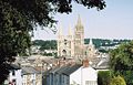 |
Truro Truro Truro is a city and civil parish in Cornwall, England, United Kingdom. The city is the centre for administration, leisure and retail in Cornwall, with a population recorded in the 2001 census of 17,431. Truro urban statistical area, which includes parts of surrounding parishes, has a 2001 census... Truru |
City | 17,431 | Cornwall Cornwall Cornwall is a unitary authority and ceremonial county of England, within the United Kingdom. It is bordered to the north and west by the Celtic Sea, to the south by the English Channel, and to the east by the county of Devon, over the River Tamar. Cornwall has a population of , and covers an area of... Kernow |
Truro Municipal Borough Truro Truro is a city and civil parish in Cornwall, England, United Kingdom. The city is the centre for administration, leisure and retail in Cornwall, with a population recorded in the 2001 census of 17,431. Truro urban statistical area, which includes parts of surrounding parishes, has a 2001 census... |
|
| Tywardreath and Par Tywardreath and Par Tywardreath and Par is a civil parish in Cornwall, England, UK. The 2001 UK census recorded that 3,161 people resided in the parish.The parish takes its name from its principal villages, Tywardreath and the fishing port Par.-External links:*... Chi war Dreth ha Porth |
Civil parish | 3,161 | Cornwall Cornwall Cornwall is a unitary authority and ceremonial county of England, within the United Kingdom. It is bordered to the north and west by the Celtic Sea, to the south by the English Channel, and to the east by the county of Devon, over the River Tamar. Cornwall has a population of , and covers an area of... Kernow |
St Austell with Fowey Municipal Borough |
|
|
| Veryan Veryan Veryan is a coastal civil parish and a village on the Roseland Peninsula in Cornwall, United Kingdom. The main settlements are at Veryan Churchtown, Veryan Green, Portloe and the smaller hamlets of Trewartha, Treviskey, Carne and Camels... Elerghi |
Civil parish | 982 | Cornwall Cornwall Cornwall is a unitary authority and ceremonial county of England, within the United Kingdom. It is bordered to the north and west by the Celtic Sea, to the south by the English Channel, and to the east by the county of Devon, over the River Tamar. Cornwall has a population of , and covers an area of... Kernow |
Truro Rural District |
|
|
| Wadebridge Wadebridge Wadebridge is a civil parish and town in north Cornwall, England, United Kingdom. The town straddles the River Camel five miles upstream from Padstow.... Ponsrys |
Town | 6,351 | Cornwall Cornwall Cornwall is a unitary authority and ceremonial county of England, within the United Kingdom. It is bordered to the north and west by the Celtic Sea, to the south by the English Channel, and to the east by the county of Devon, over the River Tamar. Cornwall has a population of , and covers an area of... Kernow |
Wadebridge and Padstow Rural District |
|
|
| Warbstow Warbstow Warbstow is a village and civil parish in Cornwall, England, United Kingdom. The parish has a population of 439 according to the 2001 census.The parish is one of the few left in England to still have an exclave... Lannwarburgh |
Civil parish | 439 | Cornwall Cornwall Cornwall is a unitary authority and ceremonial county of England, within the United Kingdom. It is bordered to the north and west by the Celtic Sea, to the south by the English Channel, and to the east by the county of Devon, over the River Tamar. Cornwall has a population of , and covers an area of... Kernow |
Launceston Rural District |
|
|
| Warleggan Warleggan Warleggan is a civil parish on the southern edge of Bodmin Moor in Cornwall, England, United Kingdom.The parish is roughly oblong in shape with hamlets near the church and at Mount. The River Warleggan, a tributary of the River Fowey, runs through the parish, forming its western boundary in places... Gorlegan |
Civil parish | 203 | Cornwall Cornwall Cornwall is a unitary authority and ceremonial county of England, within the United Kingdom. It is bordered to the north and west by the Celtic Sea, to the south by the English Channel, and to the east by the county of Devon, over the River Tamar. Cornwall has a population of , and covers an area of... Kernow |
Liskeard Rural District |
|
|
| Week St Mary Week St Mary Week St Mary is a civil parish and village in northeast Cornwall, United Kingdom. It is situated south of Bude close to the River Tamar and the border between Cornwall and Devon in the Hundred of Stratton.... Gwig Sen Maria |
Civil parish | 550 | Cornwall Cornwall Cornwall is a unitary authority and ceremonial county of England, within the United Kingdom. It is bordered to the north and west by the Celtic Sea, to the south by the English Channel, and to the east by the county of Devon, over the River Tamar. Cornwall has a population of , and covers an area of... Kernow |
Stratton Rural District |
|
|
| Wendron Wendron Wendron is a village and civil parish in Cornwall, United Kingdom. It is situated three miles north of Helston.The Revd G. H. Doble served for almost twenty years as the Vicar of Wendron . Langdon recorded the existence of eight stone crosses in the parish, including two at Merther Uny... Egloswendron |
Civil parish | 2,476 | Cornwall Cornwall Cornwall is a unitary authority and ceremonial county of England, within the United Kingdom. It is bordered to the north and west by the Celtic Sea, to the south by the English Channel, and to the east by the county of Devon, over the River Tamar. Cornwall has a population of , and covers an area of... Kernow |
Kerrier Rural District |
|
|
| Werrington Werrington, Cornwall Werrington is a civil parish in Cornwall, England, United Kingdom. It was formerly in Devon.In Werrington Park is a substantial house built by Sir Francis Drake about 1620. A larger mansion was built next to it on the site of old parish church in the early 18th century... Trewolvrin |
Civil parish | 453 | Cornwall Cornwall Cornwall is a unitary authority and ceremonial county of England, within the United Kingdom. It is bordered to the north and west by the Celtic Sea, to the south by the English Channel, and to the east by the county of Devon, over the River Tamar. Cornwall has a population of , and covers an area of... Kernow |
Launceston Rural District |
|
|
| Whitstone Whitstone Whitstone is a village and civil parish in east Cornwall, United Kingdom. It is roughly halfway between the towns of Bude and Launceston.-History:... Mengwynn |
Civil parish | 582 | Cornwall Cornwall Cornwall is a unitary authority and ceremonial county of England, within the United Kingdom. It is bordered to the north and west by the Celtic Sea, to the south by the English Channel, and to the east by the county of Devon, over the River Tamar. Cornwall has a population of , and covers an area of... Kernow |
Stratton Rural District |
|
|
| Withiel Withiel Withiel is a civil parish and village in Cornwall, United Kingdom. The name Withiel is derived from the Cornish word Gwydhyel, meaning wooded place... Gwydhyel |
Civil parish | 351 | Cornwall Cornwall Cornwall is a unitary authority and ceremonial county of England, within the United Kingdom. It is bordered to the north and west by the Celtic Sea, to the south by the English Channel, and to the east by the county of Devon, over the River Tamar. Cornwall has a population of , and covers an area of... Kernow |
Wadebridge and Padstow Rural District |
|
|
| Wolf Rock Wolf Rock, Cornwall Wolf Rock is a treacherous rock located east of St Mary's, Isles of Scilly and southwest of Land's End, in Cornwall, United Kingdom. A lighthouse, known as the Wolf Rock Lighthouse, was built on the rock by James Walker from 1861 to 1869; it entered service in January 1870.The lighthouse is in... |
Unparished area | 0 | Cornwall Cornwall Cornwall is a unitary authority and ceremonial county of England, within the United Kingdom. It is bordered to the north and west by the Celtic Sea, to the south by the English Channel, and to the east by the county of Devon, over the River Tamar. Cornwall has a population of , and covers an area of... Kernow |
West Penwith Rural District West Penwith Rural District West Penwith Rural District was a rural district in Cornwall, United Kingdom from 1894 to 1974. It was enlarged in 1934 by the abolition of Hayle, Ludgvan, Madron, Paul, and Phillack urban districts, also taking in part of the disbanded Redruth Rural District... |
|
|
| Zennor Zennor Zennor is a village and civil parish in Cornwall in England. The parish includes the villages of Zennor, Boswednack and Porthmeor and the hamlet of Treen. It is located on the north coast, about north of Penzance. Alphabetically, the parish is the last in Britain—its name comes from the Cornish... Sen Senar |
Civil parish | 217 | Cornwall Cornwall Cornwall is a unitary authority and ceremonial county of England, within the United Kingdom. It is bordered to the north and west by the Celtic Sea, to the south by the English Channel, and to the east by the county of Devon, over the River Tamar. Cornwall has a population of , and covers an area of... Kernow |
West Penwith Rural District West Penwith Rural District West Penwith Rural District was a rural district in Cornwall, United Kingdom from 1894 to 1974. It was enlarged in 1934 by the abolition of Hayle, Ludgvan, Madron, Paul, and Phillack urban districts, also taking in part of the disbanded Redruth Rural District... |
|
|
| Bryher Bryher, Isles of Scilly Bryher is the smallest of the five inhabited islands of the Isles of Scilly. It is home to a population of 83 . Bryher has an area of .-Geography:... Bryher |
Civil parish | 92 | Isles of Scilly Isles of Scilly The Isles of Scilly form an archipelago off the southwestern tip of the Cornish peninsula of Great Britain. The islands have had a unitary authority council since 1890, and are separate from the Cornwall unitary authority, but some services are combined with Cornwall and the islands are still part... Enesek Syllan |
Isles of Scilly Rural District Isles of Scilly The Isles of Scilly form an archipelago off the southwestern tip of the Cornish peninsula of Great Britain. The islands have had a unitary authority council since 1890, and are separate from the Cornwall unitary authority, but some services are combined with Cornwall and the islands are still part... |
|
|
| St Agnes Aganas |
Civil parish | 73 | Isles of Scilly Isles of Scilly The Isles of Scilly form an archipelago off the southwestern tip of the Cornish peninsula of Great Britain. The islands have had a unitary authority council since 1890, and are separate from the Cornwall unitary authority, but some services are combined with Cornwall and the islands are still part... Enesek Syllan |
Isles of Scilly Rural District Isles of Scilly The Isles of Scilly form an archipelago off the southwestern tip of the Cornish peninsula of Great Britain. The islands have had a unitary authority council since 1890, and are separate from the Cornwall unitary authority, but some services are combined with Cornwall and the islands are still part... |
|
|
| St Martin's St Martin's, Isles of Scilly St Martin's is the northernmost populated island of the Isles of Scilly, United Kingdom. It has an area of .-Description:There are three main settlements on the island - Higher Town, Middle Town and Lower Town - in addition to a number of scattered farms and cottages, with a total population of... Brechiek |
Civil parish | 142 | Isles of Scilly Isles of Scilly The Isles of Scilly form an archipelago off the southwestern tip of the Cornish peninsula of Great Britain. The islands have had a unitary authority council since 1890, and are separate from the Cornwall unitary authority, but some services are combined with Cornwall and the islands are still part... Enesek Syllan |
Isles of Scilly Rural District Isles of Scilly The Isles of Scilly form an archipelago off the southwestern tip of the Cornish peninsula of Great Britain. The islands have had a unitary authority council since 1890, and are separate from the Cornwall unitary authority, but some services are combined with Cornwall and the islands are still part... |
|
|
| St Mary's Ennor |
Civil parish | 1,666 | Isles of Scilly Isles of Scilly The Isles of Scilly form an archipelago off the southwestern tip of the Cornish peninsula of Great Britain. The islands have had a unitary authority council since 1890, and are separate from the Cornwall unitary authority, but some services are combined with Cornwall and the islands are still part... Enesek Syllan |
Isles of Scilly Rural District Isles of Scilly The Isles of Scilly form an archipelago off the southwestern tip of the Cornish peninsula of Great Britain. The islands have had a unitary authority council since 1890, and are separate from the Cornwall unitary authority, but some services are combined with Cornwall and the islands are still part... |
|
|
| Tresco Ynys Skaw |
Civil parish | 180 | Isles of Scilly Isles of Scilly The Isles of Scilly form an archipelago off the southwestern tip of the Cornish peninsula of Great Britain. The islands have had a unitary authority council since 1890, and are separate from the Cornwall unitary authority, but some services are combined with Cornwall and the islands are still part... Enesek Syllan |
Isles of Scilly Rural District Isles of Scilly The Isles of Scilly form an archipelago off the southwestern tip of the Cornish peninsula of Great Britain. The islands have had a unitary authority council since 1890, and are separate from the Cornwall unitary authority, but some services are combined with Cornwall and the islands are still part... |
|