

List of Sites of Special Scientific Interest in Cornwall
Encyclopedia
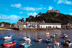
Cornwall
Cornwall is a unitary authority and ceremonial county of England, within the United Kingdom. It is bordered to the north and west by the Celtic Sea, to the south by the English Channel, and to the east by the county of Devon, over the River Tamar. Cornwall has a population of , and covers an area of...
(including the Isles of Scilly
Isles of Scilly
The Isles of Scilly form an archipelago off the southwestern tip of the Cornish peninsula of Great Britain. The islands have had a unitary authority council since 1890, and are separate from the Cornwall unitary authority, but some services are combined with Cornwall and the islands are still part...
) in the south-west of England
England
England is a country that is part of the United Kingdom. It shares land borders with Scotland to the north and Wales to the west; the Irish Sea is to the north west, the Celtic Sea to the south west, with the North Sea to the east and the English Channel to the south separating it from continental...
, UK
United Kingdom
The United Kingdom of Great Britain and Northern IrelandIn the United Kingdom and Dependencies, other languages have been officially recognised as legitimate autochthonous languages under the European Charter for Regional or Minority Languages...
. Cornwall has a population of across an area of 3563 km² (880,435.7 acre), making it one of the least dense counties within England. The north coast of Cornwall falls on the Celtic Sea
Celtic Sea
The Celtic Sea is the area of the Atlantic Ocean off the south coast of Ireland bounded to the east by Saint George's Channel; other limits include the Bristol Channel, the English Channel, and the Bay of Biscay, as well as adjacent portions of Wales, Cornwall, Devon, and Brittany...
in the Atlantic Ocean
Atlantic Ocean
The Atlantic Ocean is the second-largest of the world's oceanic divisions. With a total area of about , it covers approximately 20% of the Earth's surface and about 26% of its water surface area...
, which also surrounds the Isles of Scilly, the south coast falls on the English Channel
English Channel
The English Channel , often referred to simply as the Channel, is an arm of the Atlantic Ocean that separates southern England from northern France, and joins the North Sea to the Atlantic. It is about long and varies in width from at its widest to in the Strait of Dover...
and the county is bounded by the River Tamar
River Tamar
The Tamar is a river in South West England, that forms most of the border between Devon and Cornwall . It is one of several British rivers whose ancient name is assumed to be derived from a prehistoric river word apparently meaning "dark flowing" and which it shares with the River Thames.The...
, forming the border with Devon
Devon
Devon is a large county in southwestern England. The county is sometimes referred to as Devonshire, although the term is rarely used inside the county itself as the county has never been officially "shired", it often indicates a traditional or historical context.The county shares borders with...
, to the east. Cornish geology consists mainly of rocks from the Devonian
Devonian
The Devonian is a geologic period and system of the Paleozoic Era spanning from the end of the Silurian Period, about 416.0 ± 2.8 Mya , to the beginning of the Carboniferous Period, about 359.2 ± 2.5 Mya...
and Carboniferous
Carboniferous
The Carboniferous is a geologic period and system that extends from the end of the Devonian Period, about 359.2 ± 2.5 Mya , to the beginning of the Permian Period, about 299.0 ± 0.8 Mya . The name is derived from the Latin word for coal, carbo. Carboniferous means "coal-bearing"...
geological periods. Granite forms a large part of these, with mineralisations of tin
Tin
Tin is a chemical element with the symbol Sn and atomic number 50. It is a main group metal in group 14 of the periodic table. Tin shows chemical similarity to both neighboring group 14 elements, germanium and lead and has two possible oxidation states, +2 and the slightly more stable +4...
, copper
Copper
Copper is a chemical element with the symbol Cu and atomic number 29. It is a ductile metal with very high thermal and electrical conductivity. Pure copper is soft and malleable; an exposed surface has a reddish-orange tarnish...
, lead
Lead
Lead is a main-group element in the carbon group with the symbol Pb and atomic number 82. Lead is a soft, malleable poor metal. It is also counted as one of the heavy metals. Metallic lead has a bluish-white color after being freshly cut, but it soon tarnishes to a dull grayish color when exposed...
and arsenic
Arsenic
Arsenic is a chemical element with the symbol As, atomic number 33 and relative atomic mass 74.92. Arsenic occurs in many minerals, usually in conjunction with sulfur and metals, and also as a pure elemental crystal. It was first documented by Albertus Magnus in 1250.Arsenic is a metalloid...
having been mined in the area. This gives rise to many distinct habitats, with strong marine influences, including sand dunes, rocky reef
Reef
In nautical terminology, a reef is a rock, sandbar, or other feature lying beneath the surface of the water ....
s, stack
Stack (geology)
A stack is a geological landform consisting of a steep and often vertical column or columns of rock in the sea near a coast, isolated by erosion. Stacks are formed through processes of coastal geomorphology, which are entirely natural. Time, wind and water are the only factors involved in the...
s and headland
Headland
A headland is a point of land, usually high and often with a sheer drop, that extends out into a body of water.Headland can also refer to:*Headlands and bays*headLand, an Australian television series...
s as well as heathland
Heath
-Habitats:* Heath or heathland, low-growing woody vegetation, mostly consisting of heathers and related species* Heaths in the British National Vegetation Classification system...
, moorland
Moorland
Moorland or moor is a type of habitat, in the temperate grasslands, savannas, and shrublands biome, found in upland areas, characterised by low-growing vegetation on acidic soils and heavy fog...
and unusual river profiles.
In England the body responsible for designating SSSIs is Natural England
Natural England
Natural England is the non-departmental public body of the UK government responsible for ensuring that England's natural environment, including its land, flora and fauna, freshwater and marine environments, geology and soils, are protected and improved...
, which chooses a site because of its fauna
Fauna
Fauna or faunæ is all of the animal life of any particular region or time. The corresponding term for plants is flora.Zoologists and paleontologists use fauna to refer to a typical collection of animals found in a specific time or place, e.g. the "Sonoran Desert fauna" or the "Burgess shale fauna"...
, flora
Plant
Plants are living organisms belonging to the kingdom Plantae. Precise definitions of the kingdom vary, but as the term is used here, plants include familiar organisms such as trees, flowers, herbs, bushes, grasses, vines, ferns, mosses, and green algae. The group is also called green plants or...
, geological
Geology
Geology is the science comprising the study of solid Earth, the rocks of which it is composed, and the processes by which it evolves. Geology gives insight into the history of the Earth, as it provides the primary evidence for plate tectonics, the evolutionary history of life, and past climates...
or physiographical features. Natural England took over the role of designating and managing SSSIs from English Nature
English Nature
English Nature was the United Kingdom government agency that promoted the conservation of wildlife, geology and wild places throughout England between 1990 and 2006...
in October 2006 when it was formed from the amalgamation of English Nature, parts of the Countryside Agency
Countryside Agency
The Countryside Agency in England was a statutory body set up in 1999 with the task of improving the quality of the rural environment and the lives of those living in it. The Agency was formed by merging the Countryside Commission and the Rural Development Commission...
and the Rural Development Service
Rural Development Service
The Rural Development Service was formerly part of the UK Government's Department for Environment, Food and Rural Affairs . It ceased to exist on 1 October 2006 following the creation of Natural England.- History :...
. Natural England, like its predecessor, uses the 1974-1996 county system
Metropolitan and non-metropolitan counties of England
Metropolitan and non-metropolitan counties are one of the four levels of subdivisions of England used for the purposes of local government outside Greater London. As originally constituted, the metropolitan and non-metropolitan counties each consisted of multiple districts, had a county council and...
and as such the same approach is followed here, rather than adopting the current local government
Subdivisions of England
The subdivisions of England consist of a hierarchy of administrative divisions, and non-administrative ceremonial areas. All of England is divided into one of nine regions and 48 ceremonial counties, although these have only a limited role in public policy....
or ceremonial county
Ceremonial counties of England
The ceremonial counties are areas of England to which are appointed a Lord Lieutenant, and are defined by the government as counties and areas for the purposes of the Lieutenancies Act 1997 with reference to the metropolitan and non-metropolitan counties of England and Lieutenancies Act 1997...
boundaries.
There are 167 sites designated in this Area of Search
Area of Search
Areas of Search are geographical areas used in the selection of Sites of Special Scientific Interest. In England these are largely based on the 1974–1996 administrative counties...
, of which most, 83, have been designated due to their biological interest
Flora and fauna of Cornwall
Cornwall is the county that forms the tip of the southwestern peninsula of England; this area has a mild and warm climate regulated by the Gulf Stream...
, with 53 due to their geological interest
Geology of Cornwall
The Geology of Cornwall is dominated by its granite backbone, part of the Cornubian batholith, formed during the Variscan orogeny. Around this is an extensive metamorphic aureole formed in the mainly Devonian slates that make up most of the rest of the county...
and 31 for both. The data in the table is taken from English Nature in the form of citation sheets for each SSSI.
A–B
| Site name | Reason for Designation | Area | Grid reference | Year in which notified | Map | ||
|---|---|---|---|---|---|---|---|
| Biological Interest | Geological Interest | Hectares | Acres | ||||
| Aire Point to Carrick Du Aire Point to Carrick Du SSSI Aire Point to Carrick Du SSSI is a Site of Special Scientific Interest on the Penwith Peninsula, Cornwall. It is 5.98 square kilometres in extent, stretching from to... |
704.8 | 1741.6 | 1972 | http://www.natureonthemap.naturalengland.org.uk/map.aspx?map=sssi&feature=2000041,sssi,HYPERLINK,LABEL | |||
| Amble Marshes | 57.3 | 141.6 | 1951 | http://www.natureonthemap.naturalengland.org.uk/map.aspx?map=sssi&feature=1002146,sssi,HYPERLINK,LABEL | |||
| Annet Annet, Isles of Scilly Annet is the second largest of the fifty or so uninhabited Isles of Scilly, one km west of St Agnes with a length of one km and approximately 22 ha in area. The low lying island is almost divided in two by a narrow neck of land at West Porth which can, at times, be covered by waves... |
119.5 | 295.3 | 1971 | http://www.natureonthemap.naturalengland.org.uk/map.aspx?map=sssi&feature=1001100,sssi,HYPERLINK,LABEL | |||
| Baulk Head to Mullion Baulk Head to Mullion Baulk Head to Mullion is a coastal Site of Special Scientific Interest in Cornwall, England, UK, noted for both its biological and geological interest.-Geography:... |
152.3 | 376.3 | 1995 | http://www.natureonthemap.naturalengland.org.uk/map.aspx?map=sssi&feature=2000125,sssi,HYPERLINK,LABEL | |||
| Bedruthan Steps and Park Head | 80.8 | 200.0 | 1951 | http://www.natureonthemap.naturalengland.org.uk/map.aspx?map=sssi&feature=1002099,sssi,HYPERLINK,LABEL | |||
| Belowda Beacon Belowda Belowda is a village in Cornwall, England, UK. The village is just north of the A30 trunk road approximately seven miles west-southwest of Bodmin. The village also gives its name to the nearby Belowda Beacon.-Mines:... |
0.5 | 1.2 | 1996 | http://www.natureonthemap.naturalengland.org.uk/map.aspx?map=sssi&feature=2000097,sssi,HYPERLINK,LABEL | |||
| Big Pool and Browarth Point (St Agnes) | 10.0 | 25.0 | 1971 | http://www.natureonthemap.naturalengland.org.uk/map.aspx?map=sssi&feature=1001119,sssi,HYPERLINK,LABEL | |||
| Boconnoc Park and Woods Boconnoc Boconnoc is a civil parish in Cornwall, United Kingdom, approximately four miles east of Lostwithiel. According to the 2001 census the parish had a population of 121.The parish is rural in character and is fairly well wooded... |
50.4 | 124.5 | 1977 | http://www.natureonthemap.naturalengland.org.uk/map.aspx?map=sssi&feature=1002190,sssi,HYPERLINK,LABEL | |||
| Bodmin Moor, North Bodmin Moor Bodmin Moor is a granite moorland in northeastern Cornwall, England, United Kingdom. It is in size, and originally dates from the Carboniferous period of geological history.... |
4957.0 | 12248.0 | 1951 | http://www.natureonthemap.naturalengland.org.uk/map.aspx?map=sssi&feature=1002227,sssi,HYPERLINK,LABEL | |||
| Borlasevath and Retallack Moor | 54.1 | 133.6 | 1994 | http://www.natureonthemap.naturalengland.org.uk/map.aspx?map=sssi&feature=1006452,sssi,HYPERLINK,LABEL | |||
| Boscastle to Widemouth Boscastle to Widemouth Boscastle to Widemouth is a coastal Site of Special Scientific Interest in Cornwall, England, UK, noted for both its biological and geological interest.-Geography:... |
639.0 | 1579.0 | 1972 | http://www.natureonthemap.naturalengland.org.uk/map.aspx?map=sssi&feature=1002241,sssi,HYPERLINK,LABEL | |||
| Boscawen | 8.8 | 21.8 | 1997 | http://www.natureonthemap.naturalengland.org.uk/map.aspx?map=sssi&feature=2000136,sssi,HYPERLINK,LABEL | |||
| Brendonmoor Week St Mary Week St Mary is a civil parish and village in northeast Cornwall, United Kingdom. It is situated south of Bude close to the River Tamar and the border between Cornwall and Devon in the Hundred of Stratton.... |
11.7 | 29.0 | 1990 | http://www.natureonthemap.naturalengland.org.uk/map.aspx?map=sssi&feature=1005925,sssi,HYPERLINK,LABEL | |||
| Breney Common Breney Common Breney Common is a nature reserve and Site of Special Scientific Interest, noted for its biological interest, in central Cornwall, England, UK. It is located mainly in Lanlivery civil parish, with the Saints' Way footpath running through it.... |
114.6 | 283.2 | 1979 | http://www.natureonthemap.naturalengland.org.uk/map.aspx?map=sssi&feature=1003183,sssi,HYPERLINK,LABEL | |||
| Bude Coast Bude Bude is a small seaside resort town in North Cornwall, England, at the mouth of the River Neet . It lies just south of Flexbury, north of Widemouth Bay and west of Stratton and is located along the A3073 road off the A39. Bude is twinned with Ergué-Gabéric in Brittany, France... |
92.5 | 228.6 | 1987 | http://www.natureonthemap.naturalengland.org.uk/map.aspx?map=sssi&feature=1001539,sssi,HYPERLINK,LABEL | |||
C
| Site name | Reason for Designation | Area | Grid reference | Year in which notified | Map | ||
|---|---|---|---|---|---|---|---|
| Biological Interest | Geological Interest | Hectares | Acres | ||||
| Cabilla Manor Wood | 15.1 | 37.3 | 1989 | http://www.natureonthemap.naturalengland.org.uk/map.aspx?map=sssi&feature=1004285,sssi,HYPERLINK,LABEL | |||
| Caerthillian to Kennack Caerthillian to Kennack Caerthillian to Kennack is a coastal Site of Special Scientific Interest on the Lizard Peninsula in Cornwall, England, UK, noted for both its biological and geological interest... |
141.1 | 349.6 | 1951 | http://www.natureonthemap.naturalengland.org.uk/map.aspx?map=sssi&feature=1004373,sssi,HYPERLINK,LABEL | |||
| Cameron Quarry | 0.5 | 1.2 | 1996 | http://www.natureonthemap.naturalengland.org.uk/map.aspx?map=sssi&feature=2000128,sssi,HYPERLINK,LABEL | |||
| Carn Grey Rock and Quarry Treverbyn Treverbyn is a civil parish and village in mid-Cornwall, United Kingdom.The church of St Peter is modern as the medieval chapel was closed at the time of the Reformation. The parish was formed from part of St Austell parish in 1847... |
1.9 | 4.8 | 1991 | http://www.natureonthemap.naturalengland.org.uk/map.aspx?map=sssi&feature=1003589,sssi,HYPERLINK,LABEL | |||
| Carnkief Pond | 11.2 | 27.7 | 1951 | http://www.natureonthemap.naturalengland.org.uk/map.aspx?map=sssi&feature=1002293,sssi,HYPERLINK,LABEL | |||
| Carrick Heaths Carrick Heaths Carrick Heaths is a Site of Special Scientific Interest , noted for its biological interest, in central Cornwall, England, UK. It incorporates the old Silverwell Moor SSSI. Within the site the Red Data Book listed Barn Owl can be found.-Geography:... |
42.7 | 105.5 | 1973 | http://www.natureonthemap.naturalengland.org.uk/map.aspx?map=sssi&feature=2000368,sssi,HYPERLINK,LABEL | |||
| Carricknath Point to Porthbean Beach Carricknath Point to Porthbean Beach Carricknath Point to Porthbean Beach is a coastal Site of Special Scientific Interest in Cornwall, England, UK, noted for its biological interest.-Geography:... |
49.5 | 122.3 | 2000 | http://www.natureonthemap.naturalengland.org.uk/map.aspx?map=sssi&feature=2000421,sssi,HYPERLINK,LABEL | |||
| Carrine Common & Penwethers Carrine Common & Penwethers Carrine Common & Penwethers is a Site of Special Scientific Interest in Cornwall, England, UK, noted for its biological interest. The site is located by the settlement of Penweathers, within the civil parish of Kea, half a mile south of the city of Truro.Carrine Common is also designated a... |
45.8 | 113.3 | 1973 | http://www.natureonthemap.naturalengland.org.uk/map.aspx?map=sssi&feature=1002937,sssi,HYPERLINK,LABEL | |||
| Castle Down (Tresco) | 58.1 | 143.6 | 1971 | http://www.natureonthemap.naturalengland.org.uk/map.aspx?map=sssi&feature=1001130,sssi,HYPERLINK,LABEL | |||
| Chapel Down (St. Martin's) St Martin's, Isles of Scilly St Martin's is the northernmost populated island of the Isles of Scilly, United Kingdom. It has an area of .-Description:There are three main settlements on the island - Higher Town, Middle Town and Lower Town - in addition to a number of scattered farms and cottages, with a total population of... |
34.9 | 86.2 | 1971 | http://www.natureonthemap.naturalengland.org.uk/map.aspx?map=sssi&feature=1001147,sssi,HYPERLINK,LABEL | |||
| Chyenhal Moor Paul, Cornwall Paul is a civil parish and village in Cornwall, United Kingdom. It is situated two miles south of Penzance and one mile south of Newlyn.The village of Paul is represented on Penzance Town Council... |
11.9 | 29.4 | 1951 | http://www.natureonthemap.naturalengland.org.uk/map.aspx?map=sssi&feature=1002966,sssi,HYPERLINK,LABEL | |||
| Clicker Tor Quarry Menheniot Menheniot is a civil parish and village in Cornwall, United Kingdom. The village is situated 2½ miles southeast of Liskeard. The meaning of the name is "sanctuary of Neot" .... |
4.3 | 10.6 | 1967 | http://www.natureonthemap.naturalengland.org.uk/map.aspx?map=sssi&feature=1002982,sssi,HYPERLINK,LABEL | |||
| Cligga Head Perranporth Perranporth is a small seaside resort on the north coast of Cornwall, England, United Kingdom. It is southwest of Newquay and northwest of Truro. Perranporth and its long beach face the Atlantic Ocean.... |
113.5 | 280.5 | 1951 | http://www.natureonthemap.naturalengland.org.uk/map.aspx?map=sssi&feature=1002991,sssi,HYPERLINK,LABEL | |||
| Coombe Mill Coombe, Bude Coombe is a hamlet in northeast Cornwall, United Kingdom.Combe is situated in the civil parish of Morwenstow three miles north of Bude. Most houses in the settlement are owned by the Landmark Trust-Coombe Mill:... |
0.5 | 1.2 | 2000 | http://www.natureonthemap.naturalengland.org.uk/map.aspx?map=sssi&feature=2000394,sssi,HYPERLINK,LABEL | |||
| Coverack Cove and Dolor Point Coverack Coverack is a coastal village and fishing port in Cornwall, England, UK. It is situated on the east side of the Lizard peninsula approximately nine miles south of Falmouth.... |
5.6 | 13.9 | 1951 | http://www.natureonthemap.naturalengland.org.uk/map.aspx?map=sssi&feature=1006274,sssi,HYPERLINK,LABEL | |||
| Coverack to Porthoustock Coverack to Porthoustock Coverack to Porthoustock is a coastal Site of Special Scientific Interest in Cornwall, England, UK, noted for both its biological and geological interest. The site contains 4 Red Data Book plant species.-Geography:... |
173.5 | 428.6 | 1951 | http://www.natureonthemap.naturalengland.org.uk/map.aspx?map=sssi&feature=1006569,sssi,HYPERLINK,LABEL | |||
| Crocadon Quarry St Mellion St Mellion is a village and rural civil parish in east Cornwall, United Kingdom. The parish is three miles south of Callington and is in the St Germans Registration District. The population in the 2001 census was 377... |
0.2 | 0.4 | 1998 | http://www.natureonthemap.naturalengland.org.uk/map.aspx?map=sssi&feature=2000185,sssi,HYPERLINK,LABEL | |||
| Crow's Nest Crow's Nest, Cornwall Crow's Nest is a village in Cornwall, England, UK. It is located within the civil parish of St Cleer, on the southeastern edge of Bodmin Moor, north of the town of Liskeard.... |
18.9 | 46.8 | 1999 | http://www.natureonthemap.naturalengland.org.uk/map.aspx?map=sssi&feature=2000274,sssi,HYPERLINK,LABEL | |||
| Crowhill Valley | 42.5 | 105.0 | 1951 | http://www.natureonthemap.naturalengland.org.uk/map.aspx?map=sssi&feature=1000641,sssi,HYPERLINK,LABEL | |||
| Cuckoo Rock to Turbot Point Cuckoo Rock to Turbot Point Cuckoo Rock to Turbot Point is a coastal Geological Conservation Review site and Site of Special Scientific Interest in Cornwall, England, UK, noted for its geological interest.-Geography:... |
102.5 | 253.4 | 1998 | http://www.natureonthemap.naturalengland.org.uk/map.aspx?map=sssi&feature=2000113,sssi,HYPERLINK,LABEL | |||
| Cudden Point to Prussia Cove Prussia Cove Prussia Cove , formerly called the King's Cove, is a small private estate on the coast of Mount's Bay and to the east of Cudden Point, west Cornwall, UK. Part of the area is designated as a Site of Special Scientific Interest , a Geological Conservation Review site and is in an Area of Outstanding... |
15.9 | 39.2 | 1991 | http://www.natureonthemap.naturalengland.org.uk/map.aspx?map=sssi&feature=1003626,sssi,HYPERLINK,LABEL | |||
D–G
| Site name | Reason for Designation | Area | Grid reference | Year in which notified | Map | ||
|---|---|---|---|---|---|---|---|
| Biological Interest | Geological Interest | Hectares | Acres | ||||
| De Lank Quarries De Lank Quarries De Lank Quarries is a geological Site of Special Scientific Interest in St Breward parish, north Cornwall, notified in 1994. The quarries have produced typical biotite granites and are of such quality that a slab now forms the base section of the reception desk at the Geological Society of London... |
21.9 | 54.1 | 1994 | http://www.natureonthemap.naturalengland.org.uk/map.aspx?map=sssi&feature=2000099,sssi,HYPERLINK,LABEL | |||
| Dozmary Pool Dozmary Pool Dozmary Pool is a small lake on Bodmin Moor, Cornwall, UK situated 16.9 km/10.5 mi from the sea. It lies about 15 km northeast of Bodmin and 2 km south of Bolventor: it originated in the post-glacial period. The outflow from the pool is into Colliford Lake... |
104.2 | 257.5 | 1951 | http://www.natureonthemap.naturalengland.org.uk/map.aspx?map=sssi&feature=1000726,sssi,HYPERLINK,LABEL | |||
| Draynes Wood River Fowey The River Fowey is a river in Cornwall, United Kingdom.It rises about north-west of Brown Willy on Bodmin Moor, passes Lanhydrock House, Restormel Castle and Lostwithiel, then broadens at Milltown before joining the English Channel at Fowey. It is only navigable by larger craft for the last .... |
38.0 | 93.9 | 1951 | http://www.natureonthemap.naturalengland.org.uk/map.aspx?map=sssi&feature=1003106,sssi,HYPERLINK,LABEL | |||
| Duckpool to Furzey Cove | 87.3 | 215.7 | 1996 | http://www.natureonthemap.naturalengland.org.uk/map.aspx?map=sssi&feature=2000027,sssi,HYPERLINK,LABEL | |||
| East Lizard Heathlands | 287.4 | 710.1 | 1951 | http://www.natureonthemap.naturalengland.org.uk/map.aspx?map=sssi&feature=2000126,sssi,HYPERLINK,LABEL | |||
| Eastern Isles | 83.8 | 207.1 | 1971 | http://www.natureonthemap.naturalengland.org.uk/map.aspx?map=sssi&feature=1001168,sssi,HYPERLINK,LABEL | |||
| Eglarooze Cliff Portwrinkle Portwrinkle is a small coastal village in south-east Cornwall, United Kingdom. It is situated at the western end of Whitsand Bay five miles south-west of Saltash.... |
30.8 | 76.1 | 1951 | http://www.natureonthemap.naturalengland.org.uk/map.aspx?map=sssi&feature=1003125,sssi,HYPERLINK,LABEL | |||
| Folly Rocks Praa Sands Praa Sands is a coastal village in the Parish of Breage, located off the main road between Helston and Penzance in Cornwall, England, UK... |
2.4 | 6.0 | 1990 | http://www.natureonthemap.naturalengland.org.uk/map.aspx?map=sssi&feature=1003660,sssi,HYPERLINK,LABEL | |||
| Gerrans Bay to Camels Cove | 139.5 | 344.7 | 1951 | http://www.natureonthemap.naturalengland.org.uk/map.aspx?map=sssi&feature=1002267,sssi,HYPERLINK,LABEL | |||
| Godrevy Head to St Agnes | 627.4 | 1550.3 | 1951 | http://www.natureonthemap.naturalengland.org.uk/map.aspx?map=sssi&feature=1003195,sssi,HYPERLINK,LABEL | |||
| Goonhilly Downs Goonhilly Downs Goonhilly Downs is a Site of Special Scientific Interest that forms a raised plateau in the central western area of the Lizard Peninsula in Cornwall, England, UK. Situated just south of Helston and the Naval Air Station at Culdrose, it is famous for its Goonhilly Satellite Earth Station, the... |
1271.0 | 3140.7 | 1951 | http://www.natureonthemap.naturalengland.org.uk/map.aspx?map=sssi&feature=1003215,sssi,HYPERLINK,LABEL | |||
| Goss and Tregoss Moors | 701.9 | 1734.4 | 1988 | http://www.natureonthemap.naturalengland.org.uk/map.aspx?map=sssi&feature=1001443,sssi,HYPERLINK,LABEL | |||
| Great Pool (Tresco) | 17.5 | 43.2 | 1971 | http://www.natureonthemap.naturalengland.org.uk/map.aspx?map=sssi&feature=1001219,sssi,HYPERLINK,LABEL | |||
| Great Wheal Fortune | 0.5 | 1.4 | 1991 | http://www.natureonthemap.naturalengland.org.uk/map.aspx?map=sssi&feature=1005904,sssi,HYPERLINK,LABEL | |||
| Greenamoor | 32.5 | 79.4 | 1992 | http://www.natureonthemap.naturalengland.org.uk/map.aspx?map=sssi&feature=1006514,sssi,HYPERLINK,LABEL | |||
| Greenscoombe Wood, Luckett Luckett, Cornwall Luckett is a hamlet in east Cornwall, United Kingdom. It is situated in a former mining area beside the River Tamar approximately three miles north of Callington.... |
29.3 | 72.4 | 1973 | http://www.natureonthemap.naturalengland.org.uk/map.aspx?map=sssi&feature=1003365,sssi,HYPERLINK,LABEL | |||
| Greystone Quarry Lezant Lezant is a civil parish and village in east Cornwall, United Kingdom. Lezant village is situated approximately five miles south of Launceston. The population of the parish in the 2001 census was 751.-Geography:... |
4.4 | 10.9 | 1994 | http://www.natureonthemap.naturalengland.org.uk/map.aspx?map=sssi&feature=1001700,sssi,HYPERLINK,LABEL | |||
| Grimscott Grimscott Grimscott is a village in Cornwall, England, UK. It is situated in the civil parish of Launcells, east of the town of Bude.Half a mile east of the village is Grimscott SSSI , noted for its biological interest.... |
11.0 | 27.0 | 1992 | http://www.natureonthemap.naturalengland.org.uk/map.aspx?map=sssi&feature=1006500,sssi,HYPERLINK,LABEL | |||
| Gugh Gugh Gugh could be described as the sixth inhabited island of the Isles of Scilly, but is usually included with St Agnes with which it is joined by a sandy tombolo known as "The Bar" when exposed at low tide. The island is only one km long and about 0.5 km wide, with the highest point, Kittern... |
37.7 | 93.2 | 1976 | http://www.natureonthemap.naturalengland.org.uk/map.aspx?map=sssi&feature=1001239,sssi,HYPERLINK,LABEL | |||
| Gwithian to Mexico Towans | 371.1 | 917.2 | 1953 | http://www.natureonthemap.naturalengland.org.uk/map.aspx?map=sssi&feature=1004171,sssi,HYPERLINK,LABEL | |||
H–L
| Site name | Reason for Designation | Area | Grid reference | Year in which notified | Map | ||
|---|---|---|---|---|---|---|---|
| Biological Interest | Geological Interest | Hectares | Acres | ||||
| Harbour Cove | 29.1 | 71.9 | 1990 | http://www.natureonthemap.naturalengland.org.uk/map.aspx?map=sssi&feature=1001632,sssi,HYPERLINK,LABEL | |||
| Hawkstor Pit Hawk's Tor Hawk's Tor is a hill and tor on Bodmin Moor in Cornwall, England, UK. Its summit is above sea level.The tor, which is in the civil parish of Blisland, is located north east of the town of Bodmin. The slopes of the tor contain Hawkstor Downs, the Stripple stones, a stone circle and Hawkstor Pit,... |
5.9 | 9.7 | 1993 | http://www.natureonthemap.naturalengland.org.uk/map.aspx?map=sssi&feature=1002616,sssi,HYPERLINK,LABEL | |||
| Hayle Estuary & Carrack Gladden Hayle Estuary and Carrack Gladden SSSI The Hayle Estuary and Carrack Gladden SSSI is a Site of Special Scientific Interest, noted for its biological interest, in Cornwall, England, UK.It consists of three distinct parts, each of which is covered in a separate article:* the Hayle Estuary... |
190.3 | 470.2 | 1951 | http://www.natureonthemap.naturalengland.org.uk/map.aspx?map=sssi&feature=1003229,sssi,HYPERLINK,LABEL | |||
| Higher Moors and Porth Hellick Pool (St. Mary's) | 16.2 | 40.0 | 1971 | http://www.natureonthemap.naturalengland.org.uk/map.aspx?map=sssi&feature=1001252,sssi,HYPERLINK,LABEL | |||
| Hingston Down Quarry & Consols Hingston Down Hingston Down is a hill not far from Gunnislake in Cornwall in the United Kingdom.-History:This is possibly the Hingston Down mentioned in the Anglo-Saxon Chronicle which says that in 835 Egbert king of the West Saxons defeated an army of Vikings and Cornish at Hengestdun = "Stallion Hill"... |
24.2 | 59.8 | 1995 | http://www.natureonthemap.naturalengland.org.uk/map.aspx?map=sssi&feature=2000098,sssi,HYPERLINK,LABEL | |||
| Kelsey Head | 227.6 | 562.4 | 1951 | http://www.natureonthemap.naturalengland.org.uk/map.aspx?map=sssi&feature=1003293,sssi,HYPERLINK,LABEL | |||
| Kennack to Coverack | 265.7 | 656.5 | 1951 | http://www.natureonthemap.naturalengland.org.uk/map.aspx?map=sssi&feature=1003305,sssi,HYPERLINK,LABEL | |||
| Kernick and Ottery Meadows River Ottery The River Ottery is a small river in northeast Cornwall, United Kingdom. The river is approximately twenty miles long from its source southeast of Otterham to its confluence with the River Tamar at Nether Bridge, two miles northeast of Launceston.The headwaters of the River Ottery are within the... |
29.8 | 71.6 | 1992 | http://www.natureonthemap.naturalengland.org.uk/map.aspx?map=sssi&feature=1006533,sssi,HYPERLINK,LABEL | |||
| Kingsand to Sandway Point Kingsand Kingsand and Cawsand are twin villages in southeast Cornwall, United Kingdom. The villages are situated on the Rame Peninsula and in the parish of Maker-with-Rame.... |
6.7 | 15.3 | 1994 | http://www.natureonthemap.naturalengland.org.uk/map.aspx?map=sssi&feature=1007124,sssi,HYPERLINK,LABEL | |||
| Lidcott Mine Laneast Laneast is a village and civil parish in Cornwall, United Kingdom. It is situated above the River Inny valley approximately six miles west of Launceston. The population in the 2001 census was 164.-Geography:... |
0.1 | 0.3 | 1987 | http://www.natureonthemap.naturalengland.org.uk/map.aspx?map=sssi&feature=1001469,sssi,HYPERLINK,LABEL | |||
| Loe Pool | 128.7 | 318.0 | 1951 | http://www.natureonthemap.naturalengland.org.uk/map.aspx?map=sssi&feature=1003319,sssi,HYPERLINK,LABEL | |||
| Loggans Moor Loggans Moor Loggans Moor is a nature reserve and Site of Special Scientific Interest, noted for its biological interest, in west Cornwall, England, UK. It is located 1 mile north-east of the town of Hayle, off the A30 road.... |
10.7 | 26.4 | 1986 | http://www.natureonthemap.naturalengland.org.uk/map.aspx?map=sssi&feature=1001479,sssi,HYPERLINK,LABEL | |||
| Lower Bostraze and Leswidden Lower Bostraze and Leswidden SSSI Lower Bostraze And Leswidden SSSI is a biological Site of Special Scientific Interest, located on the Penwith Peninsula, Cornwall, a little to the east of St Just, approximately 8 km west of Penzance.... |
2.3 | 5.7 | 1996 | http://www.natureonthemap.naturalengland.org.uk/map.aspx?map=sssi&feature=2000182,sssi,HYPERLINK,LABEL | |||
| Lower Fal & Helford Intertidal | 277.7 | 686.0 | 1997 | http://www.natureonthemap.naturalengland.org.uk/map.aspx?map=sssi&feature=2000174,sssi,HYPERLINK,LABEL | |||
| Lower Moors (St. Mary's) | 10.2 | 25.2 | 1971 | http://www.natureonthemap.naturalengland.org.uk/map.aspx?map=sssi&feature=1001273,sssi,HYPERLINK,LABEL | |||
| Luxulyan Quarry | 49.9 | 123.5 | 1993 | http://www.natureonthemap.naturalengland.org.uk/map.aspx?map=sssi&feature=1003606,sssi,HYPERLINK,LABEL | |||
| Lymsworthy Meadows | 7.7 | 19.0 | 1992 | http://www.natureonthemap.naturalengland.org.uk/map.aspx?map=sssi&feature=1006469,sssi,HYPERLINK,LABEL | |||
| Lynher Estuary River Lynher The River Lynher flows through east Cornwall, UK, passing St Germans and enters the River Tamar at the Hamoaze, which in turn flows into Plymouth Sound.-Geography:... |
687.3 | 1698.3 | 1951 | http://www.natureonthemap.naturalengland.org.uk/map.aspx?map=sssi&feature=1004001,sssi,HYPERLINK,LABEL |
M–O
| Site name | Reason for Designation | Area | Grid reference | Year in which notified | Map | ||
|---|---|---|---|---|---|---|---|
| Biological Interest | Geological Interest | Hectares | Acres | ||||
| Malpas Estuary | 101.5 | 250.8 | 1951 | http://www.natureonthemap.naturalengland.org.uk/map.aspx?map=sssi&feature=1004029,sssi,HYPERLINK,LABEL | |||
| Marazion Marsh Marazion Marsh Marazion Marsh is a Royal Society for the Protection of Birds reserve situated in a shallow river valley, half a kilometre to the west of Marazion, Cornwall, England, UK... |
59.9 | 148.0 | 1951 | http://www.natureonthemap.naturalengland.org.uk/map.aspx?map=sssi&feature=1004035,sssi,HYPERLINK,LABEL | |||
| Meddon Moor Meddon Moor Meddon Moor is a Site of Special Scientific Interest in Cornwall, England, UK. The moor is located in the very north-eastern corner of Cornwall, on the border with Devon, within the civil parish of Morwenstow... |
32.0 | 79.0 | 1992 | http://www.natureonthemap.naturalengland.org.uk/map.aspx?map=sssi&feature=1004222,sssi,HYPERLINK,LABEL | |||
| Meneage Coastal Section | 79.7 | 197.0 | 1994 | http://www.natureonthemap.naturalengland.org.uk/map.aspx?map=sssi&feature=1003683,sssi,HYPERLINK,LABEL | |||
| Merthen Wood | 72.2 | 178.4 | 1972 | http://www.natureonthemap.naturalengland.org.uk/map.aspx?map=sssi&feature=1004064,sssi,HYPERLINK,LABEL | |||
| Minster Church | 0.7 | 1.7 | 1998 | http://www.natureonthemap.naturalengland.org.uk/map.aspx?map=sssi&feature=2000184,sssi,HYPERLINK,LABEL | |||
| Mulberry Downs Quarry | 3.2 | 7.9 | 1973 | http://www.natureonthemap.naturalengland.org.uk/map.aspx?map=sssi&feature=1004083,sssi,HYPERLINK,LABEL | |||
| Mullion Cliff to Predannack Cliff | 108.5 | 268.1 | 1951 | http://www.natureonthemap.naturalengland.org.uk/map.aspx?map=sssi&feature=1004096,sssi,HYPERLINK,LABEL | |||
| Nance Wood Portreath Portreath is a civil parish, village and fishing port on the north coast of Cornwall, United Kingdom. The village is situated approximately three miles northwest of Redruth.... |
9.8 | 24.2 | 1951 | http://www.natureonthemap.naturalengland.org.uk/map.aspx?map=sssi&feature=1004126,sssi,HYPERLINK,LABEL | |||
| Newlyn Downs | 115.7 | 285.9 | 1997 | http://www.natureonthemap.naturalengland.org.uk/map.aspx?map=sssi&feature=2000160,sssi,HYPERLINK,LABEL | |||
| Norrard Rocks | 35.6 | 88.0 | 1971 | http://www.natureonthemap.naturalengland.org.uk/map.aspx?map=sssi&feature=1001870,sssi,HYPERLINK,LABEL | |||
| Ottery Valley River Ottery The River Ottery is a small river in northeast Cornwall, United Kingdom. The river is approximately twenty miles long from its source southeast of Otterham to its confluence with the River Tamar at Nether Bridge, two miles northeast of Launceston.The headwaters of the River Ottery are within the... |
32.5 | 80.3 | 1994 | http://www.natureonthemap.naturalengland.org.uk/map.aspx?map=sssi&feature=1000655,sssi,HYPERLINK,LABEL | |||
P
| Site name | Reason for Designation | Area | Grid reference | Year in which notified | Map | ||
|---|---|---|---|---|---|---|---|
| Biological Interest | Geological Interest | Hectares | Acres | ||||
| Park Wood River Lynher The River Lynher flows through east Cornwall, UK, passing St Germans and enters the River Tamar at the Hamoaze, which in turn flows into Plymouth Sound.-Geography:... |
32.7 | 80.9 | 1988 | http://www.natureonthemap.naturalengland.org.uk/map.aspx?map=sssi&feature=1001504,sssi,HYPERLINK,LABEL | |||
| Penberthy Croft Mine Penberthy Croft Mine Penberthy Croft Mine, is a disused mine and Site of Special Scientific Interest in Cornwall, England, UK. It is located to the north of the civil parish of St Hilary, east of the town of Penzance.... |
2.3 | 5.7 | 1993 | http://www.natureonthemap.naturalengland.org.uk/map.aspx?map=sssi&feature=1003620,sssi,HYPERLINK,LABEL | |||
| Penhale Dunes | 1070.4 | 2645.0 | 1953 | http://www.natureonthemap.naturalengland.org.uk/map.aspx?map=sssi&feature=1004143,sssi,HYPERLINK,LABEL | |||
| Peninnis Head (St. Mary's) | 16.1 | 39.7 | 1971 | http://www.natureonthemap.naturalengland.org.uk/map.aspx?map=sssi&feature=1001894,sssi,HYPERLINK,LABEL | |||
| Penlee Point Penlee Point, Mousehole Penlee Point is a promontory near the Cornish coastal fishing village of Mousehole. It was the launching point of the Penlee lifeboat, which was lost in the disaster of 1981.... |
1.8 | 4.4 | 1990 | http://www.natureonthemap.naturalengland.org.uk/map.aspx?map=sssi&feature=1005948,sssi,HYPERLINK,LABEL | |||
| Penlee Quarry | 25.8 | 64.0 | http://www.natureonthemap.naturalengland.org.uk/map.aspx?map=sssi&feature=2000129,sssi,HYPERLINK,LABEL | ||||
| Pentire Peninsula | 113.7 | 281.0 | 1951 | http://www.natureonthemap.naturalengland.org.uk/map.aspx?map=sssi&feature=1004161,sssi,HYPERLINK,LABEL | |||
| Pentle Bay, Merrick And Round Islands | 42.8 | 105.7 | 1976 | http://www.natureonthemap.naturalengland.org.uk/map.aspx?map=sssi&feature=1001909,sssi,HYPERLINK,LABEL | |||
| Phoenix United Mine | 29.8 | 112.4 | 1996 | http://www.natureonthemap.naturalengland.org.uk/map.aspx?map=sssi&feature=2000114,sssi,HYPERLINK,LABEL | |||
| Plains and Great Bay (St. Martin's) St Martin's, Isles of Scilly St Martin's is the northernmost populated island of the Isles of Scilly, United Kingdom. It has an area of .-Description:There are three main settlements on the island - Higher Town, Middle Town and Lower Town - in addition to a number of scattered farms and cottages, with a total population of... |
15.0 | 37.1 | 1971 | http://www.natureonthemap.naturalengland.org.uk/map.aspx?map=sssi&feature=1001923,sssi,HYPERLINK,LABEL | |||
| Plymouth Sound Shores And Cliffs | 45.0 | 111.0 | 1997 | http://www.natureonthemap.naturalengland.org.uk/map.aspx?map=sssi&feature=2000130,sssi,HYPERLINK,LABEL | |||
| Polruan to Polperro | 213.4 | 527.2 | 1951 | http://www.natureonthemap.naturalengland.org.uk/map.aspx?map=sssi&feature=2000314,sssi,HYPERLINK,LABEL | |||
| Polyne Quarry Polyne Quarry Polyne Quarry is a 0.1 hectare Site of Special Scientific Interest in Cornwall, England, UK. It is located to the north of Lansallos civil parish, to the west of Looe.The SSSI was designated in 1988 for its geological interest.-External links:... |
0.1 | 0.2 | 1988 | http://www.natureonthemap.naturalengland.org.uk/map.aspx?map=sssi&feature=1001595,sssi,HYPERLINK,LABEL | |||
| Polyphant Polyphant Polyphant , first recorded as Polefant ca. 1170, is a village in east Cornwall, United Kingdom. It is situated to the north of the civil parish of Lewannick, five miles west of the town of Launceston near the convergence of the River Inny and Penpont Water.The disused quarries to the north of the... |
3.4 | 8.4 | 1994 | http://www.natureonthemap.naturalengland.org.uk/map.aspx?map=sssi&feature=1001581,sssi,HYPERLINK,LABEL | |||
| Pool Of Bryher & Popplestone Bank (Bryher) Bryher, Isles of Scilly Bryher is the smallest of the five inhabited islands of the Isles of Scilly. It is home to a population of 83 . Bryher has an area of .-Geography:... |
5.9 | 14.6 | 1971 | http://www.natureonthemap.naturalengland.org.uk/map.aspx?map=sssi&feature=1001961,sssi,HYPERLINK,LABEL | |||
| Porth Seal (St. Martin's) St Martin's, Isles of Scilly St Martin's is the northernmost populated island of the Isles of Scilly, United Kingdom. It has an area of .-Description:There are three main settlements on the island - Higher Town, Middle Town and Lower Town - in addition to a number of scattered farms and cottages, with a total population of... |
1.1 | 2.6 | 1976 | http://www.natureonthemap.naturalengland.org.uk/map.aspx?map=sssi&feature=1001971,sssi,HYPERLINK,LABEL | |||
| Porthcew | 9.6 | 23.7 | 1990 | http://www.natureonthemap.naturalengland.org.uk/map.aspx?map=sssi&feature=1003686,sssi,HYPERLINK,LABEL | |||
| Porthgwarra to Pordenack Point | 157.9 | 390.2 | 1977 | http://www.natureonthemap.naturalengland.org.uk/map.aspx?map=sssi&feature=1004213,sssi,HYPERLINK,LABEL | |||
| Porthleven Cliffs | 8.8 | 21.7 | 1973 | http://www.natureonthemap.naturalengland.org.uk/map.aspx?map=sssi&feature=1004228,sssi,HYPERLINK,LABEL | |||
| Porthleven Cliffs East | 13.1 | 32.4 | 1990 | http://www.natureonthemap.naturalengland.org.uk/map.aspx?map=sssi&feature=1005924,sssi,HYPERLINK,LABEL | |||
| Porthloo | 0.66 | 1.6 | 1996 | http://www.natureonthemap.naturalengland.org.uk/map.aspx?map=sssi&feature=2000177,sssi,HYPERLINK,LABEL | |||
R
| Site name | Reason for Designation | Area | Grid reference | Year in which notified | Map | ||
|---|---|---|---|---|---|---|---|
| Biological Interest | Geological Interest | Hectares | Acres | ||||
| Rame Head Rame Head Rame Head is a coastal headland, southwest of the village of Rame in southeast Cornwall, United Kingdom.-History and antiquities:The site was used for a hill fort in the Iron Age. The headland has a prominent chapel, dedicated to St Michael, accessible by a steep footpath... & Whitsand Bay Whitsand Bay Whitsand Bay, situated in south east Cornwall, England, United Kingdom runs from Rame Head in the east to Portwrinkle in the west. It is characterised by sheer, high cliffs, dramatic scenery and long stretches of sandy beaches... |
160.1 | 395.6 | 1996 | http://www.natureonthemap.naturalengland.org.uk/map.aspx?map=sssi&feature=1021866,sssi-su,HYPERLINK | |||
| Red Moor Red Moor Red Moor is a nature reserve and Site of Special Scientific Interest , noted for its biological interest, in central Cornwall, England, UK.-Geography:... |
89.1 | 220.2 | 1979 | http://www.natureonthemap.naturalengland.org.uk/map.aspx?map=sssi&feature=1003026,sssi-su,HYPERLINK | |||
| Redlake Meadows & Hoggs Moor | 30.5 | 75.4 | 1995 | http://www.natureonthemap.naturalengland.org.uk/map.aspx?map=sssi&feature=1003049,sssi-su,HYPERLINK | |||
| Retire Common Retire Common Retire Common is a Site of Special Scientific Interest, noted for its biological interest, in central Cornwall, England, UK.-Geography:The site, notified in 1951, is located south west of the town of Bodmin, falling mainly within the civil parish of Withiel. The springs in the area of the Common... |
61.8 | 152.7 | 1951 | http://www.natureonthemap.naturalengland.org.uk/map.aspx?map=sssi&feature=1004282,sssi,HYPERLINK,LABEL | |||
| River Camel Valley and Tributaries | 621.7 | 1534.9 | 1998 | http://www.natureonthemap.naturalengland.org.uk/map.aspx?map=sssi&feature=1029234,sssi-su,HYPERLINK | |||
| Roche Rock | 2.2 | 5.4 | 1991 | http://www.natureonthemap.naturalengland.org.uk/map.aspx?map=sssi&feature=1003676,sssi-su,HYPERLINK | |||
| Rock Dunes Rock, Cornwall Rock is a coastal village in Cornwall, United Kingdom. It is situated opposite Padstow on the northeast bank of the River Camel estuary. The village is in the civil parish of St Minver Lowlands approximately four miles northwest of Wadebridge.-Geography:The main residential area is set back from... |
68.1 | 168.3 | 1953 | http://www.natureonthemap.naturalengland.org.uk/map.aspx?map=sssi&feature=1002989,sssi-su,HYPERLINK | |||
| Rosemullion | 20.5 | 50.7 | 1990 | http://www.natureonthemap.naturalengland.org.uk/map.aspx?map=sssi&feature=1021221,sssi-su,HYPERLINK | |||
| Rosenannon Bog and Downs | 135.5 | 334.7 | 1951 | http://www.natureonthemap.naturalengland.org.uk/map.aspx?map=sssi&feature=1003923,sssi-su,HYPERLINK | |||
| Rosenun Lane Dobwalls and Trewidland Dobwalls and Trewidland is a civil parish in south-east Cornwall, United Kingdom.The parish is bounded to the north by St Neot and St Cleer parishes, to the east by Liskeard and Menheniot parishes, to the south by Morval parish, to the west by the East Looe River and the parishes of St Pinnock and... |
0.4 | 0.9 | 1988 | http://www.natureonthemap.naturalengland.org.uk/map.aspx?map=sssi&feature=1003029,sssi-su,HYPERLINK | |||
| Rushy Bay and Heathy Hill (Bryher) | 12.2 | 30.1 | 1971 | http://www.natureonthemap.naturalengland.org.uk/map.aspx?map=sssi&feature=1003029,sssi-su,HYPERLINK | |||
S
| Site name | Reason for Designation | Area | Grid reference | Year in which notified | Map | ||
|---|---|---|---|---|---|---|---|
| Biological Interest | Geological Interest | Hectares | Acres | ||||
| Samson (with Green, White, Puffin & Stony Islands) Samson, Isles of Scilly Samson is the largest uninhabited island of the Isles of Scilly. It is in size. The island consists of two hills, North Hill and South Hill, which are connected by an isthmus on which the former inhabitants built many of their sturdy stone cottages... |
38.7 | 95.6 | 1971 | http://www.natureonthemap.naturalengland.org.uk/map.aspx?map=sssi&feature=1010514,sssi-su,HYPERLINK | |||
| Shipman Head & Shipman Down (Bryher) | 40.7 | 100.6 | 1971 | http://www.natureonthemap.naturalengland.org.uk/map.aspx?map=sssi&feature=1010527,sssi-su,HYPERLINK | |||
| South Terras Mine St Stephen-in-Brannel St Stephen-in-Brannel is a civil parish and village in central Cornwall, United Kingdom. St Stephen village is four miles west of St Austell on the southern edge of Cornwall's china clay district.In medieval times the parish lay within the royal manor of Brannel... |
0.6 | 1.5 | 1996 | http://www.natureonthemap.naturalengland.org.uk/map.aspx?map=sssi&feature=1003680,sssi-su,HYPERLINK | |||
| St Agnes Beacon Pits | 7.9 | 19.5 | 1951 | http://www.natureonthemap.naturalengland.org.uk/map.aspx?map=sssi&feature=1003682,sssi-su,HYPERLINK | |||
| St Austell Clay Pits | 0.6 | 1.5 | 2000 | http://www.natureonthemap.naturalengland.org.uk/map.aspx?map=sssi&feature=1026100,sssi-su,HYPERLINK | |||
| St Erth Sand Pits | 3.9 | 9.6 | 1962 | http://www.natureonthemap.naturalengland.org.uk/map.aspx?map=sssi&feature=1003685,sssi-su,HYPERLINK | |||
| St Helen's (With Northwethel & Men-a-vaur) St Helen's, Isles of Scilly St Helen's is one of the Isles of Scilly. An early Christian chapel exists on the island. It is possibly named after a St Elid, a Welsh bishop, but more than likely is Sant Teilo.The island was once used as a place where ill sailors were left to die.... |
26.6 | 65.7 | 1971 | http://www.natureonthemap.naturalengland.org.uk/map.aspx?map=sssi&feature=1019104,sssi-su,HYPERLINK | |||
| St John's Lake St John, Cornwall St John is a coastal civil parish and a village in south-east Cornwall, United Kingdom south of Saltash and south-east of Torpoint.-Geography:... |
279.2 | 689.9 | 1973 | http://www.natureonthemap.naturalengland.org.uk/map.aspx?map=sssi&feature=1003053,sssi-su,HYPERLINK | |||
| St Martin's Sedimentary Shore St Martin's, Isles of Scilly St Martin's is the northernmost populated island of the Isles of Scilly, United Kingdom. It has an area of .-Description:There are three main settlements on the island - Higher Town, Middle Town and Lower Town - in addition to a number of scattered farms and cottages, with a total population of... |
34.1 | 84.2 | 1996 | http://www.natureonthemap.naturalengland.org.uk/map.aspx?map=sssi&feature=1011168,sssi-su,HYPERLINK | |||
| St Mewan Beacon | 0.7 | 1.7 | 1993 | http://www.natureonthemap.naturalengland.org.uk/map.aspx?map=sssi&feature=1003688,sssi-su,HYPERLINK | |||
| St Michael's Mount St Michael's Mount St Michael's Mount is a tidal island located off the Mount's Bay coast of Cornwall, United Kingdom. It is a civil parish and is united with the town of Marazion by a man-made causeway of granite setts, passable between mid-tide and low water.... |
2.5 | 6.3 | 1995 | http://www.natureonthemap.naturalengland.org.uk/map.aspx?map=sssi&feature=1021299,sssi-su,HYPERLINK | |||
| St Nectan's Glen | 3.4 | 8.4 | 1985 | http://www.natureonthemap.naturalengland.org.uk/map.aspx?map=sssi&feature=1002634,sssi-su,HYPERLINK | |||
| Steeple Point to Marsland Mouth Steeple Point to Marsland Mouth Steeple Point to Marsland Mouth is a coastal Site of Special Scientific Interest in Cornwall, England, UK, noted for its biological interest.-Geography:... |
342.8 | 847.1 | 1973 | http://www.natureonthemap.naturalengland.org.uk/map.aspx?map=sssi&feature=1000489,sssi,HYPERLINK,LABEL | |||
| Stepper Point Stepper Point Stepper Point is a headland on the Atlantic coast in north Cornwall, England, UK.Stepper Point and Pentire Point stand at either side of the mouth of the River Camel; Stepper to the south-west, Pentire to the north-east.... |
1.6 | 3.9 | 1990 | http://www.natureonthemap.naturalengland.org.uk/map.aspx?map=sssi&feature=1020632,sssi-su,HYPERLINK | |||
| Stourscombe Quarry | 0.5 | 1.2 | 1953 | http://www.natureonthemap.naturalengland.org.uk/map.aspx?map=sssi&feature=1003130,sssi-su,HYPERLINK | |||
| Swanpool | 8.9 | 22.0 | 1995 | http://www.natureonthemap.naturalengland.org.uk/map.aspx?map=sssi&feature=1002508,sssi-su,HYPERLINK | |||
| Sylvia's Meadow Sylvia's Meadow Sylvia's Meadow, a Site of Special Scientific Interest, is a nature reserve owned and managed by Cornwall Wildlife Trust. It is a herb rich, site situated near Gunnislake, in East Cornwall, United Kingdom.-History:... |
4.5 | 11.4 | 1992 | http://www.natureonthemap.naturalengland.org.uk/map.aspx?map=sssi&feature=1003131,sssi-su,HYPERLINK | |||
T
| Site name | Reason for Designation | Area | Grid reference | Year in which notified | Map | ||
|---|---|---|---|---|---|---|---|
| Biological Interest | Geological Interest | Hectares | Acres | ||||
| Talland Barton Talland Talland is a hamlet and ecclesiastical parish situated between Looe and Polperro on the south coast of Cornwall... |
2.0 | 5.0 | 2009 | http://www.natureonthemap.naturalengland.org.uk/map.aspx?map=sssi&feature=2000668,sssi,HYPERLINK,LABEL | |||
| Tamar–Tavy Estuary Tamar–Tavy Estuary The Tamar–Tavy Estuary is a Site of Special Scientific Interest covering the tidal estuaries of the River Tamar and the River Tavy on the border between Cornwall and Devon in England, UK. Part of the Tamar estuary also forms the Tamar Estuary Nature Reserve, owned by the Cornwall Wildlife Trust... |
1422.3 | 3514.6 | 1991 | http://www.natureonthemap.naturalengland.org.uk/map.aspx?map=sssi&feature=1030554,sssi-su,HYPERLINK | |||
| Tater-du | 4.8 | 11.9 | 1992 | http://www.natureonthemap.naturalengland.org.uk/map.aspx?map=sssi&feature=1003693,sssi-su,HYPERLINK | |||
| Teän Teän Teän is one of the uninhabited islands to the north of the Isles of Scilly archipelago between Tresco, 1.5 km to the west and St Martin's 300 m to the east.... |
18.8 | 46.4 | 1971 | http://www.natureonthemap.naturalengland.org.uk/map.aspx?map=sssi&feature=1010552,sssi-su,HYPERLINK | |||
| Tintagel Cliffs | 221.8 | 548.1 | 1951 | http://www.natureonthemap.naturalengland.org.uk/map.aspx?map=sssi&feature=1002490,sssi-su,HYPERLINK | |||
| Trebetherick Point Trebetherick Trebetherick is a village on the north coast of Cornwall, England, United Kingdom. It is situated on the east side of the River Camel estuary approximately six miles north of Wadebridge and half-a-mile south of Polzeath.... |
20.6 | 50.9 | 1951 | http://www.natureonthemap.naturalengland.org.uk/map.aspx?map=sssi&feature=1027146,sssi-su,HYPERLINK | |||
| Treen Cliff Treen Cliff Treen Cliff is a Site of Special Scientific Interest located on the Penwith Peninsula in Cornwall, UK, 10 km south-west of Penzance. First notified in 1951, with a revision in 1973, and a further notification on 1st July, 1986, it is 48.56 ha in area, stretching from grid reference SW387220 to... |
49.3 | 121.8 | 1951 | http://www.natureonthemap.naturalengland.org.uk/map.aspx?map=sssi&feature=1000604,sssi,HYPERLINK,LABEL | |||
| Tregargus Quarries | 1.8 | 4.4 | 1951 | http://www.natureonthemap.naturalengland.org.uk/map.aspx?map=sssi&feature=1003818,sssi-su,HYPERLINK | |||
| Tregonetha & Belowda Downs | 105.1 | 259.8 | 2000 | http://www.natureonthemap.naturalengland.org.uk/map.aspx?map=sssi&feature=1026062,sssi-su,HYPERLINK | |||
| Tregonning Hill | 5.2 | 12.9 | 1994 | http://www.natureonthemap.naturalengland.org.uk/map.aspx?map=sssi&feature=1003491,sssi-su,HYPERLINK | |||
| Trehane Barton Probus, Cornwall Probus is a civil parish and village in Cornwall, England, in the United Kingdom. It is famous for having the tallest church tower in Cornwall. The tower is high, and richly decorated with carvings... |
0.0 | 0.0 | 1989 | http://www.natureonthemap.naturalengland.org.uk/map.aspx?map=sssi&feature=1003517,sssi-su,HYPERLINK | |||
| Trelavour Downs | 0.3 | 0.7 | 1990 | http://www.natureonthemap.naturalengland.org.uk/map.aspx?map=sssi&feature=1003821,sssi-su,HYPERLINK | |||
| Trelow Downs St Issey St Issey is a civil parish and village in Cornwall, United Kingdom. It is situated approximately two miles south of Padstow. The parish covers an area of approximately .-History:... |
149.8 | 370.2 | 1999 | http://www.natureonthemap.naturalengland.org.uk/map.aspx?map=sssi&feature=1022527,sssi-su,HYPERLINK | |||
| Tremearne Par | 14.5 | 35.9 | 1992 | http://www.natureonthemap.naturalengland.org.uk/map.aspx?map=sssi&feature=1005292,sssi-su,HYPERLINK | |||
| Trevaunance Cove | 6.8 | 16.9 | 1993 | http://www.natureonthemap.naturalengland.org.uk/map.aspx?map=sssi&feature=1020641,sssi-su,HYPERLINK | |||
| Trevone Bay Trevone Trevone is a seaside village near Padstow in Cornwall, England, UK.One long road, surrounded by houses, village hall, WI meeting hall, village shop and with few roads branching off, leads down to the beach. Two or three houses are "bed and breakfast" guest houses. There is a surf shop and small... |
9.4 | 23.2 | 1990 | http://www.natureonthemap.naturalengland.org.uk/map.aspx?map=sssi&feature=1003794,sssi-su,HYPERLINK | |||
| Trevose Head and Constantine Bay Trevose Head Trevose Head is a headland on the Atlantic coast of north Cornwall, United Kingdom. It is situated approximately west of Padstow. The South West Coast Path runs around the whole promontory and is within the Cornwall Area of Outstanding Natural Beauty and the Trevose Head Heritage Coast... |
158.5 | 391.7 | 1951 | http://www.natureonthemap.naturalengland.org.uk/map.aspx?map=sssi&feature=1008481,sssi-su,HYPERLINK | |||
U–Y
| Site name | Reason for Designation | Area | Grid reference | Year in which notified | Map | ||
|---|---|---|---|---|---|---|---|
| Biological Interest | Geological Interest | Hectares | Acres | ||||
| Upper Fal Estuary and Woods | 603.5 | 1490.5 | 1968 | http://www.natureonthemap.naturalengland.org.uk/map.aspx?map=sssi&feature=1003247,sssi-su,HYPERLINK | |||
| Upper Fowey Valley River Fowey The River Fowey is a river in Cornwall, United Kingdom.It rises about north-west of Brown Willy on Bodmin Moor, passes Lanhydrock House, Restormel Castle and Lostwithiel, then broadens at Milltown before joining the English Channel at Fowey. It is only navigable by larger craft for the last .... |
124.0 | 306.4 | 1989 | http://www.natureonthemap.naturalengland.org.uk/map.aspx?map=sssi&feature=1003762,sssi-su,HYPERLINK | |||
| Ventongimps Moor | 8.2 | 20.4 | 1951 | http://www.natureonthemap.naturalengland.org.uk/map.aspx?map=sssi&feature=1003521,sssi-su,HYPERLINK | |||
| Viverdon Quarry Pillaton For the village in Staffordshire, see Pillaton, StaffordshirePillaton is a village and civil parish in south east Cornwall, England, United Kingdom.... |
0.4 | 1.0 | 1985 | http://www.natureonthemap.naturalengland.org.uk/map.aspx?map=sssi&feature=1003847,sssi-su,HYPERLINK | |||
| Watermill Cove | 0.5 | 1.2 | 1996 | http://www.natureonthemap.naturalengland.org.uk/map.aspx?map=sssi&feature=1011186,sssi-su,HYPERLINK | |||
| West Cornwall Bryophytes | 53.9 | 112.4 | 1999 | http://www.natureonthemap.naturalengland.org.uk/map.aspx?map=sssi&feature=1023238,sssi-su,HYPERLINK | |||
| West Lizard | 776.3 | 1917.4 | 1968 | http://www.natureonthemap.naturalengland.org.uk/map.aspx?map=sssi&feature=1030862,sssi-su,HYPERLINK | |||
| Western Rocks Western Rocks, Isles of Scilly Western Rocks is a group of uninhabited islands in the Isles of Scilly, United Kingdom.They are located south-west of St Mary's, with Annet and St Agnes immediately to their north-east and Bishop Rock to their west. The larger islands in this archipelago are, from north to south: Great Crebwethan,... |
62.7 | 154.9 | 1971 | http://www.natureonthemap.naturalengland.org.uk/map.aspx?map=sssi&feature=1010580,sssi-su,HYPERLINK | |||
| Wheal Alfred Wheal Alfred Wheal Alfred is the site of a former copper and lead mine and a designated Site of Special Scientific Interest in west Cornwall, England, UK. The mine is located east of the town of Hayle and is also a Geological Conservation Review site. The mine is famous to geologists for its important mineral... |
1.1 | 2.8 | 1990 | http://www.natureonthemap.naturalengland.org.uk/map.aspx?map=sssi&feature=1003852,sssi-su,HYPERLINK | |||
| Wheal Gorland Wheal Gorland Wheal Gorland was a metalliferous mine located just to the north-east of the village of St Day, Cornwall, in the United Kingdom. It was one of the most important Cornish mines of the late 18th and early 19th centuries, not only for the quantity of ore it produced, but also for the wide variety of... |
0.6 | 1.5 | 1988 | http://www.natureonthemap.naturalengland.org.uk/map.aspx?map=sssi&feature=1003853,sssi-su,HYPERLINK | |||
| Wheal Martyn | 0.1 | 0.3 | 1990 | http://www.natureonthemap.naturalengland.org.uk/map.aspx?map=sssi&feature=1003855,sssi-su,HYPERLINK | |||
| Wheal Penrose | 0.9 | 2.2 | 1993 | http://www.natureonthemap.naturalengland.org.uk/map.aspx?map=sssi&feature=1003660,sssi-su,HYPERLINK | |||
| White Island (off St. Martin's) White Island, Isles of Scilly White Island is one of the larger unpopulated islands of the Isles of Scilly, part of the United Kingdom, and lies off the coast of the northernmost populated island of the group, St Martin's, to which it is joined by a tidal causeway, or isthmus... |
16.5 | 40.9 | 1971 | http://www.natureonthemap.naturalengland.org.uk/map.aspx?map=sssi&feature=1010584,sssi-su,HYPERLINK | |||
| Wingletang Down (St. Agnes) | 28.9 | 71.4 | 1971 | http://www.natureonthemap.naturalengland.org.uk/map.aspx?map=sssi&feature=1010586,sssi-su,HYPERLINK | |||
| Yeolmbridge Quarry Yeolmbridge Yeolmbridge is a village in Cornwall, two and a half miles north of Launceston.Yeolm Bridge over the River Ottery is Grade I listed and a Scheduled Ancient Monument. Built about 1350, it is considered the oldest surviving and best built of medieval Cornish bridges... |
0.7 | 1.7 | 1990 | http://www.natureonthemap.naturalengland.org.uk/map.aspx?map=sssi&feature=1003139,sssi-su,HYPERLINK |
See also
- List of SSSIs by Area of Search
- List of Special Areas of Conservation in Cornwall