

Colorado counties
Encyclopedia
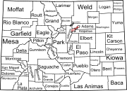
The U.S
state of Colorado
is divided into 64 counties
. Counties are important units of government in Colorado since the state has no secondary civil subdivisions, such as township
s. Two of these counties, the City and County of Denver and the City and County of Broomfield
, have consolidated city and county governments
.
 The following sortable table lists the 64 counties of the state of Colorado with the following information:
of the Territory of New Mexico, the Territory of Utah, the Territory of Kansas, and the extralegal Territory of Jefferson that previously existed within the boundaries of the present State of Colorado
, as well as the three defunct counties of the Territory of Colorado and the three defunct counties of the State of Colorado
. The table includes the following information:
No organized counties of the District of Louisiana
, the Territory of Missouri, the extralegal State of Deseret
, or the Territory of Nebraska existed within the present boundaries of the state of Colorado
.
United States
The United States of America is a federal constitutional republic comprising fifty states and a federal district...
state of Colorado
Colorado
Colorado is a U.S. state that encompasses much of the Rocky Mountains as well as the northeastern portion of the Colorado Plateau and the western edge of the Great Plains...
is divided into 64 counties
County (United States)
In the United States, a county is a geographic subdivision of a state , usually assigned some governmental authority. The term "county" is used in 48 of the 50 states; Louisiana is divided into parishes and Alaska into boroughs. Parishes and boroughs are called "county-equivalents" by the U.S...
. Counties are important units of government in Colorado since the state has no secondary civil subdivisions, such as township
Township
The word township is used to refer to different kinds of settlements in different countries. Township is generally associated with an urban area. However there are many exceptions to this rule. In Australia, the United States, and Canada, they may be settlements too small to be considered urban...
s. Two of these counties, the City and County of Denver and the City and County of Broomfield
Broomfield, Colorado
The City and County of Broomfield is a prominent suburb and tier of the Denver metropolitan area in the State of Colorado of the United States. Broomfield has a consolidated city and county government which operates under Article XX, Sections 10-13 of the Constitution of the State of Colorado. The...
, have consolidated city and county governments
Consolidated city-county
In United States local government, a consolidated city–county is a city and county that have been merged into one unified jurisdiction. As such it is simultaneously a city, which is a municipal corporation, and a county, which is an administrative division of a state...
.
Table
- The official name of the county,
- The date the county was established,
- The county seatCounty seatA county seat is an administrative center, or seat of government, for a county or civil parish. The term is primarily used in the United States....
, - The rank among the 64 counties of Colorado by population as of April 1, 2010, as counted by the 2010 United States Census,
- The county population as of April 1, 2010, as counted by the 2010 United States Census,
- The county population as of April 1, 2000, as counted by the 2000 United States Census,
- The percent population change from April 1, 2000, to April 1, 2010,
- A link to a detailed transportation map of the county.
- The average population density of the county,
- The land area of the county,
- The water area of the county,
- The total area of the county,
- The maximum surface elevation in the county,
- The minimum surface elevation in the county,
- The reference latitudeLatitudeIn geography, the latitude of a location on the Earth is the angular distance of that location south or north of the Equator. The latitude is an angle, and is usually measured in degrees . The equator has a latitude of 0°, the North pole has a latitude of 90° north , and the South pole has a...
of the county, and - The reference longitudeLongitudeLongitude is a geographic coordinate that specifies the east-west position of a point on the Earth's surface. It is an angular measurement, usually expressed in degrees, minutes and seconds, and denoted by the Greek letter lambda ....
of the county.
| County | Date Established | County Seat | Pop Rank | 2010 Census | 2000 Census | Pop Change | Map | Pop Density | Land Area | Water Area | Total Area | Max Elev | Min Elev | Latitude | Longitude |
|---|---|---|---|---|---|---|---|---|---|---|---|---|---|---|---|
| Adams County Adams County, Colorado Adams County is the fifth most populous of the 64 counties of the state of Colorado of the United States. The United States Census Bureau estimates that the county population was 441,603 in 2010 census, a 21.4% increase since 2000 census. Adams County is named for Alva Adams, Governor of the... |
1902-11-15 | Brighton Brighton, Colorado Brighton is a Home Rule Municipality in Adams and Weld counties in the U.S. state of Colorado, and the county seat of Adams County. The United States Census Bureau estimates that the city population was 31,380 in 2008.-Geography:... |
map 378.20 mi-2 146.02 km-2 1,167.653 mi2 3,024.208 km2 16.243 mi2 42.070 km2 1,183.897 mi2 3,066.278 km2 5,668 ft 1728 m 4,432 ft 1351 m |
39.8743252° N | 104.3318718° W | ||||||||||
| Alamosa County Alamosa County, Colorado Alamosa County is one of the 64 counties of the state of Colorado of the United States. The county name is the Spanish language word for a "grove of cottonwood trees." The county population was 14,966 at U.S. Census 2000... |
1913-03-08 | Alamosa Alamosa, Colorado The city of Alamosa is a Home Rule Municipality that is the county seat and the most populous city of Alamosa County, Colorado, United States. The United States Census Bureau estimates that the city population was 8,682 in 2005... |
map 21.37 mi-2 8.25 km-2 722.643 mi2 1,871.637 km2 0.698 mi2 1.808 km2 723.341 mi2 1,873.445 km2 14,351 ft 4374 m 6,387 ft 1947 m |
37.5684423° N | 105.7880414° W | ||||||||||
| Arapahoe County Arapahoe County, Colorado As of the census of 2000, there were 487,967 people, 190,909 households, and 125,809 families residing in the county. The population density was 608 people per square mile . There were 196,835 housing units at an average density of 245 per square mile... |
1861-11-01 | Littleton Littleton, Colorado Littleton is a Home Rule Municipality contained in Arapahoe, Douglas, and Jefferson counties in the U.S. state of Colorado. Littleton is a suburb of the Denver-Aurora Metropolitan Statistical Area. Littleton is the county seat of Arapahoe County and the 20th most populous city in the state of... |
map 716.71 mi-2 276.72 km-2 798.100 mi2 2,067.070 km2 7.337 mi2 19.004 km2 805.438 mi2 2,086.074 km2 6,218 ft 1895 m 4,730 ft 1442 m |
39.6446318° N | 104.3317329° W | ||||||||||
| Archuleta County Archuleta County, Colorado Archuleta County is one of the 64 counties of the state of Colorado of the United States. The United States Census Bureau estimates that the county population was 12,386 in 2006, a 25.14% increase since U.S. Census 2000... |
1885-04-14 | Pagosa Springs Pagosa Springs, Colorado Pagosa Springs is a Home Rule Municipality that is the county seat of, and the only incorporated municipality in, Archuleta County, Colorado, United States. The population was 1,591 at the 2000 census... |
map 8.95 mi-2 3.46 km-2 1,350.175 mi2 3,496.938 km2 5.339 mi2 13.828 km2 1,355.514 mi2 3,510.765 km2 13,308 ft 4056 m 6,085 ft 1855 m |
37.2023952° N | 107.0508634° W | ||||||||||
| Baca County Baca County, Colorado Baca County is the southeasternmost of the 64 counties of the state of Colorado of the United States. The county population was 4,517 at U.S. Census 2000. The county seat is Springfield.- History :... |
1889-04-16 | Springfield Springfield, Colorado The historic town of Springfield is a Statutory Town that is the county seat and most populous town of Baca County, Colorado, United States. The population was 1,562 at the 2000 census. The town was named for Springfield, Missouri, the origin of early settlers to the town... |
map 1.48 mi-2 0.57 km-2 2,554.967 mi2 6,617.334 km2 2.372 mi2 6.142 km2 2,557.338 mi2 6,623.476 km2 5,293 ft 1613 m 3,458 ft 1054 m |
37.3031437° N | 102.5354566° W | ||||||||||
| Bent County Bent County, Colorado Bent County is one of the 64 counties of the state of Colorado of the United States. The county is named in honor of frontier trader William Bent. The county population was 5,998 at U.S. Census 2000... |
1870-02-11 | Las Animas Las Animas, Colorado 200px|right|thumb|St. Mary's [[Catholic]] Church in Las AnimasThe city of Las Animas is a Statutory City that is the county seat of, and the only incorporated municipality in, Bent County, Colorado, United States. The population was 2,410 at the 2010 census. Las Animas, located in southeast... |
map 4.30 mi-2 1.66 km-2 1,512.861 mi2 3,918.292 km2 28.222 mi2 73.094 km2 1,541.083 mi2 3,991.386 km2 4,857 ft 1481 m 3,671 ft 1119 m |
37.9318907° N | 103.0775841° W | ||||||||||
| Boulder County Boulder County, Colorado Boulder County is the sixth most populous of the 64 counties of the state of Colorado of the United States. The county seat is Boulder. The most populous municipality in the county and the county seat is the City of Boulder... |
1861-11-01 | Boulder Boulder, Colorado Boulder is the county seat and most populous city of Boulder County and the 11th most populous city in the U.S. state of Colorado. Boulder is located at the base of the foothills of the Rocky Mountains at an elevation of... |
map 405.58 mi-2 156.59 km-2 726.289 mi2 1,881.080 km2 14.081 mi2 36.469 km2 740.370 mi2 1,917.549 km2 14,259 ft 4346 m 4,717 ft 1438 m |
40.0948262° N | 105.3983824° W | ||||||||||
| Broomfield City and County Broomfield, Colorado The City and County of Broomfield is a prominent suburb and tier of the Denver metropolitan area in the State of Colorado of the United States. Broomfield has a consolidated city and county government which operates under Article XX, Sections 10-13 of the Constitution of the State of Colorado. The... |
2001-11-15 | Broomfield Broomfield, Colorado The City and County of Broomfield is a prominent suburb and tier of the Denver metropolitan area in the State of Colorado of the United States. Broomfield has a consolidated city and county government which operates under Article XX, Sections 10-13 of the Constitution of the State of Colorado. The... |
map 1691.87 mi-2 653.23 km-2 33.034 mi2 85.558 km2 0.566 mi2 1.466 km2 33.600 mi2 87.024 km2 5,848 ft 1783 m 4,691 ft 1430 m |
39.9533825° N | 105.0521250° W | ||||||||||
| Chaffee County Chaffee County, Colorado Chaffee County is one of the 64 counties of the state of Colorado of the United States. The county population was 16,242 at U.S. Census 2000. The county seat is Salida.-History:... |
1879-02-10 | Salida Salida, Colorado The City of Salida is a Statutory City that is the county seat and most populous city of Chaffee County, Colorado, United States. The population was 5,504 at the U.S. Census 2000.-History:800px|thumb|left| Panoramic View of Salida, 1910... |
map 17.57 mi-2 6.79 km-2 1,013.403 mi2 2,624.702 km2 1.550 mi2 4.013 km2 1,014.953 mi2 2,628.716 km2 14,427 ft 4397 m 5,298 ft 1615 m |
38.7382457° N | 106.3169723° W | ||||||||||
| Cheyenne County Cheyenne County, Colorado Cheyenne County is the fifth least densely populated of the 64 counties of the state of Colorado of the United States. The county population was 2,231 at U.S. Census 2000... |
1889-03-25 | Cheyenne Wells Cheyenne Wells, Colorado Cheyenne Wells is a Statutory Town that is the county seat and most populous town of Cheyenne County, Colorado, United States. The population was 1,010 at the 2000 census.J. L... |
map 1.03 mi-2 0.40 km-2 1,778.276 mi2 4,605.713 km2 3.153 mi2 8.166 km2 1,781.429 mi2 4,613.879 km2 5,257 ft 1602 m 3,740 ft 1140 m |
38.8353865° N | 102.6045852° W | ||||||||||
| Clear Creek County Clear Creek County, Colorado Clear Creek County is one of the 64 counties of the state of Colorado of the United States. The county population was 9,322 at U.S. Census 2000. The county seat is Georgetown... |
1861-11-01 | Georgetown Georgetown, Colorado The historic town of Georgetown is a Territorial Charter Municipality that is the county seat of Clear Creek County, Colorado, United States. The former silver mining camp along Clear Creek in the Front Range of the Rocky Mountains was established in 1859 during the Pike's Peak Gold Rush... |
map 22.99 mi-2 8.88 km-2 395.227 mi2 1,023.633 km2 1.266 mi2 3.280 km2 396.493 mi2 1,026.913 km2 14,278 ft 4352 m 5,075 ft 1547 m |
39.6894025° N | 105.6707908° W | ||||||||||
| Conejos County Conejos County, Colorado Conejos County is one of the 64 counties of the State of Colorado in the United States. The county population was 8,400 at U.S. Census 2000. The county seat is the unincorporated town of Conejos.-History:... |
1861-11-07 | Conejos Conejos, Colorado Conejos is a census-designated place, a U.S. Post Office, and the county seat of Conejos County, Colorado, United States. Conejos has the distinction of being the only unincorporated county seat in the State of Colorado. As of the 2010 Census, the CDP had a population of 58. The community is... |
map 6.41 mi-2 2.48 km-2 1,287.391 mi2 3,334.326 km2 3.566 mi2 9.235 km2 1,290.956 mi2 3,343.561 km2 13,179 ft 4017 m 7,404 ft 2257 m |
37.2134065° N | 106.1764473° W | ||||||||||
| Costilla County Costilla County, Colorado Costilla County is the ninth least populous of the 64 counties in the state of Colorado of the United States. The county population was 3,663 at U.S. Census 2000. The county seat is San Luis, the oldest town in Colorado.- History :... |
1861-11-01 | San Luis San Luis, Colorado The Town of San Luis is a statutory town that is the county seat and the most populous town of Costilla County, Colorado, United States. The population was 739 at the 2000 census.-History:... |
map 2.87 mi-2 1.11 km-2 1,226.952 mi2 3,177.790 km2 3.409 mi2 8.829 km2 1,230.360 mi2 3,186.619 km2 14,351 ft 4374 m 7,375 ft 2248 m |
37.2775474° N | 105.4289399° W | ||||||||||
| Crowley County Crowley County, Colorado Crowley County is one of the 64 counties of the State of Colorado of the United States. The county population was 5,518 at U.S. Census 2000. The county seat is Ordway.- History :... |
1911-05-29 | Ordway Ordway, Colorado The Town of Ordway is a Statutory Town that is the county seat and most populous town of Crowley County, Colorado, United States. The population was 1,248 at the U.S... |
map 7.40 mi-2 2.86 km-2 787.421 mi2 2,039.411 km2 12.908 mi2 33.430 km2 800.329 mi2 2,072.842 km2 5,228 ft 1593 m 3,966 ft 1209 m |
38.3219558° N | 103.7875617° W | ||||||||||
| Custer County Custer County, Colorado Custer County is the tenth least populous of the 64 counties of the State of Colorado of the United States. The county population was 3,503 at U.S. Census 2000. The county seat is Westcliffe.- History :... |
1877-03-09 | Westcliffe Westcliffe, Colorado -Nonprofit Cultural Groups:* * * * * -Media:* * * -External links:***... |
map 5.76 mi-2 2.22 km-2 738.625 mi2 1,913.031 km2 1.299 mi2 3.365 km2 739.925 mi2 1,916.396 km2 14,246 ft 4342 m 4,547 ft 1386 m |
38.1019939° N | 105.3735148° W | ||||||||||
| Delta County Delta County, Colorado Delta County is the 17th most populous of the 64 counties of the State of Colorado of the United States. The county population was 27,834 in the 2000 U.S. Census. The county seat is the City of Delta... |
1883-02-11 | Delta Delta, Colorado The City of Delta is the county seat and the most populous city of Delta County, Colorado, United States. The population was 8,915 at the 2010 census... |
map 27.10 mi-2 10.46 km-2 1,142.050 mi2 2,957.897 km2 6.549 mi2 16.961 km2 1,148.599 mi2 2,974.858 km2 11,396 ft 3474 m 4,763 ft 1452 m |
38.8617559° N | 107.8647570° W | ||||||||||
| Denver City and County | 1902-11-15 | Denver |
map 3922.60 mi-2 1514.52 km-2 153.000 mi2 396.269 km2 1.631 mi2 4.225 km2 154.632 mi2 400.494 km2 5,688 ft 1734 m 4,803 ft 1464 m |
39.7618487° N | 104.8806251° W | ||||||||||
| Dolores County Dolores County, Colorado Dolores County is the seventh least populous of the 64 counties of the State of Colorado of the United States. The county population was 1,844 at U.S. Census 2000. The county seat is Dove Creek.- History :... |
1881-03-04 | Dove Creek Dove Creek, Colorado The Town of Dove Creek is a Statutory Town that is the county seat and the most populous town of Dolores County, Colorado, United States. Dove Creek is the self-proclaimed Pinto Bean Capital of the World... |
map 1.93 mi-2 0.75 km-2 1,067.051 mi2 2,763.650 km2 1.049 mi2 2.716 km2 1,068.100 mi2 2,766.366 km2 14,252 ft 4344 m 4,911 ft 1497 m |
37.7476020° N | 108.5303829° W | ||||||||||
| Douglas County Douglas County, Colorado Douglas County is the eighth most populous of the 64 counties of the state of Colorado, in the United States. The county is located midway between Colorado's two largest cities: Denver and Colorado Springs... |
1861-11-01 | Castle Rock Castle Rock, Colorado The Town of Castle Rock is the county seat of Douglas County, Colorado, United States and is named for the prominent castle tower-shaped butte near the center of town. It is part of Colorado's Front Range Urban Corridor and is located roughly 28 miles south of Denver and 37 miles north of... |
map 339.74 mi-2 131.17 km-2 840.248 mi2 2,176.232 km2 2.621 mi2 6.789 km2 842.869 mi2 2,183.022 km2 9,836 ft 2998 m 5,242 ft 1598 m |
39.3264348° N | 104.9261993° W | ||||||||||
| Eagle County Eagle County, Colorado Eagle County is the thirteenth most populous of the 64 counties of the State of Colorado in the United States. The county is named for the Eagle River. The county population was 41,659 at U.S. Census 2000. The county seat is the Town of Eagle... |
1883-02-11 | Eagle Eagle, Colorado Eagle is a Statutory Town in and the county seat of Eagle County, Colorado, United States. The population was 3,032 at the 2000 census.The town was made famous as the location of the Kobe Bryant sexual assault trial.-Demographics:... |
map 30.99 mi-2 11.96 km-2 1,684.530 mi2 4,362.912 km2 7.261 mi2 18.806 km2 1,691.791 mi2 4,381.718 km2 14,011 ft 4271 m 6,220 ft 1896 m |
39.6306381° N | 106.6929439° W | ||||||||||
| El Paso County El Paso County, Colorado El Paso County is the most populous of the 64 counties of the state of Colorado of the United States, now more populous than Denver County. The United States Census Bureau concluded that the county population was 622,371 in 2010. In recent years, the population had come closer to that of Denver... |
1861-11-01 | Colorado Springs Colorado Springs, Colorado Colorado Springs is a Home Rule Municipality that is the county seat and most populous city of El Paso County, Colorado, United States. Colorado Springs is located in South-Central Colorado, in the southern portion of the state. It is situated on Fountain Creek and is located south of the Colorado... |
map 292.58 mi-2 112.97 km-2 2,126.801 mi2 5,508.390 km2 2.746 mi2 7.112 km2 2,129.547 mi2 5,515.501 km2 14,115 ft 4302 m 5,055 ft 1541 m |
38.8273831° N | 104.5274718° W | ||||||||||
| Elbert County Elbert County, Colorado Elbert County is the 21st most populous of the 64 counties of the State of Colorado of the United States. The county population was 19,872 at U.S. Census 2000. The county seat is Kiowa... |
1874-02-02 | Kiowa Kiowa, Colorado The Town of Kiowa is a Home Rule Municipality that is the county seat of Elbert County, Colorado, United States. The town population was 581 at the U.S... |
map 12.47 mi-2 4.82 km-2 1,850.847 mi2 4,793.671 km2 0.171 mi2 0.442 km2 1,851.018 mi2 4,794.113 km2 7,374 ft 2248 m 4,580 ft 1396 m |
39.3108167° N | 104.1179275° W | ||||||||||
| Fremont County Fremont County, Colorado Fremont County is the thirteenth most populous of the 64 counties of the state of Colorado of the United States. The county is named for explorer and presidential candidate John C. Frémont. The county population was 46,824 at the 2010 census. The county seat is Cañon City. The Cañon City... |
1861-11-01 | Cañon City Cañon City, Colorado The City of Cañon City is a Home Rule Municipality that is the county seat and the most populous city of Fremont County, State of Colorado. The United States Census Bureau estimated that the city population was 16,000 in 2005. Cañon City is noted for being the location of nine state and four ... |
map 30.54 mi-2 11.79 km-2 1,533.068 mi2 3,970.627 km2 0.863 mi2 2.235 km2 1,533.931 mi2 3,972.863 km2 13,110 ft 3996 m 4,573 ft 1394 m |
38.4556576° N | 105.4214383° W | ||||||||||
| Garfield County Garfield County, Colorado Garfield County is the eighth most extensive and the twelfth most populous of the 64 counties of the State of Colorado of the United States. The county population was 43,791 at U.S. Census 2000. The county is named in honor of United States President James A. Garfield... |
1883-02-10 | Glenwood Springs Glenwood Springs, Colorado The City of Glenwood Springs is a Home Rule Municipality that is the county seat and the most populous city of Garfield County, Colorado, United States. The United States Census Bureau estimated that the city population was 8,564 in 2005... |
map 19.13 mi-2 7.39 km-2 2,947.563 mi2 7,634.154 km2 8.274 mi2 21.431 km2 2,955.838 mi2 7,655.584 km2 12,361 ft 3768 m 4,471 ft 1363 m |
39.5993517° N | 107.9097801° W | ||||||||||
| Gilpin County Gilpin County, Colorado Gilpin County is the second least extensive of the 64 counties of the State of Colorado of the United States. Gilpin County was named after Colonel William Gilpin, the first Governor of the Territory of Colorado. The county population was 4,757 at U.S. Census 2000. The county seat is Central City... |
1861-11-01 | Central City Central City, Colorado Central City is a home rule municipality in Clear Creek and Gilpin counties in the U.S. state of Colorado, and the county seat of Gilpin County. The city population was 515 in the 2000 United States Census... |
map 36.30 mi-2 14.01 km-2 149.896 mi2 388.229 km2 0.364 mi2 0.942 km2 150.260 mi2 389.171 km2 13,300 ft 4054 m 4,983 ft 1519 m |
39.8610823° N | 105.5289473° W | ||||||||||
| Grand County Grand County, Colorado Grand County is the 21st largest of the 64 counties of the State of Colorado of the United States. The county population was 12,442 at U.S. Census 2000... |
1874-02-02 | Hot Sulphur Springs Hot Sulphur Springs, Colorado The Town of Hot Sulphur Springs is a Statutory Town that is the county seat of Grand County, Colorado, United States. The town population was 521 at the U.S. Census 2000 and is at an elevation of 7,680 feet .-History:... |
map 8.04 mi-2 3.10 km-2 1,846.330 mi2 4,781.972 km2 23.263 mi2 60.250 km2 1,869.592 mi2 4,842.222 km2 13,559 ft 4133 m 6,040 ft 1841 m |
40.1232891° N | 106.0958757° W | ||||||||||
| Gunnison County Gunnison County, Colorado Gunnison County is the fifth most extensive of the 64 counties of the state of Colorado in the United States. The county population was 15,324 at the 2010 census. The county was named for John W. Gunnison, a United States Army officer and captain in the Army Topographical Engineers, who surveyed... |
1877-03-09 | Gunnison Gunnison, Colorado The historic City of Gunnison, a Home Rule Municipality, is the county seat and the most populous city of Gunnison County, Colorado, United States. As of the 2010 census, the city had a population of 5,854. It was named in honor of John W... |
map 4.73 mi-2 1.83 km-2 3,239.099 mi2 8,389.229 km2 20.530 mi2 53.172 km2 3,259.629 mi2 8,442.401 km2 14,279 ft 4352 m 7,178 ft 2188 m |
38.6696792° N | 107.0781080° W | ||||||||||
| Hinsdale County Hinsdale County, Colorado Hinsdale County is the least densely populated of the 64 counties of the State of Colorado of the United States. The county population was 790 at U.S. Census 2000. The county seat and the only municipality in the county is the Town of Lake City. Hinsdale County is named for George A. Hinsdale, a... |
1874-02-10 | Lake City Lake City, Colorado The Town of Lake City is a Statutory Town that is the county seat of, and the only incorporated municipality in, Hinsdale County, Colorado, United States. The town population was 375 at the U.S. Census 2000... |
map 0.75 mi-2 0.29 km-2 1,117.251 mi2 2,893.668 km2 5.917 mi2 15.325 km2 1,123.168 mi2 2,908.992 km2 14,321 ft 4365 m 7,299 ft 2225 m |
37.8116248° N | 107.3834054° W | ||||||||||
| Huerfano County Huerfano County, Colorado Huerfano County is one of the 64 counties of the State of Colorado of the United States. The county was named for the Huerfano Butte, a local landmark. The county population was 7,862 at U.S. Census 2000... |
1861-11-01 | Walsenburg Walsenburg, Colorado The City of Walsenburg or Los Leones is a Statutory City that is the county seat and the most populous city of Huerfano County, Colorado, United States... |
map 4.22 mi-2 1.63 km-2 1,591.001 mi2 4,120.673 km2 2.236 mi2 5.792 km2 1,593.237 mi2 4,126.465 km2 14,326 ft 4366 m 4,445 ft 1355 m |
37.6878154° N | 104.9599278° W | ||||||||||
| Jackson County Jackson County, Colorado Jackson County is the fourth-least densely populated of the Colorado 64 counties of the U.S. state of Colorado. The county population was 1,577 at the 2000 Census. The county seat and the only municipality in the county is the Town of Walden.- History :... |
1909-05-05 | Walden Walden, Colorado The Town of Walden is a Statutory Town that is the county seat of, and the only incorporated municipality in, Jackson County, Colorado, United States. It is situated in the center of a large open valley called North Park. People from Walden and the surrounding area refer to themselves as "North... |
map 0.86 mi-2 0.33 km-2 1,613.723 mi2 4,179.523 km2 7.239 mi2 18.750 km2 1,620.962 mi2 4,198.273 km2 12,954 ft 3948 m 4,865 ft 1483 m |
40.6634319° N | 106.3292476° W | ||||||||||
| Jefferson County Jefferson County, Colorado Jefferson County , whose slogan is the "Gateway to the Rocky Mountains", is the fourth most populous of the 64 counties of the State of Colorado of the United States. Located along the Front Range of the Rocky Mountains, Jefferson County is adjacent to the west side of the state capital, Denver.... |
1861-11-01 | Golden Golden, Colorado The City of Golden is a home rule municipality that is the county seat of Jefferson County, Colorado, United States. Golden lies along Clear Creek at the edge of the foothills of the Front Range of the Rocky Mountains. Founded during the Pike's Peak Gold Rush on 16 June 1859, the mining camp was... |
map 699.47 mi-2 270.07 km-2 764.208 mi2 1,979.290 km2 9.825 mi2 25.446 km2 774.033 mi2 2,004.736 km2 11,589 ft 3532 m 4,986 ft 1520 m |
39.5864595° N | 105.2456005° W | ||||||||||
| Kiowa County Kiowa County, Colorado Kiowa County is the second least densely populated of the 64 counties of the State of Colorado of the United States. The county population was 1,622 at the 2000 census. The county seat is Eads... |
1889-04-11 | Eads Eads, Colorado The Town of Eads is a Statutory Town that is the county seat and the most populous town of Kiowa County, Colorado, United States. The town population was 747 at the 2000 census... |
map 0.79 mi-2 0.31 km-2 1,767.767 mi2 4,578.496 km2 18.160 mi2 47.033 km2 1,785.927 mi2 4,625.529 km2 4,697 ft 1432 m 3,687 ft 1124 m |
38.3884664° N | 102.7562096° W | ||||||||||
| Kit Carson County Kit Carson County, Colorado Kit Carson County is the 18th most extensive of the 64 counties of the State of Colorado of the United States. The county population was 8,011 at U.S. Census 2000. The county was named for Kit Carson... |
1889-04-11 | Burlington Burlington, Colorado Burlington is a Home Rule Municipality, county seat, most populous place and only city in Kit Carson County, Colorado, United States. Its population was 4191 at the U.S. Census 2010... |
map 3.83 mi-2 1.48 km-2 2,160.822 mi2 5,596.502 km2 0.869 mi2 2.252 km2 2,161.691 mi2 5,598.754 km2 5,297 ft 1615 m 3,523 ft 1074 m |
39.3053399° N | 102.6030226° W | ||||||||||
| La Plata County La Plata County, Colorado La Plata County is the fourteenth most populous of the 64 counties of the State of Colorado of the United States. The county was named for the La Plata River and the La Plata Mountains. "La plata" is the Spanish language word for "silver". The United States Census Bureau estimated that the... |
1874-02-10 | Durango Durango, Colorado The City of Durango is a Home Rule Municipality that is the county seat and the most populous city of La Plata County, Colorado, United States. The United States Census Bureau said that the city population was 16,887 in 2010 census.-History:... |
map 30.34 mi-2 11.71 km-2 1,692.078 mi2 4,382.463 km2 7.629 mi2 19.760 km2 1,699.708 mi2 4,402.223 km2 14,093 ft 4296 m 4,268 ft 1301 m |
37.2873673° N | 107.8397178° W | ||||||||||
| Lake County Lake County, Colorado Lake County is one of the 64 counties of the State of Colorado of the United States. The highest natural point in Colorado and the entire Rocky Mountains is the summit of Mount Elbert in Lake County at 14,440 feet elevation. The county population was 7,812 at U.S. Census 2000. The county seat... |
1861-11-01 | Leadville Leadville, Colorado Leadville is a Statutory City that is the county seat of, and the only municipality in, Lake County, Colorado, United States. Situated at an elevation of , Leadville is the highest incorporated city and the second highest incorporated municipality in the United States... |
map 19.39 mi-2 7.49 km-2 376.911 mi2 976.194 km2 6.998 mi2 18.124 km2 383.909 mi2 994.319 km2 14,440 ft 4401 m 8,720 ft 2658 m |
39.2043161° N | 106.3496959° W | ||||||||||
| Larimer County Larimer County, Colorado Larimer County is the seventh most populous and the ninth most extensive of the 64 counties of the State of Colorado of the United States. The county is located at the northern end of the Front Range, at the edge of the Colorado Eastern Plains along the border with Wyoming... |
1861-11-01 | Fort Collins Fort Collins, Colorado Fort Collins is a Home Rule Municipality situated on the Cache La Poudre River along the Colorado Front Range, and is the county seat and most populous city of Larimer County, Colorado, United States. Fort Collins is located north of the Colorado State Capitol in Denver. With a 2010 census... |
map 115.42 mi-2 44.56 km-2 2,596.002 mi2 6,723.613 km2 37.952 mi2 98.295 km2 2,633.954 mi2 6,821.909 km2 13,573 ft 4137 m 4,557 ft 1389 m |
40.6630912° N | 105.4821309° W | ||||||||||
| Las Animas County Las Animas County, Colorado Las Animas County has the largest area of the 64 counties of the State of Colorado of the United States. Las Animas County takes its name from the Mexican Spanish name of the Purgatoire River, originally called El Río de las Ánimas Perdidas en Purgatorio, which means "River of the Lost Souls in... |
1866-02-09 | Trinidad Trinidad, Colorado The historic City of Trinidad is a Home Rule Municipality that is the county seat and the most populous city of Las Animas County, Colorado, United States... |
map 3.25 mi-2 1.25 km-2 4,772.671 mi2 12,361.162 km2 2.676 mi2 6.930 km2 4,775.347 mi2 12,368.092 km2 13,631 ft 4155 m 4,317 ft 1316 m |
37.3188308° N | 104.0441103° W | ||||||||||
| Lincoln County Lincoln County, Colorado Lincoln County is the tenth most extensive of the 64 counties of the State of Colorado of the United States. The county population was 6,087 at U.S. Census 2000... |
1889-04-11 | Hugo Hugo, Colorado The Town of Hugo is a Statutory Town that is the county seat of Lincoln County, Colorado, United States. The town population was 885 at the U.S... |
map 2.12 mi-2 0.82 km-2 2,577.626 mi2 6,676.021 km2 8.796 mi2 22.781 km2 2,586.422 mi2 6,698.802 km2 5,973 ft 1821 m 3,923 ft 1196 m |
38.9937401° N | 103.5075545° W | ||||||||||
| Logan County Logan County, Colorado Logan County is the 23rd most extensive of the 64 counties of the State of Colorado of the United States. The county was named for General John A. Logan. The county population was 20,504 at U.S. Census 2000. The county seat is Sterling... |
1887-02-25 | Sterling Sterling, Colorado The City of Sterling is a Home Rule Municipality that is the county seat and the most populous city of Logan County, Colorado, United States. The city population was 14,777 at the 2010 census.-Geography:Sterling is located at... |
map 12.35 mi-2 4.77 km-2 1,838.546 mi2 4,761.813 km2 6.318 mi2 16.364 km2 1,844.864 mi2 4,778.177 km2 4,947 ft 1508 m 3,428 ft 1045 m |
40.7280911° N | 103.0904639° W | ||||||||||
| Mesa County Mesa County, Colorado Mesa County is the fourth most extensive and the eleventh most populous of the 64 counties of the state of Colorado in the United States. The county was named for the many large mesas in the area, including Grand Mesa. The county population was 146,723 at the 2010 United States Census. The... |
1883-02-14 | Grand Junction Grand Junction, Colorado The City of Grand Junction is the largest city in western Colorado. It is a city with a council–manager government form that is the county seat and the most populous city of Mesa County, Colorado, United States. Grand Junction is situated west-southwest of the Colorado State Capitol in Denver. As... |
map 44.07 mi-2 17.02 km-2 3,328.974 mi2 8,622.003 km2 12.149 mi2 31.467 km2 3,341.123 mi2 8,653.470 km2 11,236 ft 3425 m 4,337 ft 1322 m |
39.0194924° N | 108.4618366° W | ||||||||||
| Mineral County Mineral County, Colorado Mineral County is the second least populous of the 64 counties of the State of Colorado of the United States. The county was named for the many valuable minerals found in the mountains and streams of the area. The county population was 831 at U.S. Census 2000... |
1893-03-27 | Creede Creede, Colorado The historic town of Creede is a Statutory Town that is the county seat of, and the only incorporated municipality in, Mineral County, Colorado, United States. The town population was 377 at the U.S. Census 2000.-History:... |
map 0.81 mi-2 0.31 km-2 875.666 mi2 2,267.966 km2 2.016 mi2 5.222 km2 877.683 mi2 2,273.188 km2 13,902 ft 4237 m 7,549 ft 2301 m |
37.6514782° N | 106.9322997° W | ||||||||||
| Moffat County Moffat County, Colorado Moffat County is the northwesternmost and the second most extensive of the 64 counties of the State of Colorado of the United States. The county population was 13,184 at U.S. Census 2000. The county seat is Craig.- History :... |
1911-02-27 | Craig Craig, Colorado The City of Craig is a Home Rule Municipality that is the county seat and the most populous city of Moffat County, Colorado, United States. The population was 9,189 at the 2000 census... |
map 2.91 mi-2 1.12 km-2 4,743.290 mi2 12,285.065 km2 7.622 mi2 19.742 km2 4,750.912 mi2 12,304.807 km2 10,840 ft 3304 m 4,993 ft 1522 m |
40.5739839° N | 108.2045214° W | ||||||||||
| Montezuma County Montezuma County, Colorado Montezuma County is the southwesternmost of the 64 counties of the state of Colorado of the United States. The county population was 23,830 at U.S. Census 2000... |
1889-04-16 | Cortez Cortez, Colorado The city of Cortez is a Home Rule Municipality that is the county seat and the most populous city of Montezuma County, Colorado, United States. The city population was 8,482 at the 2010 census... |
map 12.58 mi-2 4.86 km-2 2,029.527 mi2 5,256.451 km2 10.624 mi2 27.517 km2 2,040.151 mi2 5,283.968 km2 13,237 ft 4035 m 4,639 ft 1414 m |
37.3380246° N | 108.5957863° W | ||||||||||
| Montrose County Montrose County, Colorado Montrose County is the 17th most populous of the 64 counties of the State of Colorado of the United States. The county population was 41,276 at U.S. Census 2010. The county was named for its county seat, the City of Montrose... |
1883-02-11 | Montrose Montrose, Colorado The City of Montrose is a Home Rule Municipality that is the county seat and the most populous city of Montrose County, Colorado, United States. The United States Census Bureau estimates that the city population was 15,479 in 2005. The main road that leads in and out of Montrose is U.S... |
map 18.42 mi-2 7.11 km-2 2,240.695 mi2 5,803.373 km2 1.901 mi2 4.923 km2 2,242.596 mi2 5,808.296 km2 11,453 ft 3491 m 4,711 ft 1436 m |
38.4134267° N | 108.2630424° W | ||||||||||
| Morgan County Morgan County, Colorado Morgan County is the 18th most populous of the 64 counties of the State of Colorado of the United States. The county was named after old Fort Morgan, which in turn was named in honor of Colonel Christopher A. Morgan. The county population was 27,171 at U.S. Census 2000. The county seat is the... |
1889-02-19 | Fort Morgan Fort Morgan, Colorado The City of Fort Morgan is a Home Rule Municipality that is the county seat and the most populous city of Morgan County, Colorado, United States. The United States Census Bureau estimated that the city population was 10,844 in 2005.-History:... |
map 21.99 mi-2 8.49 km-2 1,280.433 mi2 3,316.305 km2 13.310 mi2 34.474 km2 1,293.743 mi2 3,350.779 km2 4,937 ft 1505 m 3,989 ft 1216 m |
40.2623535° N | 103.8070921° W | ||||||||||
| Otero County Otero County, Colorado Otero County is one of the 64 counties of the State of Colorado of the United States. The county was named for Miguel Antonio Otero, one of the founders of the town of La Junta and a member of a prominent Hispanic family. The county population was 20,311 at U.S. Census 2000... |
1889-03-25 | La Junta La Junta, Colorado The City of La Junta is a Home Rule Municipality that is the county seat and the most populous city of Otero County, Colorado, United States. The city population was 7,568 at the U.S. Census 2000. La Junta is located on the Arkansas River in southeastern Colorado east of Pueblo.-History:During... |
map 14.92 mi-2 5.76 km-2 1,261.961 mi2 3,268.465 km2 7.742 mi2 20.052 km2 1,269.704 mi2 3,288.518 km2 5,273 ft 1607 m 3,809 ft 1161 m |
37.8841698° N | 103.7212597° W | ||||||||||
| Ouray County Ouray County, Colorado Ouray County is one of the 64 counties of the State of Colorado in the United States. The county population was 3,742 at U.S. Census 2000. As of 2010, U.S. Census data place the population at 4,436. The county seat is the City of Ouray... |
1877-01-18 | Ouray Ouray, Colorado The historic City of Ouray is a Home Rule Municipality that is the county seat and the most populous city of Ouray County, Colorado, United States. The city population was 813 at the U.S. Census 2000 and 1,000 as of the U.S. Census 2010... |
map 8.19 mi-2 3.16 km-2 541.593 mi2 1,402.719 km2 0.618 mi2 1.600 km2 542.210 mi2 1,404.318 km2 14,158 ft 4315 m 6,315 ft 1925 m |
38.1505999° N | 107.7671334° W | ||||||||||
| Park County Park County, Colorado Park County is the 17th most extensive of the 64 counties of the State of Colorado of the United States. The county was named after the large geographic region known as South Park, which was named by early fur traders and trappers in the area. The geographic center of the State of Colorado is... |
1861-11-01 | Fairplay Fairplay, Colorado The Town of Fairplay is a statutory town that is the county seat and the most populous town of Park County, Colorado, United States. Fairplay is located in South Park at an elevation of . The town is the fifth-highest incorporated place in the State of Colorado. The population was 610 at the... |
map 7.39 mi-2 2.85 km-2 2,193.846 mi2 5,682.034 km2 16.807 mi2 43.531 km2 2,210.653 mi2 5,725.565 km2 14,293 ft 4357 m 5,826 ft 1776 m |
39.1189141° N | 105.7176479° W | ||||||||||
| Phillips County Phillips County, Colorado Phillips County is one of the 64 counties of the State of Colorado of the United States. The county was named in honor of R.O. Phillips, a secretary of the Lincoln Land Company, who organized several towns in Colorado. The county population was 4,480 at U.S. Census 2000... |
1889-03-27 | Holyoke Holyoke, Colorado The City of Holyoke is a Home Rule Municipality that is the county seat and the most populous city of Phillips County, Colorado, United States. The city population was 2,261 at the 2000 census.-Geography:Holyoke is located at .... |
map 6.46 mi-2 2.49 km-2 687.928 mi2 1,781.725 km2 0.117 mi2 0.302 km2 688.044 mi2 1,782.027 km2 4,117 ft 1255 m 3,582 ft 1092 m |
40.5947117° N | 102.3451047° W | ||||||||||
| Pitkin County Pitkin County, Colorado Pitkin County is one of the 64 counties of the State of Colorado of the United States. The county is named in honor of the late Colorado Governor Frederick Walker Pitkin. The county population was 14,872 at U.S. Census 2000. The county seat is Aspen... |
1881-02-23 | Aspen Aspen, Colorado The City of Aspen is a Home Rule Municipality that is the county seat and the most populous city of Pitkin County, Colorado, United States. The United States Census Bureau estimates that the city population was 5,804 in 2005... |
map 17.67 mi-2 6.82 km-2 970.697 mi2 2,514.094 km2 2.498 mi2 6.469 km2 973.195 mi2 2,520.564 km2 14,279 ft 4352 m 5,695 ft 1736 m |
39.2175333° N | 106.9159433° W | ||||||||||
| Prowers County Prowers County, Colorado Prowers County is one of the 64 counties of the State of Colorado of the United States. The county is named in honor of John W. Prowers, a leading pioneer in the lower Arkansas valley region. The county population was 14,483 at U.S. Census 2000... |
1889-04-11 | Lamar Lamar, Colorado The City of Lamar is a Home Rule Municipality that is the county seat and the most populous city of Prowers County, Colorado, United States. The city population was 8,869 at the U.S... |
map 7.66 mi-2 2.96 km-2 1,638.394 mi2 4,243.422 km2 5.928 mi2 15.353 km2 1,644.322 mi2 4,258.775 km2 4,713 ft 1437 m 3,346 ft 1020 m |
37.9581814° N | 102.3921613° W | ||||||||||
| Pueblo County Pueblo County, Colorado Pueblo County is the tenth most populous of the 64 counties of the state of Colorado of the United States. The county was named for the historic city of Pueblo which took its name from the Spanish language word meaning "town" or "village". The United States Census Bureau estimates that the... |
1861-11-01 | Pueblo Pueblo, Colorado Pueblo is a Home Rule Municipality that is the county seat and the most populous city of Pueblo County, Colorado, United States. The population was 106,595 in 2010 census, making it the 246th most populous city in the United States.... |
map 66.66 mi-2 25.74 km-2 2,386.104 mi2 6,179.981 km2 11.691 mi2 30.280 km2 2,397.795 mi2 6,210.261 km2 12,352 ft 3765 m 4,291 ft 1308 m |
38.1706581° N | 104.4898925° W | ||||||||||
| Rio Blanco County Rio Blanco County, Colorado Rio Blanco County is the sixth most extensive of the 64 counties of the State of Colorado of the United States. The county population was 5,986 at U.S. Census 2000. The name of the county is the Spanish language name for the White River which runs through it... |
1889-03-25 | Meeker Meeker, Colorado The Town of Meeker is a Statutory Town that is the county seat and the most populous town of Rio Blanco County, Colorado, United States. The town population was 2,242 at the U.S. Census 2000. The town is largely an agricultural community, located in the wide fertile valley of the White River in... |
map 2.07 mi-2 0.80 km-2 3,220.933 mi2 8,342.179 km2 1.880 mi2 4.868 km2 3,222.813 mi2 8,347.047 km2 12,033 ft 3668 m 5,062 ft 1543 m |
39.9726062° N | 108.2006849° W | ||||||||||
| Rio Grande County Rio Grande County, Colorado Rio Grande County is one of the 64 counties of the State of Colorado of the United States. The county is named for the Rio Grande , which flows through the county. The county population was 12,413 at U.S. Census 2000... |
1874-02-10 | Del Norte Del Norte, Colorado The Town of Del Norte is a Statutory Town in and the county seat of Rio Grande County, Colorado, United States. The town population was 1,705 at the 2000 census.-Geography:Del Norte is located at .... |
map 13.14 mi-2 5.07 km-2 911.958 mi2 2,361.960 km2 0.380 mi2 0.984 km2 912.338 mi2 2,362.944 km2 13,209 ft 4026 m 7,467 ft 2276 m |
37.4857631° N | 106.4532135° W | ||||||||||
| Routt County Routt County, Colorado Routt County is the 15th most extensive of the 64 counties of the state of Colorado of the United States. The county population was 19,690 at U.S. Census 2000. The county seat is Steamboat Springs.- History :... |
1877-01-29 | Steamboat Springs Steamboat Springs, Colorado The city of Steamboat Springs is a Home Rule Municipality that is the county seat and the most populous city of Routt County, Colorado, United States. The city is also known as "Steamboat," "The Boat," or "Ski Town USA". As of the 2010 census, the city population was 12,088.The city is an... |
map 9.95 mi-2 3.84 km-2 2,362.026 mi2 6,117.619 km2 6.110 mi2 15.826 km2 2,368.136 mi2 6,133.445 km2 12,185 ft 3714 m 6,266 ft 1910 m |
40.4831597° N | 106.9852885° W | ||||||||||
| Saguache County Saguache County, Colorado Saguache County is the seventh most extensive of the 64 counties of the state of Colorado of the United States. The county name comes from a Ute language word meaning “blue earth” or “water at blue earth”. The county population was 5,917 at U.S. Census 2000... |
1866-12-29 | Saguache Saguache, Colorado The historic town of Saguache is a Statutory Town that is the county seat and most populous town of Saguache County, Colorado, United States. The population was 578 at the U.S. Census 2000.-Name:... |
map 1.93 mi-2 0.74 km-2 3,168.524 mi2 8,206.441 km2 1.720 mi2 4.455 km2 3,170.244 mi2 8,210.895 km2 14,300 ft 4359 m 6,013 ft 1833 m |
38.0339518° N | 106.2466749° W | ||||||||||
| San Juan County San Juan County, Colorado San Juan County is the least populous of the 64 counties of the state of Colorado in the United States. The county name is the Spanish language name for “Saint John”, the name Spanish explorers gave to a river and the mountain range in the area. The county population was 558 at U.S. Census 2000... |
1876-01-31 | Silverton Silverton, Colorado The town of Silverton is a Statutory Town that is the county seat of, and the only incorporated municipality in, San Juan County, Colorado, United States. Silverton is a former silver mining camp, most or all of which is now included in a federally designated National Historic Landmark District,... |
map 1.80 mi-2 0.70 km-2 387.488 mi2 1,003.588 km2 0.786 mi2 2.036 km2 388.274 mi2 1,005.624 km2 13,900 ft 4237 m 7,683 ft 2342 m |
37.7810745° N | 107.6702566° W | ||||||||||
| San Miguel County San Miguel County, Colorado San Miguel County is one of the 64 counties of the state of Colorado of the United States. The county is named for the San Miguel River. The county population was 6,594 at U.S. Census 2000... |
1883-03-02 | Telluride Telluride, Colorado The town of Telluride is the county seat and most populous town of San Miguel County in the southwestern portion of the U.S. state of Colorado. The town is a former silver mining camp on the San Miguel River in the western San Juan Mountains... |
map 5.72 mi-2 2.21 km-2 1,286.611 mi2 3,332.308 km2 2.013 mi2 5.214 km2 1,288.625 mi2 3,337.522 km2 14,023 ft 4274 m 5,308 ft 1618 m |
38.0093735° N | 108.4273260° W | ||||||||||
| Sedgwick County Sedgwick County, Colorado Sedgwick County is the northeasternmost of the 64 counties of the state of Colorado of the United States. The county was named for Fort Sedgwick, a military post along the Platte Trail, which was named for General John Sedgwick. The county population was 2,379 at U.S. 2010 Census... |
1889-04-09 | Julesburg Julesburg, Colorado The historic town of Julesburg is a statutory town that is the county seat of Sedgwick County, Colorado, United States. The town is located on the north side of the South Platte River. The population was 1,467 at the U.S. Census 2000... |
map 4.34 mi-2 1.68 km-2 548.041 mi2 1,419.419 km2 1.363 mi2 3.531 km2 549.404 mi2 1,422.950 km2 4,127 ft 1258 m 3,477 ft 1060 m |
40.8715679° N | 102.3553579° W | ||||||||||
| Summit County Summit County, Colorado Summit County is the 19th most populous of the 64 counties of the state of Colorado of the United States. The county population was 23,538 at U.S. Census 2000. The county seat is Breckenridge... |
1861-11-01 | Breckenridge Breckenridge, Colorado Established in 1859, the historic town of Breckenridge is a home rule municipality that is the county seat of Summit County, Colorado, United States. As of the 2010 Census, the town had a population of 4,540. The town also has many part-time residents, as many people have vacation homes in the area... |
map 46.02 mi-2 17.77 km-2 608.358 mi2 1,575.639 km2 10.920 mi2 28.283 km2 619.278 mi2 1,603.922 km2 14,278 ft 4352 m 7,460 ft 2274 m |
39.6210227° N | 106.1375545° W | ||||||||||
| Teller County Teller County, Colorado Teller County is the 22nd most populous of the 64 counties of the State of Colorado of the United States. The county population was 20,555 at U.S. Census 2000. The county seat is Cripple Creek, and the most populous city is Woodland Park... |
1899-03-23 | Cripple Creek Cripple Creek, Colorado The City of Cripple Creek is a Statutory City that is the county seat of Teller County, Colorado, United States. Cripple Creek is a former gold mining camp located southwest of Colorado Springs near the base of Pikes Peak. The Cripple Creek Historic District, which received National Historic... |
map 41.92 mi-2 16.18 km-2 557.055 mi2 1,442.767 km2 1.909 mi2 4.945 km2 558.965 mi2 1,447.712 km2 13,065 ft 3982 m 5,236 ft 1596 m |
38.8719937° N | 105.1825519° W | ||||||||||
| Washington County Washington County, Colorado Washington County is the 12th most extensive of the 64 counties of the State of Colorado of the United States. The county population was 4,926 at U.S. Census 2000. The county was named in honor of the United States President George Washington... |
1887-02-09 | Akron Akron, Colorado The Town of Akron is a Statutory Town that is the county seat and the most populous town of Washington County, in the U.S. State of Colorado. The town population was 1,702 at the U.S. Census 2010.- Geography :... |
map 1.91 mi-2 0.74 km-2 2,518.031 mi2 6,521.670 km2 5.872 mi2 15.207 km2 2,523.903 mi2 6,536.878 km2 5,433 ft 1656 m 3,910 ft 1192 m |
39.9654130° N | 103.2096046° W | ||||||||||
| Weld County Weld County, Colorado As of the census of 2000, there were 180,936 people, 63,247 households, and 45,221 families residing in the county. The population density was 45 people per square mile . There were 66,194 housing units at an average density of 17 per square mile... |
1861-11-01 | Greeley Greeley, Colorado The City of Greeley is a Home Rule Municipality that is the county seat and the most populous city of Weld County, Colorado, United States. Greeley is located in the region known as Northern Colorado. Greeley is situated north-northeast of the Colorado State Capitol in Denver. According to the... |
map 63.41 mi-2 24.48 km-2 3,987.238 mi2 10,326.899 km2 29.558 mi2 76.554 km2 4,016.796 mi2 10,403.453 km2 6,388 ft 1947 m 3,959 ft 1207 m |
40.5557944° N | 104.3836487° W | ||||||||||
| Yuma County Yuma County, Colorado Yuma County is the 14th most extensive of the 64 counties of the State of Colorado of the United States. The county population was 9,841 at U.S. Census 2000... |
1889-03-15 | Wray Wray, Colorado The City of Wray is a Home Rule Municipality that is the county seat of Yuma County, Colorado, United States. The population was 2,187 at the U.S. Census 2000. The school mascot is the Eagles for high school and Eaglets in the lower grades. School colors are purple and white and the Eaglets are... |
map 4.25 mi-2 1.64 km-2 2,364.405 mi2 6,123.780 km2 4.299 mi2 11.135 km2 2,368.704 mi2 6,134.915 km2 4,447 ft 1355 m 3,317 ft 1011 m |
40.0006314° N | 102.4226490° W | ||||||||||
| State of Colorado Colorado Colorado is a U.S. state that encompasses much of the Rocky Mountains as well as the northeastern portion of the Colorado Plateau and the western edge of the Great Plains... |
1876-08-01 | map | 48.52 mi-2 18.74 km-2 |
103,641.884 mi2 268,431.246 km2 |
451.779 mi2 1,170.101 km2 |
104,093.662 mi2 269,601.348 km2 |
14,440 ft 4401 m |
3,317 ft 1011 m |
38.9935752° N | 105.5077737° W | |||||
Historic counties
The sortable table below lists all the historic countiesCounty (United States)
In the United States, a county is a geographic subdivision of a state , usually assigned some governmental authority. The term "county" is used in 48 of the 50 states; Louisiana is divided into parishes and Alaska into boroughs. Parishes and boroughs are called "county-equivalents" by the U.S...
of the Territory of New Mexico, the Territory of Utah, the Territory of Kansas, and the extralegal Territory of Jefferson that previously existed within the boundaries of the present State of Colorado
Colorado
Colorado is a U.S. state that encompasses much of the Rocky Mountains as well as the northeastern portion of the Colorado Plateau and the western edge of the Great Plains...
, as well as the three defunct counties of the Territory of Colorado and the three defunct counties of the State of Colorado
Colorado
Colorado is a U.S. state that encompasses much of the Rocky Mountains as well as the northeastern portion of the Colorado Plateau and the western edge of the Great Plains...
. The table includes the following information:
- The official name of the county,
- The territory or state,
- The date the county was created,
- The date the county was abolished or excluded from the new Territory of Colorado, and
- Historical notes.
| County | Territory or State | Created | Superseded | History |
|---|---|---|---|---|
| Taos County | Territory of New Mexico | 1852-01-09 | 1861-02-28 | Originally one of the seven partidos of the Spanish, and later Mexican, province of Nuevo México Nuevo México -In Mexico:*Nuevo México, Chiapas*Nuevo México, Jalisco*Santa Fe de Nuevo México ; the province or kingdom of which Santa Fe was the capital.... . One of the nine original counties created by the Territory of New Mexico in 1852. Excluded from the new Territory of Colorado in 1861. |
| Great Salt Lake County | Territory of Utah | 1852-03-03 | 1861-02-28 | Created in 1852, and excluded from the new Territory of Colorado in 1861. |
| Iron County | Territory of Utah | 1852-03-03 | 1861-02-28 | Created in 1852, and excluded from the new Territory of Colorado in 1861. |
| Sanpete County | Territory of Utah | 1852-03-03 | 1861-02-28 | Created in 1852, and excluded from the new Territory of Colorado in 1861. |
| Utah County | Territory of Utah | 1852-03-03 | 1861-02-28 | Created in 1852, and excluded from the new Territory of Colorado in 1861. |
| Washington County | Territory of Utah | 1852-03-03 | 1861-02-28 | Created in 1852, and excluded from the new Territory of Colorado in 1861. |
| Green River County | Territory of Utah | 1852-03-03 | 1861-02-28 | Created in 1852, but never organized. Dissolved in 1857, but recreated in 1859. Excluded from the new Territory of Colorado in 1861, and the Territory of Wyoming in 1868. Finally dissolved in 1872. |
| Arapahoe County Arapahoe County, Kansas Territory Arapahoe County was a county of the United States Territory of Kansas that existed from 1855-08-25, to 1861-01-29.-History:On 1855-08-25, the Kansas Territorial Legislature created Arapahoe County to govern the western portion of the Territory of Kansas... |
Territory of Kansas | 1855-08-25 | 1861-01-29 | Created in 1855, but never organized. Reverted to unorganized territory when Kansas Kansas Kansas is a US state located in the Midwestern United States. It is named after the Kansas River which flows through it, which in turn was named after the Kansa Native American tribe, which inhabited the area. The tribe's name is often said to mean "people of the wind" or "people of the south... joined the Union United States The United States of America is a federal constitutional republic comprising fifty states and a federal district... in 1861. |
| Beaver County Beaver County, Utah As of the census of 2010, there were 6,629 people, 2,265 households, and 1,697 families residing in the county. The population density was 2.56 people per square mile . There were 2,908 housing units at an average density of 1.12 per square mile... |
Territory of Utah | 1856-01-05 | 1861-02-28 | Split from Iron Iron County, Utah As of the census of 2000, there were 33,779 people, 10,627 households, and 8,076 families residing in the county. The population density was 10 people per square mile . There were 13,618 housing units at an average density of 4 per square mile... and Millard Millard County, Utah Millard County is a county located in the U.S. state of Utah. In 2010, its population was 12,420. It was named for Millard Fillmore, thirteenth President of the United States. Its county seat is Fillmore and the largest city is Delta.-Geography:... counties in 1856. Excluded from the new Territory of Colorado in 1861. |
| Broderick County Broderick County, Kansas Territory Broderick County was a county of the United States Territory of Kansas that existed for two years from February 7, 1859 to January 29, 1861.-History:... |
Territory of Kansas | 1859-02-07 | 1861-01-29 | Split from Arapahoe County Arapahoe County, Kansas Territory Arapahoe County was a county of the United States Territory of Kansas that existed from 1855-08-25, to 1861-01-29.-History:On 1855-08-25, the Kansas Territorial Legislature created Arapahoe County to govern the western portion of the Territory of Kansas... in 1859, but never organized. Reverted to unorganized territory when Kansas Kansas Kansas is a US state located in the Midwestern United States. It is named after the Kansas River which flows through it, which in turn was named after the Kansa Native American tribe, which inhabited the area. The tribe's name is often said to mean "people of the wind" or "people of the south... joined the Union United States The United States of America is a federal constitutional republic comprising fifty states and a federal district... in 1861. |
| El Paso County El Paso County, Kansas Territory El Paso County was a county of the United States Territory of Kansas that existed for two years from 1859-02-07, to 1861-01-29.-History:In July 1858, gold was discovered along the South Platte River in Arapahoe County of the Territory of Kansas . This discovery precipitating the Pike's Peak Gold Rush... |
Territory of Kansas | 1859-02-07 | 1861-01-29 | Split from Arapahoe County Arapahoe County, Kansas Territory Arapahoe County was a county of the United States Territory of Kansas that existed from 1855-08-25, to 1861-01-29.-History:On 1855-08-25, the Kansas Territorial Legislature created Arapahoe County to govern the western portion of the Territory of Kansas... in 1859, but never organized. Reverted to unorganized territory when Kansas Kansas Kansas is a US state located in the Midwestern United States. It is named after the Kansas River which flows through it, which in turn was named after the Kansa Native American tribe, which inhabited the area. The tribe's name is often said to mean "people of the wind" or "people of the south... joined the Union United States The United States of America is a federal constitutional republic comprising fifty states and a federal district... in 1861. |
| Fremont County Fremont County, Kansas Territory Fremont County was a county of the United States Territory of Kansas that existed for two years from 1859-02-07, to 1861-01-29.-History:In July 1858, gold was discovered along the South Platte River in Arapahoe County of the Territory of Kansas . This discovery precipitating the Pike's Peak Gold Rush... |
Territory of Kansas | 1859-02-07 | 1861-01-29 | Split from Arapahoe County Arapahoe County, Kansas Territory Arapahoe County was a county of the United States Territory of Kansas that existed from 1855-08-25, to 1861-01-29.-History:On 1855-08-25, the Kansas Territorial Legislature created Arapahoe County to govern the western portion of the Territory of Kansas... in 1859, but never organized. Reverted to unorganized territory when Kansas Kansas Kansas is a US state located in the Midwestern United States. It is named after the Kansas River which flows through it, which in turn was named after the Kansa Native American tribe, which inhabited the area. The tribe's name is often said to mean "people of the wind" or "people of the south... joined the Union United States The United States of America is a federal constitutional republic comprising fifty states and a federal district... in 1861. |
| Montana County Montana County, Kansas Territory Montana County was a county of the United States Territory of Kansas that existed for two years from 1859-02-07, to 1861-01-29.-History:In July 1858, gold was discovered along the South Platte River in Arapahoe County of the Territory of Kansas . This discovery precipitating the Pike's Peak Gold Rush... |
Territory of Kansas | 1859-02-07 | 1861-01-29 | Split from Arapahoe County Arapahoe County, Kansas Territory Arapahoe County was a county of the United States Territory of Kansas that existed from 1855-08-25, to 1861-01-29.-History:On 1855-08-25, the Kansas Territorial Legislature created Arapahoe County to govern the western portion of the Territory of Kansas... in 1859, but never organized. Reverted to unorganized territory when Kansas Kansas Kansas is a US state located in the Midwestern United States. It is named after the Kansas River which flows through it, which in turn was named after the Kansa Native American tribe, which inhabited the area. The tribe's name is often said to mean "people of the wind" or "people of the south... joined the Union United States The United States of America is a federal constitutional republic comprising fifty states and a federal district... in 1861. |
| Oro County Oro County, Kansas Territory Oro County was a county of the United States Territory of Kansas that existed for two years from 1859-02-07, to 1861-01-29.-History:In July 1858, gold was discovered along the South Platte River in Arapahoe County of the Territory of Kansas . This discovery precipitating the Pike's Peak Gold Rush... |
Territory of Kansas | 1859-02-07 | 1861-01-29 | Split from Arapahoe County Arapahoe County, Kansas Territory Arapahoe County was a county of the United States Territory of Kansas that existed from 1855-08-25, to 1861-01-29.-History:On 1855-08-25, the Kansas Territorial Legislature created Arapahoe County to govern the western portion of the Territory of Kansas... in 1859, but never organized. Reverted to unorganized territory when Kansas Kansas Kansas is a US state located in the Midwestern United States. It is named after the Kansas River which flows through it, which in turn was named after the Kansa Native American tribe, which inhabited the area. The tribe's name is often said to mean "people of the wind" or "people of the south... joined the Union United States The United States of America is a federal constitutional republic comprising fifty states and a federal district... in 1861. |
| Peketon County Peketon County, Kansas Territory Peketon County was a county of the United States Territory of Kansas that existed for two years from 1859-02-07, to 1861-01-29.-History:In July 1858, gold was discovered along the South Platte River in Arapahoe County of the Territory of Kansas . This discovery precipitating the Pike's Peak Gold Rush... |
Territory of Kansas | 1859-02-07 | 1861-01-29 | Created in 1859, but never organized. Reverted to unorganized territory when Kansas Kansas Kansas is a US state located in the Midwestern United States. It is named after the Kansas River which flows through it, which in turn was named after the Kansa Native American tribe, which inhabited the area. The tribe's name is often said to mean "people of the wind" or "people of the south... joined the Union United States The United States of America is a federal constitutional republic comprising fifty states and a federal district... in 1861. |
| Arrappahoe County Arrappahoe County, Jefferson Territory Arrappahoe County was a county of the extralegal United States Territory of Jefferson that existed from November 28, 1859, until February 28, 1861. The county name was also spelled Arapaho County, Arapahoe County, Arrapahoe County, and Arappahoe County.-History:In July 1858, gold was discovered... |
Territory of Jefferson | 1859-11-28 | 1861-02-28 | One of the 12 counties created by the extralegal Territory of Jefferson in 1859. |
| Cheyenne County Cheyenne County, Jefferson Territory Cheyenne County was a county of the extralegal United States Territory of Jefferson that existed from November 28, 1859, until February 28, 1861.-History:... |
Territory of Jefferson | 1859-11-28 | 1861-02-28 | One of the 12 counties created by the extralegal Territory of Jefferson in 1859. |
| El Paso County El Paso County, Jefferson Territory El Paso County was a county of the extralegal United States Territory of Jefferson that existed from November 28, 1859, until February 28, 1861.-History:... |
Territory of Jefferson | 1859-11-28 | 1861-02-28 | One of the 12 counties created by the extralegal Territory of Jefferson in 1859. |
| Fountain County Fountain County, Jefferson Territory Fountain County was a county of the extralegal United States Territory of Jefferson that existed from November 28, 1859, until February 28, 1861.-History:... |
Territory of Jefferson | 1859-11-28 | 1861-02-28 | One of the 12 counties created by the extralegal Territory of Jefferson in 1859. |
| Heele County Heele County, Jefferson Territory Heele County was a county of the extralegal United States Territory of Jefferson that existed from November 28, 1859, until February 28, 1861. It may also have been known as Steele County.-History:... |
Territory of Jefferson | 1859-11-28 | 1861-02-28 | One of the 12 counties created by the extralegal Territory of Jefferson in 1859. |
| Jackson County Jackson County, Jefferson Territory Jackson County was a county of the extralegal United States Territory of Jefferson that existed from November 28, 1859, until February 28, 1861.-History:... |
Territory of Jefferson | 1859-11-28 | 1861-02-28 | One of the 12 counties created by the extralegal Territory of Jefferson in 1859. |
| Jefferson County Jefferson County, Jefferson Territory Jefferson County was a county of the extralegal United States Territory of Jefferson that existed from November 28, 1859, until February 28, 1861. Its territory covered a broad swath surrounding the region of the Pike's Peak Gold Rush, and was a functioning democratically elected government until... |
Territory of Jefferson | 1859-11-28 | 1861-02-28 | One of the 12 counties created by the extralegal Territory of Jefferson in 1859. |
| Mountain County | Territory of Jefferson | 1859-11-28 | 1861-02-28 | One of the 12 counties created by the extralegal Territory of Jefferson in 1859. |
| North County North County, Jefferson Territory North County was a county of the extralegal United States Territory of Jefferson that existed from November 28, 1859, until February 28, 1861.-History:... |
Territory of Jefferson | 1859-11-28 | 1861-02-28 | One of the 12 counties created by the extralegal Territory of Jefferson in 1859. |
| Park County Park County, Jefferson Territory Park County was a county of the extralegal United States Territory of Jefferson that existed from November 28, 1859, until February 28, 1861.-History:... |
Territory of Jefferson | 1859-11-28 | 1861-02-28 | One of the 12 counties created by the extralegal Territory of Jefferson in 1859. |
| St. Vrain County | Territory of Jefferson | 1859-11-28 | 1861-02-28 | One of the 12 counties created by the extralegal Territory of Jefferson in 1859. |
| Saratoga County Saratoga County, Jefferson Territory Saratoga County was a county of the extralegal United States Territory of Jefferson that existed from November 28, 1859, until February 28, 1861.-History:... |
Territory of Jefferson | 1859-11-28 | 1861-02-28 | One of the 12 counties created by the extralegal Territory of Jefferson in 1859. |
| Mora County | Territory of New Mexico | 1860-02-01 | 1861-02-28 | Split from Taos County and San Miguel County in 1860. Excluded from the new Territory of Colorado in 1861. |
| Guadalupe County Guadalupe County, Colorado Territory Guadalupe County was one of the original 17 counties created by the Territory of Colorado in 1861. Guadalupe County existed for only six days before being renamed Conejos County.-History:... |
Territory of Colorado | 1861-11-01 | 1861-11-07 | One of the 17 original counties created by the Territory of Colorado in 1861. The county was renamed Conejos County after only six days. |
| Greenwood County Greenwood County, Colorado Territory Greenwood County was a county of the Territory of Colorado that existed for four years from 1870 to 1874.-History:On November 2, 1870, the Colorado General Assembly created Greenwood County from former Cheyenne and Arapaho tribal land and the eastern portion of Huerfano County... |
Territory of Colorado | 1870-02-11 | 1874-02-06 | Created from former Cheyenne and Arapaho tribal land and the eastern portion of Huerfano County in 1870. The county was abolished in 1874 and its territory split between Elbert County and Bent County. |
| Platte County Platte County, Colorado Territory Platte County was an unorganized county of the Territory of Colorado that existed for two years from 1872 to 1874. Platte County was created from, and reverted to, Weld County, Colorado.-History:... |
Territory of Colorado | 1872-02-09 | 1874-02-09 | Created from the eastern portion of Weld County in 1872. The county was abolished in 1874 after organizers failed to secure voter approval. The territory of the county was returned to Weld County. |
| Carbonate County Carbonate County, Colorado Carbonate County was a county of the state of Colorado that existed for only two days in 1879. Carbonate County was created by renaming Lake County, Colorado.-History:On 8 February 1879, the Colorado General Assembly renamed Lake County as Carbonate County... |
State of Colorado Colorado Colorado is a U.S. state that encompasses much of the Rocky Mountains as well as the northeastern portion of the Colorado Plateau and the western edge of the Great Plains... |
1879-02-08 | 1879-02-10 | Lake County was renamed Carbonate County in 1879. Only two days later, Carbonate County was split into the new Chaffee County and the renamed Lake County. |
| Uncompaghre County Uncompaghre County, Colorado Uncompaghre County was a county of the State of Colorado that existed for only four days. Uncompaghre County was created by a temporary renaming of Ouray County in 1883.-History:... |
State of Colorado Colorado Colorado is a U.S. state that encompasses much of the Rocky Mountains as well as the northeastern portion of the Colorado Plateau and the western edge of the Great Plains... |
1883-02-27 | 1883-03-02 | Ouray County was renamed Uncompaghre County for only four days in 1883. |
| South Arapahoe County South Arapahoe County, Colorado South Arapahoe County was a county of the State of Colorado that existed for five months until it was renamed Arapahoe County in 1902.-History:... |
State of Colorado Colorado Colorado is a U.S. state that encompasses much of the Rocky Mountains as well as the northeastern portion of the Colorado Plateau and the western edge of the Great Plains... |
1902-11-15 | 1903-04-11 | One of three counties created from Arapahoe County in 1902. The name was changed back to Arapahoe County after five months. |
No organized counties of the District of Louisiana
District of Louisiana
The District of Louisiana, or Louisiana District, was an official, temporary, United States government designation for the portion of the Louisiana Purchase that had not been organized into the Orleans Territory. It officially existed from March 10, 1804 until July 4, 1805, when it was incorporated...
, the Territory of Missouri, the extralegal State of Deseret
State of Deseret
The State of Deseret was a proposed state of the United States, propositioned in 1849 by Latter-day Saint settlers in Salt Lake City. The provisional state existed for slightly over two years and was never recognized by the United States government...
, or the Territory of Nebraska existed within the present boundaries of the state of Colorado
Colorado
Colorado is a U.S. state that encompasses much of the Rocky Mountains as well as the northeastern portion of the Colorado Plateau and the western edge of the Great Plains...
.
County distinctions
- 1. Larimer CountyLarimer County, ColoradoLarimer County is the seventh most populous and the ninth most extensive of the 64 counties of the State of Colorado of the United States. The county is located at the northern end of the Front Range, at the edge of the Colorado Eastern Plains along the border with Wyoming...
is the home of the most ancient known archaeological siteArchaeological siteAn archaeological site is a place in which evidence of past activity is preserved , and which has been, or may be, investigated using the discipline of archaeology and represents a part of the archaeological record.Beyond this, the definition and geographical extent of a 'site' can vary widely,...
in the Rocky Mountain region. Artifacts more than 13,000 years old have been found at the Lindenmeier SiteLindenmeier SiteThe Lindenmeier Site is a stratified multi-component archaeological site most famous for its Folsom component. It is located on the former Lindenmeier Ranch, now the Soapstone Prairie Natural Area, in northeastern Larimer County, Colorado, United States. The site contains the most extensive...
. - 2. Costilla CountyCostilla County, ColoradoCostilla County is the ninth least populous of the 64 counties in the state of Colorado of the United States. The county population was 3,663 at U.S. Census 2000. The county seat is San Luis, the oldest town in Colorado.- History :...
was the first area within the present State of Colorado to be settled by Europeans in 1851. - 3. Taos CountyTaos County, New Mexico-2010:Whereas according to the 2010 U.S. Census Bureau:*68.7% White*0.4% Black*6.2% Native American*0.7% Asian*0.0% Native Hawaiian or Pacific Islander*3.9% Two or more races*20.1% Other races*55.8% Hispanic or Latino -2000:...
, created by the Territory of New Mexico in 1852, was the first organized county to extend into the area of the present State of Colorado. - 4. Arapahoe CountyArapahoe County, Kansas TerritoryArapahoe County was a county of the United States Territory of Kansas that existed from 1855-08-25, to 1861-01-29.-History:On 1855-08-25, the Kansas Territorial Legislature created Arapahoe County to govern the western portion of the Territory of Kansas...
, created by the Territory of Kansas in 1855, was the first county created exclusively within the area of the present State of Colorado. - 5. On November 28, 1859, the extralegal Territory of Jefferson created 12 counties:
| County | County Seat |
|---|---|
| Arrappahoe County Arrappahoe County, Jefferson Territory Arrappahoe County was a county of the extralegal United States Territory of Jefferson that existed from November 28, 1859, until February 28, 1861. The county name was also spelled Arapaho County, Arapahoe County, Arrapahoe County, and Arappahoe County.-History:In July 1858, gold was discovered... |
Denver City |
| Cheyenne County Cheyenne County, Jefferson Territory Cheyenne County was a county of the extralegal United States Territory of Jefferson that existed from November 28, 1859, until February 28, 1861.-History:... |
|
| El Paso County El Paso County, Jefferson Territory El Paso County was a county of the extralegal United States Territory of Jefferson that existed from November 28, 1859, until February 28, 1861.-History:... |
Colorado City |
| Fountain County Fountain County, Jefferson Territory Fountain County was a county of the extralegal United States Territory of Jefferson that existed from November 28, 1859, until February 28, 1861.-History:... |
Pueblo Pueblo, Colorado Pueblo is a Home Rule Municipality that is the county seat and the most populous city of Pueblo County, Colorado, United States. The population was 106,595 in 2010 census, making it the 246th most populous city in the United States.... |
| Heele County Heele County, Jefferson Territory Heele County was a county of the extralegal United States Territory of Jefferson that existed from November 28, 1859, until February 28, 1861. It may also have been known as Steele County.-History:... |
La Porte |
| Jackson County Jackson County, Jefferson Territory Jackson County was a county of the extralegal United States Territory of Jefferson that existed from November 28, 1859, until February 28, 1861.-History:... |
Boulder City |
| Jefferson County Jefferson County, Jefferson Territory Jefferson County was a county of the extralegal United States Territory of Jefferson that existed from November 28, 1859, until February 28, 1861. Its territory covered a broad swath surrounding the region of the Pike's Peak Gold Rush, and was a functioning democratically elected government until... |
Arapahoe City Arapahoe, Colorado (ghost town) Arapahoe was one of the first settlements in what is now the U.S. state of Colorado. Nothing remains of the now deserted ghost town in Jefferson County, except a historical marker on the south side of 44th Avenue, between the towns of Golden, and Wheat Ridge.-History:Gold prospectors founded... Golden City |
| Mountain County | Central City |
| North County North County, Jefferson Territory North County was a county of the extralegal United States Territory of Jefferson that existed from November 28, 1859, until February 28, 1861.-History:... |
|
| Park County Park County, Jefferson Territory Park County was a county of the extralegal United States Territory of Jefferson that existed from November 28, 1859, until February 28, 1861.-History:... |
Tarryall City Tarryall, Colorado (ghost town) Tarryall is a ghost town in northwest Park County, Colorado, United States. The town was located on upper Tarryall Creek northwest of Como, Colorado. It was once the county seat of Park County, but is now completely deserted.... |
| St. Vrain's County | St. Vrain Fort Saint Vrain Fort Saint Vrain was an 1837 fur trading post built by the Bent, St. Vrain Company, and located at the confluence of Saint Vrain Creek and the South Platte River, about 20 miles east of the Rocky Mountains in the unorganized territory of the United States. This area later became part od the State... |
| Saratoga County Saratoga County, Jefferson Territory Saratoga County was a county of the extralegal United States Territory of Jefferson that existed from November 28, 1859, until February 28, 1861.-History:... |
Breckinridge |
- 6. On November 1, 1861, the Territory of Colorado created the 17 original Colorado counties:
| County | First County Seat |
|---|---|
| Arapahoe County Arapahoe County, Colorado As of the census of 2000, there were 487,967 people, 190,909 households, and 125,809 families residing in the county. The population density was 608 people per square mile . There were 196,835 housing units at an average density of 245 per square mile... |
Denver City |
| Boulder County Boulder County, Colorado Boulder County is the sixth most populous of the 64 counties of the state of Colorado of the United States. The county seat is Boulder. The most populous municipality in the county and the county seat is the City of Boulder... |
Boulder City |
| Clear Creek County Clear Creek County, Colorado Clear Creek County is one of the 64 counties of the state of Colorado of the United States. The county population was 9,322 at U.S. Census 2000. The county seat is Georgetown... |
Idaho |
| Costilla County Costilla County, Colorado Costilla County is the ninth least populous of the 64 counties in the state of Colorado of the United States. The county population was 3,663 at U.S. Census 2000. The county seat is San Luis, the oldest town in Colorado.- History :... |
San Miguel |
| Douglas County Douglas County, Colorado Douglas County is the eighth most populous of the 64 counties of the state of Colorado, in the United States. The county is located midway between Colorado's two largest cities: Denver and Colorado Springs... |
Franktown |
| El Paso County El Paso County, Colorado El Paso County is the most populous of the 64 counties of the state of Colorado of the United States, now more populous than Denver County. The United States Census Bureau concluded that the county population was 622,371 in 2010. In recent years, the population had come closer to that of Denver... |
Colorado City |
| Fremont County Fremont County, Colorado Fremont County is the thirteenth most populous of the 64 counties of the state of Colorado of the United States. The county is named for explorer and presidential candidate John C. Frémont. The county population was 46,824 at the 2010 census. The county seat is Cañon City. The Cañon City... |
Canon City |
| Gilpin County Gilpin County, Colorado Gilpin County is the second least extensive of the 64 counties of the State of Colorado of the United States. Gilpin County was named after Colonel William Gilpin, the first Governor of the Territory of Colorado. The county population was 4,757 at U.S. Census 2000. The county seat is Central City... |
Central City |
| Guadaloupe County Guadalupe County, Colorado Territory Guadalupe County was one of the original 17 counties created by the Territory of Colorado in 1861. Guadalupe County existed for only six days before being renamed Conejos County.-History:... |
Guadaloupe |
| Huerfano County Huerfano County, Colorado Huerfano County is one of the 64 counties of the State of Colorado of the United States. The county was named for the Huerfano Butte, a local landmark. The county population was 7,862 at U.S. Census 2000... |
Autobees |
| Jefferson County Jefferson County, Colorado Jefferson County , whose slogan is the "Gateway to the Rocky Mountains", is the fourth most populous of the 64 counties of the State of Colorado of the United States. Located along the Front Range of the Rocky Mountains, Jefferson County is adjacent to the west side of the state capital, Denver.... |
Golden City |
| Lake County Lake County, Colorado Lake County is one of the 64 counties of the State of Colorado of the United States. The highest natural point in Colorado and the entire Rocky Mountains is the summit of Mount Elbert in Lake County at 14,440 feet elevation. The county population was 7,812 at U.S. Census 2000. The county seat... |
Oro City |
| Larimer County Larimer County, Colorado Larimer County is the seventh most populous and the ninth most extensive of the 64 counties of the State of Colorado of the United States. The county is located at the northern end of the Front Range, at the edge of the Colorado Eastern Plains along the border with Wyoming... |
La Porte |
| Park County Park County, Colorado Park County is the 17th most extensive of the 64 counties of the State of Colorado of the United States. The county was named after the large geographic region known as South Park, which was named by early fur traders and trappers in the area. The geographic center of the State of Colorado is... |
Tarryall City Tarryall, Colorado (ghost town) Tarryall is a ghost town in northwest Park County, Colorado, United States. The town was located on upper Tarryall Creek northwest of Como, Colorado. It was once the county seat of Park County, but is now completely deserted.... |
| Pueblo County Pueblo County, Colorado Pueblo County is the tenth most populous of the 64 counties of the state of Colorado of the United States. The county was named for the historic city of Pueblo which took its name from the Spanish language word meaning "town" or "village". The United States Census Bureau estimates that the... |
Pueblo |
| Summit County Summit County, Colorado Summit County is the 19th most populous of the 64 counties of the state of Colorado of the United States. The county population was 23,538 at U.S. Census 2000. The county seat is Breckenridge... |
Parkville |
| Weld County Weld County, Colorado As of the census of 2000, there were 180,936 people, 63,247 households, and 45,221 families residing in the county. The population density was 45 people per square mile . There were 66,194 housing units at an average density of 17 per square mile... |
St. Vrain Fort Saint Vrain Fort Saint Vrain was an 1837 fur trading post built by the Bent, St. Vrain Company, and located at the confluence of Saint Vrain Creek and the South Platte River, about 20 miles east of the Rocky Mountains in the unorganized territory of the United States. This area later became part od the State... |
- 7. Of the 17 original Colorado counties created in 1861, only Gilpin CountyGilpin County, ColoradoGilpin County is the second least extensive of the 64 counties of the State of Colorado of the United States. Gilpin County was named after Colonel William Gilpin, the first Governor of the Territory of Colorado. The county population was 4,757 at U.S. Census 2000. The county seat is Central City...
and Clear Creek CountyClear Creek County, ColoradoClear Creek County is one of the 64 counties of the state of Colorado of the United States. The county population was 9,322 at U.S. Census 2000. The county seat is Georgetown...
have retained their original boundaries with only minor survey changes. - 8. Guadalupe CountyGuadalupe County, Colorado TerritoryGuadalupe County was one of the original 17 counties created by the Territory of Colorado in 1861. Guadalupe County existed for only six days before being renamed Conejos County.-History:...
was the first Colorado county to be renamed in 1861. - 9. Las Animas CountyLas Animas County, ColoradoLas Animas County has the largest area of the 64 counties of the State of Colorado of the United States. Las Animas County takes its name from the Mexican Spanish name of the Purgatoire River, originally called El Río de las Ánimas Perdidas en Purgatorio, which means "River of the Lost Souls in...
was the first new Colorado county to be created (in 1866) after the original 17 counties. - 10. Greenwood CountyGreenwood County, Colorado TerritoryGreenwood County was a county of the Territory of Colorado that existed for four years from 1870 to 1874.-History:On November 2, 1870, the Colorado General Assembly created Greenwood County from former Cheyenne and Arapaho tribal land and the eastern portion of Huerfano County...
was the longest lived former Colorado county, existing four years from 1870 to 1874. - 11. Carbonate CountyCarbonate County, ColoradoCarbonate County was a county of the state of Colorado that existed for only two days in 1879. Carbonate County was created by renaming Lake County, Colorado.-History:On 8 February 1879, the Colorado General Assembly renamed Lake County as Carbonate County...
was the shortest lived former Colorado county, existing only two days in 1879 before being dissolved. - 12. The City and County of BroomfieldBroomfield, ColoradoThe City and County of Broomfield is a prominent suburb and tier of the Denver metropolitan area in the State of Colorado of the United States. Broomfield has a consolidated city and county government which operates under Article XX, Sections 10-13 of the Constitution of the State of Colorado. The...
became the newest Colorado county in 2001. - 13. Las Animas CountyLas Animas County, ColoradoLas Animas County has the largest area of the 64 counties of the State of Colorado of the United States. Las Animas County takes its name from the Mexican Spanish name of the Purgatoire River, originally called El Río de las Ánimas Perdidas en Purgatorio, which means "River of the Lost Souls in...
is the most extensive Colorado county. - 14. The City and County of BroomfieldBroomfield, ColoradoThe City and County of Broomfield is a prominent suburb and tier of the Denver metropolitan area in the State of Colorado of the United States. Broomfield has a consolidated city and county government which operates under Article XX, Sections 10-13 of the Constitution of the State of Colorado. The...
is the least extensive Colorado county. - 15. The El Paso CountyEl Paso County, ColoradoEl Paso County is the most populous of the 64 counties of the state of Colorado of the United States, now more populous than Denver County. The United States Census Bureau concluded that the county population was 622,371 in 2010. In recent years, the population had come closer to that of Denver...
is the most populous Colorado county. - 16. San Juan CountySan Juan County, ColoradoSan Juan County is the least populous of the 64 counties of the state of Colorado in the United States. The county name is the Spanish language name for “Saint John”, the name Spanish explorers gave to a river and the mountain range in the area. The county population was 558 at U.S. Census 2000...
is the least populous Colorado county. - 17. The El Paso CountyEl Paso County, ColoradoEl Paso County is the most populous of the 64 counties of the state of Colorado of the United States, now more populous than Denver County. The United States Census Bureau concluded that the county population was 622,371 in 2010. In recent years, the population had come closer to that of Denver...
, City and County of Denver, Arapahoe CountyArapahoe County, ColoradoAs of the census of 2000, there were 487,967 people, 190,909 households, and 125,809 families residing in the county. The population density was 608 people per square mile . There were 196,835 housing units at an average density of 245 per square mile...
, and Jefferson CountyJefferson County, ColoradoJefferson County , whose slogan is the "Gateway to the Rocky Mountains", is the fourth most populous of the 64 counties of the State of Colorado of the United States. Located along the Front Range of the Rocky Mountains, Jefferson County is adjacent to the west side of the state capital, Denver....
each have a population in excess of 500,000. - 18. San Juan CountySan Juan County, ColoradoSan Juan County is the least populous of the 64 counties of the state of Colorado in the United States. The county name is the Spanish language name for “Saint John”, the name Spanish explorers gave to a river and the mountain range in the area. The county population was 558 at U.S. Census 2000...
, Mineral CountyMineral County, ColoradoMineral County is the second least populous of the 64 counties of the State of Colorado of the United States. The county was named for the many valuable minerals found in the mountains and streams of the area. The county population was 831 at U.S. Census 2000...
, and Hinsdale CountyHinsdale County, ColoradoHinsdale County is the least densely populated of the 64 counties of the State of Colorado of the United States. The county population was 790 at U.S. Census 2000. The county seat and the only municipality in the county is the Town of Lake City. Hinsdale County is named for George A. Hinsdale, a...
each have a population of less than 1000. - 19. The City and County of Denver is the most densely populated Colorado county.
- 20. Hinsdale CountyHinsdale County, ColoradoHinsdale County is the least densely populated of the 64 counties of the State of Colorado of the United States. The county population was 790 at U.S. Census 2000. The county seat and the only municipality in the county is the Town of Lake City. Hinsdale County is named for George A. Hinsdale, a...
is the least densely populated Colorado county. - 21. Hinsdale CountyHinsdale County, ColoradoHinsdale County is the least densely populated of the 64 counties of the State of Colorado of the United States. The county population was 790 at U.S. Census 2000. The county seat and the only municipality in the county is the Town of Lake City. Hinsdale County is named for George A. Hinsdale, a...
, Kiowa CountyKiowa County, ColoradoKiowa County is the second least densely populated of the 64 counties of the State of Colorado of the United States. The county population was 1,622 at the 2000 census. The county seat is Eads...
, Mineral CountyMineral County, ColoradoMineral County is the second least populous of the 64 counties of the State of Colorado of the United States. The county was named for the many valuable minerals found in the mountains and streams of the area. The county population was 831 at U.S. Census 2000...
, and Jackson CountyJackson County, ColoradoJackson County is the fourth-least densely populated of the Colorado 64 counties of the U.S. state of Colorado. The county population was 1,577 at the 2000 Census. The county seat and the only municipality in the county is the Town of Walden.- History :...
have fewer than one resident per square mile (0.386 km−2). - 22. Lake CountyLake County, ColoradoLake County is one of the 64 counties of the State of Colorado of the United States. The highest natural point in Colorado and the entire Rocky Mountains is the summit of Mount Elbert in Lake County at 14,440 feet elevation. The county population was 7,812 at U.S. Census 2000. The county seat...
has the highest point in Colorado at the summit of Mount ElbertMount ElbertMount Elbert is the highest peak in the Rocky Mountains of North America, at , the highest of the fourteeners in Colorado, and the high point of the Sawatch Range. It is located in Lake County, approximately southwest of Leadville...
at 14440 feet (4,401 m) elevation (the highest point in the entire Rocky MountainsRocky MountainsThe Rocky Mountains are a major mountain range in western North America. The Rocky Mountains stretch more than from the northernmost part of British Columbia, in western Canada, to New Mexico, in the southwestern United States...
). - 23. Yuma CountyYuma County, ColoradoYuma County is the 14th most extensive of the 64 counties of the State of Colorado of the United States. The county population was 9,841 at U.S. Census 2000...
has the lowest point in Colorado where the Arikaree RiverArikaree RiverThe Arikaree River is a tributary of the Republican River that starts near Limon in Lincoln County, Colorado. The river flows east into Kansas, crossing the extreme northwestern corner of that state before entering Nebraska...
flows into KansasKansasKansas is a US state located in the Midwestern United States. It is named after the Kansas River which flows through it, which in turn was named after the Kansa Native American tribe, which inhabited the area. The tribe's name is often said to mean "people of the wind" or "people of the south...
at 3317 feet (1,011 m) elevation (the highest low point of any U.S. stateU.S. stateA U.S. state is any one of the 50 federated states of the United States of America that share sovereignty with the federal government. Because of this shared sovereignty, an American is a citizen both of the federal entity and of his or her state of domicile. Four states use the official title of...
). - 24. Jefferson CountyJefferson County, ColoradoJefferson County , whose slogan is the "Gateway to the Rocky Mountains", is the fourth most populous of the 64 counties of the State of Colorado of the United States. Located along the Front Range of the Rocky Mountains, Jefferson County is adjacent to the west side of the state capital, Denver....
borders ten other counties, the most of any Colorado county. - 25. Delta CountyDelta County, ColoradoDelta County is the 17th most populous of the 64 counties of the State of Colorado of the United States. The county population was 27,834 in the 2000 U.S. Census. The county seat is the City of Delta...
and the City and County of Denver each border only three other counties, the fewest of Colorado counties. - 26. The following twelve Colorado counties have a county seat with the same name as the county:
| County | County Seat |
|---|---|
| Alamosa County Alamosa County, Colorado Alamosa County is one of the 64 counties of the state of Colorado of the United States. The county name is the Spanish language word for a "grove of cottonwood trees." The county population was 14,966 at U.S. Census 2000... |
City of Alamosa Alamosa, Colorado The city of Alamosa is a Home Rule Municipality that is the county seat and the most populous city of Alamosa County, Colorado, United States. The United States Census Bureau estimates that the city population was 8,682 in 2005... |
| Boulder County Boulder County, Colorado Boulder County is the sixth most populous of the 64 counties of the state of Colorado of the United States. The county seat is Boulder. The most populous municipality in the county and the county seat is the City of Boulder... |
City of Boulder Boulder, Colorado Boulder is the county seat and most populous city of Boulder County and the 11th most populous city in the U.S. state of Colorado. Boulder is located at the base of the foothills of the Rocky Mountains at an elevation of... |
| City and County of Broomfield Broomfield, Colorado The City and County of Broomfield is a prominent suburb and tier of the Denver metropolitan area in the State of Colorado of the United States. Broomfield has a consolidated city and county government which operates under Article XX, Sections 10-13 of the Constitution of the State of Colorado. The... |
City and County of Broomfield Broomfield, Colorado The City and County of Broomfield is a prominent suburb and tier of the Denver metropolitan area in the State of Colorado of the United States. Broomfield has a consolidated city and county government which operates under Article XX, Sections 10-13 of the Constitution of the State of Colorado. The... |
| Conejos County Conejos County, Colorado Conejos County is one of the 64 counties of the State of Colorado in the United States. The county population was 8,400 at U.S. Census 2000. The county seat is the unincorporated town of Conejos.-History:... |
unincorporated town of Conejos Conejos, Colorado Conejos is a census-designated place, a U.S. Post Office, and the county seat of Conejos County, Colorado, United States. Conejos has the distinction of being the only unincorporated county seat in the State of Colorado. As of the 2010 Census, the CDP had a population of 58. The community is... |
| Delta County Delta County, Colorado Delta County is the 17th most populous of the 64 counties of the State of Colorado of the United States. The county population was 27,834 in the 2000 U.S. Census. The county seat is the City of Delta... |
City of Delta Delta, Colorado The City of Delta is the county seat and the most populous city of Delta County, Colorado, United States. The population was 8,915 at the 2010 census... |
| City and County of Denver | City and County of Denver |
| Eagle County Eagle County, Colorado Eagle County is the thirteenth most populous of the 64 counties of the State of Colorado in the United States. The county is named for the Eagle River. The county population was 41,659 at U.S. Census 2000. The county seat is the Town of Eagle... |
Town of Eagle Eagle, Colorado Eagle is a Statutory Town in and the county seat of Eagle County, Colorado, United States. The population was 3,032 at the 2000 census.The town was made famous as the location of the Kobe Bryant sexual assault trial.-Demographics:... |
| Gunnison County Gunnison County, Colorado Gunnison County is the fifth most extensive of the 64 counties of the state of Colorado in the United States. The county population was 15,324 at the 2010 census. The county was named for John W. Gunnison, a United States Army officer and captain in the Army Topographical Engineers, who surveyed... |
City of Gunnison Gunnison, Colorado The historic City of Gunnison, a Home Rule Municipality, is the county seat and the most populous city of Gunnison County, Colorado, United States. As of the 2010 census, the city had a population of 5,854. It was named in honor of John W... |
| Montrose County Montrose County, Colorado Montrose County is the 17th most populous of the 64 counties of the State of Colorado of the United States. The county population was 41,276 at U.S. Census 2010. The county was named for its county seat, the City of Montrose... |
City of Montrose Montrose, Colorado The City of Montrose is a Home Rule Municipality that is the county seat and the most populous city of Montrose County, Colorado, United States. The United States Census Bureau estimates that the city population was 15,479 in 2005. The main road that leads in and out of Montrose is U.S... |
| Ouray County Ouray County, Colorado Ouray County is one of the 64 counties of the State of Colorado in the United States. The county population was 3,742 at U.S. Census 2000. As of 2010, U.S. Census data place the population at 4,436. The county seat is the City of Ouray... |
City of Ouray Ouray, Colorado The historic City of Ouray is a Home Rule Municipality that is the county seat and the most populous city of Ouray County, Colorado, United States. The city population was 813 at the U.S. Census 2000 and 1,000 as of the U.S. Census 2010... |
| Pueblo County Pueblo County, Colorado Pueblo County is the tenth most populous of the 64 counties of the state of Colorado of the United States. The county was named for the historic city of Pueblo which took its name from the Spanish language word meaning "town" or "village". The United States Census Bureau estimates that the... |
City of Pueblo Pueblo, Colorado Pueblo is a Home Rule Municipality that is the county seat and the most populous city of Pueblo County, Colorado, United States. The population was 106,595 in 2010 census, making it the 246th most populous city in the United States.... |
| Saguache County Saguache County, Colorado Saguache County is the seventh most extensive of the 64 counties of the state of Colorado of the United States. The county name comes from a Ute language word meaning “blue earth” or “water at blue earth”. The county population was 5,917 at U.S. Census 2000... |
Town of Saguache Saguache, Colorado The historic town of Saguache is a Statutory Town that is the county seat and most populous town of Saguache County, Colorado, United States. The population was 578 at the U.S. Census 2000.-Name:... |
- 27. The name of each of the following two Colorado counties forms one part of the name of its county seat:
| County | County Seat |
|---|---|
| Cheyenne County Cheyenne County, Colorado Cheyenne County is the fifth least densely populated of the 64 counties of the state of Colorado of the United States. The county population was 2,231 at U.S. Census 2000... |
Town of Cheyenne Wells Cheyenne Wells, Colorado Cheyenne Wells is a Statutory Town that is the county seat and most populous town of Cheyenne County, Colorado, United States. The population was 1,010 at the 2000 census.J. L... |
| Morgan County Morgan County, Colorado Morgan County is the 18th most populous of the 64 counties of the State of Colorado of the United States. The county was named after old Fort Morgan, which in turn was named in honor of Colonel Christopher A. Morgan. The county population was 27,171 at U.S. Census 2000. The county seat is the... |
City of Fort Morgan Fort Morgan, Colorado The City of Fort Morgan is a Home Rule Municipality that is the county seat and the most populous city of Morgan County, Colorado, United States. The United States Census Bureau estimated that the city population was 10,844 in 2005.-History:... |
- 28. Weld CountyWeld County, ColoradoAs of the census of 2000, there were 180,936 people, 63,247 households, and 45,221 families residing in the county. The population density was 45 people per square mile . There were 66,194 housing units at an average density of 17 per square mile...
has the most incorporated municipalities of any Colorado county with 31. - 29. The following nine Colorado counties have no incorporated municipalities other than the county seat:
| County | County Seat |
|---|---|
| Archuleta County Archuleta County, Colorado Archuleta County is one of the 64 counties of the state of Colorado of the United States. The United States Census Bureau estimates that the county population was 12,386 in 2006, a 25.14% increase since U.S. Census 2000... |
Town of Pagosa Springs Pagosa Springs, Colorado Pagosa Springs is a Home Rule Municipality that is the county seat of, and the only incorporated municipality in, Archuleta County, Colorado, United States. The population was 1,591 at the 2000 census... |
| Bent County Bent County, Colorado Bent County is one of the 64 counties of the state of Colorado of the United States. The county is named in honor of frontier trader William Bent. The county population was 5,998 at U.S. Census 2000... |
City of Las Animas Las Animas, Colorado 200px|right|thumb|St. Mary's [[Catholic]] Church in Las AnimasThe city of Las Animas is a Statutory City that is the county seat of, and the only incorporated municipality in, Bent County, Colorado, United States. The population was 2,410 at the 2010 census. Las Animas, located in southeast... |
| City and County of Broomfield Broomfield, Colorado The City and County of Broomfield is a prominent suburb and tier of the Denver metropolitan area in the State of Colorado of the United States. Broomfield has a consolidated city and county government which operates under Article XX, Sections 10-13 of the Constitution of the State of Colorado. The... |
City and County of Broomfield Broomfield, Colorado The City and County of Broomfield is a prominent suburb and tier of the Denver metropolitan area in the State of Colorado of the United States. Broomfield has a consolidated city and county government which operates under Article XX, Sections 10-13 of the Constitution of the State of Colorado. The... |
| City and County of Denver | City and County of Denver |
| Hinsdale County Hinsdale County, Colorado Hinsdale County is the least densely populated of the 64 counties of the State of Colorado of the United States. The county population was 790 at U.S. Census 2000. The county seat and the only municipality in the county is the Town of Lake City. Hinsdale County is named for George A. Hinsdale, a... |
Town of Lake City Lake City, Colorado The Town of Lake City is a Statutory Town that is the county seat of, and the only incorporated municipality in, Hinsdale County, Colorado, United States. The town population was 375 at the U.S. Census 2000... |
| Jackson County Jackson County, Colorado Jackson County is the fourth-least densely populated of the Colorado 64 counties of the U.S. state of Colorado. The county population was 1,577 at the 2000 Census. The county seat and the only municipality in the county is the Town of Walden.- History :... |
Town of Walden Walden, Colorado The Town of Walden is a Statutory Town that is the county seat of, and the only incorporated municipality in, Jackson County, Colorado, United States. It is situated in the center of a large open valley called North Park. People from Walden and the surrounding area refer to themselves as "North... |
| Lake County Lake County, Colorado Lake County is one of the 64 counties of the State of Colorado of the United States. The highest natural point in Colorado and the entire Rocky Mountains is the summit of Mount Elbert in Lake County at 14,440 feet elevation. The county population was 7,812 at U.S. Census 2000. The county seat... |
City of Leadville Leadville, Colorado Leadville is a Statutory City that is the county seat of, and the only municipality in, Lake County, Colorado, United States. Situated at an elevation of , Leadville is the highest incorporated city and the second highest incorporated municipality in the United States... |
| Mineral County Mineral County, Colorado Mineral County is the second least populous of the 64 counties of the State of Colorado of the United States. The county was named for the many valuable minerals found in the mountains and streams of the area. The county population was 831 at U.S. Census 2000... |
Town of Creede Creede, Colorado The historic town of Creede is a Statutory Town that is the county seat of, and the only incorporated municipality in, Mineral County, Colorado, United States. The town population was 377 at the U.S. Census 2000.-History:... |
| San Juan County San Juan County, Colorado San Juan County is the least populous of the 64 counties of the state of Colorado in the United States. The county name is the Spanish language name for “Saint John”, the name Spanish explorers gave to a river and the mountain range in the area. The county population was 558 at U.S. Census 2000... |
Town of Silverton Silverton, Colorado The town of Silverton is a Statutory Town that is the county seat of, and the only incorporated municipality in, San Juan County, Colorado, United States. Silverton is a former silver mining camp, most or all of which is now included in a federally designated National Historic Landmark District,... |
- 30. Of all 64 Colorado counties, only Conejos CountyConejos County, ColoradoConejos County is one of the 64 counties of the State of Colorado in the United States. The county population was 8,400 at U.S. Census 2000. The county seat is the unincorporated town of Conejos.-History:...
has a county seat that is not an incorporated municipality. - 31. Only three Colorado county seats extend into other counties:
| County | County Seat | Other Counties |
|---|---|---|
| Adams County Adams County, Colorado Adams County is the fifth most populous of the 64 counties of the state of Colorado of the United States. The United States Census Bureau estimates that the county population was 441,603 in 2010 census, a 21.4% increase since 2000 census. Adams County is named for Alva Adams, Governor of the... |
City of Brighton Brighton, Colorado Brighton is a Home Rule Municipality in Adams and Weld counties in the U.S. state of Colorado, and the county seat of Adams County. The United States Census Bureau estimates that the city population was 31,380 in 2008.-Geography:... |
Weld County Weld County, Colorado As of the census of 2000, there were 180,936 people, 63,247 households, and 45,221 families residing in the county. The population density was 45 people per square mile . There were 66,194 housing units at an average density of 17 per square mile... |
| Arapahoe County Arapahoe County, Colorado As of the census of 2000, there were 487,967 people, 190,909 households, and 125,809 families residing in the county. The population density was 608 people per square mile . There were 196,835 housing units at an average density of 245 per square mile... |
City of Littleton Littleton, Colorado Littleton is a Home Rule Municipality contained in Arapahoe, Douglas, and Jefferson counties in the U.S. state of Colorado. Littleton is a suburb of the Denver-Aurora Metropolitan Statistical Area. Littleton is the county seat of Arapahoe County and the 20th most populous city in the state of... |
Douglas County Douglas County, Colorado Douglas County is the eighth most populous of the 64 counties of the state of Colorado, in the United States. The county is located midway between Colorado's two largest cities: Denver and Colorado Springs... and Jefferson County Jefferson County, Colorado Jefferson County , whose slogan is the "Gateway to the Rocky Mountains", is the fourth most populous of the 64 counties of the State of Colorado of the United States. Located along the Front Range of the Rocky Mountains, Jefferson County is adjacent to the west side of the state capital, Denver.... |
| Gilpin County Gilpin County, Colorado Gilpin County is the second least extensive of the 64 counties of the State of Colorado of the United States. Gilpin County was named after Colonel William Gilpin, the first Governor of the Territory of Colorado. The county population was 4,757 at U.S. Census 2000. The county seat is Central City... |
Central City Central City, Colorado Central City is a home rule municipality in Clear Creek and Gilpin counties in the U.S. state of Colorado, and the county seat of Gilpin County. The city population was 515 in the 2000 United States Census... |
Clear Creek County Clear Creek County, Colorado Clear Creek County is one of the 64 counties of the state of Colorado of the United States. The county population was 9,322 at U.S. Census 2000. The county seat is Georgetown... |
- 32. The City and County of Denver and the City and County of BroomfieldBroomfield, ColoradoThe City and County of Broomfield is a prominent suburb and tier of the Denver metropolitan area in the State of Colorado of the United States. Broomfield has a consolidated city and county government which operates under Article XX, Sections 10-13 of the Constitution of the State of Colorado. The...
are the only two Colorado counties with enclaves. - 33. Arapahoe CountyArapahoe County, ColoradoAs of the census of 2000, there were 487,967 people, 190,909 households, and 125,809 families residing in the county. The population density was 608 people per square mile . There were 196,835 housing units at an average density of 245 per square mile...
, Boulder CountyBoulder County, ColoradoBoulder County is the sixth most populous of the 64 counties of the state of Colorado of the United States. The county seat is Boulder. The most populous municipality in the county and the county seat is the City of Boulder...
, and Jefferson CountyJefferson County, ColoradoJefferson County , whose slogan is the "Gateway to the Rocky Mountains", is the fourth most populous of the 64 counties of the State of Colorado of the United States. Located along the Front Range of the Rocky Mountains, Jefferson County is adjacent to the west side of the state capital, Denver....
are the only three dismembered Colorado counties with exclaves. - 34. San Juan CountySan Juan County, ColoradoSan Juan County is the least populous of the 64 counties of the state of Colorado in the United States. The county name is the Spanish language name for “Saint John”, the name Spanish explorers gave to a river and the mountain range in the area. The county population was 558 at U.S. Census 2000...
has the highest mean elevation of any U.S. county at 11240 feet (3,426 m). The 25 highest U.S. counties by mean elevation are:
| Rank | County | State | Mean Elevation |
|---|
| San Juan County San Juan County, Colorado San Juan County is the least populous of the 64 counties of the state of Colorado in the United States. The county name is the Spanish language name for “Saint John”, the name Spanish explorers gave to a river and the mountain range in the area. The county population was 558 at U.S. Census 2000... |
 Colorado Colorado |
11240 feet (3,426 m) |
| Hinsdale County Hinsdale County, Colorado Hinsdale County is the least densely populated of the 64 counties of the State of Colorado of the United States. The county population was 790 at U.S. Census 2000. The county seat and the only municipality in the county is the Town of Lake City. Hinsdale County is named for George A. Hinsdale, a... |
Colorado |
10826 feet (3,299.8 m) |
| Lake County Lake County, Colorado Lake County is one of the 64 counties of the State of Colorado of the United States. The highest natural point in Colorado and the entire Rocky Mountains is the summit of Mount Elbert in Lake County at 14,440 feet elevation. The county population was 7,812 at U.S. Census 2000. The county seat... |
Colorado |
10790 feet (3,288.8 m) |
| Mineral County Mineral County, Colorado Mineral County is the second least populous of the 64 counties of the State of Colorado of the United States. The county was named for the many valuable minerals found in the mountains and streams of the area. The county population was 831 at U.S. Census 2000... |
Colorado |
10411 feet (3,173.3 m) |
| Summit County Summit County, Colorado Summit County is the 19th most populous of the 64 counties of the state of Colorado of the United States. The county population was 23,538 at U.S. Census 2000. The county seat is Breckenridge... |
Colorado |
10365 feet (3,159.3 m) |
| Clear Creek County Clear Creek County, Colorado Clear Creek County is one of the 64 counties of the state of Colorado of the United States. The county population was 9,322 at U.S. Census 2000. The county seat is Georgetown... |
Colorado |
10264 feet (3,128.5 m) |
| Pitkin County Pitkin County, Colorado Pitkin County is one of the 64 counties of the State of Colorado of the United States. The county is named in honor of the late Colorado Governor Frederick Walker Pitkin. The county population was 14,872 at U.S. Census 2000. The county seat is Aspen... |
Colorado |
9940 feet (3,029.7 m) |
| Chaffee County Chaffee County, Colorado Chaffee County is one of the 64 counties of the state of Colorado of the United States. The county population was 16,242 at U.S. Census 2000. The county seat is Salida.-History:... |
Colorado |
9915 feet (3,022.1 m) |
| Park County Park County, Colorado Park County is the 17th most extensive of the 64 counties of the State of Colorado of the United States. The county was named after the large geographic region known as South Park, which was named by early fur traders and trappers in the area. The geographic center of the State of Colorado is... |
Colorado |
9572 feet (2,917.5 m) |
| Gunnison County Gunnison County, Colorado Gunnison County is the fifth most extensive of the 64 counties of the state of Colorado in the United States. The county population was 15,324 at the 2010 census. The county was named for John W. Gunnison, a United States Army officer and captain in the Army Topographical Engineers, who surveyed... |
Colorado |
9488 feet (2,891.9 m) |
| Gilpin County Gilpin County, Colorado Gilpin County is the second least extensive of the 64 counties of the State of Colorado of the United States. Gilpin County was named after Colonel William Gilpin, the first Governor of the Territory of Colorado. The county population was 4,757 at U.S. Census 2000. The county seat is Central City... |
Colorado |
9236 feet (2,815.1 m) |
| Grand County Grand County, Colorado Grand County is the 21st largest of the 64 counties of the State of Colorado of the United States. The county population was 12,442 at U.S. Census 2000... |
Colorado |
9204 feet (2,805.4 m) |
| Saguache County Saguache County, Colorado Saguache County is the seventh most extensive of the 64 counties of the state of Colorado of the United States. The county name comes from a Ute language word meaning “blue earth” or “water at blue earth”. The county population was 5,917 at U.S. Census 2000... |
Colorado |
9193 feet (2,802 m) |
| Teller County Teller County, Colorado Teller County is the 22nd most populous of the 64 counties of the State of Colorado of the United States. The county population was 20,555 at U.S. Census 2000. The county seat is Cripple Creek, and the most populous city is Woodland Park... |
Colorado |
9052 feet (2,759 m) |
| Rio Grande County Rio Grande County, Colorado Rio Grande County is one of the 64 counties of the State of Colorado of the United States. The county is named for the Rio Grande , which flows through the county. The county population was 12,413 at U.S. Census 2000... |
Colorado |
9011 feet (2,746.6 m) |
| Custer County Custer County, Colorado Custer County is the tenth least populous of the 64 counties of the State of Colorado of the United States. The county population was 3,503 at U.S. Census 2000. The county seat is Westcliffe.- History :... |
Colorado |
8988 feet (2,739.5 m) |
| Eagle County Eagle County, Colorado Eagle County is the thirteenth most populous of the 64 counties of the State of Colorado in the United States. The county is named for the Eagle River. The county population was 41,659 at U.S. Census 2000. The county seat is the Town of Eagle... |
Colorado |
8987 feet (2,739.2 m) |
| Ouray County Ouray County, Colorado Ouray County is one of the 64 counties of the State of Colorado in the United States. The county population was 3,742 at U.S. Census 2000. As of 2010, U.S. Census data place the population at 4,436. The county seat is the City of Ouray... |
Colorado |
8951 feet (2,728.3 m) |
| Jackson County Jackson County, Colorado Jackson County is the fourth-least densely populated of the Colorado 64 counties of the U.S. state of Colorado. The county population was 1,577 at the 2000 Census. The county seat and the only municipality in the county is the Town of Walden.- History :... |
Colorado |
8863 feet (2,701.4 m) |
| Conejos County Conejos County, Colorado Conejos County is one of the 64 counties of the State of Colorado in the United States. The county population was 8,400 at U.S. Census 2000. The county seat is the unincorporated town of Conejos.-History:... |
Colorado |
8774 feet (2,674.3 m) |
| Costilla County Costilla County, Colorado Costilla County is the ninth least populous of the 64 counties in the state of Colorado of the United States. The county population was 3,663 at U.S. Census 2000. The county seat is San Luis, the oldest town in Colorado.- History :... |
Colorado |
8681 feet (2,646 m) |
| Taos County Taos County, New Mexico -2010:Whereas according to the 2010 U.S. Census Bureau:*68.7% White*0.4% Black*6.2% Native American*0.7% Asian*0.0% Native Hawaiian or Pacific Islander*3.9% Two or more races*20.1% Other races*55.8% Hispanic or Latino -2000:... |
 New Mexico New Mexico |
8510 feet (2,593.8 m) |
| Summit County Summit County, Utah Summit County is a county located in the U.S. state of Utah, occupying a rugged and mountainous area. In 2010 its population was 36,324. It is part of the Salt Lake City Metropolitan Statistical Area as well as the Salt Lake City–Ogden–Clearfield Combined Statistical Area. The county is... |
 Utah Utah |
8388 feet (2,556.7 m) |
| Dolores County Dolores County, Colorado Dolores County is the seventh least populous of the 64 counties of the State of Colorado of the United States. The county population was 1,844 at U.S. Census 2000. The county seat is Dove Creek.- History :... |
Colorado |
8280 feet (2,523.7 m) |
| Archuleta County Archuleta County, Colorado Archuleta County is one of the 64 counties of the state of Colorado of the United States. The United States Census Bureau estimates that the county population was 12,386 in 2006, a 25.14% increase since U.S. Census 2000... |
Colorado |
8101 feet (2,469.2 m) |
See also
- State of Colorado
- Colorado census designated placesColorado census designated placesThe United States Census Bureau defines certain unincorporated communities as census designated places for enumeration in each decennial census. For the 2000 United States Census, the Census Bureau defined 85 CDPs in the State of Colorado...
- Colorado census statistical areas
- Colorado counties
- Colorado counties ranked by per capita income
- List of counties in Colorado
- Wikimedia Commons: Counties in Colorado
- Colorado metropolitan areasColorado metropolitan areasThe metropolitan areas of the State of Colorado include the urban statistical areas defined by the United States Office of Management and Budget and regions of urban population defined by other organizations.-Census statistical areas:...
- Colorado municipalitiesColorado municipalitiesThe U.S. state of Colorado currently has 271 active incorporated municipalities, including 196 towns, 73 cities, and two consolidated city and county governments.-Municipal government:...
- List of city nicknames in Colorado
- Table of Colorado municipalities by countyTable of Colorado municipalities by countyThe following table lists the 271 Colorado municipalities arranged by county and population.-Table:The table below presents the following information:...
- Wikimedia Commons: Cities in Colorado
- Geography of ColoradoGeography of ColoradoThe geography of the state of Colorado is diverse, encompassing both rugged mountainous terrain, vast plains, desert lands, desert canyons, and mesas. The state of Colorado is defined as the geospherical rectangle that stretches from 37°N to 41°N latitude and from 102°03'W to 109°03'W longitude . ...
- History of ColoradoHistory of ColoradoThe human history of Colorado extends back more than 13,000 years. The region that is today the state of Colorado was first inhabited by Native Americans...
- List of cities and towns in Colorado
- Colorado places ranked by per capita income
- List of forts in Colorado
- List of ghost towns in Colorado
- List of places in Colorado
- Outline of ColoradoOutline of Coloradothumb|The location of the [[state of Colorado]] in the [[United States of America]]thumb|An enlargeable map of the [[state of Colorado]]The following outline is provided as an overview of and topical guide to the U.S. state of Colorado:...
- Index of Colorado-related articles
- Wikimedia Commons: Colorado
- Colorado census designated places
- United States Census BureauUnited States Census BureauThe United States Census Bureau is the government agency that is responsible for the United States Census. It also gathers other national demographic and economic data...
- 2010 United States Census