

West Somerset
Encyclopedia
West Somerset is a local government district
in the English
county of Somerset
. The council covers a largely rural area, with a population of 35,075 in an area of 740 square kilometres (285.7 sq mi).
According to figures released by the Office for National Statistics
in 2009, the population of West Somerset has the oldest average age in the United Kingdom at 52.
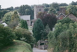
The largest centres of population are the coastal towns of Minehead
(population 10,000) and Watchet
(4,400).
The council's administrative headquarters is located in the village of Williton
, with an additional office in Minehead.
, by a merger of the previous urban district
s of Minehead and Watchet
, along with Dulverton Rural District
and Williton Rural District
.
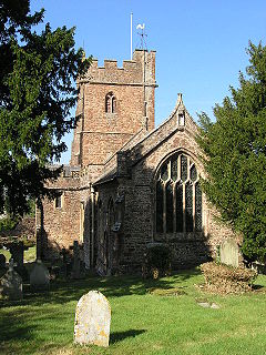
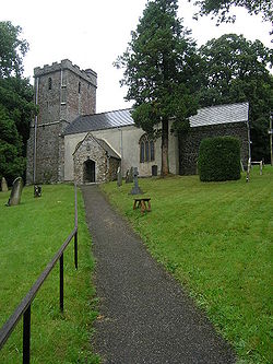
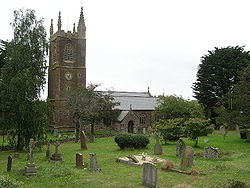
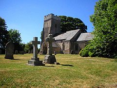
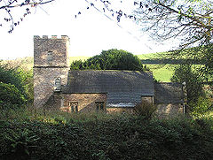
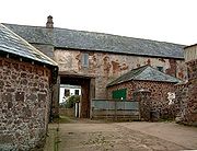
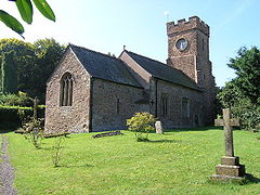
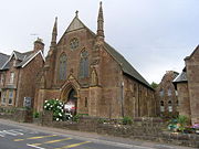
There are 33 Grade I listed buildings in West Somerset, the oldest being Culbone Church
, which is one of the smallest churches in England, and pre-Norman
in origin and Tarr Steps
which may originate in the Bronze Age
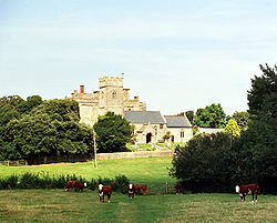
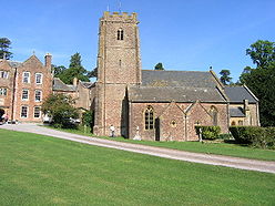
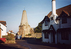
, although others date them from around 1400. Dunster
has the greatest concentration of Grade I listed buildings including Dunster Castle
, the Yarn Market
, Gallox Bridge
and Priory Church of St George
. Other sites include manor houses such as Nettlecombe Court
and Orchard Wyndham
. The most recent buildings included in the list are Crowcombe Court
which was completed in 1739 and the Church of St John the Baptist
in Carhampton
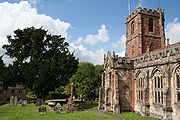
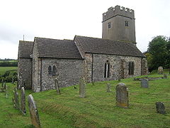
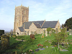
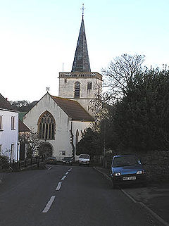
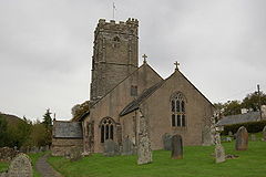
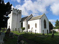
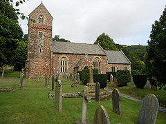
which was rebuilt in 1863. There are numerous religious structures in Somerset, with the largest number being Anglican parish churches, dating from Norman
or medieval
eras. Some of the churches are included in the Somerset towers
, a collection of distinctive, mostly spire
less Gothic
church towers.
designated in 1954 while on the eastern edge of the district are the Quantock Hills
which, in 1956, became the first Area of Outstanding Natural Beauty
created in the UK. Large areas of Exmoor and the Quantock Hills are also designated as Sites of Special Scientific Interest because of their value for wildlife.
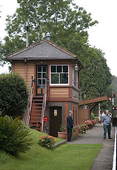
The West Somerset Railway
runs through most of the district, from Bishop's Lydeard in the south east, to Minehead
in the north west. Operated mainly as a tourist attraction, the railway runs mostly steam
and some diesel locomotive
s.
s being elected at each election. From the first election to the council in 1973 to 1995 the council had a majority of independent
s. Since then the Conservative Party
won a majority at the 2003 election
, but independents took a majority back at the 2007 election
. Following the most recent election in 2011
the Conservatives regained a majority and as of the 2011 election the council is composed of the following councillors:-
) in the five non-metropolitan districts of the county are operated by Somerset County Council
.
For a full list of schools see: List of schools in Somerset
Non-metropolitan district
Non-metropolitan districts, or colloquially shire districts, are a type of local government district in England. As created, they are sub-divisions of non-metropolitan counties in a so-called "two-tier" arrangement...
in the English
England
England is a country that is part of the United Kingdom. It shares land borders with Scotland to the north and Wales to the west; the Irish Sea is to the north west, the Celtic Sea to the south west, with the North Sea to the east and the English Channel to the south separating it from continental...
county of Somerset
Somerset
The ceremonial and non-metropolitan county of Somerset in South West England borders Bristol and Gloucestershire to the north, Wiltshire to the east, Dorset to the south-east, and Devon to the south-west. It is partly bounded to the north and west by the Bristol Channel and the estuary of the...
. The council covers a largely rural area, with a population of 35,075 in an area of 740 square kilometres (285.7 sq mi).
According to figures released by the Office for National Statistics
Office for National Statistics
The Office for National Statistics is the executive office of the UK Statistics Authority, a non-ministerial department which reports directly to the Parliament of the United Kingdom.- Overview :...
in 2009, the population of West Somerset has the oldest average age in the United Kingdom at 52.
The largest centres of population are the coastal towns of Minehead
Minehead
Minehead is a coastal town and civil parish in Somerset, England. It lies on the south bank of the Bristol Channel, north-west of the county town of Taunton, from the border with the county of Devon and in proximity of the Exmoor National Park...
(population 10,000) and Watchet
Watchet
Watchet is a harbour town and civil parish in the English county of Somerset, with an approximate population of 4,400. It is situated west of Bridgwater, north-west of Taunton, and east of Minehead. The parish includes the hamlet of Beggearn Huish...
(4,400).
The council's administrative headquarters is located in the village of Williton
Williton
Williton is a medium-sized village and civil parish in West Somerset, England. It has many of the facilities of a small town, being the administrative centre for the district. Williton is situated at the junction of the A39, A358 and B3191 roads...
, with an additional office in Minehead.
History
The district was formed on April 1, 1974, under the Local Government Act 1972Local Government Act 1972
The Local Government Act 1972 is an Act of Parliament in the United Kingdom that reformed local government in England and Wales on 1 April 1974....
, by a merger of the previous urban district
Urban district
In the England, Wales and Ireland, an urban district was a type of local government district that covered an urbanised area. Urban districts had an elected Urban District Council , which shared local government responsibilities with a county council....
s of Minehead and Watchet
Watchet
Watchet is a harbour town and civil parish in the English county of Somerset, with an approximate population of 4,400. It is situated west of Bridgwater, north-west of Taunton, and east of Minehead. The parish includes the hamlet of Beggearn Huish...
, along with Dulverton Rural District
Dulverton Rural District
Dulverton was a rural district in Somerset, England, from 1894 to 1974.It was created in 1894 under the Local Government Act 1894.In 1974 it was abolished under the Local Government Act 1972 and responsibilities transferred to West Somerset....
and Williton Rural District
Williton Rural District
Williton was a rural district in Somerset, England, from 1894 to 1974.It was created in 1894 under the Local Government Act 1894.In 1974 it was abolished under the Local Government Act 1972 when it became part of West Somerset....
.
There are 33 Grade I listed buildings in West Somerset, the oldest being Culbone Church
Culbone Church
Culbone Church located in the village of Culbone in Somerset, England is said to be the smallest church in England.The church seats about 30 people, and the chancel is x , the nave...
, which is one of the smallest churches in England, and pre-Norman
Norman architecture
About|Romanesque architecture, primarily English|other buildings in Normandy|Architecture of Normandy.File:Durham Cathedral. Nave by James Valentine c.1890.jpg|thumb|200px|The nave of Durham Cathedral demonstrates the characteristic round arched style, though use of shallow pointed arches above the...
in origin and Tarr Steps
Tarr Steps
The Tarr Steps are a prehistoric clapper bridge across the River Barle in the Exmoor National Park, Somerset, England. They are located in a National Nature Reserve about south east of Withypool and north west of Dulverton....
which may originate in the Bronze Age
Bronze Age
The Bronze Age is a period characterized by the use of copper and its alloy bronze as the chief hard materials in the manufacture of some implements and weapons. Chronologically, it stands between the Stone Age and Iron Age...
, although others date them from around 1400. Dunster
Dunster
Dunster is a village and civil parish in west Somerset, England, situated on the Bristol Channel coast south-southeast of Minehead and northwest of Taunton. The village has a population of 862 .The village has numerous restaurants and three pubs...
has the greatest concentration of Grade I listed buildings including Dunster Castle
Dunster Castle
Dunster Castle is a former motte and bailey castle, now a country house, in the village of Dunster, Somerset, England. The castle lies on the top of a steep hill called the Tor, and has been fortified since the late Anglo-Saxon period. After the Norman conquest of England in the 11th century,...
, the Yarn Market
Yarn Market, Dunster
The Yarn Market in Dunster, Somerset, England was built around 1590 and has been designated as a Grade I listed building and scheduled ancient monument....
, Gallox Bridge
Gallox Bridge, Dunster
The Gallox Bridge in Dunster, Somerset, England dates from the 15th century. It has been designated as a Grade I listed building and Scheduled Ancient Monument. The bridge is in the guardianship of English Heritage....
and Priory Church of St George
Priory Church of St George, Dunster
The Priory Church of St George in Dunster, Somerset, England is predominantly 15th century with evidence of 12th and 13th century work. It has been designated as a Grade I listed building.-History:...
. Other sites include manor houses such as Nettlecombe Court
Nettlecombe Court
Nettlecombe Court is a large country mansion in the English county of Somerset. Nettlecombe Court was originally built as a manor house, becoming a girls' boarding school in the early 1960s and since 1967 has been the Leonard Wills Field Centre run by the Field Studies Council...
and Orchard Wyndham
Orchard Wyndham
Orchard Wyndham is a historic house parts of which date from medieval times near Williton, Somerset, England.There is evidence of occupation of the site from Roman and Saxon times....
. The most recent buildings included in the list are Crowcombe Court
Crowcombe Court
Crowcombe Court in Crowcombe, Somerset, England is a large country house dating from 1724–39. It is Grade I listed.It was built, in English regional baroque style, by Thomas Parker, for Thomas Carew, and finished by Nathaniel Ireson of Wincanton, after Carew found that Parker had taken old coins,...
which was completed in 1739 and the Church of St John the Baptist
Church of St John the Baptist, Carhampton
The Church of St John the Baptist in Carhampton, Somerset, England is a Grade I listed Anglican church.The first church in the village stood to the eats of the present church and was dedicated to St Carantoc a Welsh monk of the 6th century....
in Carhampton
Carhampton, Somerset
Carhampton is a village and civil parish in West Somerset, England, to the east of Minehead.Carhampton civil parish stretches from the Bristol Channel coast inland to Exmoor. The parish has a population of 992 .-History:...
which was rebuilt in 1863. There are numerous religious structures in Somerset, with the largest number being Anglican parish churches, dating from Norman
Norman architecture
About|Romanesque architecture, primarily English|other buildings in Normandy|Architecture of Normandy.File:Durham Cathedral. Nave by James Valentine c.1890.jpg|thumb|200px|The nave of Durham Cathedral demonstrates the characteristic round arched style, though use of shallow pointed arches above the...
or medieval
Middle Ages
The Middle Ages is a periodization of European history from the 5th century to the 15th century. The Middle Ages follows the fall of the Western Roman Empire in 476 and precedes the Early Modern Era. It is the middle period of a three-period division of Western history: Classic, Medieval and Modern...
eras. Some of the churches are included in the Somerset towers
Somerset towers
The Somerset towers are a collection of distinctive, mostly spireless Gothic church towers in the county of Somerset in south west England.Where beautiful castles and church spires rise above other parts of England, the crowning glory of many Somerset towns and villages is these medieval church...
, a collection of distinctive, mostly spire
Spire
A spire is a tapering conical or pyramidal structure on the top of a building, particularly a church tower. Etymologically, the word is derived from the Old English word spir, meaning a sprout, shoot, or stalk of grass....
less Gothic
Gothic architecture
Gothic architecture is a style of architecture that flourished during the high and late medieval period. It evolved from Romanesque architecture and was succeeded by Renaissance architecture....
church towers.
Geography
West Somerset benefits from one of the most scenic landscapes in England. Nearly two thirds of the western land area of the district forms part of Exmoor National ParkExmoor
Exmoor is an area of hilly open moorland in west Somerset and north Devon in South West England, named after the main river that flows out of the district, the River Exe. The moor has given its name to a National Park, which includes the Brendon Hills, the East Lyn Valley, the Vale of Porlock and ...
designated in 1954 while on the eastern edge of the district are the Quantock Hills
Quantock Hills
The Quantock Hills is a range of hills west of Bridgwater in Somerset, England. The Quantock Hills were England’s first Area of Outstanding Natural Beauty being designated in 1956 and consists of large amounts of heathland, oak woodlands, ancient parklands and agricultural land.The hills run from...
which, in 1956, became the first Area of Outstanding Natural Beauty
Area of Outstanding Natural Beauty
An Area of Outstanding Natural Beauty is an area of countryside considered to have significant landscape value in England, Wales or Northern Ireland, that has been specially designated by the Countryside Agency on behalf of the United Kingdom government; the Countryside Council for Wales on...
created in the UK. Large areas of Exmoor and the Quantock Hills are also designated as Sites of Special Scientific Interest because of their value for wildlife.
The West Somerset Railway
West Somerset Railway
The West Somerset Railway is a railway line that originally linked and in Somerset, England.It opened in 1862 and was extended from Watchet to by the Minehead Railway in 1874. Although just a single track, improvements were needed in the first half of the twentieth century to accommodate the...
runs through most of the district, from Bishop's Lydeard in the south east, to Minehead
Minehead
Minehead is a coastal town and civil parish in Somerset, England. It lies on the south bank of the Bristol Channel, north-west of the county town of Taunton, from the border with the county of Devon and in proximity of the Exmoor National Park...
in the north west. Operated mainly as a tourist attraction, the railway runs mostly steam
Steam locomotive
A steam locomotive is a railway locomotive that produces its power through a steam engine. These locomotives are fueled by burning some combustible material, usually coal, wood or oil, to produce steam in a boiler, which drives the steam engine...
and some diesel locomotive
Diesel locomotive
A diesel locomotive is a type of railroad locomotive in which the prime mover is a diesel engine, a reciprocating engine operating on the Diesel cycle as invented by Dr. Rudolf Diesel...
s.
Governance
West Somerset District Council is elected every four years, with currently 28 councillorCouncillor
A councillor or councilor is a member of a local government council, such as a city council.Often in the United States, the title is councilman or councilwoman.-United Kingdom:...
s being elected at each election. From the first election to the council in 1973 to 1995 the council had a majority of independent
Independent (politician)
In politics, an independent or non-party politician is an individual not affiliated to any political party. Independents may hold a centrist viewpoint between those of major political parties, a viewpoint more extreme than any major party, or they may have a viewpoint based on issues that they do...
s. Since then the Conservative Party
Conservative Party (UK)
The Conservative Party, formally the Conservative and Unionist Party, is a centre-right political party in the United Kingdom that adheres to the philosophies of conservatism and British unionism. It is the largest political party in the UK, and is currently the largest single party in the House...
won a majority at the 2003 election
West Somerset Council election, 2003
The 2003 West Somerset Council election took place on 1 May 2003 to elect members of West Somerset District Council in Somerset, England. The whole council was up for election and the Conservative party stayed in overall control of the council....
, but independents took a majority back at the 2007 election
West Somerset Council election, 2007
The 2007 West Somerset Council election took place on 3 May 2007 to elect members of West Somerset District Council in Somerset, England. The whole council was up for election and independents gained overall control of the council from the Conservative party....
. Following the most recent election in 2011
West Somerset Council election, 2011
The 2011 West Somerset Council election took place on 5 May 2011 to elect members of West Somerset District Council in Somerset, England. The whole council was up for election with boundary changes since the last election in 2007 reducing the number of seats by 3...
the Conservatives regained a majority and as of the 2011 election the council is composed of the following councillors:-
| Party | Councillors |
|
| Conservative Party Conservative Party (UK) The Conservative Party, formally the Conservative and Unionist Party, is a centre-right political party in the United Kingdom that adheres to the philosophies of conservatism and British unionism. It is the largest political party in the UK, and is currently the largest single party in the House... |
19 | |
| Independent Independent (politician) In politics, an independent or non-party politician is an individual not affiliated to any political party. Independents may hold a centrist viewpoint between those of major political parties, a viewpoint more extreme than any major party, or they may have a viewpoint based on issues that they do... |
7 | |
| Labour Party Labour Party (UK) The Labour Party is a centre-left democratic socialist party in the United Kingdom. It surpassed the Liberal Party in general elections during the early 1920s, forming minority governments under Ramsay MacDonald in 1924 and 1929-1931. The party was in a wartime coalition from 1940 to 1945, after... |
2 | |
Settlements
- AllerfordAllerfordAllerford is a village in the county of Somerset, England, located within Exmoor National Park, and is part of the parish of Selworthy in the district of West Somerset. It appears in Domesday Book as “Alresford – forda Ralph de Limesy Mill”....
, Ashbeer - Battleton, Bickham, BicknollerBicknollerBicknoller is a village and civil parish on the western slopes of the Quantock Hills in the English county of Somerset.Administratively, the civil parish falls within the West Somerset local government district within the Somerset shire county, with administrative tasks shared between county,...
, Bilbrook, Bossington, Brandish Street, Bratton, Bridgetown, Brompton RalphBrompton RalphBrompton Ralph is a village and civil parish in the West Somerset district of Somerset, England, about west of Taunton, and north of Wiveliscombe. It is in a wooded district at the eastern extremity of the Brendon Hills...
, Brompton RegisBrompton RegisBrompton Regis is a village and civil parish in the West Somerset district of Somerset, England about north-east of Dulverton. It is situated on the River Haddeo in the Brendon Hills within the Exmoor National Park, close to Wimbleball Lake, a water supply reservoir constructed in the 1970s and...
, BrushfordBrushford, SomersetBrushford is a village and civil parish south of Dulverton and north of Tiverton in Devon, in the West Somerset district of Somerset, England. According to the 2001 census it had a population of 535 in 243 households... - Carhampton, Chapel Cleeve, Churchtown, ClatworthyClatworthyClatworthy is a village and civil parish in the West Somerset District of Somerset, England. It is situated from Wellington and four miles from Wiveliscombe on the southern slopes of the Brendon Hills and close to the Exmoor National Park....
, CrowcombeCrowcombeCrowcombe is a village and civil parish under the Quantock Hills in Somerset, England, south east of Watchet, and from Taunton in the Taunton Deane district...
, Crowcombe Heathfield, CulboneCulboneCulbone is a hamlet consisting of little more than the parish church and a few houses, in the parish of Oare in the Exmoor National Park, Somerset, England. As there is no road access it is a two-mile walk from Porlock Weir, and some four miles from Porlock itself.The village is situated in a...
, CutcombeCutcombeCutcombe is a village and civil parish south of Minehead and north of Dulverton straddling the ridge between Exmoor and the Brendon Hills in Somerset... - DulvertonDulvertonDulverton is a town and civil parish in the heart of West Somerset, England, near the border with Devon. The town has a population of 1,630. The parish includes the hamlets of Battleton and Ashwick which is located approximately north west of Dulverton...
, DunsterDunsterDunster is a village and civil parish in west Somerset, England, situated on the Bristol Channel coast south-southeast of Minehead and northwest of Taunton. The village has a population of 862 .The village has numerous restaurants and three pubs... - East QuantoxheadEast QuantoxheadEast Quantoxhead is a village in West Somerset, from West Quantoxhead, east of Williton, and west of Bridgwater, within the Quantock Hills Area of Outstanding Natural Beauty in Somerset, England.-History:...
, ElworthyElworthyElworthy is a small village and civil parish in the Brendon Hills south-east of Watchet, and west of Taunton, in the West Somerset district of Somerset, England...
, EscottStogumberStogumber is a village and civil parish in Somerset, England, on the eastern flank of the Brendon Hills. Besides Stogumber village itself, the parish includes the hamlets of Ashbeer, Capton, Escott, Higher Vexford, Kingswood, Lower Vellow, Lower Vexford, Preston, and Vellow.-History:The name comes...
, ExfordExford, SomersetExford is a rural village at the centre of Exmoor, north-west of Dulverton, and south-west of Minehead, in Somerset, England. Less than a mile away is the hamlet of Lyncombe....
, ExtonExton, SomersetExton is a village and civil parish north-east of Dulverton and south-west of Dunster in Somerset, England. It lies on the River Exe on Exmoor... - Flaxpool
- Halsway, Hawkridge, Higher Vexford, HolfordHolfordHolford is a village and civil parish in West Somerset within the Quantock Hills Area of Outstanding Natural Beauty, and about west of Bridgwater and east of Williton. The village has a population of about 200. The village is on the Quantock Greenway and Coleridge Way footpaths...
, Huish ChampflowerHuish ChampflowerHuish Champflower is a village and civil parish in Somerset, England, three miles north-west of Wiveliscombe and ten miles north of Wellington... - KilveKilveKilve is a village in West Somerset, England, within the Quantock Hills Area of Outstanding Natural Beauty, the first AONB to be established, in 1957....
, Kilton, Kingsbridge, Kingswood - Lawford, Leighland Chapel, LilstockLilstockLilstock is a hamlet in the civil parish of Stringston within the West Somerset district of Somerset, England. It is north-west of Bridgwater, and north-east of Williton...
, Lower Vellow, Lower Vexford, Lower Weacombe, LuccombeLuccombe, SomersetLuccombe is a village and civil parish in the Exmoor National Park in the English county of Somerset. It at the foot of the moor's highest hill, the Dunkery Beacon, and is about one mile south of the A39 road between Porlock and Minehead. Administratively it forms part of the district of West...
, LuxboroughLuxboroughLuxborough is a small village and civil parish located some south of Dunster, lying amongst the Brendon Hills and the Exmoor National Park in Somerset, England. It is divided into the hamlets of Churchtown, Kingsbridge and Pooltown, which lie within a mile of each other...
, Lynch, LyncombeExford, SomersetExford is a rural village at the centre of Exmoor, north-west of Dulverton, and south-west of Minehead, in Somerset, England. Less than a mile away is the hamlet of Lyncombe.... - MineheadMineheadMinehead is a coastal town and civil parish in Somerset, England. It lies on the south bank of the Bristol Channel, north-west of the county town of Taunton, from the border with the county of Devon and in proximity of the Exmoor National Park...
, MonksilverMonksilverMonksilver is a village west of the town of Williton in Somerset, England, on the eastern flank of the Brendon Hills and the border of the Exmoor National Park. It is on the Coleridge Way footpath.... - OareOare, SomersetOare is a village and civil parish on Oare Water on Exmoor in the West Somerset district of Somerset, England. The parish includes the hamlet of Oareford and the village of Culbone which contains its own tiny church.-History:...
, Oareford, Old CleeveOld CleeveOld Cleeve is a village and civil parish south east of Minehead in the West Somerset district of Somerset, England. The civil parish of Old Cleeve covers an area of and includes the villages of Blue Anchor, Roadwater and Washford as well as hamlets such as Bilbrook, Chapel Cleeve, Golsoncott and... - Pooltown, PorlockPorlockPorlock is a coastal village and civil parish in Somerset, England, situated in a deep hollow below Exmoor, west of Minehead. The parish, which includes Hawkcombe and Doverhay, has a population of 1,377....
, Preston - RoadwaterRoadwaterRoadwater is a village south-west of Williton, on the northern edge of the Exmoor National Park, in Somerset, England.-History:The village was formerly known as Rode and had a mill by 1243. During the 18th and 19th centuries there were a large number of mills set beside the Washford River...
- St Audries, Sampford BrettSampford BrettSampford Brett is a village and civil parish situated at the north-western edge of the Quantock Hills, Somerset, England, less than south of Williton, just off the A358 road to Taunton....
, SelworthySelworthySelworthy is a small village and civil parish from Minehead in Somerset, England. It is located in the National Trust's Holnicote Estate on the northern fringes of Exmoor. The parish includes the hamlets of Bossington, Tivington, Lynch, Brandish Street and Allerford.At Selworthy Beacon, which is...
, SimonsbathSimonsbathSimonsbath is a village high on Exmoor in the English county of Somerset. It is the principal settlement in the Exmoor civil parish, which is the largest and most sparsely populated civil parish on Exmoor, covering nearly but with a population, at the time of the 2001 census, of 203 in 78...
, SkilgateSkilgateSkilgate is a village and civil parish east of Dulverton and west of Wiveliscombe in the West Somerset district of Somerset, England. It has a population of 96....
, Stoke Pero, StogumberStogumberStogumber is a village and civil parish in Somerset, England, on the eastern flank of the Brendon Hills. Besides Stogumber village itself, the parish includes the hamlets of Ashbeer, Capton, Escott, Higher Vexford, Kingswood, Lower Vellow, Lower Vexford, Preston, and Vellow.-History:The name comes...
, StogurseyStogurseyStogursey is the name of a small village and civil parish in the Quantock Hills in Somerset, England. It is situated from Nether Stowey, and west of Bridgwater...
, StringstonStringstonStringston is a village and civil parish on the northern edge of the Quantock Hills in the English county of Somerset. The village is west of Bridgwater, and close to the villages of Holford, Kilve and Stogursey. In 2002, the parish was estimated to have a population of 116.Besides the village of... - TimberscombeTimberscombeTimberscombe is a village and civil parish on the River Avill south-west of Dunster, and south of Minehead within the Exmoor National Park in Somerset, England...
, Tivington, Torre, TreboroughTreboroughTreborough is a small village and civil parish miles south of Dunster, lying amongst the Brendon Hills within the Exmoor National Park in the West Somerset district of Somerset, England.-History:...
, Triscombe - UptonUpton, SomersetUpton is a village and civil parish north of Skilgate in Somerset, England. It is situated on a hill above the eastern end of Wimbleball Lake.-History:The parish of Upton was part of the Williton and Freemanners Hundred....
- Vellow
- WashfordWashfordWashford is a small village on the Washford River in the English county of Somerset. It is within the civil parish of Old Cleeve and is best known as the site of Cleeve Abbey, one of the best-preserved medieval monasteries in England...
, WatchetWatchetWatchet is a harbour town and civil parish in the English county of Somerset, with an approximate population of 4,400. It is situated west of Bridgwater, north-west of Taunton, and east of Minehead. The parish includes the hamlet of Beggearn Huish...
, Weacombe, West QuantoxheadWest QuantoxheadWest Quantoxhead is a small village and civil parish in the West Somerset district of Somerset, England. It lies on the route of the Coleridge Way and on the A39 road at the foot of the Quantock Hills, from East Quantoxhead, from Williton and equidistant from Bridgwater and Taunton...
, WillitonWillitonWilliton is a medium-sized village and civil parish in West Somerset, England. It has many of the facilities of a small town, being the administrative centre for the district. Williton is situated at the junction of the A39, A358 and B3191 roads...
, WinsfordWinsford, SomersetWinsford is a village and civil parish in Somerset, England, located about north-west of Dulverton.It is within the borders of the Exmoor National Park and around south-west of the coastal town of Minehead. The village has two hotels, Karslake House Hotel and the Royal Oak, both dating to before...
, WithycombeWithycombeWithycombe is a village and civil parish south east of Dunster, and from Minehead within the Exmoor National Park in the West Somerset district of Somerset, England...
, WithypoolWithypoolWithypool is a small village in Somerset, England, near the centre of Exmoor National Park and close to the border with Devon. The word Withy means Willow...
, Woodford, Wootton CourtenayWootton CourtenayWootton Courtenay is a village and civil parish on Exmoor in the West Somerset district of Somerset, England. The parish includes the village of Huntscott.-History:Wootton was part of the hundred of Carhampton.-Governance:... - Yarde
Parishes
| Image | Name | Status | Population | Former local authority | Coordinates | Refs |
|---|---|---|---|---|---|---|
 |
Bicknoller Bicknoller Bicknoller is a village and civil parish on the western slopes of the Quantock Hills in the English county of Somerset.Administratively, the civil parish falls within the West Somerset local government district within the Somerset shire county, with administrative tasks shared between county,... |
Civil parish | Williton Rural District Williton Rural District Williton was a rural district in Somerset, England, from 1894 to 1974.It was created in 1894 under the Local Government Act 1894.In 1974 it was abolished under the Local Government Act 1972 when it became part of West Somerset.... |
51.15°N 3.27°W | ||
 |
Brompton Ralph Brompton Ralph Brompton Ralph is a village and civil parish in the West Somerset district of Somerset, England, about west of Taunton, and north of Wiveliscombe. It is in a wooded district at the eastern extremity of the Brendon Hills... |
Civil parish | Williton Rural District Williton Rural District Williton was a rural district in Somerset, England, from 1894 to 1974.It was created in 1894 under the Local Government Act 1894.In 1974 it was abolished under the Local Government Act 1972 when it became part of West Somerset.... |
51.08°N 3.31°W | ||
 |
Brompton Regis Brompton Regis Brompton Regis is a village and civil parish in the West Somerset district of Somerset, England about north-east of Dulverton. It is situated on the River Haddeo in the Brendon Hills within the Exmoor National Park, close to Wimbleball Lake, a water supply reservoir constructed in the 1970s and... |
Civil parish | Dulverton Rural District Dulverton Rural District Dulverton was a rural district in Somerset, England, from 1894 to 1974.It was created in 1894 under the Local Government Act 1894.In 1974 it was abolished under the Local Government Act 1972 and responsibilities transferred to West Somerset.... |
51.07°N 3.49°W | ||
 |
Brushford Brushford, Somerset Brushford is a village and civil parish south of Dulverton and north of Tiverton in Devon, in the West Somerset district of Somerset, England. According to the 2001 census it had a population of 535 in 243 households... |
Civil parish | Dulverton Rural District Dulverton Rural District Dulverton was a rural district in Somerset, England, from 1894 to 1974.It was created in 1894 under the Local Government Act 1894.In 1974 it was abolished under the Local Government Act 1972 and responsibilities transferred to West Somerset.... |
51.02°N 3.53°W | ||
 |
Carhampton Carhampton, Somerset Carhampton is a village and civil parish in West Somerset, England, to the east of Minehead.Carhampton civil parish stretches from the Bristol Channel coast inland to Exmoor. The parish has a population of 992 .-History:... |
Civil parish | Williton Rural District Williton Rural District Williton was a rural district in Somerset, England, from 1894 to 1974.It was created in 1894 under the Local Government Act 1894.In 1974 it was abolished under the Local Government Act 1972 when it became part of West Somerset.... |
51.17°N 3.42°W | ||
 |
Clatworthy Clatworthy Clatworthy is a village and civil parish in the West Somerset District of Somerset, England. It is situated from Wellington and four miles from Wiveliscombe on the southern slopes of the Brendon Hills and close to the Exmoor National Park.... |
Civil parish | Williton Rural District Williton Rural District Williton was a rural district in Somerset, England, from 1894 to 1974.It was created in 1894 under the Local Government Act 1894.In 1974 it was abolished under the Local Government Act 1972 when it became part of West Somerset.... |
51.07°N 3.35°W | ||
 |
Crowcombe Crowcombe Crowcombe is a village and civil parish under the Quantock Hills in Somerset, England, south east of Watchet, and from Taunton in the Taunton Deane district... |
Civil parish | Williton Rural District Williton Rural District Williton was a rural district in Somerset, England, from 1894 to 1974.It was created in 1894 under the Local Government Act 1894.In 1974 it was abolished under the Local Government Act 1972 when it became part of West Somerset.... |
51.12°N 3.23°W | ||
 |
Cutcombe Cutcombe Cutcombe is a village and civil parish south of Minehead and north of Dulverton straddling the ridge between Exmoor and the Brendon Hills in Somerset... |
Civil parish | Williton Rural District Williton Rural District Williton was a rural district in Somerset, England, from 1894 to 1974.It was created in 1894 under the Local Government Act 1894.In 1974 it was abolished under the Local Government Act 1972 when it became part of West Somerset.... |
51.14°N 3.53°W | ||
 |
Dulverton Dulverton Dulverton is a town and civil parish in the heart of West Somerset, England, near the border with Devon. The town has a population of 1,630. The parish includes the hamlets of Battleton and Ashwick which is located approximately north west of Dulverton... |
Town | Dulverton Rural District Dulverton Rural District Dulverton was a rural district in Somerset, England, from 1894 to 1974.It was created in 1894 under the Local Government Act 1894.In 1974 it was abolished under the Local Government Act 1972 and responsibilities transferred to West Somerset.... |
51.05°N 3.55°W | ||
 |
Dunster Dunster Dunster is a village and civil parish in west Somerset, England, situated on the Bristol Channel coast south-southeast of Minehead and northwest of Taunton. The village has a population of 862 .The village has numerous restaurants and three pubs... |
Civil parish | Williton Rural District Williton Rural District Williton was a rural district in Somerset, England, from 1894 to 1974.It was created in 1894 under the Local Government Act 1894.In 1974 it was abolished under the Local Government Act 1972 when it became part of West Somerset.... |
51.18°N 3.45°W | ||
 |
East Quantoxhead East Quantoxhead East Quantoxhead is a village in West Somerset, from West Quantoxhead, east of Williton, and west of Bridgwater, within the Quantock Hills Area of Outstanding Natural Beauty in Somerset, England.-History:... |
Civil parish | Williton Rural District Williton Rural District Williton was a rural district in Somerset, England, from 1894 to 1974.It was created in 1894 under the Local Government Act 1894.In 1974 it was abolished under the Local Government Act 1972 when it became part of West Somerset.... |
51.18°N 3.24°W | ||
 |
Elworthy Elworthy Elworthy is a small village and civil parish in the Brendon Hills south-east of Watchet, and west of Taunton, in the West Somerset district of Somerset, England... |
Civil parish | Williton Rural District Williton Rural District Williton was a rural district in Somerset, England, from 1894 to 1974.It was created in 1894 under the Local Government Act 1894.In 1974 it was abolished under the Local Government Act 1972 when it became part of West Somerset.... |
51.11°N 3.31°W | ||
 |
Exford Exford, Somerset Exford is a rural village at the centre of Exmoor, north-west of Dulverton, and south-west of Minehead, in Somerset, England. Less than a mile away is the hamlet of Lyncombe.... |
Civil parish | Dulverton Rural District Dulverton Rural District Dulverton was a rural district in Somerset, England, from 1894 to 1974.It was created in 1894 under the Local Government Act 1894.In 1974 it was abolished under the Local Government Act 1972 and responsibilities transferred to West Somerset.... |
51.13°N 3.64°W | ||
| Exmoor | Civil parish | Dulverton Rural District Dulverton Rural District Dulverton was a rural district in Somerset, England, from 1894 to 1974.It was created in 1894 under the Local Government Act 1894.In 1974 it was abolished under the Local Government Act 1972 and responsibilities transferred to West Somerset.... |
51.14°N 3.75°W | |||
| Exton Exton, Somerset Exton is a village and civil parish north-east of Dulverton and south-west of Dunster in Somerset, England. It lies on the River Exe on Exmoor... |
Civil parish | Dulverton Rural District Dulverton Rural District Dulverton was a rural district in Somerset, England, from 1894 to 1974.It was created in 1894 under the Local Government Act 1894.In 1974 it was abolished under the Local Government Act 1972 and responsibilities transferred to West Somerset.... |
51.09°N 3.54°W | |||
 |
Holford Holford Holford is a village and civil parish in West Somerset within the Quantock Hills Area of Outstanding Natural Beauty, and about west of Bridgwater and east of Williton. The village has a population of about 200. The village is on the Quantock Greenway and Coleridge Way footpaths... |
Civil parish | Williton Rural District Williton Rural District Williton was a rural district in Somerset, England, from 1894 to 1974.It was created in 1894 under the Local Government Act 1894.In 1974 it was abolished under the Local Government Act 1972 when it became part of West Somerset.... |
51.16°N 3.21°W | ||
 |
Huish Champflower Huish Champflower Huish Champflower is a village and civil parish in Somerset, England, three miles north-west of Wiveliscombe and ten miles north of Wellington... |
Civil parish | Dulverton Rural District Dulverton Rural District Dulverton was a rural district in Somerset, England, from 1894 to 1974.It was created in 1894 under the Local Government Act 1894.In 1974 it was abolished under the Local Government Act 1972 and responsibilities transferred to West Somerset.... |
51.06°N 3.36°W | ||
 |
Kilve Kilve Kilve is a village in West Somerset, England, within the Quantock Hills Area of Outstanding Natural Beauty, the first AONB to be established, in 1957.... |
Civil parish | Williton Rural District Williton Rural District Williton was a rural district in Somerset, England, from 1894 to 1974.It was created in 1894 under the Local Government Act 1894.In 1974 it was abolished under the Local Government Act 1972 when it became part of West Somerset.... |
51.18°N 3.22°W | ||
 |
Luccombe Luccombe, Somerset Luccombe is a village and civil parish in the Exmoor National Park in the English county of Somerset. It at the foot of the moor's highest hill, the Dunkery Beacon, and is about one mile south of the A39 road between Porlock and Minehead. Administratively it forms part of the district of West... |
Civil parish | Williton Rural District Williton Rural District Williton was a rural district in Somerset, England, from 1894 to 1974.It was created in 1894 under the Local Government Act 1894.In 1974 it was abolished under the Local Government Act 1972 when it became part of West Somerset.... |
51.19°N 3.56°W | ||
| Luxborough Luxborough Luxborough is a small village and civil parish located some south of Dunster, lying amongst the Brendon Hills and the Exmoor National Park in Somerset, England. It is divided into the hamlets of Churchtown, Kingsbridge and Pooltown, which lie within a mile of each other... |
Civil parish | Williton Rural District Williton Rural District Williton was a rural district in Somerset, England, from 1894 to 1974.It was created in 1894 under the Local Government Act 1894.In 1974 it was abolished under the Local Government Act 1972 when it became part of West Somerset.... |
51.13°N 3.46°W | |||
| Minehead Minehead Minehead is a coastal town and civil parish in Somerset, England. It lies on the south bank of the Bristol Channel, north-west of the county town of Taunton, from the border with the county of Devon and in proximity of the Exmoor National Park... |
Town | Williton Rural District Williton Rural District Williton was a rural district in Somerset, England, from 1894 to 1974.It was created in 1894 under the Local Government Act 1894.In 1974 it was abolished under the Local Government Act 1972 when it became part of West Somerset.... Minehead Urban District Minehead Minehead is a coastal town and civil parish in Somerset, England. It lies on the south bank of the Bristol Channel, north-west of the county town of Taunton, from the border with the county of Devon and in proximity of the Exmoor National Park... |
51.20°N 3.47°W | |||
 |
Minehead Without Minehead Without Minehead Without is a civil parish in the English county of Somerset, and within the Exmoor National Park. As its name suggests, the parish covers a rural area to the west of, but not including, the small coastal town of Minehead... |
Civil parish | Williton Rural District Williton Rural District Williton was a rural district in Somerset, England, from 1894 to 1974.It was created in 1894 under the Local Government Act 1894.In 1974 it was abolished under the Local Government Act 1972 when it became part of West Somerset.... |
51.20°N 3.51°W | ||
 |
Monksilver Monksilver Monksilver is a village west of the town of Williton in Somerset, England, on the eastern flank of the Brendon Hills and the border of the Exmoor National Park. It is on the Coleridge Way footpath.... |
Civil parish | Williton Rural District Williton Rural District Williton was a rural district in Somerset, England, from 1894 to 1974.It was created in 1894 under the Local Government Act 1894.In 1974 it was abolished under the Local Government Act 1972 when it became part of West Somerset.... |
51.13°N 3.33°W | ||
 |
Nettlecombe Nettlecombe, Somerset Nettlecombe is a civil parish in the English county of Somerset. The parish covers a rural area below the Brendon Hills, comprising the small hamlets of Woodford, Yarde and Torre together with more isolated individual farms and homes... |
Civil parish | Williton Rural District Williton Rural District Williton was a rural district in Somerset, England, from 1894 to 1974.It was created in 1894 under the Local Government Act 1894.In 1974 it was abolished under the Local Government Act 1972 when it became part of West Somerset.... |
51.13°N 3.35°W | ||
| Oare Oare, Somerset Oare is a village and civil parish on Oare Water on Exmoor in the West Somerset district of Somerset, England. The parish includes the hamlet of Oareford and the village of Culbone which contains its own tiny church.-History:... |
Civil parish | Williton Rural District Williton Rural District Williton was a rural district in Somerset, England, from 1894 to 1974.It was created in 1894 under the Local Government Act 1894.In 1974 it was abolished under the Local Government Act 1972 when it became part of West Somerset.... |
51.20°N 3.71°W | |||
 |
Old Cleeve Old Cleeve Old Cleeve is a village and civil parish south east of Minehead in the West Somerset district of Somerset, England. The civil parish of Old Cleeve covers an area of and includes the villages of Blue Anchor, Roadwater and Washford as well as hamlets such as Bilbrook, Chapel Cleeve, Golsoncott and... |
Civil parish | Williton Rural District Williton Rural District Williton was a rural district in Somerset, England, from 1894 to 1974.It was created in 1894 under the Local Government Act 1894.In 1974 it was abolished under the Local Government Act 1972 when it became part of West Somerset.... |
51.17°N 3.38°W | ||
 |
Porlock Porlock Porlock is a coastal village and civil parish in Somerset, England, situated in a deep hollow below Exmoor, west of Minehead. The parish, which includes Hawkcombe and Doverhay, has a population of 1,377.... |
Civil parish | Williton Rural District Williton Rural District Williton was a rural district in Somerset, England, from 1894 to 1974.It was created in 1894 under the Local Government Act 1894.In 1974 it was abolished under the Local Government Act 1972 when it became part of West Somerset.... |
51.21°N 3.60°W | ||
| Sampford Brett Sampford Brett Sampford Brett is a village and civil parish situated at the north-western edge of the Quantock Hills, Somerset, England, less than south of Williton, just off the A358 road to Taunton.... |
Civil parish | Williton Rural District Williton Rural District Williton was a rural district in Somerset, England, from 1894 to 1974.It was created in 1894 under the Local Government Act 1894.In 1974 it was abolished under the Local Government Act 1972 when it became part of West Somerset.... |
51.16°N 3.31°W | |||
| Selworthy Selworthy Selworthy is a small village and civil parish from Minehead in Somerset, England. It is located in the National Trust's Holnicote Estate on the northern fringes of Exmoor. The parish includes the hamlets of Bossington, Tivington, Lynch, Brandish Street and Allerford.At Selworthy Beacon, which is... |
Civil parish | Williton Rural District Williton Rural District Williton was a rural district in Somerset, England, from 1894 to 1974.It was created in 1894 under the Local Government Act 1894.In 1974 it was abolished under the Local Government Act 1972 when it became part of West Somerset.... |
51.21°N 3.55°W | |||
 |
Skilgate Skilgate Skilgate is a village and civil parish east of Dulverton and west of Wiveliscombe in the West Somerset district of Somerset, England. It has a population of 96.... |
Civil parish | Dulverton Rural District Dulverton Rural District Dulverton was a rural district in Somerset, England, from 1894 to 1974.It was created in 1894 under the Local Government Act 1894.In 1974 it was abolished under the Local Government Act 1972 and responsibilities transferred to West Somerset.... |
51.04°N 3.45°W | ||
 |
Stogumber Stogumber Stogumber is a village and civil parish in Somerset, England, on the eastern flank of the Brendon Hills. Besides Stogumber village itself, the parish includes the hamlets of Ashbeer, Capton, Escott, Higher Vexford, Kingswood, Lower Vellow, Lower Vexford, Preston, and Vellow.-History:The name comes... |
Civil parish | Williton Rural District Williton Rural District Williton was a rural district in Somerset, England, from 1894 to 1974.It was created in 1894 under the Local Government Act 1894.In 1974 it was abolished under the Local Government Act 1972 when it became part of West Somerset.... |
51.13°N 3.29°W | ||
 |
Stogursey Stogursey Stogursey is the name of a small village and civil parish in the Quantock Hills in Somerset, England. It is situated from Nether Stowey, and west of Bridgwater... |
Civil parish | Williton Rural District Williton Rural District Williton was a rural district in Somerset, England, from 1894 to 1974.It was created in 1894 under the Local Government Act 1894.In 1974 it was abolished under the Local Government Act 1972 when it became part of West Somerset.... |
51.18°N 3.14°W | ||
| Stringston Stringston Stringston is a village and civil parish on the northern edge of the Quantock Hills in the English county of Somerset. The village is west of Bridgwater, and close to the villages of Holford, Kilve and Stogursey. In 2002, the parish was estimated to have a population of 116.Besides the village of... |
Civil parish | Williton Rural District Williton Rural District Williton was a rural district in Somerset, England, from 1894 to 1974.It was created in 1894 under the Local Government Act 1894.In 1974 it was abolished under the Local Government Act 1972 when it became part of West Somerset.... |
51.18°N 3.18°W | |||
 |
Timberscombe Timberscombe Timberscombe is a village and civil parish on the River Avill south-west of Dunster, and south of Minehead within the Exmoor National Park in Somerset, England... |
Civil parish | Williton Rural District Williton Rural District Williton was a rural district in Somerset, England, from 1894 to 1974.It was created in 1894 under the Local Government Act 1894.In 1974 it was abolished under the Local Government Act 1972 when it became part of West Somerset.... |
51.13°N 3.54°W | ||
 |
Treborough Treborough Treborough is a small village and civil parish miles south of Dunster, lying amongst the Brendon Hills within the Exmoor National Park in the West Somerset district of Somerset, England.-History:... |
Civil parish | Williton Rural District Williton Rural District Williton was a rural district in Somerset, England, from 1894 to 1974.It was created in 1894 under the Local Government Act 1894.In 1974 it was abolished under the Local Government Act 1972 when it became part of West Somerset.... |
51.12°N 3.41°W | ||
| Upton Upton, Somerset Upton is a village and civil parish north of Skilgate in Somerset, England. It is situated on a hill above the eastern end of Wimbleball Lake.-History:The parish of Upton was part of the Williton and Freemanners Hundred.... |
Civil parish | Dulverton Rural District Dulverton Rural District Dulverton was a rural district in Somerset, England, from 1894 to 1974.It was created in 1894 under the Local Government Act 1894.In 1974 it was abolished under the Local Government Act 1972 and responsibilities transferred to West Somerset.... |
51.10°N 3.44°W | |||
| Watchet Watchet Watchet is a harbour town and civil parish in the English county of Somerset, with an approximate population of 4,400. It is situated west of Bridgwater, north-west of Taunton, and east of Minehead. The parish includes the hamlet of Beggearn Huish... |
Town | Watchet Urban District Watchet Watchet is a harbour town and civil parish in the English county of Somerset, with an approximate population of 4,400. It is situated west of Bridgwater, north-west of Taunton, and east of Minehead. The parish includes the hamlet of Beggearn Huish... |
51.18°N 3.33°W | |||
| West Quantoxhead West Quantoxhead West Quantoxhead is a small village and civil parish in the West Somerset district of Somerset, England. It lies on the route of the Coleridge Way and on the A39 road at the foot of the Quantock Hills, from East Quantoxhead, from Williton and equidistant from Bridgwater and Taunton... |
Civil parish | Williton Rural District Williton Rural District Williton was a rural district in Somerset, England, from 1894 to 1974.It was created in 1894 under the Local Government Act 1894.In 1974 it was abolished under the Local Government Act 1972 when it became part of West Somerset.... |
51.17°N 3.27°W | |||
 |
Williton Williton Williton is a medium-sized village and civil parish in West Somerset, England. It has many of the facilities of a small town, being the administrative centre for the district. Williton is situated at the junction of the A39, A358 and B3191 roads... |
Civil parish | Williton Rural District Williton Rural District Williton was a rural district in Somerset, England, from 1894 to 1974.It was created in 1894 under the Local Government Act 1894.In 1974 it was abolished under the Local Government Act 1972 when it became part of West Somerset.... |
51.16°N 3.31°W | ||
 |
Winsford Winsford, Somerset Winsford is a village and civil parish in Somerset, England, located about north-west of Dulverton.It is within the borders of the Exmoor National Park and around south-west of the coastal town of Minehead. The village has two hotels, Karslake House Hotel and the Royal Oak, both dating to before... |
Civil parish | Dulverton Rural District Dulverton Rural District Dulverton was a rural district in Somerset, England, from 1894 to 1974.It was created in 1894 under the Local Government Act 1894.In 1974 it was abolished under the Local Government Act 1972 and responsibilities transferred to West Somerset.... |
51.10°N 3.57°W | ||
 |
Withycombe Withycombe Withycombe is a village and civil parish south east of Dunster, and from Minehead within the Exmoor National Park in the West Somerset district of Somerset, England... |
Civil parish | Williton Rural District Williton Rural District Williton was a rural district in Somerset, England, from 1894 to 1974.It was created in 1894 under the Local Government Act 1894.In 1974 it was abolished under the Local Government Act 1972 when it became part of West Somerset.... |
51.16°N 3.41°W | ||
 |
Withypool and Hawkridge | Civil parish | Dulverton Rural District Dulverton Rural District Dulverton was a rural district in Somerset, England, from 1894 to 1974.It was created in 1894 under the Local Government Act 1894.In 1974 it was abolished under the Local Government Act 1972 and responsibilities transferred to West Somerset.... |
51.11°N 3.65°W | ||
 |
Wootton Courtenay Wootton Courtenay Wootton Courtenay is a village and civil parish on Exmoor in the West Somerset district of Somerset, England. The parish includes the village of Huntscott.-History:Wootton was part of the hundred of Carhampton.-Governance:... |
Civil parish | Williton Rural District Williton Rural District Williton was a rural district in Somerset, England, from 1894 to 1974.It was created in 1894 under the Local Government Act 1894.In 1974 it was abolished under the Local Government Act 1972 when it became part of West Somerset.... |
51.18°N 3.52°W |
Education
County schools (those which are not independentIndependent school
An independent school is a school that is independent in its finances and governance; it is not dependent upon national or local government for financing its operations, nor reliant on taxpayer contributions, and is instead funded by a combination of tuition charges, gifts, and in some cases the...
) in the five non-metropolitan districts of the county are operated by Somerset County Council
Somerset County Council
Somerset County Council is the county council of Somerset in the South West of England, an elected local government authority responsible for the most significant local government services in most of the county.-Area covered:...
.
For a full list of schools see: List of schools in Somerset
See also
- List of Grade I listed buildings in West Somerset
- Quay West RadioQuay West RadioQuay West Radio was the brand of two radio stations broadcasting in Somerset.*Quay West 107.4 broadcast in the Bridgwater and Sedgemoor areas.*Quay West 100.4/102.8 broadcast to West Somerset.-History:...