

U.S. Route 62 in New York
Encyclopedia
U.S. Route 62 is a part of the U.S. Highway System that runs from the United States – Mexico border at El Paso, Texas
, to Niagara Falls, New York
. In the U.S. state
of New York
, US 62 extends 102.77 miles (165.39 km) from the New York – Pennsylvania border south of Jamestown
to an intersection with New York State Route 104 (NY 104) in downtown Niagara Falls. It bypasses the city of Jamestown and serves the cities of Buffalo
and Niagara Falls, along with several villages. It is the only north–south mainline U.S. highway in Western New York
.
US 62 was extended into New York ca. 1932 and originally overlapped the state highway
s that had previously been designated along its routing—namely NY 18
, NY 60
, NY 83
, and NY 241
. These overlaps were eliminated individually during the 1940s and 1960s. The last of the four overlaps, with NY 18 from Dayton
to Niagara Falls, was removed ca. 1962.
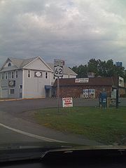
US 62 has one special route, US 62 Business, located in Niagara Falls. US 62 Business is a former routing of US 62 within the city and was once NY 62A
.
, Cattaraugus
, and Niagara
Counties, the route is maintained by the New York State Department of Transportation
(NYSDOT). In Erie County
, US 62 is locally maintained within the cities of Buffalo
and Lackawanna
and county-maintained in Amherst
between NY 263
and NY 324
. The remainder of the highway in the county is state-maintained.
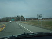
8 miles (13 km) southeast of the city of Jamestown
in Chautauqua County
. The route proceeds northward through the town of Kiantone
, paralleling the course of Conewango Creek
, which lies to the east to the highway. As it approaches the vicinity of the hamlet of Stillwater, US 62 crosses Stillwater Creek and intersects NY 60
at a junction east of the community. While NY 60 heads northwestward to serve Stillwater, and the city of Jamestown beyond it, US 62 turns east and enters the town of Carroll
upon crossing the Conewango Creek. Just inside the town line, US 62 passes through the large hamlet of Frewsburg
.
 The route continues on, paralleling Conewango Creek through the towns of Carroll and Poland
to an interchange with the Southern Tier Expressway (Interstate 86
or I-86 and NY 17
) southeast of the hamlet of Kennedy. US 62 continues on to Kennedy, where it crosses the creek once more and intersects NY 394
. US 62 curves eastward, joining NY 394 northeastward out of Kennedy to a junction known as Schermerhorn Corners. Here, NY 394 continues eastward along the banks of the creek while US 62 heads northward through a small valley surrounding Indian Brook and into the town of Ellington
.
South of the hamlet of Ellington, the small creek valley gives way to a larger cut of land surrounding Clear Creek. Indian Brook ends near this point; however, US 62 continues northward to serve the community. In Ellington, US 62 turns eastward for 2.5 miles (4 km) before veering back to the north at the Chautauqua–Cattaraugus County
county line. The route straddles the county line and runs along the base of a larger valley surrounding Conewango Creek to the aptly named community of Conewango Valley, where it intersects NY 83
. NY 83 heads northwestward into Chautauqua County while US 62 curves eastward to traverse the width of the valley. In the hamlet of Conewango, US 62 meets NY 241
and turns north to follow the eastern edge of the valley through the town of Conewango
.
 Upon entering the town of Leon
, US 62 veers slightly northeastward to run along the base of a small valley surrounding Mud Creek. The two entities separate at the hamlet of Leon, and US 62 returns northward, descending the eastern side of the Conewango Creek valley and becoming the eastern valley road once again. Just before crossing into the town of Dayton
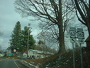
, US 62 leaves the edge of the valley and heads northward through the gully. Here, it crosses over Conewango Creek once more and intersects NY 322
. At the northern extent of the ravine, US 62 turns northeastward toward the community of Dayton, the site of its junction with NY 353
.
Past Dayton, the valley becomes much less defined as the route follows a small stream through the town of Persia
and into the village of Gowanda
. US 62 becomes Jamestown Street and serves as the primary north–south street through the community. It intersects NY 39
in the village center, and the two routes embark on an overlap along Main Street. Just past the junction, the two routes cross Cattaraugus Creek
and enter Erie County
.
while US 62 and NY 39 veer eastward onto Sandhill Road. The routes turn northward at the village limits and remain conjoined to the hamlet of Collins, where NY 39 leaves US 62 on Main Street.
 US 62 continues north through the largely rural towns of Collins
and North Collins
to the village of North Collins
, located in the extreme northwestern corner of the town. Inside the village, US 62 connects to NY 249
. Past North Collins, US 62 heads through the town of Eden
as well as the large hamlet of the same name contained within. Northeast of the hamlet of Eden, the route crosses over the south branch of Eighteenmile Creek and intersects NY 75
. NY 75 joins US 62 northward into the village of Hamburg
.
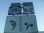 In Hamburg, the most developed location along the route since Gowanda, US 62 and NY 75 initially head north on Pierce Avenue. At Main Street, the concurrency ends as US 62 turns east to follow Main through the village center. It remains on Main Street up to Buffalo Street, where it intersects NY 391
by way of a roundabout
. East of the roundabout, Main Street becomes NY 391; US 62, meanwhile, follows Buffalo Street through the northern portion of Hamburg and into the surrounding town of the same name
, where it becomes South Park Avenue. The amount of development alongside the roadway remains high, reflecting its close proximity to the city of Buffalo
. As it heads north, US 62 passes by the Erie County Fair
grounds and Hilbert College
and crosses over the New York State Thruway
(I-90
) before intersecting with US 20
.
North of US 20, US 62 parallels the Thruway northward to the village of Blasdell
, located on the border of Hamburg and the city of Lackawanna
. Here, US 62 meets NY 179
in the southeastern part of the community. The route continues onward through Blasdell and into Lackawanna, intersecting Ridge Road, an east–west arterial linking US 62 to NY 5
, US 219
, and the Thruway. Just northwest of the Ridge Road junction are the Buffalo and Erie County Botanical Gardens
, situated on the Lackawanna side of the Lackawanna–Buffalo city line. US 62 serves as the primary access road to the grounds, then enters Buffalo.
, is a predominantly a working-class Irish American
neighborhood, once heavily industrialized. Route 62, now known as South Park Avenue, turns slightly northwest at Southside Parkway. At Abbott Road, US 62 becomes Bailey Avenue.
Across the Buffalo River
from Abbott Road is Seneca Street (NY 16
), which provides access to I-190
. The Interstate Highway can also be reached via the intersection with NY 354
a few blocks to the north. After passing William Street, Bailey Avenue begins to run along the city's eastern border with Cheektowaga.
North of these junctions, the road passes through the city's industrial East Side, then back into residential neighborhoods where it intersects Broadway, the western terminus of NY 130
. After the densely developed neighborhoods where Walden Avenue and Genesee Street intersect, it crosses under the Kensington Expressway (NY 33
), where other local roads provide access.
A few miles further on, at SUNY Buffalo's city campus, Route 62 intersects Main Street (NY 5
) at the northeast corner of the city and enters the town of Amherst
.
Less than a mile beyond Main, Grover Cleveland Highway (NY 263
) veers off to the northeast. US 62 continues north through heavily suburban territory to the junction with Sheridan Drive (NY 324
), a major commercial strip across Buffalo's northern suburbs. Here it leaves Bailey Avenue and follows Sheridan west for a half-mile (0.8 km) to another major junction, Niagara Falls Boulevard, at the Amherst–Tonawanda
town line. It turns north again, following the Boulevard (as it is locally known) past Boulevard Mall
at the junction with Maple and Brighton roads, then through another commercial strip to I-290
.
North of the expressway, the road becomes less heavily developed. At the Ellicott Creek
crossing, some signs for the former NY 356
are still visible. A short distance further on, as Tonawanda Creek
starts to run parallel to the highway, all the land to the west becomes part of Amherst. Two miles to the north, after passing White Chapel Memorial Park, US 62 crosses the creek into Niagara County
.
 Now in Wheatfield
, US 62 begins to turn to the northwest as it intersects NY 425
outside of North Tonawanda
. The route continues through residential areas of Wheatfield to the town of Niagara
, meeting NY 429
along the way. In Niagara, the properties along the highway become more industrial as US 62 approaches Niagara Falls International Airport
. Just south of the airport, the route intersects both Williams Road (unsigned NY 952V) and NY 182
. West of NY 182, US 62 dips southwest and enters the city of Niagara Falls
.
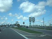
In Niagara Falls, US 62 initially passes by a mixture of commercial and residential developments. It meets NY 265
(Military Road) in the easternmost part of the city ahead of a junction with Interstate 190
exit 22 a mile (1.6 km) to the west. Past I-190, US 62 enters a more industrialized section of the city as it approaches the eastern terminus of US 62 Business, its business route
through the Pine Avenue commercial district. Upon intersecting Packard Road, a local northeast–southwest arterial situated just east of Pine Avenue, US 62 splits into a one-way couplet to serve the residential portion of downtown Niagara Falls. US 62 travels into the city (northbound) on Walnut Avenue and out (southbound) on Ferry Avenue and both intersect NY 61
near the eastern end of the couplet. The couplet continues west for roughly 1.75 miles (2.82 km) to NY 104
(Main Street), where US 62 terminates northeast of the city's tourism district and the Rainbow Bridge
to Canada
.
extending from the Pennsylvania state line in Ripley
to the village of Youngstown
by way of the cities of Buffalo
, North Tonawanda
, and Niagara Falls
. Route 18 did not enter the Buffalo city limits, however; it ended at the southern city line and resumed at the junction of Kenmore Avenue—which straddles the northern boundary of the city—and Niagara Falls Boulevard. It then followed Niagara Falls Boulevard northwest to Niagara Falls, where it continued to Main Street by way of Pine Avenue. When the first set of routes in the modern state highway system were assigned in 1924, the northern segment of Route 18 was designated as part of NY 34. The route also extended a short distance southward into Buffalo to end at NY 5A (later NY 5
). Also assigned in 1924 was NY 18
, a route that began at the Pennsylvania state line north of Bradford, Pennsylvania
, and passed through Salamanca
, Dayton
, and Hamburg
on its way to its northern terminus in Buffalo.
 In the 1930 renumbering of state highways in New York, NY 34 became part of NY 18, which was extended north through Buffalo by way of an overlap with NY 5 along Main Street. Meanwhile, two highways in the Southern Tier
—NY 83
and NY 241
—were created as part of the renumbering. NY 241 led from NY 18 in Dayton south to Randolph
, while NY 83 followed a roughly parallel routing to NY 241 from Frewsburg to Silver Creek
. In Frewsburg, NY 83 ended at NY 60
, a route assigned in the mid-1920s that extended from Pennsylvania
to Fredonia
via Frewsburg and Jamestown
.
 US 62
US 62
originally ended in Maysville, Kentucky
, when it was assigned in 1930. It was extended northeast through Ohio
, Pennsylvania
, and western New York
to Niagara Falls ca. 1932. In New York
, US 62 overlapped NY 60 and NY 83 to Conewango Valley, then veered east onto a previously unnumbered highway to Conewango
, where it became concurrent with NY 241 and NY 18 north through Dayton, Hamburg, and Buffalo to Niagara Falls. By 1935, US 62 and NY 18 were realigned through Buffalo to bypass downtown on Bailey Avenue. The two routes then overlapped NY 5 southwest on Main Street for roughly 0.5 mile (0.80467 km) to reach Niagara Falls Boulevard.
The overlaps between US 62 and the pre-existing state highways it followed were gradually eliminated over the course of the next three decades. NY 60 and NY 83 were truncated in the 1940s to Frewsburg and Conewango Valley, respectively. NY 241, meanwhile, was cut back to Conewango in the late 1940s. The overlap with NY 18, the longest of the four initial overlaps, remained into the early 1960s, when NY 18 was truncated to Lewiston
(north of Niagara Falls) ca. 1962.
, a suburb just north of Buffalo, it was realigned slightly in the late 1930s to continue north on Bailey Avenue past Main Street to Eggert Road. The route then turned northwest onto Eggert to rejoin its former alignment on Niagara Falls Boulevard. It was rerouted further ca. 1962 to follow Bailey to Sheridan Drive, where it overlapped NY 324
west along Sheridan to its junction with Niagara Falls Boulevard. The former routing of US 62 along Niagara Falls Boulevard from the Buffalo city line to NY 324 is now NY 950K, an unsigned reference route 1.57 miles (2.53 km) in length.
Farther north in Niagara Falls, US 62 was shifted south in the mid-1960s from Pine Street onto Walnut and Ferry Avenues, which had been transformed into a one-way couplet. Its former routing on Pine Avenue was designated as NY 62A
in the early 1970s and redesignated as US 62 Business in 2006.
In Chautauqua County
, construction began in the mid-1960s on a new alignment for US 62 between the Pennsylvania state line and NY 60 between Stillwater and Frewsburg. The highway opened to traffic as a realignment of US 62 by 1973. As a result, NY 60 was truncated to its junction with the new US 62 roadway and the routing of former NY 60 to Frewsburg became part of US 62. The original routing of US 62 from the state line to Frewsburg is now maintained by Chautauqua County as County Route 53.
of US 62 in the city of Niagara Falls
. It runs east–west for 2.12 miles (3.41 km) along Pine Avenue from NY 104
in downtown Niagara Falls to US 62 east of the city center. US 62 Business was assigned in 2006; prior to that time, it was NY 62A and, before that, the former routing of US 62 through Niagara Falls.
El Paso, Texas
El Paso, is a city in and the county seat of El Paso County, Texas, United States, and lies in far West Texas. In the 2010 census, the city had a population of 649,121. It is the sixth largest city in Texas and the 19th largest city in the United States...
, to Niagara Falls, New York
Niagara Falls, New York
Niagara Falls is a city in Niagara County, New York, United States. As of the 2010 census, the city had a total population of 50,193, down from the 55,593 recorded in the 2000 census. It is across the Niagara River from Niagara Falls, Ontario , both named after the famed Niagara Falls which they...
. In the U.S. state
U.S. state
A U.S. state is any one of the 50 federated states of the United States of America that share sovereignty with the federal government. Because of this shared sovereignty, an American is a citizen both of the federal entity and of his or her state of domicile. Four states use the official title of...
of New York
New York
New York is a state in the Northeastern region of the United States. It is the nation's third most populous state. New York is bordered by New Jersey and Pennsylvania to the south, and by Connecticut, Massachusetts and Vermont to the east...
, US 62 extends 102.77 miles (165.39 km) from the New York – Pennsylvania border south of Jamestown
Jamestown, New York
Jamestown is a city in Chautauqua County, New York in the United States. The population was 31,146 at the 2010 census.The City of Jamestown is adjacent to Town of Ellicott and is at the southern tip of Chautauqua Lake...
to an intersection with New York State Route 104 (NY 104) in downtown Niagara Falls. It bypasses the city of Jamestown and serves the cities of Buffalo
Buffalo, New York
Buffalo is the second most populous city in the state of New York, after New York City. Located in Western New York on the eastern shores of Lake Erie and at the head of the Niagara River across from Fort Erie, Ontario, Buffalo is the seat of Erie County and the principal city of the...
and Niagara Falls, along with several villages. It is the only north–south mainline U.S. highway in Western New York
Western New York
Western New York is the westernmost region of the state of New York. It includes the cities of Buffalo, Rochester, Niagara Falls, the surrounding suburbs, as well as the outlying rural areas of the Great Lakes lowlands, the Genesee Valley, and the Southern Tier. Some historians, scholars and others...
.
US 62 was extended into New York ca. 1932 and originally overlapped the state highway
State highway
State highway, state road or state route can refer to one of three related concepts, two of them related to a state or provincial government in a country that is divided into states or provinces :#A...
s that had previously been designated along its routing—namely NY 18
New York State Route 18
New York State Route 18 is an east–west state highway in western New York in the United States. It runs parallel to the south shore of Lake Ontario for most of its length between Niagara County and Monroe County...
, NY 60
New York State Route 60
New York State Route 60 is a north–south state highway in Chautauqua County, New York, United States. The southern terminus of the route is at an intersection with U.S. Route 62 south of the city of Jamestown in the town of Kiantone. Its northern terminus is at a junction with NY 5...
, NY 83
New York State Route 83
New York State Route 83 is a state route located entirely in Chautauqua County, New York in the United States. It extends from an intersection with U.S. Route 62 in the hamlet of Conewango Valley to NY 60 in the hamlet of Laona, near Fredonia...
, and NY 241
New York State Route 241
New York State Route 241 is a north–south state highway in Cattaraugus County, New York, United States. The southern terminus of the route is at an intersection with NY 394 in the village of Randolph and its northern terminus is at a junction with U.S. Route 62 in the town of...
. These overlaps were eliminated individually during the 1940s and 1960s. The last of the four overlaps, with NY 18 from Dayton
Dayton, New York
Dayton is a town in Cattaraugus County, New York, United States. The population was 1,945 at the 2000 census.The Town of Dayton is on the western border of Cattaraugus County.- History :...
to Niagara Falls, was removed ca. 1962.
US 62 has one special route, US 62 Business, located in Niagara Falls. US 62 Business is a former routing of US 62 within the city and was once NY 62A
New York State Route 62A
U.S. Route 62 Business is a business route of US 62 located within the city of Niagara Falls, New York, in the United States. It follows Pine Avenue through downtown Niagara Falls, spanning between New York State Route 104 at its western terminus and US 62 at its eastern extent...
.
Route description
Maintenance of the New York segment of US 62 is handled by several jurisdictions. In ChautauquaChautauqua County, New York
-Major highways:* Interstate 86/New York State Route 17 * Interstate 90 * U.S. Route 20* U.S. Route 62* New York State Route 5* New York State Route 39* New York State Route 60* New York State Route 394...
, Cattaraugus
Cattaraugus County, New York
Cattaraugus County is a county located in the U.S. state of New York. As of the 2010 census, the population was 80,317. The county seat is Little Valley.-History:...
, and Niagara
Niagara County, New York
Niagara County is a county located in the U.S. state of New York. As of the 2010 census, the population was 216,469. The county seat is Lockport. The county name is from the Iroquois word Onguiaahra; meaning the strait or thunder of waters. It is the location of Niagara Falls and Fort Niagara, and...
Counties, the route is maintained by the New York State Department of Transportation
New York State Department of Transportation
The New York State Department of Transportation is responsible for the development and operation of highways, railroads, mass transit systems, ports, waterways and aviation facilities in the U.S...
(NYSDOT). In Erie County
Erie County, New York
Erie County is a county located in the U.S. state of New York. As of the 2010 census, the population was 919,040. The county seat is Buffalo. The county's name comes from Lake Erie, which in turn comes from the Erie tribe of American Indians who lived south and east of the lake before 1654.Erie...
, US 62 is locally maintained within the cities of Buffalo
Buffalo, New York
Buffalo is the second most populous city in the state of New York, after New York City. Located in Western New York on the eastern shores of Lake Erie and at the head of the Niagara River across from Fort Erie, Ontario, Buffalo is the seat of Erie County and the principal city of the...
and Lackawanna
Lackawanna, New York
Lackawanna is a city in Erie County, New York, U.S., located just south of the city of Buffalo in the western part of New York state. The population was 18,141 at the 2010 census. The name derives from the Lackawanna Steel Company...
and county-maintained in Amherst
Amherst, New York
Amherst is a town in Erie County, New York, United States. As of the 2010 census, the town had a total population of 122,366. This represents an increase of 5.0% from the 2000 census. The town is named for Jeffrey Amherst, a British Army officer of the colonial period...
between NY 263
New York State Route 263
New York State Route 263 is a state highway located entirely within the town of Amherst in Erie County, New York, in the United States. It extends from just north of the northeast corner of the city of Buffalo in a roughly northeast direction almost straight to just south of the north county...
and NY 324
New York State Route 324
New York State Route 324 is an east–west state highway located in the western portion of New York in the United States...
. The remainder of the highway in the county is state-maintained.
Chautauqua and Cattaraugus Counties
US 62 crosses the New York – Pennsylvania border and enters New YorkNew York
New York is a state in the Northeastern region of the United States. It is the nation's third most populous state. New York is bordered by New Jersey and Pennsylvania to the south, and by Connecticut, Massachusetts and Vermont to the east...
8 miles (13 km) southeast of the city of Jamestown
Jamestown, New York
Jamestown is a city in Chautauqua County, New York in the United States. The population was 31,146 at the 2010 census.The City of Jamestown is adjacent to Town of Ellicott and is at the southern tip of Chautauqua Lake...
in Chautauqua County
Chautauqua County, New York
-Major highways:* Interstate 86/New York State Route 17 * Interstate 90 * U.S. Route 20* U.S. Route 62* New York State Route 5* New York State Route 39* New York State Route 60* New York State Route 394...
. The route proceeds northward through the town of Kiantone
Kiantone, New York
Kiantone, New York is a town in Chautauqua County, New York, United States. As of the 2000 census, the town had a total population of 1,385.The Town of Kiantone is immediately south of Jamestown, New York and is at the south border of the county....
, paralleling the course of Conewango Creek
Conewango Creek
Conewango Creek is a tributary of the Allegheny River in Pennsylvania and western New York in the United States.The creek's drainage covers much of southeastern Chautauqua County, New York and southwestern Cattaraugus County, New York. The creek's most notable tributary is the Chadakoin River,...
, which lies to the east to the highway. As it approaches the vicinity of the hamlet of Stillwater, US 62 crosses Stillwater Creek and intersects NY 60
New York State Route 60
New York State Route 60 is a north–south state highway in Chautauqua County, New York, United States. The southern terminus of the route is at an intersection with U.S. Route 62 south of the city of Jamestown in the town of Kiantone. Its northern terminus is at a junction with NY 5...
at a junction east of the community. While NY 60 heads northwestward to serve Stillwater, and the city of Jamestown beyond it, US 62 turns east and enters the town of Carroll
Carroll, New York
Carroll is a town in Chautauqua County, New York, United States. The population was 3,635 at the 2000 census. The town is named after Charles Carroll, a signer of the Declaration of Independence....
upon crossing the Conewango Creek. Just inside the town line, US 62 passes through the large hamlet of Frewsburg
Frewsburg, New York
Frewsburg, New York is a small hamlet located in the Town of Carroll in Chautauqua County, New York, United States. The population was 1,965 at the 2000 census. The postal code is 14738 and the telephone exchange Frewsburg, New York is a small hamlet (and census-designated place) located in the...
.
Poland, Chautauqua County, New York
Poland is a town in Chautauqua County, New York, U.S. The population was 2,467 at the 2000 census.The Town of Poland is on the county's eastern border.-History:The town was first settled in 1804....
to an interchange with the Southern Tier Expressway (Interstate 86
Interstate 86 (east)
Interstate 86 is an Interstate Highway that extends for through northwestern Pennsylvania and southern New York in the United States...
or I-86 and NY 17
New York State Route 17
New York State Route 17 is a state highway that extends for through the Southern Tier and Downstate regions of New York in the United States...
) southeast of the hamlet of Kennedy. US 62 continues on to Kennedy, where it crosses the creek once more and intersects NY 394
New York State Route 394
New York State Route 394 is a state highway located within Cattaraugus and Chautauqua Counties in southwestern New York, United States. Its western terminus is located on the shore of Lake Erie at an intersection with NY 5 in the Westfield hamlet of Barcelona...
. US 62 curves eastward, joining NY 394 northeastward out of Kennedy to a junction known as Schermerhorn Corners. Here, NY 394 continues eastward along the banks of the creek while US 62 heads northward through a small valley surrounding Indian Brook and into the town of Ellington
Ellington, New York
Ellington is a town in Chautauqua County, New York, United States. The population was 1,639 at the 2000 census.- History :The first settler arrived around 1814.The Town of Ellington was formed in 1824 from the Town of Gerry.-Geography:...
.
South of the hamlet of Ellington, the small creek valley gives way to a larger cut of land surrounding Clear Creek. Indian Brook ends near this point; however, US 62 continues northward to serve the community. In Ellington, US 62 turns eastward for 2.5 miles (4 km) before veering back to the north at the Chautauqua–Cattaraugus County
Cattaraugus County, New York
Cattaraugus County is a county located in the U.S. state of New York. As of the 2010 census, the population was 80,317. The county seat is Little Valley.-History:...
county line. The route straddles the county line and runs along the base of a larger valley surrounding Conewango Creek to the aptly named community of Conewango Valley, where it intersects NY 83
New York State Route 83
New York State Route 83 is a state route located entirely in Chautauqua County, New York in the United States. It extends from an intersection with U.S. Route 62 in the hamlet of Conewango Valley to NY 60 in the hamlet of Laona, near Fredonia...
. NY 83 heads northwestward into Chautauqua County while US 62 curves eastward to traverse the width of the valley. In the hamlet of Conewango, US 62 meets NY 241
New York State Route 241
New York State Route 241 is a north–south state highway in Cattaraugus County, New York, United States. The southern terminus of the route is at an intersection with NY 394 in the village of Randolph and its northern terminus is at a junction with U.S. Route 62 in the town of...
and turns north to follow the eastern edge of the valley through the town of Conewango
Conewango, New York
Conewango is a town in Cattaraugus County, New York, United States. The population was 1,732 at the 2000 census. The town is named after a creek which flows through the town....
.
Leon, New York
Leon is a town in Cattaraugus County, New York, United States. The population was 1,380 at the 2000 census. The name is derived from the former Kingdom of León in Spain, though it is pronounced like the American first name, "Lee-on"....
, US 62 veers slightly northeastward to run along the base of a small valley surrounding Mud Creek. The two entities separate at the hamlet of Leon, and US 62 returns northward, descending the eastern side of the Conewango Creek valley and becoming the eastern valley road once again. Just before crossing into the town of Dayton
Dayton, New York
Dayton is a town in Cattaraugus County, New York, United States. The population was 1,945 at the 2000 census.The Town of Dayton is on the western border of Cattaraugus County.- History :...
, US 62 leaves the edge of the valley and heads northward through the gully. Here, it crosses over Conewango Creek once more and intersects NY 322
New York State Route 322
New York State Route 322 is a state highway in the Southern Tier of New York, United States. The western terminus of the route is at an intersection with NY 83 in Balcom Corners, a hamlet within the Chautauqua County town of Villenova. Its eastern terminus is at a junction with U.S....
. At the northern extent of the ravine, US 62 turns northeastward toward the community of Dayton, the site of its junction with NY 353
New York State Route 353
New York State Route 353 is a north–south state highway located within Cattaraugus County, New York, in the United States. It extends for from an intersection with NY 417 in the city of Salamanca to a junction with U.S. Route 62 in the hamlet of Dayton...
.
Past Dayton, the valley becomes much less defined as the route follows a small stream through the town of Persia
Persia, New York
Persia is a town in Cattaraugus County, New York, United States. The population was 2,512 at the 2000 census.The Town of Persia is in the northwest part of the county.- History :The town was first settled around 1812....
and into the village of Gowanda
Gowanda, New York
Gowanda is a village in New York in the United States and lies partly in Erie County and partly in Cattaraugus County. The population was 2,842 at the 2000 census. The name is a local native term meaning "almost surrounded by hills" or "beautiful place among the hills...
. US 62 becomes Jamestown Street and serves as the primary north–south street through the community. It intersects NY 39
New York State Route 39
New York State Route 39 is an east–west state highway in the western portion of New York in the United States. It begins and ends at intersections with U.S. Route 20 apart...
in the village center, and the two routes embark on an overlap along Main Street. Just past the junction, the two routes cross Cattaraugus Creek
Cattaraugus Creek
Cattaraugus Creek is a stream, approximately 68 miles long, in western New York in the United States. The creek drains a wooded rural portion of western New York southwest of Buffalo into Lake Erie. In its lower course it flows primarily through the Cattaraugus Reservation of the Seneca tribe...
and enter Erie County
Erie County, New York
Erie County is a county located in the U.S. state of New York. As of the 2010 census, the population was 919,040. The county seat is Buffalo. The county's name comes from Lake Erie, which in turn comes from the Erie tribe of American Indians who lived south and east of the lake before 1654.Erie...
.
South of Buffalo
Despite the change in counties, US 62 and NY 39 remain in the village of Gowanda. The routes leave Main Street on the eastern riverbank and become Buffalo Street as they head north through the village. Outside of the village center, Buffalo Street widens to include a center turn lane. The extra lane remains until the junction of Buffalo Street and Sandhill Road. Here, Buffalo Street becomes NY 438New York State Route 438
New York State Route 438 is a north–south state highway located entirely in Erie County, New York, in the United States. Though signed as north–south, the route runs in an almost east–west direction for between Gowanda and Irving through the Cattaraugus Indian Reservation. The...
while US 62 and NY 39 veer eastward onto Sandhill Road. The routes turn northward at the village limits and remain conjoined to the hamlet of Collins, where NY 39 leaves US 62 on Main Street.
Collins, New York
Collins is a town in Erie County, New York, United States. The town is on the south border of the county and is considered to be one of the "Southtowns" of Erie County. The population indicated by the 2000 census was 8,307. The population for 2007 is estimated at 7,092, a loss of 1,215...
and North Collins
North Collins (town), New York
North Collins is a town in Erie County, New York United States. The population was 3,376 at the 2000 census. The name is derived from its parent town, Collins....
to the village of North Collins
North Collins (village), New York
North Collins is a village in Erie County, New York, United States. The population was 1,079 at the 2000 census. The name is derived from the local town.The Village of North Collins is in the northwest corner of the Town of North Collins....
, located in the extreme northwestern corner of the town. Inside the village, US 62 connects to NY 249
New York State Route 249
New York State Route 249 is a state highway located within Erie County, New York, in the United States. It runs east–west across southwestern Erie County from the shores of Lake Erie in the town of Farnham to the hamlet of Langford in the town of North Collins.-Route...
. Past North Collins, US 62 heads through the town of Eden
Eden, New York
Eden is a town located south of Buffalo, in Erie County, New York, USA. The population was 8,076 at the 2000 census. The basis for choosing the town's name is unknown....
as well as the large hamlet of the same name contained within. Northeast of the hamlet of Eden, the route crosses over the south branch of Eighteenmile Creek and intersects NY 75
New York State Route 75
New York State Route 75 is a north–south state highway in Erie County, New York, in the United States. It extends for from an intersection with NY 39 in the Collins hamlet of Collins Center to an interchange with NY 5 in the town of Hamburg...
. NY 75 joins US 62 northward into the village of Hamburg
Hamburg (village), New York
Hamburg is a village in Erie County, New York, United States. The population was 10,116 at the 2000 census. The village is reportedly named after Hamburg, a city in Germany...
.
New York State Route 391
New York State Route 391 is a short state highway in Erie County, New York, United States. The route is signed as north–south; however, it follows more of a southeast–northwest alignment between NY 277 in the hamlet of North Boston and U.S. Route 62 in the village of Hamburg...
by way of a roundabout
Roundabout
A roundabout is the name for a road junction in which traffic moves in one direction around a central island. The word dates from the early 20th century. Roundabouts are common in many countries around the world...
. East of the roundabout, Main Street becomes NY 391; US 62, meanwhile, follows Buffalo Street through the northern portion of Hamburg and into the surrounding town of the same name
Hamburg (town), New York
Hamburg is a town in Erie County, New York, United States. As of the 2000 census, the town had a total population of 56,259.The Town of Hamburg is on the western border of the county and is south of Buffalo, New York. Hamburg is one of the "Southtowns" in Erie County...
, where it becomes South Park Avenue. The amount of development alongside the roadway remains high, reflecting its close proximity to the city of Buffalo
Buffalo, New York
Buffalo is the second most populous city in the state of New York, after New York City. Located in Western New York on the eastern shores of Lake Erie and at the head of the Niagara River across from Fort Erie, Ontario, Buffalo is the seat of Erie County and the principal city of the...
. As it heads north, US 62 passes by the Erie County Fair
Erie County Fair
The Erie County Fair is a fair held in Hamburg in Erie County, New York every August. It is the second largest fair in New York topped only by Great New York State Fair which is larger, and the third largest county fair in the United States, often drawing over one million in attendance.The first...
grounds and Hilbert College
Hilbert College
Hilbert College is a private Franciscan college located in the Town of Hamburg, about 20 minutes south of Buffalo, New York. The college is named after Mother Collette Hilbert of the Franciscan Sisters of Saint Joseph, who founded the school to train teachers in 1957...
and crosses over the New York State Thruway
New York State Thruway
The New York State Thruway is a system of limited-access highways located within the state of New York in the United States. The system, known officially as the Governor Thomas E. Dewey Thruway for former New York Governor Thomas E. Dewey, is operated by the New York State Thruway Authority and...
(I-90
Interstate 90 in New York
Interstate 90 is a part of the Interstate Highway System that runs from Seattle, Washington, to Boston, Massachusetts. In the U.S. state of New York, I-90 extends from the Pennsylvania state line at Ripley to the Massachusetts state line at Canaan...
) before intersecting with US 20
U.S. Route 20 in New York
U.S. Route 20 is a part of the U.S. Highway System that runs from Newport, Oregon, to Boston, Massachusetts. In the U.S. state of New York, US 20 extends from the Pennsylvania state line at Ripley to the Massachusetts state line in the Berkshire Mountains. US 20 is the longest...
.
North of US 20, US 62 parallels the Thruway northward to the village of Blasdell
Blasdell, New York
Blasdell is a village in Erie County, New York, United States. The population was 2,718 according to the year 2000 census. The name is derived from Herman Blasdell, the first station master of the Erie and Pennsylvania railroad depot...
, located on the border of Hamburg and the city of Lackawanna
Lackawanna, New York
Lackawanna is a city in Erie County, New York, U.S., located just south of the city of Buffalo in the western part of New York state. The population was 18,141 at the 2010 census. The name derives from the Lackawanna Steel Company...
. Here, US 62 meets NY 179
New York State Route 179
New York State Route 179 is a short state highway located south of Buffalo in Erie County, New York, in the United States. It is a four-lane divided road for most of its length. It is known as Mile Strip Road. A small section between U.S...
in the southeastern part of the community. The route continues onward through Blasdell and into Lackawanna, intersecting Ridge Road, an east–west arterial linking US 62 to NY 5
New York State Route 5
New York State Route 5 is a state highway that extends for across the state of New York in the United States. It begins at the Pennsylvania state line in the Chautauqua County town of Ripley and passes through Buffalo, Syracuse, Utica, Schenectady, and several other smaller cities and...
, US 219
U.S. Route 219 in New York
U.S. Route 219 is a part of the U.S. Highway System that runs from Rich Creek, Virginia, to West Seneca, New York. In the U.S. state of New York, US 219 extends from the Pennsylvania state line at Carrollton to an interchange with the New York State Thruway at exit 55 in West...
, and the Thruway. Just northwest of the Ridge Road junction are the Buffalo and Erie County Botanical Gardens
Buffalo and Erie County Botanical Gardens
The Buffalo and Erie County Botanical Gardens are botanical gardens located at 2655 South Park Avenue, Buffalo, New York, USA in South Park. These gardens are the product of landscaping architect Frederick Law Olmsted, glass-house architects Lord & Burnham, and botanist and plant-explorer John F...
, situated on the Lackawanna side of the Lackawanna–Buffalo city line. US 62 serves as the primary access road to the grounds, then enters Buffalo.
Buffalo to Niagara Falls
This area of the city, known as South BuffaloSouth Buffalo, Buffalo, New York
South Buffalo is a neigborhood that makes up the southern third of the City of Buffalo, New York, USA. Traditionally known for its large Irish-American community, this once heavily industrialized district was home to many steel mills, automotive parts manufacturers, petroleum refineries, foundries,...
, is a predominantly a working-class Irish American
Irish American
Irish Americans are citizens of the United States who can trace their ancestry to Ireland. A total of 36,278,332 Americans—estimated at 11.9% of the total population—reported Irish ancestry in the 2008 American Community Survey conducted by the U.S. Census Bureau...
neighborhood, once heavily industrialized. Route 62, now known as South Park Avenue, turns slightly northwest at Southside Parkway. At Abbott Road, US 62 becomes Bailey Avenue.
Across the Buffalo River
Buffalo River (New York)
The Buffalo River is a river that empties into the eastern end of Lake Erie, one of the Great Lakes, by the City of Buffalo in the United States of America. This stream is called the Buffalo River only in the vicinity of the city and is known as Buffalo Creek as it flows through other parts of...
from Abbott Road is Seneca Street (NY 16
New York State Route 16
New York State Route 16 is a state highway in western New York, United States. It runs from the Pennsylvania state line, where it is one of the highest highways in the state in elevation, to downtown Buffalo. NY 16 is a major route through Erie County, despite the construction of the...
), which provides access to I-190
Interstate 190 (New York)
Interstate 190 runs 28.34 miles from Interstate 90 near Buffalo, New York to Lewiston, New York via Niagara Falls. Parts of this highway were built on the former rights-of-way of the Lehigh Valley Railroad and the Erie Canal. It is referred to by locals as The One-Ninety...
. The Interstate Highway can also be reached via the intersection with NY 354
New York State Route 354
New York State Route 354 is a state highway in New York, USA. NY 354 is one of several highways radiating eastward from its western terminus in downtown Buffalo, New York. The east terminus of NY 354 is in the Village of Attica, where it ends at NY 98 and NY 238 as West...
a few blocks to the north. After passing William Street, Bailey Avenue begins to run along the city's eastern border with Cheektowaga.
North of these junctions, the road passes through the city's industrial East Side, then back into residential neighborhoods where it intersects Broadway, the western terminus of NY 130
New York State Route 130
New York State Route 130 is a state highway entirely within Erie County, New York, United States. It runs east–west from U.S. Route 62 in Buffalo to the village of Depew, where it terminates at NY 78...
. After the densely developed neighborhoods where Walden Avenue and Genesee Street intersect, it crosses under the Kensington Expressway (NY 33
New York State Route 33
New York State Route 33 is an east–west state highway in western New York in the United States. The route extends for just under from NY 5 in Buffalo in the west to NY 31 in Rochester in the east. It is, in fact, the only state highway that directly connects both cities, although...
), where other local roads provide access.
A few miles further on, at SUNY Buffalo's city campus, Route 62 intersects Main Street (NY 5
New York State Route 5
New York State Route 5 is a state highway that extends for across the state of New York in the United States. It begins at the Pennsylvania state line in the Chautauqua County town of Ripley and passes through Buffalo, Syracuse, Utica, Schenectady, and several other smaller cities and...
) at the northeast corner of the city and enters the town of Amherst
Amherst, New York
Amherst is a town in Erie County, New York, United States. As of the 2010 census, the town had a total population of 122,366. This represents an increase of 5.0% from the 2000 census. The town is named for Jeffrey Amherst, a British Army officer of the colonial period...
.
Less than a mile beyond Main, Grover Cleveland Highway (NY 263
New York State Route 263
New York State Route 263 is a state highway located entirely within the town of Amherst in Erie County, New York, in the United States. It extends from just north of the northeast corner of the city of Buffalo in a roughly northeast direction almost straight to just south of the north county...
) veers off to the northeast. US 62 continues north through heavily suburban territory to the junction with Sheridan Drive (NY 324
New York State Route 324
New York State Route 324 is an east–west state highway located in the western portion of New York in the United States...
), a major commercial strip across Buffalo's northern suburbs. Here it leaves Bailey Avenue and follows Sheridan west for a half-mile (0.8 km) to another major junction, Niagara Falls Boulevard, at the Amherst–Tonawanda
Tonawanda (town), New York
Tonawanda is a town in Erie County, New York, United States. As of the 2000 census, the town had a population of 78,155. The town is at the north border of the county and is the northern suburb of Buffalo...
town line. It turns north again, following the Boulevard (as it is locally known) past Boulevard Mall
Boulevard Mall
Boulevard Mall, which opened in 1962, is a shopping mall located north of City of Buffalo at the western edge of the Town of Amherst in Erie County, New York, USA. The name derives from its location on Niagara Falls Boulevard , which divides Amherst from the Town of Tonawanda...
at the junction with Maple and Brighton roads, then through another commercial strip to I-290
Interstate 290 (New York)
Interstate 290 runs for near Buffalo, New York from I-90 to I-190. It connects Buffalo with its northern suburbs of Amherst and Tonawanda, and provides a route to Niagara Falls that bypasses the city of Buffalo. I-290 also connects to Interstate 990, and through this connection,...
.
North of the expressway, the road becomes less heavily developed. At the Ellicott Creek
Ellicott Creek
Ellicott Creek is a stream in Western New York, United States. It is a tributary of Tonawanda Creek, which in turn into the Niagara River.-Course:...
crossing, some signs for the former NY 356
New York State Route 356
New York State Route 356 was an east–west state highway in Erie County, New York, United States. The final western terminus of the route was at an intersection with U.S. Route 62 on the Tonawanda–Amherst town line. Its eastern terminus was at a junction with NY 270 in the Amherst...
are still visible. A short distance further on, as Tonawanda Creek
Tonawanda Creek
Tonawanda Creek is a small river in Western New York, in the United States. William Bright says the best that can be said of the name is that it is "probably from an Iroquoian source, but of unclear derivation".-Description:...
starts to run parallel to the highway, all the land to the west becomes part of Amherst. Two miles to the north, after passing White Chapel Memorial Park, US 62 crosses the creek into Niagara County
Niagara County, New York
Niagara County is a county located in the U.S. state of New York. As of the 2010 census, the population was 216,469. The county seat is Lockport. The county name is from the Iroquois word Onguiaahra; meaning the strait or thunder of waters. It is the location of Niagara Falls and Fort Niagara, and...
.
Wheatfield, New York
Wheatfield is a town in Niagara County, New York, United States. The population was 18,117 at the 2010 census. The name stems from the agricultural use of the town lands: Growing Wheat....
, US 62 begins to turn to the northwest as it intersects NY 425
New York State Route 425
New York State Route 425 is a New York state highway that runs from NY 18 in Wilson, New York on the shore of Lake Ontario to a connection with Interstate 290 in the Town of Tonawanda...
outside of North Tonawanda
North Tonawanda, New York
North Tonawanda is a city in Niagara County, New York, United States. The population was 31,568 at the 2000 census. It is part of the Buffalo–Niagara Falls Metropolitan Statistical Area. The city is named after Tonawanda Creek, its south border...
. The route continues through residential areas of Wheatfield to the town of Niagara
Niagara, New York
Niagara is a town in Niagara County, New York, United States. As of the 2010 census, the town had a total population of 8,378. The town is named after the famous waterfall Niagara Falls....
, meeting NY 429
New York State Route 429
New York State Route 429 is a north–south state highway located entirely within Niagara County, New York, in the United States. It extends for from an intersection with NY 265 and NY 384 in North Tonawanda to a junction with NY 104 on the border between the towns of Cambria...
along the way. In Niagara, the properties along the highway become more industrial as US 62 approaches Niagara Falls International Airport
Niagara Falls International Airport
-Traffic figures:Niagara Falls International received 56,943 passengers in 2008. As per Federal Aviation Administration records, the airport had 660 passenger boardings in calendar year 2005 and 1,409 unscheduled enplanements in 2006....
. Just south of the airport, the route intersects both Williams Road (unsigned NY 952V) and NY 182
New York State Route 182
New York State Route 182 is a state highway in Niagara County, New York, United States. It serves as a signed connection between the Whirlpool Rapids Bridge over the Niagara River and the Niagara Falls International Airport east of the city of Niagara Falls...
. West of NY 182, US 62 dips southwest and enters the city of Niagara Falls
Niagara Falls, New York
Niagara Falls is a city in Niagara County, New York, United States. As of the 2010 census, the city had a total population of 50,193, down from the 55,593 recorded in the 2000 census. It is across the Niagara River from Niagara Falls, Ontario , both named after the famed Niagara Falls which they...
.
In Niagara Falls, US 62 initially passes by a mixture of commercial and residential developments. It meets NY 265
New York State Route 265
New York State Route 265 is a state highway located in the western part of New York in the United States. NY 265 is a north–south route that roughly parallels the western parts of the Niagara River in Erie County and Niagara County...
(Military Road) in the easternmost part of the city ahead of a junction with Interstate 190
Interstate 190 (New York)
Interstate 190 runs 28.34 miles from Interstate 90 near Buffalo, New York to Lewiston, New York via Niagara Falls. Parts of this highway were built on the former rights-of-way of the Lehigh Valley Railroad and the Erie Canal. It is referred to by locals as The One-Ninety...
exit 22 a mile (1.6 km) to the west. Past I-190, US 62 enters a more industrialized section of the city as it approaches the eastern terminus of US 62 Business, its business route
Business route
A business route in the United States and Canada is a short special route connected to a parent numbered highway at its beginning, then routed through the central business district of a nearby city or town, and finally reconnecting with the same parent numbered highway again at its...
through the Pine Avenue commercial district. Upon intersecting Packard Road, a local northeast–southwest arterial situated just east of Pine Avenue, US 62 splits into a one-way couplet to serve the residential portion of downtown Niagara Falls. US 62 travels into the city (northbound) on Walnut Avenue and out (southbound) on Ferry Avenue and both intersect NY 61
New York State Route 61
New York State Route 61 is a state highway located almost entirely in the city of Niagara Falls in Niagara County, New York in the United States. The road runs across the city in a northwest–southeast direction, terminating at NY 384 at its southern extent and NY 104 at its northern...
near the eastern end of the couplet. The couplet continues west for roughly 1.75 miles (2.82 km) to NY 104
New York State Route 104
New York State Route 104 is a long east–west state highway in Upstate New York, United States. It spans six counties and enters the vicinity of four cities—Niagara Falls, Lockport, Rochester, and Oswego—as it follows a routing largely parallel to that of the southern shoreline of Lake...
(Main Street), where US 62 terminates northeast of the city's tourism district and the Rainbow Bridge
Rainbow Bridge (Niagara Falls)
The Rainbow Bridge at Niagara Falls is an international steel arch bridge across the Niagara River gorge, and is a world-famous tourist site. It connects the cities of Niagara Falls, New York, United States , and Niagara Falls, Ontario, Canada .-Construction:The Rainbow Bridge was built near the...
to Canada
Canada
Canada is a North American country consisting of ten provinces and three territories. Located in the northern part of the continent, it extends from the Atlantic Ocean in the east to the Pacific Ocean in the west, and northward into the Arctic Ocean...
.
Early designations
In 1908, the New York State Legislature created Route 18, an unsigned legislative routeLegislative route
In United States, a legislative route or legislative highway is a highway defined by laws passed in a state legislature. The numbering of such highways may or may not correspond to the numbers familiar to the public as part of the state, U.S. highway, and Interstate highway systems...
extending from the Pennsylvania state line in Ripley
Ripley, New York
Ripley is a town on Lake Erie in the westernmost part of Chautauqua County, New York, USA. The population was 2,636 at the 2000 census. The town was named after General Eleazer Wheelock Ripley. There are no incorporated villages in the town, but there is one CDP: Ripley.- History :Ripley was...
to the village of Youngstown
Youngstown, New York
Youngstown is a village in Niagara County, New York, USA. The population was 1,957 at the 2000 census. It is part of the Buffalo–Niagara Falls Metropolitan Statistical Area....
by way of the cities of Buffalo
Buffalo, New York
Buffalo is the second most populous city in the state of New York, after New York City. Located in Western New York on the eastern shores of Lake Erie and at the head of the Niagara River across from Fort Erie, Ontario, Buffalo is the seat of Erie County and the principal city of the...
, North Tonawanda
North Tonawanda, New York
North Tonawanda is a city in Niagara County, New York, United States. The population was 31,568 at the 2000 census. It is part of the Buffalo–Niagara Falls Metropolitan Statistical Area. The city is named after Tonawanda Creek, its south border...
, and Niagara Falls
Niagara Falls, New York
Niagara Falls is a city in Niagara County, New York, United States. As of the 2010 census, the city had a total population of 50,193, down from the 55,593 recorded in the 2000 census. It is across the Niagara River from Niagara Falls, Ontario , both named after the famed Niagara Falls which they...
. Route 18 did not enter the Buffalo city limits, however; it ended at the southern city line and resumed at the junction of Kenmore Avenue—which straddles the northern boundary of the city—and Niagara Falls Boulevard. It then followed Niagara Falls Boulevard northwest to Niagara Falls, where it continued to Main Street by way of Pine Avenue. When the first set of routes in the modern state highway system were assigned in 1924, the northern segment of Route 18 was designated as part of NY 34. The route also extended a short distance southward into Buffalo to end at NY 5A (later NY 5
New York State Route 5
New York State Route 5 is a state highway that extends for across the state of New York in the United States. It begins at the Pennsylvania state line in the Chautauqua County town of Ripley and passes through Buffalo, Syracuse, Utica, Schenectady, and several other smaller cities and...
). Also assigned in 1924 was NY 18
New York State Route 18
New York State Route 18 is an east–west state highway in western New York in the United States. It runs parallel to the south shore of Lake Ontario for most of its length between Niagara County and Monroe County...
, a route that began at the Pennsylvania state line north of Bradford, Pennsylvania
Bradford, Pennsylvania
Bradford is a small city located in rural McKean County, Pennsylvania, in the United States 78 miles south of Buffalo, New York. Settled in 1823, Bradford was chartered as a city in 1879 and emerged as a wild oil boomtown in the Pennsylvanian oil rush in the late 19th century...
, and passed through Salamanca
Salamanca (city), New York
Salamanca is a city in Cattaraugus County, New York, United States, located inside the Allegany Indian Reservation. The population was 6,097 at the 2000 census.-Geography:...
, Dayton
Dayton, New York
Dayton is a town in Cattaraugus County, New York, United States. The population was 1,945 at the 2000 census.The Town of Dayton is on the western border of Cattaraugus County.- History :...
, and Hamburg
Hamburg (village), New York
Hamburg is a village in Erie County, New York, United States. The population was 10,116 at the 2000 census. The village is reportedly named after Hamburg, a city in Germany...
on its way to its northern terminus in Buffalo.
Southern Tier
The Southern Tier is a geographical term that refers to the counties of New York State west of the Catskill Mountains along the northern border of Pennsylvania. It is a loosely defined term that generally includes the counties that border Pennsylvania west of Delaware County inclusive...
—NY 83
New York State Route 83
New York State Route 83 is a state route located entirely in Chautauqua County, New York in the United States. It extends from an intersection with U.S. Route 62 in the hamlet of Conewango Valley to NY 60 in the hamlet of Laona, near Fredonia...
and NY 241
New York State Route 241
New York State Route 241 is a north–south state highway in Cattaraugus County, New York, United States. The southern terminus of the route is at an intersection with NY 394 in the village of Randolph and its northern terminus is at a junction with U.S. Route 62 in the town of...
—were created as part of the renumbering. NY 241 led from NY 18 in Dayton south to Randolph
Randolph (village), New York
Randolph is currently a village in Cattaraugus County, New York, USA. The population was 1,316 at the 2000 census.The Village of Randolph is within the Town of Randolph...
, while NY 83 followed a roughly parallel routing to NY 241 from Frewsburg to Silver Creek
Silver Creek, New York
- Demographics :At the 2010 census there were 2,656 people, 1,048 households and 718 families residing in the village. The population density was 2,213.3 people per square mile . There were 1,174 housing units, with an average density of 978.3 per square mile...
. In Frewsburg, NY 83 ended at NY 60
New York State Route 60
New York State Route 60 is a north–south state highway in Chautauqua County, New York, United States. The southern terminus of the route is at an intersection with U.S. Route 62 south of the city of Jamestown in the town of Kiantone. Its northern terminus is at a junction with NY 5...
, a route assigned in the mid-1920s that extended from Pennsylvania
Pennsylvania
The Commonwealth of Pennsylvania is a U.S. state that is located in the Northeastern and Mid-Atlantic regions of the United States. The state borders Delaware and Maryland to the south, West Virginia to the southwest, Ohio to the west, New York and Ontario, Canada, to the north, and New Jersey to...
to Fredonia
Fredonia, New York
Fredonia is a village in Chautauqua County, New York, United States. The population was 11,068 as of 2009.The Village of Fredonia is in the Town of Pomfret south of Lake Erie...
via Frewsburg and Jamestown
Jamestown, New York
Jamestown is a city in Chautauqua County, New York in the United States. The population was 31,146 at the 2010 census.The City of Jamestown is adjacent to Town of Ellicott and is at the southern tip of Chautauqua Lake...
.
Extension of US 62 into New York
U.S. Route 62
U.S. Route 62 runs from the US-Mexico border at El Paso, Texas to Niagara Falls, New York, near the United States-Canada border. It is the only east-west US Route that connects Mexico and Canada.Parts of U.S...
originally ended in Maysville, Kentucky
Maysville, Kentucky
Maysville is a city in and the county seat of Mason County, Kentucky, United States. The population was 8,993 at the 2000 census, making it the fiftieth largest city in Kentucky by population. Maysville is on the Ohio River, northeast of Lexington. It is the principal city of the Maysville...
, when it was assigned in 1930. It was extended northeast through Ohio
Ohio
Ohio is a Midwestern state in the United States. The 34th largest state by area in the U.S.,it is the 7th‑most populous with over 11.5 million residents, containing several major American cities and seven metropolitan areas with populations of 500,000 or more.The state's capital is Columbus...
, Pennsylvania
Pennsylvania
The Commonwealth of Pennsylvania is a U.S. state that is located in the Northeastern and Mid-Atlantic regions of the United States. The state borders Delaware and Maryland to the south, West Virginia to the southwest, Ohio to the west, New York and Ontario, Canada, to the north, and New Jersey to...
, and western New York
Western New York
Western New York is the westernmost region of the state of New York. It includes the cities of Buffalo, Rochester, Niagara Falls, the surrounding suburbs, as well as the outlying rural areas of the Great Lakes lowlands, the Genesee Valley, and the Southern Tier. Some historians, scholars and others...
to Niagara Falls ca. 1932. In New York
New York
New York is a state in the Northeastern region of the United States. It is the nation's third most populous state. New York is bordered by New Jersey and Pennsylvania to the south, and by Connecticut, Massachusetts and Vermont to the east...
, US 62 overlapped NY 60 and NY 83 to Conewango Valley, then veered east onto a previously unnumbered highway to Conewango
Conewango, New York
Conewango is a town in Cattaraugus County, New York, United States. The population was 1,732 at the 2000 census. The town is named after a creek which flows through the town....
, where it became concurrent with NY 241 and NY 18 north through Dayton, Hamburg, and Buffalo to Niagara Falls. By 1935, US 62 and NY 18 were realigned through Buffalo to bypass downtown on Bailey Avenue. The two routes then overlapped NY 5 southwest on Main Street for roughly 0.5 mile (0.80467 km) to reach Niagara Falls Boulevard.
The overlaps between US 62 and the pre-existing state highways it followed were gradually eliminated over the course of the next three decades. NY 60 and NY 83 were truncated in the 1940s to Frewsburg and Conewango Valley, respectively. NY 241, meanwhile, was cut back to Conewango in the late 1940s. The overlap with NY 18, the longest of the four initial overlaps, remained into the early 1960s, when NY 18 was truncated to Lewiston
Lewiston (town), New York
Lewiston is a town in Niagara County, New York United States. The population was 16,262 at the 2010 census. The town and its contained village are named after Morgan Lewis, a governor of New York....
(north of Niagara Falls) ca. 1962.
Realignments
US 62 has been realigned in three locations since the 1930s. In southern AmherstAmherst, New York
Amherst is a town in Erie County, New York, United States. As of the 2010 census, the town had a total population of 122,366. This represents an increase of 5.0% from the 2000 census. The town is named for Jeffrey Amherst, a British Army officer of the colonial period...
, a suburb just north of Buffalo, it was realigned slightly in the late 1930s to continue north on Bailey Avenue past Main Street to Eggert Road. The route then turned northwest onto Eggert to rejoin its former alignment on Niagara Falls Boulevard. It was rerouted further ca. 1962 to follow Bailey to Sheridan Drive, where it overlapped NY 324
New York State Route 324
New York State Route 324 is an east–west state highway located in the western portion of New York in the United States...
west along Sheridan to its junction with Niagara Falls Boulevard. The former routing of US 62 along Niagara Falls Boulevard from the Buffalo city line to NY 324 is now NY 950K, an unsigned reference route 1.57 miles (2.53 km) in length.
Farther north in Niagara Falls, US 62 was shifted south in the mid-1960s from Pine Street onto Walnut and Ferry Avenues, which had been transformed into a one-way couplet. Its former routing on Pine Avenue was designated as NY 62A
New York State Route 62A
U.S. Route 62 Business is a business route of US 62 located within the city of Niagara Falls, New York, in the United States. It follows Pine Avenue through downtown Niagara Falls, spanning between New York State Route 104 at its western terminus and US 62 at its eastern extent...
in the early 1970s and redesignated as US 62 Business in 2006.
In Chautauqua County
Chautauqua County, New York
-Major highways:* Interstate 86/New York State Route 17 * Interstate 90 * U.S. Route 20* U.S. Route 62* New York State Route 5* New York State Route 39* New York State Route 60* New York State Route 394...
, construction began in the mid-1960s on a new alignment for US 62 between the Pennsylvania state line and NY 60 between Stillwater and Frewsburg. The highway opened to traffic as a realignment of US 62 by 1973. As a result, NY 60 was truncated to its junction with the new US 62 roadway and the routing of former NY 60 to Frewsburg became part of US 62. The original routing of US 62 from the state line to Frewsburg is now maintained by Chautauqua County as County Route 53.
US 62 Business
U.S. Route 62 Business is a business routeBusiness route
A business route in the United States and Canada is a short special route connected to a parent numbered highway at its beginning, then routed through the central business district of a nearby city or town, and finally reconnecting with the same parent numbered highway again at its...
of US 62 in the city of Niagara Falls
Niagara Falls, New York
Niagara Falls is a city in Niagara County, New York, United States. As of the 2010 census, the city had a total population of 50,193, down from the 55,593 recorded in the 2000 census. It is across the Niagara River from Niagara Falls, Ontario , both named after the famed Niagara Falls which they...
. It runs east–west for 2.12 miles (3.41 km) along Pine Avenue from NY 104
New York State Route 104
New York State Route 104 is a long east–west state highway in Upstate New York, United States. It spans six counties and enters the vicinity of four cities—Niagara Falls, Lockport, Rochester, and Oswego—as it follows a routing largely parallel to that of the southern shoreline of Lake...
in downtown Niagara Falls to US 62 east of the city center. US 62 Business was assigned in 2006; prior to that time, it was NY 62A and, before that, the former routing of US 62 through Niagara Falls.