

New York State Route 265
Encyclopedia
New York State Route 265 (NY 265) is a state highway
located in the western part of New York
in the United States
. NY 265 is a north–south route that roughly parallels the western parts of the Niagara River
in Erie County
and Niagara County
. For much of its southern course, it is more frequently referred to by its longtime name, Military Road.
It is also known as Main Street in Tonawanda
, and when concurrent with NY 384
, River Road from NY 266
.
near a complicated exit off I-190
that also involves NY 198
(the Scajaquada Expressway), and NY 266
(Niagara Street). After following Amherst and Tonawanda streets northeast for about 0.6 mile (0.965604 km) around a slight curve, 265 finds the south end of Military Road which runs from there in a straight north-northeast line through the industrial neighborhoods of northwestern Buffalo into the suburbs, where it forms for a time the western border of the village of Kenmore
.
 At the intersection with busy Sheridan Drive, (NY 324
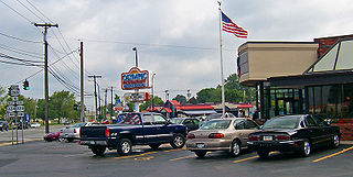
), are the Olympic and the Royal, two of the northern Buffalo area's most popular Greek
family restaurant
s, both of which not only survive but thrive despite competing ownership. Next, 265 crosses under the Youngmann Expressway (I-290
) without an interchange; traffic going to the highway is directed along Knoche Road (CR 306) to the exit at Delaware Avenue (NY 384
).
Beyond the expressway, 265 enters the city of Tonawanda
as Main Street and becomes mainly residential with a few small businesses here and there. Just before crossing Tonawanda Creek
and leaving Erie County, it absorbs NY 266 from the east.
's business district, 265 and 384 merge and assume the name River Road, which belongs to 266 in Erie County. The joined routes accordingly run alongside the Niagara River
for several miles in Wheatfield
, just before splitting before crossing Cayuga Creek in the eastern projection of Niagara Falls
.
Once again Military Road, 265 runs straight almost due northwest out of the city into the town of Niagara
towards the Fashion Outlets of Niagara Falls
, a super-regional outlet mall, and a 204000 sq ft (18,952.2 m²). Wal-Mart
Supercenter, located on the road near the junction with NY 182
. Continuing northwest, NY 265 makes its way to the reservoir at the Niagara Power Project, a joint U.S.-Canadian hydroelectric
venture that provides a significant portion of New York's electricity. The highway runs along I-190 as the two cross over the reservoir's dramatic outlet and into town of Lewiston
.
Shortly past that, access to the interstate and Canada
is provided through the proximity of the last exit before the Lewiston-Queenston Bridge
and the border. From there it is an equally short distance to 265's northern terminus, at NY 104
.
during the War of 1812
to connect Buffalo
with the encampments up at Fort Niagara
. The surviving portions of that route are those that still carry the name. NY 265, meanwhile, was assigned ca. 1936 to the portion of its modern alignment south of Tonawanda
. It was extended northward along NY 384
and Military Road to its current northern terminus near Lewiston in the early 1940s.
State highway
State highway, state road or state route can refer to one of three related concepts, two of them related to a state or provincial government in a country that is divided into states or provinces :#A...
located in the western part of New York
New York
New York is a state in the Northeastern region of the United States. It is the nation's third most populous state. New York is bordered by New Jersey and Pennsylvania to the south, and by Connecticut, Massachusetts and Vermont to the east...
in the United States
United States
The United States of America is a federal constitutional republic comprising fifty states and a federal district...
. NY 265 is a north–south route that roughly parallels the western parts of the Niagara River
Niagara River
The Niagara River flows north from Lake Erie to Lake Ontario. It forms part of the border between the Province of Ontario in Canada and New York State in the United States. There are differing theories as to the origin of the name of the river...
in Erie County
Erie County, New York
Erie County is a county located in the U.S. state of New York. As of the 2010 census, the population was 919,040. The county seat is Buffalo. The county's name comes from Lake Erie, which in turn comes from the Erie tribe of American Indians who lived south and east of the lake before 1654.Erie...
and Niagara County
Niagara County, New York
Niagara County is a county located in the U.S. state of New York. As of the 2010 census, the population was 216,469. The county seat is Lockport. The county name is from the Iroquois word Onguiaahra; meaning the strait or thunder of waters. It is the location of Niagara Falls and Fort Niagara, and...
. For much of its southern course, it is more frequently referred to by its longtime name, Military Road.
It is also known as Main Street in Tonawanda
Tonawanda (city), New York
Tonawanda is a city in Erie County, New York, United States. The population was 16,136 at the 2000 census. It is located at the northern edge of Erie County, south across the Erie Canal from North Tonawanda, and north of Buffalo, New York...
, and when concurrent with NY 384
New York State Route 384
New York State Route 384 is a state highway in Western New York in the United States. It is a north–south route extending from the city of Buffalo, Erie County to the city of Niagara Falls, Niagara County, and is one of several routes directly connecting the two cities. The southern terminus...
, River Road from NY 266
New York State Route 266
New York State Route 266 is a state highway in Erie County, New York, in the United States. It runs along the Niagara River from the city of Buffalo to the city of North Tonawanda. The southern terminus of the route is at the ramps leading to Interstate 190 exit 8 in Buffalo...
.
Erie County
Route 265 begins in western BuffaloBuffalo, New York
Buffalo is the second most populous city in the state of New York, after New York City. Located in Western New York on the eastern shores of Lake Erie and at the head of the Niagara River across from Fort Erie, Ontario, Buffalo is the seat of Erie County and the principal city of the...
near a complicated exit off I-190
Interstate 190 (New York)
Interstate 190 runs 28.34 miles from Interstate 90 near Buffalo, New York to Lewiston, New York via Niagara Falls. Parts of this highway were built on the former rights-of-way of the Lehigh Valley Railroad and the Erie Canal. It is referred to by locals as The One-Ninety...
that also involves NY 198
New York State Route 198
New York State Route 198 is a state highway located entirely within the city of Buffalo, New York, in the United States. It is named the Scajaquada Expressway for Scajaquada Creek, which it parallels as it heads across northern Buffalo...
(the Scajaquada Expressway), and NY 266
New York State Route 266
New York State Route 266 is a state highway in Erie County, New York, in the United States. It runs along the Niagara River from the city of Buffalo to the city of North Tonawanda. The southern terminus of the route is at the ramps leading to Interstate 190 exit 8 in Buffalo...
(Niagara Street). After following Amherst and Tonawanda streets northeast for about 0.6 mile (0.965604 km) around a slight curve, 265 finds the south end of Military Road which runs from there in a straight north-northeast line through the industrial neighborhoods of northwestern Buffalo into the suburbs, where it forms for a time the western border of the village of Kenmore
Kenmore, New York
Village of Kenmore is a village in Erie County, New York, in the United States. The population was 16,426 at the 2000 census. It is part of the Buffalo-Niagara Falls metropolitan area....
.
New York State Route 324
New York State Route 324 is an east–west state highway located in the western portion of New York in the United States...
), are the Olympic and the Royal, two of the northern Buffalo area's most popular Greek
Cuisine of Greece
Greek cuisine is a Mediterranean cuisine, sharing characteristics with the cuisines of Italy, the Balkans, Turkey, and the Levant. Contemporary Greek cookery makes wide use of olive oil, vegetables and herbs, grains and bread, wine, fish, and various meats, including poultry, rabbit and pork. Also...
family restaurant
Restaurant
A restaurant is an establishment which prepares and serves food and drink to customers in return for money. Meals are generally served and eaten on premises, but many restaurants also offer take-out and food delivery services...
s, both of which not only survive but thrive despite competing ownership. Next, 265 crosses under the Youngmann Expressway (I-290
Interstate 290 (New York)
Interstate 290 runs for near Buffalo, New York from I-90 to I-190. It connects Buffalo with its northern suburbs of Amherst and Tonawanda, and provides a route to Niagara Falls that bypasses the city of Buffalo. I-290 also connects to Interstate 990, and through this connection,...
) without an interchange; traffic going to the highway is directed along Knoche Road (CR 306) to the exit at Delaware Avenue (NY 384
New York State Route 384
New York State Route 384 is a state highway in Western New York in the United States. It is a north–south route extending from the city of Buffalo, Erie County to the city of Niagara Falls, Niagara County, and is one of several routes directly connecting the two cities. The southern terminus...
).
Beyond the expressway, 265 enters the city of Tonawanda
Tonawanda (city), New York
Tonawanda is a city in Erie County, New York, United States. The population was 16,136 at the 2000 census. It is located at the northern edge of Erie County, south across the Erie Canal from North Tonawanda, and north of Buffalo, New York...
as Main Street and becomes mainly residential with a few small businesses here and there. Just before crossing Tonawanda Creek
Tonawanda Creek
Tonawanda Creek is a small river in Western New York, in the United States. William Bright says the best that can be said of the name is that it is "probably from an Iroquoian source, but of unclear derivation".-Description:...
and leaving Erie County, it absorbs NY 266 from the east.
Niagara County
A few blocks into North TonawandaNorth Tonawanda, New York
North Tonawanda is a city in Niagara County, New York, United States. The population was 31,568 at the 2000 census. It is part of the Buffalo–Niagara Falls Metropolitan Statistical Area. The city is named after Tonawanda Creek, its south border...
's business district, 265 and 384 merge and assume the name River Road, which belongs to 266 in Erie County. The joined routes accordingly run alongside the Niagara River
Niagara River
The Niagara River flows north from Lake Erie to Lake Ontario. It forms part of the border between the Province of Ontario in Canada and New York State in the United States. There are differing theories as to the origin of the name of the river...
for several miles in Wheatfield
Wheatfield, New York
Wheatfield is a town in Niagara County, New York, United States. The population was 18,117 at the 2010 census. The name stems from the agricultural use of the town lands: Growing Wheat....
, just before splitting before crossing Cayuga Creek in the eastern projection of Niagara Falls
Niagara Falls, New York
Niagara Falls is a city in Niagara County, New York, United States. As of the 2010 census, the city had a total population of 50,193, down from the 55,593 recorded in the 2000 census. It is across the Niagara River from Niagara Falls, Ontario , both named after the famed Niagara Falls which they...
.
Once again Military Road, 265 runs straight almost due northwest out of the city into the town of Niagara
Niagara, New York
Niagara is a town in Niagara County, New York, United States. As of the 2010 census, the town had a total population of 8,378. The town is named after the famous waterfall Niagara Falls....
towards the Fashion Outlets of Niagara Falls
Fashion Outlets of Niagara Falls
Fashion Outlets of Niagara Falls, formerly Niagara Factory Outlet Mall and Niagara Factory Outlets, is an outlet mall serving Niagara Falls, New York. The outlet mall opened in 1982 in a former King's Department Store and connecting plaza. Before this, the site once hosted a drive-in movie...
, a super-regional outlet mall, and a 204000 sq ft (18,952.2 m²). Wal-Mart
Wal-Mart
Wal-Mart Stores, Inc. , branded as Walmart since 2008 and Wal-Mart before then, is an American public multinational corporation that runs chains of large discount department stores and warehouse stores. The company is the world's 18th largest public corporation, according to the Forbes Global 2000...
Supercenter, located on the road near the junction with NY 182
New York State Route 182
New York State Route 182 is a state highway in Niagara County, New York, United States. It serves as a signed connection between the Whirlpool Rapids Bridge over the Niagara River and the Niagara Falls International Airport east of the city of Niagara Falls...
. Continuing northwest, NY 265 makes its way to the reservoir at the Niagara Power Project, a joint U.S.-Canadian hydroelectric
Hydroelectricity
Hydroelectricity is the term referring to electricity generated by hydropower; the production of electrical power through the use of the gravitational force of falling or flowing water. It is the most widely used form of renewable energy...
venture that provides a significant portion of New York's electricity. The highway runs along I-190 as the two cross over the reservoir's dramatic outlet and into town of Lewiston
Lewiston (town), New York
Lewiston is a town in Niagara County, New York United States. The population was 16,262 at the 2010 census. The town and its contained village are named after Morgan Lewis, a governor of New York....
.
Shortly past that, access to the interstate and Canada
Canada
Canada is a North American country consisting of ten provinces and three territories. Located in the northern part of the continent, it extends from the Atlantic Ocean in the east to the Pacific Ocean in the west, and northward into the Arctic Ocean...
is provided through the proximity of the last exit before the Lewiston-Queenston Bridge
Lewiston-Queenston Bridge
The Lewiston–Queenston Bridge is an arch bridge that crosses the Niagara River gorge just south of the Niagara Escarpment. The bridge was officially opened on November 1, 1962. It is an international bridge between the United States and Canada. It connects Interstate 190 in the town of Lewiston,...
and the border. From there it is an equally short distance to 265's northern terminus, at NY 104
New York State Route 104
New York State Route 104 is a long east–west state highway in Upstate New York, United States. It spans six counties and enters the vicinity of four cities—Niagara Falls, Lockport, Rochester, and Oswego—as it follows a routing largely parallel to that of the southern shoreline of Lake...
.
History
Military Road was built by the ArmyUnited States Army
The United States Army is the main branch of the United States Armed Forces responsible for land-based military operations. It is the largest and oldest established branch of the U.S. military, and is one of seven U.S. uniformed services...
during the War of 1812
War of 1812
The War of 1812 was a military conflict fought between the forces of the United States of America and those of the British Empire. The Americans declared war in 1812 for several reasons, including trade restrictions because of Britain's ongoing war with France, impressment of American merchant...
to connect Buffalo
Buffalo, New York
Buffalo is the second most populous city in the state of New York, after New York City. Located in Western New York on the eastern shores of Lake Erie and at the head of the Niagara River across from Fort Erie, Ontario, Buffalo is the seat of Erie County and the principal city of the...
with the encampments up at Fort Niagara
Fort Niagara
Fort Niagara is a fortification originally built to protect the interests of New France in North America. It is located near Youngstown, New York, on the eastern bank of the Niagara River at its mouth, on Lake Ontario.-Origin:...
. The surviving portions of that route are those that still carry the name. NY 265, meanwhile, was assigned ca. 1936 to the portion of its modern alignment south of Tonawanda
Tonawanda (city), New York
Tonawanda is a city in Erie County, New York, United States. The population was 16,136 at the 2000 census. It is located at the northern edge of Erie County, south across the Erie Canal from North Tonawanda, and north of Buffalo, New York...
. It was extended northward along NY 384
New York State Route 384
New York State Route 384 is a state highway in Western New York in the United States. It is a north–south route extending from the city of Buffalo, Erie County to the city of Niagara Falls, Niagara County, and is one of several routes directly connecting the two cities. The southern terminus...
and Military Road to its current northern terminus near Lewiston in the early 1940s.