
New York State Route 5
Encyclopedia
New York State Route 5 (NY 5) is a state highway
that extends for 370.87 miles (596.86 km) across the state of New York
in the United States. It begins at the Pennsylvania state line in the Chautauqua County
town of Ripley
and passes through Buffalo
, Syracuse
, Utica
, Schenectady
, and several other smaller cities and communities on its way to downtown Albany
in Albany County
, where it terminates at U.S. Route 9 (US 9), here routed along the service roads for Interstate 787 (I-787). Prior to the construction of the New York State Thruway
, it was one of two main east–west highways traversing upstate New York
, the other being US 20
. West of New York, NY 5 continues as Pennsylvania Route 5 (PA 5) to Erie
.
NY 5 overlaps
with US 20 twice along its routing. The second, a 68 miles (109 km) overlap through western and central New York, is the second-longest concurrency in the state, stretching from Avon
east to the city of Auburn
in Cayuga County
. The concurrency is known locally as "Routes 5 and 20". As the route proceeds across the state, it also directly or indirectly meets every major north–south highway in upstate New York
, including all three north–south Interstate Highways (I-390
in Avon
, I-81 in Syracuse via US 11, and I-87
in Albany).
NY 5 was assigned in 1924 as a true cross-state highway, extending from the Pennsylvania state line in the west to the Massachusetts
state line in the east, mostly by way of modern US 20. At the time, modern NY 5 between Buffalo and Albany was designated as New York State Route 5A. By 1926, NY 5 was moved onto the routing of NY 5A while the old routing of NY 5 became NY 7. It was truncated in 1927 to Athol Springs
in the west and Albany in the east following the assignment of US 20, and again in 1930 to downtown Buffalo. NY 5 was reextended to the Pennsylvania state line ca. 1932 by way of its old routing to Athol Springs, an old alignment of US 20, and a lakeside spur route of US 20 that had been assigned in 1930. Only local realignments have occurred since.
, Erie Boulevard and West Genesee Street in Syracuse
, State Street in Schenectady
, and Central Avenue in Albany
, the state capital. It is a major local road in many other locations along its path.
NY 5 runs concurrent to US 20 twice between its endpoints: for three miles (5 km) between Silver Creek
and Irving
and for 68 miles (109 km) across western and central New York. At 67.6 miles (108 km) in length, the eastern overlap between NY 5 and US 20 is the longest surface-road concurrency in New York State, behind only the concurrency of NY 17
and I-86
in the Southern Tier
. When the length of east–west NY 17 is officially designated I-86 (scheduled for 2012), NY 17 will be truncated to a short north–south segment in downstate and the Routes 5 and 20 concurrency will become the longest in the state. In addition, NY 5 will then overtake NY 17 as the longest New York state route.
Maintenance of the majority of NY 5's 371 miles (597 km) is performed by the New York State Department of Transportation
. However, locally-owned and maintained sections exist in six cities. The city-maintained sections of NY 5 are in Buffalo
from NY 16
north to the city line (except of the Goodell Street portion, which is state-maintained); in Syracuse
between the western city line and just west of NY 635
; in Utica
from Leland Avenue east to the city line; in Amsterdam between Division and West Main Streets; in Schenectady
from Washington Avenue to the eastern city line; and the entirety of NY 5 within Albany
.
becomes NY 5 upon entering New York. It very closely follows the shore of Lake Erie
through all of Chautauqua County
. Once reaching the village of Silver Creek
it briefly overlaps US 20 until entering Erie County
at the Cattaraugus Reservation
and Route 438
where the roads once again split. Once in Erie County it pulls slightly inward from the lake shore from Brant
to the hamlet of Wanakah
. Once past Wanakah, the road once again closely borders the lake shore and goes through steadily more heavily developed areas, particularly the Ford
Stamping Plant and the Bethlehem Steel
plant in the city of Lackawanna
where the road is called the Hamburg Turnpike and eight wind powered turbines, which pump power into the national grid are visible. Near the northern edge of the city, NY 5 begins to ascend onto an elevated roadway as connects to Ridge Road by way of an interchange. Here, the route becomes the Skyway. After a quarter-mile, NY 5 passes seamlessly into Buffalo
.
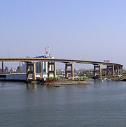 A short distance past the city line, NY 5 passes over the Union Ship Canal on a span of the elevated road known as the Father Baker
Bridge. North of the waterway, the Skyway gains a pair of frontage road
s, both named Fuhrmann Boulevard. Both the service roads and the Skyway run parallel to Lake Erie
until the northern end of the Buffalo Outer Harbor. Here, the frontage roads end while NY 5 turns to the northeast, crossing the Buffalo River
and entering downtown. On the north bank, the Skyway returns to a northerly routing as it passes First Niagara Center, located directly to the east, and Buffalo and Erie County Naval & Military Park
, situated to the west, and meets I-190
at exit 7. Past the interchange, the Skyway ends and the route descends in elevation, becoming an at-grade roadway once more at Church Street in the shadow of Buffalo City Hall
. NY 384
begins here, following Delaware Avenue north into the heart of downtown, while NY 5 turns east onto Church.
At Main Street, Church Street splits into a pair of one-way streets and becomes North and South Division Street. The route follows South Division eastward for two blocks to an intersection with Ellicott Street located one block north of Coca-Cola Field. At the junction, which includes the northern terminus of NY 16
, NY 5 turns northward, rejoining NY 5 westbound one block later at North Division. The route continues on Ellicott for nine blocks to the unidirectional East Tupper Street, where NY 5 westbound separates from the route once more. NY 5 eastbound, however, continues north on Ellicott for an additional block to the one-way Goodell Street. NY 5 heads west on Goodell for two blocks before turning north onto Main Street, rejoining NY 5 westbound at the intersection.
The route continues along Main Street throughout the remainder of its length in Buffalo, cutting through the city diagonally from southwest to northeast until it enters the town of Amherst
at the intersection of Bailey Avenue (US 62) at the south campus of the University at Buffalo.
, including the hamlets of Snyder
and Eggertsville and the village of Williamsville
and is heavily developed through the entire length of the town, particularly at the intersection with Transit Road (NY 78
). In the town of Clarence
, the road dips into a significant depression known as Clarence Hollow. Once leaving Clarence, NY 5 goes through predominantly rural areas until reaching the city of Batavia in Genesee County
, closely paralleling the New York State Thruway
through much of the county. The road travels eastward until reaching Livingston County
and the village of Caledonia
.
NY 5 heads southeast from the village of Caledonia, paralleling the former right-of-way
of an Erie-Lackawanna Railroad branch line that connected the villages of Caledonia and Avon
as it heads through spacious fields containing little more than farmland. At a rural intersection controlled by single-head flashing traffic signals west of Avon, NY 5 meets US 20
for the second time. The routes embark on a second concurrency
, merging onto the right-of-way of NY 5 as they cross the Genesee River
and enter both the town
and village
of Avon.
(LAL) grade crossing, the number of homes increases rapidly, only to be replaced by businesses in the area surrounding the LAL mainline. Located on the western edge of this transition is NY 39
, which terminates at this junction. Past the tracks, West Main intersects Rochester Street, a locally important north–south two-lane arterial that continues north of the village to the Rochester
suburb of Brighton
as East River Road. Shortly after this intersection, the homes return, following NY 5 and US 20 as West Main enters the heart of the village.
In the center of Avon, West Main feeds into Park Place, a large traffic circle
providing access to two local streets from NY 5 and US 20. The routes follow the circle counter-clockwise, departing the roundabout on East Main Street. The street proceeds east, passing through four blocks of densely populated neighborhoods before exiting the village and abruptly entering vast, barren fields to the east. NY 5 and US 20, now named Avon-Lima Road, intersects NY 15
two miles (3 km) to the east in East Avon, a community based around the intersection and the streets comprising it, and connects to I-390
at exit 10 a half-mile from NY 15. Continuing on, the road intersects a number of county routes over the next four miles (6 km) before becoming West Main Street once more, this time for the village of Lima
. At an intersection with NY 15A
in the village center, NY 5 and US 20 become East Main Street, retaining the name to the Ontario County
line at Honeoye Creek
.
, Routes 5 and 20 go unnamed as they proceed eastward. Roughly one mile from the county line in the hamlet of West Bloomfield, Routes 5 and 20 meet the southern terminus of NY 65
. Exiting the hamlet, NY 5 and US 20 head through another area dominated by open land, intersecting County Route 38 (CR 38) before passing seamlessly into East Bloomfield
. A mile and a half from the town line, Routes 5 and 20 intersect NY 64
, a road running northwest–southeast from the Monroe County
line south to NY 5 and US 20. NY 64, whose right-of-way ends at Routes 5 and 20 at the foot of a small hill, joins the two routes eastward on a triple overlap, entering the village of Bloomfield
and intersecting the southern terminus of NY 444
south of the portion of Bloomfield once known as Holcomb. Near the junction with NY 444, Routes 5, 20 and 64 take on a due east alignment, absorbing the routing used by Gauss Road west of this point.
A mile to the east at Whalen Road, NY 64 separates from NY 5 and US 20, following the road, and US 20A
, which has its eastern terminus at this intersection, south toward Bristol
. Routes 5 and 20 continue on through rural Ontario County before splitting from its easterly alignment at an intersection four miles (6 km) west of NY 64 and US 20A in the town of Canandaigua
. West Avenue, the former routing of NY 5 and US 20 into downtown Canandaigua
, continues east from the junction while NY 5 and US 20 turn south onto a bypass around Canandaigua.
to the southeast, NY 5 and US 20 meet NY 21
at a four-way intersection. Like Routes 5 and 20, NY 21 once continued directly into downtown, in this instance via Bristol Street to the east of the junction, but now follows Routes 5 and 20 along the east–west leg of the bypass. Past Bristol Street, the bypass widens from two to four lanes and, after meeting two local streets, enters the city of Canandaigua as the limited-access Western Boulevard, albeit with no exits. The route loses this distinction prior to intersecting South Main Street, where Routes 5 and 20 meet the southern terminus of NY 332
. NY 21 departs the bypass, following NY 332 into downtown, while NY 5 and US 20 continue onto the four-laned, median separated Eastern Boulevard, the original section of the Routes 5 and 20 bypass of Canandaigua. The roadway acts a center of commerce for the city, sporting restaurant
s, hotel
s, and supermarket
s along its length within the city limits.
Upon exiting the city, the establishments become a pair of shopping plazas centered around the intersection with the northern terminus of NY 364
. Across the town line in Hopewell
a quarter-mile to the east, a third plaza, once anchored by a Wal-Mart
, dominates the northeast corner of County Road 10 and Eastern Boulevard. On the adjacent parcel is another plaza containing a new Wal-Mart. At the entrance to the second plaza, Routes 5 and 20 intersect Lakeshore Drive, the former routing of NY 5 and US 20 to the south of the bypass. Past the junction, the divided highway comes to an end and, after another half-mile, narrows to two lanes.
. After 10.3 miles (16.6 km) of eastward progression through open land, the routes meet the northern terminus of both NY 14A
and NY 245
, concurrent at this location, in the town of Geneva
. A half-mile past NY 14A and NY 245, Routes 5 and 20 enter the city of Geneva and widens into a four lane road. In the city, NY 5 and US 20 intersect NY 14
by way of a pseudo-interchange on the bank of Seneca Lake. Routes 5 and 20 turn into a divided highway again at this point. At the interchange, NY 14 Truck joins Routes 5 and 20, bypassing a sharp turn on NY 14 downtown. NY 5 and US 20 continues as a divided highway around the northern tip of Seneca Lake, crossing the Preemption Line
and entering Seneca County
at its midpoint. A mile to the east in East Geneva, just east of a railroad underpass, Routes 5 and 20 meet the northern terminus of NY 96A
at a former trumpet interchange that has been converted to an intersection with a traffic signal.
 From NY 96A east to the village of Waterloo
, a distance of roughly four miles, Routes 5 and 20 becomes a two lane road and runs parallel to the Cayuga-Seneca Canal
. In Waterloo, the concurrency meets NY 96
in the village center. East of the village, the distance between the canal and the roadway decreases, making NY 5 and US 20 the closest road to the water for the next one and a half miles to NY 414
in the town of Seneca Falls
. NY 414 joins NY 5 and US 20, overlapping the road for 4.3 miles (6.9 km) into the village of Seneca Falls
. At Cayuga Street, NY 414 turns south, crossing the water body that is the canal and the Seneca River
and becoming Ovid Street while NY 5 and US 20 turns north onto Cayuga, following the street around the small Van Cleef Lake, through the Finger Lakes Railway
grade crossing, and exiting the village. Three miles from NY 414, just west of Montezuma National Wildlife Refuge
, NY 5 and US 20 meets NY 318
and NY 89
at intersections close enough to be considered a single junction. The intersection with Route 89 has a traffic signal.
About three miles (5 km) later, after entering Cayuga County over the Seneca River
/Cayuga and Seneca Canal, just north of Cayuga Lake
, the two routes meet NY 90
in the town of Aurelius
, at a traffic signal. A few miles east of that intersection, the highway meets the Finger Lakes Railway again, but crosses it via an overpass
. The routes continue eastward through Aurelius
to the city of Auburn
where it turns into a divided four lane highway again. On the western edge of the city, just after passing Finger Lakes Mall, NY 5 and US 20 meet the eastern terminus of NY 326
, which is also a four lane divided highway for a short stretch. In downtown Auburn, NY 5 and US 20's east and west lanes split apart from each other for a short distance as an arterial over the alignments of Clark Street, Franklin Street, and Grant Avenue. The arterial runs concurrent with NY 38
for 0.2 mile (0.321868 km). NY 38 then splits from the concurrency and joins NY 34
. A quarter-mile to the east, US 20 separates from NY 5 at the northern terminus of NY 38A
. Route 5 continues on after the split as the four-lane Grant Avenue passing by a high number shopping areas.
in Camillus to Fairmount
, NY 5 is a 5 miles (8 km) limited-access highway traversing the western suburbs of Syracuse
. At one time, the highway was to be extended to West Street in Syracuse, via the current Grand Avenue. The freeway has partial access to NY 173
from westbound NY 5. East of NY 173, the freeway connects to NY 695
at a directional-T interchange and passes over NY 297
without access. East of Fairmount, NY 5 alters to the south before turning east onto West Genesee Street and converting to grade-level intersections
.
 In Syracuse, NY 5 is parallel to I-690
for much of its routing but never encounters the highway, thus making the north–south streets that intersect NY 5 entry points to and from I-690. In downtown Syracuse, West Genesee Street becomes James Street. At the southern tip of the interchange between I-690 and I-81, NY 5 transfers onto Erie Boulevard and intersects State Street (US 11), but passes under I-81 without access. From the downtown area to DeWitt, NY 5 is divided. At the Syracuse-DeWitt boundary, NY 5 intersects NY 635
and eastward, it curves to a southeast course. Near Shoppingtown Mall
, NY 5 turns east onto Genesee Street to begin an overlap with NY 92
. Less than a mile east of the mall, NY 5 and NY 92 intersect I-481
at a cloverleaf interchange
.
. The segment of the overlap with NY 92 between I-481 and the eastern split is the busiest area of NY 5 in the Syracuse area and in all of Onondaga County. Past the split, NY 5 continues east through Onondaga and Madison
counties, passing Fayetteville
, Chittenango
, and Canastota
before entering the vicinity of Oneida
. West of the city, NY 5 intersects NY 365A, a spur route of NY 365
leading directly into downtown. To the east, NY 5 (which forms the southern boundary of the city) meets NY 46
before crossing over Oneida Creek
and into Oneida County
.
Just past the county line in Oneida Castle
, NY 5 intersects NY 365, a route leading northward to the New York State Thruway
in Verona
. NY 5 presses on, passing through the villages of Sherrill
and Vernon
(briefly overlapping NY 31
) and the town of Westmoreland
to the town of Kirkland
, where NY 5 intersects NY 233
, crosses over Oriskany Creek
, and meets the western terminus of NY 5B. The spur of NY 5 later rejoins its parent yards from where NY 5A
departs NY 5 to serve western Utica
. NY 5 itself continues eastward through New Hartford
, meeting NY 12B
prior to merging with NY 12
at Genesee Street. Both routes continue eastward across the Sauquoit Creek into Utica
.
, and all three cross the city together. NY 5 also intersects with the terminus of NY 840
at this point. Just south of the New York State Thruway
, I-790
begins as a short expressway, also including NY 5, 8, and 12. After crossing out of the city, they meet the Thruway, with NY 8 and 12 continuing northeast, while NY 5 and I-790 turn to the east-south-east, picking up the tail-end of NY 49
. These three, still as an expressway, straddle each side of the Thruway for a short way, with I-790 technically ending at the ramps for I-90. NY 5 continues to the end of the expressway, only a few hundred feet later, dropping to Leland Avenue. A few hundred feet to the north of the Thruway, NY 5 turns eastward again to continue down Herkimer Road. It closely parallels the Thruway all the way to Herkimer
, where NY 5 moves slightly northward through the center of the village, becoming State Street, while I-90 crosses the Erie Canal
and goes south for a short distance. There is a short concurrency with NY 28
in the village.
After exiting Herkimer, NY 5 continues east, closely paralleling this time the canal, through the city of Little Falls
as Main Street, where two more concurrencies occur, with NY 167
and NY 169
. Route 5 continues to parallel the canal, and in some instances again, the Thruway, through Amsterdam
, becoming Amsterdam Road all the way to Scotia
, where it crosses the canal into Schenectady
as Mohawk Avenue, turning into State Street upon entering the city limits. It continues fairly straight on a southeast course into Albany
as Central Avenue until it reaches Townsend Park
. At this point, Route 5 turns into Washington Avenue and all signage referring to NY 5 ceases. The New York State Department of Transportation
recognizes the route, however, as it continues down Washington Ave past the New York State Capitol
building, turning south for a short distance as Eagle Street. NY 5 then continues east on State Street to Broadway, where it again turns south east shortly before returning east on a small spur of Broadway, traveling underneath US 9
and I-787
. NY 5 ends at the Hudson River
.
in 1783, a surge of westward migration into Central
and Western New York
began. At the time, most travel west of the Albany area was by water. While rudimentary roads were laid out following the Mohawk River
, there were no major land routes west of Fort Schuyler (present day Utica
), except for an old east–west Iroquois
trail that was a simple foot path. By the late 1780s many companies began to set up their operations in the new settlements in the Central and Western New York. As a result, there was a clamor for the building of a main road running west from Utica.
On March 22, 1794, the New York State Legislature passed a law calling for the laying out and improvement of a public road from old Fort Schuyler on the Mohawk River to the settlement of Canawaugus on the Genesee River
, in as straight a line as the topography of the land would allow. This road was officially known as the "Great Genesee Road" and is one of the earliest state roads in New York, intended to provide access to the New Military Tract. As planned, it generally followed the old Iroquois trail through Oneida
, Manlius
, Onondaga Valley (south of modern Syracuse
), Skaneateles
, Auburn
, Seneca Falls
, Geneva, and Canandaigua
before ending at the Genesee River. Four years later, another legislative act authorized the extension of the Genesee Road to Buffalo
.
By the end of the 18th century, while the Genesee Road had been greatly improved and saw heavy traffic, many portions were still substandard and some sections had still not been completed. Partly because of this, and also because of the success of the Lancaster Turnpike in Pennsylvania
, the state outsourced the task of improving and maintaining the Genesee Road to a private company. On April 1, 1800, the Seneca Road Company was chartered for this purpose and the portion of the Genesee Road from Utica to Canandaigua was improved and operated as a toll road known as the Seneca Turnpike, which was 157 miles (253 km) long and, at the time, the longest turnpike
in the state. Three days later, the old road following the Mohawk River between Utica and Schenectady
also became a turnpike, known as the Mohawk Turnpike.
With the road leading from Albany
northwest to Schenectady having been already established as a turnpike (the Albany and Schenectady Turnpike) in 1797, an all-turnpike route over good quality roads was now available from Albany to Canandaigua. The western extension of the Genesee Road to Buffalo soon followed suit and also became an improved Macadam
toll road, the Ontario and Genesee Turnpike, in 1805. The Seneca Road Company was authorized to create a more northerly alternate route of the Seneca Turnpike in 1806. This branch left the original turnpike east of Seneca Falls and crossed more level terrain through Elbridge
, Geddes
, and Fayetteville
before rejoining the old path at Chittenango
. As the city of Syracuse
developed, traffic patterns changed and the northern branch route became more heavily used than the original road.
The construction and opening of the Erie Canal
in 1825 along the same alignment as the Albany to Buffalo route began to eat away at the revenues of these turnpike companies. In time, the turnpike business had become unprofitable and the companies were dissolved by 1852, causing the roads to revert to public control. The Seneca Road Company dissolved in 1852. The old, southern path of the Seneca Turnpike is now Franklin Street and Old Seneca Turnpike from Auburn to Marcellus
, NY 175
between Marcellus and Onondaga Hill
, and NY 173
from there east to Chittenango.
, the state began to take over and pave major throughfares at the beginning of the 20th century. In 1908, the state legislature created a statewide system of unsigned legislative route
s. One of the routes assigned at this time was Route 6, an Albany–Buffalo highway that followed the path of the Genesee Road and the Seneca Turnpike from Buffalo to Utica, the Mohawk Turnpike between Utica and Schenectady, and the Albany and Schenectady Turnpike from Schenectady to Albany. From Auburn to Chittenango, Route 6 utilized most of the newer, northern branch of the Seneca Turnpike.
The automobile allowed people to quickly travel long distances and a way to mark routes became needed. One early means of marking routes was the establishment of various auto trail
associations in the 1910s. These associations selected good quality roads and marked them with symbols or colors on telephone poles. Most of legislative Route 6 eventually became part of the Yellowstone Trail
, a cross-country auto trail established in 1912 that ran from Washington to Massachusetts
. In New York, the trail used modern US 20
from Pennsylvania to Silver Creek
, most of modern NY 5 from Silver Creek to Albany, and modern US 20 again from Albany to Massachusetts.
In 1924, following what other states did, New York began to assign route numbers to its main thoroughfares. The Albany to Buffalo portion of the Yellowstone Trail, which ran through the cities of Syracuse and Utica, was assigned the number NY 5A. The portion of the Yellowstone Trail southwest of Buffalo and east of Albany became part of NY 5, which bypassed Syracuse and Utica to the south. The Buffalo to Albany portion of NY 5's original alignment used a new road, Broadway Road, from Buffalo to Avon
and the old Cherry Valley Turnpike alignment from Skaneateles to Albany. In between Avon and Skaneateles, NY 5 and 5A overlapped.
By 1926, however, the Buffalo to Albany section of Route 5 was relocated onto the Genesee Road alignment, replacing NY 5A. NY 5's former, more southerly alignment was redesignated as NY 7. In 1927, the establishment of the U.S. Highway System created more numbering changes. US 20, which mainly followed the Yellowstone Trail elsewhere in the country, was designated in New York along NY 5 southwest of Hamburg and east of Albany and along old NY 7 from Skaneateles to Albany. Between the towns of Hamburg and Avon, the new US 20 used an even more southerly alignment, running via East Aurora and Warsaw. This truncated both ends of NY 5 to Athol Springs
(south of Buffalo in the town of Hamburg) in the west, and to Albany in the east.
In the 1930 state highway renumbering, NY 5 was truncated even further to begin in downtown Buffalo. The portion between Buffalo and Athol Springs was assigned as part of NY 62. Southwest of Buffalo, Southwestern Boulevard, an alternate route of US 20 between Irving
and Big Tree
(east of Athol Springs) became NY 20B. Further southwest, another alternate route of US 20 between the Pennsylvania line and Silver Creek
, running along the shore of Lake Erie, was designated as NY 20A. The NY 20A and NY 20B designations proved to be short-lived. Ca. 1932, US 62 was extended into New York, causing NY 62 to be renumbered. Around the same time, US 20 was realigned to follow NY 20B from Irving to Big Tree. NY 5 was extended along part of old NY 62 to Athol Springs, from where it continued to the Pennsylvania state line by way of US 20's old routing to Irving and all of NY 20A.
to the Buffalo River
. At the river, the new roadway broke from Fuhrmann and continued directly into downtown, returning to grade level two blocks south of Niagara Square. The expressway, known as the Buffalo Skyway, became part of a rerouted NY 5 by 1956. Visually, the Skyway cuts off the city from the Buffalo inner harbor. In 2008, there was momentum to tear it down, but the momentum has passed.
Farther east in Utica, construction began in the early 1950s on a new arterial highway—known as the North–South Arterial—through the city center. The new roadway bypassed NY 5, which was initially routed on Genesee Street and Herkimer Road through Utica. The first portion of the highway to open was the segment north of River Road, which was completed by 1956. It was extended southward to Oriskany Street (NY 5A
) by 1961 and completed entirely by 1964, at which time it became part of a rerouted NY 5 and NY 12
. Two portions of Genesee Street, from NY 12 in New Hartford to the Utica city line and from NY 5S
to Herkimer Road in Utica, remain state maintained to this day as unsigned NY 921E and NY 921C, respectively.
In the Syracuse
suburbs of Camillus
and Geddes
, NY 5 was initially routed on West Genesee Street between the villages of Camillus
and Solvay
. Construction on a bypass of this segment of NY 5 began in the early 1970s and was completed between NY 695
and Genesee Street by 1977. By the following year, the freeway was open to traffic up to Hinsdale Road; however, NY 5 remained on Genesee Street between Hinsdale and the Solvay village limits. The remainder of the Camillus Bypass was completed ca. 1979, at which time NY 5 was realigned to follow the freeway. Genesee Street is now largely maintained by Onondaga County as CR 98; however, two portions of the street remain state maintained. Near the western end of the expressway, the former routing of NY 5 became part of an extended NY 174
. Between the Camillus town line and the eastern end of the bypass, Genesee Street is unsigned NY 930W.
Smaller realignments also took place in other cities along the route. In Canandaigua
, NY 5 originally entered the city on West Avenue and followed South Main Street and Lakeshore Drive through the city limits before rejoining its current routing in Hopewell
. In the mid-1950s, a new bypass was built north of Lakeshore Drive from South Main Street to Hopewell. It became part of a realigned NY 5 by 1956. The remainder of the bypass around the southwestern extents of the city was built in the late 1970s and early 1980s. The former routing of NY 5 on South Main Street remains state maintained as NY 942T; until 1996, the portion of West Avenue between the west end of the bypass and the Canandaigua city line was maintained by the New York State Department of Transportation
(NYSDOT) as NY 942W. Even though maintenance of the road had been transferred to the town of Canandaigua
in 1996, the designation remained in NYSDOT documents until 2007.
In Geneva, NY 5 was initially routed on East North Street and Border City Road, overlapping NY 14
through the city and rejoining its modern routing in East Geneva. The overlap was eliminated ca. 1931 when NY 5 was moved onto a new roadway located along the edge of Seneca Lake. NY 5 was realigned again in the 1960s to use a new divided highway
built midway between the lake shore road and Border City Road. Border City Road is now maintained by Seneca County as CR 110.
State highway
State highway, state road or state route can refer to one of three related concepts, two of them related to a state or provincial government in a country that is divided into states or provinces :#A...
that extends for 370.87 miles (596.86 km) across the state of New York
New York
New York is a state in the Northeastern region of the United States. It is the nation's third most populous state. New York is bordered by New Jersey and Pennsylvania to the south, and by Connecticut, Massachusetts and Vermont to the east...
in the United States. It begins at the Pennsylvania state line in the Chautauqua County
Chautauqua County, New York
-Major highways:* Interstate 86/New York State Route 17 * Interstate 90 * U.S. Route 20* U.S. Route 62* New York State Route 5* New York State Route 39* New York State Route 60* New York State Route 394...
town of Ripley
Ripley, New York
Ripley is a town on Lake Erie in the westernmost part of Chautauqua County, New York, USA. The population was 2,636 at the 2000 census. The town was named after General Eleazer Wheelock Ripley. There are no incorporated villages in the town, but there is one CDP: Ripley.- History :Ripley was...
and passes through Buffalo
Buffalo, New York
Buffalo is the second most populous city in the state of New York, after New York City. Located in Western New York on the eastern shores of Lake Erie and at the head of the Niagara River across from Fort Erie, Ontario, Buffalo is the seat of Erie County and the principal city of the...
, Syracuse
Syracuse, New York
Syracuse is a city in and the county seat of Onondaga County, New York, United States, the largest U.S. city with the name "Syracuse", and the fifth most populous city in the state. At the 2010 census, the city population was 145,170, and its metropolitan area had a population of 742,603...
, Utica
Utica, New York
Utica is a city in and the county seat of Oneida County, New York, United States. The population was 62,235 at the 2010 census, an increase of 2.6% from the 2000 census....
, Schenectady
Schenectady, New York
Schenectady is a city in Schenectady County, New York, United States, of which it is the county seat. As of the 2010 census, the city had a population of 66,135...
, and several other smaller cities and communities on its way to downtown Albany
Albany, New York
Albany is the capital city of the U.S. state of New York, the seat of Albany County, and the central city of New York's Capital District. Roughly north of New York City, Albany sits on the west bank of the Hudson River, about south of its confluence with the Mohawk River...
in Albany County
Albany County, New York
Albany County is a county located in the U.S. state of New York, and is part of the Albany-Schenectady-Troy Metropolitan Statistical Area. The name is from the title of the Duke of York and Albany, who became James II of England . As of the 2010 census, the population was 304,204...
, where it terminates at U.S. Route 9 (US 9), here routed along the service roads for Interstate 787 (I-787). Prior to the construction of the New York State Thruway
New York State Thruway
The New York State Thruway is a system of limited-access highways located within the state of New York in the United States. The system, known officially as the Governor Thomas E. Dewey Thruway for former New York Governor Thomas E. Dewey, is operated by the New York State Thruway Authority and...
, it was one of two main east–west highways traversing upstate New York
New York
New York is a state in the Northeastern region of the United States. It is the nation's third most populous state. New York is bordered by New Jersey and Pennsylvania to the south, and by Connecticut, Massachusetts and Vermont to the east...
, the other being US 20
U.S. Route 20 in New York
U.S. Route 20 is a part of the U.S. Highway System that runs from Newport, Oregon, to Boston, Massachusetts. In the U.S. state of New York, US 20 extends from the Pennsylvania state line at Ripley to the Massachusetts state line in the Berkshire Mountains. US 20 is the longest...
. West of New York, NY 5 continues as Pennsylvania Route 5 (PA 5) to Erie
Erie, Pennsylvania
Erie is a city located in northwestern Pennsylvania in the United States. Named for the lake and the Native American tribe that resided along its southern shore, Erie is the state's fourth-largest city , with a population of 102,000...
.
NY 5 overlaps
Concurrency (road)
A concurrency, overlap, or coincidence in a road network is an instance of one physical road bearing two or more different highway, motorway, or other route numbers...
with US 20 twice along its routing. The second, a 68 miles (109 km) overlap through western and central New York, is the second-longest concurrency in the state, stretching from Avon
Avon (village), New York
Avon is a village in Livingston County, New York, USA. The population was 2,977 at the 2000 census. The village is named after the River Avon. ....
east to the city of Auburn
Auburn, New York
Auburn is a city in Cayuga County, New York, United States of America. As of the 2010 census, the city had a population of 27,687...
in Cayuga County
Cayuga County, New York
Cayuga County is a county located in the U.S. state of New York. It was named for one of the tribes of Indians in the Iroquois Confederation. Its county seat is Auburn.- History :...
. The concurrency is known locally as "Routes 5 and 20". As the route proceeds across the state, it also directly or indirectly meets every major north–south highway in upstate New York
Upstate New York
Upstate New York is the region of the U.S. state of New York that is located north of the core of the New York metropolitan area.-Definition:There is no clear or official boundary between Upstate New York and Downstate New York...
, including all three north–south Interstate Highways (I-390
Interstate 390
Interstate 390 is a north–south auxiliary Interstate Highway located entirely within New York in the United States. The southern terminus of the route is at the Southern Tier Expressway in the town of Avoca. Its northern terminus is at I-490 in Rochester...
in Avon
Avon (town), New York
Avon is a town in Livingston County, New York, United States. The town is bordered on the north by the town of Rush, New York in Monroe County. Avon is south of Rochester. The population was 6,443 at the 2000 census. The town is named after the river Avon...
, I-81 in Syracuse via US 11, and I-87
Interstate 87
Interstate 87 is a Interstate Highway located entirely within New York State in the United States of America. I-87 is the longest intrastate Interstate highway in the Interstate Highway System. Its southern end is at the Bronx approaches of the Robert F. Kennedy Bridge in New York City...
in Albany).
NY 5 was assigned in 1924 as a true cross-state highway, extending from the Pennsylvania state line in the west to the Massachusetts
Massachusetts
The Commonwealth of Massachusetts is a state in the New England region of the northeastern United States of America. It is bordered by Rhode Island and Connecticut to the south, New York to the west, and Vermont and New Hampshire to the north; at its east lies the Atlantic Ocean. As of the 2010...
state line in the east, mostly by way of modern US 20. At the time, modern NY 5 between Buffalo and Albany was designated as New York State Route 5A. By 1926, NY 5 was moved onto the routing of NY 5A while the old routing of NY 5 became NY 7. It was truncated in 1927 to Athol Springs
Athol Springs, New York
Athol Springs, New York is an unincorporated hamlet in the town of Hamburg in Erie County, New York, USA.-External Links:*...
in the west and Albany in the east following the assignment of US 20, and again in 1930 to downtown Buffalo. NY 5 was reextended to the Pennsylvania state line ca. 1932 by way of its old routing to Athol Springs, an old alignment of US 20, and a lakeside spur route of US 20 that had been assigned in 1930. Only local realignments have occurred since.
Route description
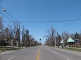
Although it is no longer commonly used for long distance travel, NY 5 is still regionally important. NY 5 is named Main Street in BuffaloBuffalo, New York
Buffalo is the second most populous city in the state of New York, after New York City. Located in Western New York on the eastern shores of Lake Erie and at the head of the Niagara River across from Fort Erie, Ontario, Buffalo is the seat of Erie County and the principal city of the...
, Erie Boulevard and West Genesee Street in Syracuse
Syracuse, New York
Syracuse is a city in and the county seat of Onondaga County, New York, United States, the largest U.S. city with the name "Syracuse", and the fifth most populous city in the state. At the 2010 census, the city population was 145,170, and its metropolitan area had a population of 742,603...
, State Street in Schenectady
Schenectady, New York
Schenectady is a city in Schenectady County, New York, United States, of which it is the county seat. As of the 2010 census, the city had a population of 66,135...
, and Central Avenue in Albany
Albany, New York
Albany is the capital city of the U.S. state of New York, the seat of Albany County, and the central city of New York's Capital District. Roughly north of New York City, Albany sits on the west bank of the Hudson River, about south of its confluence with the Mohawk River...
, the state capital. It is a major local road in many other locations along its path.
NY 5 runs concurrent to US 20 twice between its endpoints: for three miles (5 km) between Silver Creek
Silver Creek, New York
- Demographics :At the 2010 census there were 2,656 people, 1,048 households and 718 families residing in the village. The population density was 2,213.3 people per square mile . There were 1,174 housing units, with an average density of 978.3 per square mile...
and Irving
Irving, New York
Irving is a hamlet located in Chautauqua County, New York, USA. It is located near the east town line and the eastern county line in the Town of Hanover. US Route 20 and New York State Route 5 pass through the hamlet, which is also next to Cattaraugus Creek; New York State Route 438 terminates just...
and for 68 miles (109 km) across western and central New York. At 67.6 miles (108 km) in length, the eastern overlap between NY 5 and US 20 is the longest surface-road concurrency in New York State, behind only the concurrency of NY 17
New York State Route 17
New York State Route 17 is a state highway that extends for through the Southern Tier and Downstate regions of New York in the United States...
and I-86
Interstate 86 (east)
Interstate 86 is an Interstate Highway that extends for through northwestern Pennsylvania and southern New York in the United States...
in the Southern Tier
Southern Tier
The Southern Tier is a geographical term that refers to the counties of New York State west of the Catskill Mountains along the northern border of Pennsylvania. It is a loosely defined term that generally includes the counties that border Pennsylvania west of Delaware County inclusive...
. When the length of east–west NY 17 is officially designated I-86 (scheduled for 2012), NY 17 will be truncated to a short north–south segment in downstate and the Routes 5 and 20 concurrency will become the longest in the state. In addition, NY 5 will then overtake NY 17 as the longest New York state route.
Maintenance of the majority of NY 5's 371 miles (597 km) is performed by the New York State Department of Transportation
New York State Department of Transportation
The New York State Department of Transportation is responsible for the development and operation of highways, railroads, mass transit systems, ports, waterways and aviation facilities in the U.S...
. However, locally-owned and maintained sections exist in six cities. The city-maintained sections of NY 5 are in Buffalo
Buffalo, New York
Buffalo is the second most populous city in the state of New York, after New York City. Located in Western New York on the eastern shores of Lake Erie and at the head of the Niagara River across from Fort Erie, Ontario, Buffalo is the seat of Erie County and the principal city of the...
from NY 16
New York State Route 16
New York State Route 16 is a state highway in western New York, United States. It runs from the Pennsylvania state line, where it is one of the highest highways in the state in elevation, to downtown Buffalo. NY 16 is a major route through Erie County, despite the construction of the...
north to the city line (except of the Goodell Street portion, which is state-maintained); in Syracuse
Syracuse, New York
Syracuse is a city in and the county seat of Onondaga County, New York, United States, the largest U.S. city with the name "Syracuse", and the fifth most populous city in the state. At the 2010 census, the city population was 145,170, and its metropolitan area had a population of 742,603...
between the western city line and just west of NY 635
New York State Route 635
New York State Route 635 is a state highway located in the vicinity of Syracuse in Onondaga County, New York. The southern terminus of the route is at Erie Boulevard in Syracuse. The northern terminus is at Carrier Circle in DeWitt, where NY 635 connects to both the New York State...
; in Utica
Utica, New York
Utica is a city in and the county seat of Oneida County, New York, United States. The population was 62,235 at the 2010 census, an increase of 2.6% from the 2000 census....
from Leland Avenue east to the city line; in Amsterdam between Division and West Main Streets; in Schenectady
Schenectady, New York
Schenectady is a city in Schenectady County, New York, United States, of which it is the county seat. As of the 2010 census, the city had a population of 66,135...
from Washington Avenue to the eastern city line; and the entirety of NY 5 within Albany
Albany, New York
Albany is the capital city of the U.S. state of New York, the seat of Albany County, and the central city of New York's Capital District. Roughly north of New York City, Albany sits on the west bank of the Hudson River, about south of its confluence with the Mohawk River...
.
Pennsylvania to Buffalo
At the New York – Pennsylvania border in Ripley, PA 5Pennsylvania Route 5
Pennsylvania Route 5 is a westward continuation of New York State Route 5 in Pennsylvania. It runs from North East, Pennsylvania at the New York-Pennsylvania border to near Erie, a total of . The highway is called the Purple Heart Highway and mostly called Lake Road...
becomes NY 5 upon entering New York. It very closely follows the shore of Lake Erie
Lake Erie
Lake Erie is the fourth largest lake of the five Great Lakes in North America, and the tenth largest globally. It is the southernmost, shallowest, and smallest by volume of the Great Lakes and therefore also has the shortest average water residence time. It is bounded on the north by the...
through all of Chautauqua County
Chautauqua County, New York
-Major highways:* Interstate 86/New York State Route 17 * Interstate 90 * U.S. Route 20* U.S. Route 62* New York State Route 5* New York State Route 39* New York State Route 60* New York State Route 394...
. Once reaching the village of Silver Creek
Silver Creek, New York
- Demographics :At the 2010 census there were 2,656 people, 1,048 households and 718 families residing in the village. The population density was 2,213.3 people per square mile . There were 1,174 housing units, with an average density of 978.3 per square mile...
it briefly overlaps US 20 until entering Erie County
Erie County, New York
Erie County is a county located in the U.S. state of New York. As of the 2010 census, the population was 919,040. The county seat is Buffalo. The county's name comes from Lake Erie, which in turn comes from the Erie tribe of American Indians who lived south and east of the lake before 1654.Erie...
at the Cattaraugus Reservation
Cattaraugus Reservation
Cattaraugus Reservation is an Indian reservation of the Seneca Indian Nation of the Iroquois Confederacy located in New York. As of the 2000 census, the Indian reservation had a total population of 2,412. Its total area is about 34.4 mi²...
and Route 438
New York State Route 438
New York State Route 438 is a north–south state highway located entirely in Erie County, New York, in the United States. Though signed as north–south, the route runs in an almost east–west direction for between Gowanda and Irving through the Cattaraugus Indian Reservation. The...
where the roads once again split. Once in Erie County it pulls slightly inward from the lake shore from Brant
Brant, New York
Brant is a town in Erie County, New York, United States. As of the 2000 U.S. census, the town had a population of 1,906. The town was named after the Mohawk leader Joseph Brant....
to the hamlet of Wanakah
Wanakah, New York
Wanakah, New York is an unincorporated hamlet in the town of Hamburg in Erie County, New York, USA.-References:...
. Once past Wanakah, the road once again closely borders the lake shore and goes through steadily more heavily developed areas, particularly the Ford
Ford Motor Company
Ford Motor Company is an American multinational automaker based in Dearborn, Michigan, a suburb of Detroit. The automaker was founded by Henry Ford and incorporated on June 16, 1903. In addition to the Ford and Lincoln brands, Ford also owns a small stake in Mazda in Japan and Aston Martin in the UK...
Stamping Plant and the Bethlehem Steel
Bethlehem Steel
The Bethlehem Steel Corporation , based in Bethlehem, Pennsylvania, was once the second-largest steel producer in the United States, after Pittsburgh, Pennsylvania-based U.S. Steel. After a decline in the U.S...
plant in the city of Lackawanna
Lackawanna, New York
Lackawanna is a city in Erie County, New York, U.S., located just south of the city of Buffalo in the western part of New York state. The population was 18,141 at the 2010 census. The name derives from the Lackawanna Steel Company...
where the road is called the Hamburg Turnpike and eight wind powered turbines, which pump power into the national grid are visible. Near the northern edge of the city, NY 5 begins to ascend onto an elevated roadway as connects to Ridge Road by way of an interchange. Here, the route becomes the Skyway. After a quarter-mile, NY 5 passes seamlessly into Buffalo
Buffalo, New York
Buffalo is the second most populous city in the state of New York, after New York City. Located in Western New York on the eastern shores of Lake Erie and at the head of the Niagara River across from Fort Erie, Ontario, Buffalo is the seat of Erie County and the principal city of the...
.
Father Nelson Baker
Nelson Henry Baker was a Roman Catholic priest and church administrator in the Buffalo, New York area. At the time of his death in 1936, the "city of charity" he developed under the patronage of Our Lady of Victory in Lackawanna, NY consisted of a minor basilica, an infant home, a home for unwed...
Bridge. North of the waterway, the Skyway gains a pair of frontage road
Frontage road
A frontage road is a non-limited access road running parallel to a higher-speed road, usually a freeway, and feeding it at appropriate points of access...
s, both named Fuhrmann Boulevard. Both the service roads and the Skyway run parallel to Lake Erie
Lake Erie
Lake Erie is the fourth largest lake of the five Great Lakes in North America, and the tenth largest globally. It is the southernmost, shallowest, and smallest by volume of the Great Lakes and therefore also has the shortest average water residence time. It is bounded on the north by the...
until the northern end of the Buffalo Outer Harbor. Here, the frontage roads end while NY 5 turns to the northeast, crossing the Buffalo River
Buffalo River (New York)
The Buffalo River is a river that empties into the eastern end of Lake Erie, one of the Great Lakes, by the City of Buffalo in the United States of America. This stream is called the Buffalo River only in the vicinity of the city and is known as Buffalo Creek as it flows through other parts of...
and entering downtown. On the north bank, the Skyway returns to a northerly routing as it passes First Niagara Center, located directly to the east, and Buffalo and Erie County Naval & Military Park
Buffalo and Erie County Naval & Military Park
The Buffalo and Erie County Naval & Military Park, formerly known as The Buffalo Naval and Servicemen's Park, is a museum on the shore of Lake Erie in Buffalo, New York. It is home to several decommissioned US Naval vessels, including the Cleveland-class cruiser , the Fletcher-class destroyer ,...
, situated to the west, and meets I-190
Interstate 190 (New York)
Interstate 190 runs 28.34 miles from Interstate 90 near Buffalo, New York to Lewiston, New York via Niagara Falls. Parts of this highway were built on the former rights-of-way of the Lehigh Valley Railroad and the Erie Canal. It is referred to by locals as The One-Ninety...
at exit 7. Past the interchange, the Skyway ends and the route descends in elevation, becoming an at-grade roadway once more at Church Street in the shadow of Buffalo City Hall
Buffalo City Hall
Buffalo City Hall is the seat for municipal government in the City of Buffalo, New York State. Located at 65 Niagara Square, the 32 story Art Deco building was completed in 1931 by Dietel, Wade & Jones....
. NY 384
New York State Route 384
New York State Route 384 is a state highway in Western New York in the United States. It is a north–south route extending from the city of Buffalo, Erie County to the city of Niagara Falls, Niagara County, and is one of several routes directly connecting the two cities. The southern terminus...
begins here, following Delaware Avenue north into the heart of downtown, while NY 5 turns east onto Church.
At Main Street, Church Street splits into a pair of one-way streets and becomes North and South Division Street. The route follows South Division eastward for two blocks to an intersection with Ellicott Street located one block north of Coca-Cola Field. At the junction, which includes the northern terminus of NY 16
New York State Route 16
New York State Route 16 is a state highway in western New York, United States. It runs from the Pennsylvania state line, where it is one of the highest highways in the state in elevation, to downtown Buffalo. NY 16 is a major route through Erie County, despite the construction of the...
, NY 5 turns northward, rejoining NY 5 westbound one block later at North Division. The route continues on Ellicott for nine blocks to the unidirectional East Tupper Street, where NY 5 westbound separates from the route once more. NY 5 eastbound, however, continues north on Ellicott for an additional block to the one-way Goodell Street. NY 5 heads west on Goodell for two blocks before turning north onto Main Street, rejoining NY 5 westbound at the intersection.
The route continues along Main Street throughout the remainder of its length in Buffalo, cutting through the city diagonally from southwest to northeast until it enters the town of Amherst
Amherst, New York
Amherst is a town in Erie County, New York, United States. As of the 2010 census, the town had a total population of 122,366. This represents an increase of 5.0% from the 2000 census. The town is named for Jeffrey Amherst, a British Army officer of the colonial period...
at the intersection of Bailey Avenue (US 62) at the south campus of the University at Buffalo.
Buffalo to Avon
Once leaving the city of Buffalo, NY 5 heads east through the densely populated suburban town of AmherstAmherst, New York
Amherst is a town in Erie County, New York, United States. As of the 2010 census, the town had a total population of 122,366. This represents an increase of 5.0% from the 2000 census. The town is named for Jeffrey Amherst, a British Army officer of the colonial period...
, including the hamlets of Snyder
Snyder, New York
Snyder is a hamlet within the town of Amherst in Erie County, New York, United States that is part of the Buffalo – Niagara Falls metropolitan area. The hamlet was established in 1837...
and Eggertsville and the village of Williamsville
Williamsville, New York
Williamsville is a village in Erie County, New York in the United States. The population was 5,573 at the 2000 census. The village is named after Jonas Williams, an early settler...
and is heavily developed through the entire length of the town, particularly at the intersection with Transit Road (NY 78
New York State Route 78
New York State Route 78 , most commonly known as Transit Road, is a state highway in Western New York, USA. While it is signed north–south, the lower portion runs in an east–west direction across Wyoming County, from its beginning north of the Village of Gainesville.NY 78 is...
). In the town of Clarence
Clarence, New York
Clarence is a town located in the northeastern part of Erie County, New York, United States. The population was 30,673 according to the 2010 census. This represents an increase of 17.42% from the 2000 census figure . Clarence is also the name of a postal district in the south part of the town...
, the road dips into a significant depression known as Clarence Hollow. Once leaving Clarence, NY 5 goes through predominantly rural areas until reaching the city of Batavia in Genesee County
Genesee County, New York
Genesee County is a county located in Western New York, United States. As of the 2010 census, the population was 60,079. Its name is from the Seneca Indian word Gen-nis'-hee-yo meaning "The Beautiful Valley." Its county seat is Batavia.- History :...
, closely paralleling the New York State Thruway
New York State Thruway
The New York State Thruway is a system of limited-access highways located within the state of New York in the United States. The system, known officially as the Governor Thomas E. Dewey Thruway for former New York Governor Thomas E. Dewey, is operated by the New York State Thruway Authority and...
through much of the county. The road travels eastward until reaching Livingston County
Livingston County, New York
As of the census of 2000, there were 64,328 people, 22,150 households, and 15,349 families residing in the county. The population density was 102 people per square mile . There were 24,023 housing units at an average density of 38 per square mile...
and the village of Caledonia
Caledonia (village), New York
Caledonia is a village in Livingston County, New York, USA. The population was 2,327 at the 2000 census. The name refers to Scotland.The Village of Caledonia is located inside the Town of Caledonia and is southwest of Rochester, Monroe County....
.
NY 5 heads southeast from the village of Caledonia, paralleling the former right-of-way
Right-of-way (railroad)
A right-of-way is a strip of land that is granted, through an easement or other mechanism, for transportation purposes, such as for a trail, driveway, rail line or highway. A right-of-way is reserved for the purposes of maintenance or expansion of existing services with the right-of-way...
of an Erie-Lackawanna Railroad branch line that connected the villages of Caledonia and Avon
Avon (village), New York
Avon is a village in Livingston County, New York, USA. The population was 2,977 at the 2000 census. The village is named after the River Avon. ....
as it heads through spacious fields containing little more than farmland. At a rural intersection controlled by single-head flashing traffic signals west of Avon, NY 5 meets US 20
U.S. Route 20 in New York
U.S. Route 20 is a part of the U.S. Highway System that runs from Newport, Oregon, to Boston, Massachusetts. In the U.S. state of New York, US 20 extends from the Pennsylvania state line at Ripley to the Massachusetts state line in the Berkshire Mountains. US 20 is the longest...
for the second time. The routes embark on a second concurrency
Concurrency (road)
A concurrency, overlap, or coincidence in a road network is an instance of one physical road bearing two or more different highway, motorway, or other route numbers...
, merging onto the right-of-way of NY 5 as they cross the Genesee River
Genesee River
The Genesee River is a North American river flowing northward through the Twin Tiers of Pennsylvania and New York. The river provided the original power for the Rochester area's 19th century mills and still provides hydroelectric power for downtown Rochester....
and enter both the town
Avon (town), New York
Avon is a town in Livingston County, New York, United States. The town is bordered on the north by the town of Rush, New York in Monroe County. Avon is south of Rochester. The population was 6,443 at the 2000 census. The town is named after the river Avon...
and village
Avon (village), New York
Avon is a village in Livingston County, New York, USA. The population was 2,977 at the 2000 census. The village is named after the River Avon. ....
of Avon.
Avon to Ontario County
NY 5 and US 20 become West Main Street upon entering the village, underscoring the road's status as the primary east–west highway through the town. The route continues southeast from the Genesee, passing through the forested but sparsely populated western area of the village. As the route approaches the Livonia, Avon and Lakeville RailroadLivonia, Avon and Lakeville Railroad
The Livonia, Avon and Lakeville Railroad is a short line railroad that operates in Livingston County and Monroe County in New York, United States...
(LAL) grade crossing, the number of homes increases rapidly, only to be replaced by businesses in the area surrounding the LAL mainline. Located on the western edge of this transition is NY 39
New York State Route 39
New York State Route 39 is an east–west state highway in the western portion of New York in the United States. It begins and ends at intersections with U.S. Route 20 apart...
, which terminates at this junction. Past the tracks, West Main intersects Rochester Street, a locally important north–south two-lane arterial that continues north of the village to the Rochester
Rochester, New York
Rochester is a city in Monroe County, New York, south of Lake Ontario in the United States. Known as The World's Image Centre, it was also once known as The Flour City, and more recently as The Flower City...
suburb of Brighton
Brighton, Monroe County, New York
Brighton is a town in Monroe County, New York, USA. The population was 36,609 at the 2010 census.-History:The Town of Brighton, located on the southeast border of the city of Rochester, was originally settled approximately 1790, and formally established in 1814—earning it recognition as one...
as East River Road. Shortly after this intersection, the homes return, following NY 5 and US 20 as West Main enters the heart of the village.
In the center of Avon, West Main feeds into Park Place, a large traffic circle
Traffic circle
A traffic circle or rotary is a type of circular intersection in which traffic must travel in one direction around a central island. In some countries, traffic entering the circle has the right-of-way and drivers in the circle must yield. In many other countries, traffic entering the circle must...
providing access to two local streets from NY 5 and US 20. The routes follow the circle counter-clockwise, departing the roundabout on East Main Street. The street proceeds east, passing through four blocks of densely populated neighborhoods before exiting the village and abruptly entering vast, barren fields to the east. NY 5 and US 20, now named Avon-Lima Road, intersects NY 15
New York State Route 15
New York State Route 15 is a north–south state highway located in western New York in the United States. The southern terminus of the route is officially at Interstate 390 exit 3 south of the village of Wayland, although some signage indicating that NY 15 continues south to...
two miles (3 km) to the east in East Avon, a community based around the intersection and the streets comprising it, and connects to I-390
Interstate 390
Interstate 390 is a north–south auxiliary Interstate Highway located entirely within New York in the United States. The southern terminus of the route is at the Southern Tier Expressway in the town of Avoca. Its northern terminus is at I-490 in Rochester...
at exit 10 a half-mile from NY 15. Continuing on, the road intersects a number of county routes over the next four miles (6 km) before becoming West Main Street once more, this time for the village of Lima
Lima (village), New York
Lima is a village in Livingston County, New York, USA. The population was 2,459 at the 2000 census.The Village of Lima is in the Town of Lima and is nineteen miles south of the city of Rochester, NY.- History :...
. At an intersection with NY 15A
New York State Route 15A
New York State Route 15A is a north–south state highway located in the western portion of New York in the United States. It serves as an easterly alternate route of NY 15, beginning in the Livingston County town of Springwater and ending to the north in the Monroe County city of...
in the village center, NY 5 and US 20 become East Main Street, retaining the name to the Ontario County
Ontario County, New York
As of the census of 2000, there were 100,224 people, 38,370 households, and 26,360 families residing in the county. The population density was 156 people per square mile . There were 42,647 housing units at an average density of 66 per square mile...
line at Honeoye Creek
Honeoye Creek
Honeoye Creek is a tributary of the Genesee River in western New York in the United States.Honeoye Creek emerges from the north end of Honeoye Lake, one of the Finger Lakes, in Richmond, Ontario County...
.
Western Ontario County
In the town of West BloomfieldWest Bloomfield, New York
West Bloomfield is a town in Ontario County, New York, USA. The population was 2,549 at the 2000 census.The Town of West Bloomfield is on the county's western border and is south of the City of Rochester.- History :...
, Routes 5 and 20 go unnamed as they proceed eastward. Roughly one mile from the county line in the hamlet of West Bloomfield, Routes 5 and 20 meet the southern terminus of NY 65
New York State Route 65
New York State Route 65 is a north–south state highway located in the western portion of New York in the United States. It extends for from an intersection with U.S. Route 20 and NY 5 in the Ontario County town of West Bloomfield to a junction with NY 96 in the Monroe County...
. Exiting the hamlet, NY 5 and US 20 head through another area dominated by open land, intersecting County Route 38 (CR 38) before passing seamlessly into East Bloomfield
East Bloomfield, New York
East Bloomfield is a town in Ontario County, New York, United States. The population was 3,361 at the 2000 census.The Town of East Bloomfield is in the western part of the county, south of Rochester, NY.- History :...
. A mile and a half from the town line, Routes 5 and 20 intersect NY 64
New York State Route 64
New York State Route 64 is a north–south state highway in the Finger Lakes region of New York in the United States. Its southern terminus is at an intersection with NY 21 in the hamlet of Bristol Springs within the town of South Bristol, Ontario County...
, a road running northwest–southeast from the Monroe County
Monroe County, New York
Monroe County is a county located in the U.S. state of New York. As of the 2010 census, the population was 744,344. It is named after James Monroe, fifth President of the United States of America. Its county seat is the city of Rochester....
line south to NY 5 and US 20. NY 64, whose right-of-way ends at Routes 5 and 20 at the foot of a small hill, joins the two routes eastward on a triple overlap, entering the village of Bloomfield
Bloomfield, New York
Bloomfield is a village in Ontario County, New York, United States. The population was 1,267 at the 2000 census.The Village of Bloomfield is in the Town of East Bloomfield and is west of Canandaigua, NY.- History :...
and intersecting the southern terminus of NY 444
New York State Route 444
New York State Route 444 is a north–south state highway in Ontario County, New York, in the United States. It serves as a connector between the overlapping routes of U.S. Route 20, NY 5, and NY 64 south of the village of Bloomfield and NY 96 in the village of Victor...
south of the portion of Bloomfield once known as Holcomb. Near the junction with NY 444, Routes 5, 20 and 64 take on a due east alignment, absorbing the routing used by Gauss Road west of this point.
A mile to the east at Whalen Road, NY 64 separates from NY 5 and US 20, following the road, and US 20A
U.S. Route 20A (New York)
U.S. Route 20A is an east–west alternate route of US 20 that extends for across the western portion of New York in the United States. It leaves US 20 in Hamburg, a suburb of Buffalo, and rejoins it in East Bloomfield about five miles west of Canandaigua, the county seat of...
, which has its eastern terminus at this intersection, south toward Bristol
Bristol, New York
Bristol is a town in Ontario County, New York, USA. The population was 2,421 at the 2000 census. The town is named after Bristol County, Massachusetts by settlers from New England....
. Routes 5 and 20 continue on through rural Ontario County before splitting from its easterly alignment at an intersection four miles (6 km) west of NY 64 and US 20A in the town of Canandaigua
Canandaigua (town), New York
Canandaigua is a town in Ontario County, New York, USA. The population was 7,649 at the 2000 census. The name is a native word for "the chosen spot" or "the chosen place."...
. West Avenue, the former routing of NY 5 and US 20 into downtown Canandaigua
Canandaigua (city), New York
Canandaigua is a city in Ontario County, New York, USA, of which it is the county seat. The population was 11,264 at the 2000 census...
, continues east from the junction while NY 5 and US 20 turn south onto a bypass around Canandaigua.
Canandaigua area
Half a mile from the start of the bypass and a short distance before the arterial makes a turn eastward to traverse Canandaigua LakeCanandaigua Lake
Canandaigua Lake is the fourth largest of the Finger Lakes, in the U.S. state of New York. The city of Canandaigua is located at the northern shore of the lake and the village of Naples is just a few miles south of the southern end...
to the southeast, NY 5 and US 20 meet NY 21
New York State Route 21
New York State Route 21 is a state highway extending for through the western part of New York in the United States. The southern terminus of the route is at NY 417 in Andover. The northern terminus is at NY 104 in Williamson...
at a four-way intersection. Like Routes 5 and 20, NY 21 once continued directly into downtown, in this instance via Bristol Street to the east of the junction, but now follows Routes 5 and 20 along the east–west leg of the bypass. Past Bristol Street, the bypass widens from two to four lanes and, after meeting two local streets, enters the city of Canandaigua as the limited-access Western Boulevard, albeit with no exits. The route loses this distinction prior to intersecting South Main Street, where Routes 5 and 20 meet the southern terminus of NY 332
New York State Route 332
New York State Route 332 is a north–south state highway that extends for through Ontario County in the Finger Lakes region of New York in the United States. The southern terminus of the route is at an intersection with U.S. Route 20, NY 5, and NY 21 just south of...
. NY 21 departs the bypass, following NY 332 into downtown, while NY 5 and US 20 continue onto the four-laned, median separated Eastern Boulevard, the original section of the Routes 5 and 20 bypass of Canandaigua. The roadway acts a center of commerce for the city, sporting restaurant
Restaurant
A restaurant is an establishment which prepares and serves food and drink to customers in return for money. Meals are generally served and eaten on premises, but many restaurants also offer take-out and food delivery services...
s, hotel
Hotel
A hotel is an establishment that provides paid lodging on a short-term basis. The provision of basic accommodation, in times past, consisting only of a room with a bed, a cupboard, a small table and a washstand has largely been replaced by rooms with modern facilities, including en-suite bathrooms...
s, and supermarket
Supermarket
A supermarket, a form of grocery store, is a self-service store offering a wide variety of food and household merchandise, organized into departments...
s along its length within the city limits.
Upon exiting the city, the establishments become a pair of shopping plazas centered around the intersection with the northern terminus of NY 364
New York State Route 364
New York State Route 364 is a state highway located in the Finger Lakes region of New York in the United States. It extends for from an intersection with NY 14A in Penn Yan to a junction with the concurrent routes of U.S. Route 20 and NY 5 just east of the Canandaigua city...
. Across the town line in Hopewell
Hopewell, New York
Hopewell is a town in Ontario County, New York, United States. The population was 3,346 at the 2000 census.The Town of Hopewell is in the north central part of the county, east of the City of Canandaigua.-History:...
a quarter-mile to the east, a third plaza, once anchored by a Wal-Mart
Wal-Mart
Wal-Mart Stores, Inc. , branded as Walmart since 2008 and Wal-Mart before then, is an American public multinational corporation that runs chains of large discount department stores and warehouse stores. The company is the world's 18th largest public corporation, according to the Forbes Global 2000...
, dominates the northeast corner of County Road 10 and Eastern Boulevard. On the adjacent parcel is another plaza containing a new Wal-Mart. At the entrance to the second plaza, Routes 5 and 20 intersect Lakeshore Drive, the former routing of NY 5 and US 20 to the south of the bypass. Past the junction, the divided highway comes to an end and, after another half-mile, narrows to two lanes.
Canandaigua to Auburn
Deeper into Hopewell, the area surrounding Routes 5 and 20 become rural once more. Roughly 1.5 miles (2.4 km) from the end of the bypass, NY 5 and US 20 meet NY 247New York State Route 247
New York State Route 247 is a north–south state highway located in the Finger Lakes region of New York in the United States. It extends for from an intersection with NY 364 in the Yates County town of Potter to a junction with U.S. Route 20 and NY 5 in the Ontario...
. After 10.3 miles (16.6 km) of eastward progression through open land, the routes meet the northern terminus of both NY 14A
New York State Route 14A
New York State Route 14A is a north–south state highway located in the Finger Lakes region of New York in the United States. It extends for from an interchange with NY 14 in the Schuyler County town of Reading to an intersection with U.S. Route 20 and NY 5 west of the Ontario...
and NY 245
New York State Route 245
New York State Route 245 is a state highway in the Finger Lakes region of New York in the United States. The southern terminus of the route is at NY 21 in Naples. The northern terminus is at NY 5, U.S. Route 20 and NY 14A west of Geneva...
, concurrent at this location, in the town of Geneva
Geneva (town), New York
Geneva is a town in Ontario County, New York, USA. The population was 3,289 at the 2000 census. The actual source of the name is ambiguous.The Town of Geneva is in the southeastern part of the county and borders the City of Geneva.- History :...
. A half-mile past NY 14A and NY 245, Routes 5 and 20 enter the city of Geneva and widens into a four lane road. In the city, NY 5 and US 20 intersect NY 14
New York State Route 14
New York State Route 14 is a state highway located in western New York in the United States. Along with NY 19, it is one of two routes to transect the state in a north–south fashion between the Pennsylvania border and Lake Ontario...
by way of a pseudo-interchange on the bank of Seneca Lake. Routes 5 and 20 turn into a divided highway again at this point. At the interchange, NY 14 Truck joins Routes 5 and 20, bypassing a sharp turn on NY 14 downtown. NY 5 and US 20 continues as a divided highway around the northern tip of Seneca Lake, crossing the Preemption Line
Preemption Line
The Preemption Line divides the Indian lands of western New York State awarded to New York from those awarded to Commonwealth of Massachusetts by the Treaty of Hartford of 1786...
and entering Seneca County
Seneca County, New York
As of the census of 2000, there were 33,342 people, 12,630 households, and 8,626 families residing in the county. The population density was 103 people per square mile . There were 14,794 housing units at an average density of 46 per square mile...
at its midpoint. A mile to the east in East Geneva, just east of a railroad underpass, Routes 5 and 20 meet the northern terminus of NY 96A
New York State Route 96A
New York State Route 96A is a state highway in Seneca County, New York, in the United States. It is a north–south road between Seneca Lake and Cayuga Lake, two of the Finger Lakes. NY 96A is two lanes wide for most of its length, with the exception of the long four-lane divided highway...
at a former trumpet interchange that has been converted to an intersection with a traffic signal.
Waterloo (village), New York
Waterloo is a village in and the county seat of Seneca County, New York, United States. The population was 5,111 at the 2000 census. The village is named after the Waterloo in Belgium, where Napoleon was defeated...
, a distance of roughly four miles, Routes 5 and 20 becomes a two lane road and runs parallel to the Cayuga-Seneca Canal
Cayuga-Seneca Canal
The Cayuga–Seneca Canal is a canal in New York, USA. It is now part of the New York State Canal System.The Cayuga–Seneca Canal connects the Erie Canal to Cayuga Lake and Seneca Lake. It is approximately long.-History:...
. In Waterloo, the concurrency meets NY 96
New York State Route 96
New York State Route 96 is a northwest–southeast state highway in the Finger Lakes region of New York in the United States. The southern terminus of the route is at an interchange with NY 17 in the Southern Tier village of Owego, Tioga County. Its northern terminus is at a junction with...
in the village center. East of the village, the distance between the canal and the roadway decreases, making NY 5 and US 20 the closest road to the water for the next one and a half miles to NY 414
New York State Route 414
New York State Route 414 is a north–south state highway in the Southern Tier and Finger Lakes regions of New York in the United States. It extends for from an intersection with NY 352 in the Steuben County city of Corning to a junction with NY 104 in the Wayne County town of Huron...
in the town of Seneca Falls
Seneca Falls (town), New York
Seneca Falls is a town in Seneca County, New York, United States. The population was 9,347 at the 2000 census.The Town of Seneca Falls contains a village also called Seneca Falls...
. NY 414 joins NY 5 and US 20, overlapping the road for 4.3 miles (6.9 km) into the village of Seneca Falls
Seneca Falls (village), New York
Seneca Falls is a village in Seneca County, New York, United States. The population was 6,861 at the 2000 census. The village is in the Town of Seneca Falls, east of Geneva, New York. On March 16, 2010, village residents voted to dissolve the village, a move that would take effect at the end of 2011...
. At Cayuga Street, NY 414 turns south, crossing the water body that is the canal and the Seneca River
Seneca River (New York)
The Seneca River in central New York flows from west to east, from Seneca Lake, through the Montezuma Marsh at the north end of Cayuga Lake to the Seneca's confluence with the Oneida and Oswego rivers at the Three Rivers area north of Syracuse. Much of the river has been channelized to form part...
and becoming Ovid Street while NY 5 and US 20 turns north onto Cayuga, following the street around the small Van Cleef Lake, through the Finger Lakes Railway
Finger Lakes Railway
The Finger Lakes Railway is a class III railroad in the Finger Lakes region of New York.The Finger Lakes Railway began operation on July 23, 1995 and operates in Onondaga, Cayuga, Seneca, Ontario, Schuyler and Yates counties....
grade crossing, and exiting the village. Three miles from NY 414, just west of Montezuma National Wildlife Refuge
Montezuma National Wildlife Refuge
Montezuma National Wildlife Refuge is a wildlife preserve operated by the United States Fish and Wildlife Service, encompassing part of the Montezuma Swamp at the north end of Cayuga Lake...
, NY 5 and US 20 meets NY 318
New York State Route 318
New York State Route 318 is an east–west state highway in the Finger Lakes region of New York, United States. The western terminus of the route is at an intersection with NY 14 at New York State Thruway exit 42 in the town of Phelps. The eastern terminus is at an intersection that...
and NY 89
New York State Route 89
New York State Route 89 is a north–south state highway in central New York in the United States. It extends for from an intersection with NY 13, NY 34, and NY 96 in the Tompkins County city of Ithaca to an interchange with NY 104 in the Wayne County town of town of Wolcott...
at intersections close enough to be considered a single junction. The intersection with Route 89 has a traffic signal.
About three miles (5 km) later, after entering Cayuga County over the Seneca River
Seneca River (New York)
The Seneca River in central New York flows from west to east, from Seneca Lake, through the Montezuma Marsh at the north end of Cayuga Lake to the Seneca's confluence with the Oneida and Oswego rivers at the Three Rivers area north of Syracuse. Much of the river has been channelized to form part...
/Cayuga and Seneca Canal, just north of Cayuga Lake
Cayuga Lake
Cayuga Lake is the longest of central New York's glacial Finger Lakes, and is the second largest in surface area and second largest in volume. It is just under 40 miles long. Its average width is 1.7 miles , and it is at its widest point near Aurora...
, the two routes meet NY 90
New York State Route 90
New York State Route 90 is a north–south state highway in the Finger Lakes region of New York, United States. All but five of the route's are located in Cayuga County, with the remaining situated in Cortland County. The southern terminus of the route is at an intersection with U.S....
in the town of Aurelius
Aurelius, New York
Aurelius is a town in Cayuga County, New York, USA. The population was 2,792 at the 2010 census. The town was named after the Roman Emperor Marcus Aurelius.The Town of Aurelius is at the western edge of the county and borders the City of Auburn....
, at a traffic signal. A few miles east of that intersection, the highway meets the Finger Lakes Railway again, but crosses it via an overpass
Overpass
An overpass is a bridge, road, railway or similar structure that crosses over another road or railway...
. The routes continue eastward through Aurelius
Aurelius, New York
Aurelius is a town in Cayuga County, New York, USA. The population was 2,792 at the 2010 census. The town was named after the Roman Emperor Marcus Aurelius.The Town of Aurelius is at the western edge of the county and borders the City of Auburn....
to the city of Auburn
Auburn, New York
Auburn is a city in Cayuga County, New York, United States of America. As of the 2010 census, the city had a population of 27,687...
where it turns into a divided four lane highway again. On the western edge of the city, just after passing Finger Lakes Mall, NY 5 and US 20 meet the eastern terminus of NY 326
New York State Route 326
New York State Route 326 is a state highway in Cayuga County, New York, United States. NY 326 runs in a southwest to northeast direction from the village of Union Springs to the city of Auburn. The western terminus of the route is at an intersection with NY 90 near the northern...
, which is also a four lane divided highway for a short stretch. In downtown Auburn, NY 5 and US 20's east and west lanes split apart from each other for a short distance as an arterial over the alignments of Clark Street, Franklin Street, and Grant Avenue. The arterial runs concurrent with NY 38
New York State Route 38
New York State Route 38 is a north–south state highway in the Finger Lakes region of New York in the United States. Its southern terminus is at an intersection with NY 96 in the town of Owego in Tioga County. The northern terminus is at a junction with NY 104A in the town of...
for 0.2 mile (0.321868 km). NY 38 then splits from the concurrency and joins NY 34
New York State Route 34
New York State Route 34 is a north–south New York state route located in Central New York. Its southern terminus is at the Pennsylvania state line in the village of Waverly, where it connects to Pennsylvania Route 199 and meets NY 17...
. A quarter-mile to the east, US 20 separates from NY 5 at the northern terminus of NY 38A
New York State Route 38A
New York State Route 38A is a north–south state highway located within Onondaga and Cayuga Counties in central New York, United States. The southern terminus of the route is at an intersection with NY 38 in the village of Moravia. Its northern terminus is at a junction with U.S....
. Route 5 continues on after the split as the four-lane Grant Avenue passing by a high number shopping areas.
Auburn to Syracuse
From NY 174New York State Route 174
New York State Route 174 is a state highway in Onondaga County, located in Central New York, United States. The highway is long and passes through mostly rural regions. Route 174 begins at an intersection with NY 41 in Borodino, a hamlet of Spafford...
in Camillus to Fairmount
Fairmount, New York
Fairmount is a hamlet in Onondaga County, New York, United States. The Fairmount area was originally part of the New York State Salt Reservation, but was annexed to the Town of Camillus in 1834. Prior to that date, census enumerations for Fairmount were included in the Town of Onondaga census...
, NY 5 is a 5 miles (8 km) limited-access highway traversing the western suburbs of Syracuse
Syracuse, New York
Syracuse is a city in and the county seat of Onondaga County, New York, United States, the largest U.S. city with the name "Syracuse", and the fifth most populous city in the state. At the 2010 census, the city population was 145,170, and its metropolitan area had a population of 742,603...
. At one time, the highway was to be extended to West Street in Syracuse, via the current Grand Avenue. The freeway has partial access to NY 173
New York State Route 173
New York State Route 173 is a state highway located in the Syracuse area of central New York, United States. It takes a slightly bow-shaped route from NY 31 in the town of Van Buren to NY 5 in Chittenango, gently curving to the south of Downtown Syracuse in the center of its routing...
from westbound NY 5. East of NY 173, the freeway connects to NY 695
New York State Route 695
New York State Route 695 is a short state highway located west of Syracuse in the towns of Camillus and Geddes in Onondaga County, New York. The number of the highway was derived from the two highways that NY 695 links, Interstate 690 and NY 5...
at a directional-T interchange and passes over NY 297
New York State Route 297
New York State Route 297 is a state highway in the western suburbs of Syracuse, New York, in the United States. It is signed as north–south; however, it follows more of a southwest–northeast alignment for through the towns of Camillus and Geddes. The southern terminus of the route is at an...
without access. East of Fairmount, NY 5 alters to the south before turning east onto West Genesee Street and converting to grade-level intersections
At-grade intersection
An at-grade intersection is a junction at which two or more transport axes cross at the same level .-Traffic management:With areas of high or fast traffic, an at-grade intersection normally requires a traffic control device such as a stop sign, traffic light or railway signal to manage conflicting...
.
Interstate 690
Interstate 690 is an auxiliary Interstate Highway that extends for through the vicinity of Syracuse, New York, in the United States. It is a spur of I-90 that travels southeast from Thruway exit 39 in Van Buren to I-481 in DeWitt...
for much of its routing but never encounters the highway, thus making the north–south streets that intersect NY 5 entry points to and from I-690. In downtown Syracuse, West Genesee Street becomes James Street. At the southern tip of the interchange between I-690 and I-81, NY 5 transfers onto Erie Boulevard and intersects State Street (US 11), but passes under I-81 without access. From the downtown area to DeWitt, NY 5 is divided. At the Syracuse-DeWitt boundary, NY 5 intersects NY 635
New York State Route 635
New York State Route 635 is a state highway located in the vicinity of Syracuse in Onondaga County, New York. The southern terminus of the route is at Erie Boulevard in Syracuse. The northern terminus is at Carrier Circle in DeWitt, where NY 635 connects to both the New York State...
and eastward, it curves to a southeast course. Near Shoppingtown Mall
Shoppingtown Mall
Shoppingtown Mall is a regional shopping mall in Dewitt, New York, United States with over 75 stores, with Dick's Sporting Goods, JCPenney, Macy's and Sears serving as anchor stores. It has a food court and a fourteen-screen Regal Cinemas movie theater...
, NY 5 turns east onto Genesee Street to begin an overlap with NY 92
New York State Route 92
New York State Route 92 is a state highway located in central New York in the United States. The western terminus of the route is at an intersection with U.S. Route 11 in downtown Syracuse. Its eastern terminus is at a junction with US 20 west of the village of Cazenovia...
. Less than a mile east of the mall, NY 5 and NY 92 intersect I-481
Interstate 481
Interstate 481 is an auxiliary Interstate Highway that serves as an eastern bypass of Syracuse, New York, in the United States. It begins at its parent, I-81, in the city's southern end and travels through the eastern Syracuse suburbs of Jamesville, DeWitt, and Cicero before rejoining I-81 in...
at a cloverleaf interchange
Cloverleaf interchange
A cloverleaf interchange is a two-level interchange in which left turns, reverse direction in left-driving regions, are handled by ramp roads...
.
Syracuse to Utica
NY 5 and NY 92 remain concurrent up to Highbridge Road, where NY 92 splits from NY 5 and heads southeast to ManliusManlius (village), New York
Manlius is a village in Onondaga County, New York, USA. The population was 4,819 at the 2000 census. The village takes its name from its town.The Village of Manlius is near the south town line of the Town of Manlius and is southeast of the City of Syracuse of which it is a suburb.An area of about...
. The segment of the overlap with NY 92 between I-481 and the eastern split is the busiest area of NY 5 in the Syracuse area and in all of Onondaga County. Past the split, NY 5 continues east through Onondaga and Madison
Madison County, New York
Madison County is a county located in the U.S. state of New York. As of the 2010 census, the population was 73,442. It is named after James Madison, fourth President of the United States of America...
counties, passing Fayetteville
Fayetteville, New York
Fayetteville is a village located in Onondaga County, New York, United States. As of the 2000 U.S. Census, the village had a population of 4,190. The village is named after Lafayette, a national hero of both France and the United States...
, Chittenango
Chittenango, New York
Chittenango is a village located in Madison County, New York, in the United States. The village is in the south part of the Town of Sullivan. The population was 5,081 at the 2010 census.- History :...
, and Canastota
Canastota, New York
Canastota is a village located inside the Town of Lenox in Madison County, New York, United States. The population was 4,425 at the 2000 census.The Village of Canastota is in the south part of the Town of Lenox.- History :...
before entering the vicinity of Oneida
Oneida, New York
Oneida is a city in Madison County located west of Oneida Castle and east of Canastota, New York, United States. The population was 10,987 at the 2000 census. The city, like both Oneida County and the nearby silver and china maker, takes its name from the Oneida tribe...
. West of the city, NY 5 intersects NY 365A, a spur route of NY 365
New York State Route 365
New York State Route 365 is an east–west state highway in the central portion of New York in the United States. It extends for from an intersection with NY 5 east of the Oneida County city of Oneida to a junction with NY 8 in the Herkimer County town of Ohio...
leading directly into downtown. To the east, NY 5 (which forms the southern boundary of the city) meets NY 46
New York State Route 46
New York State Route 46 is a state highway in Central New York, United States. It extends from NY 12B in the Madison County town of Eaton to NY 12D in the Oneida County village of Boonville. NY 46 passes through the cities of Oneida and Rome.-Madison County:NY 46 begins at...
before crossing over Oneida Creek
Oneida Creek
Oneida Creek is a small river in New York in the USA. The creek enters Oneida Lake at its southeast corner at a location known as South Bay, a bay of the lake...
and into Oneida County
Oneida County, New York
Oneida County is a county located in the U.S. state of New York. As of the 2010 census, the population was 234,878. The county seat is Utica. The name is in honor of the Oneida, an Iroquoian tribe that formerly occupied the region....
.
Just past the county line in Oneida Castle
Oneida Castle, New York
Oneida Castle is a village in Oneida County, New York, United States. The population was 627 at the 2000 census.The Village of Oneida Castle is in the northwest corner of the Town of Vernon...
, NY 5 intersects NY 365, a route leading northward to the New York State Thruway
New York State Thruway
The New York State Thruway is a system of limited-access highways located within the state of New York in the United States. The system, known officially as the Governor Thomas E. Dewey Thruway for former New York Governor Thomas E. Dewey, is operated by the New York State Thruway Authority and...
in Verona
Verona, New York
Verona is a town in Oneida County, New York, United States. The population was 6,425 at the 2000 census. The source of the town name is unknown, though it's possibly named after Verona, Italy....
. NY 5 presses on, passing through the villages of Sherrill
Sherrill, New York
Sherrill is a city in Oneida County, New York, United States. With a population of 3,147 , it is the least populous city in the state. Sherill is located at the western end of the Town of Vernon on Route 5. Sherrill is referred to as The Silver City.-History:Sherrill was founded in 1916 through a...
and Vernon
Vernon (village), New York
Vernon is a village in Oneida County, New York, United States. The population was 1,155 at the 2000 census.The Village of Vernon is located east of the center of the Town of Vernon at the junction of Routes 5 and 31.-History:...
(briefly overlapping NY 31
New York State Route 31
New York State Route 31 is a state highway that extends for across western and central New York in the United States. The western terminus of the route is at an intersection with NY 104 in the city of Niagara Falls. Its eastern terminus is at a traffic circle with NY 26 in Vernon...
) and the town of Westmoreland
Westmoreland, New York
Westmoreland is a town in Oneida County, New York, United States. The population was 6,207 at the 2000 census.The Town of Westmoreland is in the west-central part of the county. The New York State Thruway passes across the town. Westmoreland is west of Utica, New York.The Westmoreland Central...
to the town of Kirkland
Kirkland, New York
Kirkland is a town in Oneida County, New York, United States. The population was 10,138 at the 2000 census. The town is named after Samuel Kirkland, a missionary among the Oneidas.The Town of Kirkland is southwest of Utica, New York...
, where NY 5 intersects NY 233
New York State Route 233
New York State Route 233 is a state highway in Oneida County, New York, United States. The southern terminus of the route is at an intersection with NY 12B southwest of the Clinton. Its northern terminus is at an interchange with the Utica–Rome Expressway within the Rome city limits but...
, crosses over Oriskany Creek
Oriskany Creek
Oriskany Creek is a river in New York, USA. It rises in Madison County and flows northeastward, primarily through Oneida County. Oriskany Creek is a tributary of the Mohawk River and therefore part of the Hudson River watershed....
, and meets the western terminus of NY 5B. The spur of NY 5 later rejoins its parent yards from where NY 5A
New York State Route 5A
New York State Route 5A is an east–west state highway contained within Oneida County, New York, in the United States. It is a alternate route of NY 5 between New Hartford and downtown Utica. At its eastern end, NY 5A becomes NY 5S. The route is four lanes wide and passes...
departs NY 5 to serve western Utica
Utica, New York
Utica is a city in and the county seat of Oneida County, New York, United States. The population was 62,235 at the 2010 census, an increase of 2.6% from the 2000 census....
. NY 5 itself continues eastward through New Hartford
New Hartford (town), New York
.New Hartford is a town in Oneida County, New York, United States. As of the 2000 census, the town population was 21,172. The name of New Hartford was provided by a settler family from Hartford, Connecticut....
, meeting NY 12B
New York State Route 12B
New York State Route 12B is a state highway in the central part of New York, United States. NY 12B is a north–south highway connecting Oneida County in the north to Chenango County in the south, passing through Madison County in between. The southern terminus of NY 12B is at...
prior to merging with NY 12
New York State Route 12
New York State Route 12 is a state highway extending for through central and northern New York in the United States. The southern terminus of the route is at U.S. Route 11 in the town of Chenango in the Southern Tier. The northern terminus is at NY 37 near the village of...
at Genesee Street. Both routes continue eastward across the Sauquoit Creek into Utica
Utica, New York
Utica is a city in and the county seat of Oneida County, New York, United States. The population was 62,235 at the 2010 census, an increase of 2.6% from the 2000 census....
.
Utica to Albany
NY 5 enters the city of Utica on a concurrency with NY 12 heading in a northeast direction. It shortly picks up NY 8New York State Route 8
New York State Route 8 is a state highway in the central part of New York in the United States. It runs in a southwest-to-northeast direction from the Southern Tier to the northern part of Lake George. The southern terminus of the route is at an interchange with NY 17 in the town of...
, and all three cross the city together. NY 5 also intersects with the terminus of NY 840
New York State Route 840
New York State Route 840 is an east–west state highway in Oneida County, New York, United States. It is a superhighway extension of Judd Road , which ended at Halsey Road in Whitestown prior to the construction of NY 840...
at this point. Just south of the New York State Thruway
New York State Thruway
The New York State Thruway is a system of limited-access highways located within the state of New York in the United States. The system, known officially as the Governor Thomas E. Dewey Thruway for former New York Governor Thomas E. Dewey, is operated by the New York State Thruway Authority and...
, I-790
Interstate 790
Interstate 790 is an auxiliary Interstate Highway in the city of Utica, New York, in the United States. It runs for from an interchange with NY 5A and NY 5S in downtown Utica to exit 31 of the New York State Thruway east of the city...
begins as a short expressway, also including NY 5, 8, and 12. After crossing out of the city, they meet the Thruway, with NY 8 and 12 continuing northeast, while NY 5 and I-790 turn to the east-south-east, picking up the tail-end of NY 49
New York State Route 49
New York State Route 49 is an east–west state highway in New York in the United States. It runs from NY 3 in Volney to Interstate 790 , NY 5, NY 8 and NY 12 in Utica...
. These three, still as an expressway, straddle each side of the Thruway for a short way, with I-790 technically ending at the ramps for I-90. NY 5 continues to the end of the expressway, only a few hundred feet later, dropping to Leland Avenue. A few hundred feet to the north of the Thruway, NY 5 turns eastward again to continue down Herkimer Road. It closely parallels the Thruway all the way to Herkimer
Herkimer (village), New York
Herkimer is a village in Herkimer County, New York, United States, about southeast of Utica. As of the 2000 census, it had a population of 7,498 people. The village is named after the Herkimers, Palatine German immigrants who settled in this area in 1723...
, where NY 5 moves slightly northward through the center of the village, becoming State Street, while I-90 crosses the Erie Canal
Erie Canal
The Erie Canal is a waterway in New York that runs about from Albany, New York, on the Hudson River to Buffalo, New York, at Lake Erie, completing a navigable water route from the Atlantic Ocean to the Great Lakes. The canal contains 36 locks and encompasses a total elevation differential of...
and goes south for a short distance. There is a short concurrency with NY 28
New York State Route 28
New York State Route 28 is a state highway extending for in the shape of a "C" between the Hudson Valley city of Kingston and southern Warren County in the U.S. state of New York. Along the way, it intersects several major routes, including Interstate 88 , U.S. Route 20 , and the...
in the village.
After exiting Herkimer, NY 5 continues east, closely paralleling this time the canal, through the city of Little Falls
Little Falls (city), New York
Little Falls is a city in Herkimer County, New York, USA. The population was 5,188 at the 2000 census. The name is derived from a small cataract near the city....
as Main Street, where two more concurrencies occur, with NY 167
New York State Route 167
New York State Route 167 is a north–south state highway located mostly within Herkimer County in eastern New York, United States. The southern terminus of the route is at an intersection with U.S. Route 20 in Richfield Springs, Otsego County. Its northern terminus is at a junction with...
and NY 169
New York State Route 169
New York State Route 169 is a north–south state highway located within Herkimer County, New York, in the United States. It extends for from an intersection with NY 5S in the town of Danube to a junction with NY 28 and NY 29 in the village of Middleville...
. Route 5 continues to parallel the canal, and in some instances again, the Thruway, through Amsterdam
Amsterdam (city), New York
Amsterdam is a city located in Montgomery County, New York, USA. As of the 2010 census, the city had a total population of 18,620. The name is derived from the city of Amsterdam in the Netherlands....
, becoming Amsterdam Road all the way to Scotia
Scotia, New York
Scotia is a village in Schenectady County, New York, United States, incorporated in 1904. The population was 7,957 at the 2000 census.The Village of Scotia is part of the Town of Glenville, partly contiguous with Schenectady, New York and is connected by the Western Gateway Bridge over the Mohawk...
, where it crosses the canal into Schenectady
Schenectady, New York
Schenectady is a city in Schenectady County, New York, United States, of which it is the county seat. As of the 2010 census, the city had a population of 66,135...
as Mohawk Avenue, turning into State Street upon entering the city limits. It continues fairly straight on a southeast course into Albany
Albany, New York
Albany is the capital city of the U.S. state of New York, the seat of Albany County, and the central city of New York's Capital District. Roughly north of New York City, Albany sits on the west bank of the Hudson River, about south of its confluence with the Mohawk River...
as Central Avenue until it reaches Townsend Park
Townsend Park
Townsend Park is a small urban park in Albany, New York. It encompasses a triangle of land formed by the Y-intersection of Central and Washington avenues , with the third border formed by Henry Johnson Boulevard....
. At this point, Route 5 turns into Washington Avenue and all signage referring to NY 5 ceases. The New York State Department of Transportation
New York State Department of Transportation
The New York State Department of Transportation is responsible for the development and operation of highways, railroads, mass transit systems, ports, waterways and aviation facilities in the U.S...
recognizes the route, however, as it continues down Washington Ave past the New York State Capitol
New York State Capitol
The New York State Capitol is the capitol building of the U.S. state of New York. Housing the New York State Legislature, it is located in the state capital city Albany, on State Street in Capitol Park. The building, completed in 1899 at a cost of $25 million , was the most expensive government...
building, turning south for a short distance as Eagle Street. NY 5 then continues east on State Street to Broadway, where it again turns south east shortly before returning east on a small spur of Broadway, traveling underneath US 9
U.S. Route 9
U.S. Route 9 is a north–south United States highway in the states of Delaware, New Jersey, and New York in the United States. It is one of only two U.S. highways with a ferry connection ; the other being US 10. US 9 is signed east–west in Delaware and north–south on the rest of...
and I-787
Interstate 787
Interstate 787 is an auxiliary Interstate Highway in the U.S. state of New York. I-787 is the main highway for those traveling into and out of downtown Albany. The southern terminus is at the Interstate 87/New York State Thruway exit 23 toll plaza southwest of downtown Albany...
. NY 5 ends at the Hudson River
Hudson River
The Hudson is a river that flows from north to south through eastern New York. The highest official source is at Lake Tear of the Clouds, on the slopes of Mount Marcy in the Adirondack Mountains. The river itself officially begins in Henderson Lake in Newcomb, New York...
.
Early roads
Soon after the end of the American RevolutionAmerican Revolution
The American Revolution was the political upheaval during the last half of the 18th century in which thirteen colonies in North America joined together to break free from the British Empire, combining to become the United States of America...
in 1783, a surge of westward migration into Central
Central New York
Central New York is a term used to broadly describe the central region of New York State, roughly including the following counties and cities:...
and Western New York
Western New York
Western New York is the westernmost region of the state of New York. It includes the cities of Buffalo, Rochester, Niagara Falls, the surrounding suburbs, as well as the outlying rural areas of the Great Lakes lowlands, the Genesee Valley, and the Southern Tier. Some historians, scholars and others...
began. At the time, most travel west of the Albany area was by water. While rudimentary roads were laid out following the Mohawk River
Mohawk River
The Mohawk River is a river in the U.S. state of New York. It is the largest tributary of the Hudson River. The Mohawk flows into the Hudson in the Capital District, a few miles north of the city of Albany. The river is named for the Mohawk Nation of the Iroquois Confederacy...
, there were no major land routes west of Fort Schuyler (present day Utica
Utica, New York
Utica is a city in and the county seat of Oneida County, New York, United States. The population was 62,235 at the 2010 census, an increase of 2.6% from the 2000 census....
), except for an old east–west Iroquois
Iroquois
The Iroquois , also known as the Haudenosaunee or the "People of the Longhouse", are an association of several tribes of indigenous people of North America...
trail that was a simple foot path. By the late 1780s many companies began to set up their operations in the new settlements in the Central and Western New York. As a result, there was a clamor for the building of a main road running west from Utica.
On March 22, 1794, the New York State Legislature passed a law calling for the laying out and improvement of a public road from old Fort Schuyler on the Mohawk River to the settlement of Canawaugus on the Genesee River
Genesee River
The Genesee River is a North American river flowing northward through the Twin Tiers of Pennsylvania and New York. The river provided the original power for the Rochester area's 19th century mills and still provides hydroelectric power for downtown Rochester....
, in as straight a line as the topography of the land would allow. This road was officially known as the "Great Genesee Road" and is one of the earliest state roads in New York, intended to provide access to the New Military Tract. As planned, it generally followed the old Iroquois trail through Oneida
Oneida, New York
Oneida is a city in Madison County located west of Oneida Castle and east of Canastota, New York, United States. The population was 10,987 at the 2000 census. The city, like both Oneida County and the nearby silver and china maker, takes its name from the Oneida tribe...
, Manlius
Manlius (village), New York
Manlius is a village in Onondaga County, New York, USA. The population was 4,819 at the 2000 census. The village takes its name from its town.The Village of Manlius is near the south town line of the Town of Manlius and is southeast of the City of Syracuse of which it is a suburb.An area of about...
, Onondaga Valley (south of modern Syracuse
Syracuse, New York
Syracuse is a city in and the county seat of Onondaga County, New York, United States, the largest U.S. city with the name "Syracuse", and the fifth most populous city in the state. At the 2010 census, the city population was 145,170, and its metropolitan area had a population of 742,603...
), Skaneateles
Skaneateles (village), New York
Skaneateles is a village in the town of Skaneateles, Onondaga County, New York, United States. The village is named from and located on the shores of Skaneateles Lake, one of the Finger Lakes. The village, as of the 2000 census, has a population of 2,616 residents. The main highway through the...
, Auburn
Auburn, New York
Auburn is a city in Cayuga County, New York, United States of America. As of the 2010 census, the city had a population of 27,687...
, Seneca Falls
Seneca Falls (village), New York
Seneca Falls is a village in Seneca County, New York, United States. The population was 6,861 at the 2000 census. The village is in the Town of Seneca Falls, east of Geneva, New York. On March 16, 2010, village residents voted to dissolve the village, a move that would take effect at the end of 2011...
, Geneva, and Canandaigua
Canandaigua (city), New York
Canandaigua is a city in Ontario County, New York, USA, of which it is the county seat. The population was 11,264 at the 2000 census...
before ending at the Genesee River. Four years later, another legislative act authorized the extension of the Genesee Road to Buffalo
Buffalo, New York
Buffalo is the second most populous city in the state of New York, after New York City. Located in Western New York on the eastern shores of Lake Erie and at the head of the Niagara River across from Fort Erie, Ontario, Buffalo is the seat of Erie County and the principal city of the...
.
By the end of the 18th century, while the Genesee Road had been greatly improved and saw heavy traffic, many portions were still substandard and some sections had still not been completed. Partly because of this, and also because of the success of the Lancaster Turnpike in Pennsylvania
Pennsylvania
The Commonwealth of Pennsylvania is a U.S. state that is located in the Northeastern and Mid-Atlantic regions of the United States. The state borders Delaware and Maryland to the south, West Virginia to the southwest, Ohio to the west, New York and Ontario, Canada, to the north, and New Jersey to...
, the state outsourced the task of improving and maintaining the Genesee Road to a private company. On April 1, 1800, the Seneca Road Company was chartered for this purpose and the portion of the Genesee Road from Utica to Canandaigua was improved and operated as a toll road known as the Seneca Turnpike, which was 157 miles (253 km) long and, at the time, the longest turnpike
Toll road
A toll road is a privately or publicly built road for which a driver pays a toll for use. Structures for which tolls are charged include toll bridges and toll tunnels. Non-toll roads are financed using other sources of revenue, most typically fuel tax or general tax funds...
in the state. Three days later, the old road following the Mohawk River between Utica and Schenectady
Schenectady, New York
Schenectady is a city in Schenectady County, New York, United States, of which it is the county seat. As of the 2010 census, the city had a population of 66,135...
also became a turnpike, known as the Mohawk Turnpike.
With the road leading from Albany
Albany, New York
Albany is the capital city of the U.S. state of New York, the seat of Albany County, and the central city of New York's Capital District. Roughly north of New York City, Albany sits on the west bank of the Hudson River, about south of its confluence with the Mohawk River...
northwest to Schenectady having been already established as a turnpike (the Albany and Schenectady Turnpike) in 1797, an all-turnpike route over good quality roads was now available from Albany to Canandaigua. The western extension of the Genesee Road to Buffalo soon followed suit and also became an improved Macadam
Macadam
Macadam is a type of road construction pioneered by the Scotsman John Loudon McAdam in around 1820. The method simplified what had been considered state-of-the-art at that point...
toll road, the Ontario and Genesee Turnpike, in 1805. The Seneca Road Company was authorized to create a more northerly alternate route of the Seneca Turnpike in 1806. This branch left the original turnpike east of Seneca Falls and crossed more level terrain through Elbridge
Elbridge (town), New York
Elbridge is a town in Onondaga County, New York, United States. The population was 6,091 at the 2000 census. The town is named after Elbridge Gerry, a Vice President of the United States, and one of the signers of the Declaration of Independence....
, Geddes
Geddes, New York
Geddes is a town in Onondaga County, New York, United States. The population was 17,740 at the 2000 census.The Town of Geddes is west of the neighborhood of Far Westside of Syracuse. The town is a western suburb of Syracuse.- History :...
, and Fayetteville
Fayetteville, New York
Fayetteville is a village located in Onondaga County, New York, United States. As of the 2000 U.S. Census, the village had a population of 4,190. The village is named after Lafayette, a national hero of both France and the United States...
before rejoining the old path at Chittenango
Chittenango, New York
Chittenango is a village located in Madison County, New York, in the United States. The village is in the south part of the Town of Sullivan. The population was 5,081 at the 2010 census.- History :...
. As the city of Syracuse
Syracuse, New York
Syracuse is a city in and the county seat of Onondaga County, New York, United States, the largest U.S. city with the name "Syracuse", and the fifth most populous city in the state. At the 2010 census, the city population was 145,170, and its metropolitan area had a population of 742,603...
developed, traffic patterns changed and the northern branch route became more heavily used than the original road.
The construction and opening of the Erie Canal
Erie Canal
The Erie Canal is a waterway in New York that runs about from Albany, New York, on the Hudson River to Buffalo, New York, at Lake Erie, completing a navigable water route from the Atlantic Ocean to the Great Lakes. The canal contains 36 locks and encompasses a total elevation differential of...
in 1825 along the same alignment as the Albany to Buffalo route began to eat away at the revenues of these turnpike companies. In time, the turnpike business had become unprofitable and the companies were dissolved by 1852, causing the roads to revert to public control. The Seneca Road Company dissolved in 1852. The old, southern path of the Seneca Turnpike is now Franklin Street and Old Seneca Turnpike from Auburn to Marcellus
Marcellus (village), New York
Marcellus is a village located in the Town of Marcellus in Onondaga County, New York, USA. The population was 1,826 at the 2000 census. The Village of Marcellus is southwest of Syracuse and is in the southern part of the Town of Marcellus.-History:...
, NY 175
New York State Route 175
New York State Route 175 is a west–east state highway located in Onondaga County, New York, in the United States. The route begins at an intersection with U.S. Route 20 east of the village of Skaneateles and passes through the village of Marcellus before ending at a junction with...
between Marcellus and Onondaga Hill
Onondaga Hill, New York
Onondaga Hill is a hamlet in the Town of Onondaga in Onondaga County, New York, southwest of the city of Syracuse. It is located on the Seneca Turnpike at the intersection of New York State Route 173 and New York State Route 175....
, and NY 173
New York State Route 173
New York State Route 173 is a state highway located in the Syracuse area of central New York, United States. It takes a slightly bow-shaped route from NY 31 in the town of Van Buren to NY 5 in Chittenango, gently curving to the south of Downtown Syracuse in the center of its routing...
from there east to Chittenango.
Designation
The improvement of the road from Buffalo southwest to Pennsylvania in the mid-19th century soon allowed for continuous travel across the entire state of New York. With the advent of the automobileAutomobile
An automobile, autocar, motor car or car is a wheeled motor vehicle used for transporting passengers, which also carries its own engine or motor...
, the state began to take over and pave major throughfares at the beginning of the 20th century. In 1908, the state legislature created a statewide system of unsigned legislative route
Legislative route
In United States, a legislative route or legislative highway is a highway defined by laws passed in a state legislature. The numbering of such highways may or may not correspond to the numbers familiar to the public as part of the state, U.S. highway, and Interstate highway systems...
s. One of the routes assigned at this time was Route 6, an Albany–Buffalo highway that followed the path of the Genesee Road and the Seneca Turnpike from Buffalo to Utica, the Mohawk Turnpike between Utica and Schenectady, and the Albany and Schenectady Turnpike from Schenectady to Albany. From Auburn to Chittenango, Route 6 utilized most of the newer, northern branch of the Seneca Turnpike.
The automobile allowed people to quickly travel long distances and a way to mark routes became needed. One early means of marking routes was the establishment of various auto trail
Auto trail
The system of auto trails was an informal network of marked routes that existed in the United States and Canada in the early part of the 20th century. Marked with colored bands on telephone poles, the trails were intended to help travellers in the early days of the automobile.Auto trails were...
associations in the 1910s. These associations selected good quality roads and marked them with symbols or colors on telephone poles. Most of legislative Route 6 eventually became part of the Yellowstone Trail
Yellowstone Trail
The Yellowstone Trail was the first transcontinental automobile highway through the upper tier of states in the United States. It ran from Massachusetts to Seattle. It was conceived by J.W. Parmley of Ipswich, South Dakota in 1912. Originally, Parmley and his business colleagues wanted a good road...
, a cross-country auto trail established in 1912 that ran from Washington to Massachusetts
Massachusetts
The Commonwealth of Massachusetts is a state in the New England region of the northeastern United States of America. It is bordered by Rhode Island and Connecticut to the south, New York to the west, and Vermont and New Hampshire to the north; at its east lies the Atlantic Ocean. As of the 2010...
. In New York, the trail used modern US 20
U.S. Route 20 in New York
U.S. Route 20 is a part of the U.S. Highway System that runs from Newport, Oregon, to Boston, Massachusetts. In the U.S. state of New York, US 20 extends from the Pennsylvania state line at Ripley to the Massachusetts state line in the Berkshire Mountains. US 20 is the longest...
from Pennsylvania to Silver Creek
Silver Creek, New York
- Demographics :At the 2010 census there were 2,656 people, 1,048 households and 718 families residing in the village. The population density was 2,213.3 people per square mile . There were 1,174 housing units, with an average density of 978.3 per square mile...
, most of modern NY 5 from Silver Creek to Albany, and modern US 20 again from Albany to Massachusetts.
In 1924, following what other states did, New York began to assign route numbers to its main thoroughfares. The Albany to Buffalo portion of the Yellowstone Trail, which ran through the cities of Syracuse and Utica, was assigned the number NY 5A. The portion of the Yellowstone Trail southwest of Buffalo and east of Albany became part of NY 5, which bypassed Syracuse and Utica to the south. The Buffalo to Albany portion of NY 5's original alignment used a new road, Broadway Road, from Buffalo to Avon
Avon (village), New York
Avon is a village in Livingston County, New York, USA. The population was 2,977 at the 2000 census. The village is named after the River Avon. ....
and the old Cherry Valley Turnpike alignment from Skaneateles to Albany. In between Avon and Skaneateles, NY 5 and 5A overlapped.
By 1926, however, the Buffalo to Albany section of Route 5 was relocated onto the Genesee Road alignment, replacing NY 5A. NY 5's former, more southerly alignment was redesignated as NY 7. In 1927, the establishment of the U.S. Highway System created more numbering changes. US 20, which mainly followed the Yellowstone Trail elsewhere in the country, was designated in New York along NY 5 southwest of Hamburg and east of Albany and along old NY 7 from Skaneateles to Albany. Between the towns of Hamburg and Avon, the new US 20 used an even more southerly alignment, running via East Aurora and Warsaw. This truncated both ends of NY 5 to Athol Springs
Athol Springs, New York
Athol Springs, New York is an unincorporated hamlet in the town of Hamburg in Erie County, New York, USA.-External Links:*...
(south of Buffalo in the town of Hamburg) in the west, and to Albany in the east.
In the 1930 state highway renumbering, NY 5 was truncated even further to begin in downtown Buffalo. The portion between Buffalo and Athol Springs was assigned as part of NY 62. Southwest of Buffalo, Southwestern Boulevard, an alternate route of US 20 between Irving
Irving, New York
Irving is a hamlet located in Chautauqua County, New York, USA. It is located near the east town line and the eastern county line in the Town of Hanover. US Route 20 and New York State Route 5 pass through the hamlet, which is also next to Cattaraugus Creek; New York State Route 438 terminates just...
and Big Tree
Big Tree, New York
Big Tree, New York is an unincorporated hamlet in the town of Hamburg in Erie County, New York, USA.-References:...
(east of Athol Springs) became NY 20B. Further southwest, another alternate route of US 20 between the Pennsylvania line and Silver Creek
Silver Creek, New York
- Demographics :At the 2010 census there were 2,656 people, 1,048 households and 718 families residing in the village. The population density was 2,213.3 people per square mile . There were 1,174 housing units, with an average density of 978.3 per square mile...
, running along the shore of Lake Erie, was designated as NY 20A. The NY 20A and NY 20B designations proved to be short-lived. Ca. 1932, US 62 was extended into New York, causing NY 62 to be renumbered. Around the same time, US 20 was realigned to follow NY 20B from Irving to Big Tree. NY 5 was extended along part of old NY 62 to Athol Springs, from where it continued to the Pennsylvania state line by way of US 20's old routing to Irving and all of NY 20A.
Expressway relocations
Originally, NY 5 entered Buffalo from the south on Fuhrmann Boulevard and Michigan Avenue and followed South Park Avenue and Main Street through the city before rejoining its modern alignment at Goodell Street. In the mid-1950s, a new limited-access highway was constructed along Fuhrmann Boulevard from LackawannaLackawanna, New York
Lackawanna is a city in Erie County, New York, U.S., located just south of the city of Buffalo in the western part of New York state. The population was 18,141 at the 2010 census. The name derives from the Lackawanna Steel Company...
to the Buffalo River
Buffalo River (New York)
The Buffalo River is a river that empties into the eastern end of Lake Erie, one of the Great Lakes, by the City of Buffalo in the United States of America. This stream is called the Buffalo River only in the vicinity of the city and is known as Buffalo Creek as it flows through other parts of...
. At the river, the new roadway broke from Fuhrmann and continued directly into downtown, returning to grade level two blocks south of Niagara Square. The expressway, known as the Buffalo Skyway, became part of a rerouted NY 5 by 1956. Visually, the Skyway cuts off the city from the Buffalo inner harbor. In 2008, there was momentum to tear it down, but the momentum has passed.
Farther east in Utica, construction began in the early 1950s on a new arterial highway—known as the North–South Arterial—through the city center. The new roadway bypassed NY 5, which was initially routed on Genesee Street and Herkimer Road through Utica. The first portion of the highway to open was the segment north of River Road, which was completed by 1956. It was extended southward to Oriskany Street (NY 5A
New York State Route 5A
New York State Route 5A is an east–west state highway contained within Oneida County, New York, in the United States. It is a alternate route of NY 5 between New Hartford and downtown Utica. At its eastern end, NY 5A becomes NY 5S. The route is four lanes wide and passes...
) by 1961 and completed entirely by 1964, at which time it became part of a rerouted NY 5 and NY 12
New York State Route 12
New York State Route 12 is a state highway extending for through central and northern New York in the United States. The southern terminus of the route is at U.S. Route 11 in the town of Chenango in the Southern Tier. The northern terminus is at NY 37 near the village of...
. Two portions of Genesee Street, from NY 12 in New Hartford to the Utica city line and from NY 5S
New York State Route 5S
New York State Route 5S is an east–west state highway located in the Mohawk Valley of New York in the United States. It extends for from an interchange with NY 5, NY 5A, NY 8, and NY 12 in Utica to a smaller interchange with NY 890 in Rotterdam...
to Herkimer Road in Utica, remain state maintained to this day as unsigned NY 921E and NY 921C, respectively.
In the Syracuse
Syracuse, New York
Syracuse is a city in and the county seat of Onondaga County, New York, United States, the largest U.S. city with the name "Syracuse", and the fifth most populous city in the state. At the 2010 census, the city population was 145,170, and its metropolitan area had a population of 742,603...
suburbs of Camillus
Camillus (town), New York
Camillus is a town in Onondaga County, New York, U.S. The population was 24,167 at the 2010 census. The town was named after Roman military leader Marcus Furius Camillus by a clerk interested in the classics....
and Geddes
Geddes, New York
Geddes is a town in Onondaga County, New York, United States. The population was 17,740 at the 2000 census.The Town of Geddes is west of the neighborhood of Far Westside of Syracuse. The town is a western suburb of Syracuse.- History :...
, NY 5 was initially routed on West Genesee Street between the villages of Camillus
Camillus (village), New York
Camillus is a village in Onondaga County, New York, United States. The population was 1,249 at the 2000 census. The village takes its name from the town in which it is located...
and Solvay
Solvay, New York
Solvay is a village located in Onondaga County, New York, and a suburb of the city of Syracuse. According to the 2000 census, the village had a total population of 6,845...
. Construction on a bypass of this segment of NY 5 began in the early 1970s and was completed between NY 695
New York State Route 695
New York State Route 695 is a short state highway located west of Syracuse in the towns of Camillus and Geddes in Onondaga County, New York. The number of the highway was derived from the two highways that NY 695 links, Interstate 690 and NY 5...
and Genesee Street by 1977. By the following year, the freeway was open to traffic up to Hinsdale Road; however, NY 5 remained on Genesee Street between Hinsdale and the Solvay village limits. The remainder of the Camillus Bypass was completed ca. 1979, at which time NY 5 was realigned to follow the freeway. Genesee Street is now largely maintained by Onondaga County as CR 98; however, two portions of the street remain state maintained. Near the western end of the expressway, the former routing of NY 5 became part of an extended NY 174
New York State Route 174
New York State Route 174 is a state highway in Onondaga County, located in Central New York, United States. The highway is long and passes through mostly rural regions. Route 174 begins at an intersection with NY 41 in Borodino, a hamlet of Spafford...
. Between the Camillus town line and the eastern end of the bypass, Genesee Street is unsigned NY 930W.
Smaller realignments also took place in other cities along the route. In Canandaigua
Canandaigua (city), New York
Canandaigua is a city in Ontario County, New York, USA, of which it is the county seat. The population was 11,264 at the 2000 census...
, NY 5 originally entered the city on West Avenue and followed South Main Street and Lakeshore Drive through the city limits before rejoining its current routing in Hopewell
Hopewell, New York
Hopewell is a town in Ontario County, New York, United States. The population was 3,346 at the 2000 census.The Town of Hopewell is in the north central part of the county, east of the City of Canandaigua.-History:...
. In the mid-1950s, a new bypass was built north of Lakeshore Drive from South Main Street to Hopewell. It became part of a realigned NY 5 by 1956. The remainder of the bypass around the southwestern extents of the city was built in the late 1970s and early 1980s. The former routing of NY 5 on South Main Street remains state maintained as NY 942T; until 1996, the portion of West Avenue between the west end of the bypass and the Canandaigua city line was maintained by the New York State Department of Transportation
New York State Department of Transportation
The New York State Department of Transportation is responsible for the development and operation of highways, railroads, mass transit systems, ports, waterways and aviation facilities in the U.S...
(NYSDOT) as NY 942W. Even though maintenance of the road had been transferred to the town of Canandaigua
Canandaigua (town), New York
Canandaigua is a town in Ontario County, New York, USA. The population was 7,649 at the 2000 census. The name is a native word for "the chosen spot" or "the chosen place."...
in 1996, the designation remained in NYSDOT documents until 2007.
In Geneva, NY 5 was initially routed on East North Street and Border City Road, overlapping NY 14
New York State Route 14
New York State Route 14 is a state highway located in western New York in the United States. Along with NY 19, it is one of two routes to transect the state in a north–south fashion between the Pennsylvania border and Lake Ontario...
through the city and rejoining its modern routing in East Geneva. The overlap was eliminated ca. 1931 when NY 5 was moved onto a new roadway located along the edge of Seneca Lake. NY 5 was realigned again in the 1960s to use a new divided highway
Divided Highway
Divided Highway is a compilation album by American rock band The Doobie Brothers, released in 2003. . All tracks are taken from the albums Cycles and Brotherhood .-Track listing:...
built midway between the lake shore road and Border City Road. Border City Road is now maintained by Seneca County as CR 110.
Suffixed routes
NY 5 has three suffixed routes, all located in Oneida County, with NY 5S extending eastward into three other counties. The NY 5A designation was also used for two other routes.- The NY 5A designation has been used for three distinct highways:
- The first NY 5A was a short-lived designation for the portion of modern NY 5 east of BuffaloBuffalo, New YorkBuffalo is the second most populous city in the state of New York, after New York City. Located in Western New York on the eastern shores of Lake Erie and at the head of the Niagara River across from Fort Erie, Ontario, Buffalo is the seat of Erie County and the principal city of the...
. When it existed from 1924 to the mid-1920s, NY 5 was routed on what is now US 20U.S. Route 20 in New YorkU.S. Route 20 is a part of the U.S. Highway System that runs from Newport, Oregon, to Boston, Massachusetts. In the U.S. state of New York, US 20 extends from the Pennsylvania state line at Ripley to the Massachusetts state line in the Berkshire Mountains. US 20 is the longest...
. - The second NY 5A was a northerly alternate route of NY 5 between AureliusAurelius, New YorkAurelius is a town in Cayuga County, New York, USA. The population was 2,792 at the 2010 census. The town was named after the Roman Emperor Marcus Aurelius.The Town of Aurelius is at the western edge of the county and borders the City of Auburn....
and SennettSennett, New YorkSennett is a town in Cayuga County, New York, United States. The population was 3,595 at the 2010 census. The town is named after a public official and early settler, Daniel Sennett....
in Cayuga CountyCayuga County, New YorkCayuga County is a county located in the U.S. state of New York. It was named for one of the tribes of Indians in the Iroquois Confederation. Its county seat is Auburn.- History :...
. It was assigned ca. 1933 and renumbered to NY 135 ca. 1937. That route was removed ca. 1939. Its former routing is now maintained by Cayuga County as CR 10A, CR 10B, and CR 10C. - The current NY 5ANew York State Route 5ANew York State Route 5A is an east–west state highway contained within Oneida County, New York, in the United States. It is a alternate route of NY 5 between New Hartford and downtown Utica. At its eastern end, NY 5A becomes NY 5S. The route is four lanes wide and passes...
(5.65 miles or 9.09 km) is a short alternate route of NY 5 between New HartfordNew Hartford (town), New York.New Hartford is a town in Oneida County, New York, United States. As of the 2000 census, the town population was 21,172. The name of New Hartford was provided by a settler family from Hartford, Connecticut....
and downtown UticaUtica, New YorkUtica is a city in and the county seat of Oneida County, New York, United States. The population was 62,235 at the 2010 census, an increase of 2.6% from the 2000 census....
in Oneida CountyOneida County, New YorkOneida County is a county located in the U.S. state of New York. As of the 2010 census, the population was 234,878. The county seat is Utica. The name is in honor of the Oneida, an Iroquoian tribe that formerly occupied the region....
. It was assigned in the mid-1930s.
- The first NY 5A was a short-lived designation for the portion of modern NY 5 east of Buffalo
- NY 5B (3.12 miles or 5.02 km) is a short alternate route southwest of Utica in Oneida County, connecting NY 5 to NY 12BNew York State Route 12BNew York State Route 12B is a state highway in the central part of New York, United States. NY 12B is a north–south highway connecting Oneida County in the north to Chenango County in the south, passing through Madison County in between. The southern terminus of NY 12B is at...
. The route was assigned in the 1930s. - NY 5SNew York State Route 5SNew York State Route 5S is an east–west state highway located in the Mohawk Valley of New York in the United States. It extends for from an interchange with NY 5, NY 5A, NY 8, and NY 12 in Utica to a smaller interchange with NY 890 in Rotterdam...
(73.03 miles or 117.53 km) is an alternate route of NY 5 on the south side of the Mohawk RiverMohawk RiverThe Mohawk River is a river in the U.S. state of New York. It is the largest tributary of the Hudson River. The Mohawk flows into the Hudson in the Capital District, a few miles north of the city of Albany. The river is named for the Mohawk Nation of the Iroquois Confederacy...
between Utica, Oneida County, and RotterdamRotterdam (town), New YorkRotterdam is a town in Schenectady County, New York, United States. The population was 28,316 at the 2000 census.The town of Rotterdam is in the south-central part of the county. It was founded by Dutch settlers, who named it after the port of Rotterdam in the Netherlands, where many emigrants last...
, Schenectady CountySchenectady County, New YorkSchenectady County is a county located in the U.S. state of New York. As of the 2010 census, the population was 154,727. It is part of the Albany-Schenectady-Troy Metropolitan Statistical Area. The county seat is Schenectady. The name is from a Mohawk Indian word meaning "on the other side of the...
. The route parallels NY 5 (which follows the north side of the river) and is partially a limited-access highway. It was assigned as part of the 1930 renumbering of state highways in New York.