

Berkshire County, Massachusetts
Encyclopedia
Western Massachusetts
Western Massachusetts is a loosely defined geographical region of the U.S. state of Massachusetts which contains the Berkshires, the Pioneer Valley, and some or all of the Swift River Valley. The region is always considered to include Berkshire, Franklin, Hampshire, and Hampden counties, and the...
edge of the U.S. state
U.S. state
A U.S. state is any one of the 50 federated states of the United States of America that share sovereignty with the federal government. Because of this shared sovereignty, an American is a citizen both of the federal entity and of his or her state of domicile. Four states use the official title of...
of Massachusetts
Massachusetts
The Commonwealth of Massachusetts is a state in the New England region of the northeastern United States of America. It is bordered by Rhode Island and Connecticut to the south, New York to the west, and Vermont and New Hampshire to the north; at its east lies the Atlantic Ocean. As of the 2010...
. As of the 2010 census, the population was 131,219. Its largest city and traditional county seat
County seat
A county seat is an administrative center, or seat of government, for a county or civil parish. The term is primarily used in the United States....
is Pittsfield
Pittsfield, Massachusetts
Pittsfield is the largest city and the county seat of Berkshire County, Massachusetts, United States. It is the principal city of the Pittsfield, Massachusetts Metropolitan Statistical Area which encompasses all of Berkshire County. Its area code is 413. Its ZIP code is 01201...
. The Berkshire Hills
The Berkshires
The Berkshires , is a highland geologic region located in the western parts of Massachusetts and Connecticut.Also referred to as the Berkshire Hills, Berkshire Mountains, and Berkshire Plateau, the region enjoys a vibrant tourism industry based on music, arts, and recreation.-Definition:The term...
are centered on Berkshire County, and the county itself is often referred to simply as "the Berkshires".
Law and government
Of the fourteen Massachusetts counties, Berkshire County is one of seven that exists today only as a historical geographic region, and has no county government. All former county functions were assumed by state agencies in 2000. The sheriff and some other regional officials with specific duties are still elected locally to perform duties within the county region, but there is no county council or commissioner. However, communities are now granted the right to form their own regional compacts for sharing services. The towns of Berkshire County have formed such a regional compact known as the Berkshire Regional Planning Commission.Berkshire County has three (3) Registry of Deeds Districts, Northern, Middle, and Southern.
- Berkshire Northern District is located in Adams, MA and records for the city of North Adams and the towns of Adams, Cheshire, Clarksburg, Florida, Hancock, Lanesborough, New Ashford, Savoy, Williamstown and Windsor.
- Berkshire Middle District is located in Pittsfield MA and records for the city of Pittsfield and the towns of Becket, Dalton, Hinsdale, Lee, Lenox, Otis, Peru, Richmond, Stockbridge, Tyringham and Washington.
- Berkshire Southern District is located in Great Barrington, MA and records for the towns of Alford, Egremont, Great Barrington, Monterey, Mount Washington, New Marlborough, Sandisfield, Sheffield and West Stockbridge.
| Voter Registration and Party Enrollment as of October 13, 2010 | |||||||||||||||
|---|---|---|---|---|---|---|---|---|---|---|---|---|---|---|---|
| Party | Number of Voters | Percentage |
Democratic Democratic Party (United States) The Democratic Party is one of two major contemporary political parties in the United States, along with the Republican Party. The party's socially liberal and progressive platform is largely considered center-left in the U.S. political spectrum. The party has the lengthiest record of continuous... |
33,293 | 37.63% |
Republican Republican Party (United States) The Republican Party is one of the two major contemporary political parties in the United States, along with the Democratic Party. Founded by anti-slavery expansion activists in 1854, it is often called the GOP . The party's platform generally reflects American conservatism in the U.S... |
8,420 | 9.52% |
Unaffiliated | 46,089 | 51.52% |
Minor Parties | 669 | 0.76% | |
| Total | 88,471 | 100% | |||||||||||||
Berkshire County is located in the , a primarily rural district that makes up most of Western Massachusetts
Western Massachusetts
Western Massachusetts is a loosely defined geographical region of the U.S. state of Massachusetts which contains the Berkshires, the Pioneer Valley, and some or all of the Swift River Valley. The region is always considered to include Berkshire, Franklin, Hampshire, and Hampden counties, and the...
.
The General Court of Massachusetts is the state legislature of the Commonwealth of Massachusetts. The name "General Court" is a hold-over from the Colonial Era, when this body also sat in judgment of judicial appeals cases. Before the adoption of the state constitution in 1780, it was called the "Great and General Court," but the official title was shortened by John Adams, author of the state constitution, apparently in the name of republican simplicity. It is a bicameral body. The upper house is the Massachusetts Senate which is composed of 40 members. The lower body, the Massachusetts House of Representatives, has 160 members.
Berkshire County has four (4) districts and elected Representatives in the Massachusetts House of Representatives.
- First Berkshire. - Consisting of the towns of Adams, Clarksburg, Florida, North Adams, Savoy and Williamstown, all in the county of Berkshire; and the towns of Charlemont, Hawley, Heath, Monroe and Rowe, all in the county of Franklin. Gailanne Cariddi (D) is the current Representative.
- Second Berkshire. - Consisting of the towns of Becket, Cheshire, Dalton, Hancock, Hinsdale, Lanesborough, New Ashford, Peru, Richmond, Washington and Windsor, and precinct B of ward 1, of the city of Pittsfield, all in the county of Berkshire; the towns of Ashfield, Bernardston, Buckland, Colrain, Leyden, Northfield and Shelburne, all in the county of Franklin; and the towns of Cummington, Middlefield and Plainfield, all in the county of Hampshire. Paul Mark (D) is the current Representative.
- Third Berkshire. - Consisting of precinct A of ward 1, all precincts of wards 2, 3, 4, precinct A of ward 5, and all precincts of wards 6 and 7, of the city of Pittsfield, in the county of Berkshire. Christopher N. Speranzo (D), was the Representative, but has left for another position. A special election to fill his unexpired term has Tricia Farley-Bouvier (D) as the current representative.
- Fourth Berkshire. - Consisting of the towns of Alford, Egremont, Great Barrington, Lee, Lenox, Monterey, Mount Washington, New Marlborough, Otis, precinct 5B of the city of Pittsfield, the towns of Sandisfield, Sheffield, Stockbridge, Tyringham and West Stockbridge, all in the county of Berkshire; and the towns of Blandford, Chester and Tolland, all in the county of Hampden. William Smitty Pignatelli (D), is the current Representative.
Berkshire County is located in one (1) district for the Massachusetts Senate.
The district consist of all of Berkshire County and the following cities: Chesterfield, Cummington, Goshen, Huntington, Middlefield, Plainfield, Westhampton, Williamsburg and Worthington, in the county of Hampshire; and Ashfield, Charlemont, Conway, Hawley, Heath, Monroe and Rowe, in the county of Franklin. Benjamin B. Downing (D), is the current Senator.
The Massachusetts Governor's Council, also known as the Executive Council, is composed of eight individuals elected from districts, and the Lt. Governor who serves ex officio. The eight councillors are elected from their respective districts every two years. Berkshire County is located in the 8th District.
The Council generally meets at noon on Wednesdays in its State House Chamber, next to the Governor's Office, to act on such issues as payments from the state treasury, criminal pardons and commutations, and approval of gubernatorial appointments; such as judges, notaries and justices of the peace.
See also the League of Women Voters of Massachusetts page on counties.
Geography
According to the 2000 census, the county has a total area of 946.27 square miles (2,450.8 km²), of which 931.32 square miles (2,412.1 km²) (or 98.42%) is land and 14.95 square miles (38.7 km²) (or 1.58%) is water. The highest natural point in Massachusetts, Mount GreylockMount Greylock
Mount Greylock is the highest natural point in Massachusetts at . Its peak is located in the northwest corner of the state in the western part of the town of Adams in Berkshire County. Although geologically part of the Taconic Mountains, Mount Greylock is commonly associated with the abutting...
at 3,492 feet (1,064 m) is located in Berkshire County.
Berkshire County is one of two Massachusetts counties that borders three different neighboring states; the other being Worcester County
Worcester County, Massachusetts
-Demographics:In 1990 Worcester County had a population of 709,705.As of the census of 2000, there were 750,963 people, 283,927 households, and 192,502 families residing in the county. The population density was 496 people per square mile . There were 298,159 housing units at an average density...
. The two counties are also the only ones to touch both the northern and southern state lines.
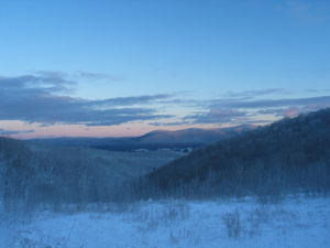
Running north-south through the county are the Berkshire Hills in the eastern part of the county and the Taconic Mountains
Taconic Mountains
The Taconic Mountains or Taconic Range are a physiographic section of the larger New England province and part of the Appalachian Mountains, running along the eastern border of New York State and adjacent New England from northwest Connecticut to western Massachusetts, north to central western...
in the western part of the county. They are a source of pride for their beauty, attract many tourists and summering residents, and have marked the county's character.
Adjacent counties
- Bennington County, Vermont (north)
- Franklin CountyFranklin County, Massachusetts-Demographics:As of the census of 2000, there were 71,535 people, 29,466 households, and 18,416 families residing in the county. The population density was 102 people per square mile . There were 31,939 housing units at an average density of 46 per square mile...
(northeast) - Hampshire CountyHampshire County, Massachusetts-Demographics:As of the census of 2000, there were 152,251 people, 55,991 households, and 33,818 families residing in the county. The population density was 288 people per square mile . There were 58,644 housing units at an average density of 111 per square mile...
(east) - Hampden CountyHampden County, Massachusetts-Demographics:As of the census of 2004, there were 461,228 people, 175,288 households, and 115,690 families residing in the county. The population density was 738 people per square mile . There were 185,876 housing units at an average density of 301 per square mile...
(southeast) - Litchfield County, ConnecticutLitchfield County, ConnecticutLitchfield County is a county located in the northwestern corner of the U.S. state of Connecticut. Litchfield County has the lowest population density of any county in Connecticut but is geographically the state's largest county. As of 2010 the population was 189,927...
(south) - Dutchess County, New YorkDutchess County, New YorkDutchess County is a county located in the U.S. state of New York, in the state's Mid-Hudson Region of the Hudson Valley. The 2010 census lists the population as 297,488...
(southwest) - Columbia County, New YorkColumbia County, New YorkColumbia County is a county located in the U.S. state of New York. As of the 2010 census, the population was 63,096. The county seat is Hudson. The name comes from the Latin feminine form of the name of Christopher Columbus, which was at the time of the formation of the county a popular proposal...
(west) - Rensselaer County, New YorkRensselaer County, New YorkRensselaer County is a county in the U.S. state of New York. As of the 2010 census, the population was 159,429. Its name is in honor of the family of Kiliaen van Rensselaer, the original Dutch owner of the land in the area. Its county seat is Troy...
(northwest)
Demographics
As of the censusCensus
A census is the procedure of systematically acquiring and recording information about the members of a given population. It is a regularly occurring and official count of a particular population. The term is used mostly in connection with national population and housing censuses; other common...
of 2000, there were 134,953 people, 56,006 households, and 35,115 families residing in the county. The population density
Population density
Population density is a measurement of population per unit area or unit volume. It is frequently applied to living organisms, and particularly to humans...
was 145 people per square mile (56/km²). There were 66,301 housing units at an average density of 71 per square mile (27/km²). The racial makeup of the county was 95.02% White
Race (United States Census)
Race and ethnicity in the United States Census, as defined by the Federal Office of Management and Budget and the United States Census Bureau, are self-identification data items in which residents choose the race or races with which they most closely identify, and indicate whether or not they are...
, 1.99% Black
Race (United States Census)
Race and ethnicity in the United States Census, as defined by the Federal Office of Management and Budget and the United States Census Bureau, are self-identification data items in which residents choose the race or races with which they most closely identify, and indicate whether or not they are...
or African American
Race (United States Census)
Race and ethnicity in the United States Census, as defined by the Federal Office of Management and Budget and the United States Census Bureau, are self-identification data items in which residents choose the race or races with which they most closely identify, and indicate whether or not they are...
, 0.15% Native American
Race (United States Census)
Race and ethnicity in the United States Census, as defined by the Federal Office of Management and Budget and the United States Census Bureau, are self-identification data items in which residents choose the race or races with which they most closely identify, and indicate whether or not they are...
, 0.99% Asian
Race (United States Census)
Race and ethnicity in the United States Census, as defined by the Federal Office of Management and Budget and the United States Census Bureau, are self-identification data items in which residents choose the race or races with which they most closely identify, and indicate whether or not they are...
, 0.04% Pacific Islander
Race (United States Census)
Race and ethnicity in the United States Census, as defined by the Federal Office of Management and Budget and the United States Census Bureau, are self-identification data items in which residents choose the race or races with which they most closely identify, and indicate whether or not they are...
, 0.59% from other races
Race (United States Census)
Race and ethnicity in the United States Census, as defined by the Federal Office of Management and Budget and the United States Census Bureau, are self-identification data items in which residents choose the race or races with which they most closely identify, and indicate whether or not they are...
, and 1.23% from two or more races. 1.69% of the population were Hispanic
Race (United States Census)
Race and ethnicity in the United States Census, as defined by the Federal Office of Management and Budget and the United States Census Bureau, are self-identification data items in which residents choose the race or races with which they most closely identify, and indicate whether or not they are...
or Latino
Race (United States Census)
Race and ethnicity in the United States Census, as defined by the Federal Office of Management and Budget and the United States Census Bureau, are self-identification data items in which residents choose the race or races with which they most closely identify, and indicate whether or not they are...
of any race. 16.5% were of Italian
Italian people
The Italian people are an ethnic group that share a common Italian culture, ancestry and speak the Italian language as a mother tongue. Within Italy, Italians are defined by citizenship, regardless of ancestry or country of residence , and are distinguished from people...
, 16.4% Irish
Irish people
The Irish people are an ethnic group who originate in Ireland, an island in northwestern Europe. Ireland has been populated for around 9,000 years , with the Irish people's earliest ancestors recorded having legends of being descended from groups such as the Nemedians, Fomorians, Fir Bolg, Tuatha...
, 10.8% French
French people
The French are a nation that share a common French culture and speak the French language as a mother tongue. Historically, the French population are descended from peoples of Celtic, Latin and Germanic origin, and are today a mixture of several ethnic groups...
, 10.3% English
English people
The English are a nation and ethnic group native to England, who speak English. The English identity is of early mediaeval origin, when they were known in Old English as the Anglecynn. England is now a country of the United Kingdom, and the majority of English people in England are British Citizens...
, 8.0% Polish, 7.1% German, 5.8% American
United States
The United States of America is a federal constitutional republic comprising fifty states and a federal district...
and 5.1% French Canadian
French Canadian
French Canadian or Francophone Canadian, , generally refers to the descendents of French colonists who arrived in New France in the 17th and 18th centuries...
ancestry according to Census 2000. 94.1% spoke English
English language
English is a West Germanic language that arose in the Anglo-Saxon kingdoms of England and spread into what was to become south-east Scotland under the influence of the Anglian medieval kingdom of Northumbria...
, 1.6% Spanish
Spanish language
Spanish , also known as Castilian , is a Romance language in the Ibero-Romance group that evolved from several languages and dialects in central-northern Iberia around the 9th century and gradually spread with the expansion of the Kingdom of Castile into central and southern Iberia during the...
and 1.1% French
French language
French is a Romance language spoken as a first language in France, the Romandy region in Switzerland, Wallonia and Brussels in Belgium, Monaco, the regions of Quebec and Acadia in Canada, and by various communities elsewhere. Second-language speakers of French are distributed throughout many parts...
as their first language.
There were 56,006 households out of which 27.50% had children under the age of 18 living with them, 48.00% were married couples
Marriage
Marriage is a social union or legal contract between people that creates kinship. It is an institution in which interpersonal relationships, usually intimate and sexual, are acknowledged in a variety of ways, depending on the culture or subculture in which it is found...
living together, 11.00% had a female householder with no husband present, and 37.30% were non-families. 31.60% of all households were made up of individuals and 13.90% had someone living alone who was 65 years of age or older. The average household size was 2.30 and the average family size was 2.89.
In the county the population was spread out with 22.40% under the age of 18, 8.40% from 18 to 24, 26.40% from 25 to 44, 24.90% from 45 to 64, and 17.90% who were 65 years of age or older. The median age was 40 years. For every 100 females there were 91.70 males. For every 100 females age 18 and over, there were 88.10 males.
The median income for a household in the county was $39,047, and the median income for a family was $50,162. Males had a median income of $36,692 versus $26,504 for females. The per capita income
Per capita income
Per capita income or income per person is a measure of mean income within an economic aggregate, such as a country or city. It is calculated by taking a measure of all sources of income in the aggregate and dividing it by the total population...
for the county was $21,807. About 6.50% of families and 9.50% of the population were below the poverty line, including 12.30% of those under age 18 and 7.20% of those age 65 or over.
Politics
| Year | Democrat Democratic Party (United States) The Democratic Party is one of two major contemporary political parties in the United States, along with the Republican Party. The party's socially liberal and progressive platform is largely considered center-left in the U.S. political spectrum. The party has the lengthiest record of continuous... |
Republican Republican Party (United States) The Republican Party is one of the two major contemporary political parties in the United States, along with the Democratic Party. Founded by anti-slavery expansion activists in 1854, it is often called the GOP . The party's platform generally reflects American conservatism in the U.S... |
|---|---|---|
| 2008 | 74.9% 49,558 | 22.5% 14,876 |
| 2004 | 73.1% 47,743 | 25.7% 16,806 |
| 2000 | 63.9% 37,934 | 26.6% 15,805 |
In the last two U.S. Presidential elections, Berkshire County was Massachusetts's second-bluest county
Red counties and blue counties
Red counties and blue counties are counties of the United States whose residents predominantly and consistently vote for the Republican Party or the Democratic Party, respectively. These patterns are seen in local, state, United States House of Representatives, U.S. Senate, and U.S. Presidential...
behind Suffolk County
Suffolk County, Massachusetts
Suffolk County has no land border with Plymouth County to its southeast, but the two counties share a water boundary in the middle of Massachusetts Bay.-National protected areas:*Boston African American National Historic Site...
, which consists primarily of Boston
Boston
Boston is the capital of and largest city in Massachusetts, and is one of the oldest cities in the United States. The largest city in New England, Boston is regarded as the unofficial "Capital of New England" for its economic and cultural impact on the entire New England region. The city proper had...
. In 2004
United States presidential election, 2004
The United States presidential election of 2004 was the United States' 55th quadrennial presidential election. It was held on Tuesday, November 2, 2004. Republican Party candidate and incumbent President George W. Bush defeated Democratic Party candidate John Kerry, the then-junior U.S. Senator...
, the Bay State's native son John Kerry
John Kerry
John Forbes Kerry is the senior United States Senator from Massachusetts, the 10th most senior U.S. Senator and chairman of the Senate Foreign Relations Committee. He was the presidential nominee of the Democratic Party in the 2004 presidential election, but lost to former President George W...
carried Berkshire by a massive 47.4% margin over incumbent President George W. Bush
George W. Bush
George Walker Bush is an American politician who served as the 43rd President of the United States, from 2001 to 2009. Before that, he was the 46th Governor of Texas, having served from 1995 to 2000....
, with Kerry winning his home state by 25.2% over President Bush. In 2008
United States presidential election, 2008
The United States presidential election of 2008 was the 56th quadrennial presidential election. It was held on November 4, 2008. Democrat Barack Obama, then the junior United States Senator from Illinois, defeated Republican John McCain, the senior U.S. Senator from Arizona. Obama received 365...
, the county voted for Barack Obama
Barack Obama
Barack Hussein Obama II is the 44th and current President of the United States. He is the first African American to hold the office. Obama previously served as a United States Senator from Illinois, from January 2005 until he resigned following his victory in the 2008 presidential election.Born in...
by an even wider 52.4% margin over John McCain
John McCain
John Sidney McCain III is the senior United States Senator from Arizona. He was the Republican nominee for president in the 2008 United States election....
, with Obama winning by 25.8% over McCain statewide.
History
Berkshire County was originally inhabited by the MahicanMahican
The Mahican are an Eastern Algonquian Native American tribe, originally settling in the Hudson River Valley . After 1680, many moved to Stockbridge, Massachusetts. During the early 1820s and 1830s, most of the Mahican descendants migrated westward to northeastern Wisconsin...
(Muh-he-ka-neew) Native American tribe, until the early 18th century when the first English settlers and frontiersmen appeared around this time and began setting up farms and homesteads. On April 25, 1724 “The English finally paid the Indians 460 pounds, 3 barrels of cider, and 30 quarts of rum for what is today Berkshire County” (page 5. Wood, David H. Lenox Massachusetts Shire Town. Published by the town of Lenox, 1969). This deal exempted modern Sheffield
Sheffield, Massachusetts
Not to be confused with the city of Sheffield in the UK, or Sheffield, Vermont.Sheffield is a town in Berkshire County, Massachusetts, United States. It is part of the Pittsfield, Massachusetts Metropolitan Statistical Area. The population was 3,257 at the 2010 census. Sheffield is home to...
, Stockbridge
Stockbridge, Massachusetts
Stockbridge is a town in Berkshire County in Western Massachusetts. It is part of the Pittsfield, Massachusetts, Metropolitan Statistical Area. The population was 1,947 at the 2010 census...
, Richmond
Richmond, Massachusetts
Richmond is a town in Berkshire County, Massachusetts, United States. It is part of the Pittsfield, Massachusetts Metropolitan Statistical Area. The population was 1,475 at the 2010 census.-History:...
and Lenox
Lenox, Massachusetts
Lenox is a town in Berkshire County, Massachusetts, United States. Set in Western Massachusetts, it is part of the Pittsfield, Massachusetts Metropolitan Statistical Area. The population was 5,077 at the 2000 census. Where the town has a border with Stockbridge is the site of Tanglewood, summer...
, which were collected at various other dates into English territory.
In the 19th century many of the towns of Berkshire County became popular with the country's elite as they built what they called "cottages" throughout the country side. The Gilded Age ended in the early 20th century with the income tax, World War I, and the Great Depression. In the 20th century many of these cottages were torn or burned down, became prep schools, or were left uninhabited.
Today the Berkshires is known throughout the East Coast and the country as the summer home of the Boston Symphony Orchestra. It's viewed as a place to relax, from Tanglewood to the Norman Rockwell museum.
Cities, towns, and villages

- AdamsAdams, MassachusettsAdams is a town in Berkshire County, Massachusetts, United States. It is part of the Pittsfield, Massachusetts Metropolitan Statistical Area. The population was 8,485 at the 2010 census.-History:...
- AlfordAlford, MassachusettsAlford is a town in Berkshire County, Massachusetts, United States. It is part of the Pittsfield, Massachusetts Metropolitan Statistical Area. The population was 494 at the 2010 census.- History :...
- BecketBecket, MassachusettsBecket is a town in Berkshire County, Massachusetts, United States. It is part of the Pittsfield, Massachusetts Metropolitan Statistical Area. The population was 1,779 at the 2010 census.- History :...
- CheshireCheshire, MassachusettsCheshire is a town in Berkshire County, Massachusetts, United States. It is part of the Pittsfield, Massachusetts Metropolitan Statistical Area. The population was 3,401 at the 2000 census.-History:...
- ClarksburgClarksburg, MassachusettsClarksburg is a town in Berkshire County, Massachusetts, United States. It is part of the Pittsfield, Massachusetts Metropolitan Statistical Area...
- DaltonDalton, MassachusettsDalton is a town in Berkshire County, Massachusetts, United States. Dalton is the transition town between the urban and rural pieces of Berkshire County, Massachusetts. It is part of the Pittsfield, Massachusetts Metropolitan Statistical Area. The population was 6,892 at the 2000 census.- History...
- EgremontEgremont, MassachusettsEgremont is a town in Berkshire County, Massachusetts, United States. It is part of the Pittsfield, Massachusetts Metropolitan Statistical Area. The population was 1,225 at the 2010 census. Egremont consists of two villages, North Egremont and South Egremont....
- FloridaFlorida, MassachusettsFlorida is a town in Berkshire County, Massachusetts, United States. It is part of the Pittsfield, Massachusetts Metropolitan Statistical Area. The population was 676 at the 2000 census. It is home to the east portal of the Hoosac Tunnel, as well as Whitcomb Summit , the highest point of the Mohawk...
- Great BarringtonGreat Barrington, MassachusettsGreat Barrington is a town in Berkshire County, Massachusetts, United States. It is part of the Pittsfield, Massachusetts Metropolitan Statistical Area. The population was 7,104 at the 2010 census. Both a summer resort and home to Ski Butternut, Great Barrington includes the villages of Van...
- HousatonicHousatonic, MassachusettsHousatonic is a village and census-designated place in the town of Great Barrington in Berkshire County, Massachusetts, United States. It is part of the Pittsfield, Massachusetts Metropolitan Statistical Area. The population was 1,335 at the 2000 census....
(a village of Great Barrington)* - Van Deusenville (a village of Great Barrington)
*
- Housatonic
- HancockHancock, MassachusettsHancock is a town in Berkshire County, Massachusetts, United States. It is part of the Pittsfield, Massachusetts Metropolitan Statistical Area. The population was 717 at the 2010 census.- History :...
- HinsdaleHinsdale, MassachusettsHinsdale is a town in Berkshire County, Massachusetts, United States. It is part of the Pittsfield, Massachusetts Metropolitan Statistical Area...
- LanesboroughLanesborough, MassachusettsLanesborough is a town in Berkshire County, Massachusetts, United States. It is part of the Pittsfield, Massachusetts Metropolitan Statistical Area. The population was 2,990 at the 2000 census.-History:...
- Berkshire (a village of Lanesborough)
*
- Berkshire (a village of Lanesborough)
- LeeLee, MassachusettsLee is a town in Berkshire County, Massachusetts, United States. It is part of the Pittsfield, Massachusetts, metropolitan statistical area. The population was 5,943 which was determined in the 2010 census. Lee, which includes the villages of South and East Lee, is part of the Berkshires resort...
- LenoxLenox, MassachusettsLenox is a town in Berkshire County, Massachusetts, United States. Set in Western Massachusetts, it is part of the Pittsfield, Massachusetts Metropolitan Statistical Area. The population was 5,077 at the 2000 census. Where the town has a border with Stockbridge is the site of Tanglewood, summer...
- Lenox DaleLenox Dale, MassachusettsLenox Dale is a village in Lenox, Massachusetts, United States at the border of the town of Lee, along the Housatonic River. It is a small village, but a village nonetheless with its own post office , school, two stores, and a Catholic church. The main street in the town is Crystal Street. Crystal...
(a village of Lenox)*
- Lenox Dale
- MontereyMonterey, MassachusettsMonterey is a town in Berkshire County, Massachusetts, United States. It is part of the Pittsfield, Massachusetts Metropolitan Statistical Area. The population was 934 at the 2000 census.- History :...
Shares services with Great Barrington - Mount WashingtonMount Washington, MassachusettsMount Washington is a town in Berkshire County, Massachusetts, United States. It is part of the Pittsfield, Massachusetts Metropolitan Statistical Area. The population was 130 at the 2000 census, making it the smallest town in Berkshire County and, after Gosnold and Monroe, the third smallest in...
- New AshfordNew Ashford, MassachusettsNew Ashford is a town in Berkshire County, Massachusetts, United States. It is part of the Pittsfield, Massachusetts Metropolitan Statistical Area. The population was 247 at the 2000 census.- History :...
- New MarlboroughNew Marlborough, MassachusettsNew Marlborough is a town in Berkshire County, Massachusetts, United States. It is part of the Pittsfield, Massachusetts Metropolitan Statistical Area. The population was 1,494 at the 2000 census...
- Clayton (a village of New Marlborough)
* - Hartsville (a village of New Marlborough)
* - Mill River (a village of New Marlborough)
* - Southfield (a village of New Marlborough)
*
- Clayton (a village of New Marlborough)
- North AdamsNorth Adams, MassachusettsNorth Adams is a city in Berkshire County, Massachusetts, United States. It is part of the Pittsfield, Massachusetts Metropolitan Statistical Area. The population was 13,708 as of the 2010 census, making it the least populous city in the state...
- OtisOtis, MassachusettsOtis is a town in Berkshire County, Massachusetts, United States. It is part of the Pittsfield, Massachusetts Metropolitan Statistical Area. The population was 1,365 at the 2000 census....
- PeruPeru, MassachusettsPeru is a town in Berkshire County, Massachusetts, United States. The population was 821 at the 2000 census.- History :Originally known as Northern Berkshire Township Number 2 and including all of Hinsdale and part of Middlefield, the town was first settled in 1767 and was officially incorporated...
- PittsfieldPittsfield, MassachusettsPittsfield is the largest city and the county seat of Berkshire County, Massachusetts, United States. It is the principal city of the Pittsfield, Massachusetts Metropolitan Statistical Area which encompasses all of Berkshire County. Its area code is 413. Its ZIP code is 01201...
- RichmondRichmond, MassachusettsRichmond is a town in Berkshire County, Massachusetts, United States. It is part of the Pittsfield, Massachusetts Metropolitan Statistical Area. The population was 1,475 at the 2010 census.-History:...
- SandisfieldSandisfield, MassachusettsSandisfield is a town in Berkshire County, Massachusetts, United States. It is part of the Pittsfield, Massachusetts Metropolitan Statistical Area. The population was 824 at the 2000 census.- History :...
- SavoySavoy, MassachusettsSavoy is a town in Berkshire County, Massachusetts, United States. It is part of the Pittsfield, Massachusetts Metropolitan Statistical Area. The population was 705 at the 2000 census.- History :...
- SheffieldSheffield, MassachusettsNot to be confused with the city of Sheffield in the UK, or Sheffield, Vermont.Sheffield is a town in Berkshire County, Massachusetts, United States. It is part of the Pittsfield, Massachusetts Metropolitan Statistical Area. The population was 3,257 at the 2010 census. Sheffield is home to...
Shares services with Great Barrington- Ashley Falls (a village of Sheffield)
*
- Ashley Falls (a village of Sheffield)
- StockbridgeStockbridge, MassachusettsStockbridge is a town in Berkshire County in Western Massachusetts. It is part of the Pittsfield, Massachusetts, Metropolitan Statistical Area. The population was 1,947 at the 2010 census...
- Glendale (a village of Stockbridge)
* - Interlaken (a village of Stockbridge)
*
- Glendale (a village of Stockbridge)
- TyringhamTyringham, MassachusettsTyringham is a town in Berkshire County, Massachusetts, United States. It is part of the Pittsfield, Massachusetts Metropolitan Statistical Area. The population was 327 at the 2010 census.- History :...
Shares many services with Lee - WashingtonWashington, MassachusettsWashington is a town in Berkshire County, Massachusetts, United States. It is part of the Pittsfield, Massachusetts Metropolitan Statistical Area. The population was 538 at the 2010 census.- History :...
Shares services with Lenox - West StockbridgeWest Stockbridge, MassachusettsWest Stockbridge is a town in Berkshire County, Massachusetts, United States. It is part of the Pittsfield, Massachusetts Metropolitan Statistical Area. The population was 1,416 at the 2000 census.- History :...
- WilliamstownWilliamstown, MassachusettsWilliamstown is a town in Berkshire County, in the northwest corner of Massachusetts. It shares a border with Vermont to the north and New York to the west. It is part of the Pittsfield, Massachusetts Metropolitan Statistical Area. The population was 7,754 at the 2010 census...
- WindsorWindsor, MassachusettsWindsor is a town in Berkshire County, Massachusetts, United States. It is part of the Pittsfield, Massachusetts Metropolitan Statistical Area. The population was 875 at the 2000 census.-History:...
| North: Bennington County, Vermont | ||
| West: Rensselaer County, New York Rensselaer County, New York Rensselaer County is a county in the U.S. state of New York. As of the 2010 census, the population was 159,429. Its name is in honor of the family of Kiliaen van Rensselaer, the original Dutch owner of the land in the area. Its county seat is Troy... |
Berkshire County | East: Franklin County, Massachusetts Franklin County, Massachusetts -Demographics:As of the census of 2000, there were 71,535 people, 29,466 households, and 18,416 families residing in the county. The population density was 102 people per square mile . There were 31,939 housing units at an average density of 46 per square mile... |
|---|---|---|
| West: Columbia County, New York Columbia County, New York Columbia County is a county located in the U.S. state of New York. As of the 2010 census, the population was 63,096. The county seat is Hudson. The name comes from the Latin feminine form of the name of Christopher Columbus, which was at the time of the formation of the county a popular proposal... |
East: Hampshire County, Massachusetts Hampshire County, Massachusetts -Demographics:As of the census of 2000, there were 152,251 people, 55,991 households, and 33,818 families residing in the county. The population density was 288 people per square mile . There were 58,644 housing units at an average density of 111 per square mile... |
|
| East: Hampden County, Massachusetts Hampden County, Massachusetts -Demographics:As of the census of 2004, there were 461,228 people, 175,288 households, and 115,690 families residing in the county. The population density was 738 people per square mile . There were 185,876 housing units at an average density of 301 per square mile... |
||
| South: Litchfield County, Connecticut Litchfield County, Connecticut Litchfield County is a county located in the northwestern corner of the U.S. state of Connecticut. Litchfield County has the lowest population density of any county in Connecticut but is geographically the state's largest county. As of 2010 the population was 189,927... |
°: There is also a southern border with Dutchess County, New York
Dutchess County, New York
Dutchess County is a county located in the U.S. state of New York, in the state's Mid-Hudson Region of the Hudson Valley. The 2010 census lists the population as 297,488...
, however this is in a forested area and there is no direct access to Berkshire County.
See also
- National Register of Historic Places listings in Berkshire County, Massachusetts
- USS Berkshire County (LST-288)USS Berkshire County (LST-288)USS Berkshire County was an built for the United States Navy during World War II. Named for Berkshire County, Massachusetts, she was the only U.S. Naval vessel to bear the name....
External links
- Berkshires.org (Berkshire Vacation Site
- iBerkshires.com (news web site)
- BerkshireRecordDotCom (A Web site]
- Map of cities and towns of Massachusetts
- Wall & Gray. 1871 Atlas of Massachusetts. Map of Massachusetts. USA. New England. Counties - Berkshire, Franklin, Hampshire and Hampden, Worcester, Middlesex, Essex and Norfolk, Boston - Suffolk,Plymouth, Bristol, Barnstable and Dukes (Cape Cod). Cities - Springfield, Worcester, Lowell, Lawrence, Haverhill, Newburyport, Salem, Lynn, Taunton, Fall River. New Bedford. These 1871 maps of the Counties and Cities are useful to see the roads and rail lines.
- Beers,D.G. 1872 Atlas of Essex County Map of Massachusetts Plate 5. Click on the map for a very large image. Also see detailed map of 1872 Essex County Plate 7.