
Boulevard
Encyclopedia
Road
A road is a thoroughfare, route, or way on land between two places, which typically has been paved or otherwise improved to allow travel by some conveyance, including a horse, cart, or motor vehicle. Roads consist of one, or sometimes two, roadways each with one or more lanes and also any...
, usually a wide, multi-lane
Lane
A lane is a part of the roadway within a road marked out for use by a single line of vehicles in such a way as to control and guide drivers for the purpose of reducing traffic conflicts. Most public roads have at least two lanes, one for traffic in each direction, separated by Lane markings...
arterial thoroughfare, divided with a median down the centre, and roadways along each side designed as slow travel and parking lanes and for bicycle and pedestrian usage, often with an above-average quality of landscaping
Landscaping
Landscaping refers to any activity that modifies the visible features of an area of land, including:# living elements, such as flora or fauna; or what is commonly referred to as gardening, the art and craft of growing plants with a goal of creating a beautiful environment within the landscape.#...
and scenery. The division into peripheral roads for local use and a central main thoroughfare for regional traffic is a principal feature of the boulevard. Larger and busier boulevards usually feature a median. It was first introduced in the French language in 1435 as boloard and has since been altered into boulevard.
Americas
Argentina
Avenida 9 de Julio in the heart of Buenos AiresBuenos Aires
Buenos Aires is the capital and largest city of Argentina, and the second-largest metropolitan area in South America, after São Paulo. It is located on the western shore of the estuary of the Río de la Plata, on the southeastern coast of the South American continent...
, capital city of Argentina
Argentina
Argentina , officially the Argentine Republic , is the second largest country in South America by land area, after Brazil. It is constituted as a federation of 23 provinces and an autonomous city, Buenos Aires...
, is as wide as 7 lanes in each direction, with 4 further lanes flanking the main boulevard in parallel roads on either side.
Dominican Republic
In the Dominican Republic, more specifically in Greater Santo Domingo there is the Winston Churchill and 27 de Febrero Boulevard in Downtown Santo DomingoDowntown Santo Domingo
Downtown Santo Domingo or better known as Polígono Central is a term used to group several neighborhoods located in central Santo Domingo, D.N, Dominican Republic defined as the area delineated by John F Kennedy Avenue on the north , on the west by Wiston Churchill avenue, on the east by Maximo...
and Las Americas Boulevard in Santo Domingo Este
Santo Domingo Este
Santo Domingo Este is a municipality and the provincial capital of the Santo Domingo province in the Dominican Republic. Within the municipality there is one municipal district : San Luis.....
. These boulevards are known for their wide median with plazas and trees on it.
Mexico
Paseo de la ReformaPaseo de la Reforma
Paseo de la Reforma is a wide avenue that runs in a straight line, cutting diagonally across Mexico City. It was designed by Ferdinand von Rosenzweig in the 1860s and modeled after the great boulevards of Europe, such as Vienna's Ringstrasse or the Champs-Élysées in Paris...
(English: "Reform Promenade") is a 12 kilometer long boulevard in Mexico City
Mexico City
Mexico City is the Federal District , capital of Mexico and seat of the federal powers of the Mexican Union. It is a federal entity within Mexico which is not part of any one of the 31 Mexican states but belongs to the federation as a whole...
, Mexico
Mexico
The United Mexican States , commonly known as Mexico , is a federal constitutional republic in North America. It is bordered on the north by the United States; on the south and west by the Pacific Ocean; on the southeast by Guatemala, Belize, and the Caribbean Sea; and on the east by the Gulf of...
that runs in a straight line, cutting diagonally across the city. It runs from Chapultepec Park, then passes alongside the Torre Mayor
Torre Mayor
The Torre Mayor is a skyscraper in Mexico City, United Mexican States. With a height of 225 metres to the top floor and 55 storeys, it's the second tallest building in Latin America, surpassed by Ocean Two in Panama City with 236 metres...
(currently Latin America's tallest building), continues through the fashionable Zona Rosa
Zona Rosa
Zona Rosa is a neighborhood in Mexico City which is known for its shopping, nightlife, gay community, and its recently established Korean community...
and then to the Zócalo
Zócalo
The Zócalo is the main plaza or square in the heart of the historic center of Mexico City. The plaza used to be known simply as the "Main Square" or "Arms Square," and today its formal name is Plaza de la Constitución...
by Juárez Avenue and Francisco I. Madero Street. One of the most famous monuments of the Paseo is El Ángel de la Independencia – a tall column with a gilded statue of a Winged Victory
Nike (mythology)
In Greek mythology, Nike was a goddess who personified victory, also known as the Winged Goddess of Victory. The Roman equivalent was Victoria. Depending upon the time of various myths, she was described as the daughter of Pallas and Styx and the sister of Kratos , Bia , and Zelus...
on its top and marble statues at its base depicting the heroes of the Mexican War of Independence
Mexican War of Independence
The Mexican War of Independence was an armed conflict between the people of Mexico and the Spanish colonial authorities which started on 16 September 1810. The movement, which became known as the Mexican War of Independence, was led by Mexican-born Spaniards, Mestizos and Amerindians who sought...
.
The Paseo de la Reforma was designed in the 1860s during the Second Mexican Empire
Second Mexican Empire
The Second Mexican Empire was the name of Mexico under the regime established from 1864 to 1867. It was created by Napoleon III of France, who attempted to use the Mexican adventure to recapture some of the grandeur of earlier Napoleonic times...
by the Austrian military officer and engineer Ferdinand von Rosenzweig
Ferdinand von Rosenzweig
Ferdinand Ritter Edler Von Rosenzweig was an Austrian military officer. He served first under Kaiser Franz Joseph I of Austria-Hungary and then under Emperor Maximilian I of Mexico. He was married to Hungarian princess Catarina Radzivil de Atavia who was a lady in the court of Empress Carlota of...
on the orders of Maximilian I of Mexico
Maximilian I of Mexico
Maximilian I was the only monarch of the Second Mexican Empire.After a distinguished career in the Austrian Navy, he was proclaimed Emperor of Mexico on April 10, 1864, with the backing of Napoleon III of France and a group of Mexican monarchists who sought to revive the Mexican monarchy...
. He wanted to connect his imperial residence, Chapultepec Castle, to the Palacio Nacional
National Palace (Mexico)
The National Palace, or Palacio Nacional in Spanish), was the seat of the federal executive in Mexico. It is located on Mexico City's main square, the Plaza de la Constitución...
in the city's center. When it was inaugurated, it was named the Paseo de la Emperatriz (The Empress's Promenade), after his consort, Empress Carlota of Mexico. The name now commemorates the liberal reforms of 19th century president Benito Juárez
Benito Juárez
Benito Juárez born Benito Pablo Juárez García, was a Mexican lawyer and politician of Zapotec origin from Oaxaca who served five terms as president of Mexico: 1858–1861 as interim, 1861–1865, 1865–1867, 1867–1871 and 1871–1872...
.
United States and Canada
United States
The United States of America is a federal constitutional republic comprising fifty states and a federal district...
and Canada
Canada
Canada is a North American country consisting of ten provinces and three territories. Located in the northern part of the continent, it extends from the Atlantic Ocean in the east to the Pacific Ocean in the west, and northward into the Arctic Ocean...
, municipalities
Local government
Local government refers collectively to administrative authorities over areas that are smaller than a state.The term is used to contrast with offices at nation-state level, which are referred to as the central government, national government, or federal government...
and developers have adapted the term to refer to arterial roads, not necessarily boulevards in the traditional sense. In California, many so-called “boulevards” extend into the mountains as narrow, winding road segments only two lanes in width. However, boulevards can be any divided highway with at-grade intersections to local streets. They are commonly abbreviated Blvd. Some celebrated examples in California include:
- Sunset BoulevardSunset Boulevard (disambiguation)Sunset Boulevard may refer to:*Sunset Boulevard, a celebrated street in western Los Angeles County, California*Sunset Boulevard , a 1950 film starring Gloria Swanson and William Holden*Sunset Boulevard , the score for the 1950 film...
in San Francisco, which has rows of trees on both sides of the thoroughfare, and is bisected by a tree-filled median. It connects local streets throughout the Sunset District. - The Los AngelesLos ÁngelesLos Ángeles is the capital of the province of Biobío, in the commune of the same name, in Region VIII , in the center-south of Chile. It is located between the Laja and Biobío rivers. The population is 123,445 inhabitants...
area's more famous Sunset BoulevardSunset BoulevardSunset Boulevard is a street in the western part of Los Angeles County, California, that stretches from Figueroa Street in downtown Los Angeles to the Pacific Coast Highway at the Pacific Ocean in the Pacific Palisades...
; Santa Monica Boulevard; Wilshire BoulevardWilshire BoulevardWilshire Boulevard is one of the principal east-west arterial roads in Los Angeles, California, United States. It was named for Henry Gaylord Wilshire , an Ohio native who made and lost fortunes in real estate, farming, and gold mining. Henry Wilshire initiated what was to become Wilshire...
; and Hollywood BoulevardHollywood Boulevard-Revitalization:In recent years successful efforts have been made at cleaning up Hollywood Blvd., as the street had gained a reputation for crime and seediness. Central to these efforts was the construction of the Hollywood and Highland shopping center and adjacent Kodak Theatre in 2001...
. Many important thoroughfares in Los Angeles are boulevards.
In Chicago
Chicago
Chicago is the largest city in the US state of Illinois. With nearly 2.7 million residents, it is the most populous city in the Midwestern United States and the third most populous in the US, after New York City and Los Angeles...
, the boulevard system is a network of wide, planted-median boulevards that winds through the south, west, and north sides of the city and includes a ring of parks. Most of the boulevards and parks are 3–6 miles from The Loop
Chicago Loop
The Loop or Chicago Loop is one of 77 officially designated Chicago community areas located in the City of Chicago, Illinois. It is the historic commercial center of downtown Chicago...
. Seattle also features a network of boulevards that connect most of the city's public parks to each other, a design recommended by the Olmsted Brothers
Olmsted Brothers
The Olmsted Brothers company was an influential landscape design firm in the United States, formed in 1898 by stepbrothers John Charles Olmsted and Frederick Law Olmsted, Jr. .-History:...
.
Sometimes, the word "Boulevard" is used as a standalone name, as is the case in Atlanta
Boulevard (Atlanta)
Boulevard is a street in the Old Fourth Ward neighborhood of Atlanta, Georgia. The street runs east of, and parallel to, Atlanta's Downtown Connector. It is bordered by Ponce de Leon Avenue to the north , and McDonough Boulevard to the south...
, and Roosevelt Boulevard
Roosevelt Boulevard (Philadelphia)
Roosevelt Boulevard , often referred to simply as "the Boulevard," is a major traffic artery through North and Northeast Philadelphia...
in the Northeast
Northeast Philadelphia
Northeast Philadelphia, nicknamed Northeast Philly, the Northeast and the Great Northeast, is a section of the city of Philadelphia, Pennsylvania. According to the 2000 Census, the Northeast has a sizable percentage of the city's 1.547 million people — a population of between 300,000 and 450,000,...
section of Philadelphia
Philadelphia, Pennsylvania
Philadelphia is the largest city in the Commonwealth of Pennsylvania and the county seat of Philadelphia County, with which it is coterminous. The city is located in the Northeastern United States along the Delaware and Schuylkill rivers. It is the fifth-most-populous city in the United States,...
is sometimes referred to as simply "The Boulevard". The section of Côte Saint-Luc Road that is located in Westmount, a suburb of Montreal
Montreal
Montreal is a city in Canada. It is the largest city in the province of Quebec, the second-largest city in Canada and the seventh largest in North America...
, is also referred to as "The Boulevard," as was the majority of Broadway (New York City)
Broadway (New York City)
Broadway is a prominent avenue in New York City, United States, which runs through the full length of the borough of Manhattan and continues northward through the Bronx borough before terminating in Westchester County, New York. It is the oldest north–south main thoroughfare in the city, dating to...
in the 19th century. In Pittsburgh, "The Boulevard of the Allies" runs through and connects major areas of the city.
Kansas City, Missouri
Kansas City, Missouri
Kansas City, Missouri is the largest city in the U.S. state of Missouri and is the anchor city of the Kansas City Metropolitan Area, the second largest metropolitan area in Missouri. It encompasses in parts of Jackson, Clay, Cass, and Platte counties...
, is famous for having more boulevards and avenues in the world than any city (if the term is used lightly) except Paris, France. In Charlotte, North Carolina
Charlotte, North Carolina
Charlotte is the largest city in the U.S. state of North Carolina and the seat of Mecklenburg County. In 2010, Charlotte's population according to the US Census Bureau was 731,424, making it the 17th largest city in the United States based on population. The Charlotte metropolitan area had a 2009...
, Independence Boulevard connects Uptown
Charlotte center city
Charlotte center city is the central area of Charlotte, North Carolina. The headquarters for the Fortune 500 companies Bank of America and Duke Energy are located here, as well as the headquarters for East Coast operations for Wells Fargo.Museums, sporting venues, shops, hotels, restaurants, and...
to the southeastern section of the city, although the westernmost segment is actually a freeway.
Nineteenth century parkway
Parkway
The term parkway has several distinct principal meanings and numerous synonyms around the world, for either a type of landscaped area or a type of road.Type of landscaped area:...
s, such as Brooklyn's Ocean Parkway
Ocean Parkway (Brooklyn)
Ocean Parkway is a broad boulevard in the west central portion of the borough of Brooklyn in New York City.-Route description:Ocean Parkway extends over a distance of about five miles , running almost north to south from the vicinity of Prospect Park to Brighton Beach...
, were often built in the form of boulevards and are informally referred to as such. In some cities, however, the term "boulevard" does not specify a larger, wider, or more important road. "Boulevard" may simply be used as one of many words describing roads in communities containing multiple iterations of the same street name (such as in the Ranchlands district of Calgary
Calgary
Calgary is a city in the Province of Alberta, Canada. It is located in the south of the province, in an area of foothills and prairie, approximately east of the front ranges of the Canadian Rockies...
, where Ranchlands Boulevard exists side-by-side with Ranchlands Road, Ranchlands Court, Ranchlands Mews, etc.) Nowadays boulevards can be found most anywhere and their original structured meaning has lost almost all meaning.
Lake Shore Boulevard, a six-lane thoroughfare runs along the lakefront in Toronto
Toronto
Toronto is the provincial capital of Ontario and the largest city in Canada. It is located in Southern Ontario on the northwestern shore of Lake Ontario. A relatively modern city, Toronto's history dates back to the late-18th century, when its land was first purchased by the British monarchy from...
from Woodbine Avenue in the east to the city limits in the west. The section between Jameson Avenue
Jameson Avenue
Jameson Avenue is a multi-lane arterial road in the Parkdale neighbourhood in Toronto, Ontario, Canada. It is a north-south roadway from Lake Shore Boulevard to Queen Street...
and the Humber River
Humber River (Ontario)
The Humber River is one of two major rivers on either side of Toronto, Ontario, Canada, the other being the Don River to the east. It was designated a Canadian Heritage River on September 24, 1999....
(the original section), as an example of urban planning, was laid out to provide a pleasant drive with a view of Humber Bay
Humber Bay
Humber Bay is a bay of Lake Ontario south of Toronto, Ontario, Canada. It is located between Ontario Place on the east and Mimico Creek to the west. The bay gives its name to Etobicoke's Humber Bay neighbourhood.-History:...
on Lake Ontario
Lake Ontario
Lake Ontario is one of the five Great Lakes of North America. It is bounded on the north and southwest by the Canadian province of Ontario, and on the south by the American state of New York. Ontario, Canada's most populous province, was named for the lake. In the Wyandot language, ontarío means...
and easy access to the park lands by automobile. It was later expanded for commuting.
A famous american example is Las Vegas Blvd in Las Vegas, Nevada
Nevada
Nevada is a state in the western, mountain west, and southwestern regions of the United States. With an area of and a population of about 2.7 million, it is the 7th-largest and 35th-most populous state. Over two-thirds of Nevada's people live in the Las Vegas metropolitan area, which contains its...
.
Uruguay
In MontevideoMontevideo
Montevideo is the largest city, the capital, and the chief port of Uruguay. The settlement was established in 1726 by Bruno Mauricio de Zabala, as a strategic move amidst a Spanish-Portuguese dispute over the platine region, and as a counter to the Portuguese colony at Colonia del Sacramento...
, Artigas Boulevard
Artigas Boulevard
Artigas Boulevard is an avenue in Montevideo named after Uruguayan hero José Artigas. It starts from the Rambla of Montevideo at Punta Carretas, goes north for about 6.5 kilometers, turns 100º west, and runs for another 4 kilometers up to the Rambla at Capurro - Bella Vista.It meets with...
is an important avenue (40 m wide) that encloses the central area.
Israel
Tel AvivTel Aviv
Tel Aviv , officially Tel Aviv-Yafo , is the second most populous city in Israel, with a population of 404,400 on a land area of . The city is located on the Israeli Mediterranean coastline in west-central Israel. It is the largest and most populous city in the metropolitan area of Gush Dan, with...
, established in 1909, was originally designed along the guidelines set out by architect
Architect
An architect is a person trained in the planning, design and oversight of the construction of buildings. To practice architecture means to offer or render services in connection with the design and construction of a building, or group of buildings and the space within the site surrounding the...
Sir Patrick Geddes
Patrick Geddes
Sir Patrick Geddes was a Scottish biologist, sociologist, philanthropist and pioneering town planner. He is known for his innovative thinking in the fields of urban planning and education....
. Geddes designed a green or garden ring of boulevards surrounding the central city, which still exists today and continues to characterize Tel Aviv. One of the most famous and busy streets in the city is Rothschild Boulevard
Rothschild Boulevard
Rothschild Boulevard is one of the principal streets in the center of Tel Aviv, Israel, beginning in Neve Tzedek at its southwestern edge and running north to Habima Theatre. It is one of the busiest and most expensive streets in the city, being one of the city's main tourist attractions...
.
Philippines
Manila
Manila is the capital of the Philippines. It is one of the sixteen cities forming Metro Manila.Manila is located on the eastern shores of Manila Bay and is bordered by Navotas and Caloocan to the north, Quezon City to the northeast, San Juan and Mandaluyong to the east, Makati on the southeast,...
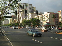
's premier boulevard is Roxas Boulevard
Roxas Boulevard
Roxas Boulevard is a boulevard in Metro Manila, and an eight-lane arterial road that connects the center of Manila with Pasay City, Parañaque City. It is one of the major arteries in the city's metropolitan network, designated as Radial Road 1...
in the heart of the city. Located along this bayshore road are luxury hotels, the Cultural Center of the Philippines
Cultural Center of the Philippines
The Cultural Center of the Philippines is a government-owned and controlled corporation established to preserve, develop and promote arts and culture in the Philippines. The CCP was established through Executive Order No. 30 s. 1966 by President Ferdinand Marcos...
performing arts complex, shopping malls and parks. Located in the northern terminus of the road is Rizal Park
Rizal Park
Rizal Park, also known as Luneta Park or colloquially Luneta, is a historical urban park located in the heart of the city of Manila, Philippines, adjacent to the old walled city of Manila, now Intramuros. Since the Spanish Colonial Era, the park has been a favorite spot for unwinding, socializing,...
, the historic urban park
Urban park
An urban park, is also known as a municipal park or a public park, public open space or municipal gardens , is a park in cities and other incorporated places to offer recreation and green space to residents of, and visitors to, the municipality...
of Manila.
India
New DelhiNew Delhi
New Delhi is the capital city of India. It serves as the centre of the Government of India and the Government of the National Capital Territory of Delhi. New Delhi is situated within the metropolis of Delhi. It is one of the nine districts of Delhi Union Territory. The total area of the city is...
's premier boulevard is Rajpath Boulevard in the heart of the city of New Delhi
New Delhi
New Delhi is the capital city of India. It serves as the centre of the Government of India and the Government of the National Capital Territory of Delhi. New Delhi is situated within the metropolis of Delhi. It is one of the nine districts of Delhi Union Territory. The total area of the city is...
. Tree lined road with lakes and fountains designed by British Architect Edwin Luyten from 1912 to 1930
France
Baron HaussmannBaron Haussmann
Georges-Eugène Haussmann, commonly known as Baron Haussmann , was a French civic planner whose name is associated with the rebuilding of Paris...
made such roads well-known in his re-shaping of Second Empire
Second French Empire
The Second French Empire or French Empire was the Imperial Bonapartist regime of Napoleon III from 1852 to 1870, between the Second Republic and the Third Republic, in France.-Rule of Napoleon III:...
Paris
Paris
Paris is the capital and largest city in France, situated on the river Seine, in northern France, at the heart of the Île-de-France region...
between 1853 and 1870. The French word boulevard originally referred to the flat summit of a rampart
Defensive wall
A defensive wall is a fortification used to protect a city or settlement from potential aggressors. In ancient to modern times, they were used to enclose settlements...
(the etymology of the word distantly parallels that of bulwark which is a Dutch loanword (bolwerk)). Several Parisian boulevards replaced old city walls; more generally, boulevards encircle a city center, in contrast to avenue
Street name
A street name or odonym is an identifying name given to a street. The street name usually forms part of the address...
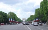
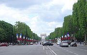
s that radiate from the center. Boulevard is sometimes used to describe an elegantly wide road, such as those in Paris, approaching the Champs-Élysées
Champs-Élysées
The Avenue des Champs-Élysées is a prestigious avenue in Paris, France. With its cinemas, cafés, luxury specialty shops and clipped horse-chestnut trees, the Avenue des Champs-Élysées is one of the most famous streets and one of the most expensive strip of real estate in the world. The name is...
. Famous French boulevards: Avenue Montaigne
Avenue Montaigne
Avenue Montaigne is a street in the 8th arrondisement of Paris, France-Name origin:Avenue Montaigne was originally called the allée des Veuves because women in mourning gathered there, but the street has changed much since those days of the early 18th century. The current name comes from Michel...
, Montmartre, Invalides, Boulevard Haussmann
Boulevard Haussmann
Boulevard Haussmann, running from the 8th to the 9th arrondissement,is one of the wide tree-lined boulevards created in Paris during the Second French Empire by Baron Haussmann, with enthusiastic support from Napoleon III....
. Frequenters of boulevards were sometimes called boulevardiers
Germany
Berlin
Berlin is the capital city of Germany and is one of the 16 states of Germany. With a population of 3.45 million people, Berlin is Germany's largest city. It is the second most populous city proper and the seventh most populous urban area in the European Union...
and arguably in all of Germany is Unter den Linden
Unter den Linden
Unter den Linden is a boulevard in the Mitte district of Berlin, the capital of Germany. It is named for its linden trees that line the grassed pedestrian mall between two carriageways....
: location of the Berlin State Opera
Berlin State Opera
The Staatsoper Unter den Linden is a German opera company. Its permanent home is the opera house on the Unter den Linden boulevard in the Mitte district of Berlin, which also hosts the Staatskapelle Berlin orchestra.-Early years:...
, Berlin Cathedral, the former royal palace, Humboldt University, the Neue Wache
Neue Wache
The Neue Wache is a building in central Berlin, the capital of Germany. It is located on the north side of the Unter den Linden, a major east-west thoroughfare in the centre of the city. Dating from 1816, the Neue Wache was designed by the architect Karl Friedrich Schinkel and is a leading example...
state memorial, the Germany Historical Museum housed in the old arsenal
Zeughaus
The Zeughaus of Berlin is the oldest structure on the Unter den Linden. It was built by the Brandenburg Elector Frederick III between 1695 and 1730 in the baroque style, to be used as an artillery arsenal...
and Brandenburg Gate
Brandenburg Gate
The Brandenburg Gate is a former city gate and one of the most well-known landmarks of Berlin and Germany. It is located west of the city centre at the junction of Unter den Linden and Ebertstraße, immediately west of the Pariser Platz. It is the only remaining gate of a series through which...
being the boulevards focal point. Most famed for its classy shopping facilities is Berlin's Kurfürstendamm
Kurfürstendamm
The Kurfürstendamm, known locally as the Ku'damm, is one of the most famous avenues in Berlin. The street takes its name from the former Kurfürsten of Brandenburg. This very broad, long boulevard can be considered the Champs-Élysées of Berlin — full of shops, houses, hotels and restaurants...
. In the 1920s it was considered one of the most cosmopolitain places in Europe, being not only an elegant residential area but also a major centre of nightlife and leisure. Ku'damm retained this air throughout the Cold War
Cold War
The Cold War was the continuing state from roughly 1946 to 1991 of political conflict, military tension, proxy wars, and economic competition between the Communist World—primarily the Soviet Union and its satellite states and allies—and the powers of the Western world, primarily the United States...
becoming the hub of free West-Berlin. Still today it is the city's most frequented shopping district. A notable boulevard in Berlin's East is Karl-Marx-Allee
Karl-Marx-Allee
The Karl-Marx-Allee is a monumental socialist boulevard built by the GDR between 1952 and 1960 in Berlin Friedrichshain and Mitte. Today the boulevard is named after Karl Marx....
, which was built primarily in the 1950s in Stalinist Classicism architecture with decorative buildings. One section of the boulevard is more decorative while the other is more modern. In the center of the boulevard is the Strausberger Platz, which has buildings in wedding-cake style
Wedding-cake style
In architecture, a "wedding-cake style" is an informal reference to buildings with many distinct tiers, each set back from the one below, resulting in a shape like a wedding cake, that are richly ornamented with classicising detail, as if made in sugar icing....
. The boulevard is divided into various blocks. Between 1949 and 1989, it was the main center of East Berlin
East Berlin
East Berlin was the name given to the eastern part of Berlin between 1949 and 1990. It consisted of the Soviet sector of Berlin that was established in 1945. The American, British and French sectors became West Berlin, a part strongly associated with West Germany but a free city...
. The Königsallee
Königsallee
The Königsallee is an urban boulevard in Düsseldorf, state capital of North Rhine-Westphalia, Germany. The Königsallee is noted for both the landscaped canal that runs along its center, as well as for the fashion showrooms and luxury retail stores located along its sides.Nicknamed Kö by the...
in Düsseldorf
Düsseldorf
Düsseldorf is the capital city of the German state of North Rhine-Westphalia and centre of the Rhine-Ruhr metropolitan region.Düsseldorf is an important international business and financial centre and renowned for its fashion and trade fairs. Located centrally within the European Megalopolis, the...
is known for its many famous fashion stores and showrooms.
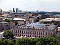
Ireland
_33.jpg)
Italy
Florence
Florence is the capital city of the Italian region of Tuscany and of the province of Florence. It is the most populous city in Tuscany, with approximately 370,000 inhabitants, expanding to over 1.5 million in the metropolitan area....
's historic centre, for example, is surrounded by the Viali di Circonvallazione
Viali di Circonvallazione
The Viali di Circonvallazione are a series of 6-lane boulevards surrounding north part of the historic centre of Florence.-History:The boulevards follows the outline of the ancient walls of Florence, that were demolished since 1865 according to the Giuseppe Poggi's project to make Florence, then...
, a series of 6-lane wide streets; the boulevards follow the outline of the ancient walls of Florence, that were demolished since 1865 to make Florence, then the capital of Italy (for 5 years, 1865–1870), a modern and big city like the other European capitals. The Viali were inspired by the similar Parisian boulevards.
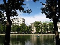
Russia
The dictionary defines boulevard as a wide green strip in the middle of a city street or on the embankmentEmbankment (transportation)
To keep a road or railway line straight or flat, and where the comparative cost or practicality of alternate solutions is prohibitive, the land over which the road or rail line will travel is built up to form an embankment. An embankment is therefore in some sense the opposite of a cutting, and...
. Historical Boulevard Ring
Boulevard Ring
The Boulevard Ring is Moscow's second centremost ring road . Boulevards form a semicircular chain along the western, northern and eastern sides of the historical White City of Moscow; in the south the incomplete ring is terminated by the embankments of Moskva River...
in Moscow
Moscow
Moscow is the capital, the most populous city, and the most populous federal subject of Russia. The city is a major political, economic, cultural, scientific, religious, financial, educational, and transportation centre of Russia and the continent...
emerged on the site of the former White City
Bely Gorod
Bely Gorod is the central core area of Moscow, Russia. The name comes from the color of its defensive wall, which was erected in 1585-1593 at the behest of tsar Feodor I and Boris Godunov by architect Fyodor Kon...
walls (demolished in 1760s and 1770s) before the Fire of 1812
Fire of Moscow (1812)
The 1812 Fire of Moscow broke out on September 14, 1812 in Moscow on the day when Russian troops and most residents abandoned the city and Napoleon's vanguard troops entered the city following the Battle of Borodino...
, starting with Tverskoy Boulevard
Tverskoy Boulevard
Tverskoy Boulevard is one of the main thoroughfares in central Moscow. It is a part of the Boulevard Ring and begins at the end of the Nikitsky Boulevard, at the crossing with Nikitsky Street. The boulevard ends at the Pushkin Square and Tverskaya Street, one of the busiest places in Moscow...
in 1796. The whole ring was replanted and rebuilt after the fire, in 1820s; together with the embanknments of Moskva River
Moskva River
The Moskva River is a river that flows through the Moscow and Smolensk Oblasts in Russia, and is a tributary of the Oka River.-Etymology:...
the boulevards form the second centremost city ring. Green boulevards of that period were terminated with corner hotel and shop buildings, most of them eventually demolished to make way for street traffic. Garden Ring
Garden Ring
The Garden Ring, also known as the "B" Ring , is a circular avenue around the central Moscow, its course corresponding to what used to be the city ramparts surrounding Zemlyanoy Gorod in the 17th century....
, developed in the middle of 19th century, had traditional median boulevards in its western part and side gardens in the east (streets with side strips of green, even those separating main traffic and frontage road
Frontage road
A frontage road is a non-limited access road running parallel to a higher-speed road, usually a freeway, and feeding it at appropriate points of access...
s, are not usually considered boulevards).
Street names of Saint Petersburg
Saint Petersburg
Saint Petersburg is a city and a federal subject of Russia located on the Neva River at the head of the Gulf of Finland on the Baltic Sea...
evolved differently: median greens of major avenues were called boulevards, but the avenues themlselves typically were and still are called prospekts (i.e. Bolshoy Prospekt of Vasilievsky Island
Vasilievsky Island
Vasilyevsky Island is an island in Saint Petersburg, Russia, bordered by the rivers Bolshaya Neva and Malaya Neva in the south and northeast, and by the Gulf of Finland in the west. Vasilyevsky Island is separated from Dekabristov Island by the Smolenka River...
).
United Kingdom
Due to city planning and physical geography, the U.K. has only a few boulevards. Glasgow's Great Western Road is a good example, a mostly dual carriageway road running to the outer suburbs passing through the fashionable West End district, with many shops and bars dotted along the route. After the Great Fire of LondonGreat Fire of London
The Great Fire of London was a major conflagration that swept through the central parts of the English city of London, from Sunday, 2 September to Wednesday, 5 September 1666. The fire gutted the medieval City of London inside the old Roman City Wall...
, London
London
London is the capital city of :England and the :United Kingdom, the largest metropolitan area in the United Kingdom, and the largest urban zone in the European Union by most measures. Located on the River Thames, London has been a major settlement for two millennia, its history going back to its...
was supposed to be formed of straight boulevards, squares and plazas which are seen in mainland Europe, but due to land ownership issues these plans never came to light. Boulevards in London are rare but examples, such as Blackfriars Road
Blackfriars Road
Blackfriars Road is a road in Southwark, SE1. It runs between St George's Circus at the southern end and Blackfriars Bridge over the River Thames at the northern end, leading to the City of London. Halfway up on the west side is Southwark tube station, on the corner with The Cut...
, do exist. Milton Keynes
Milton Keynes
Milton Keynes , sometimes abbreviated MK, is a large town in Buckinghamshire, in the south east of England, about north-west of London. It is the administrative centre of the Borough of Milton Keynes...
, Buckinghamshire
Buckinghamshire
Buckinghamshire is a ceremonial and non-metropolitan home county in South East England. The county town is Aylesbury, the largest town in the ceremonial county is Milton Keynes and largest town in the non-metropolitan county is High Wycombe....
, is one of only a handful of examples where boulevards are a key feature. This is due to Milton Keynes being built as a modern new town
New town
A new town is a specific type of a planned community, or planned city, that was carefully planned from its inception and is typically constructed in a previously undeveloped area. This contrasts with settlements that evolve in a more ad hoc fashion. Land use conflicts are uncommon in new...
in the 1960s. Nottingham
Nottingham
Nottingham is a city and unitary authority in the East Midlands of England. It is located in the ceremonial county of Nottinghamshire and represents one of eight members of the English Core Cities Group...
also has an extensive network of Boulevards.
Australia
Melbourne has at least four roads named "the Boulevard." These are, generally, long roads with many curves which wind alongside the Yarra RiverYarra River
The Yarra River, originally Birrarung, is a river in east-central Victoria, Australia. The lower stretches of the river is where the city of Melbourne was established in 1835 and today Greater Melbourne dominates and influences the landscape of its lower reaches...
.
In addition, the spelling of boulevard with an extra 'e' is common, for example the Southlands Boulevarde
Southlands Boulevarde
Southlands Boulevarde is a shopping centre located in Willetton, Western Australia, along Pinetree Gully Road and facing Willetton Senior High School. Its shops include Woolworths, Coles...
shopping centre in southern Perth. Australia post officially abbreviates boulevard as "BVD".
Several Melbourne thoroughfares not named as a boulevard do in fact follow the boulevard configuration of multiple lanes and landscaping. These include St Kilda Road, Royal Parade
Royal Parade
Royal Parade can refer to:* Royal Parade, Melbourne - a street in Melbourne.* A variant of the Virginia Reel card game....
, Victoria Parade
Victoria Street, Melbourne
Victoria Street is one of the major thoroughfares of inner Melbourne. Running east to west, Victoria Street touches the Hoddle Grid at the intersection of La Trobe Street and Spring Street, opposite the Carlton Gardens. It runs from its terminus at the intersection of Munster Terrace in North...
, Flemington Road, and the outer section of Mount Alexander Road
Mount Alexander Road, Melbourne
Mount Alexander Road is a major road in Melbourne's inner northern suburbs.It commences at the junction of Flemington Road and CityLink in the suburb of North Melbourne, proceeds North through Flemington forming the boundary between Flemington and Travancore, then forming the boundary between...
. Sydneys boulevards are Norwest Boulevard in Bella Vista
Bella Vista, New South Wales
Bella Vista is a suburb of north-western Sydney, in the state of New South Wales, Australia. Bella Vista is located 33 kilometres west of the Sydney central business district, in the local government area of the The Hills Shire. Bella Vista is part of the Greater Western Sydney region and the Hills...
and Baulkham Hills
Baulkham Hills, New South Wales
Baulkham Hills is a suburb in the north-west of Sydney, in the state of New South Wales, Australia. Baulkham Hills is located 31 kilometres north-west of the Sydney central business district in the local government area of The Hills Shire...
, The Boulevard in Kirrawee
Kirrawee, New South Wales
Kirrawee is a suburb in southern Sydney, in the state of New South Wales, Australia. Kirrawee is located 25 kilometres south of the Sydney central business district in the Sutherland Shire. Kirrawee lies between Sutherland, to the west and Gymea and Grays Point, to the east...
, Brighton-le-Sands
Brighton-Le-Sands, New South Wales
Brighton-Le-Sands , is a suburb in southern Sydney, in the state of New South Wales, Australia. Brighton-Le-Sands is located 13 kilometres south of the Sydney central business district, on the western shore of Botany Bay...
, Cammeray
Cammeray, New South Wales
Cammeray is a suburb on the lower North Shore of Sydney, New South Wales, Australia. Cammeray is located 5 kilometres north of the Sydney central business district, in the local government area of North Sydney Council.Cammeray is mostly a residential area...
, Canley Vale
Canley Vale, New South Wales
Canley Vale is a suburb of Sydney, in the state of New South Wales, Australia. Canley Vale is located 30 kilometres south-west of the Sydney central business district, in the local government area of the City of Fairfield and is part of the South-western Sydney region.-History:Aboriginal people...
, Caringbah
Caringbah, New South Wales
Caringbah is a suburb, in southern Sydney, in the state of New South Wales, Australia. Caringbah is located 24 kilometres south of the Sydney central business district in the local government area of Sutherland Shire...
, Cheltenham
Cheltenham, New South Wales
Cheltenham is a suburb of Sydney, in the state of New South Wales, Australia. Cheltenham is located 21 kilometres north-west of the Sydney central business district in the local government area of Hornsby Shire...
, Dulwich Hill
Dulwich Hill, New South Wales
Dulwich Hill is a residential suburb in the Inner West of Sydney, in the state of New South Wales, Australia. Dulwich Hill is located 9 kilometres south-west of the Sydney central business district, in the local government area of Marrickville Council...
, Epping
Epping, New South Wales
Epping is a suburb of Sydney, in the state of New South Wales, Australia. Epping is located 18 kilometres north-west of the Sydney central business district in the local government areas of the City of Ryde, the City of Parramatta and Hornsby Shire and is located in the Northern...
, Fairfield
Fairfield, New South Wales
Fairfield is a western suburb of Sydney, in the state of New South Wales, Australia. Fairfield is located 29 kilometres west of the Sydney central business district and is the administrative centre for the local government area of the City of Fairfield and is also partly in the local government...
, Fairfield Heights, Fairfield West, Gymea
Gymea, New South Wales
Gymea is a suburb in southern Sydney, in the state of New South Wales, Australia. Gymea is located 26 kilometres south of the Sydney central business district in the local government area of the Sutherland Shire. The postcode is 2227, which it shares with adjacent suburb Gymea Bay.-History:The...
, Lakemba
Lakemba, New South Wales
Lakemba is a suburb in south-western Sydney, in the state of New South Wales, Australia. Lakemba is located 15 kilometres south-west of the Sydney central business district, in the local government area of the City of Canterbury....
, Lewisham
Lewisham, New South Wales
Lewisham is a suburb in the inner-west of Sydney, in the state of New South Wales, Australia. Lewisham is located 8 kilometres south-west of the Sydney central business district, in the local government area of Marrickville Council. The postcode is 2049...
, Lidcombe
Lidcombe, New South Wales
Lidcombe is a suburb in western Sydney, in the state of New South Wales Australia. Lidcombe is located 14 kilometres west of the Sydney central business district, in the local government area of Auburn Council....
, Lilyfield
Lilyfield, New South Wales
Lilyfield is a small suburb in the Inner West of Sydney, in the state of New South Wales, Australia. Lilyfield is located 6 kilometres west of the Sydney central business district, in the local government area of the Municipality of Leichhardt....
, Malabar
Malabar, New South Wales
Malabar is a suburb in south-eastern Sydney, in the state of New South Wales, Australia. Malabar is located 12 kilometres south-east of the Sydney central business district, in the local government area of the City of Randwick.-Location:...
, Miranda
Miranda, New South Wales
Miranda is a suburb in southern Sydney, in the state of New South Wales, Australia. Miranda is located 24 kilometres south of the Sydney central business district, in the Sutherland Shire....
, Newport
Newport, New South Wales
Newport is a suburb in northern Sydney, in the state of New South Wales, Australia. Newport is located 31 kilometres north of the Sydney central business district, in the local government area of Pittwater Council, and is part of the Northern Beaches region....
, Petersham
Petersham, New South Wales
Petersham is a suburb in the Inner West of Sydney, in the state of New South Wales, Australia. Petersham is located 6 kilometres south-west of the Sydney central business district, in the local government area of Marrickville Council...
, Punchbowl
Punchbowl, New South Wales
Punchbowl, a suburb of local government areas City of Bankstown and the City of Canterbury is located 17 kilometres south-west of the Sydney central business district, in the state of New South Wales, Australia, and is a part of the South-western Sydney region.- History :Punchbowl is named for a...
, Sans Souci
Sans Souci, New South Wales
Sans Souci is a southern Sydney suburb in the state of New South Wales, Australia. Sans Souci is 17 kilometres south of the Sydney central business district and lies across the local government areas of the City of Rockdale and the Municipality of Kogarah. It is part of the St George area.Sans...
, Smithfield
Smithfield, New South Wales
* Highest Recorded Temperature: 44.2 °C* Lowest Recorded Temperature: -2.3 °C* Warmest Month: January* Coolest Month: July* Highest Precipitation: February* Lowest Precipitation: August-Demographics:...
, Strathfield, Sutherland
Sutherland, New South Wales
Sutherland is a suburb in southern Sydney, in the state of New South Wales, Australia. Sutherland is located 26 kilometres south of the Sydney central business district and is the administrative centre for the local government area of the Sutherland Shire....
, Wiley Park
Wiley Park, New South Wales
Wiley Park is a suburb in south-western Sydney, in the state of New South Wales, Australia. Wiley Park is located 17 kilometres south-west of the Sydney central business district in the City of Canterbury.-History:...
and Yagoona
Yagoona, New South Wales
Yagoona, a suburb of local government area City of Bankstown, is located 20 kilometres south-west of the Sydney central business district, in the state of New South Wales, Australia, and is a part of the South-western Sydney region. Yagoona is an Aboriginal word meaning 'now' or...
.
New Zealand
Construction began on the OrewaOrewa
Orewa, a town in New Zealand's North Island lies on the Hibiscus Coast, just north of the base of the Whangaparaoa Peninsula and 40 kilometres north of central Auckland. Orewa's population was 7,326 in the 2006 Census, an increase of 1,692 from 2001. It is a popular holiday destination...
Boulevard in March 2009, the works are expected to be complete by February 2010. This boulevard will be approximately 400 m long with Pohutukawa
Pohutukawa
The Pōhutukawa is a coastal evergreen tree in the myrtle family, Myrtaceae, that produces a brilliant display of red flowers made up of a mass of stamens. The Pōhutukawa is one of twelve Metrosideros species endemic to New Zealand...
and palm lined footpaths, a wide cycleway will be constructed on the beach side of the road and carparks on the business side. The Orewa Boulevard is a project commissioned by the Rodney District Council with the vision of connecting the CBD
Central business district
A central business district is the commercial and often geographic heart of a city. In North America this part of a city is commonly referred to as "downtown" or "city center"...
to Orewa Beach.
Alternative meanings
Central reservationCentral reservation
On divided roads, such as divided highways or freeways/motorways, the central reservation , median, parkway , median strip or central nature strip is the area which separates opposing lanes of traffic...
: Some people also use the term boulevard to refer to the division or central reservation in such a road, whether specifically in a “boulevard” in the above sense or not. It can consist of anything from a simple thick curb
Curb (road)
A curb, or kerb , is the edge where a raised pavement/sidewalk/footpath, road median, or road shoulder meets an unraised street or other roadway.-Function:...
of concrete, to a wide strip of grass, to a thoroughly landscaped space of trees, shrub
Shrub
A shrub or bush is distinguished from a tree by its multiple stems and shorter height, usually under 5–6 m tall. A large number of plants may become either shrubs or trees, depending on the growing conditions they experience...
s, and other foliage; in urban areas, boulevards can also contain public art
Art
Art is the product or process of deliberately arranging items in a way that influences and affects one or more of the senses, emotions, and intellect....
or memorial
Memorial
A memorial is an object which serves as a focus for memory of something, usually a person or an event. Popular forms of memorials include landmark objects or art objects such as sculptures, statues or fountains, and even entire parks....
s. Wide boulevards also sometimes serve as rights-of-way for tram
Tram
A tram is a passenger rail vehicle which runs on tracks along public urban streets and also sometimes on separate rights of way. It may also run between cities and/or towns , and/or partially grade separated even in the cities...
s or light rail
Light rail
Light rail or light rail transit is a form of urban rail public transportation that generally has a lower capacity and lower speed than heavy rail and metro systems, but higher capacity and higher speed than traditional street-running tram systems...
systems. Kansas City, Missouri
Kansas City, Missouri
Kansas City, Missouri is the largest city in the U.S. state of Missouri and is the anchor city of the Kansas City Metropolitan Area, the second largest metropolitan area in Missouri. It encompasses in parts of Jackson, Clay, Cass, and Platte counties...
, has more “boulevard” miles than the city of Paris (if the term is used lightly). One such famous boulevard is Ward Parkway
Ward Parkway
Ward Parkway is a boulevard in Kansas City, Missouri near the Kansas-Missouri state line. Ward Parkway begins at Brookside Boulevard on the eastern edge of the Country Club Plaza and continues westward along Brush Creek as U.S. Route 56 until it turns southward across the creek just before the...
, which features fountains, statues, and vast quantities of grass and trees in the center. Also of note, The Paseo
The Paseo
The Paseo is a major north–south parkway in Kansas City, Missouri. It runs in the center of the city: from Cliff Drive and Lexington Avenue on the bluffs above the Missouri River in the Pendleton Heights historic neighborhood, to 85th Street and Woodland Avenue...
in the city center was modeled after Mexico's Paseo de la Reforma
Paseo de la Reforma
Paseo de la Reforma is a wide avenue that runs in a straight line, cutting diagonally across Mexico City. It was designed by Ferdinand von Rosenzweig in the 1860s and modeled after the great boulevards of Europe, such as Vienna's Ringstrasse or the Champs-Élysées in Paris...
.
Road verge: Another use for the term boulevard is for a strip of grass between a sidewalk
Sidewalk
A sidewalk, or pavement, footpath, footway, and sometimes platform, is a path along the side of a road. A sidewalk may accommodate moderate changes in grade and is normally separated from the vehicular section by a curb...
and a road, and located above a curb. Though in Europe the two are often adjacent, many residential neighbourhoods in the United States and Canada feature strips of grass or other greenery between the sidewalk and the road, placed in order to both beautify the street and to provide a buffer between vehicles and pedestrians.
bicycle boulevard
Bicycle boulevard
A bicycle boulevard is a low speed street which has been optimized for bicycle traffic. Bicycle boulevards discourage cut-through motor vehicle traffic but allow local motor vehicle traffic. They are designed to give priority to cyclists as through-going traffic...
, a road
Road
A road is a thoroughfare, route, or way on land between two places, which typically has been paved or otherwise improved to allow travel by some conveyance, including a horse, cart, or motor vehicle. Roads consist of one, or sometimes two, roadways each with one or more lanes and also any...
designed primarily for use by bicycles. Vehicles will be encouraged to travel at low speeds if they are allowed at all.