
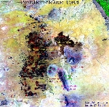
Potrillo volcanic field
Encyclopedia
The Potrillo Volcanic Field is a monogenetic
volcanic field
located on the Rio Grande Rift
, in a portion of its rift valley
, in southern New Mexico
, USA and northern Chihuahua, Mexico
. The Volcanic Field lies 22 miles (35 km) southwest of Las Cruces, New Mexico
.
is a north-south rift valley
in the Basin and Range Province of western North America
.
 The Rio grande rift is a tectonically active structure
that has evolved during two stages.
What is thought is that molten rock
went into crustal cracks which sometimes exploded violently onto the earth
’s surface up and down the rift. Several thousand years ago, here in Potrillo Volcanic Field, white-hot magma rose from 50 miles (80.5 km) under the surface up through structural fractures toward the surface to change all the landscape appearance.
In some places molten rock intruded into depositional sand but it failed to erupt through the surface, so erosion took place to expose the igneous formations. In other places molten rock erupted explosively, producing clouds of solidified lava that later fell back to earth as ash, forming a cone around the vent. In some cases, it erupted several times as a succession of lava flows from a single vent forming widespread basalt layers taking on the form of a shield. At times, molten rock came into contact with water-saturated sand and it produced superheated and highly pressurized water vapor that exploded though the earth’s surface with a devastating force creating large craters
known as maars or lakes.
In the Potrillo volcanic field, there are 10 to 15 feet thick layers of basalt spread across the volcanic field, from lava breaching the walls of the cinder cone and shield volcanoes, spilling down the flanks and spreading across the surrounding surface. The Potrillo area is generally classified as part of the southern Rio Grande rift and shows the Tertiary tectonic evolution of that structure. Extension took place in an intense 30–20 Ma phase, involving low-angle normal faults, and a less intense <10 Ma phase, involving high-angle normal. Mack & Seager (1995) argued that the Quaternary magmatism reached the surface via a transfer zone linking two adjacent N–S-trending, long-lived, extensional structures—the West Robledo and Camel Mountain faults.
The Potrillo Volcanic Field is separated into three areas; the eastern, central and western alignments. This division is based on the essentially north-south distribution of volcanic centers, which is delineated by units east of the east Robledo fault. It goes across from north to south, the eastern alignment includes Santo Tomas, San Miguel, Little Clack Mountain and Black Mountain. Most of the eastern alignment are scoria cones with and without breach flows with pahoehoe surface.
The central alignment includes Aden
, Afton, the Gardner cones, and the two maars; the Kilburne hole and Hunt’s hole. The two maars erupted through portions of pre-existing Afton series. The Afton flows may be a fissure-emplaced upon which the Gardner cones were made. Aden is a shield site of many tube-fed lavas with explosive characteristics.
The Western alignment affects The Western Potrillo Mountains, a cavalcade of hundreds of coalescing cones and flows formed upon older, thick platform was the result from possibly fissure-fed stacked flows. Also within the western area are several maars: Riley, Malpais and Potrillo. Potrillo maar is included with the western alignment due to its position west of the East Robledo fault.
is a low relief volcanic crater produced by the interaction of rising magma
and ground water and the product is shallow explosive eruptions. What happens is the heating and boiling of ground water when magma invades the ground water table and the explosions blast up through the surface. The result is a crater that looks similar to a hole that is often filled with water to form a lake. The range in size is from 60 to 2000 m (196.9 to 6,561.7 ft) across and form 10 to 200 m (32.8 to 656.2 ). There are Maars in western USA, in the Eifel region of Germany and in geologically young volcanic region of the world, one of them is Hunt’s Hole and Kilbourne Hole
located in Potrillo Volcanic Field, in Dona Ana New Mexico close to El Paso Texas. There are five maars volcanoes in Potrillo Volcanic Field.
A Cinder Cone
also known as Scoria Cone, is a steep, conical hill formed on top of a vent. Cinder Cones are landforms but not everyone knows about them because they are not as destructive as other landforms and their eruptions do not cause any loss of life. The Cinder Cones often grow up in groups and they usually occur on the sides and around the shield volcanoes and the strato volcanoes. They are formed form lava fragments called cinders, it is magma that is glassy and has hundreds of gas bubbles that are frozen, it cools quickly after it’s ejected into the air. The lava is expelled from the vent and formed around the vent when they fall back after it is ejected. Cinder Cones are approximately 250 metres (820.2 ft) height and 500 metres (1,640.4 ft) in diameter.
Potrillo Volcanic Field covers approximately 4600 square kilometres (1,776.1 sq mi) of Dona Ana County. It is a monogenetic volcanic field that can be divided in three volcanic regions; the West Potrillo Field that consists of more than 100 Cinder Cones, two maar volcanoes and associated flows that covers approximately 1250 square kilometres (482.6 sq mi). The Aden-Afton field has a number of young flows, three cinder cones and three maar volcanoes, one of them is the Kilbourne Hole; Aden-Afton Field is approximately 230 square kilometres (88.8 sq mi).
Aden Crater is a small shield cone, and it is the most unusual feature in the volcanic field because it has a lava tube, where a ground sloth
skeleton was found. It is 11,000 years old, and is now at Yale
's Peabody Museum of Natural History. This ground sloth (Nothrotheriops shastense) is one of the few specimens of this age which have been found with patches of skin and hair preserved.
Black Mountains-Santo Tomas is made up of basalt, it consists of four different eruptive centers near the Rio Grande. The West Potrillo Field is the oldest part of the Potrillo Volcanic Field.
Potrillo Volcanic Field has two important Xenolith localities that are Kilbourne Hole and Potrillo maar where mantle peridotites, feldspathic granulites and kaersutite megacryts occur. Alkali Feldspar, Olivine and Basalt
were erupted during the middle and late quaternary Rock samples collected in the northern part of the pyroclastic deposit of the Potrillo maar, and lava associated with a cinder cone yielded Potassium
and Argon
ages, approximately 1.29 and 1.18 million years. The magmatism is entirely basaltic forming scattered scoria cones. Several short lava flows were originated from each cone. There is a diverse rock types beneath the Potrillo volcanics, the range is from Proterozoic granites through a Phanerozoic
sedimentary succession to basalt-andesite volcanics of the southern fringes of the Sierra de las Uvas volcanic field. The Potrillo area is generally classified as part of the southern Rio Grande rift and shows the Tertiary
tectonic evolution of that structure.
was defined during three main periods:
During the Laramide, the thrust faults were overturned due to compression (Late Cretaceous
– Early Tertiary).
Deformation occurred during the Middle Tertiary, and it is believed it involved either northeast or north-south extension
(in the Rio Grande Rift
). The system of low angle normal faults that resulted were closely spaced and consequently cut the Laramide structures. The extensional tectonics
continued throughout the Middle Tertiary.
Finally, during the Late Tertiary tectonic uplift
took place as a result of movement on high angle normal faults.
When performing 3He
surface exposure dating
, the upper 3 centimetres (1.2 in) of flow surfaces is sufficient enough for collecting samples desired. It is essential to collect samples with primarily display flow features, such as spatter, flow lineation, and cooling rinds. 3He surface dating is a technique that is optimal when working with well preserved young surface lavas (<700 ka). All samples are analyzed on a static mass spectrometer equipped with ion counting detection. The mineral is first crushed in a vacuum, and the magmatic component of the mash is analyzed for its amount and isotropic composition of helium and neon. 3He is calculated by taking the difference of total 3He component equal to the total 4He released in the heating process times 3He/4He released in the crush step.
Cosmogenic 3He/21Ne
confirm that 3He is retained be the samples taken. Cosmogenic isotope
s are rare isotopes created when a high-energy cosmic ray interacts with the nucleus of an atom. These isotopes are produced within earth materials such as rocks or soil, in Earth's atmosphere, and in extraterrestrial items such as meteorites. By measuring cosmogenic isotopes, scientists are able to gain insight into a range of geological and astronomical processes. There are both radioactive and stable cosmogenic isotopes. This assumes ⁴He released by heating is due to magmatic component with a helium isotopic composition which seems to be a reasonable assumption for a low uranium olivine.
Ne concentrations monitor assumption that 4He belongs to the magmatic component. Ne has 3 isotopes: 20Ne, 21Ne, and 22Ne. 22Ne is dominated by the magmatic component. 21Ne has a cosmogenic contribution.
of the Potrillo Volcanic Field consists of over 100 cinder cones within the area of the Rio Grande Rift in southern New Mexico. The most recent age dating study revealed the age to be from 1 million to 20,000 years old. It is a 50 square kilometres (19.3 sq mi) field in S.E. Dona Ana County, NM.
There are 3 groups of slope angles;
This process of grouping was done by 3He surface exposure dating and 40Ar
/39Ar dating. The new morphologic dating methods suggest that cinder cone formation in the Potrillo Volcanic Field may have occurred at different intervals and that the field may be currently developing new cinder cones. The cinder cone slope distribution in the Potrillo volcanic field suggests that volcanism occurred at different time intervals. In addition, trend line analysis provides a powerful and useful tool for predicting cinder cone ages in the Potrillo volcanic field. This area has arid climate & cone degradation is a product of mechanical weathering.
The age-angle relationship is quantitatively modeled by diffusion equations, like Comparison of 3He to 40Ar/39Ar, and by overlapping DRG
digital elevation models, digital topographic maps DEM
. The formula angle = tan−1(height/radius) was used to obtain the angles. The overall comparison of all groups in the south west region extending from New Mexico to Mexico are used for the dating and comparison of age but the climate, and terrain conditions are looked to see the weathering conditions.
angle relationship created by Buckman and Anderson in 1979. The maximum scarp angle increases approximately linearly with the logarithm of the scarp height. In other terms, plotting the maximum height of a slope versus the maximum slope angle allows the age of the fault to be estimated; since the shallower the angle is the older the fault scrap becomes.
The second method used was the linear-plus-cubic diffusion, which is a model of fault scarping. This method uses the diffusive process on hill slopes, such as rain-splash and wind erosion, that move sediment down hill. t = t’(SO)*2/k (0). The last method used to date the faulting was the morphologic dating without numerical model. Such a technique requires that down slope debris instability is a timedependent function of slope angle, in units of volume per time per length of contour (Nash, 2005). The scarp ages can be determined based on the relationship Ta/Tb = H*-2 b / H-2 b From the first method we can conclude that there were at least five seismic events that did not occur at the same time. From method two we can say than the faulting ages
between 57ka to 377ka with surface offset of 11.2m that had a magnitude of 6-7 earthquakes. Finally the third method of dating concludes that the relative ages of the east Potrillo fault scarps ranges form 153,000 to 239,000.
s are divided according to their textures into:
is defined as an ultra mafic rock that is composed of by and large of minerals of the pyroxene group for example enstatite
, bronzite
or diopside
and are sorted into clinopyroxenite, orthopyroxenite and the websterites. Pyroxenites have been located as layers inside large masses of peridotite. These pyroxenite layers have come to be inferred as a yield of the reaction between rising magmas and peridotite of the upper mantle. The Southern Rio Grande Rift, including the Portrillo Volcanic field, is an area where pyroxenites are most prevalent. Pyroxenites are generally coupled with zones of extension implying that there is a correlation between asthenospheric
outpouring and invasive growth of mantle pyroxenites. The methods by which pyroxenites are formed is somewhat undefined. Pyroxenites may possibly represent preserved remnants of Farallon (oceanic) plate
that subducted under the North American plate and mixed with mantle melts and created the xenoliths that have surfaced in Kilbourne Hole and Potrillo Maar. However others suggest that they could be cumulates
derived from alkali basaltic pyroxenite samples continue to preserve a more widespread reaction which is specifically helpful in examining the thermal and chemical alteration of the Rio Grande rifting. More evidence showing this rock contact and with melt deep in the mantle is that primary mantle carbonates
are present in many of the pyroxenites found in the Rio Grande Rift magmas or primary melt compositions that crystallized in the upper mantle.
The low crust of the PVF consists of a single density of 2880 kg/m3. The upper to middle crust (between 5 km and 20 km) of the PVF has a block with a density of 2740 kg/m3. The density at 11 to 15 km (6.8 to 9.3 ) of depth is 2880 kg/m3. This body is a mid-crustal “welt” and velocities within this region increase up to and greater than 6.35 km/s. This greater density creates a lateral density contrast and in turn generates long-wavelength gravity high. The upper mantle densities at the PVF are decreased from 3280 to 3250 kg/m3. Evidence of this can be supported by the west to east decrease in velocities from approximately 7.96 to 7.70 km/s.
Coyote Hill and the West Portillo mountains make up the western portion of the PVF, with region velocities in this uplift from 4.5 km/s to over 6.0 km/s at the depth of 2.5 km. To the east is the Malpais basin and velocities within this basin range from 1.68 km/s to 4.86 km/s at a depth of approximately 3 km. The Mesilla basin is an asymmetric basin that adjoins the eastern edge of the PVF and extends on to the western flank of the Franklin mountain uplift. At a depth of about 1.5 km the velocities in the western area range from approximately 2.4 km/s to 4.0 km/s at a depth of about 1.5 km.
There is increased seismic reflectivity within the crust and at the Moho
interface concentrated below the PVF. The mid-crustal shows reflectivity increases between 40 and 70 km (24.9 and 43.5 ) offset; mid-crustal reflectivity is present between 4 and 6 seconds, reduced time.

Monogenetic volcanic field
A monogenetic volcanic field is a volcanic field of small, scattered volcanic vents. These volcanic fields, containing numerous monogenetic volcanoes, are noted for having only one short eruptive event at each volcano, as opposed to regular volcanoes that have several eruptions from the same vent...
volcanic field
Volcanic field
A volcanic field is an area of the Earth's crust that is prone to localized volcanic activity. They usually contain 10 to 100 volcanoes, such as cinder cones and are usually in clusters. Lava flows may also occur...
located on the Rio Grande Rift
Rio Grande Rift
The Rio Grande Rift is a north-trending continental rift zone. It separates the Colorado Plateau in the west from the interior of the North American craton on the east. The rift extends from central Colorado in the north to the state of Chihuahua, Mexico in the south. The rift zone consists of four...
, in a portion of its rift valley
Rift valley
A rift valley is a linear-shaped lowland between highlands or mountain ranges created by the action of a geologic rift or fault. This action is manifest as crustal extension, a spreading apart of the surface which is subsequently further deepened by the forces of erosion...
, in southern New Mexico
New Mexico
New Mexico is a state located in the southwest and western regions of the United States. New Mexico is also usually considered one of the Mountain States. With a population density of 16 per square mile, New Mexico is the sixth-most sparsely inhabited U.S...
, USA and northern Chihuahua, Mexico
Mexico
The United Mexican States , commonly known as Mexico , is a federal constitutional republic in North America. It is bordered on the north by the United States; on the south and west by the Pacific Ocean; on the southeast by Guatemala, Belize, and the Caribbean Sea; and on the east by the Gulf of...
. The Volcanic Field lies 22 miles (35 km) southwest of Las Cruces, New Mexico
Las Cruces, New Mexico
Las Cruces, also known as "The City of the Crosses", is the county seat of Doña Ana County, New Mexico, United States. The population was 97,618 in 2010 according to the 2010 Census, making it the second largest city in the state....
.
Rio Grande Rift
The Rio Grande RiftRio Grande Rift
The Rio Grande Rift is a north-trending continental rift zone. It separates the Colorado Plateau in the west from the interior of the North American craton on the east. The rift extends from central Colorado in the north to the state of Chihuahua, Mexico in the south. The rift zone consists of four...
is a north-south rift valley
Rift valley
A rift valley is a linear-shaped lowland between highlands or mountain ranges created by the action of a geologic rift or fault. This action is manifest as crustal extension, a spreading apart of the surface which is subsequently further deepened by the forces of erosion...
in the Basin and Range Province of western North America
North America
North America is a continent wholly within the Northern Hemisphere and almost wholly within the Western Hemisphere. It is also considered a northern subcontinent of the Americas...
.
- Rifting began in Late OligoceneOligoceneThe Oligocene is a geologic epoch of the Paleogene Period and extends from about 34 million to 23 million years before the present . As with other older geologic periods, the rock beds that define the period are well identified but the exact dates of the start and end of the period are slightly...
period. - The Rio Grande Rift begins in central Colorado and runs southward to end in the state of Chihuahua, MexicoMexicoThe United Mexican States , commonly known as Mexico , is a federal constitutional republic in North America. It is bordered on the north by the United States; on the south and west by the Pacific Ocean; on the southeast by Guatemala, Belize, and the Caribbean Sea; and on the east by the Gulf of...
. - Due to the rollback of Farallon PlateFarallon PlateThe Farallon Plate was an ancient oceanic plate, which began subducting under the west coast of the North American Plate— then located in modern Utah— as Pangaea broke apart during the Jurassic Period...
, a temporal pattern of magmatismMagmatismThe formation of igneous rocks from magma is known as Magmatism.Magmatism is a process responsible for mountain formation. The process of magmatism produces an additional mass and volume to the Earth’s surface. For example the formation of volcanoes or island arcs at convergent plate boundaries...
oldest in east and swept progressively westward - MantleMantle (geology)The mantle is a part of a terrestrial planet or other rocky body large enough to have differentiation by density. The interior of the Earth, similar to the other terrestrial planets, is chemically divided into layers. The mantle is a highly viscous layer between the crust and the outer core....
upwelling providing heat and extension. - Gravitational collapse due to crustal thickening of the subduction zone, with deformation occurring as far west as Death ValleyDeath ValleyDeath Valley is a desert valley located in Eastern California. Situated within the Mojave Desert, it features the lowest, driest, and hottest locations in North America. Badwater, a basin located in Death Valley, is the specific location of the lowest elevation in North America at 282 feet below...
, California. - Collapse extension of the Basin and Range and the Rio Grande Rift continues even today, although at a reduced rate compared to the Oligocene and the MioceneMioceneThe Miocene is a geological epoch of the Neogene Period and extends from about . The Miocene was named by Sir Charles Lyell. Its name comes from the Greek words and and means "less recent" because it has 18% fewer modern sea invertebrates than the Pliocene. The Miocene follows the Oligocene...
.
Volcanology
Structure
Structure is a fundamental, tangible or intangible notion referring to the recognition, observation, nature, and permanence of patterns and relationships of entities. This notion may itself be an object, such as a built structure, or an attribute, such as the structure of society...
that has evolved during two stages.
- The first phase was from the late OligoceneOligoceneThe Oligocene is a geologic epoch of the Paleogene Period and extends from about 34 million to 23 million years before the present . As with other older geologic periods, the rock beds that define the period are well identified but the exact dates of the start and end of the period are slightly...
to early MioceneMioceneThe Miocene is a geological epoch of the Neogene Period and extends from about . The Miocene was named by Sir Charles Lyell. Its name comes from the Greek words and and means "less recent" because it has 18% fewer modern sea invertebrates than the Pliocene. The Miocene follows the Oligocene...
and at that time thirty to fifty percent of the Rio Grande rift was made; volcanismVolcanismVolcanism is the phenomenon connected with volcanoes and volcanic activity. It includes all phenomena resulting from and causing magma within the crust or mantle of a planet to rise through the crust and form volcanic rocks on the surface....
at that time included basaltic andesiteBasaltic andesiteBasaltic andesite is a black volcanic rock containing about 55% silica. Minerals in basaltic andesite include olivine, augite and plagioclase. Basaltic andesite can be found in volcanoes around the world, including in Central America and the Andes of South America. Basaltic andesite is common in...
s, andesites, and silicic ash flow tuffs. - The second stage began around the mid-Miocene to QuaternaryQuaternaryThe Quaternary Period is the most recent of the three periods of the Cenozoic Era in the geologic time scale of the ICS. It follows the Neogene Period, spanning 2.588 ± 0.005 million years ago to the present...
and continues to the present. It is about ten percent of the Rio Grande extension; there is some evidence of the continuous rifting including young fault scarps, seismicity, high heat flow, and ongoing uplift as established by geodetic measurements. Mafic volcanism is related to this stage.
What is thought is that molten rock
Rock (geology)
In geology, rock or stone is a naturally occurring solid aggregate of minerals and/or mineraloids.The Earth's outer solid layer, the lithosphere, is made of rock. In general rocks are of three types, namely, igneous, sedimentary, and metamorphic...
went into crustal cracks which sometimes exploded violently onto the earth
Earth
Earth is the third planet from the Sun, and the densest and fifth-largest of the eight planets in the Solar System. It is also the largest of the Solar System's four terrestrial planets...
’s surface up and down the rift. Several thousand years ago, here in Potrillo Volcanic Field, white-hot magma rose from 50 miles (80.5 km) under the surface up through structural fractures toward the surface to change all the landscape appearance.
In some places molten rock intruded into depositional sand but it failed to erupt through the surface, so erosion took place to expose the igneous formations. In other places molten rock erupted explosively, producing clouds of solidified lava that later fell back to earth as ash, forming a cone around the vent. In some cases, it erupted several times as a succession of lava flows from a single vent forming widespread basalt layers taking on the form of a shield. At times, molten rock came into contact with water-saturated sand and it produced superheated and highly pressurized water vapor that exploded though the earth’s surface with a devastating force creating large craters
Crater lake
A crater lake is a lake that forms in a volcanic crater or caldera, such as a maar; less commonly and with lower association to the term a lake may form in an impact crater caused by a meteorite. Sometimes lakes which form inside calderas are called caldera lakes, but often this distinction is not...
known as maars or lakes.
In the Potrillo volcanic field, there are 10 to 15 feet thick layers of basalt spread across the volcanic field, from lava breaching the walls of the cinder cone and shield volcanoes, spilling down the flanks and spreading across the surrounding surface. The Potrillo area is generally classified as part of the southern Rio Grande rift and shows the Tertiary tectonic evolution of that structure. Extension took place in an intense 30–20 Ma phase, involving low-angle normal faults, and a less intense <10 Ma phase, involving high-angle normal. Mack & Seager (1995) argued that the Quaternary magmatism reached the surface via a transfer zone linking two adjacent N–S-trending, long-lived, extensional structures—the West Robledo and Camel Mountain faults.
The Potrillo Volcanic Field is separated into three areas; the eastern, central and western alignments. This division is based on the essentially north-south distribution of volcanic centers, which is delineated by units east of the east Robledo fault. It goes across from north to south, the eastern alignment includes Santo Tomas, San Miguel, Little Clack Mountain and Black Mountain. Most of the eastern alignment are scoria cones with and without breach flows with pahoehoe surface.
The central alignment includes Aden
Aden Lava Flow Wilderness Study Area
Aden Lava Flow Wilderness Study Area is one of many Wilderness Study Areas operated by the Bureau of Land Management in New Mexico. It is in size....
, Afton, the Gardner cones, and the two maars; the Kilburne hole and Hunt’s hole. The two maars erupted through portions of pre-existing Afton series. The Afton flows may be a fissure-emplaced upon which the Gardner cones were made. Aden is a shield site of many tube-fed lavas with explosive characteristics.
The Western alignment affects The Western Potrillo Mountains, a cavalcade of hundreds of coalescing cones and flows formed upon older, thick platform was the result from possibly fissure-fed stacked flows. Also within the western area are several maars: Riley, Malpais and Potrillo. Potrillo maar is included with the western alignment due to its position west of the East Robledo fault.
Volcanology II
A maarMaar
A maar is a broad, low-relief volcanic crater that is caused by a phreatomagmatic eruption, an explosion caused by groundwater coming into contact with hot lava or magma. A maar characteristically fills with water to form a relatively shallow crater lake. The name comes from the local Moselle...
is a low relief volcanic crater produced by the interaction of rising magma
Magma
Magma is a mixture of molten rock, volatiles and solids that is found beneath the surface of the Earth, and is expected to exist on other terrestrial planets. Besides molten rock, magma may also contain suspended crystals and dissolved gas and sometimes also gas bubbles. Magma often collects in...
and ground water and the product is shallow explosive eruptions. What happens is the heating and boiling of ground water when magma invades the ground water table and the explosions blast up through the surface. The result is a crater that looks similar to a hole that is often filled with water to form a lake. The range in size is from 60 to 2000 m (196.9 to 6,561.7 ft) across and form 10 to 200 m (32.8 to 656.2 ). There are Maars in western USA, in the Eifel region of Germany and in geologically young volcanic region of the world, one of them is Hunt’s Hole and Kilbourne Hole
Kilbourne Hole
Kilbourne Hole is a maar volcanic crater, located west of the Franklin mountains of El Paso, Texas, in the Potrillo Volcanic Field of Doña Ana County, New Mexico. Nearby Hunt's Hole lies several miles just south of Kilbourne Hole. These holes are rare examples of volcanic action without a...
located in Potrillo Volcanic Field, in Dona Ana New Mexico close to El Paso Texas. There are five maars volcanoes in Potrillo Volcanic Field.
A Cinder Cone
Cinder cone
According to the , Cinder Cone is the proper name of 1 cinder cone in Canada and 7 cinder cones in the United States:In Canada: Cinder Cone In the United States:...
also known as Scoria Cone, is a steep, conical hill formed on top of a vent. Cinder Cones are landforms but not everyone knows about them because they are not as destructive as other landforms and their eruptions do not cause any loss of life. The Cinder Cones often grow up in groups and they usually occur on the sides and around the shield volcanoes and the strato volcanoes. They are formed form lava fragments called cinders, it is magma that is glassy and has hundreds of gas bubbles that are frozen, it cools quickly after it’s ejected into the air. The lava is expelled from the vent and formed around the vent when they fall back after it is ejected. Cinder Cones are approximately 250 metres (820.2 ft) height and 500 metres (1,640.4 ft) in diameter.
Potrillo Volcanic Field covers approximately 4600 square kilometres (1,776.1 sq mi) of Dona Ana County. It is a monogenetic volcanic field that can be divided in three volcanic regions; the West Potrillo Field that consists of more than 100 Cinder Cones, two maar volcanoes and associated flows that covers approximately 1250 square kilometres (482.6 sq mi). The Aden-Afton field has a number of young flows, three cinder cones and three maar volcanoes, one of them is the Kilbourne Hole; Aden-Afton Field is approximately 230 square kilometres (88.8 sq mi).
Aden Crater is a small shield cone, and it is the most unusual feature in the volcanic field because it has a lava tube, where a ground sloth
Ground sloth
Ground sloths are a diverse group of extinct sloths, in the mammalian superorder Xenarthra. Their most recent survivors lived in the Antilles, where it has been proposed they may have survived until 1550 CE; however, the youngest AMS radiocarbon date reported is 4190 BP, calibrated to c. 4700 BP...
skeleton was found. It is 11,000 years old, and is now at Yale
YALE
RapidMiner, formerly YALE , is an environment for machine learning, data mining, text mining, predictive analytics, and business analytics. It is used for research, education, training, rapid prototyping, application development, and industrial applications...
's Peabody Museum of Natural History. This ground sloth (Nothrotheriops shastense) is one of the few specimens of this age which have been found with patches of skin and hair preserved.
Black Mountains-Santo Tomas is made up of basalt, it consists of four different eruptive centers near the Rio Grande. The West Potrillo Field is the oldest part of the Potrillo Volcanic Field.
Potrillo Volcanic Field has two important Xenolith localities that are Kilbourne Hole and Potrillo maar where mantle peridotites, feldspathic granulites and kaersutite megacryts occur. Alkali Feldspar, Olivine and Basalt
Basalt
Basalt is a common extrusive volcanic rock. It is usually grey to black and fine-grained due to rapid cooling of lava at the surface of a planet. It may be porphyritic containing larger crystals in a fine matrix, or vesicular, or frothy scoria. Unweathered basalt is black or grey...
were erupted during the middle and late quaternary Rock samples collected in the northern part of the pyroclastic deposit of the Potrillo maar, and lava associated with a cinder cone yielded Potassium
Potassium
Potassium is the chemical element with the symbol K and atomic number 19. Elemental potassium is a soft silvery-white alkali metal that oxidizes rapidly in air and is very reactive with water, generating sufficient heat to ignite the hydrogen emitted in the reaction.Potassium and sodium are...
and Argon
Argon
Argon is a chemical element represented by the symbol Ar. Argon has atomic number 18 and is the third element in group 18 of the periodic table . Argon is the third most common gas in the Earth's atmosphere, at 0.93%, making it more common than carbon dioxide...
ages, approximately 1.29 and 1.18 million years. The magmatism is entirely basaltic forming scattered scoria cones. Several short lava flows were originated from each cone. There is a diverse rock types beneath the Potrillo volcanics, the range is from Proterozoic granites through a Phanerozoic
Phanerozoic
The Phanerozoic Eon is the current eon in the geologic timescale, and the one during which abundant animal life has existed. It covers roughly 542 million years and goes back to the time when diverse hard-shelled animals first appeared...
sedimentary succession to basalt-andesite volcanics of the southern fringes of the Sierra de las Uvas volcanic field. The Potrillo area is generally classified as part of the southern Rio Grande rift and shows the Tertiary
Tertiary
The Tertiary is a deprecated term for a geologic period 65 million to 2.6 million years ago. The Tertiary covered the time span between the superseded Secondary period and the Quaternary...
tectonic evolution of that structure.
Structural geology
The structural geology of the East Potrillo MountainsEast Potrillo Mountains
The East Potrillo Mountains are a mountain range in south central Doña Ana County, New Mexico. They are located approximately 25 miles west of El Paso, Texas, 30 miles southwest of Las Cruces, New Mexico, and 30 miles east of Columbus, New Mexico. The southern tip of the range is less than 5...
was defined during three main periods:
- LaramideLaramide orogenyThe Laramide orogeny was a period of mountain building in western North America, which started in the Late Cretaceous, 70 to 80 million years ago, and ended 35 to 55 million years ago. The exact duration and ages of beginning and end of the orogeny are in dispute, as is the cause. The Laramide...
- Middle TertiaryTertiaryThe Tertiary is a deprecated term for a geologic period 65 million to 2.6 million years ago. The Tertiary covered the time span between the superseded Secondary period and the Quaternary...
- Late TertiaryTertiaryThe Tertiary is a deprecated term for a geologic period 65 million to 2.6 million years ago. The Tertiary covered the time span between the superseded Secondary period and the Quaternary...
During the Laramide, the thrust faults were overturned due to compression (Late Cretaceous
Late Cretaceous
The Late Cretaceous is the younger of two epochs into which the Cretaceous period is divided in the geologic timescale. Rock strata from this epoch form the Upper Cretaceous series...
– Early Tertiary).
Deformation occurred during the Middle Tertiary, and it is believed it involved either northeast or north-south extension
Rift
In geology, a rift or chasm is a place where the Earth's crust and lithosphere are being pulled apart and is an example of extensional tectonics....
(in the Rio Grande Rift
Rio Grande Rift
The Rio Grande Rift is a north-trending continental rift zone. It separates the Colorado Plateau in the west from the interior of the North American craton on the east. The rift extends from central Colorado in the north to the state of Chihuahua, Mexico in the south. The rift zone consists of four...
). The system of low angle normal faults that resulted were closely spaced and consequently cut the Laramide structures. The extensional tectonics
Extensional tectonics
Extensional tectonics is concerned with the structures formed, and the tectonic processes associated with, the stretching of the crust or lithosphere.-Deformation styles:...
continued throughout the Middle Tertiary.
Finally, during the Late Tertiary tectonic uplift
Tectonic uplift
Tectonic uplift is a geological process most often caused by plate tectonics which increases elevation. The opposite of uplift is subsidence, which results in a decrease in elevation. Uplift may be orogenic or isostatic.-Orogenic uplift:...
took place as a result of movement on high angle normal faults.
Isotope geochemistry
Potrillo Volcanic field contains alkaline basanitic lavas and cinder cones in the southernmost New Mexico. La Mesa is a surface which formed between 900 and 700 Ka, which holds the lavas in the central and eastern region of the field. There are three separate eruptive centers; Afton eruptive center which resides directly against La Mesa central province, the Aden complex which is a crater that lies above the Afton flows, lastly the Black Mountain, which is adjacent to a series of cinder cones.When performing 3He
Helium
Helium is the chemical element with atomic number 2 and an atomic weight of 4.002602, which is represented by the symbol He. It is a colorless, odorless, tasteless, non-toxic, inert, monatomic gas that heads the noble gas group in the periodic table...
surface exposure dating
Surface exposure dating
Surface exposure dating is a collection of geochronological techniques for estimating the length of time that a rock has been exposed at or near Earth's surface. Surface exposure dating is used to date glacial advances and retreats, erosion history, lava flows, meteorite impacts, rock slides, fault...
, the upper 3 centimetres (1.2 in) of flow surfaces is sufficient enough for collecting samples desired. It is essential to collect samples with primarily display flow features, such as spatter, flow lineation, and cooling rinds. 3He surface dating is a technique that is optimal when working with well preserved young surface lavas (<700 ka). All samples are analyzed on a static mass spectrometer equipped with ion counting detection. The mineral is first crushed in a vacuum, and the magmatic component of the mash is analyzed for its amount and isotropic composition of helium and neon. 3He is calculated by taking the difference of total 3He component equal to the total 4He released in the heating process times 3He/4He released in the crush step.
Cosmogenic 3He/21Ne
Neon
Neon is the chemical element that has the symbol Ne and an atomic number of 10. Although a very common element in the universe, it is rare on Earth. A colorless, inert noble gas under standard conditions, neon gives a distinct reddish-orange glow when used in either low-voltage neon glow lamps or...
confirm that 3He is retained be the samples taken. Cosmogenic isotope
Isotope
Isotopes are variants of atoms of a particular chemical element, which have differing numbers of neutrons. Atoms of a particular element by definition must contain the same number of protons but may have a distinct number of neutrons which differs from atom to atom, without changing the designation...
s are rare isotopes created when a high-energy cosmic ray interacts with the nucleus of an atom. These isotopes are produced within earth materials such as rocks or soil, in Earth's atmosphere, and in extraterrestrial items such as meteorites. By measuring cosmogenic isotopes, scientists are able to gain insight into a range of geological and astronomical processes. There are both radioactive and stable cosmogenic isotopes. This assumes ⁴He released by heating is due to magmatic component with a helium isotopic composition which seems to be a reasonable assumption for a low uranium olivine.
Ne concentrations monitor assumption that 4He belongs to the magmatic component. Ne has 3 isotopes: 20Ne, 21Ne, and 22Ne. 22Ne is dominated by the magmatic component. 21Ne has a cosmogenic contribution.
| Surface Exposure ages of samples from Potrillo Volcanic Field | ||
|---|---|---|
| Description | 3He/21Ne (melt) | Age “Ka” (melt) |
| Black Mountain | ||
| Upper flow associated | 2.6 ± 0.6 | 77 ± 4 |
| Cinder cone | 3.0 ± 0.5 | 85 ± 7 |
| Lower flow | 2.6 ± 0.5 | 69 ± 5 |
| Afton volcanic center | ||
| Flow resting on La Mesa | 2.4 ± 0.3 | 72 ± 4 |
| surface | 2.3 ± 0.3 | 81 ± 4 |
| Aden volcanic center | ||
| Flow collected 5 km | 2.5 ± 1.2 | 16.9 ± 3 |
| From Aden crater | N/A | 15.9 ± 2 |
| Spatter cone in Aden | N/A | 15.7 ± 2 |
| Crater | 1.5 ± 0.5 | 17.9 ± 2 |
| Lava lake within crater | N/A | 18.2± 3 |
Cinder cone morphology
The current morphologyGeomorphology
Geomorphology is the scientific study of landforms and the processes that shape them...
of the Potrillo Volcanic Field consists of over 100 cinder cones within the area of the Rio Grande Rift in southern New Mexico. The most recent age dating study revealed the age to be from 1 million to 20,000 years old. It is a 50 square kilometres (19.3 sq mi) field in S.E. Dona Ana County, NM.
There are 3 groups of slope angles;
- Group 1: age of around 250 Ka years old.
- Group 2: age of around 125 Ka years old.
- Group 3: age of around 60 Ka years old.
This process of grouping was done by 3He surface exposure dating and 40Ar
Argon
Argon is a chemical element represented by the symbol Ar. Argon has atomic number 18 and is the third element in group 18 of the periodic table . Argon is the third most common gas in the Earth's atmosphere, at 0.93%, making it more common than carbon dioxide...
/39Ar dating. The new morphologic dating methods suggest that cinder cone formation in the Potrillo Volcanic Field may have occurred at different intervals and that the field may be currently developing new cinder cones. The cinder cone slope distribution in the Potrillo volcanic field suggests that volcanism occurred at different time intervals. In addition, trend line analysis provides a powerful and useful tool for predicting cinder cone ages in the Potrillo volcanic field. This area has arid climate & cone degradation is a product of mechanical weathering.
The age-angle relationship is quantitatively modeled by diffusion equations, like Comparison of 3He to 40Ar/39Ar, and by overlapping DRG
Digital raster graphic
A digital raster graphic is a digital image resulting from scanning a paper USGS topographic map for use on a computer. DRGs created by USGS are typically scanned at 250 dpi and saved as a TIFF. The raster image usually includes the original border information, referred to as the "map collar". ...
digital elevation models, digital topographic maps DEM
USGS DEM
The USGS DEM standard is a geospatial file format developed by the United States Geological Survey for storing a raster-based digital elevation model. It is an open standard, and is used throughout the world...
. The formula angle = tan−1(height/radius) was used to obtain the angles. The overall comparison of all groups in the south west region extending from New Mexico to Mexico are used for the dating and comparison of age but the climate, and terrain conditions are looked to see the weathering conditions.
Fault scarps
The approximate age of the East Potrillo’s faulting is estimated to be around 57,000 to 377,000 years. The age of the faulting was determined by the utilization of three different processes that show similar results on the dates of the faulting on the east Potrillo mountains that is caused by the Rio Grande rift. The first method to determine age was the scarp heightslope-angle relationship created by Buckman and Anderson in 1979. The maximum scarp angle increases approximately linearly with the logarithm of the scarp height. In other terms, plotting the maximum height of a slope versus the maximum slope angle allows the age of the fault to be estimated; since the shallower the angle is the older the fault scrap becomes.
The second method used was the linear-plus-cubic diffusion, which is a model of fault scarping. This method uses the diffusive process on hill slopes, such as rain-splash and wind erosion, that move sediment down hill. t = t’(SO)*2/k (0). The last method used to date the faulting was the morphologic dating without numerical model. Such a technique requires that down slope debris instability is a timedependent function of slope angle, in units of volume per time per length of contour (Nash, 2005). The scarp ages can be determined based on the relationship Ta/Tb = H*-2 b / H-2 b From the first method we can conclude that there were at least five seismic events that did not occur at the same time. From method two we can say than the faulting ages
between 57ka to 377ka with surface offset of 11.2m that had a magnitude of 6-7 earthquakes. Finally the third method of dating concludes that the relative ages of the east Potrillo fault scarps ranges form 153,000 to 239,000.
Peridotite xenoliths
Kilbourne Hole xenolithXenolith
A xenolith is a rock fragment which becomes enveloped in a larger rock during the latter's development and hardening. In geology, the term xenolith is almost exclusively used to describe inclusions in igneous rock during magma emplacement and eruption...
s are divided according to their textures into:
- fine grained lherzoliteLherzoliteLherzolite is a type of ultramafic igneous rock. It is a coarse grained rock consisting of 40 to 90% olivine along with significant orthopyroxene and lesser calcic chromium rich clinopyroxene. Minor minerals include chromium and aluminium spinels and garnets. Plagioclase can occur in lherzolites...
- protogranular to porphyroclastic lherzolite
- porphyroclastic olivineOlivineThe mineral olivine is a magnesium iron silicate with the formula 2SiO4. It is a common mineral in the Earth's subsurface but weathers quickly on the surface....
-rich peridotitePeridotiteA peridotite is a dense, coarse-grained igneous rock, consisting mostly of the minerals olivine and pyroxene. Peridotite is ultramafic, as the rock contains less than 45% silica. It is high in magnesium, reflecting the high proportions of magnesium-rich olivine, with appreciable iron...
-
- Age: Middle-late Quaternary: 1-Ma – 8-ka
- Temperatures: Equigranular 978-984 C, lherzolite 1020-1044 C, olivine-rich 1052-1184 C
- Xenoliths were derived from 35 to 70 km deep
- Calculated P-waveP-waveP-waves are a type of elastic wave, also called seismic waves, that can travel through gases , solids and liquids, including the Earth. P-waves are produced by earthquakes and recorded by seismographs...
velocities for Peridotite range from 7.75 km/s to 7.89 km/s - Rio Grande Rift P-wave velocities range from 7.6 km/s to 7.8 km/s
-
Pyroxenites
A pyroxenitePyroxenite
Pyroxenite is an ultramafic igneous rock consisting essentially of minerals of the pyroxene group, such as augite and diopside, hypersthene, bronzite or enstatite. They are classified into clinopyroxenites, orthopyroxenites, and the websterites which contain both pyroxenes...
is defined as an ultra mafic rock that is composed of by and large of minerals of the pyroxene group for example enstatite
Enstatite
Enstatite is the magnesium endmember of the pyroxene silicate mineral series enstatite - ferrosilite . The magnesium rich members of the solid solution series are common rock-forming minerals found in igneous and metamorphic rocks...
, bronzite
Bronzite
Bronzite is a member of the orthopyroxene group of minerals, belonging with enstatite and hypersthene to the orthorhombic series of the group...
or diopside
Diopside
Diopside is a monoclinic pyroxene mineral with composition MgCaSi2O6. It forms complete solid solution series with hedenbergite and augite, and partial solid solutions with orthopyroxene and pigeonite. It forms variably colored, but typically dull green crystals in the monoclinic prismatic class...
and are sorted into clinopyroxenite, orthopyroxenite and the websterites. Pyroxenites have been located as layers inside large masses of peridotite. These pyroxenite layers have come to be inferred as a yield of the reaction between rising magmas and peridotite of the upper mantle. The Southern Rio Grande Rift, including the Portrillo Volcanic field, is an area where pyroxenites are most prevalent. Pyroxenites are generally coupled with zones of extension implying that there is a correlation between asthenospheric
Asthenosphere
The asthenosphere is the highly viscous, mechanically weak and ductilely-deforming region of the upper mantle of the Earth...
outpouring and invasive growth of mantle pyroxenites. The methods by which pyroxenites are formed is somewhat undefined. Pyroxenites may possibly represent preserved remnants of Farallon (oceanic) plate
Farallon Plate
The Farallon Plate was an ancient oceanic plate, which began subducting under the west coast of the North American Plate— then located in modern Utah— as Pangaea broke apart during the Jurassic Period...
that subducted under the North American plate and mixed with mantle melts and created the xenoliths that have surfaced in Kilbourne Hole and Potrillo Maar. However others suggest that they could be cumulates
Cumulate rock
Cumulate rocks are igneous rocks formed by the accumulation of crystals from a magma either by settling or floating. Cumulate rocks are named according to their texture; cumulate texture is diagnostic of the conditions of formation of this group of igneous rocks.-Formation:Cumulate rocks are the...
derived from alkali basaltic pyroxenite samples continue to preserve a more widespread reaction which is specifically helpful in examining the thermal and chemical alteration of the Rio Grande rifting. More evidence showing this rock contact and with melt deep in the mantle is that primary mantle carbonates
Carbonate rock
Carbonate rocks are a class of sedimentary rocks composed primarily of carbonate minerals. The two major types are limestone, which is composed of calcite or aragonite and dolostone, which is composed of the mineral dolomite .Calcite can be either dissolved by groundwater or precipitated by...
are present in many of the pyroxenites found in the Rio Grande Rift magmas or primary melt compositions that crystallized in the upper mantle.
Geophysics
Recently, velocity data was acquired using both reflected and refracted arrivals. This data has shown that the upper 5 km of the crust beneath the Portillo Volcanic Field (PVF) is characterized by alternating regions of low and high velocities of 2.5-3.7 km/s and 3.5-4.3 km/s, respectively. The velocities increase with depth to approximately 6.0 km/s at 10 km, 6.5 km/s at 16 km, and they increase sharply from 6.9 to 8.0 km/s between 28 and 38 km.The low crust of the PVF consists of a single density of 2880 kg/m3. The upper to middle crust (between 5 km and 20 km) of the PVF has a block with a density of 2740 kg/m3. The density at 11 to 15 km (6.8 to 9.3 ) of depth is 2880 kg/m3. This body is a mid-crustal “welt” and velocities within this region increase up to and greater than 6.35 km/s. This greater density creates a lateral density contrast and in turn generates long-wavelength gravity high. The upper mantle densities at the PVF are decreased from 3280 to 3250 kg/m3. Evidence of this can be supported by the west to east decrease in velocities from approximately 7.96 to 7.70 km/s.
Coyote Hill and the West Portillo mountains make up the western portion of the PVF, with region velocities in this uplift from 4.5 km/s to over 6.0 km/s at the depth of 2.5 km. To the east is the Malpais basin and velocities within this basin range from 1.68 km/s to 4.86 km/s at a depth of approximately 3 km. The Mesilla basin is an asymmetric basin that adjoins the eastern edge of the PVF and extends on to the western flank of the Franklin mountain uplift. At a depth of about 1.5 km the velocities in the western area range from approximately 2.4 km/s to 4.0 km/s at a depth of about 1.5 km.
There is increased seismic reflectivity within the crust and at the Moho
Mohorovičić discontinuity
The Mohorovičić discontinuity , usually referred to as the Moho, is the boundary between the Earth's crust and the mantle. Named after the pioneering Croatian seismologist Andrija Mohorovičić, the Moho separates both the oceanic crust and continental crust from underlying mantle...
interface concentrated below the PVF. The mid-crustal shows reflectivity increases between 40 and 70 km (24.9 and 43.5 ) offset; mid-crustal reflectivity is present between 4 and 6 seconds, reduced time.
Notable vents
| Name | Elevation | Coordinates | Last eruption |
| Aden Crater Aden Crater Aden Crater is a crater in Doña Ana County, New Mexico. It is located between Santa Teresa, New Mexico and Las Cruces, New Mexico. The crater is a remote location that can be hiked and explored. The area has deep caverns that can be very dangerous to inexperienced hikers and spelunkers. A ground... |
- | - | - |
| Hunt's Hole | - | - | - |
| Kilbourne Hole | 1292 metres (4,239 ft) | 31.97°N 106.97°W | 80,000 years ago |
| Malpais tuff ring | - | - | - |
| Potrillo Maar | - | - | - |
| Mount Riley Mount Riley Mount Riley is a mountain, 2,100 m, standing along the northeast side of Long Valley, just west of California Plateau, in the Queen Maud Mountains. Mapped by United States Geological Survey from surveys and U.S. Navy air photos, 1960-64. Named by Advisory Committee on Antarctic Names for LTJG... |
- | - | - |
Driving directions