

Mohorovičić discontinuity
Encyclopedia
Core–mantle boundary
The core–mantle boundary lies between the Earth's silicate mantle and its liquid iron-nickel outer core. This boundary is located at approximately 2900 km of depth beneath the Earth's surface. The boundary is observed via the discontinuity in seismic wave velocities at that depth...
between the Earth
Earth
Earth is the third planet from the Sun, and the densest and fifth-largest of the eight planets in the Solar System. It is also the largest of the Solar System's four terrestrial planets...
's crust
Crust (geology)
In geology, the crust is the outermost solid shell of a rocky planet or natural satellite, which is chemically distinct from the underlying mantle...
and the mantle
Mantle (geology)
The mantle is a part of a terrestrial planet or other rocky body large enough to have differentiation by density. The interior of the Earth, similar to the other terrestrial planets, is chemically divided into layers. The mantle is a highly viscous layer between the crust and the outer core....
. Named after the pioneering Croatian
Croats
Croats are a South Slavic ethnic group mostly living in Croatia, Bosnia and Herzegovina and nearby countries. There are around 4 million Croats living inside Croatia and up to 4.5 million throughout the rest of the world. Responding to political, social and economic pressure, many Croats have...
seismologist Andrija Mohorovičić
Andrija Mohorovicic
Andrija Mohorovičić was a Croatian meteorologist and seismologist. He is best known for the eponymous Mohorovičić discontinuity and is considered a founder of modern seismology.-Early years:...
, the Moho separates both the oceanic crust
Oceanic crust
Oceanic crust is the part of Earth's lithosphere that surfaces in the ocean basins. Oceanic crust is primarily composed of mafic rocks, or sima, which is rich in iron and magnesium...
and continental crust
Continental crust
The continental crust is the layer of igneous, sedimentary, and metamorphic rocks which form the continents and the areas of shallow seabed close to their shores, known as continental shelves. This layer is sometimes called sial due to more felsic, or granitic, bulk composition, which lies in...
from underlying mantle. The Moho mostly lies entirely within the lithosphere
Lithosphere
The lithosphere is the rigid outermost shell of a rocky planet. On Earth, it comprises the crust and the portion of the upper mantle that behaves elastically on time scales of thousands of years or greater.- Earth's lithosphere :...
; only beneath mid-ocean ridge
Mid-ocean ridge
A mid-ocean ridge is a general term for an underwater mountain system that consists of various mountain ranges , typically having a valley known as a rift running along its spine, formed by plate tectonics. This type of oceanic ridge is characteristic of what is known as an oceanic spreading...
s does it define the lithosphere
Lithosphere
The lithosphere is the rigid outermost shell of a rocky planet. On Earth, it comprises the crust and the portion of the upper mantle that behaves elastically on time scales of thousands of years or greater.- Earth's lithosphere :...
– asthenosphere
Asthenosphere
The asthenosphere is the highly viscous, mechanically weak and ductilely-deforming region of the upper mantle of the Earth...
boundary. The Mohorovičić discontinuity was first identified in 1909 by Mohorovičić, when he observed that seismogram
Seismogram
A seismogram is a graph output by a seismograph. It is a record of the ground motion at a measuring station as a function of time. Seismograms typically record motions in three cartesian axes , with the z axis perpendicular to the Earth's surface and the x- and y- axes parallel to the surface...
s from shallow-focus earthquake
Earthquake
An earthquake is the result of a sudden release of energy in the Earth's crust that creates seismic waves. The seismicity, seismism or seismic activity of an area refers to the frequency, type and size of earthquakes experienced over a period of time...
s had two sets of P-waves and S-waves, one that followed a direct path near the Earth's surface and the other refracted
Refraction
Refraction is the change in direction of a wave due to a change in its speed. It is essentially a surface phenomenon . The phenomenon is mainly in governance to the law of conservation of energy. The proper explanation would be that due to change of medium, the phase velocity of the wave is changed...
by a high velocity medium.
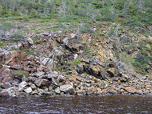
The Mohorovičić discontinuity is 5 to 10 km (3.1 to 6.2 mi) below the ocean floor and 20 to 90 km (12.4 to 55.9 mi) beneath typical continents
Continental crust
The continental crust is the layer of igneous, sedimentary, and metamorphic rocks which form the continents and the areas of shallow seabed close to their shores, known as continental shelves. This layer is sometimes called sial due to more felsic, or granitic, bulk composition, which lies in...
, with an average of 35 kilometres (21.7 mi) beneath them.
Nature of the Moho
Immediately above the Moho the velocities of primary seismic waves (P-waves) are approximately those of basaltBasalt
Basalt is a common extrusive volcanic rock. It is usually grey to black and fine-grained due to rapid cooling of lava at the surface of a planet. It may be porphyritic containing larger crystals in a fine matrix, or vesicular, or frothy scoria. Unweathered basalt is black or grey...
(6.7 – 7.2 km/s), and below they are that of peridotitic
Peridotite
A peridotite is a dense, coarse-grained igneous rock, consisting mostly of the minerals olivine and pyroxene. Peridotite is ultramafic, as the rock contains less than 45% silica. It is high in magnesium, reflecting the high proportions of magnesium-rich olivine, with appreciable iron...
or dunitic
Dunite
Dunite is an igneous, plutonic rock, of ultramafic composition, with coarse-grained or phaneritic texture. The mineral assemblage is greater than 90% olivine, with minor amounts of other minerals such as pyroxene, chromite and pyrope. Dunite is the olivine-rich end-member of the peridotite group...
Earth-materials (7.6 – 8.6 km/s). That suggests the Moho marks a change of composition, but the interface appears to be too even for any believable sorting mechanism within the Earth. Near-surface observations suggest such sorting produces an irregular surface. Some history of suggestions that the boundary marks instead a phase change controlled by a temperature gradient in the Earth can be found in Howell.
Exploration
During the late 1950s and early 1960s, a proposal was taken up in the executive committee of the National Science FoundationNational Science Foundation
The National Science Foundation is a United States government agency that supports fundamental research and education in all the non-medical fields of science and engineering. Its medical counterpart is the National Institutes of Health...
to drill a hole through the ocean floor to reach this boundary. However the operation, named Project Mohole
Project Mohole
Project Mohole was an ambitious attempt to drill through the Earth's crust into the Mohorovičić discontinuity, and to provide an Earth science complement to the high profile Space Race. The project was initially led by the American Miscellaneous Society with funding from the National Science...
, never received sufficient support and was mismanaged; it was canceled by the United States Congress
United States Congress
The United States Congress is the bicameral legislature of the federal government of the United States, consisting of the Senate and the House of Representatives. The Congress meets in the United States Capitol in Washington, D.C....
in 1967. Simultaneous efforts were made by the Soviet Union at the Kola Institute
Kola Superdeep Borehole
The Kola Superdeep Borehole is the result of a scientific drilling project of the Soviet Union in Kola Peninsula. The project attempted to drill as deep as possible into the Earth's crust. Drilling began on 24 May 1970 using the Uralmash-4E, and later the Uralmash-15000 series drilling rig. A...
, which reached a depth of 12260 metres (40,223.1 ft) over 15 years, the world's deepest hole until 2011, before that attempt was also abandoned in 1989.
Reaching the discontinuity remains an important scientific objective. A more recent proposal considers a self-descending tungsten capsule heated by radiogenic heat to explore Earth's interior
Structure of the Earth
The interior structure of the Earth, similar to the outer, is layered. These layers can be defined by either their chemical or their rheological properties. The Earth has an outer silicate solid crust, a highly viscous mantle, a liquid outer core that is much less viscous than the mantle, and a...
near the Moho discontinuity and in the upper mantle. The Japanese project Chikyu Hakken
Chikyu Hakken
is a Japanese scientific drilling ship built for the Integrated Ocean Drilling Program . The vessel is designed to ultimately drill seven kilometres beneath the seabed, where the Earth's crust is much thinner, and into the Earth's mantle, deeper than any other hole drilled in the ocean thus...
("Earth Discovery") also aims to explore this general area.
See also
- Brittle-ductile transition zoneBrittle-ductile transition zoneThe brittle-ductile transition zone is the strongest part of the Earth's crust. For quartz and feldspar rich rocks in continental crust this occurs at an approximate depth of 13–18 km . At this depth rock becomes less likely to fracture, and more likely to deform ductilely by creep...
- Core–mantle boundaryCore–mantle boundaryThe core–mantle boundary lies between the Earth's silicate mantle and its liquid iron-nickel outer core. This boundary is located at approximately 2900 km of depth beneath the Earth's surface. The boundary is observed via the discontinuity in seismic wave velocities at that depth...
- Kola Superdeep BoreholeKola Superdeep BoreholeThe Kola Superdeep Borehole is the result of a scientific drilling project of the Soviet Union in Kola Peninsula. The project attempted to drill as deep as possible into the Earth's crust. Drilling began on 24 May 1970 using the Uralmash-4E, and later the Uralmash-15000 series drilling rig. A...
- Lehmann discontinuityLehmann discontinuityThe Lehmann discontinuity refers to an abrupt increase of P-wave and S-wave velocities in the vicinity of 220±30 km depth, discovered by seismologist Inge Lehmann. It appears beneath continents, but not usually beneath oceans, and does not readily appear in globally averaged studies...