
Rift valley
Overview
Rift
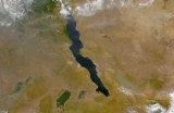
In geology, a rift or chasm is a place where the Earth's crust and lithosphere are being pulled apart and is an example of extensional tectonics....
or fault. This action is manifest as crustal extension, a spreading apart of the surface which is subsequently further deepened by the forces of erosion. When the tensional forces are strong enough to cause the plate to split apart it will do so such that a center block will drop down relative to its flanking blocks, forming a graben
Graben
In geology, a graben is a depressed block of land bordered by parallel faults. Graben is German for ditch. Graben is used for both the singular and plural....
.
Unanswered Questions
Discussions