
Pennsylvania Route 68
Encyclopedia
Pennsylvania Route 68 is a 90.3 miles (145.3 km) long east–west state highway
located in western Pennsylvania
in the United States
. The western terminus of the route is at the Ohio
state line west of Glasgow
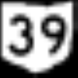
, where PA 68 continues into Ohio as State Route 39
. The eastern terminus is at U.S. Route 322 in Clarion
.
border in Ohioville
, Beaver County
, where the road continues west into that state as SR 39
. From the state line, the route heads east-northeast on two-lane undivided Midland Road, passing between wooded areas to the north and a Norfolk Southern railroad line to the south with industrial areas and the Ohio River
farther south. The road crosses the Little Beaver Creek
into Glasgow
and passes north of residential areas. PA 68 heads back into Ohioville and runs east through forested areas immediately to the north of the railroad tracks and the Ohio River. The road curves east-southeast and enters Midland
, becoming Midland Avenue and passing homes. The route comes to an intersection with PA 168
, where that route turns southeast to form a concurrency
with PA 68, running through residential areas before heading through the commercial downtown of Midland. The road heads into industrial areas and becomes Midland Beaver Road, with PA 168 splitting to the south at an interchange to cross the Ohio River on the Shippingport Bridge
. Past this, PA 68 continues northeast through more forests with the Norfolk Southern line and the river to the southeast. The road heads into residential areas with some industry, heading farther from the railroad line and the Ohio River. The route curves east past more homes, crossing over the Norfolk Southern line as it continues into more wooded areas. PA 68 turns northeast and runs between the railroad tracks to the northwest and the Ohio River to the southeast, crossing into Vanport Township
and entering industrial areas as State Street. The road passes over the railroad tracks and runs past more commercial establishments before widening into a four-lane divided highway
and coming to an interchange with I-376
. After this interchange, the route becomes a two-lane undivided road again and continues through residential areas with some businesses. PA 68 becomes the border between Vanport Township to the north and Beaver
to the south, where the name becomes 3rd Street. The road fully enters Beaver and runs through the commercial downtown. The route heads past homes before passing under a CSX railroad line and crossing into Bridgewater
, where it reaches an interchange with PA 51
. At this point, PA 68 heads east to form a concurrency with PA 51 on a four-lane divided highway, crossing the Beaver River
into Rochester
.
Here, the road passes over a Norfolk Southern railroad line and comes to an interchange with PA 18
/PA 65
, at which point PA 51 heads east along with PA 65 and PA 18 splits from PA 65 to head south and cross the Ohio River on the Rochester–Monaca Bridge. Here, PA 68 splits into a one-way pair
, with the eastbound direction following a ramp to Pleasant Street before heading north on Rhode Island Avenue and westbound PA 68 following Adams Street. Both directions of the route rejoin on two-lane undivided Adams Street and the route heads through residential areas with some businesses. PA 68 turns northwest onto Virginia Avenue and passes more homes, becoming the border between Rochester to the west and Rochester Township
to the east. The road fully enters Rochester Township and passes through North Rochester before turning northeast and becoming Sunflower Road. The route curves east and enters Daugherty Township
, winding northeast through more rural areas of homes. PA 68 runs through more rural residential areas with some fields and woods, turning east before heading southeast into New Sewickley Township
. The road reaches the community of Sunflower, turning northeast to run through more wooded areas with some farms and homes. The route passes through Unionville before passing under I-76
(Pennsylvania Turnpike
) and intersecting the northern terminus of PA 989
. PA 68 winds northeast through more farmland and woodland with some residences, crossing into Marion Township
.
in Butler County
and becomes West Beaver Street, heading into residential areas. The road curves east and reaches an intersection with US 19
, where PA 68 turns north to join that route on South Main Street, passing through the commercial downtown. The road intersects the eastern terminus of PA 288
, where it becomes North Main Street, before PA 68 splits from US 19 by heading east on East Grandview Avenue. The route runs past homes, crossing into Harmony
and becoming Evans City Road. PA 68 heads through residential and commercial areas a short distance to the south of Connoquenessing Creek
a Buffalo and Pittsburgh Railroad
line, crossing into Jackson Township
and becoming a four-lane divided highway as it comes to an interchange with access to and from the southbound direction of I-79
. The road becomes two lanes and undivided again as it continues southeast into wooded areas with some development, passing through Eldenau and Harmony Junction. The route continues to the southwest of the railroad tracks and Breakneck Creek
, reaching an intersection with PA 528
.
Here, PA 528 turns southeast to form a concurrency with PA 68. The road passes through woods before heading into Evans City
, where it becomes West Main Street and runs past homes and businesses. The two routes curve to the east and cross the Buffalo and Pittsburgh Railroad line and the Breakneck Creek into the commercial downtown of Evans City, becoming East Main Street. PA 528 splits from PA 68 by turning north onto Franklin Street and PA 68 passes more residences, turning to the northeast. The road enters Forward Township
and becomes Evans City Road again, running through farmland and woodland with some residential and commercial buildings. The route passes over Connoquenessing Creek and a Buffalo and Pittsburgh Railroad line, heading through woodland and turning north. PA 68 heads into farmland with some woods and residences, crossing into Connoquenessing
, where it passes to the east of the residential center of town. The road heads into Connoquenessing Township
and curves northeast, running through more agricultural and wooded areas with a few homes. The route passes through increasing areas of residential and commercial development, heading north of Butler Farm Show Airport before continuing into Butler Township
. Here, PA 68 curves east and heads past more areas of housing, coming to an intersection with PA 356
.
Here, PA 68 heads southeast along with PA 356 on New Castle Road, a three-lane road with a center left-turn lane that runs through wooded areas and commercial development. The road enters Butler
and becomes New Castle Street, running through residential areas with some businesses. PA 68/PA 356 heads east onto West Cunningham Street before splitting into a one-way pair, with eastbound PA 68/southbound PA 356 following West Cunningham Street and westbound PA 68/northbound PA 356 following West Jefferson Street. The two routes head into the commercial downtown of Butler, coming to an intersection with PA 8
at which point PA 356 splits from PA 68 by heading south along that route. The one-way pair carrying PA 68 becomes East Cunningham Street eastbound and East Jefferson Street westbound, with eastbound PA 68 turning north onto South McKean Street to rejoin westbound PA 68 on two-way East Jefferson Street. The road heads east through commercial areas with some homes, turning northeast into residential areas as it becomes the border between Butler to the northwest and Butler Township to the southeast. The route fully enters Butler Township again as it passes near Butler Memorial Hospital before coming to a bridge that carries the route over two Bessemer and Lake Erie Railroad
lines and Connoquenessing Creek, crossing into Summit Township
. PA 68 comes to an interchange with the US 422
freeway, where it also intersects the southern terminus of PA 38
; here, the road is a four-lane divided highway.
Past this, the road becomes two lanes and undivided, with the name becoming Chicora Road as it enters wooded areas with some homes. The route heads into a mix of farms and woods with some residences as it crosses into Oakland Township
. PA 68 winds northeast through more wooded areas with some homes, passing through Woodbine
. The road runs through more farmland and woodland with scattered residences, heading through North Oakland. The route crosses into Donegal Township
and turns north, at which point it begins to run to the west of a Buffalo and Pittsburgh Railroad line. PA 68 curves northeast and east, heading into Chicora
and crossing under the railroad tracks. The road curves northeast and becomes South Main Street, passing homes before becoming North Main Street in the center of town, where it passes a few businesses. After running past more residences, the route curves northeast and crosses into Fairview Township
, becoming Chicora Road again and winding through agricultural and wooded areas with some homes. The road turns east and crosses PA 268
in Kepples Corners.
in Armstrong County
and becomes an unnamed road, heading through forested areas with some homes, passing through Kaylor. The road turns east before a curve to the north, coming to the residential community of Brady's Bend
. Past this, the route turns southeast through more forests.
PA 68 crosses the Allegheny River
into East Brady
, Clarion County
, becoming Bridge Street. The route turns southwest onto Kellys Way and passes homes with some businesses. PA 68 turns southeast onto 3rd Street and runs through residential areas before curving east as Simpson Road and heading through wooded areas. The road enters Brady Township
and runs northeast through more woodland with some fields and homes. The route continues into Madison Township
and runs through more rural areas, passing through New Athens and Maple Grove. PA 68 heads into Rimersburg
and becomes Main Street, passing homes. The road intersects the western terminus of PA 861
, where it becomes the border between Rimersburg to the west and Toby Township
to the east before fully entering Toby Township and passing through Rimersburg Station.
The route becomes unnamed as it passes through wooded areas with some farm fields and homes, heading to the north. PA 68 briefly heads through Piney Township
before entering Sligo
and passing homes on Colerain Street. The route intersects the eastern terminus of PA 58
and turns east onto Front Street, running past more residences. The road heads back into Piney Township and becomes unnamed, continuing through agricultural areas with some woods and homes, turning northeast into Monroe Township
. The route runs through more farmland and woodland with some residences, turning north and heading through Reidsburg, where it crosses an abandoned railroad line and Piney Creek. PA 68 runs north through more rural areas before passing through Williamsburg
and becoming a four-lane divided highway as it reaches an interchange with I-80
/PA 66
. Past this, the road heads through business areas before becoming undivided and heading into wooded areas with some homes in Clarion Township
as South 5th Avenue. PA 68 enters Clarion
and runs north-northeast past more residences before ending at US 322
in the commercial downtown.
State highway
State highway, state road or state route can refer to one of three related concepts, two of them related to a state or provincial government in a country that is divided into states or provinces :#A...
located in western Pennsylvania
Pennsylvania
The Commonwealth of Pennsylvania is a U.S. state that is located in the Northeastern and Mid-Atlantic regions of the United States. The state borders Delaware and Maryland to the south, West Virginia to the southwest, Ohio to the west, New York and Ontario, Canada, to the north, and New Jersey to...
in the United States
United States
The United States of America is a federal constitutional republic comprising fifty states and a federal district...
. The western terminus of the route is at the Ohio
Ohio
Ohio is a Midwestern state in the United States. The 34th largest state by area in the U.S.,it is the 7th‑most populous with over 11.5 million residents, containing several major American cities and seven metropolitan areas with populations of 500,000 or more.The state's capital is Columbus...
state line west of Glasgow
Glasgow, Pennsylvania
Glasgow is a borough in Beaver County, Pennsylvania, U.S., along the Ohio River. The population was 63 at the 2000 census.-Geography:Glasgow is located at ....
, where PA 68 continues into Ohio as State Route 39
Ohio State Route 39
State Route 39 is a primarily east–west running state highway in north-central and northeastern portion of the U.S. state of Ohio. The route runs through seven counties on its approximately trip through the region...
. The eastern terminus is at U.S. Route 322 in Clarion
Clarion, Pennsylvania
Clarion is a borough in Clarion County in the U.S. state of Pennsylvania, about 100 miles north-northeast of Pittsburgh and part of the Pittsburgh DMA. Clarion was settled in 1839 and incorporated in 1841. In the past, the surrounding area produced natural gas, oil, lumber and coal. Merely 2,004...
.
Beaver County
PA 68 begins at the OhioOhio
Ohio is a Midwestern state in the United States. The 34th largest state by area in the U.S.,it is the 7th‑most populous with over 11.5 million residents, containing several major American cities and seven metropolitan areas with populations of 500,000 or more.The state's capital is Columbus...
border in Ohioville
Ohioville, Pennsylvania
Ohioville is a borough in Beaver County, Pennsylvania, United States. The population was 3,759 at the 2000 census.-Geography:Ohioville is located at , in part along the Ohio River....
, Beaver County
Beaver County, Pennsylvania
-Demographics:As of the census of 2000, there were 181,412 people, 72,576 households, and 50,512 families residing in the county. The population density was 418 people per square mile . There were 77,765 housing units at an average density of 179 per square mile...
, where the road continues west into that state as SR 39
Ohio State Route 39
State Route 39 is a primarily east–west running state highway in north-central and northeastern portion of the U.S. state of Ohio. The route runs through seven counties on its approximately trip through the region...
. From the state line, the route heads east-northeast on two-lane undivided Midland Road, passing between wooded areas to the north and a Norfolk Southern railroad line to the south with industrial areas and the Ohio River
Ohio River
The Ohio River is the largest tributary, by volume, of the Mississippi River. At the confluence, the Ohio is even bigger than the Mississippi and, thus, is hydrologically the main stream of the whole river system, including the Allegheny River further upstream...
farther south. The road crosses the Little Beaver Creek
Little Beaver Creek
The Little Beaver Creek is a wild and scenic area in Ohio. The Little Beaver Creek watershed is located primarily in Columbiana County in northeast Ohio, and in portions of Carroll County, Mahoning County, and western Pennsylvania, draining approximately 605 mi² , of which 503 mi² are in Ohio...
into Glasgow
Glasgow, Pennsylvania
Glasgow is a borough in Beaver County, Pennsylvania, U.S., along the Ohio River. The population was 63 at the 2000 census.-Geography:Glasgow is located at ....
and passes north of residential areas. PA 68 heads back into Ohioville and runs east through forested areas immediately to the north of the railroad tracks and the Ohio River. The road curves east-southeast and enters Midland
Midland, Pennsylvania
Midland is a borough located along the Ohio River in Beaver County, Pennsylvania, United States. As of the 2000 census, the borough population was 3,137.-Geography:Midland is located at ....
, becoming Midland Avenue and passing homes. The route comes to an intersection with PA 168
Pennsylvania Route 168
Pennsylvania Route 168 is a highway in Western Pennsylvania that runs for from Pennsylvania Route 18 in Frankfort Springs to Pennsylvania Route 208 in Volant...
, where that route turns southeast to form a concurrency
Concurrency (road)
A concurrency, overlap, or coincidence in a road network is an instance of one physical road bearing two or more different highway, motorway, or other route numbers...
with PA 68, running through residential areas before heading through the commercial downtown of Midland. The road heads into industrial areas and becomes Midland Beaver Road, with PA 168 splitting to the south at an interchange to cross the Ohio River on the Shippingport Bridge
Shippingport Bridge
The Shippingport Bridge is a cantilever bridge carrying Pennsylvania Route 168 across the Ohio River between Shippingport, Pennsylvania and Midland, Pennsylvania.The southern approach to the bridge is adjacent to the Beaver Valley Nuclear Generating Station....
. Past this, PA 68 continues northeast through more forests with the Norfolk Southern line and the river to the southeast. The road heads into residential areas with some industry, heading farther from the railroad line and the Ohio River. The route curves east past more homes, crossing over the Norfolk Southern line as it continues into more wooded areas. PA 68 turns northeast and runs between the railroad tracks to the northwest and the Ohio River to the southeast, crossing into Vanport Township
Vanport Township, Pennsylvania
Vanport Township is a township in Beaver County, Pennsylvania, along the Ohio River. The population was 1,451 at the 2000 census.-Geography:...
and entering industrial areas as State Street. The road passes over the railroad tracks and runs past more commercial establishments before widening into a four-lane divided highway
Divided Highway
Divided Highway is a compilation album by American rock band The Doobie Brothers, released in 2003. . All tracks are taken from the albums Cycles and Brotherhood .-Track listing:...
and coming to an interchange with I-376
Interstate 376
Interstate 376 is a major auxiliary route of the Interstate Highway System in the U.S. state of Pennsylvania, located entirely within the Allegheny Plateau. It runs from I-80 near Sharon south and east to a junction with the Pennsylvania Turnpike in Monroeville, after having crossed the Turnpike...
. After this interchange, the route becomes a two-lane undivided road again and continues through residential areas with some businesses. PA 68 becomes the border between Vanport Township to the north and Beaver
Beaver, Pennsylvania
Beaver is a borough in and the county seat of Beaver County, Pennsylvania, United States, at the confluence of the Beaver and Ohio Rivers. As of the 2000 census, the borough population was 4,775, having dropped from 5,641 in 1940....
to the south, where the name becomes 3rd Street. The road fully enters Beaver and runs through the commercial downtown. The route heads past homes before passing under a CSX railroad line and crossing into Bridgewater
Bridgewater, Pennsylvania
Bridgewater is a borough in Beaver County, Pennsylvania, United States. The population was 739 at the 2000 census. It is best known as the home of the Bruster's Ice Cream chain. A few scenes in the 1986 movie Gung Ho were also shot in Bridgewater...
, where it reaches an interchange with PA 51
Pennsylvania Route 51
Pennsylvania Route 51 is a major state highway in Western Pennsylvania. It runs for from Uniontown to the Ohio state line near Darlington, where it connects with Ohio State Route 14. Route 51 is the termination point for Pennsylvania Route 43, Pennsylvania Route 48 and Pennsylvania Route 88. ...
. At this point, PA 68 heads east to form a concurrency with PA 51 on a four-lane divided highway, crossing the Beaver River
Beaver River (Pennsylvania)
The Beaver River is a tributary of the Ohio River in Western Pennsylvania in the United States with a length of approximately 21 mi . It flows through a historically important coal-producing region north of Pittsburgh...
into Rochester
Rochester, Pennsylvania
Rochester is a borough in Beaver County, Pennsylvania, United States. Located northwest of Pittsburgh, it is part of the Pittsburgh metropolitan area. The population was 4,014 at the 2000 census....
.
Here, the road passes over a Norfolk Southern railroad line and comes to an interchange with PA 18
Pennsylvania Route 18
Pennsylvania Route 18 is a major north–south highway in Western Pennsylvania whose southern terminus is at the West Virginia state line in Greene County, Pennsylvania near the village of Garrison, while the northern terminus is at PA Route 5 in Lake City, Pennsylvania...
/PA 65
Pennsylvania Route 65
Pennsylvania Route 65 is a major state highway located in western Pennsylvania, United States. The route, traveling north–south from the Interstate 279/U.S...
, at which point PA 51 heads east along with PA 65 and PA 18 splits from PA 65 to head south and cross the Ohio River on the Rochester–Monaca Bridge. Here, PA 68 splits into a one-way pair
One-way pair
A one-way pair, one-way couple, or just couplet is a pair of parallel, usually one-way streets that carry opposite directions of a signed route or major traffic flow, or sometimes opposite directions of a bus or streetcar route....
, with the eastbound direction following a ramp to Pleasant Street before heading north on Rhode Island Avenue and westbound PA 68 following Adams Street. Both directions of the route rejoin on two-lane undivided Adams Street and the route heads through residential areas with some businesses. PA 68 turns northwest onto Virginia Avenue and passes more homes, becoming the border between Rochester to the west and Rochester Township
Rochester Township, Pennsylvania
Rochester Township is a township in Beaver County, Pennsylvania. As of the 2000 census, it had a population of 3,129.-Geography:According to the United States Census Bureau, the township has a total area of 3.9 square miles , of which, 3.8 square miles of it is land and 0.1 square...
to the east. The road fully enters Rochester Township and passes through North Rochester before turning northeast and becoming Sunflower Road. The route curves east and enters Daugherty Township
Daugherty Township, Pennsylvania
Daugherty Township is a township in Beaver County, Pennsylvania, United States. The population was 3,441 at the 2000 census.-Geography:According to the United States Census Bureau, the township has a total area of , of which, of it is land and of it is water.-Demographics:As of the census of...
, winding northeast through more rural areas of homes. PA 68 runs through more rural residential areas with some fields and woods, turning east before heading southeast into New Sewickley Township
New Sewickley Township, Pennsylvania
New Sewickley Township is a township in Beaver County, Pennsylvania, United States. The population was 7,076 at the 2000 census.-Geography:According to the United States Census Bureau, the township has a total area of 32.7 square miles , all of it land.-History:New Sewickley Township is a part...
. The road reaches the community of Sunflower, turning northeast to run through more wooded areas with some farms and homes. The route passes through Unionville before passing under I-76
Interstate 76 (east)
Interstate 76 is an Interstate Highway in the United States, running 435 miles from an interchange with Interstate 71 west of Akron, Ohio, east to Interstate 295 near Camden, New Jersey....
(Pennsylvania Turnpike
Pennsylvania Turnpike
The Pennsylvania Turnpike is a toll highway system operated by the Pennsylvania Turnpike Commission in the Commonwealth of Pennsylvania, United States. The three sections of the turnpike system total . The main section extends from Ohio to New Jersey and is long...
) and intersecting the northern terminus of PA 989
Pennsylvania Route 989
Pennsylvania Route 989 is a long state highway in north-western Beaver County. The southern terminus is at Pennsylvania Route 65 in Ambridge, and the northern terminus is at Pennsylvania Route 68 in Unionville.-Route description:...
. PA 68 winds northeast through more farmland and woodland with some residences, crossing into Marion Township
Marion Township, Beaver County, Pennsylvania
Marion Township is a township in Beaver County, Pennsylvania, United States. The population was 940 at the 2000 census.-Geography:According to the United States Census Bureau, the township has a total area of 10.5 square miles , of which, 10.3 square miles of it is land and...
.
Butler County
PA 68 enters ZelienopleZelienople, Pennsylvania
Zelienople is a borough in Butler County, Pennsylvania, north of Pittsburgh. The population was 4,123 at the 2000 census.-Geography:According to the United States Census Bureau, the borough has a total area of , of which 98% is land and 1.35% is water....
in Butler County
Butler County, Pennsylvania
-Demographics:As of the census of 2000, there were 174,083 people, 65,862 households, and 46,827 families residing in the county. The population density was 221 people per square mile . There were 69,868 housing units at an average density of 89 per square mile...
and becomes West Beaver Street, heading into residential areas. The road curves east and reaches an intersection with US 19
U.S. Route 19 in Pennsylvania
U.S. Route 19 in Pennsylvania closely parallels Interstate 79 for its entire length. US 19 enters Pennsylvania in Greene County near Mount Morris. Its northern terminus is in the city of Erie. Part is named for Commodore Oliver Hazard Perry, hero of the Battle of Lake Erie.-Route description:In...
, where PA 68 turns north to join that route on South Main Street, passing through the commercial downtown. The road intersects the eastern terminus of PA 288
Pennsylvania Route 288
Pennsylvania Route 288 or State Route 288 is an east–west route in western Pennsylvania, United States. The highway is 15.4 miles long from PA Route 18 in Wampum to the U.S...
, where it becomes North Main Street, before PA 68 splits from US 19 by heading east on East Grandview Avenue. The route runs past homes, crossing into Harmony
Harmony, Pennsylvania
Harmony is a borough in Butler County, Pennsylvania, United States. The population was 937 at the 2000 census. It is located about 30 miles north of Pittsburgh, Pennsylvania.-Geography:...
and becoming Evans City Road. PA 68 heads through residential and commercial areas a short distance to the south of Connoquenessing Creek
Connoquenessing Creek
Connoquenessing Creek is a tributary of the Beaver River, approximately 50 mi long, in Western Pennsylvania in the United States.-Course:...
a Buffalo and Pittsburgh Railroad
Buffalo and Pittsburgh Railroad
The Buffalo and Pittsburgh Railroad is a Class II railroad operating in New York and Pennsylvania.The BPRR is owned by Genesee and Wyoming Industries. Its main line runs between Buffalo, New York and Eidenau, Pennsylvania, north of Pittsburgh. Here, connections are made to the city center via the...
line, crossing into Jackson Township
Jackson Township, Butler County, Pennsylvania
Jackson Township is a township in Butler County, Pennsylvania, United States. The population was 3,645 at the 2000 census.-Geography:According to the United States Census Bureau, the township has a total area of , of which, of it is land and of it is water.-Demographics:As of the census of 2000,...
and becoming a four-lane divided highway as it comes to an interchange with access to and from the southbound direction of I-79
Interstate 79
Interstate 79 is an Interstate Highway in the eastern United States, designated from Interstate 77 in Charleston, West Virginia to Pennsylvania Route 5 and Pennsylvania Route 290 in Erie, Pennsylvania...
. The road becomes two lanes and undivided again as it continues southeast into wooded areas with some development, passing through Eldenau and Harmony Junction. The route continues to the southwest of the railroad tracks and Breakneck Creek
Breakneck Creek
Breakneck Creek is a tributary of Connoquenessing Creek that flows in a northwardly direction in Western Pennsylvania. It forms in the village of Bakerstown in Allegheny County then flows northwest through the borough of Valencia in Butler County....
, reaching an intersection with PA 528
Pennsylvania Route 528
Pennsylvania Route 528 is an long state highway located in Butler county in Pennsylvania. The southern terminus is at US 19 near Zelienople. The northern terminus is at PA 8 near West Liberty.-Route description:...
.
Here, PA 528 turns southeast to form a concurrency with PA 68. The road passes through woods before heading into Evans City
Evans City, Pennsylvania
Evans City is a borough in Butler County, Pennsylvania, United States. The population was 2,009 at the 2000 census.-Geography:Evans City is located at ....
, where it becomes West Main Street and runs past homes and businesses. The two routes curve to the east and cross the Buffalo and Pittsburgh Railroad line and the Breakneck Creek into the commercial downtown of Evans City, becoming East Main Street. PA 528 splits from PA 68 by turning north onto Franklin Street and PA 68 passes more residences, turning to the northeast. The road enters Forward Township
Forward Township, Butler County, Pennsylvania
Forward Township is a township in Butler County, Pennsylvania, United States. The population was 2,687 at the 2000 census.-Geography:According to the United States Census Bureau, the township has a total area of , of which, of it is land and of it is water.-Demographics:As of the census of 2000,...
and becomes Evans City Road again, running through farmland and woodland with some residential and commercial buildings. The route passes over Connoquenessing Creek and a Buffalo and Pittsburgh Railroad line, heading through woodland and turning north. PA 68 heads into farmland with some woods and residences, crossing into Connoquenessing
Connoquenessing, Pennsylvania
Connoquenessing is a borough in Butler County, Pennsylvania, United States. The population was 564 at the 2000 census.-Geography:Connoquenessing is located at ....
, where it passes to the east of the residential center of town. The road heads into Connoquenessing Township
Connoquenessing Township, Pennsylvania
Connoquenessing Township is a township in Butler County, Pennsylvania, United States. The population was 3,653 at the 2000 census.-History:The township was linked to Butler, Evans City and Pittsburgh in 1908 by the Pittsburgh, Harmony, Butler and New Castle Railway, an interurban trolley line...
and curves northeast, running through more agricultural and wooded areas with a few homes. The route passes through increasing areas of residential and commercial development, heading north of Butler Farm Show Airport before continuing into Butler Township
Butler Township, Butler County, Pennsylvania
Butler Township is a township in Butler County, Pennsylvania, United States. The population was 17,185 at the 2000 census. The township was first settled in 1795...
. Here, PA 68 curves east and heads past more areas of housing, coming to an intersection with PA 356
Pennsylvania Route 356
Pennsylvania Route 356 is an long state highway located in Westmoreland, Allegheny, Butler, and Armstrong counties in Pennsylvania. The southern terminus is at PA 66 near Oklahoma...
.
Here, PA 68 heads southeast along with PA 356 on New Castle Road, a three-lane road with a center left-turn lane that runs through wooded areas and commercial development. The road enters Butler
Butler, Pennsylvania
The city of Butler is the county seat of Butler County in the U.S. state of Pennsylvania, situated north of Pittsburgh. The population was 15,121 at the 2000 census.- History :...
and becomes New Castle Street, running through residential areas with some businesses. PA 68/PA 356 heads east onto West Cunningham Street before splitting into a one-way pair, with eastbound PA 68/southbound PA 356 following West Cunningham Street and westbound PA 68/northbound PA 356 following West Jefferson Street. The two routes head into the commercial downtown of Butler, coming to an intersection with PA 8
Pennsylvania Route 8
Pennsylvania Route 8 is a major long route in western Pennsylvania. Officially, PA 8 is named the William Flinn Highway. Its southern terminus is at Interstate 376, U.S. Route 22, and U.S. Route 30 in Pittsburgh...
at which point PA 356 splits from PA 68 by heading south along that route. The one-way pair carrying PA 68 becomes East Cunningham Street eastbound and East Jefferson Street westbound, with eastbound PA 68 turning north onto South McKean Street to rejoin westbound PA 68 on two-way East Jefferson Street. The road heads east through commercial areas with some homes, turning northeast into residential areas as it becomes the border between Butler to the northwest and Butler Township to the southeast. The route fully enters Butler Township again as it passes near Butler Memorial Hospital before coming to a bridge that carries the route over two Bessemer and Lake Erie Railroad
Bessemer and Lake Erie Railroad
The Bessemer and Lake Erie Railroad is a class II railroad that operates in northwestern Pennsylvania and northeastern Ohio.The railroad's main route runs from the Lake Erie port of Conneaut, Ohio to the Pittsburgh suburb of Penn Hills, Pennsylvania, a distance of 139 miles...
lines and Connoquenessing Creek, crossing into Summit Township
Summit Township, Butler County, Pennsylvania
Summit Township is a township in Butler County, Pennsylvania, United States. The population was 4,728 at the 2000 census.-Geography:According to the United States Census Bureau, the township has a total area of 22.3 square miles , of which, 22.3 square miles of it is land and...
. PA 68 comes to an interchange with the US 422
U.S. Route 422
U.S. Route 422 is a long spur route of US 22 split into two segments in the U.S. states of Ohio and Pennsylvania. The western spur begins in downtown Cleveland, Ohio, and ends at Ebensburg, Pennsylvania...
freeway, where it also intersects the southern terminus of PA 38
Pennsylvania Route 38
Pennsylvania Route 38 is a long state highway located in northwest Pennsylvania. The southern terminus is at U.S. Route 422 and Pennsylvania Route 68 northeast of downtown Butler. The northern terminus is at U.S...
; here, the road is a four-lane divided highway.
Past this, the road becomes two lanes and undivided, with the name becoming Chicora Road as it enters wooded areas with some homes. The route heads into a mix of farms and woods with some residences as it crosses into Oakland Township
Oakland Township, Butler County, Pennsylvania
Oakland Township is a township in Butler County, Pennsylvania, United States. The population was 3,074 at the 2000 census.-Geography:According to the United States Census Bureau, the township has a total area of 23.2 square miles , of which, 22.9 square miles of it is land and...
. PA 68 winds northeast through more wooded areas with some homes, passing through Woodbine
Woodbine, Pennsylvania
Woodbine is an unincorporated community in York County, Pennsylvania, United States. Until 1978, this community was served by the Maryland and Pennsylvania Railroad at milepost 50.6.-Geography:Woodbine is located at ....
. The road runs through more farmland and woodland with scattered residences, heading through North Oakland. The route crosses into Donegal Township
Donegal Township, Butler County, Pennsylvania
Donegal Township is a township in Butler County, Pennsylvania, United States. The population was 1,722 at the 2000 census.-Geography:According to the United States Census Bureau, the township has a total area of , of which, of it is land and of it is water.-Demographics:As of the census of 2000,...
and turns north, at which point it begins to run to the west of a Buffalo and Pittsburgh Railroad line. PA 68 curves northeast and east, heading into Chicora
Chicora, Pennsylvania
Chicora is a borough in Butler County, Pennsylvania, United States. The population was 1,021 at the 2000 census.-Geography:Chicora is located at ....
and crossing under the railroad tracks. The road curves northeast and becomes South Main Street, passing homes before becoming North Main Street in the center of town, where it passes a few businesses. After running past more residences, the route curves northeast and crosses into Fairview Township
Fairview Township, Butler County, Pennsylvania
Fairview Township is a township in Butler County, Pennsylvania, United States. The population was 2,061 at the 2000 census.-Geography:According to the United States Census Bureau, the township has a total area of , of which, of it is land and 0.04% is water.-Demographics:As of the census of 2000,...
, becoming Chicora Road again and winding through agricultural and wooded areas with some homes. The road turns east and crosses PA 268
Pennsylvania Route 268
Pennsylvania Route 268 is a long state highway located in Armstrong, Butler, and Venango counties in Pennsylvania. The southern terminus is at US 422 in West Kittanning. The northern terminus is at PA 38/PA 208 in Emlenton.-Route description:...
in Kepples Corners.
Armstrong and Clarion counties
PA 68 heads into Bradys Bend TownshipBradys Bend Township, Pennsylvania
Bradys Bend Township is a township in Armstrong County, Pennsylvania, United States. The population was 939 at the 2000 census.-Geography:According to the United States Census Bureau, the township has a total area of , all of it land.-Demographics:...
in Armstrong County
Armstrong County, Pennsylvania
Armstrong County is a county located in the U.S. state of Pennsylvania. As of the 2010 census, the population was 68,941. It is located northeast of Pittsburgh and Allegheny County. Armstrong County was added to the Pittsburgh Metropolitan Statistical Area in 2003.The county seat is Kittanning...
and becomes an unnamed road, heading through forested areas with some homes, passing through Kaylor. The road turns east before a curve to the north, coming to the residential community of Brady's Bend
Brady's Bend, Pennsylvania
Brady's Bend, also known as Bradys Bend, is named for Captain Samuel Brady , famed frontier scout and the subject of many legends. The photo is a composite of three shots taken about 1,400 ft. above sea level...
. Past this, the route turns southeast through more forests.
PA 68 crosses the Allegheny River
Allegheny River
The Allegheny River is a principal tributary of the Ohio River; it is located in the Eastern United States. The Allegheny River joins with the Monongahela River to form the Ohio River at the "Point" of Point State Park in Downtown Pittsburgh, Pennsylvania...
into East Brady
East Brady, Pennsylvania
East Brady is a borough in Clarion County, Pennsylvania, United States and is part of the Pittsburgh DMA. The population was 1,038 at the 2000 census.-History:East Brady is named after Captain Samuel Brady, who fought with Native Americans at that location....
, Clarion County
Clarion County, Pennsylvania
As of the census of 2000, there were 41,765 people, 16,052 households, and 10,738 families residing in the county. The population density was 69 people per square mile . There were 19,426 housing units at an average density of 32 per square mile...
, becoming Bridge Street. The route turns southwest onto Kellys Way and passes homes with some businesses. PA 68 turns southeast onto 3rd Street and runs through residential areas before curving east as Simpson Road and heading through wooded areas. The road enters Brady Township
Brady Township, Clarion County, Pennsylvania
Brady Township is a township in Clarion County, Pennsylvania, United States. The population was 62 at the 2000 census.-Geography:According to the United States Census Bureau, the township has a total area of , of which, of it is land and of it is water.-Demographics:As of the census of 2000,...
and runs northeast through more woodland with some fields and homes. The route continues into Madison Township
Madison Township, Clarion County, Pennsylvania
Madison Township is a township in Clarion County, Pennsylvania, United States. The population was 1,442 at the 2000 census.-Geography:According to the United States Census Bureau, the township has a total area of 27.9 square miles , of which, 27.1 square miles of it is land and...
and runs through more rural areas, passing through New Athens and Maple Grove. PA 68 heads into Rimersburg
Rimersburg, Pennsylvania
Rimersburg is a borough in Clarion County in the U.S. state of Pennsylvania. The population was 1,051 at the 2000 census.-Geography:Rimersburg is located at .According to the United States Census Bureau, the borough has a total area of , all of it land....
and becomes Main Street, passing homes. The road intersects the western terminus of PA 861
Pennsylvania Route 861
Pennsylvania Route 861 is a long state highway located in Clarion county in Pennsylvania. The western terminus is at PA 68 in Rimersburg. The eastern terminus is at PA 66 in New Bethlehem.-Route description:...
, where it becomes the border between Rimersburg to the west and Toby Township
Toby Township, Pennsylvania
Toby Township is a township in Clarion County, Pennsylvania, United States. The population was 1,166 at the 2000 census.-Geography:According to the United States Census Bureau, the township has a total area of 29.1 square miles , of which, 28.9 square miles of it is land and...
to the east before fully entering Toby Township and passing through Rimersburg Station.
The route becomes unnamed as it passes through wooded areas with some farm fields and homes, heading to the north. PA 68 briefly heads through Piney Township
Piney Township, Pennsylvania
Piney Township is a township in Clarion County, Pennsylvania, United States. The population was 516 at the 2000 census.-Geography:According to the United States Census Bureau, the township has a total area of 17.9 square miles , of which, 17.8 square miles of it is land and...
before entering Sligo
Sligo, Pennsylvania
Sligo is a borough in Clarion County, Pennsylvania, United States. The population was 728 at the 2000 census.It was named after the town and county of Sligo in Ireland.-Geography:Sligo is located at ....
and passing homes on Colerain Street. The route intersects the eastern terminus of PA 58
Pennsylvania Route 58
Pennsylvania Route 58 is located in Western Pennsylvania, running 71.2 miles from the Ohio state line west of Jamestown in Mercer County to Sligo in Clarion County.-Mercer County:...
and turns east onto Front Street, running past more residences. The road heads back into Piney Township and becomes unnamed, continuing through agricultural areas with some woods and homes, turning northeast into Monroe Township
Monroe Township, Clarion County, Pennsylvania
Monroe Township is a township in Clarion County, Pennsylvania, United States. As of the 2000 census, the township had a total population of 1,587.-Geography:...
. The route runs through more farmland and woodland with some residences, turning north and heading through Reidsburg, where it crosses an abandoned railroad line and Piney Creek. PA 68 runs north through more rural areas before passing through Williamsburg
Williamsburg, Pennsylvania
Williamsburg in Morrisons Cove, is a borough in Blair County, Pennsylvania, United States. The population was 1,345 at the 2000 census. It is part of the Altoona, PA Metropolitan Statistical Area.-History:...
and becoming a four-lane divided highway as it reaches an interchange with I-80
Interstate 80 in Pennsylvania
The transcontinental Interstate 80 is designated across northern Pennsylvania as the Keystone Shortway, officially the Z.H. Confair Memorial Highway. This route was built mainly along a completely new alignment, not paralleling any earlier U.S. Routes, as a shortcut to the tolled Pennsylvania...
/PA 66
Pennsylvania Route 66
Pennsylvania Route 66 is a long state highway in Western Pennsylvania. Its northern terminus is at U.S. Route 6 in Kane. Its southern terminus is at US 119 near New Stanton. West of Greensburg, PA 66 becomes the tolled Amos K. Hutchinson Bypass, a part of the Pennsylvania Turnpike System. The...
. Past this, the road heads through business areas before becoming undivided and heading into wooded areas with some homes in Clarion Township
Clarion Township, Pennsylvania
Clarion Township is a township in Clarion County, Pennsylvania, United States. The population was 3,273 at the 2000 census.-Geography:According to the United States Census Bureau, the township has a total area of , of which, of it is land and of it is water.-Demographics:As of the census of...
as South 5th Avenue. PA 68 enters Clarion
Clarion, Pennsylvania
Clarion is a borough in Clarion County in the U.S. state of Pennsylvania, about 100 miles north-northeast of Pittsburgh and part of the Pittsburgh DMA. Clarion was settled in 1839 and incorporated in 1841. In the past, the surrounding area produced natural gas, oil, lumber and coal. Merely 2,004...
and runs north-northeast past more residences before ending at US 322
U.S. Route 322 in Pennsylvania
U.S. Route 322 is a U.S. highway running from Cleveland, Ohio east to Atlantic City, New Jersey. In the U.S. state of Pennsylvania, the route runs from the Ohio border in West Shenango Township southeast to the Commodore Barry Bridge over the Delaware River in Chester, at which point the route...
in the commercial downtown.
Major intersections
| County | Location | Mile | Destinations | Notes |
|---|---|---|---|---|
| Beaver Beaver County, Pennsylvania -Demographics:As of the census of 2000, there were 181,412 people, 72,576 households, and 50,512 families residing in the county. The population density was 418 people per square mile . There were 77,765 housing units at an average density of 179 per square mile... |
Glasgow Glasgow, Pennsylvania Glasgow is a borough in Beaver County, Pennsylvania, U.S., along the Ohio River. The population was 63 at the 2000 census.-Geography:Glasgow is located at .... |
0.0 | Ohio state line, western terminus | |
| Midland Midland, Pennsylvania Midland is a borough located along the Ohio River in Beaver County, Pennsylvania, United States. As of the 2000 census, the borough population was 3,137.-Geography:Midland is located at .... |
3.0 | West end of PA 168 overlap | ||
| Industry Industry, Pennsylvania Industry is a borough in Beaver County, Pennsylvania, along the Ohio River. As of the 2000 census, the borough population was 1,921.- History :... |
4.9 | East end of PA 168 overlap | ||
| Vanport Township | 11.5-11.7 | I-376 exit 38 | ||
| Beaver Beaver, Pennsylvania Beaver is a borough in and the county seat of Beaver County, Pennsylvania, United States, at the confluence of the Beaver and Ohio Rivers. As of the 2000 census, the borough population was 4,775, having dropped from 5,641 in 1940.... |
14.0 | West end of PA 51 overlap | ||
| Rochester Rochester, Pennsylvania Rochester is a borough in Beaver County, Pennsylvania, United States. Located northwest of Pittsburgh, it is part of the Pittsburgh metropolitan area. The population was 4,014 at the 2000 census.... |
14.3 | Interchange, east end of PA 51 overlap | ||
| 14.6 | ||||
| New Sewickley Township | 22.2 | |||
| Butler Butler County, Pennsylvania -Demographics:As of the census of 2000, there were 174,083 people, 65,862 households, and 46,827 families residing in the county. The population density was 221 people per square mile . There were 69,868 housing units at an average density of 89 per square mile... |
Zelienople Zelienople, Pennsylvania Zelienople is a borough in Butler County, Pennsylvania, north of Pittsburgh. The population was 4,123 at the 2000 census.-Geography:According to the United States Census Bureau, the borough has a total area of , of which 98% is land and 1.35% is water.... |
27.1 | West end of US 19 overlap | |
| 27.3 | ||||
| 27.4 | East end of US 19 overlap | |||
| Jackson Township Jackson Township, Butler County, Pennsylvania Jackson Township is a township in Butler County, Pennsylvania, United States. The population was 3,645 at the 2000 census.-Geography:According to the United States Census Bureau, the township has a total area of , of which, of it is land and of it is water.-Demographics:As of the census of 2000,... |
28.4 | I-79 exit 87 | ||
| 31.6 | West end of PA 528 overlap | |||
| Evans City Evans City, Pennsylvania Evans City is a borough in Butler County, Pennsylvania, United States. The population was 2,009 at the 2000 census.-Geography:Evans City is located at .... |
32.5 | East end of PA 528 overlap | ||
| Butler Township Butler Township, Butler County, Pennsylvania Butler Township is a township in Butler County, Pennsylvania, United States. The population was 17,185 at the 2000 census. The township was first settled in 1795... |
43.3 | West end of PA 356 overlap | ||
| Butler Butler, Pennsylvania The city of Butler is the county seat of Butler County in the U.S. state of Pennsylvania, situated north of Pittsburgh. The population was 15,121 at the 2000 census.- History :... |
45.0 | East end of PA 356 overlap | ||
| Butler Township Butler Township, Butler County, Pennsylvania Butler Township is a township in Butler County, Pennsylvania, United States. The population was 17,185 at the 2000 census. The township was first settled in 1795... |
46.6 | Interchange | ||
| 46.8 | ||||
| Fairview Township Fairview Township, Butler County, Pennsylvania Fairview Township is a township in Butler County, Pennsylvania, United States. The population was 2,061 at the 2000 census.-Geography:According to the United States Census Bureau, the township has a total area of , of which, of it is land and 0.04% is water.-Demographics:As of the census of 2000,... |
59.1 | |||
| Clarion Clarion County, Pennsylvania As of the census of 2000, there were 41,765 people, 16,052 households, and 10,738 families residing in the county. The population density was 69 people per square mile . There were 19,426 housing units at an average density of 32 per square mile... |
Rimersburg Rimersburg, Pennsylvania Rimersburg is a borough in Clarion County in the U.S. state of Pennsylvania. The population was 1,051 at the 2000 census.-Geography:Rimersburg is located at .According to the United States Census Bureau, the borough has a total area of , all of it land.... |
74.7 | ||
| Sligo Sligo, Pennsylvania Sligo is a borough in Clarion County, Pennsylvania, United States. The population was 728 at the 2000 census.It was named after the town and county of Sligo in Ireland.-Geography:Sligo is located at .... |
79.4 | |||
| Monroe Township Monroe Township, Clarion County, Pennsylvania Monroe Township is a township in Clarion County, Pennsylvania, United States. As of the 2000 census, the township had a total population of 1,587.-Geography:... |
88.1-88.2 | I-80/PA 66 exit 62 | ||
| Clarion Clarion, Pennsylvania Clarion is a borough in Clarion County in the U.S. state of Pennsylvania, about 100 miles north-northeast of Pittsburgh and part of the Pittsburgh DMA. Clarion was settled in 1839 and incorporated in 1841. In the past, the surrounding area produced natural gas, oil, lumber and coal. Merely 2,004... |
90.3 | Eastern terminus |
Related routes
- Pennsylvania Route 168Pennsylvania Route 168Pennsylvania Route 168 is a highway in Western Pennsylvania that runs for from Pennsylvania Route 18 in Frankfort Springs to Pennsylvania Route 208 in Volant...
- Pennsylvania Route 268Pennsylvania Route 268Pennsylvania Route 268 is a long state highway located in Armstrong, Butler, and Venango counties in Pennsylvania. The southern terminus is at US 422 in West Kittanning. The northern terminus is at PA 38/PA 208 in Emlenton.-Route description:...
- Pennsylvania Route 368Pennsylvania Route 368Pennsylvania Route 368 is an long state highway located in Armstrong and Clarion counties in Pennsylvania. The western terminus is at PA 268 in Parker. The eastern terminus is at PA 58 in Callensburg...
- Pennsylvania Route 468 (former)
- Pennsylvania Route 968 (former)