
Pennsylvania Route 51
Encyclopedia
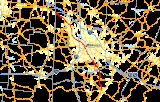
Pennsylvania Route 51 is a major state highway
in Western Pennsylvania
. It runs for 89 miles (143.2 km) from Uniontown
to the Ohio
state line near Darlington
, where it connects with Ohio State Route 14. Route 51 is the termination point for Pennsylvania Route 43, Pennsylvania Route 48
and Pennsylvania Route 88
. Century III Mall
is located on this road in West Mifflin. The Route is a major connection from Uniontown and the rest of Fayette County
to Pittsburgh.
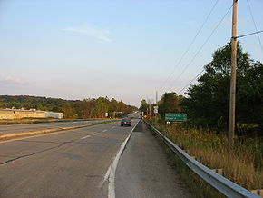
The highway is four-lane highway south of Pittsburgh as it passes through Pittsburgh's South Hills
, but narrows to a two-lane road through several boroughs along the Ohio River
. It becomes four lanes again after passing Racine in Beaver County and continues to the Ohio border. In the South Hills, Route 51 (Saw Mill Run Blvd.), along with US 19, is one of the major routes in and out of Pittsburgh, as it provides access to several bridges and tunnels. Route 51 is one of the highways that enters the West End Circle, an intersection in the West End
.
at an intersection with U.S. Route 40 Business. As Route 51 heads north, it exits Uniontown and intersects with U.S. Route 119
, Uniontown's bypass
. North of US 119, PA 51 is a rural, multi-lane divided highway
that is also known as Pittsburgh Road. In North Union Township
, Route 51 divides for 0.7 miles (1.1 km); the road has a large median that is home to several businesses. It then shifts towards the northwest, continuing as a multi-lane divided highway. In Perry Township
, PA 51 intersects Pennsylvania Route 201
at a cloverleaf interchange
. North of PA 201, it enters the borough of Perryopolis
as Fuller Drive; after leaving the city to the north, PA 51 begins to parallel the Youghiogheny River
.
, PA 51 intersects the southern terminus of Pennsylvania Route 981
. About 2000 feet (609.6 m) northwest of PA 981, it also intersects Interstate 70 at exits 46 A-B to form a full cloverleaf interchange
. To the northwest in Sweeneys Crossroads
, the road intersects Pennsylvania Route 201
again. PA 51 divides before reaching the county border and also passes by Rostraver Airport
. Route 51 only spends seven miles (11 km) in Westmoreland County, all in Rostraver Township
.
, PA 51 is called Hayden Boulevard, and it meets with Pennsylvania Route 136
at a diamond interchange
. Route 51 intersects the southern terminus of Pennsylvania Route 48
in Forward Township
before entering the boroughs of Elizabeth
and West Elizabeth
. In West Elizabeth, after crossing the Monongahela River
via the Elizabeth Bridge, PA 51 immediately intersects with Pennsylvania Route 837
. It then continues towards Jefferson Hills
in the northwest, where it meets the northern terminus of Pennsylvania Route 43 (Mon-Fayette Expressway) at exit 54. PA 43 is expected to extend further north of PA 51. Northwest of PA 43, PA 51 becomes Clairton Boulevard. In Pleasant Hills
and West Mifflin, PA 51 passes by the Century III Mall
, one of the largest in the area. The stretch of PA 51/Clairton Blvd. continues through Baldwin Borough
, Whitehall
, and Brentwood
. At the border of Brentwood
and Overbrook
, PA 51 becomes Saw Mill Run Boulevard.
At the southern tip of Pittsburgh, PA 51 intersects the northern terminus of Pennsylvania Route 88
before continuing towards the north as Saw Mill Run Blvd. It meets with the Liberty Tunnel
connector, which leads towards the Liberty Bridge
and Interstate 579
; PA 51 also begins a concurrency with U.S. Route 19 Truck
at this junction. The US 19 Truck/PA 51 concurrency ends when US 19 TRK joins Interstate 376
, U.S. Route 22
, and U.S. Route 30
at exit 5. At this point, PA 51 begins a brief concurrency with U.S. Route 19
through the West End Bypass, a short expressway in Pittsburgh's West End
section. The US 19/PA 51 concurrency ends at the infamous West End Circle. Heading toward McKees Rocks
, Route 51 continues towards the northwest as West Carson Street, paralleling the Ohio River
. Entering McKees Rocks, it makes a 90 degree turn to become Locust Street, then makes another turn to become Charties Avenue, and makes a final turn towards the northwest to become Island Avenue. In Stowe Township
, PA 51 becomes Robinson Boulevard (formerly Fleming Park Rd.) and passes south of Neville Island on the Ohio River. After a couple of S-curves, Route 51 becomes Coraopolis Road and intersects Interstate 79
at exit 64. It becomes State Avenue in Coraopolis
before dividing into two one-way
streets called 4th and 5th Avenues. North of Coraopolis, PA 51 continues to parallel the Ohio River as University Boulevard in Moon Township
. It then becomes Stoops Ferry Road and passes through Crescent Township on McGovern Road before entering Beaver County. The route spends 36 miles in Allegheny County.
 At the Beaver County
line, PA 51 intersects the eastern terminus of Pennsylvania Route 151
. North of PA 151, Route 51 enters South Heights
as Jordan Street. The route extends past the Ambridge-Aliquippa bridge, through the city of Aliquippa
and West Aliquippa. Farther to the north, the highway heads towards the north as Constitution Boulevard entering Monaca
as Beaver and Pennsylvania Avenues before making a 90-degree turn towards the north. Route 51 crosses the Ohio River on the Monaca-East Rochester Bridge
, entering the borough of East Rochester
. It makes a 90-degree turn to the west to begin a concurrency with Pennsylvania Route 65
. In Rochester
, PA 51/PA 65 meet with Pennsylvania Route 18
; the concurrency ends in downtown Rochester, when PA 51 begins a concurrency with Pennsylvania Route 68
. PA 51/PA 68 cross the Beaver River
on the Beaver Bridge. In Bridgewater
, the PA 51/PA 68 concurrency ends when Route 51 makes a 45-degree turn towards the northwest and continues towards the northwest as Constitution Boulevard. In Chippewa Township
, it intersects Interstate 376
(James E. Ross Highway) at exit 31. Northwest of I-376, Route 51 intersects the western terminus of Pennsylvania Route 588
and Pennsylvania Route 251
. In South Beaver Township
, PA 51 intersects Pennsylvania Route 168
and continues towards the northwest as Constitution Boulevard. Pennsylvania Route 51 terminates (ends) at the Ohio
state line; in Ohio, it continues as Ohio State Route 14.
Before the turnpikes were built, Route 51, alongside Ohio State Route 14, served as the main corridor connecting Pittsburgh and Cleveland
.
The Saw Mill Run Boulevard section of the highway was the first direct connection between Pittsburgh and the South Hills once the Liberty Tunnel was completed. It significantly decreased the driving time to Pittsburgh from the cities of Clairton, Duquesne, McKeesport.
Improvements are planned at the intersection with PA 88
south of Pittsburgh, where bottlenecks occur regularly. Other improvements planned include new interchanges at the Liberty Tunnel and West End Bridge (West End Circle), a center median for the rest of Saw Mill Run Boulevard, and an improved intersection with Woodruff Street.
The finished product was to include a 5.5 miles (8.9 km) limited access expressway from Overbrook to the West End. It would have been twice the width of the current highway and had a total cost of nearly $150 million. Interest in the expressway declined once the Southwestern Pennsylvania Regional Planning Commission expressed concerns about business along the corridor, and the project was dropped in 1973.
. The truck designation is only present in one direction and is actually part of a wrong-way concurrency. A cloverleaf has been established to direct traffic between Elizabeth's main street (known as Center Ave and McKeesport Road on different ends of town), but it's narrow and winding design makes it difficult for trucks to access Route 51 southbound. As a result, they are directed to enter onto Route 51 northbound, cross the bridge over the Monongahela River
, and use a special u-turn exit to reach southbound lanes of travel.
State highway
State highway, state road or state route can refer to one of three related concepts, two of them related to a state or provincial government in a country that is divided into states or provinces :#A...
in Western Pennsylvania
Western Pennsylvania
Western Pennsylvania consists of the western third of the state of Pennsylvania in the United States. Pittsburgh is the largest city in the region, with a metropolitan area population of about 2.4 million people, and serves as its economic and cultural center. Erie, Altoona, and Johnstown are its...
. It runs for 89 miles (143.2 km) from Uniontown
Uniontown, Pennsylvania
Uniontown is a city in Fayette County, Pennsylvania, southeast of Pittsburgh and part of the Pittsburgh Metro Area. Population in 1900, 7,344; in 1910, 13,344; in 1920, 15,692; and in 1940, 21,819. The population was 10,372 at the 2010 census...
to the Ohio
Ohio
Ohio is a Midwestern state in the United States. The 34th largest state by area in the U.S.,it is the 7th‑most populous with over 11.5 million residents, containing several major American cities and seven metropolitan areas with populations of 500,000 or more.The state's capital is Columbus...
state line near Darlington
Darlington, Pennsylvania
Darlington is a borough in Beaver County, Pennsylvania, United States. The population was 299 at the 2000 census.-Geography:Darlington is located at ....
, where it connects with Ohio State Route 14. Route 51 is the termination point for Pennsylvania Route 43, Pennsylvania Route 48
Pennsylvania Route 48
Pennsylvania Route 48 is long state highway located in the Pittsburgh, Pennsylvania area. The route is predominantly a two-lane highway as it runs through McKeesport and other suburbs. The entire routing of PA 48 is part of the Orange Belt, both reaching their southern terminus at Pennsylvania...
and Pennsylvania Route 88
Pennsylvania Route 88
Pennsylvania Route 88 is a long north–south state highway located in southwestern Pennsylvania. The southern terminus of the route is at U.S. Route 119 in Point Marion less than from the Pennsylvania-West Virginia border. The northern terminus is at Pennsylvania Route 51 in Pittsburgh...
. Century III Mall
Century III Mall
Century III Mall is a regional shopping mall located in the southern suburb of West Mifflin, Pennsylvania. It is the fourth largest shopping mall in the Greater Pittsburgh area. Opened in 1979, and remodeled in 1997, the three-level mall contains of retail space and approximately 110 stores...
is located on this road in West Mifflin. The Route is a major connection from Uniontown and the rest of Fayette County
Fayette County, Pennsylvania
Fayette County is a county located in the U.S. state of Pennsylvania. As of the2010 census, the population was 136,606. The county is part of the Pittsburgh Metropolitan Statistical Area....
to Pittsburgh.
The highway is four-lane highway south of Pittsburgh as it passes through Pittsburgh's South Hills
South Hills (Pennsylvania)
The South Hills is a term generally used to collectively describe the southern suburbs of Pittsburgh, Pennsylvania, and the neighborhoods in the City of Pittsburgh south of the South Side Slopes. The city neighborhoods include Knoxville, Mt. Oliver, Allentown, Banksville, Beechview, Brookline,...
, but narrows to a two-lane road through several boroughs along the Ohio River
Ohio River
The Ohio River is the largest tributary, by volume, of the Mississippi River. At the confluence, the Ohio is even bigger than the Mississippi and, thus, is hydrologically the main stream of the whole river system, including the Allegheny River further upstream...
. It becomes four lanes again after passing Racine in Beaver County and continues to the Ohio border. In the South Hills, Route 51 (Saw Mill Run Blvd.), along with US 19, is one of the major routes in and out of Pittsburgh, as it provides access to several bridges and tunnels. Route 51 is one of the highways that enters the West End Circle, an intersection in the West End
West End (Pittsburgh)
West End Village is a neighborhood in Pittsburgh, Pennsylvania's west city area. It has a zip code of 15220, and has representation on Pittsburgh City Council by the council member for District 2 ....
.
Fayette County
PA 51 begins as Pittsburgh Street in downtown UniontownUniontown, Pennsylvania
Uniontown is a city in Fayette County, Pennsylvania, southeast of Pittsburgh and part of the Pittsburgh Metro Area. Population in 1900, 7,344; in 1910, 13,344; in 1920, 15,692; and in 1940, 21,819. The population was 10,372 at the 2010 census...
at an intersection with U.S. Route 40 Business. As Route 51 heads north, it exits Uniontown and intersects with U.S. Route 119
U.S. Route 119
U.S. Route 119, commonly abbreviated as US 119, is a spur of US 19. It is a north–south route that was an original United States highway of 1926. It is often referred to as Corridor G east of US 23 and KY 80 in Kentucky to Interstate 64 at Charleston, West Virginia.- Kentucky :US 119 is a two...
, Uniontown's bypass
Bypass (road)
A bypass is a road or highway that avoids or "bypasses" a built-up area, town, or village, to let through traffic flow without interference from local traffic, to reduce congestion in the built-up area, and to improve road safety....
. North of US 119, PA 51 is a rural, multi-lane divided highway
Divided Highway
Divided Highway is a compilation album by American rock band The Doobie Brothers, released in 2003. . All tracks are taken from the albums Cycles and Brotherhood .-Track listing:...
that is also known as Pittsburgh Road. In North Union Township
North Union Township, Fayette County, Pennsylvania
North Union Township is a township in Fayette County, Pennsylvania, United States. The population was 14,140 at the 2000 census. The Laurel Highlands School District serves the township....
, Route 51 divides for 0.7 miles (1.1 km); the road has a large median that is home to several businesses. It then shifts towards the northwest, continuing as a multi-lane divided highway. In Perry Township
Perry Township, Fayette County, Pennsylvania
Perry Township is a township in Fayette County, Pennsylvania, United States. The population was 2,786 at the 2000 census. The Frazier School District serves the township....
, PA 51 intersects Pennsylvania Route 201
Pennsylvania Route 201
Pennsylvania Route 201, designated by the Pennsylvania Department of Transportation as State Route 201, is a long south-north state highway located in southeast Pennsylvania in the counties of Fayette and Westmoreland. The southern terminus is at U.S. Route 119/PA 711 in Connellsville...
at a cloverleaf interchange
Cloverleaf interchange
A cloverleaf interchange is a two-level interchange in which left turns, reverse direction in left-driving regions, are handled by ramp roads...
. North of PA 201, it enters the borough of Perryopolis
Perryopolis, Pennsylvania
Perryopolis is a borough in Fayette County, Pennsylvania, United States. The population was 1,764 at the 2000 census.-History:George Washington purchased here when land first became available. He visited in 1770 and said, "as fine a land as I have ever seen, a great deal of rich meadow; it is well...
as Fuller Drive; after leaving the city to the north, PA 51 begins to parallel the Youghiogheny River
Youghiogheny River
The Youghiogheny River , or the Yough for short, is a tributary of the Monongahela River in the U.S. states of West Virginia, Maryland, and Pennsylvania...
.
Westmoreland County
Upon entering Westmoreland CountyWestmoreland County, Pennsylvania
-Demographics:As of the census of 2000, there were 369,993 people, 149,813 households, and 104,569 families residing in the county. The population density was 361 people per square mile . There were 161,058 housing units at an average density of 157 per square mile...
, PA 51 intersects the southern terminus of Pennsylvania Route 981
Pennsylvania Route 981
Pennsylvania Route 981 is a state highway which runs across Westmoreland County, in southwestern Pennsylvania. The highway begins at Pennsylvania Route 51 in Rostraver Township, Pennsylvania, and runs northward across Westmoreland County, passing through the towns of Mount Pleasant, Latrobe, and...
. About 2000 feet (609.6 m) northwest of PA 981, it also intersects Interstate 70 at exits 46 A-B to form a full cloverleaf interchange
Cloverleaf interchange
A cloverleaf interchange is a two-level interchange in which left turns, reverse direction in left-driving regions, are handled by ramp roads...
. To the northwest in Sweeneys Crossroads
Rostraver Township, Pennsylvania
Rostraver Township is a township in Westmoreland County, Pennsylvania, United States. The population was 11,634 at the 2000 census.-History:Rostraver Township is the location of the Household No. 1 Site, which was once occupied by a Monongahela village....
, the road intersects Pennsylvania Route 201
Pennsylvania Route 201
Pennsylvania Route 201, designated by the Pennsylvania Department of Transportation as State Route 201, is a long south-north state highway located in southeast Pennsylvania in the counties of Fayette and Westmoreland. The southern terminus is at U.S. Route 119/PA 711 in Connellsville...
again. PA 51 divides before reaching the county border and also passes by Rostraver Airport
Rostraver Airport
Rostraver Airport is a public use airport in Westmoreland County, Pennsylvania, United States. It is located five nautical miles east of the central business district of Monongahela, Pennsylvania in Rostraver Township...
. Route 51 only spends seven miles (11 km) in Westmoreland County, all in Rostraver Township
Rostraver Township, Pennsylvania
Rostraver Township is a township in Westmoreland County, Pennsylvania, United States. The population was 11,634 at the 2000 census.-History:Rostraver Township is the location of the Household No. 1 Site, which was once occupied by a Monongahela village....
.
Allegheny County
Upon entering Allegheny CountyAllegheny County, Pennsylvania
Allegheny County is a county in the southwestern part of the U.S. state of Pennsylvania. As of the 2010 census, the population was 1,223,348; making it the second most populous county in Pennsylvania, following Philadelphia County. The county seat is Pittsburgh...
, PA 51 is called Hayden Boulevard, and it meets with Pennsylvania Route 136
Pennsylvania Route 136
Pennsylvania Route 136 is a long state highway located in Washington, Allegheny, and Westmoreland counties in Pennsylvania. The western terminus is at US 40 & PA 18 in Washington...
at a diamond interchange
Diamond interchange
A diamond interchange is a common type of road junction, used where a freeway crosses a minor road. The freeway itself is grade-separated from the minor road, one crossing the other over a bridge...
. Route 51 intersects the southern terminus of Pennsylvania Route 48
Pennsylvania Route 48
Pennsylvania Route 48 is long state highway located in the Pittsburgh, Pennsylvania area. The route is predominantly a two-lane highway as it runs through McKeesport and other suburbs. The entire routing of PA 48 is part of the Orange Belt, both reaching their southern terminus at Pennsylvania...
in Forward Township
Forward Township, Allegheny County, Pennsylvania
Forward Township is a township in Allegheny County, Pennsylvania, United States. The population was 3,376 at the 2010 census. The township is named after Walter Forward, U.S...
before entering the boroughs of Elizabeth
Elizabeth, Pennsylvania
Elizabeth is a borough in Allegheny County, Pennsylvania, on the east bank of the Monongahela River, where Pennsylvania Route 51 crosses, upstream of Pittsburgh and close to the county line. The population was 1,493 at the 2010 census...
and West Elizabeth
West Elizabeth, Pennsylvania
West Elizabeth is a borough in Allegheny County, Pennsylvania, United States. The population was 518 at the 2010 census.-Geography:West Elizabeth is located at ....
. In West Elizabeth, after crossing the Monongahela River
Monongahela River
The Monongahela River is a river on the Allegheny Plateau in north-central West Virginia and southwestern Pennsylvania in the United States...
via the Elizabeth Bridge, PA 51 immediately intersects with Pennsylvania Route 837
Pennsylvania Route 837
Pennsylvania Route 837 is a state route located in western Pennsylvania. The southern terminus of the route is at Pennsylvania Route 88 in the Carroll Township hamlet of Wickerham Manor. The northern terminus is at U.S. Route 19 and Pennsylvania Route 51 in downtown Pittsburgh at the junction of...
. It then continues towards Jefferson Hills
Jefferson Hills, Pennsylvania
Jefferson Hills is a borough in Allegheny County, Pennsylvania, United States. It includes the community of "Large, Pennsylvania". As of the 2010 census the population was 10,619...
in the northwest, where it meets the northern terminus of Pennsylvania Route 43 (Mon-Fayette Expressway) at exit 54. PA 43 is expected to extend further north of PA 51. Northwest of PA 43, PA 51 becomes Clairton Boulevard. In Pleasant Hills
Pleasant Hills, Pennsylvania
Pleasant Hills is a borough in Allegheny County, Pennsylvania, United States. As of the 2010 census, the population was 8,268.-Geography:Pleasant Hills is located at ....
and West Mifflin, PA 51 passes by the Century III Mall
Century III Mall
Century III Mall is a regional shopping mall located in the southern suburb of West Mifflin, Pennsylvania. It is the fourth largest shopping mall in the Greater Pittsburgh area. Opened in 1979, and remodeled in 1997, the three-level mall contains of retail space and approximately 110 stores...
, one of the largest in the area. The stretch of PA 51/Clairton Blvd. continues through Baldwin Borough
Baldwin, Pennsylvania
Baldwin is a borough in Allegheny County, Pennsylvania, United States, and is part of the Pittsburgh Metro Area. The population was 19,767 at the 2010 census.-Geography:...
, Whitehall
Whitehall, Allegheny County, Pennsylvania
Whitehall is a borough in Allegheny County, Pennsylvania, United States. The population was 13,944 at the 2010 census.-History:The Whitehall is probably named after Silas D. Prior's tavern on Brownsville Road, which was re-named White Hall in the 1850s...
, and Brentwood
Brentwood, Pennsylvania
Brentwood is a borough in Allegheny County, Pennsylvania, United States, and is part of the Pittsburgh Metro Area. The population was 9,643 at the 2010 census.-Geography and climate:Brentwood is located at ....
. At the border of Brentwood
Brentwood, Pennsylvania
Brentwood is a borough in Allegheny County, Pennsylvania, United States, and is part of the Pittsburgh Metro Area. The population was 9,643 at the 2010 census.-Geography and climate:Brentwood is located at ....
and Overbrook
Overbrook (Pittsburgh)
Overbrook is a neighborhood on Pittsburgh, Pennsylvania's South Hills area. It has a zip codes of 15227, 15234 and 15210 and has representation on Pittsburgh City Council by the council member for District 4 . Originally called Fairhaven, the name was changed to Overbrook when breaking away from...
, PA 51 becomes Saw Mill Run Boulevard.
At the southern tip of Pittsburgh, PA 51 intersects the northern terminus of Pennsylvania Route 88
Pennsylvania Route 88
Pennsylvania Route 88 is a long north–south state highway located in southwestern Pennsylvania. The southern terminus of the route is at U.S. Route 119 in Point Marion less than from the Pennsylvania-West Virginia border. The northern terminus is at Pennsylvania Route 51 in Pittsburgh...
before continuing towards the north as Saw Mill Run Blvd. It meets with the Liberty Tunnel
Liberty Tunnel
The Liberty Tunnels are a pair of tunnels located in Pittsburgh, Pennsylvania that allow motorists to travel between the South Hills of Pittsburgh and the city, through Mt. Washington...
connector, which leads towards the Liberty Bridge
Liberty Bridge
The following bridges are called the Liberty Bridge:*Ponte della Libertà in Venice*Liberty Bridge *Liberty Bridge *Liberty Bridge at Falls Park on the Reedy *Liberty Bridge...
and Interstate 579
Interstate 579
Interstate 579 is a north–south Interstate Highway entirely within Pittsburgh, Pennsylvania. At long, it is short but not the shortest signed Interstate, an honor which belongs to I-375 in Michigan...
; PA 51 also begins a concurrency with U.S. Route 19 Truck
U.S. Route 19 Truck (Pittsburgh, Pennsylvania)
U.S. Route 19 Truck is a truck route route of U.S. Route 19 located in Western Pennsylvania in the Pittsburgh Metro Area that has a length of . It is a loop off US 19; the southern terminus located in Mt. Lebanon and the northern terminus in McCandless Township, connecting to US 19 at both ends...
at this junction. The US 19 Truck/PA 51 concurrency ends when US 19 TRK joins Interstate 376
Interstate 376
Interstate 376 is a major auxiliary route of the Interstate Highway System in the U.S. state of Pennsylvania, located entirely within the Allegheny Plateau. It runs from I-80 near Sharon south and east to a junction with the Pennsylvania Turnpike in Monroeville, after having crossed the Turnpike...
, U.S. Route 22
U.S. Route 22
U.S. Route 22 is a west–east route and is one of the original United States highways of 1926, running from Cincinnati, Ohio, at US 27, US 42, US 127, and US 52 to Newark, New Jersey, at U.S. Route 1/9 near the Newark Liberty International Airport.US 22 also carries the names of the William...
, and U.S. Route 30
U.S. Route 30
U.S. Route 30 is an east–west main route of the system of United States Numbered Highways, with the highway traveling across the northern tier of the country. It is the third longest U.S. route, after U.S. Route 20 and U.S. Route 6. The western end of the highway is at Astoria, Oregon; the...
at exit 5. At this point, PA 51 begins a brief concurrency with U.S. Route 19
U.S. Route 19
U.S. Route 19 is a north–south U.S. Highway. Despite encroaching Interstate Highways, the route has remained a long-haul route, connecting the Gulf of Mexico with Lake Erie....
through the West End Bypass, a short expressway in Pittsburgh's West End
West End (Pittsburgh)
West End Village is a neighborhood in Pittsburgh, Pennsylvania's west city area. It has a zip code of 15220, and has representation on Pittsburgh City Council by the council member for District 2 ....
section. The US 19/PA 51 concurrency ends at the infamous West End Circle. Heading toward McKees Rocks
McKees Rocks, Pennsylvania
McKees Rocks, also known as "The Rocks", is a borough in Allegheny County, Pennsylvania, along the south bank of the Ohio River. The borough population was 6,104 at the 2010 census.In the past, it was known for its extensive iron and steel interests...
, Route 51 continues towards the northwest as West Carson Street, paralleling the Ohio River
Ohio River
The Ohio River is the largest tributary, by volume, of the Mississippi River. At the confluence, the Ohio is even bigger than the Mississippi and, thus, is hydrologically the main stream of the whole river system, including the Allegheny River further upstream...
. Entering McKees Rocks, it makes a 90 degree turn to become Locust Street, then makes another turn to become Charties Avenue, and makes a final turn towards the northwest to become Island Avenue. In Stowe Township
Stowe Township, Pennsylvania
Stowe Township is a township in Allegheny County, Pennsylvania, United States. The population was 6,362 at the 2010 census.It is located in the Sto-Rox School District, which serves both Stowe Township and the neighboring borough of McKees Rocks....
, PA 51 becomes Robinson Boulevard (formerly Fleming Park Rd.) and passes south of Neville Island on the Ohio River. After a couple of S-curves, Route 51 becomes Coraopolis Road and intersects Interstate 79
Interstate 79
Interstate 79 is an Interstate Highway in the eastern United States, designated from Interstate 77 in Charleston, West Virginia to Pennsylvania Route 5 and Pennsylvania Route 290 in Erie, Pennsylvania...
at exit 64. It becomes State Avenue in Coraopolis
Coraopolis, Pennsylvania
Coraopolis is a borough in Allegheny County, Pennsylvania, USA. The population was 5,677 at the 2010 census. In 1940 the population peaked at 11,086. It is a small community located to the west of Pittsburgh, along the Ohio River and to the east of the Pittsburgh International Airport...
before dividing into two one-way
One-way traffic
One-way traffic is traffic that moves in a single direction. A one-way street is a street either facilitating only one-way traffic, or designed to direct vehicles to move in one direction.-General signs:...
streets called 4th and 5th Avenues. North of Coraopolis, PA 51 continues to parallel the Ohio River as University Boulevard in Moon Township
Moon Township, Pennsylvania
Moon Township is a township along the Ohio River in Allegheny County, Pennsylvania, United States. Moon is a part of the Pittsburgh Metro Area and is located northwest of Pittsburgh. The origin of its name is unknown for certain, although it has been suggested that it derives from a...
. It then becomes Stoops Ferry Road and passes through Crescent Township on McGovern Road before entering Beaver County. The route spends 36 miles in Allegheny County.
Beaver County
Beaver County, Pennsylvania
-Demographics:As of the census of 2000, there were 181,412 people, 72,576 households, and 50,512 families residing in the county. The population density was 418 people per square mile . There were 77,765 housing units at an average density of 179 per square mile...
line, PA 51 intersects the eastern terminus of Pennsylvania Route 151
Pennsylvania Route 151
Pennsylvania Route 151 is an long state highway located in Beaver County, Pennsylvania. The western terminus of the route is at US 30 near Harshaville. The eastern terminus is at PA 51 in South Heights...
. North of PA 151, Route 51 enters South Heights
South Heights, Pennsylvania
South Heights is a borough in Beaver County, Pennsylvania, along the Ohio River. The population was 542 at the 2000 census. South Heights was first known as Ethel's Landing, a docking point on the Ohio River. The name of the town was changed to Shannopin when the Pittsburgh and Lake Erie Railroad...
as Jordan Street. The route extends past the Ambridge-Aliquippa bridge, through the city of Aliquippa
Aliquippa, Pennsylvania
Aliquippa is a city in Beaver County, Pennsylvania, United States, within the Pittsburgh metropolitan area. The population was 9,438 at the 2010 census. Formerly a borough, it was formally named a city in 1987 by the Aliquippa Council.-History:...
and West Aliquippa. Farther to the north, the highway heads towards the north as Constitution Boulevard entering Monaca
Monaca, Pennsylvania
Monaca is a borough in Beaver County, Pennsylvania, United States along the Ohio River, northwest of Pittsburgh. Monaca was first incorporated as Phillipsburg in 1840, and had been known by that name since the 1820s. In 1892, the name of the borough was changed to Monaca in honor of the Native...
as Beaver and Pennsylvania Avenues before making a 90-degree turn towards the north. Route 51 crosses the Ohio River on the Monaca-East Rochester Bridge
Monaca-East Rochester Bridge
The Monaca – East Rochester Bridge is a steel through continuous truss bridge which crosses the Ohio River between Monaca, Pennsylvania and East Rochester, Pennsylvania. It opened in 1959 and was tolled until 1973.-External links:*...
, entering the borough of East Rochester
East Rochester, Pennsylvania
East Rochester is a borough in Beaver County, Pennsylvania, along the Ohio River. The population was 623 at the 2000 census.-Geography:East Rochester is located at ....
. It makes a 90-degree turn to the west to begin a concurrency with Pennsylvania Route 65
Pennsylvania Route 65
Pennsylvania Route 65 is a major state highway located in western Pennsylvania, United States. The route, traveling north–south from the Interstate 279/U.S...
. In Rochester
Rochester, Pennsylvania
Rochester is a borough in Beaver County, Pennsylvania, United States. Located northwest of Pittsburgh, it is part of the Pittsburgh metropolitan area. The population was 4,014 at the 2000 census....
, PA 51/PA 65 meet with Pennsylvania Route 18
Pennsylvania Route 18
Pennsylvania Route 18 is a major north–south highway in Western Pennsylvania whose southern terminus is at the West Virginia state line in Greene County, Pennsylvania near the village of Garrison, while the northern terminus is at PA Route 5 in Lake City, Pennsylvania...
; the concurrency ends in downtown Rochester, when PA 51 begins a concurrency with Pennsylvania Route 68
Pennsylvania Route 68
Pennsylvania Route 68 is a long east–west state highway located in western Pennsylvania in the United States. The western terminus of the route is at the Ohio state line west of Glasgow, where PA 68 continues into Ohio as State Route 39. The eastern terminus is at U.S...
. PA 51/PA 68 cross the Beaver River
Beaver River (Pennsylvania)
The Beaver River is a tributary of the Ohio River in Western Pennsylvania in the United States with a length of approximately 21 mi . It flows through a historically important coal-producing region north of Pittsburgh...
on the Beaver Bridge. In Bridgewater
Bridgewater, Pennsylvania
Bridgewater is a borough in Beaver County, Pennsylvania, United States. The population was 739 at the 2000 census. It is best known as the home of the Bruster's Ice Cream chain. A few scenes in the 1986 movie Gung Ho were also shot in Bridgewater...
, the PA 51/PA 68 concurrency ends when Route 51 makes a 45-degree turn towards the northwest and continues towards the northwest as Constitution Boulevard. In Chippewa Township
Chippewa Township, Pennsylvania
Chippewa Township is a township in Beaver County, Pennsylvania, United States. The population was 7,021 at the 2000 census.-Geography:According to the United States Census Bureau, the township has a total area of , all of it land.-Demographics:...
, it intersects Interstate 376
Interstate 376
Interstate 376 is a major auxiliary route of the Interstate Highway System in the U.S. state of Pennsylvania, located entirely within the Allegheny Plateau. It runs from I-80 near Sharon south and east to a junction with the Pennsylvania Turnpike in Monroeville, after having crossed the Turnpike...
(James E. Ross Highway) at exit 31. Northwest of I-376, Route 51 intersects the western terminus of Pennsylvania Route 588
Pennsylvania Route 588
Pennsylvania Route 588 is an east–west state highway in the Western Pennsylvania counties of Beaver and Butler. It travels sixteen miles between PA 51 in Chippewa Township, Beaver County and PA 288 in Zelienople...
and Pennsylvania Route 251
Pennsylvania Route 251
Pennsylvania Route 251 is an long state highway located in Beaver county in Pennsylvania. The western terminus is at the Ohio state line in South Beaver Township. The eastern terminus is at PA 18 in Beaver Falls.-Route description:...
. In South Beaver Township
South Beaver Township, Pennsylvania
South Beaver Township is a township in Beaver County, Pennsylvania, United States. The population was 2,974 at the 2000 census.-History:Darlington and South Beaver townships are connected by the Watts Mill Bridge, which is listed on the National Register of Historic Places as the "Bridge in South...
, PA 51 intersects Pennsylvania Route 168
Pennsylvania Route 168
Pennsylvania Route 168 is a highway in Western Pennsylvania that runs for from Pennsylvania Route 18 in Frankfort Springs to Pennsylvania Route 208 in Volant...
and continues towards the northwest as Constitution Boulevard. Pennsylvania Route 51 terminates (ends) at the Ohio
Ohio
Ohio is a Midwestern state in the United States. The 34th largest state by area in the U.S.,it is the 7th‑most populous with over 11.5 million residents, containing several major American cities and seven metropolitan areas with populations of 500,000 or more.The state's capital is Columbus...
state line; in Ohio, it continues as Ohio State Route 14.
History
Route 51 was first signed in 1927. The north section was signed first, followed by the section between Pittsburgh and Uniontown. Major construction projects included a bypass of Perryopolis built in 1950, the West End Bypass in Pittsburgh that was completed in 1953, and the interchange at the southern portal of the Liberty Tunnels in Pittsburgh.Before the turnpikes were built, Route 51, alongside Ohio State Route 14, served as the main corridor connecting Pittsburgh and Cleveland
Cleveland, Ohio
Cleveland is a city in the U.S. state of Ohio and is the county seat of Cuyahoga County, the most populous county in the state. The city is located in northeastern Ohio on the southern shore of Lake Erie, approximately west of the Pennsylvania border...
.
The Saw Mill Run Boulevard section of the highway was the first direct connection between Pittsburgh and the South Hills once the Liberty Tunnel was completed. It significantly decreased the driving time to Pittsburgh from the cities of Clairton, Duquesne, McKeesport.
Improvements are planned at the intersection with PA 88
Pennsylvania Route 88
Pennsylvania Route 88 is a long north–south state highway located in southwestern Pennsylvania. The southern terminus of the route is at U.S. Route 119 in Point Marion less than from the Pennsylvania-West Virginia border. The northern terminus is at Pennsylvania Route 51 in Pittsburgh...
south of Pittsburgh, where bottlenecks occur regularly. Other improvements planned include new interchanges at the Liberty Tunnel and West End Bridge (West End Circle), a center median for the rest of Saw Mill Run Boulevard, and an improved intersection with Woodruff Street.
Saw Mill Run Expressway (canceled)
The Saw Mill Run Expressway was a highway proposed for the South Hills. It would have been built on the same right-of-way as Saw Mill Run Boulevard. In 1964, while designated as "the worst bottleneck in Western Pennsylvania," a plan was made to turn the crowded highway into an expressway. The plan was proposed to the Department of Highways and included a renovation of the Liberty Tunnel, several widening projects, new turning lanes, and a central median. The plan would have required cooperation from the surrounding communities.The finished product was to include a 5.5 miles (8.9 km) limited access expressway from Overbrook to the West End. It would have been twice the width of the current highway and had a total cost of nearly $150 million. Interest in the expressway declined once the Southwestern Pennsylvania Regional Planning Commission expressed concerns about business along the corridor, and the project was dropped in 1973.
Major intersections
PA 51 Truck
Pennsylvania Route 51 Truck is a 1/2 mi long truck route in the Pittsburgh subrub of Elizabeth, PennsylvaniaElizabeth, Pennsylvania
Elizabeth is a borough in Allegheny County, Pennsylvania, on the east bank of the Monongahela River, where Pennsylvania Route 51 crosses, upstream of Pittsburgh and close to the county line. The population was 1,493 at the 2010 census...
. The truck designation is only present in one direction and is actually part of a wrong-way concurrency. A cloverleaf has been established to direct traffic between Elizabeth's main street (known as Center Ave and McKeesport Road on different ends of town), but it's narrow and winding design makes it difficult for trucks to access Route 51 southbound. As a result, they are directed to enter onto Route 51 northbound, cross the bridge over the Monongahela River
Monongahela River
The Monongahela River is a river on the Allegheny Plateau in north-central West Virginia and southwestern Pennsylvania in the United States...
, and use a special u-turn exit to reach southbound lanes of travel.