
Pennsylvania Route 8
Encyclopedia
Pennsylvania Route 8 is a major 148 miles (238.2 km) long route in western Pennsylvania
. Officially, PA 8 is named the William Flinn Highway. Its southern terminus is at Interstate 376
, U.S. Route 22, and U.S. Route 30 (I-376/US 22/US 30) in Pittsburgh
. Its northern terminus is US 20 in Erie
.
and Pennsylvania Route 130
prior to crossing the Allegheny River
and exiting Pittsburgh.
 North of the bridge that crosses the Allegheny River, PA 8 meets Pennsylvania Route 28
at an interchange. 8 miles (13 km) north of Pittsburgh, PA 8 intersects Interstate 76
and the Pennsylvania Turnpike
at exit 39. In Middlesex Township
, PA 8 runs concurrent
with Pennsylvania Route 228
for 2 miles (3 km). In Butler
, PA 8 crosses Connoquenessing Creek
on the General Richard Butler Bridge then runs with Pennsylvania Route 356
through downtown on South Main Street.
North of the city of Butler, PA 8 meets U.S. Route 422
at an interchange. About 12 miles (19.3 km) east of Slippery Rock
, PA 8 meets Pennsylvania Route 528
and Pennsylvania Route 173
. In the Moraine State Forest, PA 8 meets Pennsylvania Route 108
. In the town of Harrisville
, PA 8 intersects Pennsylvania Route 58
(Grove City Harrisville Road). A few miles north of the Butler
-Venango
county line, PA 8 meets Interstate 80 at exit 29 near Barkeyville
.
. North of the expressway, PA 8 is called Pittsburgh Road. South of Franklin
, PA 8 merges with U.S. Route 62, beginning a 10 miles (16.1 km) concurrency with the route. In Franklin, PA 8 and US 62 meet U.S. Route 322
in the city center. The routes form a short, 0.5 mile (0.80467 km) concurrency through the city before splitting near the Allegheny River
. North of US 322, PA 8 and US 62 begin to parallel the Allegheny River. West of downtown Oil City
, the concurrency with US 62 ends. US 62 crosses the Allegheny and runs south of the city before turning north towards the Allegheny National Forest
and New York
. PA 8, however, continues into Oil City, where PA 8 meets Pennsylvania Route 8 Business, the first of two auxiliary routes of PA 8, at Center Street. While PA 8 Business heads into Oil City, PA 8 runs west of the city along the former routing of Pennsylvania Route 8 Bypass, rejoining PA 8 Business at North Seneca Street north of town.
North of Oil City, PA 8 is named Oil City-Titusville Road. In the city of Titusville
, PA 8 meets Pennsylvania Route 27
and the southern terminus of Pennsylvania Route 89
at the intersection of Franklin Street and Central Avenue. PA 8 forms a concurrency with PA 27 westward along the one-way streets of Central Avenue and Diamond Street before splitting at Spring Street.
In Riceville
, PA 8 intersects Pennsylvania Route 77
. 5 miles (8 km) north of PA 77, PA 8 enters Erie County
. In Union City
, PA 8 merges with U.S. Route 6 for 0.5 mile (0.80467 km) through downtown. Just north of the split with US 6, PA 8 meets the southern terminus of the northern segment of Pennsylvania Route 97. PA 8 passes by a dry lake called Union City Lake south of Wattsburg
, where it merges with Pennsylvania Route 89
. The two routes run concurrent to one another through Wattsburg, where PA 8 and PA 89 meet the western terminus of Pennsylvania Route 474
, to the Venango Township
community of Lowville, where PA 8 breaks from PA 89, taking a more westerly routing than PA 89. PA 8 is named Wattsburg Road between Lowville and the Erie city line.
1.5 miles (2.4 km) southeast of Erie
, PA 8 interchanges with Interstate 90 at exit 29, which shows a sign for Parade Street (northbound) and Hammett (southbound).
In the city itself, PA 8, as Pine Avenue, meets the northern terminus of Old French Road (PA 97) a mere 700 feet (213.4 m) south of its northern terminus at U.S. Route 20. PA 97 and PA 8 effectively join to become Parade Street, which continues north to Front Street, just south of the Bayfront Parkway.
to Erie
. South of Pittsburgh
, PA 8 followed the current U.S. Route 19 alignment from the West Virginia state line to Canonsburg
, as well as the present Pennsylvania Route 50
alignment from Bridgeville
to Crafton
. The West Virginia – Pittsburgh segment was decommissioned in 1930.
In 1934, construction began on PA 8 between the Allegheny
–Butler
county line and Three Degree Road. This segment opened in 1935. Later, in 1958, construction commenced on the segment from Grant Avenue to Pennsylvania Route 28
in Etna
. In that same year, the route was widened and a median was installed from Franklin to Reno. The Grant Avenue – PA 28 segment was completed the following year. In 1961, PA 8 from the end of the Richard C. Frame Memorial Highway at Interstate 80 to Franklin was upgraded with a median, and, in 1968, the section from Reno to Oil City
had a median installed as well.
In 1973, construction began on the section of expressway from Pennsylvania Route 308
in Pearl to the northern end of the present expressway south of Franklin in Venango County
. That same year, the southern terminus of PA 8 was moved from West Carson Street in Pittsburgh to Pennsylvania Route 28
in Etna. In 1974, construction began on the remainder of the expressway from the present southern end at Wesley to PA 308. The highway was completed in 1976. In 1977, the southern terminus was moved to its current location from PA 28 in Etna. In 1979, the route was realigned onto what was then PA 8 Bypass (Main Street) to bypass downtown Oil City. PA 8 Bypass, initially signed in 1941, was decommissioned while the former routing in PA 8 in Oil City became Pennsylvania Route 8 Business.
.
In 1979, a two-lane but development-free bypass of Oil City was constructed on the westbank of Oil Creek and featured the designation of Pennsylvania Route 8 Bypass. The original eastbank sector and its two bridges were initially kept as mainline Route 8. The first half of the very short route features one-way couples through the heart of the municipality, and the northern half features a single, business-lined two-lane street. Mainline Route 8 was redirected to the former bypass upon the commissioning of Route 8 Business.
, Crawford County, Pennsylvania
. In 1980, the designation was established to remove trucks from the complicated intersection with Pennsylvania Route 27
and to provide direct access for local trucks past the borough's small industrial area along St. John Street. For its entire length it is cosigned with Truck Route 27.
Pennsylvania
The Commonwealth of Pennsylvania is a U.S. state that is located in the Northeastern and Mid-Atlantic regions of the United States. The state borders Delaware and Maryland to the south, West Virginia to the southwest, Ohio to the west, New York and Ontario, Canada, to the north, and New Jersey to...
. Officially, PA 8 is named the William Flinn Highway. Its southern terminus is at Interstate 376
Interstate 376
Interstate 376 is a major auxiliary route of the Interstate Highway System in the U.S. state of Pennsylvania, located entirely within the Allegheny Plateau. It runs from I-80 near Sharon south and east to a junction with the Pennsylvania Turnpike in Monroeville, after having crossed the Turnpike...
, U.S. Route 22, and U.S. Route 30 (I-376/US 22/US 30) in Pittsburgh
Pittsburgh, Pennsylvania
Pittsburgh is the second-largest city in the US Commonwealth of Pennsylvania and the county seat of Allegheny County. Regionally, it anchors the largest urban area of Appalachia and the Ohio River Valley, and nationally, it is the 22nd-largest urban area in the United States...
. Its northern terminus is US 20 in Erie
Erie, Pennsylvania
Erie is a city located in northwestern Pennsylvania in the United States. Named for the lake and the Native American tribe that resided along its southern shore, Erie is the state's fourth-largest city , with a population of 102,000...
.
Pittsburgh to Interstate 80
The southern terminus of PA 8 is at an interchange with I-376, US 22, and US 30 east of downtown Pittsburgh. The route, running along Ardmore Boulevard, Penn Avenue and Washington Boulevard, heads west from I-376 and runs through the eastern districts of the city. PA 8 has intersections with Pennsylvania Route 380Pennsylvania Route 380
Pennsylvania Route 380 , also known as J.F. Bonetto Memorial Highway, is a long state highway in western portions of the U.S. state of Pennsylvania. The western terminus of the route is at Interstate 579 in downtown Pittsburgh near Mellon Arena...
and Pennsylvania Route 130
Pennsylvania Route 130
Pennsylvania Route 130 is a long state highway located in Allegheny and Westmoreland counties in Pennsylvania. The western terminus is at PA 8 in Pittsburgh. The eastern terminus is at PA 381 near Kregar....
prior to crossing the Allegheny River
Allegheny River
The Allegheny River is a principal tributary of the Ohio River; it is located in the Eastern United States. The Allegheny River joins with the Monongahela River to form the Ohio River at the "Point" of Point State Park in Downtown Pittsburgh, Pennsylvania...
and exiting Pittsburgh.
Pennsylvania Route 28
Pennsylvania Route 28 is a major state highway which runs for 97 miles from Interstate 279 and Interstate 579 at the Interstate 279 Interchange in Pittsburgh to U.S. Route 219 in Brockway in the U.S. state of Pennsylvania. The expressway from Kittanning to Pittsburgh is called the Alexander H...
at an interchange. 8 miles (13 km) north of Pittsburgh, PA 8 intersects Interstate 76
Interstate 76 (east)
Interstate 76 is an Interstate Highway in the United States, running 435 miles from an interchange with Interstate 71 west of Akron, Ohio, east to Interstate 295 near Camden, New Jersey....
and the Pennsylvania Turnpike
Pennsylvania Turnpike
The Pennsylvania Turnpike is a toll highway system operated by the Pennsylvania Turnpike Commission in the Commonwealth of Pennsylvania, United States. The three sections of the turnpike system total . The main section extends from Ohio to New Jersey and is long...
at exit 39. In Middlesex Township
Middlesex Township, Butler County, Pennsylvania
Middlesex Township is a township in Butler County, Pennsylvania, United States. The population was 5,586 at the 2000 census.-Geography:According to the United States Census Bureau, the township has a total area of 23.0 square miles , of which, 23.0 square miles of it is land and...
, PA 8 runs concurrent
Concurrency (road)
A concurrency, overlap, or coincidence in a road network is an instance of one physical road bearing two or more different highway, motorway, or other route numbers...
with Pennsylvania Route 228
Pennsylvania Route 228
Pennsylvania Route 228 is an long state highway located in Butler county in Pennsylvania. The western terminus is at US 19 in Cranberry Township. The eastern terminus is at PA 356 in Buffalo Township...
for 2 miles (3 km). In Butler
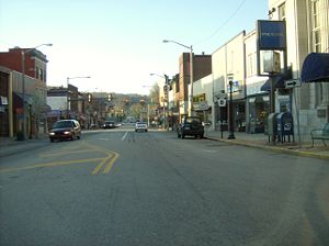
Butler, Pennsylvania
The city of Butler is the county seat of Butler County in the U.S. state of Pennsylvania, situated north of Pittsburgh. The population was 15,121 at the 2000 census.- History :...
, PA 8 crosses Connoquenessing Creek
Connoquenessing Creek
Connoquenessing Creek is a tributary of the Beaver River, approximately 50 mi long, in Western Pennsylvania in the United States.-Course:...
on the General Richard Butler Bridge then runs with Pennsylvania Route 356
Pennsylvania Route 356
Pennsylvania Route 356 is an long state highway located in Westmoreland, Allegheny, Butler, and Armstrong counties in Pennsylvania. The southern terminus is at PA 66 near Oklahoma...
through downtown on South Main Street.
North of the city of Butler, PA 8 meets U.S. Route 422
U.S. Route 422
U.S. Route 422 is a long spur route of US 22 split into two segments in the U.S. states of Ohio and Pennsylvania. The western spur begins in downtown Cleveland, Ohio, and ends at Ebensburg, Pennsylvania...
at an interchange. About 12 miles (19.3 km) east of Slippery Rock
Slippery Rock, Pennsylvania
Slippery Rock is a borough in Butler County, Pennsylvania, United States. The population was 3,068 at the 2000 census. It is home to the Slippery Rock University of Pennsylvania.-Geography:Slippery Rock is located at ....
, PA 8 meets Pennsylvania Route 528
Pennsylvania Route 528
Pennsylvania Route 528 is an long state highway located in Butler county in Pennsylvania. The southern terminus is at US 19 near Zelienople. The northern terminus is at PA 8 near West Liberty.-Route description:...
and Pennsylvania Route 173
Pennsylvania Route 173
Pennsylvania Route 173 is located in western Pennsylvania, running from PA Route 8 south of Slippery Rock in Butler County, to north of Cochranton in Crawford County.-Route description:...
. In the Moraine State Forest, PA 8 meets Pennsylvania Route 108
Pennsylvania Route 108
Pennsylvania Route 108 is a highway in Western Pennsylvania that runs for from the Ohio state line near SNPJ to Pennsylvania Route 8 in Adams Corner. PA 108 intersects US Route 422 in New Castle and US Route 19 near Harlansburg...
. In the town of Harrisville
Harrisville, Pennsylvania
Harrisville is a borough in Butler County, Pennsylvania, United States. The population was 883 at the 2000 census.-History:The Seneca Indians used the Harrisville area for growing corn due to its fertile soil and flat growing area....
, PA 8 intersects Pennsylvania Route 58
Pennsylvania Route 58
Pennsylvania Route 58 is located in Western Pennsylvania, running 71.2 miles from the Ohio state line west of Jamestown in Mercer County to Sligo in Clarion County.-Mercer County:...
(Grove City Harrisville Road). A few miles north of the Butler
Butler County, Pennsylvania
-Demographics:As of the census of 2000, there were 174,083 people, 65,862 households, and 46,827 families residing in the county. The population density was 221 people per square mile . There were 69,868 housing units at an average density of 89 per square mile...
-Venango
Venango County, Pennsylvania
Venango County is a county located in the U.S. state of Pennsylvania. As of the 2010 census, the population was 54,984. Its county seat is Franklin.-History:Venango County was created on March 12, 1800 from parts of Allegheny and Lycoming Counties...
county line, PA 8 meets Interstate 80 at exit 29 near Barkeyville
Barkeyville, Pennsylvania
Barkeyville is a borough in Venango County, Pennsylvania, United States. The population was 237 at the 2000 census.-Geography:Barkeyville is located at ....
.
Mae West Bend
About 0.5 mile (0.80467 km) north of the interchange of PA 28 (in the borough of Etna) is a very sharp and hazardous curve, known to Pittsburghers as "Mae West Bend". The site of numerous accidents over the years, this curve has recently been widened by razing the deteriorating buildings along the inner edge of the curve and digging out the mountainside so that two lanes ran in each direction throughout the curve (Southbound travellers previously had to merge left on the curve as the right lane ended).Interstate 80 to Erie
2 miles (3 km) north of I-80, PA 8 becomes a limited-access highway. The expressway is 9 miles (14 km) long and has only two exits, one of which serves as the northern terminus of Pennsylvania Route 308Pennsylvania Route 308
Pennsylvania Route 308 is an long state highway located in Butler and Venango counties in Pennsylvania. The southern terminus is at PA 8 near Butler...
. North of the expressway, PA 8 is called Pittsburgh Road. South of Franklin
Franklin, Venango County, Pennsylvania
Franklin is a city in Venango County, Pennsylvania, United States. The population was estimated 7,212 in the 2000 census. It is the county seat of Venango County.-Geography:Franklin is located at ....
, PA 8 merges with U.S. Route 62, beginning a 10 miles (16.1 km) concurrency with the route. In Franklin, PA 8 and US 62 meet U.S. Route 322
U.S. Route 322
U.S. Route 322 is a long, east–west United States Highway, traversing Ohio, Pennsylvania, and New Jersey. The road is a spur of U.S. Route 22 and one of the original highways from 1926...
in the city center. The routes form a short, 0.5 mile (0.80467 km) concurrency through the city before splitting near the Allegheny River
Allegheny River
The Allegheny River is a principal tributary of the Ohio River; it is located in the Eastern United States. The Allegheny River joins with the Monongahela River to form the Ohio River at the "Point" of Point State Park in Downtown Pittsburgh, Pennsylvania...
. North of US 322, PA 8 and US 62 begin to parallel the Allegheny River. West of downtown Oil City
Oil City, Pennsylvania
Oil City is a city in Venango County, Pennsylvania that is known in the initial exploration and development of the petroleum industry. After the first oil wells were drilled nearby in the 1850s, Oil City became central in the petroleum industry while hosting headquarters for the Pennzoil, Quaker...
, the concurrency with US 62 ends. US 62 crosses the Allegheny and runs south of the city before turning north towards the Allegheny National Forest
Allegheny National Forest
The Allegheny National Forest is a National Forest located in northwestern Pennsylvania. The forest covers of land. Within the forest is Kinzua Dam, which impounds the Allegheny River to form Allegheny Reservoir. The administrative headquarters for the Allegheny National Forest is located in Warren...
and New York
New York
New York is a state in the Northeastern region of the United States. It is the nation's third most populous state. New York is bordered by New Jersey and Pennsylvania to the south, and by Connecticut, Massachusetts and Vermont to the east...
. PA 8, however, continues into Oil City, where PA 8 meets Pennsylvania Route 8 Business, the first of two auxiliary routes of PA 8, at Center Street. While PA 8 Business heads into Oil City, PA 8 runs west of the city along the former routing of Pennsylvania Route 8 Bypass, rejoining PA 8 Business at North Seneca Street north of town.
North of Oil City, PA 8 is named Oil City-Titusville Road. In the city of Titusville
Titusville, Pennsylvania
Titusville is a city in Crawford County, Pennsylvania, United States. The population was 6,146 at the 2000 census. In 1859, oil was successfully drilled in Titusville, resulting in the birth of the modern oil industry.-History:...
, PA 8 meets Pennsylvania Route 27
Pennsylvania Route 27
Pennsylvania Route 27 is a long state highway located in northwest Pennsylvania. The western terminus of the route is at Park Avenue near U.S. Route 6 and U.S. Route 19 in Meadville. The eastern terminus is at Pennsylvania Route 69 three miles south of Sugar Grove.-History:From 1927 to 1928, PA...
and the southern terminus of Pennsylvania Route 89
Pennsylvania Route 89
Pennsylvania Route 89 is a long north–south state highway located in northwestern Pennsylvania. The southern terminus of the route is at Pennsylvania Route 8 and Pennsylvania Route 27 in Titusville. The northern terminus is at Pennsylvania Route 5 north of North East.-Route description:PA 89...
at the intersection of Franklin Street and Central Avenue. PA 8 forms a concurrency with PA 27 westward along the one-way streets of Central Avenue and Diamond Street before splitting at Spring Street.
In Riceville
Riceville, Pennsylvania
Riceville is a census-designated place in Crawford County, Pennsylvania, United States. The population was 82 at the 2000 census.-Geography:Riceville is located at ....
, PA 8 intersects Pennsylvania Route 77
Pennsylvania Route 77
Pennsylvania Route 77 is a long east–west state highway located in northwest Pennsylvania. The western terminus of the route is at Pennsylvania Route 27 in Meadville...
. 5 miles (8 km) north of PA 77, PA 8 enters Erie County
Erie County, Pennsylvania
Erie County is a county located in the U.S. state of Pennsylvania. As of 2010, the population was 280,566. Its county seat is the City of Erie.- Geography :...
. In Union City
Union City, Pennsylvania
Union City is a borough in Erie County, Pennsylvania, southeast of Erie. In the twentieth century, there were three large chair factories, planing and grist mills, a powdered milk plant, and several furniture factories. In 1900, 3,104 people lived here, and in 1910, 3,684 people lived here. The...
, PA 8 merges with U.S. Route 6 for 0.5 mile (0.80467 km) through downtown. Just north of the split with US 6, PA 8 meets the southern terminus of the northern segment of Pennsylvania Route 97. PA 8 passes by a dry lake called Union City Lake south of Wattsburg
Wattsburg, Pennsylvania
Wattsburg is a borough in Erie County, Pennsylvania, United States. The population was 378 at the 2000 census. It is part of the Erie Metropolitan Statistical Area.Wattsburg is along the banks of French Creek ....
, where it merges with Pennsylvania Route 89
Pennsylvania Route 89
Pennsylvania Route 89 is a long north–south state highway located in northwestern Pennsylvania. The southern terminus of the route is at Pennsylvania Route 8 and Pennsylvania Route 27 in Titusville. The northern terminus is at Pennsylvania Route 5 north of North East.-Route description:PA 89...
. The two routes run concurrent to one another through Wattsburg, where PA 8 and PA 89 meet the western terminus of Pennsylvania Route 474
Pennsylvania Route 474
Route 474 is a short state highway in Venango Township, Erie County, Pennsylvania...
, to the Venango Township
Venango Township, Erie County, Pennsylvania
Venango Township is a township in Erie County, Pennsylvania, United States. The population was 2,277 at the 2000 census.-Geography:According to the United States Census Bureau, the township has a total area of 43.7 square miles , 43.6 square miles of which is land and 0.1 square...
community of Lowville, where PA 8 breaks from PA 89, taking a more westerly routing than PA 89. PA 8 is named Wattsburg Road between Lowville and the Erie city line.
1.5 miles (2.4 km) southeast of Erie
Erie, Pennsylvania
Erie is a city located in northwestern Pennsylvania in the United States. Named for the lake and the Native American tribe that resided along its southern shore, Erie is the state's fourth-largest city , with a population of 102,000...
, PA 8 interchanges with Interstate 90 at exit 29, which shows a sign for Parade Street (northbound) and Hammett (southbound).
In the city itself, PA 8, as Pine Avenue, meets the northern terminus of Old French Road (PA 97) a mere 700 feet (213.4 m) south of its northern terminus at U.S. Route 20. PA 97 and PA 8 effectively join to become Parade Street, which continues north to Front Street, just south of the Bayfront Parkway.
History
PA 8 was first signed in 1926 from West VirginiaWest Virginia
West Virginia is a state in the Appalachian and Southeastern regions of the United States, bordered by Virginia to the southeast, Kentucky to the southwest, Ohio to the northwest, Pennsylvania to the northeast and Maryland to the east...
to Erie
Erie, Pennsylvania
Erie is a city located in northwestern Pennsylvania in the United States. Named for the lake and the Native American tribe that resided along its southern shore, Erie is the state's fourth-largest city , with a population of 102,000...
. South of Pittsburgh
Pittsburgh, Pennsylvania
Pittsburgh is the second-largest city in the US Commonwealth of Pennsylvania and the county seat of Allegheny County. Regionally, it anchors the largest urban area of Appalachia and the Ohio River Valley, and nationally, it is the 22nd-largest urban area in the United States...
, PA 8 followed the current U.S. Route 19 alignment from the West Virginia state line to Canonsburg
Canonsburg, Pennsylvania
Canonsburg is a borough in Washington County, Pennsylvania, southwest of Pittsburgh. Canonsburg was laid out by Colonel John Canon in 1789 and incorporated in 1802....
, as well as the present Pennsylvania Route 50
Pennsylvania Route 50
Pennsylvania Route 50 is a long state highway located in western Pennsylvania. The western terminus of the route is at Pennsylvania Route 844 in the Independence Township community of Independence less than a mile from the West Virginia state line. The eastern terminus is at Pennsylvania Route 60...
alignment from Bridgeville
Bridgeville, Pennsylvania
Bridgeville is a borough in Allegheny County, Pennsylvania, United States. The population was 5,148 at the 2010 census.-Geography:Bridgeville is located along Chartiers Creek, about southwest of downtown Pittsburgh at ....
to Crafton
Crafton, Pennsylvania
Crafton is a borough in Allegheny County, Pennsylvania, United States, west of downtown Pittsburgh. The population grew from 1,927 in 1900 to 4,583 in 1910 and to 7,163 in 1940. The population was 5,951 at the 2010 census.-History:...
. The West Virginia – Pittsburgh segment was decommissioned in 1930.
In 1934, construction began on PA 8 between the Allegheny
Allegheny County, Pennsylvania
Allegheny County is a county in the southwestern part of the U.S. state of Pennsylvania. As of the 2010 census, the population was 1,223,348; making it the second most populous county in Pennsylvania, following Philadelphia County. The county seat is Pittsburgh...
–Butler
Butler County, Pennsylvania
-Demographics:As of the census of 2000, there were 174,083 people, 65,862 households, and 46,827 families residing in the county. The population density was 221 people per square mile . There were 69,868 housing units at an average density of 89 per square mile...
county line and Three Degree Road. This segment opened in 1935. Later, in 1958, construction commenced on the segment from Grant Avenue to Pennsylvania Route 28
Pennsylvania Route 28
Pennsylvania Route 28 is a major state highway which runs for 97 miles from Interstate 279 and Interstate 579 at the Interstate 279 Interchange in Pittsburgh to U.S. Route 219 in Brockway in the U.S. state of Pennsylvania. The expressway from Kittanning to Pittsburgh is called the Alexander H...
in Etna
Etna, Pennsylvania
Etna is a borough in Allegheny County, Pennsylvania, on the Allegheny River, opposite Pittsburgh. It flourished in the past when it was the site of rolling mills, furnaces, steel mills, galvanized-pipe works, and other manufacturers. In 1900, 5,384 people lived in Etna. In 1910, 5,830 lived there,...
. In that same year, the route was widened and a median was installed from Franklin to Reno. The Grant Avenue – PA 28 segment was completed the following year. In 1961, PA 8 from the end of the Richard C. Frame Memorial Highway at Interstate 80 to Franklin was upgraded with a median, and, in 1968, the section from Reno to Oil City
Oil City, Pennsylvania
Oil City is a city in Venango County, Pennsylvania that is known in the initial exploration and development of the petroleum industry. After the first oil wells were drilled nearby in the 1850s, Oil City became central in the petroleum industry while hosting headquarters for the Pennzoil, Quaker...
had a median installed as well.
In 1973, construction began on the section of expressway from Pennsylvania Route 308
Pennsylvania Route 308
Pennsylvania Route 308 is an long state highway located in Butler and Venango counties in Pennsylvania. The southern terminus is at PA 8 near Butler...
in Pearl to the northern end of the present expressway south of Franklin in Venango County
Venango County, Pennsylvania
Venango County is a county located in the U.S. state of Pennsylvania. As of the 2010 census, the population was 54,984. Its county seat is Franklin.-History:Venango County was created on March 12, 1800 from parts of Allegheny and Lycoming Counties...
. That same year, the southern terminus of PA 8 was moved from West Carson Street in Pittsburgh to Pennsylvania Route 28
Pennsylvania Route 28
Pennsylvania Route 28 is a major state highway which runs for 97 miles from Interstate 279 and Interstate 579 at the Interstate 279 Interchange in Pittsburgh to U.S. Route 219 in Brockway in the U.S. state of Pennsylvania. The expressway from Kittanning to Pittsburgh is called the Alexander H...
in Etna. In 1974, construction began on the remainder of the expressway from the present southern end at Wesley to PA 308. The highway was completed in 1976. In 1977, the southern terminus was moved to its current location from PA 28 in Etna. In 1979, the route was realigned onto what was then PA 8 Bypass (Main Street) to bypass downtown Oil City. PA 8 Bypass, initially signed in 1941, was decommissioned while the former routing in PA 8 in Oil City became Pennsylvania Route 8 Business.
Major intersections
PA 8 Business
Pennsylvania Route 8 Business is a 1 miles (1.6 km) long business route in Venango County, PennsylvaniaVenango County, Pennsylvania
Venango County is a county located in the U.S. state of Pennsylvania. As of the 2010 census, the population was 54,984. Its county seat is Franklin.-History:Venango County was created on March 12, 1800 from parts of Allegheny and Lycoming Counties...
.
In 1979, a two-lane but development-free bypass of Oil City was constructed on the westbank of Oil Creek and featured the designation of Pennsylvania Route 8 Bypass. The original eastbank sector and its two bridges were initially kept as mainline Route 8. The first half of the very short route features one-way couples through the heart of the municipality, and the northern half features a single, business-lined two-lane street. Mainline Route 8 was redirected to the former bypass upon the commissioning of Route 8 Business.
PA 8 Truck
Pennsylvania Route 8 Truck is a 1/2 mi long truck route in TitusvilleTitusville, Pennsylvania
Titusville is a city in Crawford County, Pennsylvania, United States. The population was 6,146 at the 2000 census. In 1859, oil was successfully drilled in Titusville, resulting in the birth of the modern oil industry.-History:...
, Crawford County, Pennsylvania
Crawford County, Pennsylvania
Crawford County is a county located in the U.S. state of Pennsylvania. As of 2010, the population was 88,765.Crawford County was created on March 12, 1800, from part of Allegheny County and named for Colonel William Crawford...
. In 1980, the designation was established to remove trucks from the complicated intersection with Pennsylvania Route 27
Pennsylvania Route 27
Pennsylvania Route 27 is a long state highway located in northwest Pennsylvania. The western terminus of the route is at Park Avenue near U.S. Route 6 and U.S. Route 19 in Meadville. The eastern terminus is at Pennsylvania Route 69 three miles south of Sugar Grove.-History:From 1927 to 1928, PA...
and to provide direct access for local trucks past the borough's small industrial area along St. John Street. For its entire length it is cosigned with Truck Route 27.