

List of National Historic Landmarks in Ohio
Encyclopedia
This is a List of National Historic Landmarks in Ohio and other landmarks of equivalent landmark status in the state. The United States' National Historic Landmark
(NHL) program is operated under the auspices of the National Park Service
, and recognizes structures, districts, objects, and similar resources according to a list of criteria of national significance. There are 70 NHLs in Ohio
and four additional National Park Service-administered areas of primarily historic importance.
has more than any other county.
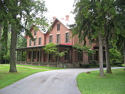
The James A. Garfield National Historic Site
and the William Howard Taft National Historic Site
are also designated as NHLs and are listed above. The remaining four are as follows.
National Historic Landmark
A National Historic Landmark is a building, site, structure, object, or district, that is officially recognized by the United States government for its historical significance...
(NHL) program is operated under the auspices of the National Park Service
National Park Service
The National Park Service is the U.S. federal agency that manages all national parks, many national monuments, and other conservation and historical properties with various title designations...
, and recognizes structures, districts, objects, and similar resources according to a list of criteria of national significance. There are 70 NHLs in Ohio
Ohio
Ohio is a Midwestern state in the United States. The 34th largest state by area in the U.S.,it is the 7th‑most populous with over 11.5 million residents, containing several major American cities and seven metropolitan areas with populations of 500,000 or more.The state's capital is Columbus...
and four additional National Park Service-administered areas of primarily historic importance.
Current National Historic Landmarks in Ohio
The 70 NHLs in Ohio are distributed across 34 of the 88 counties in the state. With fourteen NHLs, Hamilton CountyHamilton County, Ohio
As of 2000, there were 845,303 people, 346,790 households, and 212,582 families residing in the county. The population density was 2,075 people per square mile . There were 373,393 housing units at an average density of 917 per square mile...
has more than any other county.
| Landmark name | Image | Year listed | Locality | County | Description | |
|---|---|---|---|---|---|---|
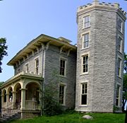
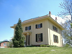
| Adena Adena Mansion Adena Mansion was built for Thomas Worthington by Benjamin Latrobe, and was completed in 1806-1807. It is located west of downtown Chillicothe, Ohio, United States. The property surrounding the mansion included the location of the first mound found to belong to the Adena culture and thus the... |
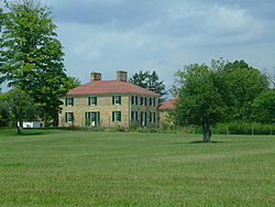 |
Chillicothe Chillicothe, Ohio Chillicothe is a city in and the county seat of Ross County, Ohio, United States.Chillicothe was the first and third capital of Ohio and is located in southern Ohio along the Scioto River. The name comes from the Shawnee name Chalahgawtha, meaning "principal town", as it was a major settlement of... 39.353613°N 83.015345°W |
Ross Ross County, Ohio As of the census of 2000, there were 73,345 people, 27,136 households, and 19,185 families residing in the county. The population density was 106 people per square mile . There were 29,461 housing units at an average density of 43 per square mile... |
Mansion of Thomas Worthington | ||
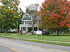
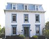
| Baum-Taft House | 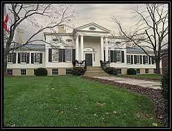 |
Cincinnati Cincinnati, Ohio Cincinnati is a city in the U.S. state of Ohio. Cincinnati is the county seat of Hamilton County. Settled in 1788, the city is located to north of the Ohio River at the Ohio-Kentucky border, near Indiana. The population within city limits is 296,943 according to the 2010 census, making it Ohio's... 39.1025°N 84.503333°W |
Hamilton Hamilton County, Ohio As of 2000, there were 845,303 people, 346,790 households, and 212,582 families residing in the county. The population density was 2,075 people per square mile . There were 373,393 housing units at an average density of 917 per square mile... |
Taft family home now an art museum | ||
| Beginning Point of the U.S. Public Land Survey Beginning Point of the U.S. Public Land Survey The Beginning Point of the U.S. Public Land Survey is a monument at the border between the U.S. states of Ohio and Pennsylvania, on the north side of the Ohio River. It is near the three-way intersection of Ohio, Pennsylvania, and the northern tip of West Virginia, in both the Pittsburgh... |
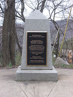 |
East Liverpool, OH East Liverpool, Ohio As of the census of 2000, there were 13,089 people, 5,261 households, and 3,424 families residing in the city. The population density was 3,010.3 people per square mile . There were 5,743 housing units at an average density of 1,320.8 per square mile... and Ohioville, PA Ohioville, Pennsylvania Ohioville is a borough in Beaver County, Pennsylvania, United States. The population was 3,759 at the 2000 census.-Geography:Ohioville is located at , in part along the Ohio River.... 40.6404872208°N 80.5193774299°W |
Columbiana, OH Columbiana County, Ohio Columbiana County is a county located in the U.S. state of Ohio. As of 2010, the population was 107,841. It is named for Christopher Columbus and the county seat is Lisbon.... and Beaver, PA Beaver County, Pennsylvania -Demographics:As of the census of 2000, there were 181,412 people, 72,576 households, and 50,512 families residing in the county. The population density was 418 people per square mile . There were 77,765 housing units at an average density of 179 per square mile... |
Marker of origin of Northwest Territories survey, on Pennsylvania border | ||
| Carew Tower-Netherland Plaza Hotel Carew Tower Carew Tower is the second tallest building in Cincinnati, Ohio, United States. However, it is still the highest elevated building in the city. The Great American Insurance building is only taller because of the basement. Completed in 1930, it stands 49 stories tall in the heart of downtown,... |
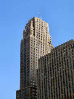 |
Cincinnati Cincinnati, Ohio Cincinnati is a city in the U.S. state of Ohio. Cincinnati is the county seat of Hamilton County. Settled in 1788, the city is located to north of the Ohio River at the Ohio-Kentucky border, near Indiana. The population within city limits is 296,943 according to the 2010 census, making it Ohio's... 39.0990120962°N 84.5252235948°W |
Hamilton Hamilton County, Ohio As of 2000, there were 845,303 people, 346,790 households, and 212,582 families residing in the county. The population density was 2,075 people per square mile . There were 373,393 housing units at an average density of 917 per square mile... |
|||
| Cincinnati Music Hall | 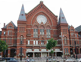 |
Cincinnati Cincinnati, Ohio Cincinnati is a city in the U.S. state of Ohio. Cincinnati is the county seat of Hamilton County. Settled in 1788, the city is located to north of the Ohio River at the Ohio-Kentucky border, near Indiana. The population within city limits is 296,943 according to the 2010 census, making it Ohio's... 39.108928°N 84.518286°W |
Hamilton Hamilton County, Ohio As of 2000, there were 845,303 people, 346,790 households, and 212,582 families residing in the county. The population density was 2,075 people per square mile . There were 373,393 housing units at an average density of 917 per square mile... |
NRHP 70000496 | ||
| Cincinnati Observatory Cincinnati Observatory The Cincinnati Observatory, located in Cincinnati, Ohio on top of Mt. Lookout. It consists of two observatory buildings housing an 11 inch and 16 inch aperture refracting telescope. It is the oldest professional observatory in the United States... |
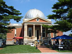 |
Cincinnati Cincinnati, Ohio Cincinnati is a city in the U.S. state of Ohio. Cincinnati is the county seat of Hamilton County. Settled in 1788, the city is located to north of the Ohio River at the Ohio-Kentucky border, near Indiana. The population within city limits is 296,943 according to the 2010 census, making it Ohio's... 39.1409349808°N 84.4226992453°W |
Hamilton Hamilton County, Ohio As of 2000, there were 845,303 people, 346,790 households, and 212,582 families residing in the county. The population density was 2,075 people per square mile . There were 373,393 housing units at an average density of 917 per square mile... |
NRHP 80003043 | ||
| Cincinnati Union Terminal |  |
Cincinnati Cincinnati, Ohio Cincinnati is a city in the U.S. state of Ohio. Cincinnati is the county seat of Hamilton County. Settled in 1788, the city is located to north of the Ohio River at the Ohio-Kentucky border, near Indiana. The population within city limits is 296,943 according to the 2010 census, making it Ohio's... 39.109778°N 84.532190°W |
Hamilton Hamilton County, Ohio As of 2000, there were 845,303 people, 346,790 households, and 212,582 families residing in the county. The population density was 2,075 people per square mile . There were 373,393 housing units at an average density of 917 per square mile... |
NRHP 72001018 | ||
| Cincinnati Zoo Historic Structures Cincinnati Zoo Historic Structures The Cincinnati Zoo Historic Structures are a set of historic buildings at the Cincinnati Zoo in Cincinnati, Ohio. They have been listed in the National Register of Historic Places since February 27, 1987.... |
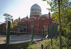 |
Cincinnati Cincinnati, Ohio Cincinnati is a city in the U.S. state of Ohio. Cincinnati is the county seat of Hamilton County. Settled in 1788, the city is located to north of the Ohio River at the Ohio-Kentucky border, near Indiana. The population within city limits is 296,943 according to the 2010 census, making it Ohio's... 39.142493°N 84.509395°W |
Hamilton Hamilton County, Ohio As of 2000, there were 845,303 people, 346,790 households, and 212,582 families residing in the county. The population density was 2,075 people per square mile . There were 373,393 housing units at an average density of 917 per square mile... |
NRHP 87000905 | ||
| Cleveland Arcade Cleveland Arcade The Arcade in downtown Cleveland, Ohio, is a Victorian-era structure of two nine-story buildings, joined by a five-story arcade with a glass skylight spanning over 300 feet , along the four balconies.... |
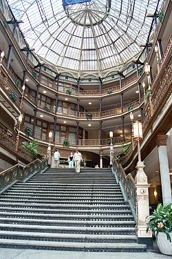 |
Cleveland Cleveland, Ohio Cleveland is a city in the U.S. state of Ohio and is the county seat of Cuyahoga County, the most populous county in the state. The city is located in northeastern Ohio on the southern shore of Lake Erie, approximately west of the Pennsylvania border... 41.499702°N 81.690794°W |
Cuyahoga Cuyahoga County, Ohio Cuyahoga County is a county located in the state of Ohio, United States. It is the most populous county in Ohio; as of the 2010 census, the population was 1,280,122. Its county seat is Cleveland. Cuyahoga County is part of Greater Cleveland, a metropolitan area, and Northeast Ohio, a... |
NRHP 73001408 | ||
| USS COD (Submarine) | 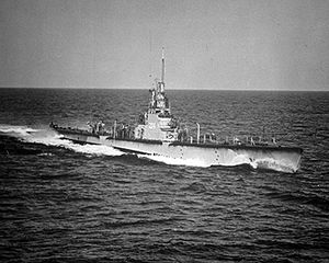 |
Cleveland Cleveland, Ohio Cleveland is a city in the U.S. state of Ohio and is the county seat of Cuyahoga County, the most populous county in the state. The city is located in northeastern Ohio on the southern shore of Lake Erie, approximately west of the Pennsylvania border... 41.5083279786°N 81.6921316816°W |
Cuyahoga Cuyahoga County, Ohio Cuyahoga County is a county located in the state of Ohio, United States. It is the most populous county in Ohio; as of the 2010 census, the population was 1,280,122. Its county seat is Cleveland. Cuyahoga County is part of Greater Cleveland, a metropolitan area, and Northeast Ohio, a... |
NRHP 86000088 | ||
| Jay Cooke Home Jay Cooke House Jay Cooke House was the summer home of Jay Cooke, a financial magnate involved in financing the union during the American Civil War, and whose failure caused the panic of 1873. The house is located at Put-in-Bay, Ohio on Gibraltar Island, Ohio.... |
 |
Gibraltar Island 41.658056°N 82.821111°W |
Ottawa Ottawa County, Ohio Ottawa County is a county located in the state of Ohio, United States. As of the 2010 census, the population was 41,428. Its county seat is Port Clinton and is named either for the Ottawa Indians who lived there, or for an Indian word meaning "trader".... |
Summer home of financier Jay Cooke Jay Cooke Jay Cooke was an American financier. Cooke and his firm Jay Cooke & Company were most notable for their role in financing the Union's war effort during the American Civil War... |
||
| Covington And Cincinnati Suspension Bridge John A. Roebling Suspension Bridge The John A. Roebling Suspension Bridge spans the Ohio River between Cincinnati, Ohio and Covington, Kentucky. When the first pedestrians crossed on December 1, 1866, it was the longest suspension bridge in the world at 1,057 feet main span. Today, many pedestrians use the bridge to get between... |
 |
Cincinnati, OH and Covington, KY Covington, Kentucky -Demographics:As of the census of 2000, there were 43,370 people, 18,257 households, and 10,132 families residing in the city. The population density was 3,301.3 people per square mile . There were 20,448 housing units at an average density of 1,556.5 per square mile... 39.0903899038°N 84.5095710637°W |
Hamilton, OH Hamilton County, Ohio As of 2000, there were 845,303 people, 346,790 households, and 212,582 families residing in the county. The population density was 2,075 people per square mile . There were 373,393 housing units at an average density of 917 per square mile... and Kenton, KY |
John A. Roebling John A. Roebling John Augustus Roebling was a German-born American civil engineer. He is famous for his wire rope suspension bridge designs, in particular, the design of the Brooklyn Bridge.-Early life:... 's suspension bridge here was dramatic new design. It set precedent for Brooklyn Bridge Brooklyn Bridge The Brooklyn Bridge is one of the oldest suspension bridges in the United States. Completed in 1883, it connects the New York City boroughs of Manhattan and Brooklyn by spanning the East River... later. |
||
| Manasseh Cutler Hall, Ohio University Manasseh Cutler Hall, Ohio University Manasseh Cutler Hall at Ohio University in the United States, was completed in 1819. This three story structure, topped by a wooden tower and cupola, is the oldest college building in the Old Northwest. It was named for Manasseh Cutler, a New England physician, botanist, and minister who wrote the... |
 |
Athens Athens, Ohio Athens is the largest city in, and the county seat of, Athens County, Ohio, United States. It is located along the Hocking River in the southeastern part of Ohio. A historic college town, Athens is home to Ohio University and is the principal city of the Athens, Ohio Micropolitan Statistical Area. ... 39.3241841015°N 82.1005115303°W |
Athens Athens County, Ohio As of the census of 2000, there were 62,223 people, 22,501 households, and 12,713 families residing in the county. The population density was 123 people per square mile . There were 24,901 housing units at an average density of 49 per square mile... |
NRHP 66000604 | ||
| Paul Laurence Dunbar House Paul Laurence Dunbar House The Paul Laurence Dunbar House was the 1904-1906 home of poet Paul Laurence Dunbar in Dayton, Ohio. It is a historic house museum owned by the state of Ohio and operated by Dayton History on behalf of the Ohio Historical Society... |
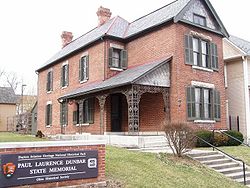 |
Dayton Dayton, Ohio Dayton is the 6th largest city in the U.S. state of Ohio and the county seat of Montgomery County, the fifth most populous county in the state. The population was 141,527 at the 2010 census. The Dayton Metropolitan Statistical Area had a population of 841,502 in the 2010 census... 39.757366°N 84.218681°W |
Montgomery Montgomery County, Ohio Montgomery County is a county located in the state of Ohio, United States. The population was 535,153 in the 2010 Census. It was named in honor of Richard Montgomery, an American Revolutionary War general killed in 1775 while attempting to capture Quebec City, Canada. The county seat is Dayton... |
Home of black poet Paul Laurence Dunbar Paul Laurence Dunbar Paul Laurence Dunbar was a seminal African American poet of the late 19th and early 20th centuries. Dunbar gained national recognition for his 1896 "Ode to Ethiopia", one poem in the collection Lyrics of Lowly Life.... |
||
| Thomas A. Edison Birthplace Thomas Alva Edison Birthplace Thomas Alva Edison Birthplace is the historic house in which the American inventor Thomas Alva Edison was born on February 11, 1847. It is located at 9 Edison Drive in Milan, Ohio, in the United States. On October 15, 1966, it was added to the National Register of Historic Places and declared a... |
 |
Milan Milan, Ohio Milan is a village in Erie and Huron counties in the U.S. state of Ohio. The population was 1,445 at the 2000 census.The Erie County portion of Milan is part of the Sandusky Metropolitan Statistical Area, while the Huron County portion is part of the Norwalk Micropolitan Statistical Area.-History... 41.2979897005°N 82.6050538446°W |
Erie Erie County, Ohio As of the census of 2000, there were 79,551 people, 31,727 households, and 21,764 families residing in the county. The population density was 312 people per square mile . There were 35,909 housing units at an average density of 141 per square mile... |
NRHP 66000608. | ||
| Wilson Bruce Evans House Wilson Bruce Evans House Wilson Bruce Evans House, also known as LOR-239-21, is a house in Oberlin, Ohio.It was declared a National Historic Landmark in 1997.-External links:**... |
Oberlin Oberlin, Ohio Oberlin is a city in Lorain County, Ohio, United States, to the south and west of Cleveland. Oberlin is perhaps best known for being the home of Oberlin College, a liberal arts college and music conservatory with approximately 3,000 students... 41.288888°N 82.216321°W |
Lorain Lorain County, Ohio Lorain County is a county located in the U.S. state of Ohio, and is considered to be a part of what is locally referred to as Greater Cleveland. As of the 2010 census, its population was 301,356. an increase from 284,664 in 2000... |
NRHP 80003143 | |||
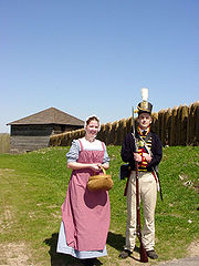
| Fallen Timbers Battlefield Fallen Timbers Battlefield The Fallen Timbers Battlefield was the site of the Battle of Fallen Timbers on 20 August 1794.The site was declared a National Historic Landmark in 1960.In 1975, interpretative information at the site was very limited.-External links:*... |
Maumee Maumee, Ohio Maumee is a city in Lucas County, Ohio, United States. It is a suburb of Toledo along the Maumee River. The population was 14,286 at the 2010 census. Maumee was also declared an All-America City by the National Civic League in June 2006.-Geography:... 41.5422623853°N 83.6974454742°W |
Lucas Lucas County, Ohio ----... |
NRHP 66000616 | |||
| Fort Ancient Fort Ancient, Ohio Fort Ancient is a collection of Native American earthworks located in Washington Township, Warren County, Ohio, along the eastern shore of the Little Miami River about seven miles southeast of Lebanon on State Route 350... |
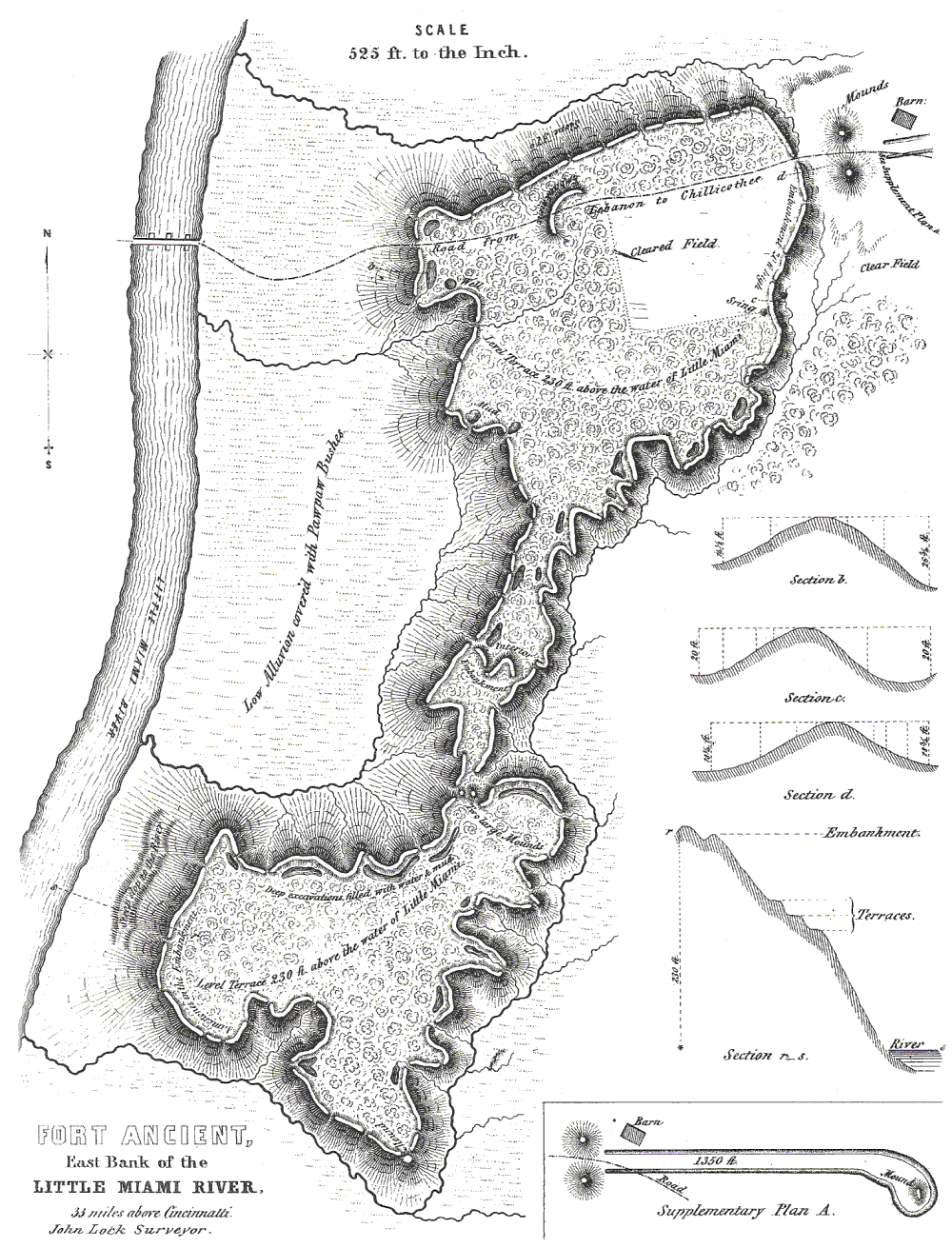 |
Lebanon Lebanon, Ohio The population at the 2010 census was 20,033. As of the census of 2000, there were 16,962 people residing in the city. The population density was 1,440.6 people per square mile . There were 6,218 housing units at an average density of 528.1 per square mile... 39.40806°N 84.0911°W |
Warren Warren County, Ohio Warren County is a county located in the state of Ohio, United States. The population was 212,693 at the 2010 census. Its county seat is Lebanon. Warren County was erected May 1, 1803, from Hamilton County, and named for Dr... |
NRHP 66000625 | ||
| Fort Meigs Fort Meigs Fort Meigs was a fortification along the Maumee River in Ohio during the War of 1812. It is named in honor of Ohio governor Return J. Meigs, Jr., for his support in providing General William Henry Harrison with militia and supplies for the line of forts along the Old Northwest... |
 |
Perrysburg Perrysburg, Ohio As of the census of 2000, there were 16,945 people, 6,592 households, and 4,561 families residing in the city. The population density was 1,899.2 people per square mile . There were 6,964 housing units at an average density of 780.5 per square mile... 41.5508063441°N 83.6515226595°W |
Wood Wood County, Ohio Wood County is a county located in the state of Ohio, United States. As of the 2010 census, the population was 125,488. Its county seat is Bowling Green. The county was named for Captain Eleazer D. Wood, the engineer for General William Henry Harrison's army, who built Fort Meigs in the War of 1812... |
NRHP 69000151 | ||
| James A. Garfield Home James A. Garfield National Historic Site James A. Garfield National Historic Site is a United States National Historic Site located in Mentor, Ohio. The site preserves the property associated with the 20th President of the United States, James Abram Garfield.-History:... |
 |
Mentor Mentor, Ohio As of the census of 2000, there were 50,278 people, 18,797 households, and 14,229 families residing in the city. The population density was 1,878.2 people per square mile . There were 19,301 housing units at an average density of 721.0 per square mile... 41.663616°N 81.351052°W |
Lake Lake County, Ohio Lake County is a county located in the U.S. state of Ohio. As of 2010, the population was 230,041. The county seat is Painesville, and the county name comes from its location on the southern shore of Lake Erie.... |
NRHP 66000613 | ||
| Joshua R. Giddings Law Office | .jpg) |
Jefferson Jefferson, Ohio Jefferson is a village in Ashtabula County, Ohio, United States. The population was 3,572 at the 2000 census. It is the county seat of Ashtabula County. Modern-day Jefferson sports the world's only perambulator museum and a historical complex including several restored 18th century buildings.... 41.744563°N 80.769422°W |
Ashtabula Ashtabula County, Ohio Ashtabula County is the northeasternmost county in the state of Ohio. As of 2010, the population was 101,497, its county seat is Jefferson. The county is named for a Native American word meaning "river of many fish".... |
NRHP 74001396. | ||
| Glendale Historic District Glendale Historic District (Glendale, Ohio) The Glendale Historic District is a historic district in Glendale, Ohio, listed in the National Register of Historic Places in 1976. It contains 439 contributing buildings.It was declared a National Historic Landmark in 1977.... |
 |
Glendale Glendale, Ohio Glendale is a village in Hamilton County, Ohio, United States. The population was 2,188 at the 2000 census. It is site of the Glendale Historic District.-Geography:Glendale is located at .... 39.271634°N 84.46362°W |
Hamilton Hamilton County, Ohio As of 2000, there were 845,303 people, 346,790 households, and 212,582 families residing in the county. The population density was 2,075 people per square mile . There were 373,393 housing units at an average density of 917 per square mile... |
NRHP 76001447 | ||
| U.S. Grant Boyhood Home Grant Boyhood Home The Grant Boyhood Home in Georgetown, Ohio was where Ulysses S. Grant lived from 1823 until 1839, when he left for West Point Military Academy.-History:... |
 |
Georgetown Georgetown, Ohio Georgetown is a village in Brown County, Ohio, United States. The population was 3,691 at the 2000 census. It is the county seat of Brown County. Georgetown was the childhood home of Ulysses S... 38.865814°N 83.902148°W |
Brown Brown County, Ohio As of the census of 2000, there were 42,285 people, 15,555 households, and 11,790 families residing in the county. The population density was 86 people per square mile . There were 17,193 housing units at an average density of 35 per square mile... |
NRHP 76001374 | ||
| Warren G. Harding Home Harding Home The Harding Home, in Marion, Ohio, was the residence of Warren G. Harding, twenty-ninth president of the United States. Harding and his future wife, Florence, designed the Queen Anne Style house in 1890, a year before their marriage. They were married there and lived there for 30 years before his... |
 |
Marion Marion, Ohio Marion is a city in the U.S. state of Ohio and the county seat of Marion County. The municipality is located in north-central Ohio, approximately north of Columbus.... 40.586279°N 83.121691°W |
Marion Marion County, Ohio Marion County is a county located in the state of Ohio, United States. As of the 2010 census, the population was 66,501. Its county seat is the city of Marion and is named for General Francis "The Swamp Fox" Marion, an officer in the Revolutionary War.... |
NRHP 66000618. | ||
| Hawthorn Hill (Orville Wright Mansion) Hawthorn Hill Hawthorn Hill in Oakwood, Ohio, USA, was the post-1914 home of Orville, Milton, and Katharine Wright. Wilbur and Orville Wright intended for it to be their joint home, but Wilbur died in 1912, before the home's 1914 completion. The brothers hired the prominent Dayton architectural firm of... |
Oakwood Oakwood, Montgomery County, Ohio Oakwood is a city in Montgomery County, Ohio, United States. The population was 9,202 at the 2010 census. Oakwood is part of the Dayton Metropolitan Statistical Area. It was incorporated in 1908... 39.7204161522°N 84.1762237843°W |
Montgomery Montgomery County, Ohio Montgomery County is a county located in the state of Ohio, United States. The population was 535,153 in the 2010 Census. It was named in honor of Richard Montgomery, an American Revolutionary War general killed in 1775 while attempting to capture Quebec City, Canada. The county seat is Dayton... |
NRHP 74001585 | |||
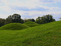
| Hopeton Earthworks Hopeton Earthworks The Hopeton Earthworks are Hopewell culture mounds and earthworks located about a mile east of the Mound City group on a terrace of the Scioto River. The walls have been damaged by cultivation. They are contained in a detached portion of Hopewell Culture National Historic Park. The Hopeton... |
Hopetown 39.379604°N 82.985474°W |
Ross Ross County, Ohio As of the census of 2000, there were 73,345 people, 27,136 households, and 19,185 families residing in the county. The population density was 106 people per square mile . There were 29,461 housing units at an average density of 43 per square mile... |
NRHP 66000623 | |||
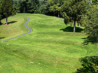
| Huffman Prairie Flying Field |  |
Fairborn Fairborn, Ohio Fairborn is a city in Greene County, Ohio, United States, near Dayton and Wright-Patterson Air Force Base. The population was 32,352 at the 2010 census... 39.803333°N 84.065833°W |
Greene Greene County, Ohio Greene County is a county located in the state of Ohio, United States. The population was 161,573 in the 2010 Census. Its county seat is Xenia, and it was named for General Nathanael Greene, an officer in the Revolutionary War. Greene County was established on March 24, 1803.Greene County is part... |
NRHP 71000640 | ||
| Johnson's Island Civil War Prison | 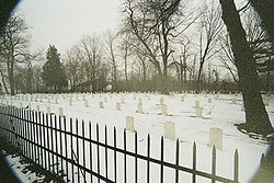 |
Danbury 41.494998°N 82.73675°W |
Ottawa Ottawa County, Ohio Ottawa County is a county located in the state of Ohio, United States. As of the 2010 census, the population was 41,428. Its county seat is Port Clinton and is named either for the Ottawa Indians who lived there, or for an Indian word meaning "trader".... |
NRHP 75001514. Johnson Island Civil War Prison and Fort Site the NRHP name. | ||
| Charles F. Kettering House Charles F. Kettering House The Charles F. Kettering House is a National Historic Landmark in Kettering, Ohio, the residence of inventor Charles F. Kettering, founder of Delco. The Tudor Revival house, also known as Ridgeleigh Terrace, was reputed to be the first house in the United States with electric air conditioning. It... |
Kettering Kettering, Ohio As of the census of 2000, there were 57,502 people, 25,657 households, and 15,727 families residing in the city. The population density was 3,077.4 people per square mile . There were 26,936 housing units at an average density of 1,441.6 per square mile... 39.692590°N 84.192796°W |
Montgomery Montgomery County, Ohio Montgomery County is a county located in the state of Ohio, United States. The population was 535,153 in the 2010 Census. It was named in honor of Richard Montgomery, an American Revolutionary War general killed in 1775 while attempting to capture Quebec City, Canada. The county seat is Dayton... |
NRHP 77001080 | |||
| Kirtland Temple Kirtland Temple The Kirtland Temple is a National Historic Landmark in Kirtland, Ohio, USA, on the eastern edge of the Cleveland metropolitan area. Owned and operated by the Community of Christ, formerly the Reorganized Church of Jesus Christ of Latter Day Saints , the house of worship was the first temple to be... |
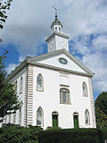 |
Kirtland Kirtland, Ohio Kirtland is a city in Lake County, Ohio, USA. The population was 6,670 at the 2000 census. Kirtland is famous for being the early headquarters of the Latter Day Saint movement.-Origins of Kirtland:... 41.625958°N 81.362149°W |
Lake Lake County, Ohio Lake County is a county located in the U.S. state of Ohio. As of 2010, the population was 230,041. The county seat is Painesville, and the county name comes from its location on the southern shore of Lake Erie.... |
NRHP 69000145 | ||
| John Mercer Langston House John Mercer Langston House The John Mercer Langston House is a National Historic Landmark in Oberlin, Ohio. It was home to John Mercer Langston, abolitionist and US Congressman, who was one of the first African-Americans elected to public office in the United States.-External links:... |
Oberlin Oberlin, Ohio Oberlin is a city in Lorain County, Ohio, United States, to the south and west of Cleveland. Oberlin is perhaps best known for being the home of Oberlin College, a liberal arts college and music conservatory with approximately 3,000 students... 41.291556°N 82.208590°W |
Lorain Lorain County, Ohio Lorain County is a county located in the U.S. state of Ohio, and is considered to be a part of what is locally referred to as Greater Cleveland. As of the 2010 census, its population was 301,356. an increase from 284,664 in 2000... |
NRHP 75001464 | |||
| Langstroth Cottage Langstroth Cottage Langstroth Cottage is a registered historic building on the Western campus of Miami University in Oxford, Ohio. It was named a National Historic Landmark on June 22, 1976. The cottage, built in 1856, is now the home for the University's Center for the Enhancement of Learning and Teaching. Beekeeper... |
Oxford Oxford, Ohio Oxford is a city in northwestern Butler County, Ohio, United States, in the southwestern portion of the state. It lies in Oxford Township, originally called the College Township. The population was 21,943 at the 2000 census. This college town was founded as a home for Miami University. Oxford... 39.5046478134°N 84.7302233766°W |
Butler Butler County, Ohio Butler County is a county located in the state of Ohio, United States. As of 2010, the population was 368,130. Its county seat is Hamilton. It is named for General Richard Butler, who died in 1791 fighting Indians in northern Ohio. Butler's army marched out of Fort Hamilton, where the city of... |
NRHP 76001378 | |||
| Edward D. Libbey House Edward D. Libbey House Edward D. Libbey House, also known as Toledo Society for the Handicapped, is a building in Toledo, Ohio. It is a Shingle style home designed by architect David L. Stine and built in 1895.It was declared a National Historic Landmark in 1983.... |
Toledo Toledo, Ohio Toledo is the fourth most populous city in the U.S. state of Ohio and is the county seat of Lucas County. Toledo is in northwest Ohio, on the western end of Lake Erie, and borders the State of Michigan... 41.660549°N 83.559008°W |
Lucas Lucas County, Ohio ----... |
NRHP 83004379 | |||
| Benjamin Lundy House Benjamin Lundy House The Benjamin Lundy House is a National Historic Landmark in Mount Pleasant, Ohio. It was home in 1820 to abolitionist Benjamin Lundy, where he established the influential antislavery newspaper The Genius of Universal Emancipation, one of the first antislavery publications in the United States.As... |
Mt. Pleasant Mount Pleasant, Ohio Mount Pleasant is a village in Jefferson County, Ohio, in the United States. As of the 2000 census, the village population was 535. It is part of the Weirton–Steubenville, WV-OH Metropolitan Statistical Area.-History:... 40.172826595°N 80.8038972478°W |
Jefferson Jefferson County, Ohio Jefferson County is a county located in the state of Ohio. As of 2010, the population was 69,709. Its county seat is Steubenville and is named for Thomas Jefferson, who was at the time Vice President.... |
NRHP 74001537 | |||
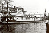
| MAJESTIC (Showboat) Majestic (riverboat) The Majestic is a historic riverboat in Cincinnati, Ohio. It was declared a National Historic Landmark on December 20, 1989.The last of the original travelling showboats, she was built in 1920 and plied the Ohio River for many years offering shows at towns along the way... |
Cincinnati Cincinnati, Ohio Cincinnati is a city in the U.S. state of Ohio. Cincinnati is the county seat of Hamilton County. Settled in 1788, the city is located to north of the Ohio River at the Ohio-Kentucky border, near Indiana. The population within city limits is 296,943 according to the 2010 census, making it Ohio's... 39.0949699572°N 84.5046695876°W |
Hamilton Hamilton County, Ohio As of 2000, there were 845,303 people, 346,790 households, and 212,582 families residing in the county. The population density was 2,075 people per square mile . There were 373,393 housing units at an average density of 917 per square mile... |
NRHP 89002456 | |||
| William H. McGuffey Boyhood Home Site William H. McGuffey Boyhood Home Site The William H. McGuffey Boyhood Home Site is a National Historic Landmark in Mahoning County, Ohio. It represents the location where William H. McGuffey, creator of the McGuffey Readers first resided in Ohio. The original property was first occupied by the McGuffey family as early as 1802, but... |
Coitsville Township 41.115833°N 80.558611°W |
Mahoning | NRHP 66000617 | |||
| William H. McGuffey House William H. McGuffey House William H. McGuffey House, also known as the William Holmes McGuffey Museum, is a National Historic Landmark house museum on the campus of Miami University in Oxford, Ohio, United States... |
Oxford Oxford, Ohio Oxford is a city in northwestern Butler County, Ohio, United States, in the southwestern portion of the state. It lies in Oxford Township, originally called the College Township. The population was 21,943 at the 2000 census. This college town was founded as a home for Miami University. Oxford... 39.507230°N 84.736078°W |
Butler Butler County, Ohio Butler County is a county located in the state of Ohio, United States. As of 2010, the population was 368,130. Its county seat is Hamilton. It is named for General Richard Butler, who died in 1791 fighting Indians in northern Ohio. Butler's army marched out of Fort Hamilton, where the city of... |
NRHP 66000605 | |||
| William McKinley Tomb | 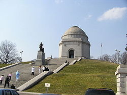 |
Canton Canton, Ohio Canton is the county seat of Stark County in northeastern Ohio, approximately south of Akron and south of Cleveland.The City of Caton is the largest incorporated area within the Canton-Massillon Metropolitan Statistical Area... 40.806667°N 81.3925°W |
Stark Stark County, Ohio Stark County is a county located in the U.S. state of Ohio. As of the 2010 census, the population was 375,586. It is included in the Canton-Massillon, Ohio Metropolitan Statistical Area.... |
NRHP 70000516 | ||
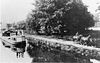
| Miami and Erie Canal Deep Cut Miami and Erie Canal Deep Cut The Miami and Erie Canal Deep Cut is a preserved, long, segment of the Miami and Erie Canal, United States. In order to avoid using locks to go over a ridge, the canal was dug deeply into the ridge, far more than the five-foot depth of the canal itself. Workers dug the canal bed up to fifty-two... |
 |
Spencerville Spencerville, Ohio Spencerville is a village in Allen County, Ohio, United States with a population of 2,235 as of the 2000 U.S. census. It is included in the Lima, Ohio Metropolitan Statistical Area.-Geography:Spencerville is located at .... 40.6875°N 84.365278°W |
Allen Allen County, Ohio Allen County is a county located in the U.S. state of Ohio. Its population was 106,331 as of the 2010 census. It is included in the Lima, Ohio Metropolitan Statistical Area as well as the Lima–Van Wert–Wapakoneta Combined Statistical Area.... and Auglaize Auglaize County, Ohio As of the census of 2000, there were 46,611 people, 17,376 households, and 12,771 families residing in the county. The population density was 116 people per square mile . There were 18,470 housing units at an average density of 46 per square mile... |
Mile long segment of the Miami and Erie Canal Miami and Erie Canal The Miami and Erie Canal was a canal that connected the Ohio River in Cincinnati, Ohio with Lake Erie in Toledo, Ohio. Construction on the canal began in 1825 and was completed in 1845. It consisted of 19 aqueducts, three guard locks, and 103 canal locks. Each lock measured by and they... cut as deep as 52 feet (15.8 m), in order to cut a trough through a blue clay ridge separating the St. Marys and Auglaize River Auglaize River The Auglaize River is a tributary of the Maumee River in northwestern Ohio in the United States. It drains a primarily rural farming area in the watershed of Lake Erie. The name of the river either comes from a Shawnee phrase meaning "fallen timbers" or a French term for "frozen water."It rises in... watersheds |
||
| Mount Pleasant Historic District Mount Pleasant Historic District (Mt. Pleasant, Ohio) The town of Mount Pleasant was established in 1803 by Robert Carothers, an Irishman from Virginia, and Jesse Thomas, a Quaker from North Carolina. Some or all of the down is designated as Mount Pleasant Historic District, a U.S. National Historic Landmark District.It is important for the role it... |
Mt. Pleasant Mount Pleasant, Ohio Mount Pleasant is a village in Jefferson County, Ohio, in the United States. As of the 2000 census, the village population was 535. It is part of the Weirton–Steubenville, WV-OH Metropolitan Statistical Area.-History:... 40.174444°N 80.798611°W |
Jefferson Jefferson County, Ohio Jefferson County is a county located in the state of Ohio. As of 2010, the population was 69,709. Its county seat is Steubenville and is named for Thomas Jefferson, who was at the time Vice President.... |
NRHP 74001536 | |||
| Newark Earthworks Newark Earthworks The Newark Earthworks in Newark and Heath, Ohio, consists of three sections of preserved earthworks: the Great Circle Earthworks, the Octagon Earthworks, and the Wright Earthworks. This complex contained the largest earthen enclosures in the world, being about 3,000 acres in extent. Today, the... |
Heath Heath, Ohio As of the census of 2000, there were 8,527 people, 3,403 households, and 2,375 families residing in the city. The population density was 816.6 people per square mile . There were 3,593 housing units at an average density of 344.1 per square mile... and Newark Newark, Ohio In addition, the remains of a road leading south from the Octagon have been documented and explored. It was first surveyed in the 19th century, when its walls were more apparent. Called the Great Hopewell Road, it may extend to the Hopewell complex at Chillicothe, Ohio... 40.042167°N 82.430111°W |
Licking Licking County, Ohio Licking County is a county located in the state of Ohio, United States. As of the 2010 census, the population was 166,492. Its county seat is Newark and is named for the salt licks that were in the area.... |
NRHP 66000614 | |||
| Oberlin College Oberlin College Oberlin College is a private liberal arts college in Oberlin, Ohio, noteworthy for having been the first American institution of higher learning to regularly admit female and black students. Connected to the college is the Oberlin Conservatory of Music, the oldest continuously operating... |
 |
Oberlin Oberlin, Ohio Oberlin is a city in Lorain County, Ohio, United States, to the south and west of Cleveland. Oberlin is perhaps best known for being the home of Oberlin College, a liberal arts college and music conservatory with approximately 3,000 students... 41.292929°N 82.218576°W |
Lorain Lorain County, Ohio Lorain County is a county located in the U.S. state of Ohio, and is considered to be a part of what is locally referred to as Greater Cleveland. As of the 2010 census, its population was 301,356. an increase from 284,664 in 2000... |
NRHP 66000615 | ||
| Ohio and Erie Canal Ohio and Erie Canal The Ohio Canal or Ohio and Erie Canal was a canal constructed in the 1820s and early 1830s. It connected Akron, Summit County, with the Cuyahoga River near its mouth on Lake Erie in Cleveland, Cuyahoga County, and a few years later, with the Ohio River near Portsmouth, Scioto County, and then... |
 |
Valley View Valley View, Ohio Valley View is a village in Cuyahoga County, Ohio, United States. The population was 2,034 at the 2010 census. It is a suburb of Cleveland with a town council form of government. It is part of a school district that also includes nearby Cuyahoga Heights and Brooklyn Heights... 41.370525°N 81.616442°W |
Cuyahoga Cuyahoga County, Ohio Cuyahoga County is a county located in the state of Ohio, United States. It is the most populous county in Ohio; as of the 2010 census, the population was 1,280,122. Its county seat is Cleveland. Cuyahoga County is part of Greater Cleveland, a metropolitan area, and Northeast Ohio, a... |
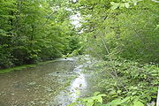
A four mile (6 km) section of canal, including Tinkers Creek Aqueduct Tinkers Creek Aqueduct Tinkers Creek Aqueduct is an aqueduct that was constructed to bridge the Ohio and Erie Canal over Tinkers Creek near its confluence with the Cuyahoga River in Valley View, Ohio. It is a relatively rare surviving example of an Ohio and Erie Canal aqueduct. It was originally constructed in... |
||
| Ohio Statehouse Ohio Statehouse The Ohio Statehouse, located in Columbus, Ohio, is the house of government for the state of Ohio. The Greek Revival building houses the Ohio General Assembly and the ceremonial offices of the Governor, Lieutenant Governor, Treasurer, and Auditor.... |
 |
Columbus Columbus, Ohio Columbus is the capital of and the largest city in the U.S. state of Ohio. The broader metropolitan area encompasses several counties and is the third largest in Ohio behind those of Cleveland and Cincinnati. Columbus is the third largest city in the American Midwest, and the fifteenth largest city... 39.9505364549°N 82.9987279098°W |
Franklin Franklin County, Ohio Franklin County is a county located in the state of Ohio, United States. In 2010 the population was 1,163,414, making it the second largest county in Ohio and the 34th largest county in population in the United States. Franklin County is also the largest in the eight-county Columbus, Ohio... |
NRHP 72001011 | ||
| Ohio Theatre |  |
Columbus Columbus, Ohio Columbus is the capital of and the largest city in the U.S. state of Ohio. The broader metropolitan area encompasses several counties and is the third largest in Ohio behind those of Cleveland and Cincinnati. Columbus is the third largest city in the American Midwest, and the fifteenth largest city... 39.960281°N 82.999078°W |
Franklin Franklin County, Ohio Franklin County is a county located in the state of Ohio, United States. In 2010 the population was 1,163,414, making it the second largest county in Ohio and the 34th largest county in population in the United States. Franklin County is also the largest in the eight-county Columbus, Ohio... |
NRHP 73001437 | ||
| John P. Parker House John P. Parker House The John P. Parker House is a National Historic Landmark in Ripley, Ohio. It was home to former slave and inventor John P. Parker from 1853 to his death in 1900, and was a stop on the Underground Railroad.... |
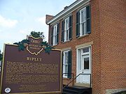 |
Ripley Ripley, Ohio Ripley is a village in Brown County, Ohio, United States, along the Ohio River 50 miles southeast of Cincinnati. The population was 1,745 at the 2000 census.-History:... 38.748852°N 83.848872°W |
Brown Brown County, Ohio As of the census of 2000, there were 42,285 people, 15,555 households, and 11,790 families residing in the county. The population density was 86 people per square mile . There were 17,193 housing units at an average density of 35 per square mile... |
NRHP 97000340 | ||
| George Hunt Pendleton House George Hunt Pendleton House The George H. Pendleton House is located at 559 Liberty Hill in the Prospect Hill Historic District of Cincinnati, Ohio. From 1879 until his death in 1889, this was the residence of Senator George Hunt Pendleton. He was a lawyer and politician. As a U.S. Senator , Pendleton spearheaded civil... |
 |
Cincinnati Cincinnati, Ohio Cincinnati is a city in the U.S. state of Ohio. Cincinnati is the county seat of Hamilton County. Settled in 1788, the city is located to north of the Ohio River at the Ohio-Kentucky border, near Indiana. The population within city limits is 296,943 according to the 2010 census, making it Ohio's... 39.110101803°N 84.5044826615°W |
Hamilton Hamilton County, Ohio As of 2000, there were 845,303 people, 346,790 households, and 212,582 families residing in the county. The population density was 2,075 people per square mile . There were 373,393 housing units at an average density of 917 per square mile... |
NRHP 66000611 | ||
| Pennsylvania Railroad Depot and Baggage Room | Dennison Dennison, Ohio Dennison is a village in Tuscarawas County, Ohio, United States. The population was 2,992 at the 2000 census, while the 2006 Census Bureau estimate listed a population of 2,908.- History :... |
Tuscarawas Tuscarawas County, Ohio Tuscarawas County is a county located in the eastern part of the state of Ohio. As of the 2010 census, the population was 92,582. Its county seat is New Philadelphia... |
||||
| People's Federal Savings and Loan Association People's Federal Savings and Loan Association The People's Federal Savings and Loan Association in Sidney is an early-modern building in western Ohio, designed by Chicago architect Louis Sullivan, the mentor of Frank Lloyd Wright. It was designed and built in 1917 for use by Peoples Federal Savings and Loan Association, which still operates... |
 |
Sidney Sidney, Ohio Sidney is a city in Shelby County, Ohio, United States. The population was 20,211 at the 2000 census. It is named after English poet Sir Phillip Sidney and is the county seat of Shelby County.Sidney was the recipient of the 1964 All-America City Award... 40.284410°N 84.156437°W |
Shelby Shelby County, Ohio As of the census of 2000, there were 47,910 people, 17,636 households, and 13,085 families residing in the county. The population density was 117 people per square mile . There were 18,682 housing units at an average density of 46 per square mile... |
Louis Sullivan Louis Sullivan Louis Henri Sullivan was an American architect, and has been called the "father of skyscrapers" and "father of modernism" He is considered by many as the creator of the modern skyscraper, was an influential architect and critic of the Chicago School, was a mentor to Frank Lloyd Wright, and an... -designed bank building |
||
| Plum Street Temple | Cincinnati Cincinnati, Ohio Cincinnati is a city in the U.S. state of Ohio. Cincinnati is the county seat of Hamilton County. Settled in 1788, the city is located to north of the Ohio River at the Ohio-Kentucky border, near Indiana. The population within city limits is 296,943 according to the 2010 census, making it Ohio's... 39.103937°N 84.518678°W |
Hamilton Hamilton County, Ohio As of 2000, there were 845,303 people, 346,790 households, and 212,582 families residing in the county. The population density was 2,075 people per square mile . There were 373,393 housing units at an average density of 917 per square mile... |
NRHP 72001021 | |||
| John Rankin House | 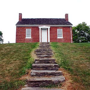 |
Ripley Ripley, Ohio Ripley is a village in Brown County, Ohio, United States, along the Ohio River 50 miles southeast of Cincinnati. The population was 1,745 at the 2000 census.-History:... 38.751111°N 83.842222°W |
Brown Brown County, Ohio As of the census of 2000, there were 42,285 people, 15,555 households, and 11,790 families residing in the county. The population density was 86 people per square mile . There were 17,193 housing units at an average density of 35 per square mile... |
Home of John Rankin John Rankin (abolitionist) John Rankin was an American Presbyterian minister, educator and abolitionist. Upon moving to Ripley, Ohio in 1822, he became known as one of Ohio's first and most active "conductors" on the Underground Railroad... , abolitionist. |
||
| Captain Edward V. Rickenbacker House | Columbus Columbus, Ohio Columbus is the capital of and the largest city in the U.S. state of Ohio. The broader metropolitan area encompasses several counties and is the third largest in Ohio behind those of Cleveland and Cincinnati. Columbus is the third largest city in the American Midwest, and the fifteenth largest city... 39.949339°N 82.962179°W |
Franklin Franklin County, Ohio Franklin County is a county located in the state of Ohio, United States. In 2010 the population was 1,163,414, making it the second largest county in Ohio and the 34th largest county in population in the United States. Franklin County is also the largest in the eight-county Columbus, Ohio... |
NRHP 76001426 | |||
| S. Bridge, National Road S Bridge, National Road The S Bridge derives its name from its sharply-curving approaches. Built in 1828, the single-arch stone bridge on Bridgewater Road carried the National Road and is one of four S bridges in Guernsey County, Ohio.... |
 |
Old Washington Old Washington, Ohio Old Washington is a village in Guernsey County, Ohio, United States. The population was 265 at the 2000 census.-History:In July 1863, Old Washington was the site of a small engagement during the course of Morgan's Raid... 40.0432980735°N 81.3743001629°W |
Guernsey Guernsey County, Ohio Guernsey County is a county located in the state of Ohio. As of 2010, the population was 40,087. Its county seat is Cambridge and is named for the Isle of Guernsey in the English Channel, from which many of the county's early settlers came.... |
NRHP 66000610 | ||
| STE. CLAIRE Ste. Claire (passenger steamboat) SS Ste. Claire is a steamship located in River Rouge, Michigan that was formerly located in Detroit, Michigan. It was declared a U.S. National Historic Landmark in 1992.The ship was designed by Frank E. Kirby, who also designed the SS Columbia.... |
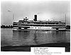 |
Toledo Toledo, Ohio Toledo is the fourth most populous city in the U.S. state of Ohio and is the county seat of Lucas County. Toledo is in northwest Ohio, on the western end of Lake Erie, and borders the State of Michigan... 41.665556°N 83.575278°W |
Lucas Lucas County, Ohio ----... |
Relocated from Michigan. | ||
| Serpent Mound Serpent Mound The Great Serpent Mound is a -long, three-foot-high prehistoric effigy mound located on a plateau of the Serpent Mound crater along Ohio Brush Creek in Adams County, Ohio. Maintained within a park by the Ohio Historical Society, it has been designated a National Historic Landmark by the United... |
 |
Locust Grove 39°01′N 83°26′W |
Adams Adams County, Ohio As of the census of 2000, there were 27,330 people, 10,501 households, and 7,613 families residing in the county. The population density was 47 people per square mile . There were 11,822 housing units at an average density of 20 per square mile... |
NRHP 66000602 | ||
| Sherman Birthplace John Sherman Birthplace Sherman Birthplace, also known as Sherman House Museum is a site in Lancaster, Ohio significant for its association with births and lives of U.S. senator John Sherman and one of his older brother's William T. Sherman, a Union general in the American Civil War.It was declared a National Historic... |
Lancaster Lancaster, Ohio Lancaster is a city in Fairfield County, Ohio, United States. As of the 2010 census, the city population was 38,780. It is located near the Hocking River, approximately southeast of Columbus, Ohio. It is the county seat of Fairfield County... 39.713722°N 82.600988°W |
Fairfield Fairfield County, Ohio Fairfield County is a county located in the state of Ohio, United States. As of 2010, the population was 146,156. Its county seat is Lancaster. Its name is a reference to the Fairfield area of the original Lancaster.... |
NRHP 66000609. | |||
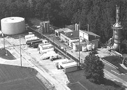
| Spacecraft Propulsion Research Facility (B-2) Spacecraft Propulsion Research Facility The Spacecraft Propulsion Research Facility is "significant in the development of the Centaur Rocket, which has launched some of America's most important space probes... |
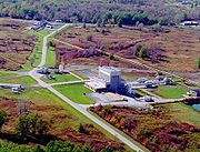 |
Sandusky Sandusky, Ohio Sandusky is a city in the U.S. state of Ohio and the county seat of Erie County. It is located in northern Ohio and is situated on the shores of Lake Erie, almost exactly half-way between Toledo to the west and Cleveland to the east.... 41.3651406762°N 82.6836998588°W |
Erie Erie County, Ohio As of the census of 2000, there were 79,551 people, 31,727 households, and 21,764 families residing in the county. The population density was 312 people per square mile . There were 35,909 housing units at an average density of 141 per square mile... |
NRHP 85002802 | ||
| Spiegel Grove (Rutherford B. Hayes Summer Home) Spiegel Grove Spiegel Grove, also known as Spiegel Grove State Park, Rutherford B. Hayes House, Rutherford B. Hayes Summer Home and Rutherford B. Hayes State Memorial is an historic site that was the estate of Civil War general and nineteenth President of the United States Rutherford B Hayes. It is located at... |
 |
Fremont Fremont, Ohio Fremont Public Schools enroll 4,450 students in public primary and secondary schools. The district administers 9 public schools including seven elementary schools, one middle school, and one high school, Fremont Ross. In addition, the city is home to one private catholic high school, Saint Joseph... 41.342037°N 83.126354°W |
Sandusky Sandusky County, Ohio Sandusky County is a county in the U.S. state of Ohio. As of the 2010 census, the population was 60,944. Its county seat is Fremont and it is named for a native word meaning "water" .... |
Estate of U.S. president Rutherford B. Hayes Rutherford B. Hayes Rutherford Birchard Hayes was the 19th President of the United States . As president, he oversaw the end of Reconstruction and the United States' entry into the Second Industrial Revolution... , now a state park |
||
| Spring Grove Cemetery Spring Grove Cemetery Spring Grove Cemetery and Arboretum is a nonprofit garden cemetery and arboretum located at 4521 Spring Grove Avenue, Cincinnati, Ohio. It is the second largest cemetery in the United States and is recognized as a U.S. National Historic Landmark.... |
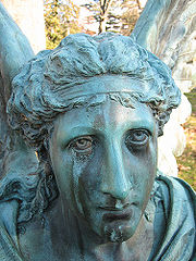 |
Cincinnati Cincinnati, Ohio Cincinnati is a city in the U.S. state of Ohio. Cincinnati is the county seat of Hamilton County. Settled in 1788, the city is located to north of the Ohio River at the Ohio-Kentucky border, near Indiana. The population within city limits is 296,943 according to the 2010 census, making it Ohio's... 39.164661°N 84.522949°W |
Hamilton Hamilton County, Ohio As of 2000, there were 845,303 people, 346,790 households, and 212,582 families residing in the county. The population density was 2,075 people per square mile . There were 373,393 housing units at an average density of 917 per square mile... |
|||
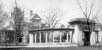
| Stan Hywet Hall | Akron Akron, Ohio Akron , is the fifth largest city in the U.S. state of Ohio and the county seat of Summit County. It is located in the Great Lakes region approximately south of Lake Erie along the Little Cuyahoga River. As of the 2010 census, the city had a population of 199,110. The Akron Metropolitan... 41.117104°N 81.548583°W |
Summit Summit County, Ohio Summit County is an urban county located in the state of Ohio, United States. As of the 2000 census, the population was 542,899. In the 2010 Census the population was 541,781. Its county seat is Akron... |
NRHP 75002058. | |||
| Sunwatch Site SunWatch Indian Village SunWatch Indian Village / Archaeological Park is a recreated Fort Ancient Native American village that sits alongside the Great Miami River in Dayton, Ohio.... |
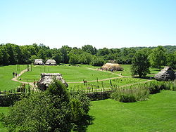 |
Dayton Dayton, Ohio Dayton is the 6th largest city in the U.S. state of Ohio and the county seat of Montgomery County, the fifth most populous county in the state. The population was 141,527 at the 2010 census. The Dayton Metropolitan Statistical Area had a population of 841,502 in the 2010 census... 39.71321°N 84.231861°W |
Montgomery Montgomery County, Ohio Montgomery County is a county located in the state of Ohio, United States. The population was 535,153 in the 2010 Census. It was named in honor of Richard Montgomery, an American Revolutionary War general killed in 1775 while attempting to capture Quebec City, Canada. The county seat is Dayton... |
|||
| Alphonso Taft Home (William Howard Taft Home) William Howard Taft National Historic Site William Howard Taft National Historic Site is a National Historic Site in Cincinnati, Ohio, maintained by the National Park Service of the United States... |
 |
Cincinnati Cincinnati, Ohio Cincinnati is a city in the U.S. state of Ohio. Cincinnati is the county seat of Hamilton County. Settled in 1788, the city is located to north of the Ohio River at the Ohio-Kentucky border, near Indiana. The population within city limits is 296,943 according to the 2010 census, making it Ohio's... 39.100706895°N 84.5033109776°W |
Hamilton Hamilton County, Ohio As of 2000, there were 845,303 people, 346,790 households, and 212,582 families residing in the county. The population density was 2,075 people per square mile . There were 373,393 housing units at an average density of 917 per square mile... |
Birthplace and home until age 25 of U.S. President William Howard Taft William Howard Taft William Howard Taft was the 27th President of the United States and later the tenth Chief Justice of the United States... |
||
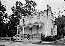
| John B. Tytus House | Middletown Middletown, Ohio Middletown is an All-America City located in Butler and Warren counties in the southwestern part of the U.S. state of Ohio. Formerly in Lemon, Turtlecreek, and Franklin townships, Middletown was incorporated by the Ohio General Assembly on February 11, 1833, and became a city in 1886... 39.513148°N 84.408301°W |
Butler Butler County, Ohio Butler County is a county located in the state of Ohio, United States. As of 2010, the population was 368,130. Its county seat is Hamilton. It is named for General Richard Butler, who died in 1791 fighting Indians in northern Ohio. Butler's army marched out of Fort Hamilton, where the city of... |
NRHP 750201335 | |||
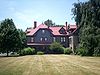
| Harriet Taylor Upton House Harriet Taylor Upton House The Harriet Taylor Upton House in Warren, Ohio was the residence of suffragette Harriet Taylor Upton from 1887 to 1931. Built in the Egyptian Revival style in 1840 by General Simon Perkins, the house was the headquarters of Upton's National American Woman's Suffrage Association from 1903 to 1905. ... |
Warren Warren, Ohio As of the census of 2000, there were 46,832 people, 19,288 households and 12,035 families residing in the city. The population density was 2,912.4 people per square mile . There were 21,279 housing units at an average density of 1,322.9 per square mile... 41.239442°N 80.822558°W |
Trumbull Trumbull County, Ohio As of the census of 2000, there were 225,116 people, 89,020 households, and 61,690 families residing in the county. The population density was 365 people per square mile . There were 95,117 housing units at an average density of 154 per square mile... |
NRHP 92001884 | |||
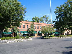
| Village of Mariemont |  |
Mariemont Mariemont, Ohio Mariemont is a planned community village in Hamilton County, Ohio, United States. It includes one or two historic districts, Village of Mariemont and Mariemont Historic District. Founded in the 1920s by Mary Emery, Mariemont exhibits English architecture from Norman to classic Georgian style... 39.143056°N 84.380833°W |
Hamilton Hamilton County, Ohio As of 2000, there were 845,303 people, 346,790 households, and 212,582 families residing in the county. The population density was 2,075 people per square mile . There were 373,393 housing units at an average density of 917 per square mile... |
NRHP 07000431 | ||
| W.P. SNYDER, JR. (Towboat) W.P. Snyder, Jr. (Towboat) W.P. SNYDER, JR. , also known as W.H. CLINGERMAN, W.P. Snyder,Jr. State Memorial, or J.L. PERRY, is a U.S. National Historic Landmark.... |
 |
Marietta Marietta, Ohio Marietta is a city in and the county seat of Washington County, Ohio, United States. During 1788, pioneers to the Ohio Country established Marietta as the first permanent American settlement of the new United States in the Northwest Territory. Marietta is located in southeastern Ohio at the mouth... 39.4183014844°N 81.4632912117°W |
Washington Washington County, Ohio Washington County is a county located in the state of Ohio. As of the 2010 census, the population was 61,778. Its county seat is Marietta. The county, the oldest in the state, is named for George Washington. Washington County is included in the Parkersburg-Marietta-Vienna, West Virginia-Ohio... |
NRHP 70000522. | ||
| Wright Cycle Company And Wright Printing Shop Wright Cycle Company The bicycle business of the Wright brothers, the Wright Cycle Company occupied five different locations in Dayton, Ohio. Orville and Wilbur Wright began their bicycle repair business in 1892, and soon added rentals and sales. In 1896 they began manufacturing and selling bicycles of their own... |
Dayton Dayton, Ohio Dayton is the 6th largest city in the U.S. state of Ohio and the county seat of Montgomery County, the fifth most populous county in the state. The population was 141,527 at the 2010 census. The Dayton Metropolitan Statistical Area had a population of 841,502 in the 2010 census... 39.755525°N 84.212047°W |
Montgomery Montgomery County, Ohio Montgomery County is a county located in the state of Ohio, United States. The population was 535,153 in the 2010 Census. It was named in honor of Richard Montgomery, an American Revolutionary War general killed in 1775 while attempting to capture Quebec City, Canada. The county seat is Dayton... |
||||
| Wright Flyer III Wright Flyer III The Wright Flyer III was the third powered aircraft built by the Wright Brothers. Orville Wright made the first flight with it on June 23, 1905. The Flyer III had an airframe of spruce construction with a wing camber of 1-in-20 as used in 1903, rather than the less effective 1-in-25 used in 1904... |
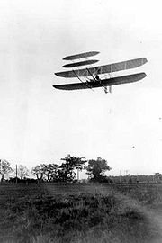 |
Dayton Dayton, Ohio Dayton is the 6th largest city in the U.S. state of Ohio and the county seat of Montgomery County, the fifth most populous county in the state. The population was 141,527 at the 2010 census. The Dayton Metropolitan Statistical Area had a population of 841,502 in the 2010 census... 39.7259069287°N 84.202073178°W |
Montgomery Montgomery County, Ohio Montgomery County is a county located in the state of Ohio, United States. The population was 535,153 in the 2010 Census. It was named in honor of Richard Montgomery, an American Revolutionary War general killed in 1775 while attempting to capture Quebec City, Canada. The county seat is Dayton... |
1905 Wright Flyer III airplane | ||
| Colonel Charles Young House Colonel Charles Young House The Colonel Charles Young house is a National Historic Landmark in Wilberforce, Ohio. A military leader, Col. Charles Young was born in 1864, the third African American graduate of West Point, first black U.S... |
Wilberforce Wilberforce, Ohio Wilberforce is a census-designated place in Greene County, Ohio, United States. The population was 1,579 at the 2000 census. The community was named for the English statesman William Wilberforce, who worked for abolition of slavery and achieved the end of the slave trade in the United Kingdom and... 39.6878326648°N 83.891110136°W |
Greene Greene County, Ohio Greene County is a county located in the state of Ohio, United States. The population was 161,573 in the 2010 Census. Its county seat is Xenia, and it was named for General Nathanael Greene, an officer in the Revolutionary War. Greene County was established on March 24, 1803.Greene County is part... |
NRHP 74001506 | |||
| Zero Gravity Research Facility |  |
Cleveland Cleveland, Ohio Cleveland is a city in the U.S. state of Ohio and is the county seat of Cuyahoga County, the most populous county in the state. The city is located in northeastern Ohio on the southern shore of Lake Erie, approximately west of the Pennsylvania border... 41.4102449443°N 81.8640998023°W |
Cuyahoga Cuyahoga County, Ohio Cuyahoga County is a county located in the state of Ohio, United States. It is the most populous county in Ohio; as of the 2010 census, the population was 1,280,122. Its county seat is Cleveland. Cuyahoga County is part of Greater Cleveland, a metropolitan area, and Northeast Ohio, a... |
NRHP 85002801. |
Historic areas of the National Park System in Ohio
National Historic Sites, National Historic Parks, National Memorials, and certain other areas listed in the National Park system are historic landmarks of national importance that are highly protected already, sometimes before the inauguration of the NHL program in 1960, and are then often not also named NHLs per se. There are six of these in Ohio. The National Park Service lists these six together with the NHLs in the state.The James A. Garfield National Historic Site
James A. Garfield National Historic Site
James A. Garfield National Historic Site is a United States National Historic Site located in Mentor, Ohio. The site preserves the property associated with the 20th President of the United States, James Abram Garfield.-History:...
and the William Howard Taft National Historic Site
William Howard Taft National Historic Site
William Howard Taft National Historic Site is a National Historic Site in Cincinnati, Ohio, maintained by the National Park Service of the United States...
are also designated as NHLs and are listed above. The remaining four are as follows.
| Landmark name |
Image | Date established | Location | County | Description | |
|---|---|---|---|---|---|---|
| Dayton Aviation Heritage National Historical Park Dayton Aviation Heritage National Historical Park thumb|left|200 px|The Wright Flyer III, now in Carillon Historical Park, shown being flown by Orville Wright on October 4, 1905, over [[Huffman Prairie]] near Dayton... |
 |
Dayton, Ohio Dayton, Ohio Dayton is the 6th largest city in the U.S. state of Ohio and the county seat of Montgomery County, the fifth most populous county in the state. The population was 141,527 at the 2010 census. The Dayton Metropolitan Statistical Area had a population of 841,502 in the 2010 census... |
Includes the Huffman Prairie Flying Field, Wright Cycle Company Wright Cycle Company The bicycle business of the Wright brothers, the Wright Cycle Company occupied five different locations in Dayton, Ohio. Orville and Wilbur Wright began their bicycle repair business in 1892, and soon added rentals and sales. In 1896 they began manufacturing and selling bicycles of their own... building, 1905 Wright Flyer III Wright Flyer III The Wright Flyer III was the third powered aircraft built by the Wright Brothers. Orville Wright made the first flight with it on June 23, 1905. The Flyer III had an airframe of spruce construction with a wing camber of 1-in-20 as used in 1903, rather than the less effective 1-in-25 used in 1904... , Paul Laurence Dunbar State Memorial Paul Laurence Dunbar House The Paul Laurence Dunbar House was the 1904-1906 home of poet Paul Laurence Dunbar in Dayton, Ohio. It is a historic house museum owned by the state of Ohio and operated by Dayton History on behalf of the Ohio Historical Society... , and Hawthorn Hill Hawthorn Hill Hawthorn Hill in Oakwood, Ohio, USA, was the post-1914 home of Orville, Milton, and Katharine Wright. Wilbur and Orville Wright intended for it to be their joint home, but Wilbur died in 1912, before the home's 1914 completion. The brothers hired the prominent Dayton architectural firm of... NHLs |
|||
| First Ladies National Historic Site First Ladies National Historic Site First Ladies National Historic Site is a United States National Historic Site located in Canton, Ohio. The site was established in 2000 to commemorate all the United States First Ladies and comprises two buildings: the Ida Saxton McKinley Historic Home and the Education & Research Center.Tours... |
Canton Canton, Ohio Canton is the county seat of Stark County in northeastern Ohio, approximately south of Akron and south of Cleveland.The City of Caton is the largest incorporated area within the Canton-Massillon Metropolitan Statistical Area... |
Stark Stark County, Ohio Stark County is a county located in the U.S. state of Ohio. As of the 2010 census, the population was 375,586. It is included in the Canton-Massillon, Ohio Metropolitan Statistical Area.... |
||||
| Hopewell Culture National Historical Park Hopewell Culture National Historical Park Hopewell Culture National Historical Park, formerly known as Mound City Group National Monument, is a United States national historical park with earthworks and burial mounds from the Hopewell culture, indigenous peoples who flourished from about 200 BC to AD 500. The park is composed of five... |
 |
Chillicothe Chillicothe, Ohio Chillicothe is a city in and the county seat of Ross County, Ohio, United States.Chillicothe was the first and third capital of Ohio and is located in southern Ohio along the Scioto River. The name comes from the Shawnee name Chalahgawtha, meaning "principal town", as it was a major settlement of... |
Ross Ross County, Ohio As of the census of 2000, there were 73,345 people, 27,136 households, and 19,185 families residing in the county. The population density was 106 people per square mile . There were 29,461 housing units at an average density of 43 per square mile... |
|||
| Perry's Victory and International Peace Memorial Perry's Victory and International Peace Memorial Perry's Victory and International Peace Memorial commemorates the Battle of Lake Erie, near Ohio's South Bass Island, in which Commodore Oliver Hazard Perry led a fleet to victory in one of the most significant naval battles to occur in the War of 1812... |
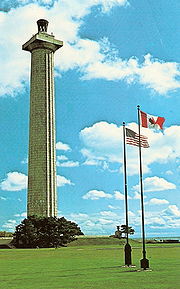 |
Put-in-Bay Put-in-Bay, Ohio Put-in-Bay is a village located on South Bass Island in Put-in-Bay Township, Ottawa County, Ohio, United States. Many believe that the name originates from some early maps of South Bass Island that showed the harbor being named Pudding Bay, probably because it was shaped like a pudding sack. The... |
Ottawa Ottawa County, Ohio Ottawa County is a county located in the state of Ohio, United States. As of the 2010 census, the population was 41,428. Its county seat is Port Clinton and is named either for the Ottawa Indians who lived there, or for an Indian word meaning "trader".... |
Former NHLs in Ohio
| Landmark name | Image | Year listed | Locality | County | Description | |
|---|---|---|---|---|---|---|
| Donald B. Donald B. (towboat) DONALD B, originally STANDARD, and now BARBARA H is a towboat that has been named a U.S. National Historic Landmark and is now based at Lamb, Indiana, across the Ohio River from Carrollton, Kentucky... |
 |
Georgetown Georgetown, Ohio Georgetown is a village in Brown County, Ohio, United States. The population was 3,691 at the 2000 census. It is the county seat of Brown County. Georgetown was the childhood home of Ulysses S... (formerly) |
Brown Brown County, Ohio As of the census of 2000, there were 42,285 people, 15,555 households, and 11,790 families residing in the county. The population density was 86 people per square mile . There were 17,193 housing units at an average density of 35 per square mile... (formerly) |
Towboat that has been relocated to Indiana | ||
| 2 | Hotel Breakers Hotel Breakers The Hotel Breakers, built in 1905, is a large historic Lake Erie resort hotel located at 1 Cedar Point Drive in the Cedar Point amusement park in Sandusky, Ohio.It was designated a U.S. National Historic Landmark in 1987 but was altered significantly in 1999... |
 |
Sandusky Sandusky, Ohio Sandusky is a city in the U.S. state of Ohio and the county seat of Erie County. It is located in northern Ohio and is situated on the shores of Lake Erie, almost exactly half-way between Toledo to the west and Cleveland to the east.... |
Erie Erie County, Ohio As of the census of 2000, there were 79,551 people, 31,727 households, and 21,764 families residing in the county. The population density was 312 people per square mile . There were 35,909 housing units at an average density of 141 per square mile... |
Significantly altered in 1999. Designation withdrawn, August 7, 2001 | |
| 3 | Rocket Engine Test Facility Rocket Engine Test Facility Rocket Engine Test Facility was the name of a facility at the NASA Glenn Research Center, formerly known as the Lewis Research Center, in Ohio.... |
 |
Cleveland Cleveland, Ohio Cleveland is a city in the U.S. state of Ohio and is the county seat of Cuyahoga County, the most populous county in the state. The city is located in northeastern Ohio on the southern shore of Lake Erie, approximately west of the Pennsylvania border... |
Cuyahoga Cuyahoga County, Ohio Cuyahoga County is a county located in the state of Ohio, United States. It is the most populous county in Ohio; as of the 2010 census, the population was 1,280,122. Its county seat is Cleveland. Cuyahoga County is part of Greater Cleveland, a metropolitan area, and Northeast Ohio, a... |
Demolished in 2003. Designation withdrawn, 4 April 2005 |
See also
- List of National Historic Landmarks by state
- National Register of Historic Places listings in Ohio