

List of Maryland hurricanes (1950–1979)
Encyclopedia

Tropical cyclone
A tropical cyclone is a storm system characterized by a large low-pressure center and numerous thunderstorms that produce strong winds and heavy rain. Tropical cyclones strengthen when water evaporated from the ocean is released as the saturated air rises, resulting in condensation of water vapor...
s have significantly affected the U.S. state of Maryland
Maryland
Maryland is a U.S. state located in the Mid Atlantic region of the United States, bordering Virginia, West Virginia, and the District of Columbia to its south and west; Pennsylvania to its north; and Delaware to its east...
. The Delmarva Peninsula
Delmarva Peninsula
The Delmarva Peninsula is a large peninsula on the East Coast of the United States, occupied by most of Delaware and portions of Maryland and Virginia...
is often affected by cyclones that brush the East Coast, while central and western Maryland commonly receive rainfall from the remnants of storms that make landfall elsewhere and track northward. Hurricanes are the most intense classification of tropical cyclones; tropical storms and tropical depressions are generally weaker.
Hurricane Agnes
Hurricane Agnes
Hurricane Agnes was the first tropical storm and first hurricane of the 1972 Atlantic hurricane season. A rare June hurricane, it made landfall on the Florida Panhandle before moving northeastward and ravaging the Mid-Atlantic region as a tropical storm...
of the 1972 season
1972 Atlantic hurricane season
The 1972 Atlantic hurricane season officially began on June 1, 1972, and lasted until November 30, 1972. These dates conventionally delimit the period of each year when most tropical cyclones form in the Atlantic basin. A strong El Niño kept hurricane activity at a minimum, and in fact the season...
was the deadliest storm, killing 19 people as a result of heavy flooding. Agnes was also the costliest storm, leaving about $80 million in damage. Hurricane Hazel
Hurricane Hazel
Hurricane Hazel was the deadliest and costliest hurricane of the 1954 Atlantic hurricane season. The storm killed as many as 1,000 people in Haiti before striking the United States near the border between North and South Carolina, as a Category 4 hurricane...
caused sustained hurricane-force winds (winds of 75 mph (121 km/h) or greater) in the state, the only storm during the time period to do so. No storms made landfall in Maryland at hurricane intensity. Between 1950 and 1979, tropical cyclones have collectively killed approximately 40 people and inflicted over $93 million in damage.
1950–1959
- September 9, 1950 – Outer moisture from Hurricane DogHurricane Dog (1950)Hurricane Dog was the most intense hurricane in the 1950 Atlantic hurricane season. The fourth named storm of the season, Dog developed on August 30 to the east of Antigua; after passing through the northern Lesser Antilles, it turned to the north and intensified into a Category 5 hurricane...
drops heavy rainfall in the Mid-Atlantic. In Bel AirBel Air, Harford County, MarylandThe town of Bel Air is the county seat of Harford County, Maryland, United States. According to the 2000 census the population of the town was 10,080. In 2009 the town's estimated population was 10,368...
, a car drove into the swollen Gunpowder RiverGunpowder RiverThe Gunpowder River is a tidal inlet on the western side of Chesapeake Bay in Maryland, United States. It is formed by the joining of two freshwater rivers, Gunpowder Falls and Little Gunpowder Falls.-Gunpowder Falls:The Big Gunpowder, long, begins in the extreme southern part of Pennsylvania's...
; three people in the car drowned and a fourth was injured. - September 1, 1952 – Tropical Storm Able crosses the state, although damage, if any, is unknown.
- October 15, 1954 – Hurricane HazelHurricane HazelHurricane Hazel was the deadliest and costliest hurricane of the 1954 Atlantic hurricane season. The storm killed as many as 1,000 people in Haiti before striking the United States near the border between North and South Carolina, as a Category 4 hurricane...
crosses the state, producing hurricane-force winds. In addition to wind damage, flooding was severe along the Chesapeake BayChesapeake BayThe Chesapeake Bay is the largest estuary in the United States. It lies off the Atlantic Ocean, surrounded by Maryland and Virginia. The Chesapeake Bay's drainage basin covers in the District of Columbia and parts of six states: New York, Pennsylvania, Delaware, Maryland, Virginia, and West...
, while flash flooding was reported inland. Overall, six deaths and about $11 million in damage were reported. - August 12, 1955 – Tropical Storm ConnieHurricane ConnieHurricane Connie was the first in a series of hurricanes to strike North Carolina during the 1955 Atlantic hurricane season. Connie struck as a Category 1, causing major flooding and inflicting extensive damage to the Outer Banks and inland to Raleigh....
makes landfall in southern Maryland, dropping heavy rainfall peaking at 12.32 in (312.9 mm) in PrestonPreston, MarylandPreston is a town in Caroline County, Maryland, United States. The population was 566 at the 2000 census. The ZIP code is 21655. The primary phone exchange is 673 and the area code is 410....
. The rainfall leads to flooding which causes $2.5 million in damage. When the schoonerSchoonerA schooner is a type of sailing vessel characterized by the use of fore-and-aft sails on two or more masts with the forward mast being no taller than the rear masts....
Levin J. Marvel capsizes in high seas, 14 people drown. - August 18, 1955 – As Tropical Storm DianeHurricane DianeHurricane Diane was one of three hurricanes to hit North Carolina during the 1955 Atlantic hurricane season, striking an area that had been hit by Hurricane Connie five days earlier...
begins its turn to the east-northeast over Virginia, associated heavy rains, combined with saturated grounds from Connie just days before, cause flooding in central parts of the state, especially along the Potomac RiverPotomac RiverThe Potomac River flows into the Chesapeake Bay, located along the mid-Atlantic coast of the United States. The river is approximately long, with a drainage area of about 14,700 square miles...
. - September 19, 1955 – Hurricane IoneHurricane IoneHurricane Ione was a strong, Category 3 hurricane that affected North Carolina in September 1955, bringing high winds and significant rainfall. It came on the heels of Hurricanes Connie and Diane, and compounded problems already caused by the two earlier hurricanes...
makes landfall in North CarolinaNorth CarolinaNorth Carolina is a state located in the southeastern United States. The state borders South Carolina and Georgia to the south, Tennessee to the west and Virginia to the north. North Carolina contains 100 counties. Its capital is Raleigh, and its largest city is Charlotte...
; its outer moisture produces light rainfall across the state. - September 28, 1956 – Hurricane FlossyHurricane Flossy (1956)Hurricane Flossy originated from a tropical disturbance in the eastern Pacific Ocean and moved across Central America into the Gulf of Mexico as a tropical depression on September 21, which became a tropical storm on September 22 and a hurricane on September 23...
passes southeast of the state, producing up to 3.3 in (83.8 mm) of rain. In nearby Washington, D.C.Washington, D.C.Washington, D.C., formally the District of Columbia and commonly referred to as Washington, "the District", or simply D.C., is the capital of the United States. On July 16, 1790, the United States Congress approved the creation of a permanent national capital as permitted by the U.S. Constitution....
, a peak wind gust of 45 mph (72.4 km/h) is reported. - September 28, 1958 – Hurricane HeleneHurricane Helene (1958)Hurricane Helene was the strongest hurricane in the 1958 Atlantic hurricane season, reaching peak winds of and tied with Hurricane Ilsa as the strongest tropical cyclone of the season. The system moved to the north of the West Indies and skirted the coast of the Southeast United States before...
remains well off of the Carolina coast, though light rain falls across the Mid-AtlanticMid-Atlantic StatesThe Mid-Atlantic states, also called middle Atlantic states or simply the mid Atlantic, form a region of the United States generally located between New England and the South...
states. - September 30, 1959 – The remnants of Hurricane GracieHurricane GracieHurricane Gracie was a major hurricane that formed in September 1959, the strongest during the 1959 Atlantic hurricane season and the most intense to strike the United States since Hurricane Hazel in 1954...
drop moderate rainfall over western Maryland.
1960–1969
- July 30, 1960 – Tropical Storm Brenda crosses southeastern Maryland. The storm's rainfall causes flooding in St. Mary's County.
- September 12, 1960 – Hurricane DonnaHurricane DonnaHurricane Donna in the 1960 Atlantic hurricane season was a Cape Verde-type hurricane which moved across the Leeward Islands, Puerto Rico, Hispanola, Cuba, The Bahamas, and every state on the East Coast of the United States...
passes just offshore, producing wind gusts of over 100 mph (160.9 km/h) in Ocean City. Flooding along the eastern shore causes two deaths. - September 21, 1961 – Hurricane EstherHurricane Esther (1961)Hurricane Esther was the fifth named storm and fifth hurricane of the 1961 Atlantic hurricane season. A long-lived Category 4 Cape Verde-type hurricane, Esther spent its lifetime offshore, before moving up the East Coast of the United States...
moves northward, parallel to the coast. Wind gusts to 45 mph (70 km/h) are observed at Ocean City, and storm surge flooding causes damage to the city's sea wall and boardwalkBoardwalkA boardwalk, in the conventional sense, is a wooden walkway for pedestrians and sometimes vehicles, often found along beaches, but they are also common as paths through wetlands, coastal dunes, and other sensitive environments....
.
- September 1, 1964 – In WesternportWesternport, MarylandWesternport is a town in Allegany County, Maryland, United States, located along the Georges Creek Valley. It is part of the Cumberland, MD-WV Metropolitan Statistical Area. The population was 2,104 at the 2000 census.-History:...
, 5.8 in (147.3 mm) of rain falls as Tropical Storm CleoHurricane CleoHurricane Cleo was the third named storm, first hurricane, and first major hurricane of the 1964 Atlantic hurricane season. Cleo was one of the longest-lived storms of the season...
tracks just south of the state. - October 4, 1964 – The remnants of Hurricane HildaHurricane HildaHurricane Hilda was the third hurricane to make landfall in the United States during the 1964 Atlantic hurricane season. Originating near Cuba, the cyclone intensified while moving through the Gulf of Mexico, and became a Category 4 hurricane in the Gulf of Mexico before striking Louisiana in...
cause light to moderate precipitation. - October 17, 1964 – The remnants of Hurricane Isbell drop light rainfall.
- September 13, 1965 – The remnants of Hurricane BetsyHurricane BetsyHurricane Betsy was a Category 4 hurricane of the 1965 Atlantic hurricane season which caused enormous damage in the Bahamas, Florida, and Louisiana. Betsy made its most intense landfall near the mouth of the Mississippi River, causing significant flooding of the waters of Lake Pontchartrain into...
produce light rainfall across western part of the state. - September 16, 1967 – Tropical Storm DoriaHurricane Doria (1967)Hurricane Doria was an unusual and erratic hurricane that existed during September 1967. The fourth named storm and hurricane of the 1967 Atlantic hurricane season, Doria developed on September 8 off the east coast of Florida. It meandered until attaining tropical storm status, at which point the...
makes landfall in Virginia; associated high seas damage the boardwalkBoardwalkA boardwalk, in the conventional sense, is a wooden walkway for pedestrians and sometimes vehicles, often found along beaches, but they are also common as paths through wetlands, coastal dunes, and other sensitive environments....
at Ocean City. - June 13, 1968 – Tropical Depression AbbyHurricane Abby (1968)Hurricane Abby was the first named storm and first hurricane of the 1968 Atlantic hurricane season. Abby was one of four tropical cyclones to strike Florida during the 1968 season and one of three tropical cyclones to form in June 1968...
produces 3.83 in (97.3 mm) of rainfall at CentrevilleCentreville, MarylandCentreville is an incorporated town in Queen Anne's County, Maryland, United States. Incorporated in 1794, it is the county seat of Queen Anne's County. The population was 1,970 at the 2000 census. The ZIP code is 21617 and the area code is 410. The local telephone exchange is 758...
. - June 26, 1968 – The remnants of Tropical Storm Candy drop moderate rainfall.
- September 11, 1968 – Tropical Depression Fourteen produces 4.68 in (118.9 mm) of rain near ParktonParkton, MarylandParkton is a rural area in the northern part of Baltimore County, Maryland, USA. It borders southern York County, PA, and this border forms part of The Mason-Dixon Line...
. - October 20, 1968 – As Hurricane GladysHurricane Gladys (1968)Hurricane Gladys was the most destructive hurricane in the 1968 Atlantic hurricane season, causing over $100 million in damage and ten deaths. The last storm of the season, it caused heavy rainfall along its path through the Western Caribbean Sea, Florida, and up through Atlantic Canada...
parallels the east coast, tides of up to 4 ft (1.2 m) are felt along the coast. As a result, street flooding is reported in Ocean City. - August 20, 1969 – The remnants of Hurricane CamilleHurricane CamilleHurricane Camille was the third and strongest tropical cyclone and second hurricane during the 1969 Atlantic hurricane season. The second of three catastrophic Category 5 hurricanes to make landfall in the United States during the 20th century , which it did near the mouth of the Mississippi River...
cause extensive flooding in VirginiaVirginiaThe Commonwealth of Virginia , is a U.S. state on the Atlantic Coast of the Southern United States. Virginia is nicknamed the "Old Dominion" and sometimes the "Mother of Presidents" after the eight U.S. presidents born there...
, though they drop only moderate rainfall peaking at 6.55 in (166.4 mm) in Maryland. - September 9, 1969 – Hurricane GerdaHurricane Gerda (1969)Hurricane Gerda was a North Atlantic tropical cyclone that formed during the 1969 Atlantic hurricane season. It was the seventh named storm, fifth hurricane and third major hurricane of the 1969 season. Gerda formed on September 6 and crossed Florida as a tropical depression...
intensifies offshore, prompting a hurricane watch for eastern Maryland. Because the storm remained offshore, only light precipitation falls.
1970–1979
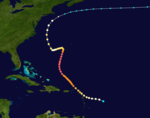
- August 28, 1971 – Tropical Storm DoriaTropical Storm Doria (1971)Tropical Storm Doria was the costliest tropical cyclone in the 1971 Atlantic hurricane season. The fifth tropical storm of the season, Doria developed from a tropical wave on August 20 to the east of the Lesser Antilles, and after five days without development it attained tropical storm status to...
parallels the east coast, resulting in tides 2.7 feet (0.8 m) above normal in Fort Henry. - September 13, 1971 – Tropical Storm Heidi passes offshore, dropping 2.86 in (72.6 mm) of rain in parts of the state.
- Early October, 1971 – The remnants of Hurricane Ginger make landfall in North CarolinaNorth CarolinaNorth Carolina is a state located in the southeastern United States. The state borders South Carolina and Georgia to the south, Tennessee to the west and Virginia to the north. North Carolina contains 100 counties. Its capital is Raleigh, and its largest city is Charlotte...
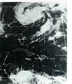
, turn north-northeast, and brush southern Maryland with light rainfall. - June 2, 1972 – Heavy rainfall from Tropical Storm AgnesHurricane AgnesHurricane Agnes was the first tropical storm and first hurricane of the 1972 Atlantic hurricane season. A rare June hurricane, it made landfall on the Florida Panhandle before moving northeastward and ravaging the Mid-Atlantic region as a tropical storm...
, combined with a separate low to the west, contribute to the state's worst flooding in 36 years. Severe damage and at least 19 deaths are reported throughout the region. Throughout the state, 1,930 were damaged, of which 103 were destroyed. 17 farm buildings were destroyed and 44 damaged, and 82 small businesses were destroyed. Total damage is estimated at $80 million. - September 3, 1972 – Tropical Storm CarrieTropical Storm Carrie (1972)Tropical Storm Carrie was a strong tropical storm that affected the East Coast of the United States in early September 1972. The third tropical cyclone of the 1972 Atlantic hurricane season, Carrie formed on August 29 from a complex sequence of meteorological events starting with the emergence of a...
remains well offshore, though its outer bands drop light precipitation across the southern Delmarva Peninsula. - September 23 – September 26, 1975 – Hurricane EloiseHurricane EloiseHurricane Eloise was the most destructive tropical cyclone of the 1975 Atlantic hurricane season. The fifth tropical storm, fourth hurricane, and second major hurricane of the season, Eloise formed as a tropical depression on September 13 to the east of the Virgin Islands...
becomes an extratropical frontal lowExtratropical cycloneExtratropical cyclones, sometimes called mid-latitude cyclones or wave cyclones, are a group of cyclones defined as synoptic scale low pressure weather systems that occur in the middle latitudes of the Earth having neither tropical nor polar characteristics, and are connected with fronts and...
over VirginiaVirginiaThe Commonwealth of Virginia , is a U.S. state on the Atlantic Coast of the Southern United States. Virginia is nicknamed the "Old Dominion" and sometimes the "Mother of Presidents" after the eight U.S. presidents born there...
. The storm's moisture drops 14.23 in (361.4 mm) of rain in WestminsterWestminster, MarylandWestminster is a city in northern Maryland, United States. It is the seat of Carroll County. The city's population was 18,590 at the 2010 census. Westminster is an outlying community within the Baltimore-Towson, MD MSA, which is part of a greater Washington-Baltimore-Northern Virginia, DC-MD-VA-WV...
, causing severe flooding, particularly in the Monocacy and Patapsco RiverPatapsco RiverThe Patapsco River is a river in central Maryland which flows into Chesapeake Bay. The river's tidal portion forms the harbor for the city of Baltimore...
basins. - October 27, 1975 – Tropical Storm Hallie becomes extratropical to the east of the state; light rain falls over the southern Delmarva PeninsulaDelmarva PeninsulaThe Delmarva Peninsula is a large peninsula on the East Coast of the United States, occupied by most of Delaware and portions of Maryland and Virginia...
. - August 9, 1976 – Hurricane BelleHurricane BelleHurricane Belle was the third tropical storm and first hurricane of the 1976 Atlantic hurricane season. The system formed as a tropical depression northeast of the Bahamas and strengthened as it moved northward towards New York and New England. Belle became a major hurricane that threatened much...
parallels the east coast, prompting hurricane warningsTropical cyclone warnings and watchesWarnings and watches are two levels of alert issued by national weather forecasting bodies to coastal areas threatened by the imminent approach of a tropical cyclone of tropical storm or hurricane intensity. They are notices to the local population and civil authorities to make appropriate...
for the coastline. The center of the storm passes to the east of the state, producing wind gusts of around 70 mph (112.7 km/h) at Ocean CityOcean City, MarylandOcean City, sometimes known as OC, or OCMD, is an Atlantic Ocean resort town in Worcester County, Maryland, United States. Ocean City is widely known in the Mid-Atlantic region of the United States and is a frequent destination for vacationers in that area...
. - Mid-September, 1976 – Subtropical Storm Three becomes extratropicalExtratropical cycloneExtratropical cyclones, sometimes called mid-latitude cyclones or wave cyclones, are a group of cyclones defined as synoptic scale low pressure weather systems that occur in the middle latitudes of the Earth having neither tropical nor polar characteristics, and are connected with fronts and...
to the south of the state. The resulting lowLow pressure areaA low-pressure area, or "low", is a region where the atmospheric pressure at sea level is below that of surrounding locations. Low-pressure systems form under areas of wind divergence which occur in upper levels of the troposphere. The formation process of a low-pressure area is known as...
moves northward, dropping moderate rainfall. - July 29 – July 31, 1979 – The remnants of Tropical Storm ClaudetteTropical Storm Claudette (1979)Tropical Storm Claudette was a long living tropical storm that produced heavy rain across Puerto Rico and Texas in late July 1979. The storm killed 2 people and left $1.1 billion in damage...
drop light, spotty rainfall in southern areas. - September 5, 1979 – Tropical Storm DavidHurricane DavidHurricane David was the fourth named tropical cyclone, second hurricane, and first major hurricane of the 1979 Atlantic hurricane season. A Category 5 hurricane on the Saffir-Simpson Hurricane Scale, David was among the deadliest hurricanes in the latter half of the 20th century, killing...
crosses the western part of the state, dropping up to 9.4 in (238.8 mm) of rainfall. Associated bands spawn seven tornadoTornadoA tornado is a violent, dangerous, rotating column of air that is in contact with both the surface of the earth and a cumulonimbus cloud or, in rare cases, the base of a cumulus cloud. They are often referred to as a twister or a cyclone, although the word cyclone is used in meteorology in a wider...
es throughout the state. One of the tornadoes strikes near CroftonCrofton, MarylandCrofton is a census-designated place and planned community in Anne Arundel County, Maryland, United States. Established in 1964, Crofton held its 40th birthday celebration in 2004....
, causing tree and structure damage, as well as one injury.
Monthly statistics
| Month | Number of recorded storms affecting Maryland |
|---|---|
| July | 3 |
| August | 5 |
| September | 16 |
| October | 5 |
Deadly storms
| Name | Year | Number of deaths |
|---|---|---|
| Hurricane Agnes Hurricane Agnes Hurricane Agnes was the first tropical storm and first hurricane of the 1972 Atlantic hurricane season. A rare June hurricane, it made landfall on the Florida Panhandle before moving northeastward and ravaging the Mid-Atlantic region as a tropical storm... |
1972 | 19 |
| Hurricane Connie Hurricane Connie Hurricane Connie was the first in a series of hurricanes to strike North Carolina during the 1955 Atlantic hurricane season. Connie struck as a Category 1, causing major flooding and inflicting extensive damage to the Outer Banks and inland to Raleigh.... |
1955 | 14 |
| Hurricane Hazel Hurricane Hazel Hurricane Hazel was the deadliest and costliest hurricane of the 1954 Atlantic hurricane season. The storm killed as many as 1,000 people in Haiti before striking the United States near the border between North and South Carolina, as a Category 4 hurricane... |
1954 | 6 |
| Hurricane Donna Hurricane Donna Hurricane Donna in the 1960 Atlantic hurricane season was a Cape Verde-type hurricane which moved across the Leeward Islands, Puerto Rico, Hispanola, Cuba, The Bahamas, and every state on the East Coast of the United States... |
1960 | 2 |
See also
- List of Maryland hurricanes (1980–present)
- List of Delaware hurricanes
- List of New Jersey hurricanes
- List of United States hurricanes
- List of Pennsylvania hurricanes