
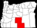
Lake County, Oregon
Encyclopedia
Lake County is a county in the high desert
south central region of the U.S. state
of Oregon
, so named for the many lakes found within its boundaries, including Lake Abert
, Hart Lake Reservoir, and Goose Lake
. While Lake is among Oregon's largest counties, it is sparsely populated with 7,895 residents in 2010. Its seat
is at Lakeview
Lake County is in a high desert region known as Oregon's Outback
, on the northwestern edge of the Great Basin
. The county is generally divided between the communities around Lakeview and Paisley
to the south and the communities around Christmas Valley
, Fort Rock
, and Silver Lake
to the north.
Its economy consists largely of agriculture and natural resource management and extraction. It is home to many large cattle ranches, hay farms, and timber holdings (both public and private), as well as several frontier towns and early 20th century homestead
s. Although lumber was once a primary economic driver in Lake County, today only one mill remains, at Lakeview.
s found in the Paisley Caves
in northern Lake County in 2007 have been radiocarbon dated
to 14,300 calendar years before present. DNA
extracted from these human remains bears certain genetic markers found only in Native American populations. Luther Cressman
found prehistoric artifacts in the Fort Rock Cave
s of northern Lake County in 1938, including basketry, stone tools, and a cache of woven sagebrush
bark sandals which have been dated to more than 10,000 years ago.
led Hudson's Bay Company
trappers to Goose Lake
in 1827. In 1832, the Hudson Bay trappers under John Work were in the Goose Lake Valley
and their journals mentioned Hunter's Hot Springs
. Work's expedition visited Warner Lakes
and Lake Abert
and camped at Crooked Creek
in the Chandler Park
area. There they documented eating wild plums
, which still grow in the area. They also reported being attacked by Indians.
In 1838, Colonel J. J. Abert, a U.S. engineer, prepared a map that includes Warner Lakes and other natural features using information from the Hudson Bay trappers. In 1843, John C. Fremont
led a party which named Christmas (Hart) Lake.
Lake County once hosted significant populations of Basque
and Irish
sheepherders. Disputes over grazing rights
, exacerbated by the introduction of wheat
farming, led to the eruption of range wars between cattle ranchers and sheep herders. At least one band of masked rifle
-armed cattlemen killed sheep in the northern part of the county and in Deschutes County during the early 20th century and they came to be known as "sheepshooters". According to the Oregon History Project, 2,300 sheep were killed in a single night in April 1904 in Lake County.
Lake County grew with the arrival of homesteaders, but the dry climate made for challenging development.
Lake County was created from Jackson
and Wasco
Counties on October 24, 1874, by the State Legislature. It then included the present Klamath County
and all of the present Lake County except Warner Valley
. In 1882, land was assigned to create Klamath County, and in 1885 the Warner area from Grant County
was added. Linkville, now Klamath Falls, was the first county seat.
M. Bullard gave 20 acres (80,000 m2) as the Lakeview townsite. By the 1875 election, a town had been started and an election moved the county seat to Lakeview. Because of poor transportation connections with the rest of Oregon, the early economic orientation of Lake County was toward California
: both the San Francisco Chronicle
and the San Francisco Examiner arrived in Lakeview daily, often before The Oregonian
. During the 1840s and 1850s the county was part of the military courier route between The Dalles
on the Columbia River
and the Presidio in San Francisco
.
The county acquired a railroad connection in the 1890s. That railroad spur, the Nevada-California-Oregon Railway
line running from Lakeview to Reno, Nevada
, emphasized the isolation of the county from the rest of Oregon. A devastating fire in 1900 destroyed much of Lakeview, including 75 businesses.
Lake County includes numerous cattle ranches. Irrigation has also permitted some agriculture based upon the raising of livestock and the growing of hay and grain despite the low rainfall and a short growing season.
Lumber and wood products are taken from the Fremont National Forest
, Bureau of Land Management
properties and private landholdings. The Collins Companies
operates the last remaining mill in the area, the Lakeview sawmill, and is also a large landowner in the region. Over 78% of the land in Lake County is owned and managed by the federal and state government.
The Lakeview
area of Lake County also includes a perlite
mine and once included uranium mining (now subject to clean-up operations). Several exploratory wells were dug for oil, but without success.
A railroad line ships timber products and perlite to Burlington Northern's rail hub in Alturas, California
. At one time the railway was the only County owned and operated rail line in the country.
Government employees from the national forest and the regional Bureau of Land Management
headquarters provide many of the higher paying salary job in an economy that otherwise would have to rely only on seasonal agricultural, tourism and lumber jobs. The Bureau of Land Management is landowner of 49% of the lands within the county.
Tourism is a growing industry because of the county's many attractions which include Hart Mountain National Antelope Refuge
, Hunter's Hot Springs, Goose Lake, Warner Canyon, hanggliding and areas for rock hunting.
Lake County is home to the Lakeview Hospital, and other regional health care facilities. It's also the location for The Warner Creek Correctional Facility opened in 2005 and is a 400-bed minimum security state prison. The prison employs an average of 110 correctional professionals and is located on a site comprising 91 acres (368,264.3 m²). The facility itself occupies less than 15 acres (60,702.9 m²) and utilizes approximately 117000 sq ft (10,869.7 m²). of building space which includes areas for inmate housing, work and education programs, health services, food services, religious services, physical plant, warehouse and storage, vehicle maintenance, a laundry facility, recreational activities, administration and various other functions. A unique feature of the prison is its use of natural geothermal sources deep inside the Earth. The geothermally heated water is pumped up through a well and piped into a heat exchange unit where the heat is then transferred to the prison’s water-loop system. Once the heat has been transferred and the water has cooled, the water is re-injected back into the ground. Two prisoners briefly escaped in 2008.
in Lake County, as well as most counties in eastern Oregon, are members of the Republican Party
. In the 2008 presidential election
, 71.53% of Lake County voters voted for Republican John McCain
, while 25.95% voted for Democrat
Barack Obama
and 1.53% of voters either voted for a Third Party
candidate or wrote in
a candidate. These numbers show a small shift towards the Democratic candidate when compared to the 2004 presidential election
, in which 77.8% of Lake Country voters voted for George W. Bush
, while 20.5% voted for John Kerry
, and 1.7% of voters either voted for a Third Party candidate or wrote in a candidate
.
, the county has a total area of 8358 mi2, of which 8136 mi2 is land and 223 mi2 (2.66%) is water.
Lake County ranges in elevation from 4130 to 8446 ft (1,258.8 to 2,574.3 m).
The area includes alkali lakes, high desert scrub, and forests of Western Juniper, Ponderosa Pine
, and Lodgepole Pine
in the hills and mountains. There are also several unusual geologic features and good areas for rockhounding and geological touring.
Lost Forest Research Natural Area
is a protected relic forest closely associated with the Christmas Valley Sand Dunes
in northeastern Lake County. Fossil Lake is an area nearby where many fossils of prehistoric animals have been identified. Glass Buttes is an obsidian
complex in the extreme northeast corner of the county. Crack in the Ground
, northeast of Christmas Valley is a long fissure with ice in its floor year round. Big Hole
, Hole-in-the-Ground
, and Fort Rock are ancient maar
craters in the northwestern part of the county.
of 2000, there were 7,422 people, 3,084 households, and 2,152 families residing in the county. The population density
was 1 person per square mile (0/km2). There were 3,999 housing units at an average density of 0 per square mile (0/km2). The racial makeup of the county was 90.97% White
, 0.13% Black
or African American
, 2.37% Native American
, 0.71% Asian
, 0.13% Pacific Islander
, 3.19% from other races
, and 2.48% from two or more races. 5.44% of the population were Hispanic
or Latino
of any race. 14.1% were of Irish
, 14.0% United States
or American, 13.8% German and 11.8% English
ancestry according to Census 2000. 95.9% spoke English
and 3.6% Spanish
as their first language.
There were 3,084 households out of which 29.00% had children under the age of 18 living with them, 58.60% were married couples
living together, 7.50% had a female householder with no husband present, and 30.20% were non-families. 26.20% of all households were made up of individuals and 11.10% had someone living alone who was 65 years of age or older. The average household size was 2.39 and the average family size was 2.84.
In the county, the population was spread out with 24.90% under the age of 18, 5.10% from 18 to 24, 24.30% from 25 to 44, 28.10% from 45 to 64, and 17.70% who were 65 years of age or older. The median age was 43 years. For every 100 females there were 100.50 males. For every 100 females age 18 and over, there were 98.30 males.
The median income for a household in the county was $29,506, and the median income for a family was $36,182. Males had a median income of $29,454 versus $23,475 for females. The per capita income
for the county was $16,136. About 13.40% of families and 16.10% of the population were below the poverty line, including 20.40% of those under age 18 and 9.50% of those age 65 or over.
bones and Native American
artifacts have been uncovered. The "world's oldest shoes" were found here in 1938, changing the dates range scientists believed that humans inhabited the far west from 4,000 years ago.
Several subsequent discoveries of even older sandals in the northern Great Basin confirmed the importance of archaeologist Luther Cressman
's work. For this find, and for other research that broke down standing theories about the nature of the prehistoric Northwest, Cressman became known as the father of Oregon archaeology.
Other sights in North Lake include the Lost Forest, Crack-in-the-ground, and Hole-in-the-ground
Oregon sunstones
are found north of Plush
. Sunstone is Oregon's state gemstone.
Other areas of interest include, Abert Lake and Abert Rim
, Goose Lake
, Hunter's Hot Springs and its Old Perpetual Geyser
, Schminck Memorial Museum and Lake County Museum, Lake County Round-Up Museum, Schmink Museum, Warner Canyon
ski area, Gearhart Mountain Wilderness
, Sheldon National Wildlife Refuge
, Summer Lake Hot Springs, sunstone
s (Oregon's state gemstone
) near Plush
, Warner Wetlands
, Summer Lake Wildlife Area
and sections of the Fremont National Forest
of the Fremont–Winema National Forests.
The Hart Mountain National Antelope Refuge
includes big-horn sheep, pronghorn antelope
, sage grouse
, predatory birds and migratory birds. The Lake County Examiner is located in Lakeview and has been published continuously since the late 19th century.
U.S. Highway 140
High Desert (Oregon)
The Oregon High Desert is a region of the U.S. state of Oregon, located east of the Cascade Range and south of the Blue Mountains, in the central and eastern parts of the state. Divided into a southern region and a northern region, the desert covers most of five Oregon counties and averages above...
south central region of the U.S. state
U.S. state
A U.S. state is any one of the 50 federated states of the United States of America that share sovereignty with the federal government. Because of this shared sovereignty, an American is a citizen both of the federal entity and of his or her state of domicile. Four states use the official title of...
of Oregon
Oregon
Oregon is a state in the Pacific Northwest region of the United States. It is located on the Pacific coast, with Washington to the north, California to the south, Nevada on the southeast and Idaho to the east. The Columbia and Snake rivers delineate much of Oregon's northern and eastern...
, so named for the many lakes found within its boundaries, including Lake Abert
Lake Abert
Lake Abert is a large, shallow, alkali lake in Lake County, Oregon, United States. It is approximately long and wide at its widest point. It is located northwest of the small, unincorporated community of Valley Falls, Oregon. The lake was named in honor of Colonel John James Abert by explorer...
, Hart Lake Reservoir, and Goose Lake
Goose Lake (Oregon-California)
Goose Lake is a large alkaline glacial lake located in the Goose Lake Valley on the Oregon-California border. The north end of the lake is in Lake County, Oregon and the south end is in Modoc County, California. The mountains at the north end of the lake are part of the Fremont National Forest...
. While Lake is among Oregon's largest counties, it is sparsely populated with 7,895 residents in 2010. Its seat
County seat
A county seat is an administrative center, or seat of government, for a county or civil parish. The term is primarily used in the United States....
is at Lakeview
Lakeview, Oregon
Lakeview is a city in Lake County, Oregon, United States. The population was 2,294 at the 2010 census. It is the county seat of Lake County. Although it is an incorporated city, the municipal government refers to the community as "The Town of Lakeview", and bills itself as "Tallest Town in Oregon"...
Lake County is in a high desert region known as Oregon's Outback
Oregon Outback
Oregon Outback is an unofficial term generally used to reference the high desert Basin and Range country of the central southern portion of the U.S...
, on the northwestern edge of the Great Basin
Great Basin
The Great Basin is the largest area of contiguous endorheic watersheds in North America and is noted for its arid conditions and Basin and Range topography that varies from the North American low point at Badwater Basin to the highest point of the contiguous United States, less than away at the...
. The county is generally divided between the communities around Lakeview and Paisley
Paisley, Oregon
Paisley is a city in Lake County, Oregon, United States. It is located along Oregon Route 31, between Summer Lake and Lake Abert. The population was 247 at the 2000 census.-History:...
to the south and the communities around Christmas Valley
Christmas Valley, Oregon
Christmas Valley is an unincorporated community in Lake County, Oregon, United States. The community was named after nearby dry Christmas Lake, east of the present townsite and the site of the former Lake post office, which ran from 1906 until 1943. Real estate development around a planned...
, Fort Rock
Fort Rock (Oregon)
Fort Rock is a volcanic landmark called a tuff ring, located on an ice age lake bed in north Lake County, Oregon, United States.The ring is about in diameter and stands about high above the surrounding plain. Its tall, straight sides resemble the palisades of a fort, thus giving the rock its name...
, and Silver Lake
Silver Lake (Oregon)
Silver Lake is a lake in Lake County, Oregon, United States. It is east of the community of Silver Lake. It is unknown who first gave the lake its descriptive name. Central Oregon residents attribute it to John C. Frémont, although no proof has been found, and he would not have seen the lake on...
to the north.
Its economy consists largely of agriculture and natural resource management and extraction. It is home to many large cattle ranches, hay farms, and timber holdings (both public and private), as well as several frontier towns and early 20th century homestead
Homestead (buildings)
A homestead is either a single building, or collection of buildings grouped together on a large agricultural holding, such as a ranch, station or a large agricultural operation of some other designation.-See also:* Farm house* Homestead Act...
s. Although lumber was once a primary economic driver in Lake County, today only one mill remains, at Lakeview.
Pre-Columbian
Pre-Clovis era coproliteCoprolite
A coprolite is fossilized animal dung. Coprolites are classified as trace fossils as opposed to body fossils, as they give evidence for the animal's behaviour rather than morphology. The name is derived from the Greek words κοπρος / kopros meaning 'dung' and λιθος / lithos meaning 'stone'. They...
s found in the Paisley Caves
Paisley Caves
The Paisley Caves complex is a system of four caves in an arid, desolate region of south-central Oregon, United States. One of the caves may contain archaeological evidence of the oldest definitively-dated human presence in North America. The site was first studied by archeologists in the 1930s...
in northern Lake County in 2007 have been radiocarbon dated
Radiocarbon dating
Radiocarbon dating is a radiometric dating method that uses the naturally occurring radioisotope carbon-14 to estimate the age of carbon-bearing materials up to about 58,000 to 62,000 years. Raw, i.e. uncalibrated, radiocarbon ages are usually reported in radiocarbon years "Before Present" ,...
to 14,300 calendar years before present. DNA
DNA
Deoxyribonucleic acid is a nucleic acid that contains the genetic instructions used in the development and functioning of all known living organisms . The DNA segments that carry this genetic information are called genes, but other DNA sequences have structural purposes, or are involved in...
extracted from these human remains bears certain genetic markers found only in Native American populations. Luther Cressman
Luther Cressman
Luther Sheeleigh Cressman was an American anthropologist. He is known as the father of Oregon anthropology....
found prehistoric artifacts in the Fort Rock Cave
Fort Rock Cave
Fort Rock Cave was the site of the earliest evidence of human habitation in the U.S. state of Oregon prior to excavation of Paisley Caves. Fort Rock Cave featured numerous well-preserved sagebrush sandals, ranging from 9,000 to 13,000 years old....
s of northern Lake County in 1938, including basketry, stone tools, and a cache of woven sagebrush
Artemisia tridentata
Artemisia tridentata is a shrub or small tree from the family Asteraceae. Some botanists treat it in the segregate genus Seriphidium, as S. tridentatum W. A. Weber, but this is not widely followed...
bark sandals which have been dated to more than 10,000 years ago.
Modern
European traders, explorers and military expeditions arrived in the region during the early part of the 19th century. Peter Skene OgdenPeter Skene Ogden
Peter Skene Ogden , was a fur trader and a Canadian explorer of what is now British Columbia and the American West...
led Hudson's Bay Company
Hudson's Bay Company
The Hudson's Bay Company , abbreviated HBC, or "The Bay" is the oldest commercial corporation in North America and one of the oldest in the world. A fur trading business for much of its existence, today Hudson's Bay Company owns and operates retail stores throughout Canada...
trappers to Goose Lake
Goose Lake (Oregon-California)
Goose Lake is a large alkaline glacial lake located in the Goose Lake Valley on the Oregon-California border. The north end of the lake is in Lake County, Oregon and the south end is in Modoc County, California. The mountains at the north end of the lake are part of the Fremont National Forest...
in 1827. In 1832, the Hudson Bay trappers under John Work were in the Goose Lake Valley
Goose Lake Valley
The Goose Lake Valley is located in south-central Oregon and northeastern California, United States. It is a high valley at the northwestern corner of North America’s basin and range province. Much of the valley floor is covered by Goose Lake, a large endorheic lake that straddles the...
and their journals mentioned Hunter's Hot Springs
Hunter's Hot Springs (Oregon)
Hunter's Hot Springs are natural geothermal springs located in Lake County, Oregon, United States, two miles north of Lakeview. The springs are named after Harry Hunter, who bought the springs in 1923. The best known feature within the geothermal area is Old Perpetual, which was once Oregon's...
. Work's expedition visited Warner Lakes
Warner Lakes
The Warner Lakes are a chain of shallow lakes and marshes in the Warner Valley of eastern Lake County, Oregon, United States. The lakes extend the length of the valley, covering approximately ....
and Lake Abert
Lake Abert
Lake Abert is a large, shallow, alkali lake in Lake County, Oregon, United States. It is approximately long and wide at its widest point. It is located northwest of the small, unincorporated community of Valley Falls, Oregon. The lake was named in honor of Colonel John James Abert by explorer...
and camped at Crooked Creek
Crooked Creek (Oregon)
Crooked Creek is a tributary of the Owyhee River in the U.S. state of Oregon. The source of Crooked Creek is at an elevation of at Crooked Creek Spring, while the mouth is at an elevation of near Rome. Crooked Creek has a watershed....
in the Chandler Park
Chandler State Wayside
Chandler State Wayside is a state park in southern Oregon, U.S.. Somewhat unusual for this part of Oregon, it is covered in large Ponderosa Pine. The picnic area is near Crooked Creek which contains crayfish and rainbow trout....
area. There they documented eating wild plums
Prunus subcordata
Prunus subcordata, known by the common names Klamath plum, Oregon plum, and Sierra plum, is a member of the genus Prunus , native to the west coast of the Western United States in California and western and southern Oregon...
, which still grow in the area. They also reported being attacked by Indians.
In 1838, Colonel J. J. Abert, a U.S. engineer, prepared a map that includes Warner Lakes and other natural features using information from the Hudson Bay trappers. In 1843, John C. Fremont
John C. Frémont
John Charles Frémont , was an American military officer, explorer, and the first candidate of the anti-slavery Republican Party for the office of President of the United States. During the 1840s, that era's penny press accorded Frémont the sobriquet The Pathfinder...
led a party which named Christmas (Hart) Lake.
Lake County once hosted significant populations of Basque
Basque people
The Basques as an ethnic group, primarily inhabit an area traditionally known as the Basque Country , a region that is located around the western end of the Pyrenees on the coast of the Bay of Biscay and straddles parts of north-central Spain and south-western France.The Basques are known in the...
and Irish
Irish people
The Irish people are an ethnic group who originate in Ireland, an island in northwestern Europe. Ireland has been populated for around 9,000 years , with the Irish people's earliest ancestors recorded having legends of being descended from groups such as the Nemedians, Fomorians, Fir Bolg, Tuatha...
sheepherders. Disputes over grazing rights
Grazing rights
Grazing rights is a legal term referring to the right of a user to allow their livestock to feed in a given area.- United States :...
, exacerbated by the introduction of wheat
Wheat
Wheat is a cereal grain, originally from the Levant region of the Near East, but now cultivated worldwide. In 2007 world production of wheat was 607 million tons, making it the third most-produced cereal after maize and rice...
farming, led to the eruption of range wars between cattle ranchers and sheep herders. At least one band of masked rifle
Rifle
A rifle is a firearm designed to be fired from the shoulder, with a barrel that has a helical groove or pattern of grooves cut into the barrel walls. The raised areas of the rifling are called "lands," which make contact with the projectile , imparting spin around an axis corresponding to the...
-armed cattlemen killed sheep in the northern part of the county and in Deschutes County during the early 20th century and they came to be known as "sheepshooters". According to the Oregon History Project, 2,300 sheep were killed in a single night in April 1904 in Lake County.
Lake County grew with the arrival of homesteaders, but the dry climate made for challenging development.
Lake County was created from Jackson
Jackson County, Oregon
-National protected areas:* Cascade–Siskiyou National Monument* Crater Lake National Park * Klamath National Forest * Rogue River-Siskiyou National Forest * Umpqua National Forest -Demographics:...
and Wasco
Wasco County, Oregon
Wasco County is a county located in the U.S. state of Oregon. The county is named for a local tribe of Native Americans, the Wasco, a Chinook tribe who lived on the south side of the Columbia River. In 2010, its population was 25,213...
Counties on October 24, 1874, by the State Legislature. It then included the present Klamath County
Klamath County, Oregon
-National protected areas:* Bear Valley National Wildlife Refuge* Crater Lake National Park * Deschutes National Forest * Fremont National Forest * Klamath Marsh National Wildlife Refuge* Lower Klamath National Wildlife Refuge...
and all of the present Lake County except Warner Valley
Warner Valley
The Warner Valley is located in south-central Oregon, United States. It is a remote valley at the northwestern corner of North America’s Basin and Range Province. The valley is home to a chain of lakes and wetlands, known as Warner Lakes. The Warner Valley was used by Native Americans for...
. In 1882, land was assigned to create Klamath County, and in 1885 the Warner area from Grant County
Grant County, Oregon
Grant County is a county located in the U.S. state of Oregon. It is included in the 8 county definition of Eastern Oregon. In 2010, its population was 7,445. It is named for President Ulysses S. Grant, who served as an army officer in the Oregon Territory, and at the time of the county's creation...
was added. Linkville, now Klamath Falls, was the first county seat.
M. Bullard gave 20 acres (80,000 m2) as the Lakeview townsite. By the 1875 election, a town had been started and an election moved the county seat to Lakeview. Because of poor transportation connections with the rest of Oregon, the early economic orientation of Lake County was toward California
California
California is a state located on the West Coast of the United States. It is by far the most populous U.S. state, and the third-largest by land area...
: both the San Francisco Chronicle
San Francisco Chronicle
thumb|right|upright|The Chronicle Building following the [[1906 San Francisco earthquake|1906 earthquake]] and fireThe San Francisco Chronicle is a newspaper serving primarily the San Francisco Bay Area of the U.S. state of California, but distributed throughout Northern and Central California,...
and the San Francisco Examiner arrived in Lakeview daily, often before The Oregonian
The Oregonian
The Oregonian is the major daily newspaper in Portland, Oregon, owned by Advance Publications. It is the oldest continuously published newspaper on the U.S. west coast, founded as a weekly by Thomas J. Dryer on December 4, 1850...
. During the 1840s and 1850s the county was part of the military courier route between The Dalles
The Dalles, Oregon
The Dalles is the largest city and county seat of Wasco County, Oregon, United States. The name of the city comes from the French word dalle The Dalles is the largest city and county seat of Wasco County, Oregon, United States. The name of the city comes from the French word dalle The Dalles is...
on the Columbia River
Columbia River
The Columbia River is the largest river in the Pacific Northwest region of North America. The river rises in the Rocky Mountains of British Columbia, Canada, flows northwest and then south into the U.S. state of Washington, then turns west to form most of the border between Washington and the state...
and the Presidio in San Francisco
San Francisco, California
San Francisco , officially the City and County of San Francisco, is the financial, cultural, and transportation center of the San Francisco Bay Area, a region of 7.15 million people which includes San Jose and Oakland...
.
The county acquired a railroad connection in the 1890s. That railroad spur, the Nevada-California-Oregon Railway
Nevada-California-Oregon Railway
The Nevada–California–Oregon Railway was a narrow gauge railroad originally planned to connect Reno, Nevada to the Columbia River. However, only of track were laid so service never extended beyond Lakeview, Oregon...
line running from Lakeview to Reno, Nevada
Reno, Nevada
Reno is the county seat of Washoe County, Nevada, United States. The city has a population of about 220,500 and is the most populous Nevada city outside of the Las Vegas metropolitan area...
, emphasized the isolation of the county from the rest of Oregon. A devastating fire in 1900 destroyed much of Lakeview, including 75 businesses.
Economy
The economy in Lake County is reliant on lumber, agriculture, natural resource extraction, health care, a prison and government. The area is also trying to promote itself for the many outdoor recreational and sightseeing opportunities offered.Lake County includes numerous cattle ranches. Irrigation has also permitted some agriculture based upon the raising of livestock and the growing of hay and grain despite the low rainfall and a short growing season.
Lumber and wood products are taken from the Fremont National Forest
Fremont National Forest
The Fremont National Forest is a United States National Forest named after John C. Frémont, who explored the area for the United States Army Corps of Engineers in 1843. It is located in western Lake and eastern Klamath counties in Oregon, and has a land area of . There are local ranger district...
, Bureau of Land Management
Bureau of Land Management
The Bureau of Land Management is an agency within the United States Department of the Interior which administers America's public lands, totaling approximately , or one-eighth of the landmass of the country. The BLM also manages of subsurface mineral estate underlying federal, state and private...
properties and private landholdings. The Collins Companies
The Collins Companies
The Collins Companies, which began operations in 1855, is a family-owned American forest products company. Headquartered in Portland, Oregon, Collins was the first privately-owned forest products company in the United States to have all of its hardwood and softwood forests certified by the Forest...
operates the last remaining mill in the area, the Lakeview sawmill, and is also a large landowner in the region. Over 78% of the land in Lake County is owned and managed by the federal and state government.
The Lakeview
Lakeview, Oregon
Lakeview is a city in Lake County, Oregon, United States. The population was 2,294 at the 2010 census. It is the county seat of Lake County. Although it is an incorporated city, the municipal government refers to the community as "The Town of Lakeview", and bills itself as "Tallest Town in Oregon"...
area of Lake County also includes a perlite
Perlite
Perlite is an amorphous volcanic glass that has a relatively high water content, typically formed by the hydration of obsidian. It occurs naturally and has the unusual property of greatly expanding when heated sufficiently...
mine and once included uranium mining (now subject to clean-up operations). Several exploratory wells were dug for oil, but without success.
A railroad line ships timber products and perlite to Burlington Northern's rail hub in Alturas, California
Alturas, California
Alturas is the county seat of Modoc County, California, United States. Alturas is located on the Pit River, east of the center of Modoc County, at an elevation of 4370 feet...
. At one time the railway was the only County owned and operated rail line in the country.
Government employees from the national forest and the regional Bureau of Land Management
Bureau of Land Management
The Bureau of Land Management is an agency within the United States Department of the Interior which administers America's public lands, totaling approximately , or one-eighth of the landmass of the country. The BLM also manages of subsurface mineral estate underlying federal, state and private...
headquarters provide many of the higher paying salary job in an economy that otherwise would have to rely only on seasonal agricultural, tourism and lumber jobs. The Bureau of Land Management is landowner of 49% of the lands within the county.
Tourism is a growing industry because of the county's many attractions which include Hart Mountain National Antelope Refuge
Hart Mountain National Antelope Refuge
Hart Mountain National Antelope Refuge is a National Wildlife Refuge on Hart Mountain in southeastern Oregon, which protects more than and more than 300 species of wildlife, including pronghorn antelope, bighorn sheep, mule deer, sage grouse, and redband trout...
, Hunter's Hot Springs, Goose Lake, Warner Canyon, hanggliding and areas for rock hunting.
Lake County is home to the Lakeview Hospital, and other regional health care facilities. It's also the location for The Warner Creek Correctional Facility opened in 2005 and is a 400-bed minimum security state prison. The prison employs an average of 110 correctional professionals and is located on a site comprising 91 acres (368,264.3 m²). The facility itself occupies less than 15 acres (60,702.9 m²) and utilizes approximately 117000 sq ft (10,869.7 m²). of building space which includes areas for inmate housing, work and education programs, health services, food services, religious services, physical plant, warehouse and storage, vehicle maintenance, a laundry facility, recreational activities, administration and various other functions. A unique feature of the prison is its use of natural geothermal sources deep inside the Earth. The geothermally heated water is pumped up through a well and piped into a heat exchange unit where the heat is then transferred to the prison’s water-loop system. Once the heat has been transferred and the water has cooled, the water is re-injected back into the ground. Two prisoners briefly escaped in 2008.
Politics
Though Lake County is located in central Oregon, politically it falls in line with the eastern side of the state. The majority of registered voters who are part of a political partyPolitical party
A political party is a political organization that typically seeks to influence government policy, usually by nominating their own candidates and trying to seat them in political office. Parties participate in electoral campaigns, educational outreach or protest actions...
in Lake County, as well as most counties in eastern Oregon, are members of the Republican Party
Republican Party (United States)
The Republican Party is one of the two major contemporary political parties in the United States, along with the Democratic Party. Founded by anti-slavery expansion activists in 1854, it is often called the GOP . The party's platform generally reflects American conservatism in the U.S...
. In the 2008 presidential election
United States presidential election, 2008
The United States presidential election of 2008 was the 56th quadrennial presidential election. It was held on November 4, 2008. Democrat Barack Obama, then the junior United States Senator from Illinois, defeated Republican John McCain, the senior U.S. Senator from Arizona. Obama received 365...
, 71.53% of Lake County voters voted for Republican John McCain
John McCain
John Sidney McCain III is the senior United States Senator from Arizona. He was the Republican nominee for president in the 2008 United States election....
, while 25.95% voted for Democrat
Democratic Party (United States)
The Democratic Party is one of two major contemporary political parties in the United States, along with the Republican Party. The party's socially liberal and progressive platform is largely considered center-left in the U.S. political spectrum. The party has the lengthiest record of continuous...
Barack Obama
Barack Obama
Barack Hussein Obama II is the 44th and current President of the United States. He is the first African American to hold the office. Obama previously served as a United States Senator from Illinois, from January 2005 until he resigned following his victory in the 2008 presidential election.Born in...
and 1.53% of voters either voted for a Third Party
Third party (politics)
In a two-party system of politics, the term third party is sometimes applied to a party other than the two dominant ones. While technically the term is limited to the third largest party or third oldest party, it is common, though innumerate, shorthand for any smaller party.For instance, in the...
candidate or wrote in
Write-in candidate
A write-in candidate is a candidate in an election whose name does not appear on the ballot, but for whom voters may vote nonetheless by writing in the person's name. Some states and local jurisdictions allow a voter to affix a sticker with a write-in candidate's name on it to the ballot in lieu...
a candidate. These numbers show a small shift towards the Democratic candidate when compared to the 2004 presidential election
United States presidential election, 2004
The United States presidential election of 2004 was the United States' 55th quadrennial presidential election. It was held on Tuesday, November 2, 2004. Republican Party candidate and incumbent President George W. Bush defeated Democratic Party candidate John Kerry, the then-junior U.S. Senator...
, in which 77.8% of Lake Country voters voted for George W. Bush
George W. Bush
George Walker Bush is an American politician who served as the 43rd President of the United States, from 2001 to 2009. Before that, he was the 46th Governor of Texas, having served from 1995 to 2000....
, while 20.5% voted for John Kerry
John Kerry
John Forbes Kerry is the senior United States Senator from Massachusetts, the 10th most senior U.S. Senator and chairman of the Senate Foreign Relations Committee. He was the presidential nominee of the Democratic Party in the 2004 presidential election, but lost to former President George W...
, and 1.7% of voters either voted for a Third Party candidate or wrote in a candidate
Write-in candidate
A write-in candidate is a candidate in an election whose name does not appear on the ballot, but for whom voters may vote nonetheless by writing in the person's name. Some states and local jurisdictions allow a voter to affix a sticker with a write-in candidate's name on it to the ballot in lieu...
.
Geography
According to the U.S. Census BureauUnited States Census Bureau
The United States Census Bureau is the government agency that is responsible for the United States Census. It also gathers other national demographic and economic data...
, the county has a total area of 8358 mi2, of which 8136 mi2 is land and 223 mi2 (2.66%) is water.
Lake County ranges in elevation from 4130 to 8446 ft (1,258.8 to 2,574.3 m).
The area includes alkali lakes, high desert scrub, and forests of Western Juniper, Ponderosa Pine
Ponderosa Pine
Pinus ponderosa, commonly known as the Ponderosa Pine, Bull Pine, Blackjack Pine, or Western Yellow Pine, is a widespread and variable pine native to western North America. It was first described by David Douglas in 1826, from eastern Washington near present-day Spokane...
, and Lodgepole Pine
Lodgepole Pine
Lodgepole Pine, Pinus contorta, also known as Shore Pine, is a common tree in western North America. Like all pines, it is evergreen.-Subspecies:...
in the hills and mountains. There are also several unusual geologic features and good areas for rockhounding and geological touring.
Lost Forest Research Natural Area
Lost Forest Research Natural Area
The Lost Forest Research Natural Area is a designated forest created by the Bureau of Land Management to protect an ancient stand of Ponderosa pine in the remote high desert county of northern Lake County, in the southeastern portion of the U.S. state of Oregon. Lost Forest is an isolated area of...
is a protected relic forest closely associated with the Christmas Valley Sand Dunes
Christmas Valley Sand Dunes
Christmas Valley Sand Dunes are a natural sand dune complex covering of public lands east of Christmas Valley in Lake County, Oregon, United States, about southeast of Bend. The area is accessible via the Christmas Valley National Back Country Byway. The dunes are up to high. It is the largest...
in northeastern Lake County. Fossil Lake is an area nearby where many fossils of prehistoric animals have been identified. Glass Buttes is an obsidian
Obsidian
Obsidian is a naturally occurring volcanic glass formed as an extrusive igneous rock.It is produced when felsic lava extruded from a volcano cools rapidly with minimum crystal growth...
complex in the extreme northeast corner of the county. Crack in the Ground
Crack in the Ground
Crack in the Ground is a volcanic fissure over two miles long and up to 70 feet deep in central Oregon, US.The eruptions from the Four Craters Lava Field were accompanied by a slight sinking of the older rock surface, forming a shallow, graben-like structure about 3 kilometers wide and extending...
, northeast of Christmas Valley is a long fissure with ice in its floor year round. Big Hole
Big Hole (Oregon)
Big Hole is a large maar in the Fort Rock Basin of Lake County, central Oregon, northeast of Crater Lake, near Oregon Route 31. It is approximately 6000 ft across and deep....
, Hole-in-the-Ground
Hole-in-the-Ground
Hole-in-the-Ground is a large maar in the Fort Rock Basin of Lake County, central Oregon, northeast of Crater Lake, near Oregon Route 31....
, and Fort Rock are ancient maar
Maar
A maar is a broad, low-relief volcanic crater that is caused by a phreatomagmatic eruption, an explosion caused by groundwater coming into contact with hot lava or magma. A maar characteristically fills with water to form a relatively shallow crater lake. The name comes from the local Moselle...
craters in the northwestern part of the county.
Watersheds
These twelve watersheds occur in whole or in part within Lake County:- Beaver-South Fork
- Goose Lake
- Guano
- Lake Abert
- Little Deschutes
- Lost
- Lower Crooked
- Silver
- Sprague
- Summer Lake
- Warner Lakes
- Williamson
Lakes
Named lakes wholly or partly in Lake County include:- Abert Lake
- Alkali LakeAlkali Lake (Oregon)Alkali Lake is a playa in Lake County, Oregon, United States. It is in the Alkali Subbasin of the Summer Lake Basin watershed in southeastern Oregon, located 26 miles east of Christmas Valley, Oregon, northeast of Lake Abert, to the immediate west of Abert Rim and Highway 395.Alkali Lake is...
- Campbell LakeWarner LakesThe Warner Lakes are a chain of shallow lakes and marshes in the Warner Valley of eastern Lake County, Oregon, United States. The lakes extend the length of the valley, covering approximately ....
- Crump Lake
- Deadhorse Lake
- Dog Lake
- Drews Reservoir
- Goose LakeGoose Lake (Oregon-California)Goose Lake is a large alkaline glacial lake located in the Goose Lake Valley on the Oregon-California border. The north end of the lake is in Lake County, Oregon and the south end is in Modoc County, California. The mountains at the north end of the lake are part of the Fremont National Forest...
- Hart Lake
- Heart Lake
- Silver LakeSilver Lake (Oregon)Silver Lake is a lake in Lake County, Oregon, United States. It is east of the community of Silver Lake. It is unknown who first gave the lake its descriptive name. Central Oregon residents attribute it to John C. Frémont, although no proof has been found, and he would not have seen the lake on...
- Summer LakeSummer Lake (Oregon)Summer Lake is a large, shallow, alkali lake in Lake County, Oregon, United States. It is approximately long and wide, and is located five miles south of the small, unincorporated community of Summer Lake, Oregon. The lake was named by explorer John C. Fremont on his expedition into Central...
- Warner LakesWarner LakesThe Warner Lakes are a chain of shallow lakes and marshes in the Warner Valley of eastern Lake County, Oregon, United States. The lakes extend the length of the valley, covering approximately ....
(Pelican, Crump, Hart, Anderson, Swamp, Mugwump, Flagstaff, Upper Campbell, Lower Campbell, Stone Corral, Turpin, and Bluejoint).
Adjacent counties
- Deschutes County, OregonDeschutes County, Oregon-National protected areas:* Deschutes National Forest * Newberry National Volcanic Monument-Demographics:As of the census of 2000, there were 115,367 people, 45,595 households, and 31,962 families residing in the county. The population density was 38 people per square mile . There were 54,583...
- (north) - Klamath County, OregonKlamath County, Oregon-National protected areas:* Bear Valley National Wildlife Refuge* Crater Lake National Park * Deschutes National Forest * Fremont National Forest * Klamath Marsh National Wildlife Refuge* Lower Klamath National Wildlife Refuge...
- (west) - Harney County, OregonHarney County, Oregon-National protected areas:*Malheur National Forest *Malheur National Wildlife Refuge*Ochoco National Forest -Demographics:As of the census of 2000, there were 7,609 people, 3,036 households, and 2,094 families residing in the county. The population density was 1 people per square mile...
- (east) - Modoc County, CaliforniaModoc County, CaliforniaModoc County is a county located in the far northeast corner of the U.S. state of California, bounded by the state of Oregon to the north and the state of Nevada to the east. As of the 2010 census, its population was 9,686, up from 9,449 at the 2000 census. The current county seat is Alturas, the...
- (south) - Washoe County, NevadaWashoe County, NevadaWashoe County is a county located in the U.S. state of Nevada. The population was 421,407 at the 2010 census. Its county seat is Reno. Washoe County includes the Reno-Sparks metropolitan area.-History:...
- (south)
National protected areas
- Deschutes National ForestDeschutes National ForestThe Deschutes National Forest is a United States National Forest located in parts of Deschutes, Klamath, Lake, and Jefferson counties in central Oregon. It comprises 1.8 million acres along the east side of the Cascade mountains. In 1908, the Deschutes National Forest was established from parts...
(part) - Fremont National ForestFremont National ForestThe Fremont National Forest is a United States National Forest named after John C. Frémont, who explored the area for the United States Army Corps of Engineers in 1843. It is located in western Lake and eastern Klamath counties in Oregon, and has a land area of . There are local ranger district...
(part) - Hart Mountain National Antelope RefugeHart Mountain National Antelope RefugeHart Mountain National Antelope Refuge is a National Wildlife Refuge on Hart Mountain in southeastern Oregon, which protects more than and more than 300 species of wildlife, including pronghorn antelope, bighorn sheep, mule deer, sage grouse, and redband trout...
- Sheldon National Wildlife RefugeSheldon National Wildlife RefugeThe Sheldon National Wildlife Refuge is a national wildlife refuge located on the northern border of the U.S. state of Nevada. A very small part extends northward into Oregon. It is managed by the United States Fish and Wildlife Service as the Nevada component of the Sheldon-Hart Mountain...
(part)
Demographics
As of the censusCensus
A census is the procedure of systematically acquiring and recording information about the members of a given population. It is a regularly occurring and official count of a particular population. The term is used mostly in connection with national population and housing censuses; other common...
of 2000, there were 7,422 people, 3,084 households, and 2,152 families residing in the county. The population density
Population density
Population density is a measurement of population per unit area or unit volume. It is frequently applied to living organisms, and particularly to humans...
was 1 person per square mile (0/km2). There were 3,999 housing units at an average density of 0 per square mile (0/km2). The racial makeup of the county was 90.97% White
Race (United States Census)
Race and ethnicity in the United States Census, as defined by the Federal Office of Management and Budget and the United States Census Bureau, are self-identification data items in which residents choose the race or races with which they most closely identify, and indicate whether or not they are...
, 0.13% Black
Race (United States Census)
Race and ethnicity in the United States Census, as defined by the Federal Office of Management and Budget and the United States Census Bureau, are self-identification data items in which residents choose the race or races with which they most closely identify, and indicate whether or not they are...
or African American
Race (United States Census)
Race and ethnicity in the United States Census, as defined by the Federal Office of Management and Budget and the United States Census Bureau, are self-identification data items in which residents choose the race or races with which they most closely identify, and indicate whether or not they are...
, 2.37% Native American
Race (United States Census)
Race and ethnicity in the United States Census, as defined by the Federal Office of Management and Budget and the United States Census Bureau, are self-identification data items in which residents choose the race or races with which they most closely identify, and indicate whether or not they are...
, 0.71% Asian
Race (United States Census)
Race and ethnicity in the United States Census, as defined by the Federal Office of Management and Budget and the United States Census Bureau, are self-identification data items in which residents choose the race or races with which they most closely identify, and indicate whether or not they are...
, 0.13% Pacific Islander
Race (United States Census)
Race and ethnicity in the United States Census, as defined by the Federal Office of Management and Budget and the United States Census Bureau, are self-identification data items in which residents choose the race or races with which they most closely identify, and indicate whether or not they are...
, 3.19% from other races
Race (United States Census)
Race and ethnicity in the United States Census, as defined by the Federal Office of Management and Budget and the United States Census Bureau, are self-identification data items in which residents choose the race or races with which they most closely identify, and indicate whether or not they are...
, and 2.48% from two or more races. 5.44% of the population were Hispanic
Race (United States Census)
Race and ethnicity in the United States Census, as defined by the Federal Office of Management and Budget and the United States Census Bureau, are self-identification data items in which residents choose the race or races with which they most closely identify, and indicate whether or not they are...
or Latino
Race (United States Census)
Race and ethnicity in the United States Census, as defined by the Federal Office of Management and Budget and the United States Census Bureau, are self-identification data items in which residents choose the race or races with which they most closely identify, and indicate whether or not they are...
of any race. 14.1% were of Irish
Irish people
The Irish people are an ethnic group who originate in Ireland, an island in northwestern Europe. Ireland has been populated for around 9,000 years , with the Irish people's earliest ancestors recorded having legends of being descended from groups such as the Nemedians, Fomorians, Fir Bolg, Tuatha...
, 14.0% United States
United States
The United States of America is a federal constitutional republic comprising fifty states and a federal district...
or American, 13.8% German and 11.8% English
English people
The English are a nation and ethnic group native to England, who speak English. The English identity is of early mediaeval origin, when they were known in Old English as the Anglecynn. England is now a country of the United Kingdom, and the majority of English people in England are British Citizens...
ancestry according to Census 2000. 95.9% spoke English
English language
English is a West Germanic language that arose in the Anglo-Saxon kingdoms of England and spread into what was to become south-east Scotland under the influence of the Anglian medieval kingdom of Northumbria...
and 3.6% Spanish
Spanish language
Spanish , also known as Castilian , is a Romance language in the Ibero-Romance group that evolved from several languages and dialects in central-northern Iberia around the 9th century and gradually spread with the expansion of the Kingdom of Castile into central and southern Iberia during the...
as their first language.
There were 3,084 households out of which 29.00% had children under the age of 18 living with them, 58.60% were married couples
Marriage
Marriage is a social union or legal contract between people that creates kinship. It is an institution in which interpersonal relationships, usually intimate and sexual, are acknowledged in a variety of ways, depending on the culture or subculture in which it is found...
living together, 7.50% had a female householder with no husband present, and 30.20% were non-families. 26.20% of all households were made up of individuals and 11.10% had someone living alone who was 65 years of age or older. The average household size was 2.39 and the average family size was 2.84.
In the county, the population was spread out with 24.90% under the age of 18, 5.10% from 18 to 24, 24.30% from 25 to 44, 28.10% from 45 to 64, and 17.70% who were 65 years of age or older. The median age was 43 years. For every 100 females there were 100.50 males. For every 100 females age 18 and over, there were 98.30 males.
The median income for a household in the county was $29,506, and the median income for a family was $36,182. Males had a median income of $29,454 versus $23,475 for females. The per capita income
Per capita income
Per capita income or income per person is a measure of mean income within an economic aggregate, such as a country or city. It is calculated by taking a measure of all sources of income in the aggregate and dividing it by the total population...
for the county was $16,136. About 13.40% of families and 16.10% of the population were below the poverty line, including 20.40% of those under age 18 and 9.50% of those age 65 or over.
Museums and other points of interest
North Lake County includes many geological sites including the Fort Rock, a crater marked by wave activity in what was once an ice age lake bed, and the Fort Rock Homestead Village Museum. It's also a site where camelCamel
A camel is an even-toed ungulate within the genus Camelus, bearing distinctive fatty deposits known as humps on its back. There are two species of camels: the dromedary or Arabian camel has a single hump, and the bactrian has two humps. Dromedaries are native to the dry desert areas of West Asia,...
bones and Native American
Native Americans in the United States
Native Americans in the United States are the indigenous peoples in North America within the boundaries of the present-day continental United States, parts of Alaska, and the island state of Hawaii. They are composed of numerous, distinct tribes, states, and ethnic groups, many of which survive as...
artifacts have been uncovered. The "world's oldest shoes" were found here in 1938, changing the dates range scientists believed that humans inhabited the far west from 4,000 years ago.
Several subsequent discoveries of even older sandals in the northern Great Basin confirmed the importance of archaeologist Luther Cressman
Luther Cressman
Luther Sheeleigh Cressman was an American anthropologist. He is known as the father of Oregon anthropology....
's work. For this find, and for other research that broke down standing theories about the nature of the prehistoric Northwest, Cressman became known as the father of Oregon archaeology.
Other sights in North Lake include the Lost Forest, Crack-in-the-ground, and Hole-in-the-ground
Oregon sunstones
Sunstone
Sunstone is a plagioclase feldspar, which when viewed from certain directions exhibits a brilliant spangled appearance; this has led to its use as a gemstone. It has been found in Southern Norway, and in some United States localities...
are found north of Plush
Plush, Oregon
Plush is an unincorporated rural community in the Warner Valley of Lake County, Oregon, United States.The one notable attraction in the area is a hot spring located on the Hart Mountain National Antelope Refuge. Hart Mountain hosts many protected big game animals including the pronghorn antelope...
. Sunstone is Oregon's state gemstone.
Other areas of interest include, Abert Lake and Abert Rim
Abert Rim
Abert Rim in Lake County, Oregon is one of the highest fault scarps in the United States. It rises 760 meters above the valley floor, finishing with an 250-meter sheer-sided basalt cap. It was formed during the Miocene epoch. At that time basaltic flood lavas covered much of eastern Oregon...
, Goose Lake
Goose Lake (Oregon-California)
Goose Lake is a large alkaline glacial lake located in the Goose Lake Valley on the Oregon-California border. The north end of the lake is in Lake County, Oregon and the south end is in Modoc County, California. The mountains at the north end of the lake are part of the Fremont National Forest...
, Hunter's Hot Springs and its Old Perpetual Geyser
Hunter's Hot Springs (Oregon)
Hunter's Hot Springs are natural geothermal springs located in Lake County, Oregon, United States, two miles north of Lakeview. The springs are named after Harry Hunter, who bought the springs in 1923. The best known feature within the geothermal area is Old Perpetual, which was once Oregon's...
, Schminck Memorial Museum and Lake County Museum, Lake County Round-Up Museum, Schmink Museum, Warner Canyon
Warner Canyon
Warner Canyon is a ski area in the U.S. state of Oregon, in a region known as Southern Oregon. The ski area was previously within the Fremont National Forest, on land now owned by Lake County.It is located northeast of Lakeview, a driving distance of...
ski area, Gearhart Mountain Wilderness
Gearhart Mountain Wilderness
Gearhart Mountain Wilderness is a wilderness area located within the Fremont National Forest in Lake County and Klamath County, south-central Oregon. This area was established in 1943 as a Wild Area and designated as Wilderness with the Wilderness Act of 1964. In 1984, an additional were added...
, Sheldon National Wildlife Refuge
Sheldon National Wildlife Refuge
The Sheldon National Wildlife Refuge is a national wildlife refuge located on the northern border of the U.S. state of Nevada. A very small part extends northward into Oregon. It is managed by the United States Fish and Wildlife Service as the Nevada component of the Sheldon-Hart Mountain...
, Summer Lake Hot Springs, sunstone
Sunstone
Sunstone is a plagioclase feldspar, which when viewed from certain directions exhibits a brilliant spangled appearance; this has led to its use as a gemstone. It has been found in Southern Norway, and in some United States localities...
s (Oregon's state gemstone
Gemstone
A gemstone or gem is a piece of mineral, which, in cut and polished form, is used to make jewelry or other adornments...
) near Plush
Plush, Oregon
Plush is an unincorporated rural community in the Warner Valley of Lake County, Oregon, United States.The one notable attraction in the area is a hot spring located on the Hart Mountain National Antelope Refuge. Hart Mountain hosts many protected big game animals including the pronghorn antelope...
, Warner Wetlands
Warner Lakes
The Warner Lakes are a chain of shallow lakes and marshes in the Warner Valley of eastern Lake County, Oregon, United States. The lakes extend the length of the valley, covering approximately ....
, Summer Lake Wildlife Area
Summer Lake Wildlife Area
The Summer Lake Wildlife Area is a wildlife refuge located on the northwestern edge of the Great Basin drainage in south-central Oregon. It is administered by the Oregon Department of Fish and Wildlife. The refuge is an important stop for waterfowl traveling along the Pacific Flyway during...
and sections of the Fremont National Forest
Fremont National Forest
The Fremont National Forest is a United States National Forest named after John C. Frémont, who explored the area for the United States Army Corps of Engineers in 1843. It is located in western Lake and eastern Klamath counties in Oregon, and has a land area of . There are local ranger district...
of the Fremont–Winema National Forests.
The Hart Mountain National Antelope Refuge
Hart Mountain National Antelope Refuge
Hart Mountain National Antelope Refuge is a National Wildlife Refuge on Hart Mountain in southeastern Oregon, which protects more than and more than 300 species of wildlife, including pronghorn antelope, bighorn sheep, mule deer, sage grouse, and redband trout...
includes big-horn sheep, pronghorn antelope
Pronghorn
The pronghorn is a species of artiodactyl mammal endemic to interior western and central North America. Though not an antelope, it is often known colloquially in North America as the prong buck, pronghorn antelope, or simply antelope, as it closely resembles the true antelopes of the Old World and...
, sage grouse
Sage Grouse
The Sage Grouse is the largest grouse in North America, where it is known as the Greater Sage-Grouse. Its range is sagebrush country in the western United States and southern Alberta and Saskatchewan, Canada. A population of smaller birds, known in the U.S. as Gunnison Sage-Grouse, were recently...
, predatory birds and migratory birds. The Lake County Examiner is located in Lakeview and has been published continuously since the late 19th century.
Newspapers
- Desert Whispers
- Lake County ExaminerLake County ExaminerThe Lake County Examiner is a weekly newspaper serving Lake County and Lakeview, Oregon. It was established in 1880 by Stephen Moss and C. A. Cogswell. The main revenue for newspapers was from legal advertisements due to the land claim boom as the homesteaders had to advertise their intentions and...
- North Lake County Outback News
Major highways
- Oregon Route 31
- U.S. Route 395U.S. Route 395 in OregonIn the U.S. state of Oregon, U.S. Route 395 traverses the desert and rural areas on the eastern side of the state. The largest cities that US 395 passes through are Pendleton, the county seat of Umatilla County, and Hermiston, also in Umatilla County....
U.S. Highway 140
Unincorporated communities
|
Fort Rock, Oregon Fort Rock is an unincorporated community in Lake County, Oregon, United States, southeast of Fort Rock State Natural Area.The community of Fort Rock was named after the natural feature Fort Rock by the town's founder, Ray Nash. Fort Rock post office was established in 1908 under postmaster Josiah... New Pine Creek, Oregon New Pine Creek is an unincorporated community in Lake County, Oregon, United States. Although it is unincorporated, it has a post office with a ZIP code of 97635. New Pine Creek lies on U.S... Plush, Oregon Plush is an unincorporated rural community in the Warner Valley of Lake County, Oregon, United States.The one notable attraction in the area is a hot spring located on the Hart Mountain National Antelope Refuge. Hart Mountain hosts many protected big game animals including the pronghorn antelope... |
Silver Lake, Oregon Silver Lake is an unincorporated community in Lake County, Oregon, United States. It is located on Oregon Route 31. Facilities include a gas station and a small store. It is also the location of North Lake School, "Home of the Cowboys".- History :... Summer Lake, Oregon Summer Lake is an unincorporated community in northern Lake County, Oregon, United States. It is located on Oregon Route 31 approximately halfway between Bend and Lakeview... Valley Falls, Oregon Valley Falls is an unincorporated community in Lake County, Oregon, United States. Valley Falls lies on U.S. Route 395 just south of its junction with Oregon Route 31 near Lake Abert.... |
See also
- National Register of Historic Places listings in Lake County, Oregon
External links
- Information on Lake County from the Oregon Blue BookOregon Blue BookThe Oregon Blue Book is the official directory and fact book for the U.S. state of Oregon copyrighted by the Oregon Secretary of State and published by the Office of the Secretary's Archives Division. As Governor Ted Kulongoski notes in his introduction for the 2005–2006 edition, it "provides...
- Irish Sheepherders of Lake County Oregon