

Great Basin
Encyclopedia
The Great Basin is the largest area of contiguous endorheic watersheds in North America
and is noted for its arid conditions and Basin and Range
topography that varies from the North American low point at Badwater Basin to the highest point of the contiguous United States
, less than 100 miles (160.9 km) away at the summit of Mount Whitney
. The region spans several physiographic
divisions, biome
s/ecoregion
s, and desert
s, and is the ancestral homeland of the Great Basin tribes
.
, which extends about 10000 sq mi (25,899.9 km²) into the Colorado River
watershed (including the Las Vegas metropolitan area
and northwest corner of Arizona
). Geographic features near the Great Basin include the Continental Divide of the Americas, the Great Divide Basin
, and the Gulf of California
.
The Great Basin's two most populous metropolitan areas are Reno
to the west and Salt Lake City on the east side. The area between these two cities is sparsely populated, but includes the smaller cities of Delta
, Elko
, Ely
, Tonopah
, Wendover
, West Wendover
, and Winnemucca
. The southern area of the basin has the communities of Palmdale, Victorville
, and Palm Springs
. Major roadways traversing the Great Basin include Interstate 80
, Interstate 15
, U.S. Route 6
, U.S. Route 50
, U.S. Route 93
, U.S. Route 95
and U.S. Route 395
, with the Nevada section of U.S. Route 50 nicknamed "The Loneliest Road in America". Railroad transportation routes also pass through Reno and Salt Lake City.
separates the Great Basin from the watersheds draining to the Pacific Ocean. The southernmost portion of the Great Basin is the watershed area of the Laguna Salada
. The Great Basin's longest and largest river is the Bear River
of 350 mi (563.3 km), and the largest single watershed is the Humboldt River
drainage of roughly 17000 sq mi (44,029.8 km²). Most Great Basin precipitation is snow, and the precipitation that neither evaporates nor is taken for human use will sink into groundwater
aquifer
s, while evaporation of collected water occurs from geographic sinks
. Lake Tahoe
, North America's largest alpine lake
, is part of the Great Basin's central Lahontan
subregion. Great Basin named deserts include the Black Rock Desert
, the Great Salt Lake Desert
, the Sevier Desert
, the Smoke Creek Desert
, Nevada salt deserts in the Great Basin Province
, the Mojave Desert
, and part of the Sonoran Desert
.
ecoregion, portions of the Great Basin extend into the Forested Mountain and Mediterranean California ecoregions. The semi-arid areas of the Forested Mountain ecoregion include the White Mountains
and Inyo Mountains
. Extending north of the 42nd parallel north
, the Northern Basin and Range (ecoregion)
has its southern border at the highest shoreline of the Pleistocene
Lake Bonneville
. The south edge of the Central Basin and Range ecoregion is in Nevada, north of the south edge of the Great Basin section
.
, Mule Deer
, Mountain Lion, and Lagomorphs such as Black-tailed Jackrabbit
and Desert Cottontail
and the coyote
s that prey on them. Packrats, Kangaroo rat
s and other small rodents are also common, but these are predominantly nocturnal. Elk
and Bighorn Sheep
are present but uncommon. Small lizards such as the Great Basin fence lizard, Longnose Leopard Lizard and Horned Lizard
are common, especially in lower elevations. Rattlesnake
s and Gopher snakes are also present. The Inyo Mountains Salamander
is endangered. Shorebirds such as Phalarope
s and Curlew
s can be found in wet areas. American White Pelican
s are common at Pyramid Lake. Golden Eagle
s are perhaps more common in the Great Basin than anywhere else in the US. Mourning Dove
, Western Meadowlark
, Black-billed Magpie
, and Common Raven
are other common bird species.
Two endangered species
of fish are found in Pyramid Lake: the Cui-ui
sucker fish
and the Lahontan cutthroat trout
.
Large invertebrates include tarantula
s (Aphonopelma
genus) and Mormon cricket
s. Exotic species, including Chukar
, Grey Partridge
, and Himalayan Snowcock
, have been successfully introduced to the Great Basin, although the latter has only thrived in the Ruby Mountains
. Cheatgrass
, an invasive species
which was unintentionally introduced, forms a critical portion of their diets. Feral
horse
s (Mustangs
) and wild burro
s are other highly reproductive, and ecosystem controversial, alien species. Most of the Great Basin is open range
and domestic cattle
and sheep are widespread.
(southern regions) and Mountain Mahogany (northern regions) form open Pinyon-juniper woodland
on the slopes of most ranges. Stands of Limber Pine
and Great Basin Bristlecone Pine (Pinus longaeva) can be found in some of the higher ranges (the Methuselah tree
is nearly 5000 years old). In riparian areas with dependable water cottonwoods (Populus fremontii
) and Quaking Aspen (Populus tremuloides
) groves exist. Grasslands contain the native Great Basin wildrye.
 Sediment build-up over thousands of years between undersea ranges created relatively flat lacustrine plain
s in underwater portions of the prehistoric area that would be named the Great Basin after they drained. For example, after forming about 32,000 years ago
, Lake Bonneville
overflowed about 14,500 years ago in the Bonneville Flood
through Red Rock Pass
and lowered to the "Provo Lake" level (the Great Salt Lake
, Utah Lake
, Sevier Lake
, Rush Lake
, and Little Salt Lake remain). Lake Lahontan
, Lake Manly
, and Lake Mojave
were similar Pleistocene
lakes.
Paleo-Indian habitation by the Great Basin tribes
began as early as 10,000 B.C. (the Numic-speaking Shoshonean peoples arrived as late as 1000 A.D.). Archaeological
evidence of habitation sites along the shore of Lake Lahontan
date from the end of the ice age when its shoreline was approximately 500 feet (152.4 m) higher along the sides of the surrounding mountains. The Great Basin was inhabited for at least several thousand years by Uto-Aztecan language group-speaking Native American
Great Basin tribes, including the Shoshone
, Ute
, Mono
, and Northern Paiute
.
Exploration of the Great Basin occurred during the 18th century Spanish colonization of the Americas
. The first American to cross the Great Basin from the Sierra Nevada was Jedediah Strong Smith in 1827. Peter Skene Ogden
of the British Hudson's Bay Company
explored the Great Salt Lake and Humboldt River regions in the late 1820s, following the eastern side of the Sierra Nevada to the Gulf of California. Benjamin Bonneville
explored the northeast portion during an 1832 expedition
. The United States had acquired control of the area north of the 42nd parallel
via the 1819 Adams–Onís Treaty with Spain and 1846 Oregon Treaty
with Britain. The US gained control of most of the rest of the Great Basin via the 1848 Mexican Cession
. The first non-indigenous settlements were connected with the eastern regions of the 1848 California Gold Rush
, with its immigrants crossing the Great Basin on the California Trail
along Nevada's Humboldt River
to Carson Pass
in the Sierras. The first American religious settlement effort was the Mormon
provisional State of Deseret
in 1849 in present day Utah and northern Nevada. The Oregon Territory
was established in 1848 and the Utah Territory
in 1850.
In 1869 the First Transcontinental Railroad
was completed at Promontory Summit in the Great Basin. Around 1902, the San Pedro, Los Angeles and Salt Lake Railroad
was constructed in the lower basin and Mojave Desert for California-Nevada rail service to Las Vegas, Nevada.
To close a 1951 Indian Claims Commission case, the Western Shoshone Claims Distribution Act of 2004
established the United States payment of $117 million to the Great Basin tribe for the acquisition
of 39000 square miles (101,009.5 km²). The Dixie Valley, Nevada, earthquake (6.6-7.1) in the Great Basin was in 1954. The Mojave and Colorado Deserts Biosphere Reserve
(4 conserved areas) was designated in 1984, and in 1986, and 1994, the Great Basin National Park
and the Mojave National Preserve
were established. In 2009, the American Land Conservancy
's Great Basin Program reserved the Green Gulch mule deer migration corridor as part of "over 80,000 acres [conserved] in Nevada and the Eastern Sierras".
North America
North America is a continent wholly within the Northern Hemisphere and almost wholly within the Western Hemisphere. It is also considered a northern subcontinent of the Americas...
and is noted for its arid conditions and Basin and Range
Basin and Range
The Basin and Range Province is a vast physiographic region defined by a unique topographic expression. Basin and Range topography is characterized by abrupt changes in elevation, alternating between narrow faulted mountain chains and flat arid valleys or basins...
topography that varies from the North American low point at Badwater Basin to the highest point of the contiguous United States
Contiguous United States
The contiguous United States are the 48 U.S. states on the continent of North America that are south of Canada and north of Mexico, plus the District of Columbia....
, less than 100 miles (160.9 km) away at the summit of Mount Whitney
Mount Whitney
Mount Whitney is the highest summit in the contiguous United States with an elevation of . It is on the boundary between California's Inyo and Tulare counties, west-northwest of the lowest point in North America at Badwater in Death Valley National Park...
. The region spans several physiographic
Physical geography
Physical geography is one of the two major subfields of geography. Physical geography is that branch of natural science which deals with the study of processes and patterns in the natural environment like the atmosphere, biosphere and geosphere, as opposed to the cultural or built environment, the...
divisions, biome
Biome
Biomes are climatically and geographically defined as similar climatic conditions on the Earth, such as communities of plants, animals, and soil organisms, and are often referred to as ecosystems. Some parts of the earth have more or less the same kind of abiotic and biotic factors spread over a...
s/ecoregion
Ecoregion
An ecoregion , sometimes called a bioregion, is an ecologically and geographically defined area that is smaller than an ecozone and larger than an ecosystem. Ecoregions cover relatively large areas of land or water, and contain characteristic, geographically distinct assemblages of natural...
s, and desert
Desert
A desert is a landscape or region that receives an extremely low amount of precipitation, less than enough to support growth of most plants. Most deserts have an average annual precipitation of less than...
s, and is the ancestral homeland of the Great Basin tribes
Great Basin tribes
The Indigenous peoples of the Great Basin are the Native American peoples of the Great Basin inhabited a cultural region between the Rocky Mountains and the Sierra Nevada, in what is now Nevada, and parts of Oregon, California, Idaho, Wyoming, and Utah. There is very little precipitation in the...
.
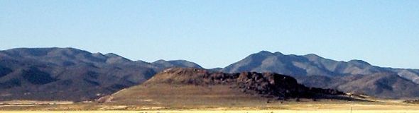
Geography
The Great Basin includes valleys, basins, lakes, and mountain ranges of Basin and Range topography. The Great Basin almost entirely contains the smaller Great Basin physiographic sectionGreat Basin section
The Great Basin section is a physiographic area which extends into the Colorado River watershed on the southeast , as well as into the watersheds of the Klamath River and Sacramento River...
, which extends about 10000 sq mi (25,899.9 km²) into the Colorado River
Colorado River
The Colorado River , is a river in the Southwestern United States and northwestern Mexico, approximately long, draining a part of the arid regions on the western slope of the Rocky Mountains. The watershed of the Colorado River covers in parts of seven U.S. states and two Mexican states...
watershed (including the Las Vegas metropolitan area
Las Vegas metropolitan area
The Las Vegas Valley is the heart of the Las Vegas-Paradise, NV MSA also known as the Las Vegas–Paradise–Henderson MSA which includes all of Clark County, Nevada, and is a metropolitan area in the southern part of the U.S. state of Nevada. The Valley is defined by the Las Vegas Valley landform, a ...
and northwest corner of Arizona
Arizona
Arizona ; is a state located in the southwestern region of the United States. It is also part of the western United States and the mountain west. The capital and largest city is Phoenix...
). Geographic features near the Great Basin include the Continental Divide of the Americas, the Great Divide Basin
Great Divide Basin
The Great Divide Basin is a drainage basin of the Continental Divide of the Americas. The basin is between the Green River watershed on the west and the Medicine Bow River watershed on the east . From the northwest, the basin begins in the "Wind River Range .....
, and the Gulf of California
Gulf of California
The Gulf of California is a body of water that separates the Baja California Peninsula from the Mexican mainland...
.
The Great Basin's two most populous metropolitan areas are Reno
Reno, Nevada
Reno is the county seat of Washoe County, Nevada, United States. The city has a population of about 220,500 and is the most populous Nevada city outside of the Las Vegas metropolitan area...
to the west and Salt Lake City on the east side. The area between these two cities is sparsely populated, but includes the smaller cities of Delta
Delta, Utah
Delta is a city in Millard County, Utah, United States. The population was 3,209 at the 2000 census.-Geography:Delta is located at ....
, Elko
Elko, Nevada
Elko is a city in Elko County, Nevada, United States. The population was 18,297 at the 2010 census. It is the county seat of Elko County. The city straddles the Humboldt River....
, Ely
Ely, Nevada
Ely is the largest city and county seat of White Pine County, Nevada, United States. Ely was founded as a stagecoach station along the Pony Express and Central Overland Route. Ely's mining boom came later than the other towns along US 50, with the discovery of copper in 1906...
, Tonopah
Tonopah, Nevada
Tonopah is a census-designated place located in and the county seat of Nye County, Nevada. It is located at the junction of U.S. Routes 6 and 95 approximately mid-way between Las Vegas and Reno....
, Wendover
Wendover, Utah
Wendover is a city in Tooele County, Utah, United States. It is part of the Elko Micropolitan Statistical Area. The population was 1,537 at the 2000 census, with a 2006 estimated population of 1,632....
, West Wendover
West Wendover, Nevada
West Wendover is a city in Elko County, Nevada, United States. The population was 4,721 at the 2000 census. It is part of the Elko Micropolitan Statistical Area. West Wendover is located on the eastern border of Nevada and the western edge of the Great Salt Lake Desert, and is contiguous with...
, and Winnemucca
Winnemucca, Nevada
-Demographics:As of the census of 2000, there were 7,174 people, 2,736 households, and 1,824 families residing in the city. The population density was 867.5 people per square mile . There were 3,280 housing units at an average density of 396.6 per square mile...
. The southern area of the basin has the communities of Palmdale, Victorville
Victorville
Victorville could refer to:*Victorville, California, a city in San Bernardino County, California, United States*Victorville shoulderband, a species of gastropod in the Helminthoglyptidae family...
, and Palm Springs
Palm Springs
Palm Springs is a desert city in CaliforniaPalm Springs may also refer to:* Palm Springs, Florida* Palm Springs, Hong Kong, a residential development in Yuen Long, Hong Kong* Coachella Valley, also known as the Palm Springs area...
. Major roadways traversing the Great Basin include Interstate 80
Interstate 80
Interstate 80 is the second-longest Interstate Highway in the United States, following Interstate 90. It is a transcontinental artery running from downtown San Francisco, California to Teaneck, New Jersey in the New York City Metropolitan Area...
, Interstate 15
Interstate 15
Interstate 15 is the fourth-longest north–south Interstate Highway in the United States, traveling through the states of California, Nevada, Arizona, Utah, Idaho, and Montana from San Diego to the Canadian border...
, U.S. Route 6
U.S. Route 6
U.S. Route 6 , also called the Grand Army of the Republic Highway, a name that honors an American Civil War veterans association, is a main route of the U.S. Highway system, running east-northeast from Bishop, California to Provincetown, Massachusetts. Until 1964, it continued south from Bishop to...
, U.S. Route 50
U.S. Route 50
U.S. Route 50 is a major east–west route of the U.S. Highway system, stretching just over from Ocean City, Maryland on the Atlantic Ocean to West Sacramento, California. Until 1972, when it was replaced by Interstate Highways west of the Sacramento area, it extended to San Francisco, near...
, U.S. Route 93
U.S. Route 93
U.S. Route 93 is a major north–south United States highway in the western United States. The southern terminus is at U.S. Route 60 in Wickenburg, Arizona. The northern terminus is at the Canadian border north of Eureka in Lincoln County, Montana, where the roadway continues into Roosville,...
, U.S. Route 95
U.S. Route 95
U.S. Route 95 is a north–south U.S. highway in the western United States. Unlike many other US highways, it has not seen deletion or replacement on most of its length by an encroaching Interstate highway corridor, due to its mostly rural course...
and U.S. Route 395
U.S. Route 395
U.S. Route 395 is a U.S. Route in the western United States. The southern terminus of the route is in the Mojave Desert at Interstate 15 near Hesperia. The northern terminus is at the Canadian border near Laurier, where the road becomes Highway 395 upon entering British Columbia. At one time, the...
, with the Nevada section of U.S. Route 50 nicknamed "The Loneliest Road in America". Railroad transportation routes also pass through Reno and Salt Lake City.
Hydrology
The Great Basin DivideGreat Basin Divide
The Great Basin Divide is the western continental divide that separates the Great Basin from the Pacific Ocean watershed. The water divide is the perimeter of the largest set of contiguous endorheic watersheds of North America, including six entire USGS watershed subregions...
separates the Great Basin from the watersheds draining to the Pacific Ocean. The southernmost portion of the Great Basin is the watershed area of the Laguna Salada
Laguna Salada (Mexico)
Laguna Salada is a vast dry lake some 10 meters below sea level in the Sonoran Desert of Baja California, southwest of Mexicali. The lake's shape vaguely resembles a rhombus. When dry, the flatness of the exposed lake bed sediments makes it a favoured location for recreational driving...
. The Great Basin's longest and largest river is the Bear River
Bear River (Utah)
The Bear River is a river, approximately long, in southwestern Wyoming, southeastern Idaho, and northern Utah, in the United States. The largest tributary of the Great Salt Lake, it drains a mountainous area and farming valleys northeast of the lake and southeast of the Snake River Plain...
of 350 mi (563.3 km), and the largest single watershed is the Humboldt River
Humboldt River
The Humboldt River runs through northern Nevada in the western United States. At approximately long it is the second longest river in the Great Basin, after the Bear River. It has no outlet to the ocean, but instead empties into the Humboldt Sink...
drainage of roughly 17000 sq mi (44,029.8 km²). Most Great Basin precipitation is snow, and the precipitation that neither evaporates nor is taken for human use will sink into groundwater
Groundwater
Groundwater is water located beneath the ground surface in soil pore spaces and in the fractures of rock formations. A unit of rock or an unconsolidated deposit is called an aquifer when it can yield a usable quantity of water. The depth at which soil pore spaces or fractures and voids in rock...
aquifer
Aquifer
An aquifer is a wet underground layer of water-bearing permeable rock or unconsolidated materials from which groundwater can be usefully extracted using a water well. The study of water flow in aquifers and the characterization of aquifers is called hydrogeology...
s, while evaporation of collected water occurs from geographic sinks
Sink (geography)
A geographic sink is a depression within an endorheic basin where water collects with no visible outlet. Instead of discharging, the collected water is lost due to evaporation and/or penetration...
. Lake Tahoe
Lake Tahoe
Lake Tahoe is a large freshwater lake in the Sierra Nevada of the United States. At a surface elevation of , it is located along the border between California and Nevada, west of Carson City. Lake Tahoe is the largest alpine lake in North America. Its depth is , making it the USA's second-deepest...
, North America's largest alpine lake
Alpine lake
Alpine lakes are classified as lakes or reservoirs at high altitudes, usually starting around 5,000 feet in elevation above sea level or above the tree line....
, is part of the Great Basin's central Lahontan
Lake Lahontan
Lake Lahontan was a large endorheic Pleistocene lake of modern northwestern Nevada that extended into northeastern California and southern Oregon...
subregion. Great Basin named deserts include the Black Rock Desert
Black Rock Desert
The Black Rock Desert is an arid region in the northern Nevada section of the Great Basin with a lakebed that is a dry remnant of Pleistocene Lake Lahontan...
, the Great Salt Lake Desert
Great Salt Lake Desert
The Great Salt Lake Desert is a large dry lake in northern Utah between the Great Salt Lake and the Nevada border which is noted for white sand from evaporite Lake Bonneville salt deposits...
, the Sevier Desert
Sevier Lake
Sevier Lake is an intermittent and endorheic lake which lies in the lowest part of the Sevier Desert, Millard County, Utah. Like Great Salt Lake and Utah Lake, it is a remnant of Pleistocene Lake Bonneville. Sevier Lake is fed primarily by the Beaver and Sevier rivers, and the additional inflow...
, the Smoke Creek Desert
Smoke Creek Desert
The Smoke Creek Desert is an arid region of northwestern Nevada, USA that lies to the north of Pyramid Lake, west of the Fox Range and east of the Smoke Creek Mountains. The southern end of the desert lies on the Pyramid Lake Indian Reservation, and a rail line lies at the eastern edge...
, Nevada salt deserts in the Great Basin Province
Great Basin Province
The Great Basin Province is a region of the Boreal Kingdom that generally corresponds to the Central Basin and Range ecoregion and the Great Basin physiographic section...
, the Mojave Desert
Mojave Desert
The Mojave Desert occupies a significant portion of southeastern California and smaller parts of central California, southern Nevada, southwestern Utah and northwestern Arizona, in the United States...
, and part of the Sonoran Desert
Sonoran Desert
The Sonoran Desert is a North American desert which straddles part of the United States-Mexico border and covers large parts of the U.S. states of Arizona and California and the northwest Mexican states of Sonora, Baja California, and Baja California Sur. It is one of the largest and hottest...
.
Ecology
Although mostly within the North American DesertNorth American Desert
The North American Deserts includes all the deserts located on the continent. It is also the term for a large U.S. Level 1 ecoregion of the North American Cordillera, in the Deserts and xeric shrublands biome...
ecoregion, portions of the Great Basin extend into the Forested Mountain and Mediterranean California ecoregions. The semi-arid areas of the Forested Mountain ecoregion include the White Mountains
White Mountains (California)
The White Mountains of California are a triangular fault block mountain range facing the Sierra Nevada across the upper Owens Valley. They extend for approximately as a greatly elevated plateau about wide on the south, narrowing to a point at the north, with elevations generally increasing...
and Inyo Mountains
Inyo Mountains
The Inyo Mountains are a short mountain range east of the Sierra Nevada mountains in eastern California in the United States. The range separates the Owens Valley to the west with Saline Valley to the east, extending for approximately 70 mi SSE from the southern end of the White Mountains,...
. Extending north of the 42nd parallel north
42nd parallel north
The 42nd parallel north is a circle of latitude that is 42 degrees north of the Earth's equatorial plane. It crosses Europe, the Mediterranean Sea, Asia, the Pacific Ocean, North America, and the Atlantic Ocean....
, the Northern Basin and Range (ecoregion)
Northern Basin and Range (ecoregion)
The Northern Basin and Range ecoregion is a Level III ecoregion designated by the United States Environmental Protection Agency in the U.S. states of Oregon, Idaho, Nevada, Utah, and California. It contains dissected lava plains, rolling hills, alluvial fans, valleys, and scattered mountain ranges...
has its southern border at the highest shoreline of the Pleistocene
Pleistocene
The Pleistocene is the epoch from 2,588,000 to 11,700 years BP that spans the world's recent period of repeated glaciations. The name pleistocene is derived from the Greek and ....
Lake Bonneville
Lake Bonneville
Lake Bonneville was a prehistoric pluvial lake that covered much of North America's Great Basin region. Most of the territory it covered was in present-day Utah, though parts of the lake extended into present-day Idaho and Nevada. Formed about 32,000 years ago, it existed until about 14,500 years...
. The south edge of the Central Basin and Range ecoregion is in Nevada, north of the south edge of the Great Basin section
Great Basin section
The Great Basin section is a physiographic area which extends into the Colorado River watershed on the southeast , as well as into the watersheds of the Klamath River and Sacramento River...
.
Fauna
Great Basin wildlife includes PronghornPronghorn
The pronghorn is a species of artiodactyl mammal endemic to interior western and central North America. Though not an antelope, it is often known colloquially in North America as the prong buck, pronghorn antelope, or simply antelope, as it closely resembles the true antelopes of the Old World and...
, Mule Deer
Mule Deer
The mule deer is a deer indigenous to western North America. The Mule Deer gets its name from its large mule-like ears. There are believed to be several subspecies, including the black-tailed deer...
, Mountain Lion, and Lagomorphs such as Black-tailed Jackrabbit
Black-tailed Jackrabbit
The black-tailed jackrabbit , also known as the american desert hare, is a common hare of the western United States and Mexico, where it is found at elevations from sea level to up to...
and Desert Cottontail
Desert Cottontail
The Desert Cottontail , also known as Audubon's Cottontail, is a New World cottontail rabbit, a member of the family Leporidae....
and the coyote
Coyote
The coyote , also known as the American jackal or the prairie wolf, is a species of canine found throughout North and Central America, ranging from Panama in the south, north through Mexico, the United States and Canada...
s that prey on them. Packrats, Kangaroo rat
Kangaroo rat
Kangaroo rats, genus Dipodomys, are small rodents native to North America. The common name derives from their bipedal form: as they hop in a manner similar to the much larger kangaroo, although they are not related...
s and other small rodents are also common, but these are predominantly nocturnal. Elk
Elk
The Elk is the large deer, also called Cervus canadensis or wapiti, of North America and eastern Asia.Elk may also refer to:Other antlered mammals:...
and Bighorn Sheep
Bighorn Sheep
The bighorn sheep is a species of sheep in North America named for its large horns. These horns can weigh up to , while the sheep themselves weigh up to . Recent genetic testing indicates that there are three distinct subspecies of Ovis canadensis, one of which is endangered: Ovis canadensis sierrae...
are present but uncommon. Small lizards such as the Great Basin fence lizard, Longnose Leopard Lizard and Horned Lizard
Horned lizard
Horned lizards are a genus of lizards which are the type genus of the family Phrynosomatidae. The horned lizard is popularly called a "horned toad", "horny toad", or "horned frog", but it is neither a toad nor a frog. The popular names come from the lizard's rounded body and blunt snout, which...
are common, especially in lower elevations. Rattlesnake
Rattlesnake
Rattlesnakes are a group of venomous snakes of the genera Crotalus and Sistrurus of the subfamily Crotalinae . There are 32 known species of rattlesnake, with between 65-70 subspecies, all native to the Americas, ranging from southern Alberta and southern British Columbia in Canada to Central...
s and Gopher snakes are also present. The Inyo Mountains Salamander
Inyo Mountains Salamander
The Inyo Mountains Salamander, Batrachoseps campi, is an endangered species of salamander in the Plethodontidae family that is endemic to California , in the western United States.-Distribution:...
is endangered. Shorebirds such as Phalarope
Phalarope
A phalarope or wadepiper is any of three living species of slender-necked shorebirds in the genus Phalaropus of the bird family Scolopacidae. They are close relatives of the shanks and tattlers, the Actitis and Terek Sandpipers, and also of the turnstones and calidrids...
s and Curlew
Curlew
The curlews , genus Numenius, are a group of eight species of birds, characterised by long, slender, downcurved bills and mottled brown plumage. They are one of the most ancient lineages of scolopacid waders, together with the godwits which look similar but have straight bills...
s can be found in wet areas. American White Pelican
American White Pelican
The American White Pelican is a large aquatic bird from the order Pelecaniformes. It breeds in interior North America, moving south and to the coasts, as far as Central America, in winter....
s are common at Pyramid Lake. Golden Eagle
Golden Eagle
The Golden Eagle is one of the best known birds of prey in the Northern Hemisphere. Like all eagles, it belongs to the family Accipitridae. Once widespread across the Holarctic, it has disappeared from many of the more heavily populated areas...
s are perhaps more common in the Great Basin than anywhere else in the US. Mourning Dove
Mourning Dove
The Mourning Dove is a member of the dove family . The bird is also called the Turtle Dove or the American Mourning Dove or Rain Dove, and formerly was known as the Carolina Pigeon or Carolina Turtledove. It is one of the most abundant and widespread of all North American birds...
, Western Meadowlark
Western Meadowlark
Not to be confused with Eastern MeadowlarkThe Western Meadowlark is a medium-sized icterid bird, about 8.5 in long. It nests on the ground in open country in western and central North America. It feeds mostly on insects, but also seeds and berries...
, Black-billed Magpie
Black-billed Magpie
The Black-billed Magpie is a bird in the crow family that inhabits the western half of North America. It is notable for its domed nests, and for being one of only four North American songbirds whose tail makes up half or more of the total body length The Black-billed Magpie (Pica hudsonia) is a...
, and Common Raven
Common Raven
The Common Raven , also known as the Northern Raven, is a large, all-black passerine bird. Found across the northern hemisphere, it is the most widely distributed of all corvids...
are other common bird species.
Two endangered species
Endangered species
An endangered species is a population of organisms which is at risk of becoming extinct because it is either few in numbers, or threatened by changing environmental or predation parameters...
of fish are found in Pyramid Lake: the Cui-ui
Cui-ui
The cui-ui, Chasmistes cujus, is a large sucker fish endemic to Pyramid Lake and, prior to its desiccation in the 20th century, Winnemucca Lake in northwestern Nevada. It feeds primarily on zooplankton and possibly on nanoplankton...
sucker fish
Catostomidae
Catostomidae is the sucker family of the order Cypriniformes. There are 80 species in this family of freshwater fishes. Catostomidae are found in North America, east central China, and eastern Siberia...
and the Lahontan cutthroat trout
Lahontan cutthroat trout
Lahontan cutthroat trout is the largest subspecies of cutthroat trout, and the state fish of Nevada.-Natural history:...
.
Large invertebrates include tarantula
Tarantula
Tarantulas comprise a group of often hairy and often very large arachnids belonging to the family Theraphosidae, of which approximately 900 species have been identified. Some members of the same Suborder may also be called "tarantulas" in the common parlance. This article will restrict itself to...
s (Aphonopelma
Aphonopelma
Aphonopelma is a genus of tarantulas, members of which are native to the Americas. It includes nearly all of the North American tarantulas north of Mexico and a considerable part of the tarantulas which range into Central America. Only a few species are described from South America...
genus) and Mormon cricket
Mormon cricket
The Mormon cricket is a large insect that can grow to almost three inches in length. They live throughout western North America in rangelands dominated by sagebrush and forbs....
s. Exotic species, including Chukar
Chukar
The Chukar Partridge or Chukar is a Eurasian upland gamebird in the pheasant family Phasianidae. It has been considered to form a superspecies complex along with the Rock Partridge, Philby's Partridge and Przevalski's Partridge and treated in the past as conspecific particularly with the first...
, Grey Partridge
Grey Partridge
The Grey Partridge, Perdix perdix, also known as the English Partridge, Hungarian Partridge, or Hun, is a gamebird in the pheasant family Phasianidae of the order Galliformes, gallinaceous birds...
, and Himalayan Snowcock
Himalayan Snowcock
The Himalayan Snowcock is a snowcock in the pheasant family Phasianidae found across the Himalayan ranges and parts of the adjoining Pamir range of Asia. It is found on alpine pastures and on steep rocky cliffs where they will dive down the hill slopes to escape. It overlaps with the slightly...
, have been successfully introduced to the Great Basin, although the latter has only thrived in the Ruby Mountains
Ruby Mountains
The Ruby Mountains comprise one of the many mountain ranges of the Great Basin in the western United States. They are the predominant range in Elko County, in the northeastern section of the state of Nevada. To the north is Secret Pass and the East Humboldt Range, and from there the Rubies run...
. Cheatgrass
Drooping Brome
Drooping brome or Cheat Grass, Bromus tectorum, is a grass native to Europe, southwestern Asia and northern Africa.-Description:...
, an invasive species
Invasive species
"Invasive species", or invasive exotics, is a nomenclature term and categorization phrase used for flora and fauna, and for specific restoration-preservation processes in native habitats, with several definitions....
which was unintentionally introduced, forms a critical portion of their diets. Feral
Feral
A feral organism is one that has changed from being domesticated to being wild or untamed. In the case of plants it is a movement from cultivated to uncultivated or controlled to volunteer. The introduction of feral animals or plants to their non-native regions, like any introduced species, may...
horse
Horse
The horse is one of two extant subspecies of Equus ferus, or the wild horse. It is a single-hooved mammal belonging to the taxonomic family Equidae. The horse has evolved over the past 45 to 55 million years from a small multi-toed creature into the large, single-toed animal of today...
s (Mustangs
Mustang (horse)
A Mustang is a free-roaming horse of the North American west that first descended from horses brought to the Americas by the Spanish. Mustangs are often referred to as wild horses, but there is intense debate over terminology...
) and wild burro
Burro
The burro is a small donkey used primarily as a pack animal. In addition, significant numbers of feral burros live in the Southwestern United States, where they are protected by law, and in Mexico...
s are other highly reproductive, and ecosystem controversial, alien species. Most of the Great Basin is open range
Rangeland
Rangelands are vast natural landscapes in the form of grasslands, shrublands, woodlands, wetlands, and deserts. Types of rangelands include tallgrass and shortgrass prairies, desert grasslands and shrublands, woodlands, savannas, chaparrals, steppes, and tundras...
and domestic cattle
Cattle
Cattle are the most common type of large domesticated ungulates. They are a prominent modern member of the subfamily Bovinae, are the most widespread species of the genus Bos, and are most commonly classified collectively as Bos primigenius...
and sheep are widespread.
Flora
Utah Juniper/Single-leaf PinyonSingle-leaf Pinyon
The Single-leaf Pinyon, ', is a pine in the pinyon pine group, native to the United States and northwest Mexico. The range is in southernmost Idaho, western Utah, Arizona, southwest New Mexico, Nevada, eastern and southern California and northern Baja California.It occurs at moderate altitudes from...
(southern regions) and Mountain Mahogany (northern regions) form open Pinyon-juniper woodland
Pinyon-juniper woodland
A Pinyon-juniper woodland is a forest type characteristic of many parts the Western United States, often in higher elevations of desert ecoregions.-Locations:...
on the slopes of most ranges. Stands of Limber Pine
Limber Pine
The Limber Pine, Pinus flexilis, is a species of pine tree-the family Pinaceae that occurs in the mountains of the Western United States, Mexico, and Canada. It is also called Southwestern White Pine and Rocky Mountain White Pine...
and Great Basin Bristlecone Pine (Pinus longaeva) can be found in some of the higher ranges (the Methuselah tree
Methuselah (tree)
Methuselah is a Great Basin Bristlecone Pine tree growing high in the White Mountains of Inyo County in eastern California. Its measured age of 4,842 years makes it the world's oldest known living non-clonal organism...
is nearly 5000 years old). In riparian areas with dependable water cottonwoods (Populus fremontii
Populus fremontii
Populus fremontii, the Fremont cottonwood or Alamo cottonwood, is a cottonwood poplar native to western North America, in California and east to Nevada, Utah, Arizona, and New Mexico, and south into Sonora in northwestern Mexico...
) and Quaking Aspen (Populus tremuloides
Populus tremuloides
Populus tremuloides is a deciduous tree native to cooler areas of North America, commonly called quaking aspen, trembling aspen, American aspen, and Quakies,. The trees have tall trunks, up to 25 metres, with smooth pale bark, scarred with black. The glossy green leaves, dull beneath, become golden...
) groves exist. Grasslands contain the native Great Basin wildrye.
History
Lacustrine plain
Some lakes get filled up by the sediments brought down by the rivers and turn into plains in the course of time. Such plains are called lacustrine plains...
s in underwater portions of the prehistoric area that would be named the Great Basin after they drained. For example, after forming about 32,000 years ago
Before Present
Before Present years is a time scale used in archaeology, geology, and other scientific disciplines to specify when events in the past occurred. Because the "present" time changes, standard practice is to use AD 1950 as the origin of the age scale, reflecting the fact that radiocarbon...
, Lake Bonneville
Lake Bonneville
Lake Bonneville was a prehistoric pluvial lake that covered much of North America's Great Basin region. Most of the territory it covered was in present-day Utah, though parts of the lake extended into present-day Idaho and Nevada. Formed about 32,000 years ago, it existed until about 14,500 years...
overflowed about 14,500 years ago in the Bonneville Flood
Bonneville Flood
The Bonneville Flood or Lake Bonneville Flood was a catastrophic flooding event in the previous ice age, which involved massive amounts of water inundating parts of southern Idaho and eastern Washington along the course of the Snake River. Unlike the Missoula Floods, which also occurred during the...
through Red Rock Pass
Red Rock Pass
Red Rock Pass is a low mountain pass in eastern Idaho, south of Downey in southern Bannock County. It is geologically significant as the spillway of ancient Lake Bonneville...
and lowered to the "Provo Lake" level (the Great Salt Lake
Great Salt Lake
The Great Salt Lake, located in the northern part of the U.S. state of Utah, is the largest salt water lake in the western hemisphere, the fourth-largest terminal lake in the world. In an average year the lake covers an area of around , but the lake's size fluctuates substantially due to its...
, Utah Lake
Utah Lake
Utah Lake is a freshwater lake in the U.S. state of Utah. On the western side of Utah Valley, the lake is overlooked by Mount Timpanogos and Mount Nebo. The lake's only river outlet, the Jordan River, is a tributary of the Great Salt Lake and is highly regulated with pumps. Evaporation accounts...
, Sevier Lake
Sevier Lake
Sevier Lake is an intermittent and endorheic lake which lies in the lowest part of the Sevier Desert, Millard County, Utah. Like Great Salt Lake and Utah Lake, it is a remnant of Pleistocene Lake Bonneville. Sevier Lake is fed primarily by the Beaver and Sevier rivers, and the additional inflow...
, Rush Lake
Rush Lake (Utah)
Rush Lake is a shallow saline lake in Tooele County in the U.S. state of Utah. It is a 16,800 year old remnant of Lake Bonneville, an ancient lake that formed approximately 32,000 years ago...
, and Little Salt Lake remain). Lake Lahontan
Lake Lahontan
Lake Lahontan was a large endorheic Pleistocene lake of modern northwestern Nevada that extended into northeastern California and southern Oregon...
, Lake Manly
Lake Manly
Lake Manly is a pluvial, former freshwater, endorheic, rift lake that filled the Death Valley basin of Inyo County, California through the Holocene before the area's climate changed to desert. Following its isolation from the Colorado River system, Lake Manly receded by evaporation with Badwater...
, and Lake Mojave
Lake Mojave
Lake Mojave is an ancient former lake fed by the Mojave River that, through the Holocene, occupied the Silver Lake and Soda Lake basins in the Mojave Desert of San Bernardino County, California. Its outlet ultimately emptied into the Colorado River north of Blythe....
were similar Pleistocene
Pleistocene
The Pleistocene is the epoch from 2,588,000 to 11,700 years BP that spans the world's recent period of repeated glaciations. The name pleistocene is derived from the Greek and ....
lakes.
Paleo-Indian habitation by the Great Basin tribes
Great Basin tribes
The Indigenous peoples of the Great Basin are the Native American peoples of the Great Basin inhabited a cultural region between the Rocky Mountains and the Sierra Nevada, in what is now Nevada, and parts of Oregon, California, Idaho, Wyoming, and Utah. There is very little precipitation in the...
began as early as 10,000 B.C. (the Numic-speaking Shoshonean peoples arrived as late as 1000 A.D.). Archaeological
Archaeology
Archaeology, or archeology , is the study of human society, primarily through the recovery and analysis of the material culture and environmental data that they have left behind, which includes artifacts, architecture, biofacts and cultural landscapes...
evidence of habitation sites along the shore of Lake Lahontan
Lake Lahontan
Lake Lahontan was a large endorheic Pleistocene lake of modern northwestern Nevada that extended into northeastern California and southern Oregon...
date from the end of the ice age when its shoreline was approximately 500 feet (152.4 m) higher along the sides of the surrounding mountains. The Great Basin was inhabited for at least several thousand years by Uto-Aztecan language group-speaking Native American
Native Americans in the United States
Native Americans in the United States are the indigenous peoples in North America within the boundaries of the present-day continental United States, parts of Alaska, and the island state of Hawaii. They are composed of numerous, distinct tribes, states, and ethnic groups, many of which survive as...
Great Basin tribes, including the Shoshone
Shoshone
The Shoshone or Shoshoni are a Native American tribe in the United States with three large divisions: the Northern, the Western and the Eastern....
, Ute
Ute Tribe
The Ute are an American Indian people now living primarily in Utah and Colorado. There are three Ute tribal reservations: Uintah-Ouray in northeastern Utah ; Southern Ute in Colorado ; and Ute Mountain which primarily lies in Colorado, but extends to Utah and New Mexico . The name of the state of...
, Mono
Mono tribe
The Mono are a Native American people who traditionally live in the central Sierra Nevada Mountains, the Eastern Sierra , the Mono Basin, and adjacent areas of the Great Basin.-Culture and geography:...
, and Northern Paiute
Paiute
Paiute refers to three closely related groups of Native Americans — the Northern Paiute of California, Idaho, Nevada and Oregon; the Owens Valley Paiute of California and Nevada; and the Southern Paiute of Arizona, southeastern California and Nevada, and Utah.-Origin of name:The origin of...
.
Exploration of the Great Basin occurred during the 18th century Spanish colonization of the Americas
Spanish colonization of the Americas
Colonial expansion under the Spanish Empire was initiated by the Spanish conquistadores and developed by the Monarchy of Spain through its administrators and missionaries. The motivations for colonial expansion were trade and the spread of the Christian faith through indigenous conversions...
. The first American to cross the Great Basin from the Sierra Nevada was Jedediah Strong Smith in 1827. Peter Skene Ogden
Peter Skene Ogden
Peter Skene Ogden , was a fur trader and a Canadian explorer of what is now British Columbia and the American West...
of the British Hudson's Bay Company
Hudson's Bay Company
The Hudson's Bay Company , abbreviated HBC, or "The Bay" is the oldest commercial corporation in North America and one of the oldest in the world. A fur trading business for much of its existence, today Hudson's Bay Company owns and operates retail stores throughout Canada...
explored the Great Salt Lake and Humboldt River regions in the late 1820s, following the eastern side of the Sierra Nevada to the Gulf of California. Benjamin Bonneville
Benjamin Bonneville
Benjamin Louis Eulalie de Bonneville was a French-born officer in the United States Army, fur trapper, and explorer in the American West...
explored the northeast portion during an 1832 expedition
American Fur Company
The American Fur Company was founded by John Jacob Astor in 1808. The company grew to monopolize the fur trade in the United States by 1830, and became one of the largest businesses in the country. The company was one the first great trusts in American business...
. The United States had acquired control of the area north of the 42nd parallel
42nd parallel north
The 42nd parallel north is a circle of latitude that is 42 degrees north of the Earth's equatorial plane. It crosses Europe, the Mediterranean Sea, Asia, the Pacific Ocean, North America, and the Atlantic Ocean....
via the 1819 Adams–Onís Treaty with Spain and 1846 Oregon Treaty
Oregon Treaty
The Oregon Treaty is a treaty between the United Kingdom and the United States that was signed on June 15, 1846, in Washington, D.C. The treaty brought an end to the Oregon boundary dispute by settling competing American and British claims to the Oregon Country, which had been jointly occupied by...
with Britain. The US gained control of most of the rest of the Great Basin via the 1848 Mexican Cession
Mexican Cession
The Mexican Cession of 1848 is a historical name in the United States for the region of the present day southwestern United States that Mexico ceded to the U.S...
. The first non-indigenous settlements were connected with the eastern regions of the 1848 California Gold Rush
California Gold Rush
The California Gold Rush began on January 24, 1848, when gold was found by James W. Marshall at Sutter's Mill in Coloma, California. The first to hear confirmed information of the gold rush were the people in Oregon, the Sandwich Islands , and Latin America, who were the first to start flocking to...
, with its immigrants crossing the Great Basin on the California Trail
California Trail
The California Trail was an emigrant trail of about across the western half of the North American continent from Missouri River towns to what is now the state of California...
along Nevada's Humboldt River
Humboldt River
The Humboldt River runs through northern Nevada in the western United States. At approximately long it is the second longest river in the Great Basin, after the Bear River. It has no outlet to the ocean, but instead empties into the Humboldt Sink...
to Carson Pass
Carson Pass
Carson Pass is the Sierra Crest mountain pass over which State Route 88 crosses. The historic pass was a point on the Carson Trail during the California Gold Rush and was used for American Civil War shipping to California until the completion of the First Transcontinental Railroad...
in the Sierras. The first American religious settlement effort was the Mormon
Mormonism
Mormonism is the religion practiced by Mormons, and is the predominant religious tradition of the Latter Day Saint movement. This movement was founded by Joseph Smith, Jr. beginning in the 1820s as a form of Christian primitivism. During the 1830s and 1840s, Mormonism gradually distinguished itself...
provisional State of Deseret
State of Deseret
The State of Deseret was a proposed state of the United States, propositioned in 1849 by Latter-day Saint settlers in Salt Lake City. The provisional state existed for slightly over two years and was never recognized by the United States government...
in 1849 in present day Utah and northern Nevada. The Oregon Territory
Oregon Territory
The Territory of Oregon was an organized incorporated territory of the United States that existed from August 14, 1848, until February 14, 1859, when the southwestern portion of the territory was admitted to the Union as the State of Oregon. Originally claimed by several countries , the region was...
was established in 1848 and the Utah Territory
Utah Territory
The Territory of Utah was an organized incorporated territory of the United States that existed from September 9, 1850, until January 4, 1896, when the final extent of the territory was admitted to the Union as the State of Utah....
in 1850.
In 1869 the First Transcontinental Railroad
First Transcontinental Railroad
The First Transcontinental Railroad was a railroad line built in the United States of America between 1863 and 1869 by the Central Pacific Railroad of California and the Union Pacific Railroad that connected its statutory Eastern terminus at Council Bluffs, Iowa/Omaha, Nebraska The First...
was completed at Promontory Summit in the Great Basin. Around 1902, the San Pedro, Los Angeles and Salt Lake Railroad
Los Angeles and Salt Lake Railroad
The Los Angeles and Salt Lake Railroad was a rail company that completed and operated a railway line between its namesake cities, via Las Vegas, Nevada. Incorporated in Utah in 1901 as the San Pedro, Los Angeles and Salt Lake Railroad, the line was largely the brainchild of William Andrews Clark,...
was constructed in the lower basin and Mojave Desert for California-Nevada rail service to Las Vegas, Nevada.
To close a 1951 Indian Claims Commission case, the Western Shoshone Claims Distribution Act of 2004
Western Shoshone Claims Distribution Act of 2004
The Western Shoshone Claims Distribution Act of 2004 established the legal framework for the distribution of the "Western Shoshone Judgement Funds" stemming from docket 326-K before the Indian Claims Commission...
established the United States payment of $117 million to the Great Basin tribe for the acquisition
Eminent domain
Eminent domain , compulsory purchase , resumption/compulsory acquisition , or expropriation is an action of the state to seize a citizen's private property, expropriate property, or seize a citizen's rights in property with due monetary compensation, but without the owner's consent...
of 39000 square miles (101,009.5 km²). The Dixie Valley, Nevada, earthquake (6.6-7.1) in the Great Basin was in 1954. The Mojave and Colorado Deserts Biosphere Reserve
Mojave and Colorado Deserts Biosphere Reserve
The Mojave and Colorado Deserts Biosphere Reserve is a biosphere reserve designated by UNESCO in 1984 to promote the ecological conservation of a cluster of areas in the Mojave and Colorado deserts of California. A principal feature is Death Valley...
(4 conserved areas) was designated in 1984, and in 1986, and 1994, the Great Basin National Park
Great Basin National Park
Great Basin National Park is a United States National Park established in 1986, located in east-central Nevada near the Utah border. The park derives its name from the Great Basin, the dry and mountainous region between the Sierra Nevada and the Wasatch Mountains. Topographically, this area is...
and the Mojave National Preserve
Mojave National Preserve
Mojave National Preserve is located in the Mojave Desert of San Bernardino County, California, USA, between Interstate 15 and Interstate 40. The preserve was established October 31, 1994 with the passage of the California Desert Protection Act by the US Congress...
were established. In 2009, the American Land Conservancy
American Land Conservancy
The mission of American Land Conservancy is to conserve land for the benefit of people and wildlife.- About ALC :American Land Conservancy is a non-profit land conservation organization dedicated to protecting America’s natural heritage by conserving land for the benefit of people and wildlife...
's Great Basin Program reserved the Green Gulch mule deer migration corridor as part of "over 80,000 acres [conserved] in Nevada and the Eastern Sierras".