

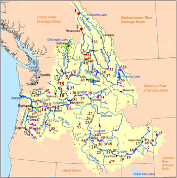
Hydroelectric dams on the Columbia River
Encyclopedia
Columbia River
The Columbia River is the largest river in the Pacific Northwest region of North America. The river rises in the Rocky Mountains of British Columbia, Canada, flows northwest and then south into the U.S. state of Washington, then turns west to form most of the border between Washington and the state...
and its tributaries
Tributary
A tributary or affluent is a stream or river that flows into a main stem river or a lake. A tributary does not flow directly into a sea or ocean...
in North America
North America
North America is a continent wholly within the Northern Hemisphere and almost wholly within the Western Hemisphere. It is also considered a northern subcontinent of the Americas...
.
(Listed in order from the headwaters, to the Pacific Ocean
Pacific Ocean
The Pacific Ocean is the largest of the Earth's oceanic divisions. It extends from the Arctic in the north to the Southern Ocean in the south, bounded by Asia and Australia in the west, and the Americas in the east.At 165.2 million square kilometres in area, this largest division of the World...
)
Mainstem Columbia dams
| Name | Capacity (MW) | Location | Date authorized | Date completed | Owner Name | Lake formed | |
|---|---|---|---|---|---|---|---|
| Mica Dam Mica Dam The Mica Dam is a hydroelectric dam spanning the Columbia River 135 kilometres north of Revelstoke, British Columbia, Canada. Completed in 1973 under the terms of the 1964 Columbia River Treaty, the Mica powerhouse has a generating capacity of . The dam is operated by BC Hydro... |
1,805 | British Columbia British Columbia British Columbia is the westernmost of Canada's provinces and is known for its natural beauty, as reflected in its Latin motto, Splendor sine occasu . Its name was chosen by Queen Victoria in 1858... , Canada Canada Canada is a North American country consisting of ten provinces and three territories. Located in the northern part of the continent, it extends from the Atlantic Ocean in the east to the Pacific Ocean in the west, and northward into the Arctic Ocean... |
1964 | 1973 | BC Hydro BC Hydro The BC Hydro and Power Authority is a Canadian electric utility in the province of British Columbia generally known simply as BC Hydro. It is the main electric distributor, serving 1.8 million customers in most areas, with the exception of the Kootenay region, where FortisBC, a subsidiary of Fortis... |
Kinbasket Lake Kinbasket Lake Kinbasket Lake is a reservoir on the Columbia River in southeast British Columbia, north of the city of Revelstoke and the town of Golden. The reservoir was created by the construction of the Mica Dam. The lake includes two reaches, Columbia Reach and Canoe Reach , referring to the river valleys... |
|
| Revelstoke Dam Revelstoke Dam The Revelstoke Dam, also known as Revelstoke Canyon Dam, is a hydroelectric dam spanning the Columbia River, 5 km north of Revelstoke, British Columbia, Canada. The powerhouse was completed in 1984 and has a generating capacity of 2480 MW. Four generating units were installed initially, with one... |
2,480 | B.C. | 1964 | 1984 | BC Hydro BC Hydro The BC Hydro and Power Authority is a Canadian electric utility in the province of British Columbia generally known simply as BC Hydro. It is the main electric distributor, serving 1.8 million customers in most areas, with the exception of the Kootenay region, where FortisBC, a subsidiary of Fortis... |
Revelstoke Lake Revelstoke Lake Lake Revelstoke or Revelstoke Lake or Revelstoke Lake Reservoir is an artificial lake on the Columbia River, north of the town of Revelstoke, British Columbia and south of Mica Creek... |
|
| Keenleyside Dam Keenleyside Dam Hugh Keenleyside Dam is a hydroelectric dam spanning the Columbia River, 12 km upstream of the city of Castlegar, British Columbia, Canada.... |
185 | B.C. | 1964 | 1968 | BC Hydro BC Hydro The BC Hydro and Power Authority is a Canadian electric utility in the province of British Columbia generally known simply as BC Hydro. It is the main electric distributor, serving 1.8 million customers in most areas, with the exception of the Kootenay region, where FortisBC, a subsidiary of Fortis... |
Raised Arrow Lakes Arrow Lakes The Arrow Lakes in British Columbia, Canada, divided into Upper Arrow Lake and Lower Arrow Lake, are widenings of the Columbia River. The lakes are situated between the Selkirk Mountains to the east and the Monashee Mountains to the west. Beachland is fairly rare, and is interspersed with rocky... |
|
| Grand Coulee Dam Grand Coulee Dam Grand Coulee Dam is a gravity dam on the Columbia River in the U.S. state of Washington built to produce hydroelectric power and provide irrigation. It was constructed between 1933 and 1942, originally with two power plants. A third power station was completed in 1974 to increase its energy... |
6,809 | Washington, USA United States The United States of America is a federal constitutional republic comprising fifty states and a federal district... |
1933 | 1942 | USBR United States Bureau of Reclamation The United States Bureau of Reclamation , and formerly the United States Reclamation Service , is an agency under the U.S... |
Franklin D. Roosevelt Lake Franklin D. Roosevelt Lake Franklin D. Roosevelt Lake is the reservoir created in 1941 by the impoundment of the Columbia River by the Grand Coulee Dam in Washington state. It is named for Franklin D. Roosevelt, who was President during the construction of the dam... , Banks Lake Banks Lake Banks Lake is a long reservoir in central Washington in the United States.Part of the Columbia Basin Project, Banks Lake occupies the northern portion of the Grand Coulee, a formerly dry coulee near the Columbia River, formed by the Missoula Floods during the Pleistocene epoch. Grand Coulee Dam,... |
|
| Chief Joseph Dam Chief Joseph Dam The Chief Joseph Dam is a concrete gravity dam on the Columbia River, upriver from Bridgeport, Washington, USA. The dam was authorized as Foster Creek Dam and Powerhouse for power generation and irrigation by the River and Harbor Act of 1946... |
2,620 | WA | 1946 | 1955 | USACE United States Army Corps of Engineers The United States Army Corps of Engineers is a federal agency and a major Army command made up of some 38,000 civilian and military personnel, making it the world's largest public engineering, design and construction management agency... |
Rufus Woods Lake | |
| Wells Dam Wells Dam Wells Dam is a hydroelectric dam located on the Columbia River, downstream from the confluence of the Okanogan River, Methow River, and the Columbia River in Washington State. The dam, associated structures, and machinery make up the Wells Hydroelectric Project. It is owned and operated by... |
840 | WA | 1967 | Douglas PUD Douglas County Public Utility District The Douglas County Public Utility District, or Douglas County PUD, is a Public Co-operative energy district located in north central Washington, USA. It is owned by its customers and governed by a Board of Commissioners elected by the customer-owners. Though it is not regulated by another... |
Lake Pateros Lake Pateros Lake Pateros is a reservoir on the Columbia River in the U.S. state of Washington. It was created in 1967 with the construction of Wells Dam. The reservoir lies almost entirely in Douglas and Okanogan counties, although the dam itself lies partially in the easternmost portion of Chelan County. The... |
||
| Rocky Reach Dam Rocky Reach Dam Rocky Reach Dam is a hydroelectric dam in the U.S. state of Washington. Chelan County Public Utility District's Rocky Reach Dam and Hydro Project is located in north central Washington state, USA on the Columbia River, about seven miles upstream from the city of Wenatchee... |
1,287 | WA | 1956 | 1961 | Chelan PUD Chelan County Public Utility District The Chelan County Public Utility District, or Chelan County PUD, provides electric, water, and wastewater public utility services in Chelan County, in north-central Washington, USA.... |
Lake Entiat Lake Entiat Lake Entiat is a reservoir between Chelan County and Douglas County in North Central Washington that is formed above Rocky Reach Dam , a hydroelectric dam on the Columbia River. The reservoir is north of Wenatchee and stretches upstream to the Wells Dam. Lincoln Rock State Park is on its east... |
|
| Rock Island Dam Rock Island Dam Rock Island Dam is a hydroelectric dam on the Columbia River in the U.S. state of Washington. Chelan County Public Utility District's Rock Island Dam and Hydro Project was the first dam to span the Columbia, having been built from 1929 to 1933. It is located near the geographical center of... |
660 | WA | 1929 | 1933 | Chelan PUD Chelan County Public Utility District The Chelan County Public Utility District, or Chelan County PUD, provides electric, water, and wastewater public utility services in Chelan County, in north-central Washington, USA.... |
Rock Island Pool Rock Island Pool Rock Island Pool is a reservoir on the Columbia River in the U.S. state of Washington. It was created in 1933 with the construction of Rock Island Dam. The reservoir stretches from there upstream to the Rocky Reach Dam.... |
|
| Wanapum Dam Wanapum Dam Wanapum Dam is a hydroelectric project located on the Columbia River downstream from Vantage, Washington where Interstate 90 crosses the Columbia from Grant County into Kittitas County. It is owned by the Grant County Public Utility District. Its reservoir is named Lake Wanapum.The dam, and its... |
1,038 | WA | 1959 | 1963 | Grant PUD Grant County Public Utility District Public Utility District No. 2 of Grant County, or Grant County PUD, is a public utility district in north central Washington state. It is owned by its customers and governed by a Board of Commissioners elected by the customer-owners. Though it is not regulated by another governmental unit, a PUD... |
Lake Wanapum Lake Wanapum Wanapum Lake is a reservoir on the Columbia River in the U.S. state of Washington. It was created in 1963 with the construction of Wanapum Dam. It stretches from there upstream to the Rock Island Dam. The lake is named for the Wanapum people.... |
|
| Priest Rapids Dam Priest Rapids Dam Priest Rapids Dam is a hydroelectric, concrete gravity dam; located on the Columbia River, between the Yakima Firing Range and the Hanford Nuclear Reservation, and bridges Yakima County and Grant County, in the U.S. state of Washington. The dam is 24 miles south of the town of Vantage, and 47 miles... |
955 | WA | 1950 | 1961 | Grant PUD Grant County Public Utility District Public Utility District No. 2 of Grant County, or Grant County PUD, is a public utility district in north central Washington state. It is owned by its customers and governed by a Board of Commissioners elected by the customer-owners. Though it is not regulated by another governmental unit, a PUD... |
Priest Rapids Lake Priest Rapids Lake Priest Rapids Lake is a reservoir on the Columbia River in the U.S. state of Washington. It was created in 1959 with the construction of Priest Rapids Dam. The reservoir stretches from there upstream to the Wanapum Dam.... |
|
| McNary Dam McNary Dam McNary Dam is a 1.4-mile long concrete gravity run-of-the-river dam which spans the Columbia River. It joins Umatilla County, Oregon with Benton County, Washington, 292 miles upriver from the mouth of the Columbia at Astoria, Oregon. It is operated by the U.S. Army Corps of Engineers' McNary... |
980 | between WA and Oregon Oregon Oregon is a state in the Pacific Northwest region of the United States. It is located on the Pacific coast, with Washington to the north, California to the south, Nevada on the southeast and Idaho to the east. The Columbia and Snake rivers delineate much of Oregon's northern and eastern... |
1941 | 1954 | USACE United States Army Corps of Engineers The United States Army Corps of Engineers is a federal agency and a major Army command made up of some 38,000 civilian and military personnel, making it the world's largest public engineering, design and construction management agency... |
Lake Wallula Lake Wallula Lake Wallula is a reservoir on the Columbia River in the United States, between the U.S. states of Washington and Oregon. It was created in 1954 with the construction of McNary Dam. It reaches from McNary Dam near the city of Umatilla, Oregon, to the Tri-Cities of Washington.-See also:* Wallula... |
|
| John Day Dam John Day Dam The John Day Dam is a concrete gravity run-of-the-river dam spanning the Columbia River in the northwestern United States. The dam features a navigation lock plus fish ladders on both sides. The John Day Lock has the highest lift of any U.S. lock... |
2,160 | between WA and OR | 1958 | 1971 | USACE United States Army Corps of Engineers The United States Army Corps of Engineers is a federal agency and a major Army command made up of some 38,000 civilian and military personnel, making it the world's largest public engineering, design and construction management agency... |
Lake Umatilla Lake Umatilla Lake Umatilla is a long reservoir on the Columbia River in the United States, between the U.S. states of Washington and Oregon. It was created in 1971 with the construction of John Day Dam, and stretches upstream to the McNary Dam. It lies in parts of Sherman, Gilliam, Morrow, and Umatilla... |
|
| The Dalles Dam | 1,780 | between WA and OR | 1960 | USACE United States Army Corps of Engineers The United States Army Corps of Engineers is a federal agency and a major Army command made up of some 38,000 civilian and military personnel, making it the world's largest public engineering, design and construction management agency... |
Lake Celilo Lake Celilo Lake Celilo is a long reservoir on the Columbia River in the United States, between the U.S. states of Washington and Oregon. It was created in 1957 with the construction of The Dalles Dam near The Dalles, Oregon, and stretches upstream to the John Day Dam. Its filling drowned the former site of... |
||
| Bonneville Dam Bonneville Dam Bonneville Lock and Dam consists of several run-of-the-river dam structures that together complete a span of the Columbia River between the U.S. states of Oregon and Washington at River Mile 146.1. The dam is located east of Portland, Oregon, in the Columbia River Gorge. The primary functions of... |
1,050 | between WA and OR | 1937 | USACE United States Army Corps of Engineers The United States Army Corps of Engineers is a federal agency and a major Army command made up of some 38,000 civilian and military personnel, making it the world's largest public engineering, design and construction management agency... |
Lake Bonneville Lake Bonneville (Oregon) Lake Bonneville is a reservoir on the Columbia River in the U.S. states of Oregon and Washington. It was created in 1937 with the construction of Bonneville Dam. The reservoir stretches between it and The Dalles Dam, upstream. It lies in parts of three counties in Oregon and two in Washington .... |
||
| Total | 24,149 |
Snake River
| Name | Height | Purpose(s) | Capacity (MW) | Year | Owner name | Reservoir name | Comments |
|---|---|---|---|---|---|---|---|
| Ice Harbor Ice Harbor Lock and Dam Ice Harbor Lock and Dam is a hydroelectric, concrete gravity run-of-the-river dam on the Snake River in Walla Walla and Franklin counties in the U.S. state of Washington. The dam is located 8 miles northeast of the town of Burbank and 12 miles east of Pasco, river mile 9.2... |
208 ft (63.4 m) | Navigation, hydroelectric | 693 | 1962 | USACE United States Army Corps of Engineers The United States Army Corps of Engineers is a federal agency and a major Army command made up of some 38,000 civilian and military personnel, making it the world's largest public engineering, design and construction management agency... |
Lake Sacajawea Lake Sacajawea (Washington) Lake Sacajawea is formed by the Ice Harbor Dam on the Snake River. It stretches from there upstream to the Lower Monumental Dam. It is named for Sacajawea, a Shoshone woman who accompanied Meriwether Lewis and William Clark during their exploration of the American West.... |
|
| Lower Monumental Lower Monumental Lock and Dam Lower Monumental Lock and Dam is a hydroelectric, concrete, run-of-the-river dam on the Snake River, and bridges Franklin County and Walla Walla County, in the state of Washington. The dam is located six miles south of the town of Kahlotus, and 43 miles north of the town of Walla... |
100 ft (30.5 m) | Navigation, hydroelectric | 932 | 1969 | USACE United States Army Corps of Engineers The United States Army Corps of Engineers is a federal agency and a major Army command made up of some 38,000 civilian and military personnel, making it the world's largest public engineering, design and construction management agency... |
Lake Herbert G. West Lake Herbert G. West Lake Herbert G. West is a reservoir formed by the Lower Monumental Dam. It extends up the Snake River for 28 miles to the tailwater of Little Goose Dam... |
|
| Little Goose Little Goose Lock and Dam Little Goose Lock and Dam is a hydroelectric, concrete, run-of-the-river dam in Columbia and Whitman counties in the state of Washington, on the Snake River. The dam is located northeast of the town of Starbuck, and north of Dayton.... |
98 ft (29.9 m) | Navigation, hydroelectric | 932 | 1970 | USACE United States Army Corps of Engineers The United States Army Corps of Engineers is a federal agency and a major Army command made up of some 38,000 civilian and military personnel, making it the world's largest public engineering, design and construction management agency... |
Lake Bryan | |
| Lower Granite Lower Granite Lock and Dam Lower Granite Lock and Dam is a concrete gravity run-of-the-river dam on the Snake River, and bridges Whitman County and Garfield County, in the U.S. state of Washington. The dam is located 22 miles south of the town of Colfax, and 35 miles north of Pomeroy.Lower Granite Dam is part of the... |
100 ft (30.5 m) | Navigation, hydroelectric | 932 | 1972 | USACE United States Army Corps of Engineers The United States Army Corps of Engineers is a federal agency and a major Army command made up of some 38,000 civilian and military personnel, making it the world's largest public engineering, design and construction management agency... |
Lower Granite Lake | |
| Hells Canyon Hells Canyon Dam Hells Canyon Dam is a concrete gravity dam on the Snake River in Hells Canyon on the Idaho-Oregon border. The dam impounds the Snake River in Hells Canyon Reservoir; its spillway elevation is above sea level.... |
330 ft (100.6 m) | Hydroelectric | 391 | 1967 | Idaho Power Company Idaho Power Company Idaho Power Company is a regulated electrical power utility. Its business involves the purchase, sale, generation, transmission and distribution of electricity in eastern Oregon and southern Idaho. It is a subsidiary of IDACORP, Inc... |
Hells Canyon Reservoir | No fish passage. |
| Oxbow Oxbow Dam Oxbow Dam is a hydroelectric run-of-the-river rockfill dam on the Snake River on the Idaho-Oregon border, in Hells Canyon . It is part of the Hells Canyon Project that also includes Hells Canyon Dam and Brownlee Dam, built and operated by Idaho Power Company.The dam's powerhouse contains four... |
175 ft (53.3 m) | Hydroelectric | 190 | 1961 | Idaho Power Company Idaho Power Company Idaho Power Company is a regulated electrical power utility. Its business involves the purchase, sale, generation, transmission and distribution of electricity in eastern Oregon and southern Idaho. It is a subsidiary of IDACORP, Inc... |
Oxbow Reservoir | |
| Brownlee Brownlee Dam Brownlee Dam is a hydroelectric earth fill embankment dam on the Snake River on the Idaho-Oregon border, in Hells Canyon . It impounds the Snake River in the long Brownlee Reservoir... |
420 ft (128 m) | Hydroelectric | 585.4 | 1958 | Idaho Power Company Idaho Power Company Idaho Power Company is a regulated electrical power utility. Its business involves the purchase, sale, generation, transmission and distribution of electricity in eastern Oregon and southern Idaho. It is a subsidiary of IDACORP, Inc... |
Brownlee Reservoir | |
| Swan Falls Swan Falls Dam Swan Falls Dam is a concrete gravity type hydroelectric dam on the Snake River, in the U.S. state of Idaho. It is located near Murphy, Idaho.The dam was built in 1901 to generate electricity. It is the oldest hydroelectric dam on the Snake River. In the 1990s the original power plant was replaced... |
107 ft (32.6 m) | Hydroelectric | 1901 | Idaho Power Company Idaho Power Company Idaho Power Company is a regulated electrical power utility. Its business involves the purchase, sale, generation, transmission and distribution of electricity in eastern Oregon and southern Idaho. It is a subsidiary of IDACORP, Inc... |
|||
| C. J. Strike C. J. Strike Dam C. J. Strike Dam is an earth-fill type hydroelectric dam on the Snake River, just below the Bruneau River confluence, in the U.S. state of Idaho. Its location is near Grand View, Idaho. Its impoundment extends up the Snake River and 12 miles up the Bruneau River.The dam's powerplant has a... |
115 ft (35.1 m) | Hydroelectric | 82.8 | 1952 | Idaho Power Company Idaho Power Company Idaho Power Company is a regulated electrical power utility. Its business involves the purchase, sale, generation, transmission and distribution of electricity in eastern Oregon and southern Idaho. It is a subsidiary of IDACORP, Inc... |
C. J. Strike Reservoir C. J. Strike Reservoir C.J. Strike Reservoir is a reservoir located in southwestern Idaho. Its main recreational features include the C. J. Strike Dam and its reservoir, an impoundment of the Snake River and Bruneau River... |
|
| Bliss Bliss Dam Bliss Dam is a concrete gravity-type hydroelectric dam on the Snake River, in the U.S. state of Idaho. The dam is located near Bliss, Idaho.Along with the Upper Salmon Falls and Lower Salmon Falls dam projects, Bliss Dam is part of Idaho Power Company's Mid-Snake Projects. The Mid-Snake Projects in... |
70 ft (21.3 m) | Hydroelectric | 1950 | Idaho Power Company Idaho Power Company Idaho Power Company is a regulated electrical power utility. Its business involves the purchase, sale, generation, transmission and distribution of electricity in eastern Oregon and southern Idaho. It is a subsidiary of IDACORP, Inc... |
Mid-Snake Project. | ||
| Milner Milner Dam Milner Dam is a rockfill dam near Burley in south central Idaho. It impounds the Snake River in a reservoir named Milner Lake. The dam spans the river across two islands, with three embankments.... |
73 ft (22.3 m) | Irrigation, hydroelectric | 1905 | Milner Dam, Inc. | Milner Lake | ||
| Minidoka Minidoka Dam The Minidoka Dam is an earthfill dam on the Snake River in south central Idaho. The dam, originally completed in 1906, is east of Rupert on county highway 400; it is 86 feet high and nearly a mile in length, with a wide overflow spillway section. The dam and power plant were listed on the... |
86 ft (26.2 m) | Irrigation, hydroelectric | 27.7 | 1906 | Bureau of Reclamation United States Bureau of Reclamation The United States Bureau of Reclamation , and formerly the United States Reclamation Service , is an agency under the U.S... |
Lake Walcott Lake Walcott Lake Walcott is a reservoir in south central Idaho in the northwestern United States, impounded by Minidoka Dam. The damming of the Snake River by the Minidoka Project formed the 11,000 acre lake beginning in 1909. "Bird Island" is an island in the lake. Lake Walcott is used for water-sports and... |
Minidoka Project. |
| American Falls American Falls Dam The American Falls Dam is a concrete gravity-type dam located near the town of American Falls, Idaho, on river mile 714.7 of the Snake River. The dam and reservoir are a part of the Minidoka Project on the Snake River Plain and are used primarily for flood control, irrigation, and recreation... |
103.5 ft (31.5 m) | Irrigation, hydroelectric | 112 | 1927, replaced 1978 | Bureau of Reclamation United States Bureau of Reclamation The United States Bureau of Reclamation , and formerly the United States Reclamation Service , is an agency under the U.S... |
American Falls Reservoir | Minidoka Project. |
| Gem State Gem State Dam Gem State Dam is a concrete and rock-fill gravity dam on the Snake River, in the U.S. state of Idaho. Its location is near Idaho Falls, Idaho. The dam's primary purpose is to generate hydroelectricity, but it also provides water for irrigation agriculture.... |
40 ft (12.2 m) | Hydroelectric, irrigation | 24 | 1988 | City of Idaho Falls Idaho Falls, Idaho Idaho Falls is a city in and the county seat of Bonneville County, Idaho, United States, and the largest city in Eastern Idaho. As of the 2010 census, the population of Idaho Falls was 56,813, with a metro population of 130,374.... |
||
| Jackson Lake Jackson Lake Dam Jackson Lake Dam is a concrete and earth-fill dam at the outlet of Jackson Lake in northwestern Wyoming, USA. The lake and dam are situated within Grand Teton National Park in Teton County. The Snake River emerges from the dam and flows about through Wyoming, Idaho, Oregon, and Washington to its... |
65 ft (19.8 m) | Irrigation | N/A | 1916, upgraded 1989 | Bureau of Reclamation United States Bureau of Reclamation The United States Bureau of Reclamation , and formerly the United States Reclamation Service , is an agency under the U.S... |
Jackson Lake Jackson Lake Jackson Lake is a lake located in north western Wyoming in Grand Teton National Park. The lake is natural, except for the top 33 feet , which is due to the construction of Jackson Lake Dam, built in 1911. This top level of the lake is utilized by farmers in Idaho for irrigation purposes... |
Minidoka Project. |
| Total | 4,766 | ||||||
Pend Oreille-Clark Fork–Flathead
| Name | Height | Purpose(s) | Capacity (MW) | Year | Owner name | Reservoir name | Comments |
|---|---|---|---|---|---|---|---|
| Waneta Dam Waneta Dam Waneta Dam is a concrete gravity-type hydroelectric dam on the Pend d'Oreille River 9 km downstream from Seven Mile Dam in the Canadian province of British Columbia. It supplies electric power to metallurgical operations at Trail, British Columbia and for BC Hydro which since 2009 has a 1/3... |
249 feet (75.9 m) | Hydroelectric | 450 MW | 1954 | Teck Cominco | ||
| Seven Mile Dam Seven Mile Dam Seven Mile Dam is a concrete gravity-type hydroelectric dam on the Pend d'Oreille River 15 km SE of Trail, 18 km downstream from Boundary Dam and 9 km upsteam from Waneta Dam in the Canadian province of British Columbia. The powerplant has a capacity of 848 MW and generates 3200 GWh per year... |
213 feet (64.9 m) | Hydroelectric | 848 MW | 1979 | BC Hydro BC Hydro The BC Hydro and Power Authority is a Canadian electric utility in the province of British Columbia generally known simply as BC Hydro. It is the main electric distributor, serving 1.8 million customers in most areas, with the exception of the Kootenay region, where FortisBC, a subsidiary of Fortis... |
||
| Boundary Dam Boundary Dam Boundary Dam is a concrete arch gravity-type hydroelectric dam on the Pend Oreille River, in the U.S. state of Washington. The dam is located in the northeast corner of Washington state, just south of the border with British Columbia, Canada. It is operated by Seattle City Light and makes up a... |
340 feet (103.6 m) | Hydroelectric | 1,050 MW | 1967 | Seattle City Light Seattle City Light Seattle City Light is the public utility providing electrical power to Seattle, Washington and parts of its metropolitan area, including all of Shoreline and Lake Forest Park and parts of unincorporated King County, Burien, Normandy Park, Seatac, Renton, and Tukwila... |
||
| Box Canyon Dam Box Canyon Dam (Washington) Box Canyon Dam is a gravity-type hydroelectric dam on the Pend Oreille River, in northeast part of the U.S. state of Washington.Capacity: 69MWExpected Production: 52MW averageReservoir Length: Length of Dam: Height of Dam: to top of gates... |
62.4 feet (19 m) | Hydroelectric | 69 MW | Pend Oreille Public Utility District | |||
| Albeni Falls Dam Albeni Falls Dam Albeni Falls Dam is located on the Pend Oreille River between Oldtown, Idaho, and Priest River, Idaho. It is located on the site of a natural waterfall named Albeni Falls, named after early pioneer Albeni Poirier.... |
90 feet (27.4 m) | Hydroelectric | 55 MW | 1955 | USACE | ||
| Cabinet Gorge Dam Cabinet Gorge Dam Cabinet Gorge Dam is a concrete gravity-arch hydroelectric dam on the Clark Fork River, in the U.S. state of Idaho. The dam is located in the Idaho Panhandle, just west of the Montana border. Cabinet Gorge Reservoir extends into Montana, nearly to Noxon Rapids Dam... |
111 feet (33.8 m) | Hydroelectric | 231 MW | 1953 | Avista Corp. | ||
| Noxon Rapids Dam Noxon Rapids Dam Noxon Rapids Dam is an earthfill gravity-type hydroelectric dam on the Clark Fork river, in the northwest part of the U.S. state of Montana.The dam is located in the far northwest of Montana near the Idaho border... |
179 feet (54.6 m) | Hydroelectric | 466 MW | 1960 | Avista Corp. | ||
| Kerr Dam Kerr Dam Kerr Dam is concrete gravity-arch dam located at river mile 72 of the Flathead River, increasing the size of Flathead Lake near Polson, Montana. The dam was designed for hydroelectricity but also serves recreational uses... |
205 feet (62.5 m) | Hydroelectric | 196 MW | 1938 | PPL PPL (utility) PPL, formerly known as PP&L or Pennsylvania Power and Light, is an energy company headquartered in Allentown, Pennsylvania, USA. It currently controls about 19,000 megawatts of electrical generating capacity in the United States, primarily in Pennsylvania and Montana, and delivers electricity to... /Tribal Confederated Salish and Kootenai Tribes of the Flathead Nation The Confederated Salish and Kootenai Tribes of the Flathead Reservation are the Bitterroot Salish, Kootenai and Pend d'Oreilles Tribes. The Flatheads lived between the Cascade Mountains and Rocky Mountains. The Salish initially lived entirely east of the Continental Divide but established their... |
Flathead Lake Flathead Lake Flathead Lake is the largest natural freshwater lake in the western part of the contiguous United States. With a surface area of between and , it is slightly larger than Lake Tahoe. The lake is a remnant of the ancient inland sea, Lake Missoula of the era of the last interglacial. Flathead Lake... |
Raised Flathead Lake 10 feet (3 m) over its natural level |
| Hungry Horse Dam Hungry Horse Dam Hungry Horse Dam is an arch dam on the South Fork Flathead River in the Rocky Mountains of the U.S. state of Montana. It is located in Flathead National Forest, in Flathead County, about south of the west entrance to Glacier National Park, southeast of Columbia Falls, and northeast of Kalispell... |
564 feet (171.9 m) | Hydroelectric, flood control, irrigation | 428 MW | 1953 | Bureau of Reclamation United States Bureau of Reclamation The United States Bureau of Reclamation , and formerly the United States Reclamation Service , is an agency under the U.S... |
Hungry Horse Reservoir | On South Fork Flathead River South Fork Flathead River The South Fork Flathead River is a major river in Northwestern Montana in the northwest United States. It is one of the three main forks of the Flathead River, a tributary of the Clark Fork River... |
| Total | 3,735 MW | ||||||
Kootenai River
| Name | Height | Purpose(s) | Capacity (MW) | Year | Owner name | Reservoir name | Comments |
|---|---|---|---|---|---|---|---|
| Libby Dam Libby Dam Libby Dam is a dam on the Kootenai River in the U.S. state of Montana.Dedicated on August 24, 1975, Libby Dam spans the Kootenai River upstream from the town of Libby, Montana. Libby Dam is tall and long. Lake Koocanusa is the name of the reservoir behind the dam; it extends upriver from... |
422 feet (128.6 m) | Hydroelectric, flood control, storage | 600 | 1975 | USACE | Lake Koocanusa Lake Koocanusa Lake Koocanusa is a reservoir in British Columbia and Montana formed by the damming of the Kootenai River by the Libby Dam in 1975.... |
Columbia River Treaty Columbia River Treaty The Columbia River Treaty is an agreement between Canada and the United States of America on the development and operation of dams in the upper Columbia River basin for power and flood control benefits in both countries. For more information about the Columbia River Treaty, visit Columbia Basin... |
| Duncan Dam Duncan Dam Duncan Dam is a dam spanning the Duncan River in the Canadian province of British Columbia.Duncan Dam was the first dam built to satisfy the Columbia River Treaty, initiated after the 1948 Vanport Oregon flood. Construction began in 1965 and was completed in 1967. It is an earthfill dam with no... |
Flood control, storage | 1967 | BC Hydro BC Hydro The BC Hydro and Power Authority is a Canadian electric utility in the province of British Columbia generally known simply as BC Hydro. It is the main electric distributor, serving 1.8 million customers in most areas, with the exception of the Kootenay region, where FortisBC, a subsidiary of Fortis... |
Duncan Lake Duncan Lake Duncan Lake may refer to one of many lakes around the world.One of several lakes in Canada:* Duncan Lake in British Columbia. Four lakes by this name.* Duncan Lake in Manitoba... |
Duncan River, flows into Kootenay Lake | ||
| Corra Linn Dam Corra Linn Dam Corra Linn Dam is a concrete hydroelectric dam on the Kootenay River in the Canadian province of British Columbia. It is located where the West Arm Kootenay Lake flows into the Kootenay River. The dam's powerplant has a generating capacity of 49 MW. The dam was formerly owned by West Kootenay Power... |
52 feet (15.8 m) | Hydroelectric, flood control, storage | 44 | 1932 | FortisBC FortisBC FortisBC Inc is an electric power and gas distribution/retail company in the Canadian province of British Columbia and a subsidiary of Fortis Inc. Newfoundland-based Fortis Inc... |
Kootenay Lake Kootenay Lake Kootenay Lake is a lake located in British Columbia, Canada and is part of theKootenay River. The lake has been raised by the Corra Linn Dam and has a dike system at the southern end, which, along with industry in the 1950s-70s, has changed the ecosystem in and around the water... |
raised lake 2m |
| Kootenay Canal Kootenay Canal The Kootenay Canal is 19km downstream of Nelson, British Columbia, Canada. Where the Kootenay River flows out of the reservoir formed by the Corra Linn Dam on Kootenay Lake., a canal diverts water to BC Hydro's Kootenay Canal Generating Station... |
276 feet (84.1 m) | Hydroelectric | 572 | 1975 | BC Hydro BC Hydro The BC Hydro and Power Authority is a Canadian electric utility in the province of British Columbia generally known simply as BC Hydro. It is the main electric distributor, serving 1.8 million customers in most areas, with the exception of the Kootenay region, where FortisBC, a subsidiary of Fortis... |
see Corra Linn Dam | |
| Upper Bonnington Falls Dam | Hydroelectric | 62 | 1907 | FortisBC FortisBC FortisBC Inc is an electric power and gas distribution/retail company in the Canadian province of British Columbia and a subsidiary of Fortis Inc. Newfoundland-based Fortis Inc... |
|||
| Lower Bonnington Falls Dam | Hydroelectric | 49.5 | 1925 | FortisBC FortisBC FortisBC Inc is an electric power and gas distribution/retail company in the Canadian province of British Columbia and a subsidiary of Fortis Inc. Newfoundland-based Fortis Inc... |
|||
| South Slocan Dam | 60 feet (18.3 m) | Hydroelectric | 53 | 1928 | FortisBC FortisBC FortisBC Inc is an electric power and gas distribution/retail company in the Canadian province of British Columbia and a subsidiary of Fortis Inc. Newfoundland-based Fortis Inc... |
||
| Brilliant Dam Brilliant Dam Brilliant Dam is a hydroelectric dam on the Kootenay River near Castlegar, British Columbia, Canada. It was built during the Second World War, mostly by Doukhobour men exempt from military service, and its twin turbines first came into operation in June, 1944.... |
140 feet (42.7 m) | Hydroelectric | 265 | 1944 | Columbia Power Corporation Columbia Power Corporation Columbia Power Corporation is a Crown Corporation, owned by the province of British Columbia, Canada. Its mandate is to undertake power projects in the Columbia River region of British Columbia.... |
||
| Total | 1,645.5 |
See also
- HydroelectricityHydroelectricityHydroelectricity is the term referring to electricity generated by hydropower; the production of electrical power through the use of the gravitational force of falling or flowing water. It is the most widely used form of renewable energy...
- List of reservoirs and dams in the United States
- Columbia River TreatyColumbia River TreatyThe Columbia River Treaty is an agreement between Canada and the United States of America on the development and operation of dams in the upper Columbia River basin for power and flood control benefits in both countries. For more information about the Columbia River Treaty, visit Columbia Basin...
(US–Canadian treaty regulating hydroelectric development)