

Frisian Islands
Encyclopedia
Archipelago
An archipelago , sometimes called an island group, is a chain or cluster of islands. The word archipelago is derived from the Greek ἄρχι- – arkhi- and πέλαγος – pélagos through the Italian arcipelago...
at the eastern edge of the North Sea
North Sea
In the southwest, beyond the Straits of Dover, the North Sea becomes the English Channel connecting to the Atlantic Ocean. In the east, it connects to the Baltic Sea via the Skagerrak and Kattegat, narrow straits that separate Denmark from Norway and Sweden respectively...
in northwestern Europe
Europe
Europe is, by convention, one of the world's seven continents. Comprising the westernmost peninsula of Eurasia, Europe is generally 'divided' from Asia to its east by the watershed divides of the Ural and Caucasus Mountains, the Ural River, the Caspian and Black Seas, and the waterways connecting...
, stretching from the north-west of the Netherlands
Netherlands
The Netherlands is a constituent country of the Kingdom of the Netherlands, located mainly in North-West Europe and with several islands in the Caribbean. Mainland Netherlands borders the North Sea to the north and west, Belgium to the south, and Germany to the east, and shares maritime borders...
through Germany
Germany
Germany , officially the Federal Republic of Germany , is a federal parliamentary republic in Europe. The country consists of 16 states while the capital and largest city is Berlin. Germany covers an area of 357,021 km2 and has a largely temperate seasonal climate...
to the west of Denmark
Denmark
Denmark is a Scandinavian country in Northern Europe. The countries of Denmark and Greenland, as well as the Faroe Islands, constitute the Kingdom of Denmark . It is the southernmost of the Nordic countries, southwest of Sweden and south of Norway, and bordered to the south by Germany. Denmark...
. The islands shield the mudflat
Mudflat
Mudflats or mud flats, also known as tidal flats, are coastal wetlands that form when mud is deposited by tides or rivers. They are found in sheltered areas such as bays, bayous, lagoons, and estuaries. Mudflats may be viewed geologically as exposed layers of bay mud, resulting from deposition of...
region of the Wadden Sea
Wadden Sea
The Wadden Sea is an intertidal zone in the southeastern part of the North Sea. It lies between the coast of northwestern continental Europe and the range of Frisian Islands, forming a shallow body of water with tidal flats and wetlands. It is rich in biological diversity...
(large parts of which fall dry during low tide) from the North Sea
North Sea
In the southwest, beyond the Straits of Dover, the North Sea becomes the English Channel connecting to the Atlantic Ocean. In the east, it connects to the Baltic Sea via the Skagerrak and Kattegat, narrow straits that separate Denmark from Norway and Sweden respectively...
.
The Frisian Islands, along with the mainland coast in the German Bight
German Bight
German Bight is the southeastern bight of the North Sea bounded by the Netherlands and Germany to the south, and Denmark and Germany to the east . To the north and west it is limited by the Dogger Bank. The Bight contains the Frisian and Danish Islands. The Wadden Sea is approximately ten to...
, form the region of Frisia
Frisia
Frisia is a coastal region along the southeastern corner of the North Sea, i.e. the German Bight. Frisia is the traditional homeland of the Frisians, a Germanic people who speak Frisian, a language group closely related to the English language...
, traditional homeland
Homeland
A homeland is the concept of the place to which an ethnic group holds a long history and a deep cultural association with —the country in which a particular national identity began. As a common noun, it simply connotes the country of one's origin...
of the Frisian people
Frisians
The Frisians are a Germanic ethnic group native to the coastal parts of the Netherlands and Germany. They are concentrated in the Dutch provinces of Friesland and Groningen and, in Germany, East Frisia and North Frisia, that was a part of Denmark until 1864. They inhabit an area known as Frisia...
. Generally, the term Frisian Islands is used for the islands where Frisian is spoken and the population is ethnically Frisian
Frisians
The Frisians are a Germanic ethnic group native to the coastal parts of the Netherlands and Germany. They are concentrated in the Dutch provinces of Friesland and Groningen and, in Germany, East Frisia and North Frisia, that was a part of Denmark until 1864. They inhabit an area known as Frisia...
. In contrast, the term Wadden Islands is used for the entire archipelago, including the Danish
Danish language
Danish is a North Germanic language spoken by around six million people, principally in the country of Denmark. It is also spoken by 50,000 Germans of Danish ethnicity in the northern parts of Schleswig-Holstein, Germany, where it holds the status of minority language...
-speaking Danish Wadden Sea Islands
Danish Wadden Sea Islands
The Danish Wadden Sea Islands are a group of islands on the western coast of Jutland, Denmark. They belong to the new region of Southern Denmark since January 1, 2007...
slightly further to the north on the western coast of Jutland
Jutland
Jutland , historically also called Cimbria, is the name of the peninsula that juts out in Northern Europe toward the rest of Scandinavia, forming the mainland part of Denmark. It has the North Sea to its west, Kattegat and Skagerrak to its north, the Baltic Sea to its east, and the Danish–German...
.
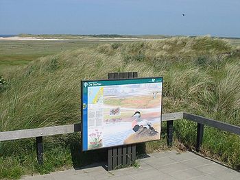
Most of the Frisian Islands are protected areas, and an international wildlife
Wildlife
Wildlife includes all non-domesticated plants, animals and other organisms. Domesticating wild plant and animal species for human benefit has occurred many times all over the planet, and has a major impact on the environment, both positive and negative....
nature reserve
Nature reserve
A nature reserve is a protected area of importance for wildlife, flora, fauna or features of geological or other special interest, which is reserved and managed for conservation and to provide special opportunities for study or research...
is being coordinated between the countries of Netherlands, Germany and Denmark. Natural gas
Natural gas
Natural gas is a naturally occurring gas mixture consisting primarily of methane, typically with 0–20% higher hydrocarbons . It is found associated with other hydrocarbon fuel, in coal beds, as methane clathrates, and is an important fuel source and a major feedstock for fertilizers.Most natural...
and oil drilling continue, however, and the presence of the Ems, Weser and Elbe
Elbe
The Elbe is one of the major rivers of Central Europe. It rises in the Krkonoše Mountains of the northwestern Czech Republic before traversing much of Bohemia , then Germany and flowing into the North Sea at Cuxhaven, 110 km northwest of Hamburg...
estuaries
Estuary
An estuary is a partly enclosed coastal body of water with one or more rivers or streams flowing into it, and with a free connection to the open sea....
and the ensuing ship
Ship
Since the end of the age of sail a ship has been any large buoyant marine vessel. Ships are generally distinguished from boats based on size and cargo or passenger capacity. Ships are used on lakes, seas, and rivers for a variety of activities, such as the transport of people or goods, fishing,...
traffic
Traffic
Traffic on roads may consist of pedestrians, ridden or herded animals, vehicles, streetcars and other conveyances, either singly or together, while using the public way for purposes of travel...
cause tension between wildlife protection and economic incentives.
Origins
During the last ice ageIce age
An ice age or, more precisely, glacial age, is a generic geological period of long-term reduction in the temperature of the Earth's surface and atmosphere, resulting in the presence or expansion of continental ice sheets, polar ice sheets and alpine glaciers...
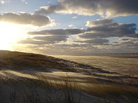
, which ended approximately 12,000 years ago, the sea level was about 60 meters below the current level, and the North Sea was dry land. Due to melting of the ice caps, the sea level rose and the water submerged the North Sea. The sea reached the current coast line approximately 7000 years ago. Due to the tides, large quantities of sand were transported to the coast. This sand piled up near rocks and behind vegetation. A large and unbroken line of dunes originated which extended all the way from contemporary Belgium
Belgium
Belgium , officially the Kingdom of Belgium, is a federal state in Western Europe. It is a founding member of the European Union and hosts the EU's headquarters, and those of several other major international organisations such as NATO.Belgium is also a member of, or affiliated to, many...
to the mouth of the river Elbe
Elbe
The Elbe is one of the major rivers of Central Europe. It rises in the Krkonoše Mountains of the northwestern Czech Republic before traversing much of Bohemia , then Germany and flowing into the North Sea at Cuxhaven, 110 km northwest of Hamburg...
, where now Hamburg
Hamburg
-History:The first historic name for the city was, according to Claudius Ptolemy's reports, Treva.But the city takes its modern name, Hamburg, from the first permanent building on the site, a castle whose construction was ordered by the Emperor Charlemagne in AD 808...
lies.
Around the beginning of the Holocene
Holocene
The Holocene is a geological epoch which began at the end of the Pleistocene and continues to the present. The Holocene is part of the Quaternary period. Its name comes from the Greek words and , meaning "entirely recent"...
era, the sea level stopped rising. The sea had however already found its way through the dunes transforming the lower country behind to the current Wadden mudflat
Mudflat
Mudflats or mud flats, also known as tidal flats, are coastal wetlands that form when mud is deposited by tides or rivers. They are found in sheltered areas such as bays, bayous, lagoons, and estuaries. Mudflats may be viewed geologically as exposed layers of bay mud, resulting from deposition of...
s. The continuous tidal currents wore gutters into the plain and this way the Wadden Islands arose.
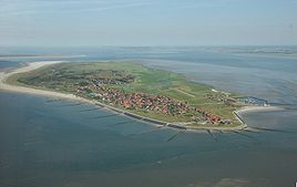
Island forming
The Dutch West FrisianWest Frisian Islands
The West Frisian Islands are a chain of islands in the North Sea off the Dutch coast, along the edge of the Wadden Sea. They continue further east as the German East Frisian Islands and are part of the Frisian Islands....
and the German East Frisian Islands
East Frisian Islands
The East Frisian Islands are a chain of islands in the North Sea, off the coast of East Frisia in Lower Saxony, Germany. The islands extend for some from west to east between the mouths of the Ems and Jade / Weser rivers and lie about 3.5 to 10 km offshore...
are barrier islands.
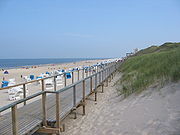
They arose along the breakers' edge where the water surge piled up sediment, and behind which sediment was carried away by the breaking waves. Over time, shoal
Shoal
Shoal, shoals or shoaling may mean:* Shoal, a sandbank or reef creating shallow water, especially where it forms a hazard to shipping* Shoal draught , of a boat with shallow draught which can pass over some shoals: see Draft...
s arose, which finally were only covered by infrequent storm floods. Once plants began to colonise the sandbanks, the land began to stabilise.
On the other hand, the North Frisian Islands
North Frisian Islands
The North Frisian Islands are a group of islands in the Wadden Sea, a part of the North Sea, off the western coast of Schleswig-Holstein, Germany. The German islands are in the traditional region of North Frisia and are part of the Schleswig-Holstein Wadden Sea National Park and the Kreis of...
arose from the remains of old Geestland
Geest (topography)
Geest is a type of slightly raised landscape that occurs in the plains of in Northern Germany, the Northern Netherlands and Denmark. It is a landscape of sandy and gravelly soils, usually mantled by a heathland vegetation, comprising glacial deposits left behind after the last ice age during the...
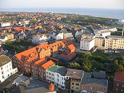
islands, where the land was partially removed by storm floods and water action and then separated from the mainland. They are, therefore, often higher and their cores are less exposed to changes than the islands to the south. Beyond the core, however, the same processes are at work, particularly evident on Sylt
Sylt
Sylt is an island in northern Germany, part of Nordfriesland district, Schleswig-Holstein, and well known for the distinctive shape of its shoreline. It belongs to the North Frisian Islands and is the largest island in North Frisia...
, where the south of the island threatens to be broken away, while the harbour at List in the north silts up.
The Danish Islands, the next in the chain to the north, arose from sandbanks. Right up into the 20th century, the silting up of the islands was a serious problem. To protect the islands, small woods were planted.
Habitation
Long before the beginning of the modern era, there were already humans inhabiting the Wadden area. Up to 800 AD, most inhabitants lived on terpenArtificial dwelling hill
An artificial dwelling hill is a mound, created to provide safe ground during high tide and river floods....
(man-made hills). The living conditions were bad, as this quote from Roman Pliny
Pliny the Elder
Gaius Plinius Secundus , better known as Pliny the Elder, was a Roman author, naturalist, and natural philosopher, as well as naval and army commander of the early Roman Empire, and personal friend of the emperor Vespasian...
shows:
... what is nature and characterisations of living by people who live without trees or shrubs. We have indeed said that in the east, to the coasts of the ocean, a number of races in such needy conditions exist; but this also applies to the races of peoples which are called the large and small Ghaucen, which we have seen in the north. There, two times in each period of a day and a night, the ocean with a fast tide submerges an immense plain, thereby the hiding the secular fight of the Nature whether the area is sea or land. There this miserable race inhabits raised pieces ground or platforms, which they have moored by hand above the level of the highest known tide. Living in huts built on the chosen spots, they seem like sailors in ships if water covers the surrounding country, but like shipwrecked people when the tide has withdrawn itself, and around their huts they catch fish which tries to escape with the expiring tide. It is for them not possible to keep herds and live on milk such as the surrounding tribes, they cannot even fight with wild animals, because all the bush country lies too far away. They braid ropes of sedges and rushes from the marshes with which they make nets to be able to catch fish, and they dig up mud with their hands and dry it more in wind than in the sun, and with soil as fuel they heat their food and their own bodies, frozen in northern wind. Their only drink comes from storing rain water in tanks front of their houses. And these are the races which, if they were now conquered by the Roman nation, say that they will fall into slavery! It is only too true: Destiny saves people as a punishment.
Around the year 1000, dike
Levee
A levee, levée, dike , embankment, floodbank or stopbank is an elongated naturally occurring ridge or artificially constructed fill or wall, which regulates water levels...
construction began. Monks were instrumental in this activity, among others those of the monastery of Aduard
Aduard
Aduard is a village in the municipality of Zuidhorn, in the Netherlands. It is located about 8 km northwest of Groningen. The history of Aduard dates back to the foundation in 1192 of a Cistercian abbey, where famous early Humanists like Rodolphus Agricola and Wessel Gansfort studied and...
. But earlier attempts had been undertaken to dam the sea. At the Frisian Peins
Peins
Peins is a small village in Franekeradeel in the province Friesland of the Netherlands and has around 270 citizens ....
(in the municipality Franeker
Franeker
Franeker is one of the eleven historical cities of Friesland and capital of the municipality of Franekeradeel. It is located about 20 km west of Leeuwarden on the Van Harinxma Canal. As of 1 January 2006, it had 12,996 inhabitants. The city is famous for the Eisinga Planetarium from around...
), a 40-meter section of dike has been discovered that is thought to date from the 1st or 2nd century BCE.
In the late Middle Ages
Middle Ages
The Middle Ages is a periodization of European history from the 5th century to the 15th century. The Middle Ages follows the fall of the Western Roman Empire in 476 and precedes the Early Modern Era. It is the middle period of a three-period division of Western history: Classic, Medieval and Modern...
the dike system was gradually strengthened and flooding diminished. Beginning in the 17th century, dikes were built further out to reclaim more land. This activity peaked in the 19th and 20th centuries.
Conservation of the West Frisian/Dutch coast
The dunes south of the Wadden Sea were also liable to this process, but man’s intervention prevented the many storm surges from changing the coast of the provinces North HollandNorth Holland
North Holland |West Frisian]]: Noard-Holland) is a province situated on the North Sea in the northwest part of the Netherlands. The provincial capital is Haarlem and its largest city is Amsterdam.-Geography:...
and South Holland
South Holland
South Holland is a province situated on the North Sea in the western part of the Netherlands. The provincial capital is The Hague and its largest city is Rotterdam.South Holland is one of the most densely populated and industrialised areas in the world...
into separate islands with Wadden mudflats behind them. However, around 1200, storm surges did break up the northern coast of Western Friesland into five islands. Around 1600, four of these along the West coast had been again recovered, but Wieringen
Wieringen
Wieringen is a municipality in the Netherlands, in the province of North Holland. It consists of a former island, also named Wieringen, and there are plans to make Wieringen an island again by widening the Amsteldiepkanaal into a lake called the Wieringerrandmeer.-Population centres :The...
, to the south-east of Texel
Texel
Texel is a municipality and an island in the Netherlands, in the province of North Holland. It is the biggest and most populated of the Frisian Islands in the Wadden Sea, and also the westernmost of this archipelago, which extends to Denmark...
, remained an island up to the 20th century.
Embankment of the mudflat
In FrieslandFriesland
Friesland is a province in the north of the Netherlands and part of the ancient region of Frisia.Until the end of 1996, the province bore Friesland as its official name. In 1997 this Dutch name lost its official status to the Frisian Fryslân...
and Groningen
Groningen (province)
Groningen [] is the northeasternmost province of the Netherlands. In the east it borders the German state of Niedersachsen , in the south Drenthe, in the west Friesland and in the north the Wadden Sea...
plans were made to embank and drain the Wadden Sea. As a result, the islands would have become part of the mainland. As of today, nature and environmental movements have been able to prevent this.
The only plan ever to be carried out was the construction of a causeway from the Frisian Holwerd
Holwerd
Holwerd is a village in the northern Netherlands, in the province of Friesland. Wadloopcentrum Fryslân in Holwerd is a center for the training of wadlopen guides and the preservation of the sport. It was the birthplace of astronomer Johannes Phocylides Holwarda. Holwerd had a station on the North...
to Ameland
Ameland
Ameland is a municipality and one of the West Frisian Islands off the north coast of the Netherlands. It consists mostly of sand dunes. It is the third major island of the West Frisians. It neighbours islands Terschelling to the West and Schiermonnikoog to the East...
, in 1872, which was not very successful. Shortly after construction, the causeway had already suffered so much storm damage that the dam was abandoned in 1882. The dam has been almost entirely eroded since then.
In the northern Wadden Sea building dams proved to be considerably simpler. Nordstrand
Nordstrand, Germany
Nordstrand is a peninsula and former island in North Frisia on the North Sea coast of Germany. It is part of the Nordfriesland district in the federal state of Schleswig-Holstein. Its area is 50 km², and its population is 2,300...
is now so much linked to the rampart by dikes that one can't really call it an island anymore, and also Langeness, Oland, Nordstrandischmoor
Nordstrandischmoor
Nordstrandischmoor is a Hallig off the North Frisian coast in Germany and lies within the Schleswig-Holstein Wadden Sea National Park.- Geography :...
, Hamburger Hallig, Sylt
Sylt
Sylt is an island in northern Germany, part of Nordfriesland district, Schleswig-Holstein, and well known for the distinctive shape of its shoreline. It belongs to the North Frisian Islands and is the largest island in North Frisia...
, and Rømø
Rømø
Rømø is a Danish island in the Wadden Sea. Rømø is part of Tønder municipality. The island has 650 inhabitants as of 1 January 2011 and covers an area of 129 km². Rømø is a popular tourist spot each year....
are all reachable by dams. Mandø
Mandø
Mandø is one of the Danish Wadden Sea islands off the southwest coast of Jutland, Denmark in the Wadden Sea, part of the North Sea. The island covers an area of 7.63 km² and has 62 inhabitants...
is even reachable without a dam by means of tidal road.
Migration
The Wadden Islands are in continuous movement. The most important movement is the 'migration': the islands themselves are slowly but certainly moving from West to East. On the West side most of the islands disappear slowly into the sea and on the East side even larger sand-banks arise. This movement is also the reason that most of the villages themselves are on the West side of their island. When they were founded they were situated in the center. Over the course of the last few centuries, many houses and even entire villages disappeared into the sea.Hook shaping
The second movement is the development of a hook shape. Along the sea breaches hook-shaped sand ridges arise, which change form with the moving of the sea arm. By growth of these hooks new shoals arise such as the Noorder and Zuiderhaaks. Sometimes such a shoal grows, originating where an island has been 'walking', and the island recovers its lost area.Inhabited
- TexelTexelTexel is a municipality and an island in the Netherlands, in the province of North Holland. It is the biggest and most populated of the Frisian Islands in the Wadden Sea, and also the westernmost of this archipelago, which extends to Denmark...
- VlielandVlielandVlieland is a municipality in the northern Netherlands. The municipality of Vlieland has only one major town: Oost-Vlieland . It is the second-least densely populated municipality in the Netherlands ....
- TerschellingTerschellingTerschelling is a municipality and an island in the northern Netherlands, one of the West Frisian Islands.Waddenislanders are known for their resourcefulness in using anything and everything that washes ashore. With few trees to use for timber, most of the farms and barns are built with masts...
- AmelandAmelandAmeland is a municipality and one of the West Frisian Islands off the north coast of the Netherlands. It consists mostly of sand dunes. It is the third major island of the West Frisians. It neighbours islands Terschelling to the West and Schiermonnikoog to the East...
- SchiermonnikoogSchiermonnikoogSchiermonnikoog is an island, a municipality, and a national park in the northern Netherlands. Schiermonnikoog is one of the West Frisian Islands, and is part of the province of Friesland....
The Dutch islands have a surface of 405.2 km² and a total of 23,872 inhabitants.
Uninhabited
- NoorderhaaksNoorderhaaksNoorderhaaks, also called Razende bol , is a Dutch sandbar in the North Sea, a few kilometres west of the Marsdiep which separates the island Texel from mainland North Holland...
- RichelRichelFor the boxer, see Richel HersisiaRichel, or rather De Richel , is a permanently dry sandbank in the Wadden Sea, in the gap between the Dutch islands of Vlieland and Terschelling. It is located about 1 kilometer east of the northernmost point of Vlieland and is administered by the municipality of...
- GriendGriendGriend is a small uninhabited Dutch island in the Wadden Sea, lying around 12 kilometres south of Terschelling. It is one of the West Frisian Islands, and belongs to the municipality of Terschelling...
- RifRif (island)Rif is a small, uninhabited, Dutch island in the Wadden Sea, lying between Ameland and Schiermonnikoog, north of Engelsmanplaat. It is one of the West Frisian Islands. The island currently has an area of less than 0.1 km². There are no breeding birds to be found, but it is popular as a high tide...
- EngelsmanplaatEngelsmanplaatEngelsmanplaat, or the Kalkman which is its local name, is a small sandbank between the Dutch islands Ameland and Schiermonnikoog.-References:...
- SimonszandSimonszandSimonszand is a small sandbank between the Dutch islands of Schiermonnikoog and Rottumerplaat....
- RottumerplaatRottumerplaatRottumerplaat is one of the three islands that make up Rottum in the West Frisian Islands. The island is located in the North Sea off the Dutch coast. Access to the island is prohibited since Rottemerplaat is a resting and forage area for numerous bird species...
- RottumeroogRottumeroogRottumeroog is one of the three islands that make up Rottum, a group of islands that are part of the West Frisian Islands archipelago. The island is situated off the Dutch coast in the North Sea. The island is named after the village Rottum in Groningen: the Benedictine "St...
- ZuiderduintjesZuiderduintjesZuiderduintjes is a very small island to the south of Rottumeroog, West Frisian Islands, Netherlands. It is part of Rottum and access to the island is prohibited since it's a rest and forage area for birds and seals....
The names of all these places suggest this is the transition area between island and shoal (plaat in Dutch). Griend and Rottumeroog are generally considered to be an island, the others are considered to disappear from time to time into the waves. The former island of Wieringen
Wieringen
Wieringen is a municipality in the Netherlands, in the province of North Holland. It consists of a former island, also named Wieringen, and there are plans to make Wieringen an island again by widening the Amsteldiepkanaal into a lake called the Wieringerrandmeer.-Population centres :The...
can be found at the top of Noord-Holland, against the Afsluitdijk
Afsluitdijk
The Afsluitdijk is a major causeway in the Netherlands, constructed between 1927 and 1933 and running from Den Oever on Wieringen in North Holland province, to the village of Zurich in Friesland province, over a length of and a width of 90 m, at an initial height of 7.25 m above sea-level.It is...
.
German Wadden Islands
(from West to East and south to North)Inhabited
- BorkumBorkumBorkum is an island and a municipality in the Leer District in Lower Saxony, northwestern Germany.-Geography:Borkum is bordered to the west by the Westerems strait , to the east by the Osterems strait, to the north by the North Sea, and to the south by the Wadden Sea...
- JuistJuistJuist is one of the seven inhabited East Frisian Islands at the edge of the Lower Saxon Wadden Sea in the southern North Sea, located between Borkum Island , Memmert Island and Norderney...
- NorderneyNorderneyNorderney is one of the seven populated East Frisian Islands off the North Sea coast of Germany. It is also a municipality in the district of Aurich in Lower Saxony....
- BaltrumBaltrumBaltrum is a barrier island off the coast of East Frisia , in Germany, and is a municipality in the district of Aurich, Lower Saxony. It is located in-between the chain of the seven inhabited East Frisian Islands...
- LangeoogLangeoogLangeoog is one of the seven inhabited East Frisian Islands at the edge of the Lower Saxon Wadden Sea in the southern North Sea, located between Baltrum Island , and Spiekeroog . It is also a municipality in the district of Wittmund in Lower Saxony, Germany. The name Langeoog means Long Island in...
- SpiekeroogSpiekeroogSpiekeroog is one of the East Frisian Islands, off the North Sea coast of Germany. It is situated between Langeoog to its west, and Wangerooge to its east. The island belongs to the district of Wittmund, in Lower Saxony in Germany. The only village on the island is also called...
- WangeroogeWangeroogeWangerooge is one of the 32 Frisian Islands in the North Sea located close to the coasts of the Netherlands, Germany and Denmark. It is also a municipality in the district of Friesland in Lower Saxony in Germany.Wangerooge is one of the East Frisian Islands...
- NeuwerkNeuwerkNeuwerk is a Wadden Sea island on the German North Sea coast and a homonymous quarter of the city of Hamburg, Germany, in the borough Hamburg-Mitte...
- PellwormPellwormPellworm is one of the North Frisian Islands on the North Sea coast of Germany. It is part of the Nordfriesland district in the federal state of Schleswig-Holstein. Its area is 37 km², and its population is roughly 1,200....
- NordstrandNordstrand, GermanyNordstrand is a peninsula and former island in North Frisia on the North Sea coast of Germany. It is part of the Nordfriesland district in the federal state of Schleswig-Holstein. Its area is 50 km², and its population is 2,300...
(presently mainland) - Inhabited Halligen
- AmrumAmrumAmrum is one of the North Frisian Islands on the German North Sea coast, south of Sylt and west of Föhr. It is part of the Nordfriesland district in the federal state of Schleswig-Holstein...
- FöhrFöhrFöhr is one of the North Frisian Islands on the German coast of the North Sea. It is part of the Nordfriesland district in the federal state of Schleswig-Holstein. Föhr is the second-largest North Sea island of Germany....
- SyltSyltSylt is an island in northern Germany, part of Nordfriesland district, Schleswig-Holstein, and well known for the distinctive shape of its shoreline. It belongs to the North Frisian Islands and is the largest island in North Frisia...
Uninhabited
- Lütje HörnLütje HörnLütje Hörn is an uninhabited East Frisian Island in the North Sea. It belongs to Germany and is located approximately 3 to 4 kilometres southeast of Borkum in the East Frisian Randzelwatt. Lütje Hörn is an unincorporated area of Leer district in Lower Saxony....
- KachelotplateKachelotplateThe Kachelotplate is a sandbar in the North Sea. It lies near the German coast, west of the island of Juist. Since 2003, enough stays above high tide that it can be called an island. Grass and dunes are settling there....
- MemmertMemmertMemmert is a small East Frisian island off the northern coast of Germany, with an area of . Memmert is uninhabited, with only one house on the island for wildlife-spotting purposes. Occasionally, some guests from the neighboring islands visit Memmert for recreation...
- Minsener-Oldoog
- Alte Mellum
- Großer KnechtsandGroßer KnechtsandThe Großer Knechtsand is a large sandbank beyond the Weser and Elbe estuaries in the eastern part of Lower Saxony's Wadden Sea off the coast of North Germany. It lies between the islands of Mellum and Neuwerk...
- Nigehörn
- Scharhörn
- TrischenTrischenTrischen is an uninhabited island in the Meldorf Bay, about 14 kilometres off the North Sea coast of Dithmarschen in north Germany – about 12 kilometres from the Trischendamm embankment. The island belongs to the municipality of Friedrichskoog and is only occupied from March to October by a bird...
- Süderoogsand
- Norderoogsand
- Japsand
- Uninhabited Halligen (Habel, Südfall, NorderoogNorderoogNorderoog is one of the ten German halligen islands of the North Frisian Islands in the Wadden Sea, which is part of the North Sea off the coast of Germany. It is only temporalily inhabited by a bird warden from March to October. The refuge hut at the northeastern end is called Jens Wand Hütte,...
)
The German islands have a surface of 448.52 km² and a total of 53,296 inhabitants. It is possible to make a boat excursion from several German Wadden Islands to the small rock island of Helgoland which is situated 70 kilometres off the coast line in the German Bight
German Bight
German Bight is the southeastern bight of the North Sea bounded by the Netherlands and Germany to the south, and Denmark and Germany to the east . To the north and west it is limited by the Dogger Bank. The Bight contains the Frisian and Danish Islands. The Wadden Sea is approximately ten to...
. Although it is no Wadden Island, there are strong cultural links with the Wadden area, for example a dialect of North Frisian
Heligolandic
Heligolandic is the dialect of the North Frisian language spoken on the German island of Heligoland in the North Sea. It is spoken today by only a few hundred of the island's 1,650 inhabitants and is also taught in schools....
is spoken here.
Not all aforementioned islands are officially considered to be Wadden Islands. For the definition of an island, a minimum of 160 hectares must no longer be submerged during average high water by the North Sea.
Danish Wadden Islands
(from South to North)- RømøRømøRømø is a Danish island in the Wadden Sea. Rømø is part of Tønder municipality. The island has 650 inhabitants as of 1 January 2011 and covers an area of 129 km². Rømø is a popular tourist spot each year....
- MandøMandøMandø is one of the Danish Wadden Sea islands off the southwest coast of Jutland, Denmark in the Wadden Sea, part of the North Sea. The island covers an area of 7.63 km² and has 62 inhabitants...
- KoresandKoresandKoresand is a sandbank in the Danish part of the Wadden Sea, south west of the island of Mandø. There was at least one settlement on Koresand until the frequent storm tides during the 1900s led to its being abandoned. In summer it is possible to travel from Mandø to Koresand by a tractor-drawn wagon....
(uninhabited) - FanøFanøFanø is a Danish island in the North Sea off the coast of southwestern Denmark, and is the very northernmost of the Danish Wadden Sea Islands...
- LangliLangliLangli is a small marsh island in the Ho Bugt near Esbjerg on the Danish North Sea Coast.It is 0.8 km long and is accessible from Ho over a 3 km long causeway at low tide. Langli was up to the flood of 1634 part of a peninsula...
(uninhabited)
In the 20th century, south of Rømø lay the only Danish hallig, Jordsand
Jordsand
Jordsand was a small Danish hallig located in the Wadden Sea southeast of the Danish island Rømø and east of the German island Sylt. The island was first known by the name Hiortsand and was possibly connected to both the mainland and the island of Sylt...
. However, in 1999 the last remains proved to be gone. North of Fanø the sand coast has been opened and closed numerous times in the course of history, but at the moment the coast line is closed, and forms a whole again save for two west coast fjords. The Danish islands have a total surface of 193.8 km² and a total of 4,173 inhabitants.