
Balch Creek
Encyclopedia
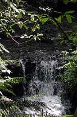
Balch Creek is a 3.5 miles (5.6 km) tributary of the Willamette River
in the U.S. state of Oregon
. Beginning at the crest of the Tualatin Mountains
(West Hills), the creek flows generally east down a canyon along Northwest Cornell Road in unincorporated Multnomah County
and through the Macleay Park section of Forest Park
, a large municipal park in Portland
. At the lower end of the park, the stream enters a pipe and remains underground until reaching the river. Danford Balch, after whom the creek is named, settled a land claim along the creek in the mid-19th century. After murdering his son-in-law, he became the first person legally hanged in Oregon.
Basalt
, mostly covered by silt in the uplands and sediment in the lowlands, underlies the Balch Creek watershed. The upper part of the watershed includes private residential land, the Audubon Society of Portland
nature sanctuary, and part of Forest Park. Mixed conifer forest of Coast Douglas-fir
, western redcedar, and western hemlock
with a well-developed understory
of shrubs and flowering plants is the natural vegetation. Sixty-two species of mammals and more than 112 species of birds use Forest Park. A small population of cutthroat trout
resides in the stream, which in 2005 was the only major water body in Portland that met state standards for bacteria, temperature, and dissolved oxygen.
Although nature reserves cover much of the upper and middle parts of the watershed, industrial sites dominate the lower part. Historic Guild's Lake
occupied part of the lower watershed through the 19th century, and in 1905 city officials held the Lewis and Clark Centennial Exposition
there on an artificial island. After the exposition, developers converted the lake and its surrounds to industrial use, and in 2001 the Portland City Council declared the site to be an "industrial sanctuary".
in unincorporated
Multnomah County near the intersection of Northwest Skyline Boulevard and Northwest Thompson Road at the crest of the West Hills. It flows generally east about 3.5 miles (5.6 km) to its confluence with the Willamette River, a major tributary of the Columbia River
. The creek drops from 1116 feet (340.2 m) above sea level
at its source to 46 feet (14 m) at its mouth, a total of 1070 feet (326.1 m). Most of this occurs in the first 2.5 miles (4 km). In the hills, the stream gradient (slope) generally ranges from 15 to 30 percent interspersed with sections of less than 15 percent along the middle reach
es.
From its source, the creek runs east on private property near Forest Park, a large municipal park in Portland, before turning briefly south about 3 miles (4.8 km) from the mouth. Soon thereafter, the stream receives an unnamed tributary on the right bank and turns southeast on private property along Northwest Cornell Road. It enters the city and the Audubon Society of Portland
simultaneously about 2 miles (3.2 km) from the mouth, receives two more unnamed tributaries on the right, and flows northeast, entering the part of Forest Park known as Macleay Park.
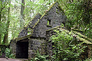
For about 0.25 mile (0.402335 km) the creek parallels Wildwood Trail, the main hiking trail in Forest Park, until reaching a former public restroom
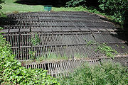
known as the Stone House. From here Balch Creek runs beside the Lower Macleay Trail, another hiking trail, for about 0.8 miles (1.3 km). Near Northwest Thurman Street, roughly 1 miles (1.6 km) from the mouth, the creek flows through a trash-catching rack into an 84 inches (213.4 cm) diameter storm sewer
. City workers first diverted the creek into a pipe in the early 20th century. The water empties into the Willamette River in the city's Northwest Industrial
neighborhood at Outfall 17. About 10 miles (16.1 km) below this outfall, the Willamette enters the Columbia River.
 The Bureau of Environmental Services (BES) of the city of Portland monitored the flow of Balch Creek from June 1996 through September 2002 at a site, Node ABB857, where the stream leaves the surface and enters a storm sewer in Macleay Park. BES reported an average summer flow of 0.2 cuft/s, a maximum of 60 cuft/s, and a minimum of 0. The average flow in winter was 1.9 cuft/s, with a maximum of 73 cuft/s and a minimum of 0.
Measurements taken during an individual spring, from mid-May to mid-July 2002, showed the flow starting at about 2.5 cuft/s and dwindling to 0 by early June. The flow through June depended partly on the weather; the highest flow, 4.5 cuft/s, occurred after a rain. Measurements taken during an individual autumn, late August to late December 2001, were close to zero until November. The largest flows during that season, 19.2 cuft/s, occurred after many days of rain.
from Grande Ronde members of the Columbia River Basalt Group
underlies the Balch Creek watershed. About 16 million years ago during the Middle Miocene
, the Columbia River ran through a lowland south of its modern channel. Eruptions from linear vents in eastern Oregon and Washington flowed down this channel through what later became the Willamette Valley
. These flows, some of which reached the Pacific Ocean
, occurred between 16.5 and 15.6 million years ago and covered almost 60000 square miles (155,399.3 km²). Geologists have identified several basalt flows in the West Hills, where they underlie the steepest slopes of Forest Park and form the columned rocks visible in parts of Balch Creek Canyon. Wind-deposited silts, unstable when wet, later covered most of the lava. Stream bank instability and siltation are common, and the threat of landslides has discouraged urban development in the hills.
About 15,000 years ago, cataclysmic ice age
events known as the Missoula Floods
or Bretz Floods originating in the Clark Fork
region of northern Idaho
inundated the Columbia River basin many times. These floods deposited huge amounts of debris and sediment and created new floodplain
s in the Willamette Valley. From then until the 19th century, the lower Balch Creek watershed consisted of swampy marshlands and shallow semi-permanent lakes such as historic Guild's Lake. The final 1 miles (1.6 km) or so of historic Balch Creek flowed across this floodplain.
s who lived in the area before settlement by non-indigenous people
in the 19th century. Members of the Multnomah
tribe of the Chinookan
people lived on Sauvie Island
in the Willamette River and on the mainland across from the island, downstream from the mouth of Balch Creek. However, since much of the area near the lower creek was swampy, it was not favored by the Multnomah. By the 1830s, diseases carried by white explorers and traders reduced the native population by up to 90 percent in the lower Columbia basin.
Historic Guild's Lake, in the lower Balch Creek watershed near the Willamette River, was named for Peter Guild , one of the first European American settlers in the area. In 1847, he acquired nearly 600 acres (2.4 km²) of the watershed through a donation land claim
. Although variations in the spelling of Guild's Lake occur in historic newspapers, maps, and other documents, Guild's Lake has been the preferred form since the beginning of the 20th century.
The creek is named for Danford Balch, who settled a 640 acres (2.6 km²) donation land claim upstream of the Guild property in 1850. After a man from a neighboring family eloped with a Balch daughter, Balch killed him with a shotgun. On October 17, 1859, at a public gallows
he became the first person to be hanged by the State of Oregon.
Macleay Park takes its name from Donald Macleay
, a Portland merchant and real-estate developer who acquired what had been the Balch property. In 1897, he donated the land for a park on condition that the city provide transport to the park for hospital patients and build paths wide enough for wheelchairs.
included a timber dam on Balch Creek and a 6 inches (15.2 cm) cast iron
pipe, which continued to supply water to Portland until the 1880s. The Bull Run River
in the Cascade Range
to the east of the city began supplying most of Portland's drinking water in 1895.
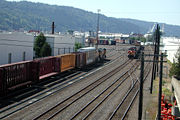 One of the first industries in the Guild's Lake area was a sawmill built in the 1880s. Although large parts of the land remained undeveloped until the early 20th century, lumber mills, grain storage structures, railroads, and docks appeared along the waterfront. The Guild's Lake Rail Yard, built by the Northern Pacific Railway
in the 1880s, became an important switching yard for trains.
In 1905, the Lewis and Clark Centennial Exposition
, held on an artificial island in Guild's Lake, helped spur growth in the area. After the exposition ended, developers filled the lake and its surrounds with soil sluice
d from parts of the Balch Creek watershed in the West Hills above the floodplain or dredged from the Willamette River. Civic leaders promoted the Guild's Lake area as a good place for industry, and by the mid-1920s the lake was gone. The USGS places historic Guild's Lake at coordinates 45.5470620°N 122.7206530°W at an elevation of 33 feet (10.1 m) above sea level between what later became Northwest Saint Helens Road and Northwest Yeon Street, slightly west of Northwest 35th Avenue in the Northwest Industrial
district of Portland.
Between the 1890s and the 1930s, channel-deepening in the Willamette River improved the city's status as a deep-water seaport, as did completion in 1914 of a port terminal. Guild's Lake, close to highways as well as marine and rail terminals, became the most important industrial area in Portland. After World War II
, chemical and petroleum processing and storage, metals manufacturing, and other large industries expanded in the area. In 2001, the Portland City Council adopted the Guild's Lake Industrial Sanctuary Plan aimed at protecting the area's "long-term economic viability as an industrial district."
 The Balch Creek watershed consists of 2248 acres (909.7 ha), equal to 3.5 square miles (9.1 km²). About 27 percent is zone
d for parks and other open space, and about 20 percent is zoned for heavy industry near the Willamette River. Multnomah County has jurisdiction over 586 acres (237.1 ha), about a quarter of the watershed. Lands zoned for residential farms and forests occupy about 13 percent of the total, mostly along the watershed's western edge. A mixture of residential, commercial, and other designations make up smaller segments. About 1,600 people lived in the Balch Creek watershed in 2000, and about 6,700 people worked there. Nearby watersheds include those of other small streams flowing directly into the Willamette along the east flank of the West Hills. The city refers to these as the Johnson-Nicolai subwatershed to the southeast, and the Kittredge and Salzman subwatersheds to the northwest. The Balch Creek watershed abuts the Tualatin River
watershed at the crest of the West Hills.
Rainfall in the watershed from 1977 to 2002 averaged about 40 inches (1,016 mm) per year. About 30 inches (762 mm) of the total fell from November through April, and about 10 inches (254 mm) fell from May through October. Minor flooding has occurred near the trash rack and caused occasional basement flooding along nearby streets.
 The watershed lies partly in the Coast Range ecoregion
and partly in the Willamette Valley ecoregion
designated by the U.S. Environmental Protection Agency
(EPA). The historic lower Balch Creek watershed through the 1880s was a mixture of open water, wetlands, grassland, and forest, while above the flood plain the watershed consisted of closed canopy forest
. People who settled here in the 19th century logged much of this forest and filled the wetlands. In 2002, aerial photographs showed that buildings, parking lots, shoreline structures, and other cleared areas covered most of the lower floodplain. On the other hand, hill forests protected from major disturbance covered about 65 percent of the watershed.
Above the floodplain, much of the habitat in the watershed consists of mixed conifer
forest. Trees and shrubs, including stands of red alder
and cottonwood trees, cover about 88 percent of the middle reaches. Near the headwaters, the forests consist mainly of mixed conifers and hardwoods with a few older Douglas-fir
s. Common species include big leaf maple, willow
, western hemlock, red alder, western red cedar
, and Douglas-fir. Most of this forest is relatively young. In Forest Park, old growth forest
, undisturbed for 250 years or more, exists mainly in isolated patches. The largest tree in the park is a Douglas-fir near the Stone House. It is 242 feet (73.8 m) high, and the trunk is 17.3 feet (5.3 m) in circumference.
Forest Park and other areas of the watershed have an understory
of well-developed shrubs including ferns, Oregon-grape
, vine maple, salal
, red huckleberry
, Fendler's waterleaf
, Indian plum
, salmonberry, and stinging nettle
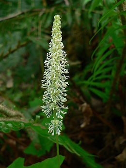
. Among the prominent wildflowers are wild ginger, Hooker's fairy bells
, vanilla leaf
, evergreen violet
, and trillium
. Rare or uncommon species include old conifers, Western wahoo
shrubs, and ornamental dawn redwoods
. Invasive species are English ivy
, European holly, clematis
, morning glory
, and Himalayan blackberry
.
 The historic creek likely supported diverse fish species, including salmon. After people filled the wetlands and diverted the lower stretch of the creek into a pipe, fish could no longer migrate to and from the Willamette River. The industrial parts of the watershed have no remaining aquatic habitat, but above the pipe the aquatic habitat remains relatively high, and Balch Creek and its tributaries support a resident population of cutthroat trout of up to about 7 inches (17.8 cm). In 2005, Balch Creek was the only major water body in Portland that met state water quality standards for bacteria, temperature and dissolved oxygen.
Nearby tracts of habitat strongly affect the wildlife in the Balch Creek watershed. This is especially true of Forest Park, which extends into other watersheds to the northwest. Birds and animals from these watersheds and from the Tualatin River
valley, the Coast Range
, the Willamette River, Sauvie Island, the Columbia River, and the Vancouver, Washington
, lowlands, move in and out of the park with relative ease. Sixty-two mammal species, including the northern flying squirrel
, black-tailed deer, creeping vole
, bobcat
, coyote, Mazama pocket gopher
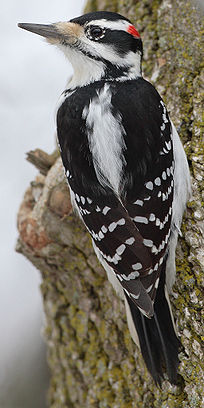
, little brown bat, Roosevelt elk, and Pacific jumping mouse use Forest Park. Blue Grouse, Great Horned Owl
, Hairy Woodpecker
, Bewick's Wren
, Orange-crowned Warbler
, Osprey
, and Hermit Thrush
are among the 112 species of birds that frequent the area. Amphibian species seen at the Audubon Society pond include rough-skinned newt
s, Pacific tree frogs
, and salamander
s.
Pressure from habitat loss, pollution, hunting, and urban development has reduced or eliminated the large predators such as wolves, bears, and wild cats and has led to increased numbers of small predators such as weasel
s and raccoon
s. Roads through the watershed severely hamper the movement of large animals. Invasive plant species such as English ivy have made the habitat simpler and less supportive of native insects and the salamanders and other amphibians that feed on them. Citizen groups such as the No Ivy League and Friends of Forest Park have engaged in projects to remove ivy, to plant native species, and to widen and protect riparian zones.
Willamette River
The Willamette River is a major tributary of the Columbia River, accounting for 12 to 15 percent of the Columbia's flow. The Willamette's main stem is long, lying entirely in northwestern Oregon in the United States...
in the U.S. state of Oregon
Oregon
Oregon is a state in the Pacific Northwest region of the United States. It is located on the Pacific coast, with Washington to the north, California to the south, Nevada on the southeast and Idaho to the east. The Columbia and Snake rivers delineate much of Oregon's northern and eastern...
. Beginning at the crest of the Tualatin Mountains
Tualatin Mountains
The Tualatin Mountains are a range of hills on the western border of Multnomah County, Oregon, United States...
(West Hills), the creek flows generally east down a canyon along Northwest Cornell Road in unincorporated Multnomah County
Multnomah County, Oregon
Multnomah County is one of 36 counties in the U.S. state of Oregon. Though smallest in area, it is the most populous as its county seat, Portland, is the state's largest city...
and through the Macleay Park section of Forest Park
Forest Park (Portland)
Forest Park is a public municipal park in the Tualatin Mountains west of downtown Portland, Oregon, United States. Stretching for more than on hillsides overlooking the Willamette River, it is one of the country's largest urban forest reserves...
, a large municipal park in Portland
Portland, Oregon
Portland is a city located in the Pacific Northwest, near the confluence of the Willamette and Columbia rivers in the U.S. state of Oregon. As of the 2010 Census, it had a population of 583,776, making it the 29th most populous city in the United States...
. At the lower end of the park, the stream enters a pipe and remains underground until reaching the river. Danford Balch, after whom the creek is named, settled a land claim along the creek in the mid-19th century. After murdering his son-in-law, he became the first person legally hanged in Oregon.
Basalt
Basalt
Basalt is a common extrusive volcanic rock. It is usually grey to black and fine-grained due to rapid cooling of lava at the surface of a planet. It may be porphyritic containing larger crystals in a fine matrix, or vesicular, or frothy scoria. Unweathered basalt is black or grey...
, mostly covered by silt in the uplands and sediment in the lowlands, underlies the Balch Creek watershed. The upper part of the watershed includes private residential land, the Audubon Society of Portland
Audubon Society of Portland
The Audubon Society of Portland is a non-profit environmental organization dedicated to wildlife conservancy in Portland, Oregon, U.S.Founded in 1902 and incorporated in 1909, it is one of the oldest such organizations in the world....
nature sanctuary, and part of Forest Park. Mixed conifer forest of Coast Douglas-fir
Coast Douglas-fir
Pseudotsuga menziesii, known as Douglas-fir, Oregon Pine, or Douglas spruce, is an evergreen conifer species native to western North America. Its variety Pseudotsuga menziesii var. menziesii, also known as coast Douglas-fir grows in the coastal regions, from west-central British Columbia, Canada...
, western redcedar, and western hemlock
Western Hemlock
Tsuga heterophylla. the Western Hemlock, is a species of hemlock native to the west coast of North America, with its northwestern limit on the Kenai Peninsula, Alaska, and its southeastern limit in northern Sonoma County, California.-Habitat:...
with a well-developed understory
Understory
Understory is the term for the area of a forest which grows at the lowest height level below the forest canopy. Plants in the understory consist of a mixture of seedlings and saplings of canopy trees together with understory shrubs and herbs...
of shrubs and flowering plants is the natural vegetation. Sixty-two species of mammals and more than 112 species of birds use Forest Park. A small population of cutthroat trout
Cutthroat trout
The cutthroat trout is a species of freshwater fish in the salmon family of order Salmoniformes. It is one of the many fish species colloquially known as trout...
resides in the stream, which in 2005 was the only major water body in Portland that met state standards for bacteria, temperature, and dissolved oxygen.
Although nature reserves cover much of the upper and middle parts of the watershed, industrial sites dominate the lower part. Historic Guild's Lake
Guild's Lake
Guild's Lake was historically a flood-prone lowland near the confluence of Balch Creek with the Willamette River in the U.S. state of Oregon. Indigenous Multnomah people established villages on nearby Sauvie Island but not in the swampy area along the Balch Creek side of the river in what later...
occupied part of the lower watershed through the 19th century, and in 1905 city officials held the Lewis and Clark Centennial Exposition
Lewis and Clark Centennial Exposition
The Lewis and Clark Centennial Exposition, commonly also known as the Lewis and Clark Exposition, and officially known as the Lewis and Clark Centennial American Pacific Exposition and Oriental Fair, was a worldwide exposition held in Portland, Oregon, United States in 1905 to celebrate the...
there on an artificial island. After the exposition, developers converted the lake and its surrounds to industrial use, and in 2001 the Portland City Council declared the site to be an "industrial sanctuary".
Course
Balch Creek begins in the Forest Park neighborhoodForest Park, Portland, Oregon
Forest Park, a neighborhood on the northwestern edge of Portland, Oregon, combines rolling green pastures, views east and west, and proximity to the attractions of Northwest District. The Forest Park neighborhood is named because of its proximity to Forest Park, the southern portion of which lies...
in unincorporated
Unincorporated area
In law, an unincorporated area is a region of land that is not a part of any municipality.To "incorporate" in this context means to form a municipal corporation, a city, town, or village with its own government. An unincorporated community is usually not subject to or taxed by a municipal government...
Multnomah County near the intersection of Northwest Skyline Boulevard and Northwest Thompson Road at the crest of the West Hills. It flows generally east about 3.5 miles (5.6 km) to its confluence with the Willamette River, a major tributary of the Columbia River
Columbia River
The Columbia River is the largest river in the Pacific Northwest region of North America. The river rises in the Rocky Mountains of British Columbia, Canada, flows northwest and then south into the U.S. state of Washington, then turns west to form most of the border between Washington and the state...
. The creek drops from 1116 feet (340.2 m) above sea level
Sea level
Mean sea level is a measure of the average height of the ocean's surface ; used as a standard in reckoning land elevation...
at its source to 46 feet (14 m) at its mouth, a total of 1070 feet (326.1 m). Most of this occurs in the first 2.5 miles (4 km). In the hills, the stream gradient (slope) generally ranges from 15 to 30 percent interspersed with sections of less than 15 percent along the middle reach
Reach (geography)
A reach in geography can mean several things. Most generally, a reach is any length of a stream between any two points. The points may be selected for any reason, such as gauging stations, river miles, natural features, and topography. They may be arbitrary or vague.A reach may also be an expanse,...
es.
From its source, the creek runs east on private property near Forest Park, a large municipal park in Portland, before turning briefly south about 3 miles (4.8 km) from the mouth. Soon thereafter, the stream receives an unnamed tributary on the right bank and turns southeast on private property along Northwest Cornell Road. It enters the city and the Audubon Society of Portland
Audubon Society of Portland
The Audubon Society of Portland is a non-profit environmental organization dedicated to wildlife conservancy in Portland, Oregon, U.S.Founded in 1902 and incorporated in 1909, it is one of the oldest such organizations in the world....
simultaneously about 2 miles (3.2 km) from the mouth, receives two more unnamed tributaries on the right, and flows northeast, entering the part of Forest Park known as Macleay Park.
For about 0.25 mile (0.402335 km) the creek parallels Wildwood Trail, the main hiking trail in Forest Park, until reaching a former public restroom
Washroom
A public toilet is a room or small building containing one or more toilets and possibly also urinals which is available for use by the general public, or in a broader meaning of "public", by customers of other...
known as the Stone House. From here Balch Creek runs beside the Lower Macleay Trail, another hiking trail, for about 0.8 miles (1.3 km). Near Northwest Thurman Street, roughly 1 miles (1.6 km) from the mouth, the creek flows through a trash-catching rack into an 84 inches (213.4 cm) diameter storm sewer
Storm drain
A storm drain, storm sewer , stormwater drain or drainage well system or simply a drain or drain system is designed to drain excess rain and ground water from paved streets, parking lots, sidewalks, and roofs. Storm drains vary in design from small residential dry wells to large municipal systems...
. City workers first diverted the creek into a pipe in the early 20th century. The water empties into the Willamette River in the city's Northwest Industrial
Northwest Industrial, Portland, Oregon
Northwest Industrial is an almost entirely industrial neighborhood in the Northwest section of Portland. According to the Portland Bureau of Planning, it "is one of the few remaining large urban industrial districts in the United States" and "one of the premier heavy industrialdistricts in the...
neighborhood at Outfall 17. About 10 miles (16.1 km) below this outfall, the Willamette enters the Columbia River.
Discharge
Measurements taken during an individual spring, from mid-May to mid-July 2002, showed the flow starting at about 2.5 cuft/s and dwindling to 0 by early June. The flow through June depended partly on the weather; the highest flow, 4.5 cuft/s, occurred after a rain. Measurements taken during an individual autumn, late August to late December 2001, were close to zero until November. The largest flows during that season, 19.2 cuft/s, occurred after many days of rain.
Geology
Solidified lavaLava
Lava refers both to molten rock expelled by a volcano during an eruption and the resulting rock after solidification and cooling. This molten rock is formed in the interior of some planets, including Earth, and some of their satellites. When first erupted from a volcanic vent, lava is a liquid at...
from Grande Ronde members of the Columbia River Basalt Group
Columbia River Basalt Group
The Columbia River Basalt Group is a large igneous province that lies across parts of the Western United States. It is found in the U.S. states of Washington, Oregon, Idaho, Nevada, and California...
underlies the Balch Creek watershed. About 16 million years ago during the Middle Miocene
Middle Miocene
The Middle Miocene is a sub-epoch of the Miocene Epoch made up of two stages: the Langhian and Serravallian stages. The Middle Miocene is preceded by the Early Miocene....
, the Columbia River ran through a lowland south of its modern channel. Eruptions from linear vents in eastern Oregon and Washington flowed down this channel through what later became the Willamette Valley
Willamette Valley
The Willamette Valley is the most populated region in the state of Oregon of the United States. Located in the state's northwest, the region is surrounded by tall mountain ranges to the east, west and south and the valley's floor is broad, flat and fertile because of Ice Age conditions...
. These flows, some of which reached the Pacific Ocean
Pacific Ocean
The Pacific Ocean is the largest of the Earth's oceanic divisions. It extends from the Arctic in the north to the Southern Ocean in the south, bounded by Asia and Australia in the west, and the Americas in the east.At 165.2 million square kilometres in area, this largest division of the World...
, occurred between 16.5 and 15.6 million years ago and covered almost 60000 square miles (155,399.3 km²). Geologists have identified several basalt flows in the West Hills, where they underlie the steepest slopes of Forest Park and form the columned rocks visible in parts of Balch Creek Canyon. Wind-deposited silts, unstable when wet, later covered most of the lava. Stream bank instability and siltation are common, and the threat of landslides has discouraged urban development in the hills.
About 15,000 years ago, cataclysmic ice age
Ice age
An ice age or, more precisely, glacial age, is a generic geological period of long-term reduction in the temperature of the Earth's surface and atmosphere, resulting in the presence or expansion of continental ice sheets, polar ice sheets and alpine glaciers...
events known as the Missoula Floods
Missoula Floods
The Missoula Floods refer to the cataclysmic floods that swept periodically across eastern Washington and down the Columbia River Gorge at the end of the last ice age. The glacial flood events have been researched since the 1920s...
or Bretz Floods originating in the Clark Fork
Clark Fork (river)
The Clark Fork is a river in the U.S. states of Montana and Idaho, approximately long. The largest river by volume in Montana, it drains an extensive region of the Rocky Mountains in western Montana and northern Idaho in the watershed of the Columbia River, flowing northwest through a long...
region of northern Idaho
Idaho
Idaho is a state in the Rocky Mountain area of the United States. The state's largest city and capital is Boise. Residents are called "Idahoans". Idaho was admitted to the Union on July 3, 1890, as the 43rd state....
inundated the Columbia River basin many times. These floods deposited huge amounts of debris and sediment and created new floodplain
Floodplain
A floodplain, or flood plain, is a flat or nearly flat land adjacent a stream or river that stretches from the banks of its channel to the base of the enclosing valley walls and experiences flooding during periods of high discharge...
s in the Willamette Valley. From then until the 19th century, the lower Balch Creek watershed consisted of swampy marshlands and shallow semi-permanent lakes such as historic Guild's Lake. The final 1 miles (1.6 km) or so of historic Balch Creek flowed across this floodplain.
Names
Multnomah County is named for Native AmericanNative Americans in the United States
Native Americans in the United States are the indigenous peoples in North America within the boundaries of the present-day continental United States, parts of Alaska, and the island state of Hawaii. They are composed of numerous, distinct tribes, states, and ethnic groups, many of which survive as...
s who lived in the area before settlement by non-indigenous people
Indigenous peoples
Indigenous peoples are ethnic groups that are defined as indigenous according to one of the various definitions of the term, there is no universally accepted definition but most of which carry connotations of being the "original inhabitants" of a territory....
in the 19th century. Members of the Multnomah
Multnomah (tribe)
The Multnomah were a tribe of Chinookan people who lived in the area of Portland, Oregon, more specifically Sauvie Island, in the United States through the early 19th century. Multnomah villages were located throughout the Portland basin and on both sides of the Columbia River...
tribe of the Chinookan
Chinookan
Chinook refers to several native amercain groups of in the Pacific Northwest region of the United States, speaking the Chinookan languages. In the early 19th century, the Chinookan-speaking peoples lived along the lower and middle Columbia River in present-day Oregon and Washington...
people lived on Sauvie Island
Sauvie Island
Sauvie Island, in the U.S. state of Oregon, originally Wapato Island or Wappatoo Island, is the largest island along the Columbia River, at 26,000 acres , and the largest river island in the United States...
in the Willamette River and on the mainland across from the island, downstream from the mouth of Balch Creek. However, since much of the area near the lower creek was swampy, it was not favored by the Multnomah. By the 1830s, diseases carried by white explorers and traders reduced the native population by up to 90 percent in the lower Columbia basin.
Historic Guild's Lake, in the lower Balch Creek watershed near the Willamette River, was named for Peter Guild , one of the first European American settlers in the area. In 1847, he acquired nearly 600 acres (2.4 km²) of the watershed through a donation land claim
Donation Land Claim Act
The Donation Land Claim Act of 1850 was a statute enacted by the United States Congress intended to promote homestead settlement in the Oregon Territory in the Pacific Northwest...
. Although variations in the spelling of Guild's Lake occur in historic newspapers, maps, and other documents, Guild's Lake has been the preferred form since the beginning of the 20th century.
The creek is named for Danford Balch, who settled a 640 acres (2.6 km²) donation land claim upstream of the Guild property in 1850. After a man from a neighboring family eloped with a Balch daughter, Balch killed him with a shotgun. On October 17, 1859, at a public gallows
Gallows
A gallows is a frame, typically wooden, used for execution by hanging, or by means to torture before execution, as was used when being hanged, drawn and quartered...
he became the first person to be hanged by the State of Oregon.
Macleay Park takes its name from Donald Macleay
Donald Macleay
Donald Macleay was a prominent 19th century merchant and banker in Portland in the U.S. state of Oregon. A native of Scotland, he emigrated at the age of 16 with his parents to the Canadian province of Quebec before relocating as an adult to California and, later, Oregon...
, a Portland merchant and real-estate developer who acquired what had been the Balch property. In 1897, he donated the land for a park on condition that the city provide transport to the park for hospital patients and build paths wide enough for wheelchairs.
Early water supply
Balch Creek was one of Portland's sources of drinking water in the mid-19th century. Stephen Coffin and Finice Caruthers, two early Portland entrepreneurs, established the first public water supply for the city in 1857 by piping water from Caruthers Creek in southwest Portland through round fir logs with 2.5 inches (6.4 cm) holes bored in them. In 1862, the Portland Water Company added water from Balch Creek to the system. The company's infrastructureInfrastructure
Infrastructure is basic physical and organizational structures needed for the operation of a society or enterprise, or the services and facilities necessary for an economy to function...
included a timber dam on Balch Creek and a 6 inches (15.2 cm) cast iron
Cast iron
Cast iron is derived from pig iron, and while it usually refers to gray iron, it also identifies a large group of ferrous alloys which solidify with a eutectic. The color of a fractured surface can be used to identify an alloy. White cast iron is named after its white surface when fractured, due...
pipe, which continued to supply water to Portland until the 1880s. The Bull Run River
Bull Run River (Oregon)
The Bull Run River is a tributary of the Sandy River in the U.S. state of Oregon. Beginning at the lower end of Bull Run Lake in the Cascade Range, it flows generally west through the Bull Run Watershed Management Unit , a restricted area meant to protect the river and its tributaries from...
in the Cascade Range
Cascade Range
The Cascade Range is a major mountain range of western North America, extending from southern British Columbia through Washington and Oregon to Northern California. It includes both non-volcanic mountains, such as the North Cascades, and the notable volcanoes known as the High Cascades...
to the east of the city began supplying most of Portland's drinking water in 1895.
Industry
Northern Pacific Railway
The Northern Pacific Railway was a railway that operated in the west along the Canadian border of the United States. Construction began in 1870 and the main line opened all the way from the Great Lakes to the Pacific when former president Ulysses S. Grant drove in the final "golden spike" in...
in the 1880s, became an important switching yard for trains.
In 1905, the Lewis and Clark Centennial Exposition
Lewis and Clark Centennial Exposition
The Lewis and Clark Centennial Exposition, commonly also known as the Lewis and Clark Exposition, and officially known as the Lewis and Clark Centennial American Pacific Exposition and Oriental Fair, was a worldwide exposition held in Portland, Oregon, United States in 1905 to celebrate the...
, held on an artificial island in Guild's Lake, helped spur growth in the area. After the exposition ended, developers filled the lake and its surrounds with soil sluice
Sluice
A sluice is a water channel that is controlled at its head by a gate . For example, a millrace is a sluice that channels water toward a water mill...
d from parts of the Balch Creek watershed in the West Hills above the floodplain or dredged from the Willamette River. Civic leaders promoted the Guild's Lake area as a good place for industry, and by the mid-1920s the lake was gone. The USGS places historic Guild's Lake at coordinates 45.5470620°N 122.7206530°W at an elevation of 33 feet (10.1 m) above sea level between what later became Northwest Saint Helens Road and Northwest Yeon Street, slightly west of Northwest 35th Avenue in the Northwest Industrial
Northwest Industrial, Portland, Oregon
Northwest Industrial is an almost entirely industrial neighborhood in the Northwest section of Portland. According to the Portland Bureau of Planning, it "is one of the few remaining large urban industrial districts in the United States" and "one of the premier heavy industrialdistricts in the...
district of Portland.
Between the 1890s and the 1930s, channel-deepening in the Willamette River improved the city's status as a deep-water seaport, as did completion in 1914 of a port terminal. Guild's Lake, close to highways as well as marine and rail terminals, became the most important industrial area in Portland. After World War II
World War II
World War II, or the Second World War , was a global conflict lasting from 1939 to 1945, involving most of the world's nations—including all of the great powers—eventually forming two opposing military alliances: the Allies and the Axis...
, chemical and petroleum processing and storage, metals manufacturing, and other large industries expanded in the area. In 2001, the Portland City Council adopted the Guild's Lake Industrial Sanctuary Plan aimed at protecting the area's "long-term economic viability as an industrial district."
Watershed
Zoning
Zoning is a device of land use planning used by local governments in most developed countries. The word is derived from the practice of designating permitted uses of land based on mapped zones which separate one set of land uses from another...
d for parks and other open space, and about 20 percent is zoned for heavy industry near the Willamette River. Multnomah County has jurisdiction over 586 acres (237.1 ha), about a quarter of the watershed. Lands zoned for residential farms and forests occupy about 13 percent of the total, mostly along the watershed's western edge. A mixture of residential, commercial, and other designations make up smaller segments. About 1,600 people lived in the Balch Creek watershed in 2000, and about 6,700 people worked there. Nearby watersheds include those of other small streams flowing directly into the Willamette along the east flank of the West Hills. The city refers to these as the Johnson-Nicolai subwatershed to the southeast, and the Kittredge and Salzman subwatersheds to the northwest. The Balch Creek watershed abuts the Tualatin River
Tualatin River
The Tualatin River is a tributary of the Willamette River located in Oregon in the United States. The river is approximately long, and it drains a fertile farming region called the Tualatin Valley southwest and west of Portland at the northwest corner of the Willamette Valley...
watershed at the crest of the West Hills.
Rainfall in the watershed from 1977 to 2002 averaged about 40 inches (1,016 mm) per year. About 30 inches (762 mm) of the total fell from November through April, and about 10 inches (254 mm) fell from May through October. Minor flooding has occurred near the trash rack and caused occasional basement flooding along nearby streets.
Flora
Coast Range (ecoregion)
The Coast Range ecoregion is a Level III ecoregion designated by the Environmental Protection Agency in the U.S. states of Washington, Oregon, and California...
and partly in the Willamette Valley ecoregion
Willamette Valley (ecoregion)
The Willamette Valley ecoregion is a Level III ecoregion designated by the United States Environmental Protection Agency in the U.S. states of Oregon and Washington. Slightly larger than the Willamette Valley for which it is named, the ecoregion contains fluvial terraces and floodplains of the...
designated by the U.S. Environmental Protection Agency
United States Environmental Protection Agency
The U.S. Environmental Protection Agency is an agency of the federal government of the United States charged with protecting human health and the environment, by writing and enforcing regulations based on laws passed by Congress...
(EPA). The historic lower Balch Creek watershed through the 1880s was a mixture of open water, wetlands, grassland, and forest, while above the flood plain the watershed consisted of closed canopy forest
Canopy (forest)
In biology, the canopy is the aboveground portion of a plant community or crop, formed by plant crowns.For forests, canopy also refers to the upper layer or habitat zone, formed by mature tree crowns and including other biological organisms .Sometimes the term canopy is used to refer to the extent...
. People who settled here in the 19th century logged much of this forest and filled the wetlands. In 2002, aerial photographs showed that buildings, parking lots, shoreline structures, and other cleared areas covered most of the lower floodplain. On the other hand, hill forests protected from major disturbance covered about 65 percent of the watershed.
Above the floodplain, much of the habitat in the watershed consists of mixed conifer
Pinophyta
The conifers, division Pinophyta, also known as division Coniferophyta or Coniferae, are one of 13 or 14 division level taxa within the Kingdom Plantae. Pinophytes are gymnosperms. They are cone-bearing seed plants with vascular tissue; all extant conifers are woody plants, the great majority being...
forest. Trees and shrubs, including stands of red alder
Red Alder
Alnus rubra, the Red alder, is a deciduous broadleaf tree native to western North America.-Description:It is the largest species of alder in North America and one of the largest in the world, reaching heights of 20–35 m. The official tallest red alder stands 32 meters tall in Clatsop County, Oregon...
and cottonwood trees, cover about 88 percent of the middle reaches. Near the headwaters, the forests consist mainly of mixed conifers and hardwoods with a few older Douglas-fir
Douglas-fir
Douglas-fir is one of the English common names for evergreen coniferous trees of the genus Pseudotsuga in the family Pinaceae. Other common names include Douglas tree, and Oregon pine. There are five species, two in western North America, one in Mexico, and two in eastern Asia...
s. Common species include big leaf maple, willow
Willow
Willows, sallows, and osiers form the genus Salix, around 400 species of deciduous trees and shrubs, found primarily on moist soils in cold and temperate regions of the Northern Hemisphere...
, western hemlock, red alder, western red cedar
Thuja plicata
Thuja plicata, commonly called Western or pacific red cedar, giant or western arborvitae, giant cedar, or shinglewood, is a species of Thuja, an evergreen coniferous tree in the cypress family Cupressaceae native to western North America...
, and Douglas-fir. Most of this forest is relatively young. In Forest Park, old growth forest
Old growth forest
An old-growth forest is a forest that has attained great age , and thereby exhibits unique ecological features. An old growth forest has also usually reached a climax community...
, undisturbed for 250 years or more, exists mainly in isolated patches. The largest tree in the park is a Douglas-fir near the Stone House. It is 242 feet (73.8 m) high, and the trunk is 17.3 feet (5.3 m) in circumference.
Forest Park and other areas of the watershed have an understory
Understory
Understory is the term for the area of a forest which grows at the lowest height level below the forest canopy. Plants in the understory consist of a mixture of seedlings and saplings of canopy trees together with understory shrubs and herbs...
of well-developed shrubs including ferns, Oregon-grape
Oregon-grape
Oregon-grape is an evergreen shrub related to the barberry. Some authors place Mahonia in the barberry genus, Berberis...
, vine maple, salal
Salal
Gaultheria shallon is a leathery-leaved shrub in the heather family , native to western North America. In English it is known as salal, shallon, or in Britain simply Gaultheria.-Ecology:...
, red huckleberry
Vaccinium parvifolium
Red Huckleberry is a species of Vaccinium native to the western North America, where it is common in forests from southeastern Alaska and British Columbia south through western Washington and Oregon to central California. In the Oregon Coast Range, it is the most common Vaccinium...
, Fendler's waterleaf
Hydrophyllum
Hydrophyllum is a genus of flowering plants in the waterleaf family which includes several herbaceous perennials native to North America. They include Hydrophyllum capitatum, the dwarf waterleaf or ballhead waterleaf. Its head is made of a series of five-petaled, five-stamened purple flowers...
, Indian plum
Oemleria cerasiformis
Oemleria cerasiformis, also known as the Osoberry and Indian Plum, is the sole species in genus Oemleria. It is a shrub native to the Pacific coast and ranges of North America, from British Columbia, Canada to Santa Barbara County, California, U.S.A. It is among the first plants to leaf out and...
, salmonberry, and stinging nettle
Stinging nettle
Stinging nettle or common nettle, Urtica dioica, is a herbaceous perennial flowering plant, native to Europe, Asia, northern Africa, and North America, and is the best-known member of the nettle genus Urtica...
. Among the prominent wildflowers are wild ginger, Hooker's fairy bells
Disporum
Disporum is a genus of about 20 species of perennial flowering plants, found in Asia from northern India to Japan. In the APG III classification system, it is placed in the family Colchicaceae....
, vanilla leaf
Achlys (plant)
Achlys is a small genus of flowering plants in the barberry family, which it shares with genera such as Berberis and Vancouveria.-Species:...
, evergreen violet
Viola sempervirens
Viola sempervirens , known by the common names Redwood Violet and Evergreen Violet, is a species in the genus Viola. It is native to the West Coast of the United States and British Columbia, Canada....
, and trillium
Trillium
Trillium is a genus of about 40–50 species of spring ephemeral perennials, native to temperate regions of North America and Asia....
. Rare or uncommon species include old conifers, Western wahoo
Euonymus occidentalis
Euonymus occidentalis is a species of spindle tree known by the common name western burning bush. It is native to western North America from British Columbia to California, where it is the only member of its genus growing wild. This is a shrub or small tree reaching maximum heights of anywhere from...
shrubs, and ornamental dawn redwoods
Metasequoia
Metasequoia is a fast-growing, deciduous tree, and the sole living species, Metasequoia glyptostroboides, is one of three species of conifers known as redwoods. It is native to the Sichuan-Hubei region of China. Although the least tall of the redwoods, it grows to at least 200 feet in height...
. Invasive species are English ivy
Hedera helix
Hedera helix is a species of ivy native to most of Europe and western Asia. It is labeled as an invasive species in a number of areas where it has been introduced.-Description:...
, European holly, clematis
Clematis
Clematis is a genus of about 300 species within the buttercup family Ranunculaceae. Their garden hybrids have been popular among gardeners beginning with Clematis × jackmanii, a garden standby since 1862; more hybrid cultivars are being produced constantly. They are mainly of Chinese and Japanese...
, morning glory
Morning glory
Morning glory is a common name for over 1,000 species of flowering plants in the family Convolvulaceae, whose current taxonomy and systematics is in flux...
, and Himalayan blackberry
Rubus armeniacus
Rubus armeniacus, Armenian Blackberry or Himalayan Blackberry, is a species of Rubus in the blackberry group Rubus subgenus Rubus series Discolores Focke. It is native to Armenia in southwest Asia, and widely naturalised elsewhere...
.
Fauna
Nearby tracts of habitat strongly affect the wildlife in the Balch Creek watershed. This is especially true of Forest Park, which extends into other watersheds to the northwest. Birds and animals from these watersheds and from the Tualatin River
Tualatin River
The Tualatin River is a tributary of the Willamette River located in Oregon in the United States. The river is approximately long, and it drains a fertile farming region called the Tualatin Valley southwest and west of Portland at the northwest corner of the Willamette Valley...
valley, the Coast Range
Pacific Coast Ranges
The Pacific Coast Ranges and the Pacific Mountain System are the series of mountain ranges that stretch along the West Coast of North America from Alaska south to Northern and Central Mexico...
, the Willamette River, Sauvie Island, the Columbia River, and the Vancouver, Washington
Vancouver, Washington
Vancouver is a city on the north bank of the Columbia River in the U.S. state of Washington. Incorporated in 1857, it is the fourth largest city in the state with a 2010 census population of 161,791 as of April 1, 2010...
, lowlands, move in and out of the park with relative ease. Sixty-two mammal species, including the northern flying squirrel
Northern Flying Squirrel
The Northern flying squirrel is one of two species of the genus Glaucomys, the only flying squirrels found in North America . Unlike most members of their family, flying squirrels are strictly nocturnal...
, black-tailed deer, creeping vole
Vole
A vole is a small rodent resembling a mouse but with a stouter body, a shorter hairy tail, a slightly rounder head, smaller ears and eyes, and differently formed molars . There are approximately 155 species of voles. They are sometimes known as meadow mice or field mice in North America...
, bobcat
Bobcat
The bobcat is a North American mammal of the cat family Felidae, appearing during the Irvingtonian stage of around 1.8 million years ago . With twelve recognized subspecies, it ranges from southern Canada to northern Mexico, including most of the continental United States...
, coyote, Mazama pocket gopher
Mazama Pocket Gopher
The Mazama Pocket Gopher, Thomomys mazama, is a smooth-toothed pocket gopher restricted to the Pacific Northwest. The species ranges from coastal Washington, through Oregon, and into north-central California.-Subspecies:...
, little brown bat, Roosevelt elk, and Pacific jumping mouse use Forest Park. Blue Grouse, Great Horned Owl
Great Horned Owl
The Great Horned Owl, , also known as the Tiger Owl, is a large owl native to the Americas. It is an adaptable bird with a vast range and is the most widely distributed true owl in the Americas.-Description:...
, Hairy Woodpecker
Hairy Woodpecker
The Hairy Woodpecker is a medium-sized woodpecker, averaging approximately 250 mm in length with a 380 mm wingspan...
, Bewick's Wren
Bewick's Wren
The Bewick's Wren is a wren native to North America. At about 14 cm long, it is grey-brown above, white below, with a long white eyebrow. While similar in appearance to the Carolina Wren, it has a long tail that is tipped in white. The song is loud and melodious, much like the song of other...
, Orange-crowned Warbler
Orange-crowned Warbler
The Orange-crowned Warbler is a small songbird of the New World warbler family.These birds are distinguished by their lack of wing bars, streaking on the underparts, strong face marking or bright colouring, resembling a fall Tennessee Warbler. The orange patch on the crown is usually not visible...
, Osprey
Osprey
The Osprey , sometimes known as the sea hawk or fish eagle, is a diurnal, fish-eating bird of prey. It is a large raptor, reaching more than in length and across the wings...
, and Hermit Thrush
Hermit Thrush
The Hermit Thrush is a medium-sized North American thrush. It is not very closely related to the other North American migrant species of Catharus, but rather to the Mexican Russet Nightingale-thrush.-Description:...
are among the 112 species of birds that frequent the area. Amphibian species seen at the Audubon Society pond include rough-skinned newt
Rough-skinned Newt
The rough-skinned newt is a North American newt known for its strong poison.- Toxicity :Many newts produce toxins to avoid predation, but the toxins of the genus Taricha are particularly potent...
s, Pacific tree frogs
Pacific Tree Frog
The Pacific Tree Frog has a range from the West Coast of the United States to British Columbia, in Canada. They live from sea level to more than 10,000 feet in many types of habitats, reproducing in aquatic settings. They are the only frogs that go "ribbit"...
, and salamander
Salamander
Salamander is a common name of approximately 500 species of amphibians. They are typically characterized by a superficially lizard-like appearance, with their slender bodies, short noses, and long tails. All known fossils and extinct species fall under the order Caudata, while sometimes the extant...
s.
Pressure from habitat loss, pollution, hunting, and urban development has reduced or eliminated the large predators such as wolves, bears, and wild cats and has led to increased numbers of small predators such as weasel
Weasel
Weasels are mammals forming the genus Mustela of the Mustelidae family. They are small, active predators, long and slender with short legs....
s and raccoon
Raccoon
Procyon is a genus of nocturnal mammals, comprising three species commonly known as raccoons, in the family Procyonidae. The most familiar species, the common raccoon , is often known simply as "the" raccoon, as the two other raccoon species in the genus are native only to the tropics and are...
s. Roads through the watershed severely hamper the movement of large animals. Invasive plant species such as English ivy have made the habitat simpler and less supportive of native insects and the salamanders and other amphibians that feed on them. Citizen groups such as the No Ivy League and Friends of Forest Park have engaged in projects to remove ivy, to plant native species, and to widen and protect riparian zones.
Works cited
- Bishop, Ellen Morris (2003). In Search of Ancient Oregon: A Geological and Natural History. Portland, Oregon: Timber Press. ISBN 978-0-88192-789-4
- Houle, Marcy Cottrell (1996). One City's Wilderness: Portland's Forest Park, second edition. Portland: Oregon Historical Society Press. ISBN 0-87595-284-4.