
1975 Pacific hurricane season
Encyclopedia
The 1975 Pacific hurricane season officially started May 15, 1975 in the eastern Pacific, and June 1, 1975 in the central Pacific, and lasted until November 30, 1975. These dates conventionally delimit the period of each year when most tropical cyclone
s form in the northeast Pacific Ocean
.
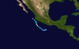
The 1975 Pacific hurricane season was near average, with 17 tropical storms forming. Of these, 9 became hurricanes, and 4 became major hurricanes by reaching Category 3 or higher on the Saffir-Simpson Hurricane Scale
. The only notable storms are Hurricane Olivia
, which killed 30 people, caused $30 million (1975 USD) in damage, and left thousands homeless when it made landfall in October; and an unnamed hurricane that developed at very high latitude, but had no affect on land. Hurricane Denise was the strongest storm of the year. Hurricanes Lily and Katrina passed close to Socorro Island
and Tropical Storm Elanor made landfall in Mexico
. Hurricane Agatha sunk a ship.
In the eastern Pacific proper (east of 140°W), sixteen tropical storms and eight hurricanes formed. Four of the hurricanes became major hurricanes by reaching Category 3 or higher on the Saffir-Simpson Hurricane Scale
. These numbers are close to the long-term averages of fifteen tropical storms, nine hurricanes, and four major hurricanes. There were also four unnamed tropical depressions. The only system to enter or form in the central Pacific (between 140°W and the international dateline) was an unusual high-latitude hurricane.
The only systems to make landfall this year were Tropical Storm Eleanor and Hurricane Olivia. Besides these two systems, Hurricane Agatha caused the sinking of a ship carrying millions of dollars worth of cargo. Tropical Storm Eleanor caused no serious impact.
The most devastating storm of the season was Hurricane Olivia. A late-season major hurricane, Olivia came ashore
near Mazatlán
. The storm killed 30 people, left around 30,000 people homeless, and caused 20 million dollars (1975 USD
) in damage.
formed on June 1. It organized into a tropical depression the next day. After heading southwestward, it turned to the northwest and strengthened into Tropical Storm Agatha on June 2. Agatha maintained its course and steadily intensified. It reached hurricane intensity on June 3 while located about 170 mi (273.6 km) southwest of Zihuatanejo. Hurricane Agatha started weakening thereafter, becoming a tropical storm on June 4 and a depression on June 5. It dissipated shortly afterwords. At this time, Agatha was located about 140 mi (225.3 km) south of the Tres Marias Islands.
Even though Agatha passed close to Mexico as it weakened, no impact is known to have been caused. Waves caused by Agatha did impact a ship called the Polynesian Diakan. A Greek freighter en route from Pago Pago
to Terminal Island, California, the Polynesian Diakan began flooding on June 3, forcing the 32-man crew to abandon the vessel. The exact cause of the initial flooding was unknown, but was speculated to be primarily due to cargo shifting and not the weather. The crew was rescued by the United States Coast Guard
. Three members required hospitalization. After being reached on June 6 by a tugboat in a salvage attempt, the vessel capsized and sank near San Clemente Island
on June 7, taking its multi-million dollar cargo of 71 containers of canned tuna
with it. The reason for the sinking was unknown.
at a location atypical for tropical cyclogenesis
. The depression moved generally westward, and intensified into Tropical Storm Bridget on June 28. It started accelerating as it turned towards the northwest, then west, and eventually to the southwest. Bridget weakened into a tropical depression on July 2 and dissipated the next day. It remnant circulation hung about in the area for a few more days. Bridget never came near land and thus, no deaths or damage were recorded.
organized into a tropical depression on July 2. It headed generally west-northwest and steadily intensified, becoming a tropical storm later on July 2. It became a hurricane on July 3 and ultimately peaked as a Category 3
hurricane. Hurricane Carlotta was first major hurricane, Category 3 or higher, of the season. It began weakening thereafter, and was a tropical storm by July 8. Carlotta became a depression on July 10 and dissipated the next day. The hurricane did not come near land and caused no significant impact.
force to parts of Mexico
, but otherwise caused no damage or casualties.
. As its center of circulation
became more pronounced and it was upgraded into Tropical Storm Eleanor. The tropical storm moved northwestward, and later curved northward. The system made landfall near Manzanillo on July 12. It quickly dissipated. Eleanor brought 20 mph (32.2 km/h) winds to the Manzanillo, but damage from the storm is minor due to the lack of heavy rains.
y area of disturbed weather that was moving on a northwestward path was upgraded into Tropical Depression Seven on July 27. It intensified into a tropical storm later that day. Francene turned to the west and weakened into a tropical depression on July 28. It slowly weakened and ceased to exist as a tropical cyclone
on July 30. Francene's remnants persisted as a tropical disturbance for another twelve hours, before completely dissipating. This tropical cyclone caused no known impact.
organized a tropical depression on August 11. It was upgraded to tropical storm intensity the next day. After heading generally westward and peaking as a weak to moderate tropical storm on August 12, Georgette slowly weakened. It weakened into a depression on August 14 and underwent extratropical transition
thereafter. The cyclone dissipated twelve hours later. Tropical Storm Georgette had no impact on land.
developed. Based on this, this system was classified as Tropical Depression Nine on August 13. The depression quickly intensified into a tropical storm and was named Hilary. The system gradually accelerated to the northwest and reached it's peak strength on August 15 with winds of 60 mph (95 km/h). Tropical Storm Hilary then started a gradual weakening trend. It became a depression on August 16, turned a little bit more westward, and dissipated on August 17. Hilary never came near land, and as such caused no death or damage.
from a tropical wave
that had entered the Pacific Ocean from the Atlantic Ocean
. It strengthened into a tropical storm later that day. The tropical storm moved westward, and became a hurricane on August 21. Ilsa became a Category 2 hurricane
on August 22. It maintained that intensity for three days as it moved out to sea. On August 25, Ilsa turned westward and rapidly weakened. It fell to tropical storm intensity on August 26. Later that day, while still maintaining winds of gale
-force, Ilsa ceased being a tropical cyclone. Ilsa's remnants continued out over the open Pacific Ocean
. The remains of Illsa eventually interacted with another weather system. That triggered the development of the unnamed hurricane of August 31–September 5.
Hurricane Ilsa caused no casualties or damage. As the unnamed hurricane formed from Ilsa's remnants, Ilsa and the latter system are unofficially the same tropical cyclone. Indeed, this year's seasonal report from the Redwood City
Eastern Pacific Hurricane Center
, in the Monthly Weather Review
includes a brief discussion of the unnamed hurricane in the report's section on Hurricane Ilsa.Neither the Central Pacific Hurricane Center
nor the official HURDAT
"best track" database of tropical cyclone location and intensity data explicitly considers them the same. Hence, as far as official records matter, Ilsa and the unnamed hurricane of August 31 – September 5 are different tropical cyclones.
. It intensified into Tropical Storm Jewel the next day. The tropical cyclone
headed generally northwest and paralleled the coast of Mexico. On August 27, Jewel became a hurricane for mere six hours, the minimum possible time in HURDAT
. Jewel then turned to the west, and then back to the northwest. Jewel weakened to depression strength on August 31. Tropical Depression Jewel dissipated shortly after that, although its remnants remained distinct until September 3. There was no impact.
hurricane with winds of 130 mi/h, the second highest of the season. Katrina then headed westward and rapidly weakened. It was downgraded into a tropical storm on September 5 and a depression on September 6. The last advisory was issued on September 7 when Katrina dissipated. Although the hurricane brought Category 3-equivalent winds to Socorro Island
on September 2, no damage was reported there or anywhere else.
absorbed the remnant circulation of Hurricane Ilsa on September 2. Convection
subsequently increased. By September 3 it was definitely a tropical cyclone as an eye
slowly formed. It then became a hurricane. The hurricane rapidly headed towards the northeast and approached a frontal cyclone
. By September 5 the hurricane had transitioned into an extratropical
after weakening from a hurricane. At the time it was less than 348 mi (560.1 km) southwest of Juneau, Alaska
. The extratropical low moved southeastward, retaining its identity until it reached Montana
, where it was absorbed by a front
.
It is unknown why this hurricane went unnamed, even though it clearly met the criteria for doing so. Any statement about why is purely speculative at this point. The hurricane is the furthest north a tropical cyclone existed in the Eastern Pacific, and is also the northernmost existence for a Pacific hurricane
. It was the only tropical cyclone to exist in the central Pacific this year. No damage or casualties were reported, although it did hassle a few ships.
weather station suggested that a tropical depression was devloping. This was confirmed on September 16 from ship reports. It intensified into a tropical storm and was named Lily. Tropical Storm Lily headed northwest in a nearly straight path. By 0000 UTC September 18, the system was a moderate tropical storm located about 160 mi (257.5 km) south of Manzanillo
Lily was upgraded to hurricane status on the same day and eventually reached its peak strength. After passing southwest of Socorro Island
, Lily weakened, becoming a storm on September 20. Lily weakened into a depression on September 21, turned to the west-southwest, and dissipated. Its remnants remained visible until September 24, when they were no longer distinct via weather satellite
. On September 19, the cyclone brought hurricane-force winds to Socorro Island. No damage or casualties were reported.
. One of them organized into a tropical depression on September 28. The next day the depression was upgraded to Tropical Storm Monica. The tropical storm initially headed west-northwestward and gradually curved towards the north. It reached its peak intensity of 50 mph (85 km/h) on September 29. Monica then gradually weakened. It became a tropical depression on October 1. The cyclone dissipated shortly thereafter. No impact was reported in association with Tropical Storm Monica.
intensity and a peak of 115 mph (185 km/h) winds just before landfall. Early on October 25, Olivia moved ashore just south of Mazatlán
causing major damage. Olivia destroyed 7,000 houses in the region, leaving 30,000 people homeless, and damage totaled $20 million (1975 USD
, $ USD). The hurricane killed 30 people, 20 of them were from drownings in shrimp boats.
on November 2. The depression drifted north for a while before turning to the west-northwest on November 3. It intensified into a tropical storm on November 4. Priscilla then began turning to the north. However, the system failed to re-curve, instead, the tropical storm turned generally westward. The tropical storm peaked in windspeed as a 65 mph (100 km/h) high-end storm on November 5. It then turned to the northwest on a heading nearly directly at Clarion Island
, but it dissipated on November 7 about 115 mi (185.1 km) short of landfall.
's area of responsibility
this year. Tropical Cyclone Thirteen formed on September 12 and lasted four days. Tropical Cyclone Seventeen formed October 16 and dissipated a day later. Tropical Cyclone Nineteen, the second-last system of the season, formed on November 1 and dissipated November 2.
. This is the last time this list was used, as modern naming began in 1978.
The central Pacific used names and numbers from the west Pacific's naming list. No names were used, as the one storm that formed in this area went unnamed.
Tropical cyclone
A tropical cyclone is a storm system characterized by a large low-pressure center and numerous thunderstorms that produce strong winds and heavy rain. Tropical cyclones strengthen when water evaporated from the ocean is released as the saturated air rises, resulting in condensation of water vapor...
s form in the northeast Pacific Ocean
Pacific Ocean
The Pacific Ocean is the largest of the Earth's oceanic divisions. It extends from the Arctic in the north to the Southern Ocean in the south, bounded by Asia and Australia in the west, and the Americas in the east.At 165.2 million square kilometres in area, this largest division of the World...
.
The 1975 Pacific hurricane season was near average, with 17 tropical storms forming. Of these, 9 became hurricanes, and 4 became major hurricanes by reaching Category 3 or higher on the Saffir-Simpson Hurricane Scale
Saffir-Simpson Hurricane Scale
The Saffir–Simpson Hurricane Scale , or the Saffir–Simpson Hurricane Wind Scale , classifies hurricanes — Western Hemisphere tropical cyclones that exceed the intensities of tropical depressions and tropical storms — into five categories distinguished by the intensities of their sustained winds...
. The only notable storms are Hurricane Olivia
Hurricane Olivia (1975)
Hurricane Olivia was considered the worst hurricane to hit Mazatlán, Sinaloa since 1943, in addition to being the strongest landfalling and costliest hurricane of the 1975 Pacific hurricane season. Olivia formed on October 22 to the south of Mexico, quickly intensifying into a tropical storm....
, which killed 30 people, caused $30 million (1975 USD) in damage, and left thousands homeless when it made landfall in October; and an unnamed hurricane that developed at very high latitude, but had no affect on land. Hurricane Denise was the strongest storm of the year. Hurricanes Lily and Katrina passed close to Socorro Island
Socorro Island
Socorro Island is a small volcanic island in the Revillagigedo Islands, a Mexican possession lying some 600 kilometers off the country's western coast at 18°48'N, 110°59'W. The size is 16.5 by 11.5 km, with an area of 132 km².- Geology :...
and Tropical Storm Elanor made landfall in Mexico
Mexico
The United Mexican States , commonly known as Mexico , is a federal constitutional republic in North America. It is bordered on the north by the United States; on the south and west by the Pacific Ocean; on the southeast by Guatemala, Belize, and the Caribbean Sea; and on the east by the Gulf of...
. Hurricane Agatha sunk a ship.
Season summary
The season began with the formation of Tropical Depression One on June 2 and ended with the extratropical transition of Tropical Storm Priscilla on November 7. No named systems formed in May, two in June, four in July, six in August, three in September, one in October, and one in November. The total length of the season, from the formation of the first depression to the dissipation of the last, was 158 days.In the eastern Pacific proper (east of 140°W), sixteen tropical storms and eight hurricanes formed. Four of the hurricanes became major hurricanes by reaching Category 3 or higher on the Saffir-Simpson Hurricane Scale
Saffir-Simpson Hurricane Scale
The Saffir–Simpson Hurricane Scale , or the Saffir–Simpson Hurricane Wind Scale , classifies hurricanes — Western Hemisphere tropical cyclones that exceed the intensities of tropical depressions and tropical storms — into five categories distinguished by the intensities of their sustained winds...
. These numbers are close to the long-term averages of fifteen tropical storms, nine hurricanes, and four major hurricanes. There were also four unnamed tropical depressions. The only system to enter or form in the central Pacific (between 140°W and the international dateline) was an unusual high-latitude hurricane.
The only systems to make landfall this year were Tropical Storm Eleanor and Hurricane Olivia. Besides these two systems, Hurricane Agatha caused the sinking of a ship carrying millions of dollars worth of cargo. Tropical Storm Eleanor caused no serious impact.
The most devastating storm of the season was Hurricane Olivia. A late-season major hurricane, Olivia came ashore
Landfall (meteorology)
Landfall is the event of a tropical cyclone or a waterspout coming onto land after being over water. When a waterspout makes landfall it is reclassified as a tornado, which can then cause damage inland...
near Mazatlán
Mazatlán
Mazatlán is a city in the Mexican state of Sinaloa; the surrounding municipio for which the city serves as the municipal seat is Mazatlán Municipality. It is located at on the Pacific coast, across from the southernmost tip of the Baja California peninsula.Mazatlán is a Nahuatl word meaning...
. The storm killed 30 people, left around 30,000 people homeless, and caused 20 million dollars (1975 USD
United States dollar
The United States dollar , also referred to as the American dollar, is the official currency of the United States of America. It is divided into 100 smaller units called cents or pennies....
) in damage.
Hurricane Agatha
An area of disturbed weather about 290 mi (467 km) southwest of AcapulcoAcapulco
Acapulco is a city, municipality and major sea port in the state of Guerrero on the Pacific coast of Mexico, southwest from Mexico City. Acapulco is located on a deep, semi-circular bay and has been a port since the early colonial period of Mexico’s history...
formed on June 1. It organized into a tropical depression the next day. After heading southwestward, it turned to the northwest and strengthened into Tropical Storm Agatha on June 2. Agatha maintained its course and steadily intensified. It reached hurricane intensity on June 3 while located about 170 mi (273.6 km) southwest of Zihuatanejo. Hurricane Agatha started weakening thereafter, becoming a tropical storm on June 4 and a depression on June 5. It dissipated shortly afterwords. At this time, Agatha was located about 140 mi (225.3 km) south of the Tres Marias Islands.
Even though Agatha passed close to Mexico as it weakened, no impact is known to have been caused. Waves caused by Agatha did impact a ship called the Polynesian Diakan. A Greek freighter en route from Pago Pago
Pago Pago, American Samoa
Pago Pago , also spelled ', is the capital of American Samoa. In 2000, its population was 11,500. The city is served by Pago Pago International Airport. Tourism, entertainment, food, and tuna canning are the primary industries here. From 1878 to 1951, this was a coaling and repair station for the...
to Terminal Island, California, the Polynesian Diakan began flooding on June 3, forcing the 32-man crew to abandon the vessel. The exact cause of the initial flooding was unknown, but was speculated to be primarily due to cargo shifting and not the weather. The crew was rescued by the United States Coast Guard
United States Coast Guard
The United States Coast Guard is a branch of the United States Armed Forces and one of the seven U.S. uniformed services. The Coast Guard is a maritime, military, multi-mission service unique among the military branches for having a maritime law enforcement mission and a federal regulatory agency...
. Three members required hospitalization. After being reached on June 6 by a tugboat in a salvage attempt, the vessel capsized and sank near San Clemente Island
San Clemente Island
San Clemente Island is the southernmost of the Channel Islands of California. It is owned and operated by the United States Navy, and is a part of Los Angeles County. Defined by the United States Census Bureau as Block Group 2 of Census Tract 5991 of Los Angeles County, California, it is long and...
on June 7, taking its multi-million dollar cargo of 71 containers of canned tuna
Tuna
Tuna is a salt water fish from the family Scombridae, mostly in the genus Thunnus. Tuna are fast swimmers, and some species are capable of speeds of . Unlike most fish, which have white flesh, the muscle tissue of tuna ranges from pink to dark red. The red coloration derives from myoglobin, an...
with it. The reason for the sinking was unknown.
Tropical Storm Bridget
On June 27, a tropical depression formed about 575 mi (925 km) south of the tip of the Baja California PeninsulaBaja California Peninsula
The Baja California peninsula , is a peninsula in northwestern Mexico. Its land mass separates the Pacific Ocean from the Gulf of California. The Peninsula extends from Mexicali, Baja California in the north to Cabo San Lucas, Baja California Sur in the south.The total area of the Baja California...
at a location atypical for tropical cyclogenesis
Tropical cyclogenesis
Tropical cyclogenesis is the term that describes the development and strengthening of a tropical cyclone in the atmosphere. The mechanisms through which tropical cyclogenesis occurs are distinctly different from those through which mid-latitude cyclogenesis occurs...
. The depression moved generally westward, and intensified into Tropical Storm Bridget on June 28. It started accelerating as it turned towards the northwest, then west, and eventually to the southwest. Bridget weakened into a tropical depression on July 2 and dissipated the next day. It remnant circulation hung about in the area for a few more days. Bridget never came near land and thus, no deaths or damage were recorded.
Hurricane Carlotta
A disturbance 480 mi (772 km) south of AcapulcoAcapulco
Acapulco is a city, municipality and major sea port in the state of Guerrero on the Pacific coast of Mexico, southwest from Mexico City. Acapulco is located on a deep, semi-circular bay and has been a port since the early colonial period of Mexico’s history...
organized into a tropical depression on July 2. It headed generally west-northwest and steadily intensified, becoming a tropical storm later on July 2. It became a hurricane on July 3 and ultimately peaked as a Category 3
Saffir-Simpson Hurricane Scale
The Saffir–Simpson Hurricane Scale , or the Saffir–Simpson Hurricane Wind Scale , classifies hurricanes — Western Hemisphere tropical cyclones that exceed the intensities of tropical depressions and tropical storms — into five categories distinguished by the intensities of their sustained winds...
hurricane. Hurricane Carlotta was first major hurricane, Category 3 or higher, of the season. It began weakening thereafter, and was a tropical storm by July 8. Carlotta became a depression on July 10 and dissipated the next day. The hurricane did not come near land and caused no significant impact.
Hurricane Denise
An unstable area developed a circulation and became a tropical depression on July 4. It headed west- northwest and became a tropical storm on July 7. The next day, it was a hurricane and turned to the west. Continuing to strengthen, it reached Category 4 intensity on July 9. This windspeed was the highest of the season. The hurricane turned to the southwest and gradually weakened. By July 11 it was nearly stationary. It then headed northwestward again and continued weakening, becoming a tropical storm on July 13. It weakened into a depression on July 14 and dissipated immediately thereafter. Denise brought winds of near-galeGale
A gale is a very strong wind. There are conflicting definitions of how strong a wind must be to be considered a gale. The U.S. government's National Weather Service defines a gale as 34–47 knots of sustained surface winds. Forecasters typically issue gale warnings when winds of this strength are...
force to parts of Mexico
Mexico
The United Mexican States , commonly known as Mexico , is a federal constitutional republic in North America. It is bordered on the north by the United States; on the south and west by the Pacific Ocean; on the southeast by Guatemala, Belize, and the Caribbean Sea; and on the east by the Gulf of...
, but otherwise caused no damage or casualties.
Tropical Storm Eleanor
An area of disturbed weather developed into a tropical depression on July 10, 100 mi (160.9 km) south of AcapulcoAcapulco
Acapulco is a city, municipality and major sea port in the state of Guerrero on the Pacific coast of Mexico, southwest from Mexico City. Acapulco is located on a deep, semi-circular bay and has been a port since the early colonial period of Mexico’s history...
. As its center of circulation
Atmospheric circulation
Atmospheric circulation is the large-scale movement of air, and the means by which thermal energy is distributed on the surface of the Earth....
became more pronounced and it was upgraded into Tropical Storm Eleanor. The tropical storm moved northwestward, and later curved northward. The system made landfall near Manzanillo on July 12. It quickly dissipated. Eleanor brought 20 mph (32.2 km/h) winds to the Manzanillo, but damage from the storm is minor due to the lack of heavy rains.
Tropical Storm Francene
A rapidly-moving squallSquall
A squall is a sudden, sharp increase in wind speed which is usually associated with active weather, such as rain showers, thunderstorms, or heavy snow. Squalls refer to an increase in the sustained winds over a short time interval, as there may be higher gusts during a squall event...
y area of disturbed weather that was moving on a northwestward path was upgraded into Tropical Depression Seven on July 27. It intensified into a tropical storm later that day. Francene turned to the west and weakened into a tropical depression on July 28. It slowly weakened and ceased to exist as a tropical cyclone
Tropical cyclone
A tropical cyclone is a storm system characterized by a large low-pressure center and numerous thunderstorms that produce strong winds and heavy rain. Tropical cyclones strengthen when water evaporated from the ocean is released as the saturated air rises, resulting in condensation of water vapor...
on July 30. Francene's remnants persisted as a tropical disturbance for another twelve hours, before completely dissipating. This tropical cyclone caused no known impact.
Tropical Storm Georgette
An area of disturbed weather about 800 mi (1,287 km) south-southwest of Cabo San LucasCabo San Lucas
Cabo San Lucas , commonly called Cabo, is a city at the southern tip of the Baja California peninsula, in the municipality of Los Cabos in the Mexican state of Baja California Sur. As of the 2010 census, the population was 68,463 people...
organized a tropical depression on August 11. It was upgraded to tropical storm intensity the next day. After heading generally westward and peaking as a weak to moderate tropical storm on August 12, Georgette slowly weakened. It weakened into a depression on August 14 and underwent extratropical transition
Extratropical cyclone
Extratropical cyclones, sometimes called mid-latitude cyclones or wave cyclones, are a group of cyclones defined as synoptic scale low pressure weather systems that occur in the middle latitudes of the Earth having neither tropical nor polar characteristics, and are connected with fronts and...
thereafter. The cyclone dissipated twelve hours later. Tropical Storm Georgette had no impact on land.
Tropical Storm Hilary
A tropical disturbance formed on August 11 and gradually organized. The next day, an atmospheric circulationAtmospheric circulation
Atmospheric circulation is the large-scale movement of air, and the means by which thermal energy is distributed on the surface of the Earth....
developed. Based on this, this system was classified as Tropical Depression Nine on August 13. The depression quickly intensified into a tropical storm and was named Hilary. The system gradually accelerated to the northwest and reached it's peak strength on August 15 with winds of 60 mph (95 km/h). Tropical Storm Hilary then started a gradual weakening trend. It became a depression on August 16, turned a little bit more westward, and dissipated on August 17. Hilary never came near land, and as such caused no death or damage.
Hurricane Ilsa
On August 18, a tropical depression formed south of the Gulf of TehuantepecGulf of Tehuantepec
Gulf of Tehuantepec is a large body of water on the Pacific coast of the Isthmus of Tehuantepec, southeastern Mexico, at . Most of the hurricanes that form in the Eastern Pacific organize in or near this body of water...
from a tropical wave
Tropical wave
Tropical waves, easterly waves, or tropical easterly waves, also known as African easterly waves in the Atlantic region, are a type of atmospheric trough, an elongated area of relatively low air pressure, oriented north to south, which move from east to west across the tropics causing areas of...
that had entered the Pacific Ocean from the Atlantic Ocean
Atlantic Ocean
The Atlantic Ocean is the second-largest of the world's oceanic divisions. With a total area of about , it covers approximately 20% of the Earth's surface and about 26% of its water surface area...
. It strengthened into a tropical storm later that day. The tropical storm moved westward, and became a hurricane on August 21. Ilsa became a Category 2 hurricane
Saffir-Simpson Hurricane Scale
The Saffir–Simpson Hurricane Scale , or the Saffir–Simpson Hurricane Wind Scale , classifies hurricanes — Western Hemisphere tropical cyclones that exceed the intensities of tropical depressions and tropical storms — into five categories distinguished by the intensities of their sustained winds...
on August 22. It maintained that intensity for three days as it moved out to sea. On August 25, Ilsa turned westward and rapidly weakened. It fell to tropical storm intensity on August 26. Later that day, while still maintaining winds of gale
Gale
A gale is a very strong wind. There are conflicting definitions of how strong a wind must be to be considered a gale. The U.S. government's National Weather Service defines a gale as 34–47 knots of sustained surface winds. Forecasters typically issue gale warnings when winds of this strength are...
-force, Ilsa ceased being a tropical cyclone. Ilsa's remnants continued out over the open Pacific Ocean
Pacific Ocean
The Pacific Ocean is the largest of the Earth's oceanic divisions. It extends from the Arctic in the north to the Southern Ocean in the south, bounded by Asia and Australia in the west, and the Americas in the east.At 165.2 million square kilometres in area, this largest division of the World...
. The remains of Illsa eventually interacted with another weather system. That triggered the development of the unnamed hurricane of August 31–September 5.
Hurricane Ilsa caused no casualties or damage. As the unnamed hurricane formed from Ilsa's remnants, Ilsa and the latter system are unofficially the same tropical cyclone. Indeed, this year's seasonal report from the Redwood City
Redwood City, California
Redwood City is a California charter city located on the San Francisco Peninsula in Northern California, approximately 27 miles south of San Francisco, and 24 miles north of San Jose. Redwood City's history spans from its earliest inhabitation by the Ohlone people, to its tradition as a port for...
Eastern Pacific Hurricane Center
Eastern Pacific Hurricane Center
The Eastern Pacific Hurricane Center was formerly the Regional Specialized Meteorological Center responsible for forecasting Pacific hurricanes in the eastern north Pacific east of 140°W...
, in the Monthly Weather Review
Monthly Weather Review
The Monthly Weather Review is a scientific journal published by the American Meteorological Society.Topics covered by the journal include research related to analysis and prediction of observed and modeled circulations of the atmosphere, including technique development, data assimilation, model...
includes a brief discussion of the unnamed hurricane in the report's section on Hurricane Ilsa.Neither the Central Pacific Hurricane Center
Central Pacific Hurricane Center
The Central Pacific Hurricane Center of the United States National Weather Service is the official body responsible for tracking and issuing tropical cyclone warnings, watches, advisories, discussions, and statements for the Central North Pacific Basin...
nor the official HURDAT
HURDAT
The North Atlantic hurricane database, or HURDAT, is the database for all tropical cyclones in the Atlantic Ocean, Gulf of Mexico and Caribbean Sea, since 1851.-History:...
"best track" database of tropical cyclone location and intensity data explicitly considers them the same. Hence, as far as official records matter, Ilsa and the unnamed hurricane of August 31 – September 5 are different tropical cyclones.
Hurricane Jewel
On August 24, a tropical depression formed from a tropical disturbance about 250 mi (402.3 km) south of AcapulcoAcapulco
Acapulco is a city, municipality and major sea port in the state of Guerrero on the Pacific coast of Mexico, southwest from Mexico City. Acapulco is located on a deep, semi-circular bay and has been a port since the early colonial period of Mexico’s history...
. It intensified into Tropical Storm Jewel the next day. The tropical cyclone
Tropical cyclone
A tropical cyclone is a storm system characterized by a large low-pressure center and numerous thunderstorms that produce strong winds and heavy rain. Tropical cyclones strengthen when water evaporated from the ocean is released as the saturated air rises, resulting in condensation of water vapor...
headed generally northwest and paralleled the coast of Mexico. On August 27, Jewel became a hurricane for mere six hours, the minimum possible time in HURDAT
HURDAT
The North Atlantic hurricane database, or HURDAT, is the database for all tropical cyclones in the Atlantic Ocean, Gulf of Mexico and Caribbean Sea, since 1851.-History:...
. Jewel then turned to the west, and then back to the northwest. Jewel weakened to depression strength on August 31. Tropical Depression Jewel dissipated shortly after that, although its remnants remained distinct until September 3. There was no impact.
Hurricane Katrina
On August 29, an area of weather developed directly into a tropical storm, skipping the tropical depression stage. Katrina steadily intensified as it headed west-northwest, gradually turning to the northwest. It peaked in intensity on September 3 as a Category 4Saffir-Simpson Hurricane Scale
The Saffir–Simpson Hurricane Scale , or the Saffir–Simpson Hurricane Wind Scale , classifies hurricanes — Western Hemisphere tropical cyclones that exceed the intensities of tropical depressions and tropical storms — into five categories distinguished by the intensities of their sustained winds...
hurricane with winds of 130 mi/h, the second highest of the season. Katrina then headed westward and rapidly weakened. It was downgraded into a tropical storm on September 5 and a depression on September 6. The last advisory was issued on September 7 when Katrina dissipated. Although the hurricane brought Category 3-equivalent winds to Socorro Island
Socorro Island
Socorro Island is a small volcanic island in the Revillagigedo Islands, a Mexican possession lying some 600 kilometers off the country's western coast at 18°48'N, 110°59'W. The size is 16.5 by 11.5 km, with an area of 132 km².- Geology :...
on September 2, no damage was reported there or anywhere else.
Hurricane Twelve
A cold core lowCold-core low
A cold-core low, also known as a cold low or cold-core cyclone, is a cyclone aloft which has an associated cold pool of air residing at high altitude within the Earth's troposphere. It is a low pressure system which strengthens with height in accordance with the thermal wind relationship. These...
absorbed the remnant circulation of Hurricane Ilsa on September 2. Convection
Atmospheric convection
Atmospheric convection is the result of a parcel-environment instability, or temperature difference, layer in the atmosphere. Different lapse rates within dry and moist air lead to instability. Mixing of air during the day which expands the height of the planetary boundary layer leads to...
subsequently increased. By September 3 it was definitely a tropical cyclone as an eye
Eye (cyclone)
The eye is a region of mostly calm weather found at the center of strong tropical cyclones. The eye of a storm is a roughly circular area and typically 30–65 km in diameter. It is surrounded by the eyewall, a ring of towering thunderstorms where the second most severe weather of a cyclone...
slowly formed. It then became a hurricane. The hurricane rapidly headed towards the northeast and approached a frontal cyclone
Weather front
A weather front is a boundary separating two masses of air of different densities, and is the principal cause of meteorological phenomena. In surface weather analyses, fronts are depicted using various colored lines and symbols, depending on the type of front...
. By September 5 the hurricane had transitioned into an extratropical
Extratropical cyclone
Extratropical cyclones, sometimes called mid-latitude cyclones or wave cyclones, are a group of cyclones defined as synoptic scale low pressure weather systems that occur in the middle latitudes of the Earth having neither tropical nor polar characteristics, and are connected with fronts and...
after weakening from a hurricane. At the time it was less than 348 mi (560.1 km) southwest of Juneau, Alaska
Juneau, Alaska
The City and Borough of Juneau is a unified municipality located on the Gastineau Channel in the panhandle of the U.S. state of Alaska. It has been the capital of Alaska since 1906, when the government of the then-District of Alaska was moved from Sitka as dictated by the U.S. Congress in 1900...
. The extratropical low moved southeastward, retaining its identity until it reached Montana
Montana
Montana is a state in the Western United States. The western third of Montana contains numerous mountain ranges. Smaller, "island ranges" are found in the central third of the state, for a total of 77 named ranges of the Rocky Mountains. This geographical fact is reflected in the state's name,...
, where it was absorbed by a front
Weather front
A weather front is a boundary separating two masses of air of different densities, and is the principal cause of meteorological phenomena. In surface weather analyses, fronts are depicted using various colored lines and symbols, depending on the type of front...
.
It is unknown why this hurricane went unnamed, even though it clearly met the criteria for doing so. Any statement about why is purely speculative at this point. The hurricane is the furthest north a tropical cyclone existed in the Eastern Pacific, and is also the northernmost existence for a Pacific hurricane
Pacific hurricane
A Pacific hurricane or tropical storm is a tropical cyclone that develops in the northeastern part of the Pacific Ocean. For organizational purposes, the northern Pacific Ocean is divided into three regions: the eastern, , central , and western...
. It was the only tropical cyclone to exist in the central Pacific this year. No damage or casualties were reported, although it did hassle a few ships.
Hurricane Lily
Rain and wind reports from the AcapulcoAcapulco
Acapulco is a city, municipality and major sea port in the state of Guerrero on the Pacific coast of Mexico, southwest from Mexico City. Acapulco is located on a deep, semi-circular bay and has been a port since the early colonial period of Mexico’s history...
weather station suggested that a tropical depression was devloping. This was confirmed on September 16 from ship reports. It intensified into a tropical storm and was named Lily. Tropical Storm Lily headed northwest in a nearly straight path. By 0000 UTC September 18, the system was a moderate tropical storm located about 160 mi (257.5 km) south of Manzanillo
Manzanillo, Colima
The name Manzanillo refers to the city as well as its surrounding municipality in the Mexican state of Colima. The city, located on the Pacific Ocean, contains Mexico's busiest port. Manzanillo was the third port created by the Spanish in the Pacific during the New Spain period...
Lily was upgraded to hurricane status on the same day and eventually reached its peak strength. After passing southwest of Socorro Island
Socorro Island
Socorro Island is a small volcanic island in the Revillagigedo Islands, a Mexican possession lying some 600 kilometers off the country's western coast at 18°48'N, 110°59'W. The size is 16.5 by 11.5 km, with an area of 132 km².- Geology :...
, Lily weakened, becoming a storm on September 20. Lily weakened into a depression on September 21, turned to the west-southwest, and dissipated. Its remnants remained visible until September 24, when they were no longer distinct via weather satellite
Weather satellite
The weather satellite is a type of satellite that is primarily used to monitor the weather and climate of the Earth. Satellites can be either polar orbiting, seeing the same swath of the Earth every 12 hours, or geostationary, hovering over the same spot on Earth by orbiting over the equator while...
. On September 19, the cyclone brought hurricane-force winds to Socorro Island. No damage or casualties were reported.
Tropical Storm Monica
In late September, three tropical disturbances moved westward across the eastern Pacific OceanPacific Ocean
The Pacific Ocean is the largest of the Earth's oceanic divisions. It extends from the Arctic in the north to the Southern Ocean in the south, bounded by Asia and Australia in the west, and the Americas in the east.At 165.2 million square kilometres in area, this largest division of the World...
. One of them organized into a tropical depression on September 28. The next day the depression was upgraded to Tropical Storm Monica. The tropical storm initially headed west-northwestward and gradually curved towards the north. It reached its peak intensity of 50 mph (85 km/h) on September 29. Monica then gradually weakened. It became a tropical depression on October 1. The cyclone dissipated shortly thereafter. No impact was reported in association with Tropical Storm Monica.
Tropical Storm Nanette
On September 28,a system developed into a tropical depression, simultaneously with Tropical Storm Monica.. It headed generally westward and on September 29, 18 hours after Monica did it, strengthened into a tropical storm. Nanette continued out to sea and slowly strengthened. It peaked in windspeed of 50 mph (85 km/h) on October 3 and turned to the southwest. It then slowly weakened. On October 4, it weakened into a tropical depression and then degenerated into a disturbance that same day. No damage or deaths were reported.Hurricane Olivia
On October 22, Tropical Depression Eighteen formed from a cluster of three thunderstorms south of Mexico and then strengthened into a tropical storm. It moved northwestward initially, followed by a northeast turn. Olivia then intensified steadily. It reached Category 3Saffir-Simpson Hurricane Scale
The Saffir–Simpson Hurricane Scale , or the Saffir–Simpson Hurricane Wind Scale , classifies hurricanes — Western Hemisphere tropical cyclones that exceed the intensities of tropical depressions and tropical storms — into five categories distinguished by the intensities of their sustained winds...
intensity and a peak of 115 mph (185 km/h) winds just before landfall. Early on October 25, Olivia moved ashore just south of Mazatlán
Mazatlán
Mazatlán is a city in the Mexican state of Sinaloa; the surrounding municipio for which the city serves as the municipal seat is Mazatlán Municipality. It is located at on the Pacific coast, across from the southernmost tip of the Baja California peninsula.Mazatlán is a Nahuatl word meaning...
causing major damage. Olivia destroyed 7,000 houses in the region, leaving 30,000 people homeless, and damage totaled $20 million (1975 USD
United States dollar
The United States dollar , also referred to as the American dollar, is the official currency of the United States of America. It is divided into 100 smaller units called cents or pennies....
, $ USD). The hurricane killed 30 people, 20 of them were from drownings in shrimp boats.
Tropical Storm Priscilla
A nearly stationary cloudy area developed a circulationAtmospheric circulation
Atmospheric circulation is the large-scale movement of air, and the means by which thermal energy is distributed on the surface of the Earth....
on November 2. The depression drifted north for a while before turning to the west-northwest on November 3. It intensified into a tropical storm on November 4. Priscilla then began turning to the north. However, the system failed to re-curve, instead, the tropical storm turned generally westward. The tropical storm peaked in windspeed as a 65 mph (100 km/h) high-end storm on November 5. It then turned to the northwest on a heading nearly directly at Clarion Island
Clarion Island
Isla Clarión, formerly called Santa Rosa, is the second largest, westernmost and most remote of the Revillagigedo Islands, west of Socorro Island and over from the Mexican mainland and an area ². It has three prominent peaks. The westernmost and tallest peak, Monte Gallegos, is high...
, but it dissipated on November 7 about 115 mi (185.1 km) short of landfall.
Other storms
Besides the tropical storms and hurricanes this season, there were also four additional tropical depressions. None of them made landfall. Tropical Cyclone Four formed on July 2 and dissipated the next day. It was the tropical cyclone to come closest to crossing 140°W and entering the Central Pacific Hurricane CenterCentral Pacific Hurricane Center
The Central Pacific Hurricane Center of the United States National Weather Service is the official body responsible for tracking and issuing tropical cyclone warnings, watches, advisories, discussions, and statements for the Central North Pacific Basin...
's area of responsibility
Area of responsibility
Area Of Responsibility is a pre-defined geographic region assigned to a Combatant commanders of the Unified Command Plan , that are used to define an area with specific geographic boundaries where they have the authority to plan and conduct operations; for which a force, or component commander...
this year. Tropical Cyclone Thirteen formed on September 12 and lasted four days. Tropical Cyclone Seventeen formed October 16 and dissipated a day later. Tropical Cyclone Nineteen, the second-last system of the season, formed on November 1 and dissipated November 2.
1975 storm names
These names were used for storms in 1975. It is the same list used in the 1971 season1971 Pacific hurricane season
The 1971 Pacific hurricane season began on May 15, 1971 in the east Pacific, and on June 1, 1971 in the central Pacific. It ended on November 30, 1971. These dates conventionally delimit the period of time when tropical cyclones form in the east Pacific Ocean....
. This is the last time this list was used, as modern naming began in 1978.
|
|
|
The central Pacific used names and numbers from the west Pacific's naming list. No names were used, as the one storm that formed in this area went unnamed.
See also
- List of Pacific hurricanes
- List of Pacific hurricane seasons
- 1975 Atlantic hurricane season1975 Atlantic hurricane seasonThe 1975 Atlantic hurricane season officially began on June 1, 1975, and lasted until November 30, 1975. These dates conventionally delimit the period of each year when most tropical cyclones form in the Atlantic basin...
- 1975 Pacific typhoon season1975 Pacific typhoon seasonThe 1975 Pacific typhoon season has no official bounds; it ran year-round in 1975, but most tropical cyclones tend to form in the northwestern Pacific Ocean between June and December...
- 1975 North Indian Ocean cyclone season
- Southern Hemisphere tropical cyclone seasons: 1974–75, 1975–76