
1925-1949 Pacific hurricane seasons
Encyclopedia
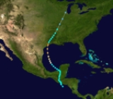
The 1925–1949 Pacific hurricane seasons all began during late spring in the northeast Pacific Ocean
and the central Pacific. They ended in late fall.
Before the satellite
age started in the 1960s, data on east Pacific hurricanes is extremely unreliable. In a few years, there are no reported cyclones although many systems certainly formed.
Pre-1900
1900-1924
1925-1949 1950-1969
1970
Pacific Ocean
The Pacific Ocean is the largest of the Earth's oceanic divisions. It extends from the Arctic in the north to the Southern Ocean in the south, bounded by Asia and Australia in the west, and the Americas in the east.At 165.2 million square kilometres in area, this largest division of the World...
and the central Pacific. They ended in late fall.
Before the satellite
Weather satellite
The weather satellite is a type of satellite that is primarily used to monitor the weather and climate of the Earth. Satellites can be either polar orbiting, seeing the same swath of the Earth every 12 hours, or geostationary, hovering over the same spot on Earth by orbiting over the equator while...
age started in the 1960s, data on east Pacific hurricanes is extremely unreliable. In a few years, there are no reported cyclones although many systems certainly formed.
Pre-1900
Pre-1900 Pacific hurricane seasons
The following is a list of Pacific hurricanes before 1900. Data on most of the storms that formed is unavailable, however, some regions had a large enough coastal population or ship traffic to give data on the occurrence of hurricanes...
1900-1924
1900-1924 Pacific hurricane seasons
The 1900–1924 Pacific hurricane seasons all began on May 15, 1900 in the northeast Pacific Ocean and on June 1, 1900 in the central Pacific. They ended on November 30, 1924. These dates conventionally delimit the time of year when most tropical cyclones form in northeast Pacific Ocean.Before the...
1925-1949 1950-1969
1950-1969 Pacific hurricane seasons
The 1950–1963 Pacific hurricane seasons all began on May 15, 1950-65 in the northeast Pacific Ocean and on June 1, 1950-65 in the central Pacific. They ended on November 30, 1950-65...
1970
1970 Pacific hurricane season
The 1970 Pacific hurricane season began on May 15, 1970 in the east Pacific, and on June 1, 1970 in the central Pacific. It ended on November 30, 1970. These dates conventionally delimit the period of time when tropical cyclones form in the eastern Pacific Ocean.This season had an above average...
1925 season
A small tropical cyclone existed in the Gulf of TehuantepecGulf of Tehuantepec
Gulf of Tehuantepec is a large body of water on the Pacific coast of the Isthmus of Tehuantepec, southeastern Mexico, at . Most of the hurricanes that form in the Eastern Pacific organize in or near this body of water...
from June 3 to June 6. It had gale-force winds, and its lowest reported pressure was 29.53inHg.
Off the coast of Mexico, a hurricane existed from July 7 to July 10. The lowest reported pressure was 28.90inHg.
A tropical cyclone existed from July 17 to July 22.
On July 31 and August 1, a tropical cyclone was encountered by a steamer
Steamboat
A steamboat or steamship, sometimes called a steamer, is a ship in which the primary method of propulsion is steam power, typically driving propellers or paddlewheels...
called the West Calera. This tropical cyclone headed west-northwest and stayed south of the Hawaiian Islands
Hawaiian Islands
The Hawaiian Islands are an archipelago of eight major islands, several atolls, numerous smaller islets, and undersea seamounts in the North Pacific Ocean, extending some 1,500 miles from the island of Hawaii in the south to northernmost Kure Atoll...
. It brought gales to Honolulu
Honolulu, Hawaii
Honolulu is the capital and the most populous city of the U.S. state of Hawaii. Honolulu is the southernmost major U.S. city. Although the name "Honolulu" refers to the urban area on the southeastern shore of the island of Oahu, the city and county government are consolidated as the City and...
from August 1 to August 4. It also brought heavy surf to Oahu
Oahu
Oahu or Oahu , known as "The Gathering Place", is the third largest of the Hawaiian Islands and most populous of the islands in the U.S. state of Hawaii. The state capital Honolulu is located on the southeast coast...
and the Big Island
Hawaii (island)
The Island of Hawaii, also called the Big Island or Hawaii Island , is a volcanic island in the North Pacific Ocean...
. That surf flooded a warehouse at Honuapo. It also flooded houses in Honuapo and Punaluu Beach, and collapsed flurtes at Hutchinson Plantation. On Oahu, Fort Kamehameha
Fort Kamehameha
Fort Kamehameha was a United States Army military base that was the site of several coastal artillery batteries to defend Pearl Harbor starting in 1907 in Honolulu, Hawaii.-History:The eastern areas of the fort were in the district called Moanalua...
was flooded. Lawn
Lawn
A lawn is an area of aesthetic and recreational land planted with grasses or other durable plants, which usually are maintained at a low and consistent height. Low ornamental meadows in natural landscaping styles are a contemporary option of a lawn...
s at Diamond Head
Diamond Head, Hawaii
Diamond Head is the name of a volcanic tuff cone on the Hawaiian island of Oahu and known to Hawaiians as Lēahi, most likely from lae 'browridge, promontory' plus ahi 'tuna' because the shape of the ridgeline resembles the shape of a tuna's dorsal fin...
and Kahala were damaged, as were houses on the northern side of Oahu.
A tropical cyclone existed on August 16. It had gale-force winds. The lowest reported pressure was 29.79inHg.
Far from land, on September 27 to September 28, the same ship that encountered the July 31-August 4 cyclone encountered a hurricane east of the Hawaiian Islands. That ship reported a pressure of 28.53inHg.
South of the Gulf of Tehuantepec, a tropical cyclone formed. It headed west-northwest. On October 24, it recurved to the north, and made landfall near Cabo Corrientes on October 25. The next day, it dissipated inland. The lowest pressure reported in association with this hurricane was 28.57inHg. It caused rain throughout coastal areas near where it hit. This hurricane also damaged many houses, and blew down trees in mountainous areas.
A ship encountered a strong tropical cyclone near Acapulco on November 10. On November 11, it was near Manzanillo. It was not seen after that. This tropical cyclone was initially reported to have a pressure of 29.19inHg (uncorrected). However, a later report attributes a pressure of 28.15inHg. Even in HURDAT
HURDAT
The North Atlantic hurricane database, or HURDAT, is the database for all tropical cyclones in the Atlantic Ocean, Gulf of Mexico and Caribbean Sea, since 1851.-History:...
, the modern "best track" database, there was no November tropical cyclone this intense until Hurricane Kenneth
2011 Pacific hurricane season
The 2011 Pacific hurricane season is an ongoing, annual cycle of tropical cyclone formation. The season officially started on May 15, 2011, for the eastern Pacific, and started on June 1, 2011, for the central Pacific, both of which ended on November 30, 2011. These dates conventionally...
in 2011, which broke this record. This hurricane also caused heavy rains to coastal areas of Mexico.
A tropical cyclone existed from December 22 to December 26.
1926 season
A tropical storm existed in the Gulf of Tehuantepec on June 13. The lowest reported pressure was 29.55inHg.Far from land, a tropical cyclone was reported on July 21. It had gale-force winds and a minimum reported pressure of 29.49inHg.
Well south of Mexico, a tropical cyclone formed on July 5. It moved northwestward, and was last observed on July 9 while located south of the southern tip of the Baja California Peninsula. It was a hurricane, and the lowest reported pressure was 28.90inHg.
On August 8, a tropical cyclone began forming. It was definitely extant on August 11, and was last seen on August 15. It caused gales and had a lowest reported pressure of 29.44inHg.
Another tropical cyclone was observed from August 22 to August 23. It had a lowest reported pressure of 29.60inHg and also caused gales.
A tropical cyclone existed from September 14 to September 16, during which time it moved along the coast. The lowest reported pressure was 29.64inHg. It caused heavy rain.
A tropical cyclone moved along the coast from Manzanillo, to Mazatlán, to the southern tip of the Baja California Peninsula, from September 24 to September 26. It had gale-force winds, a lowest reported pressure of 29.56inHg, and caused heavy rainfall.
A tropical cyclone formed south of Acapulco on October 2. The next day, it was a tropical storm. It pretty much hung around in the same area, and dissipated near the western Gulf of Tehuantepec on October 11. The lowest reported pressure was 29.55inHg.
1927 season
A tropical cyclone moved along the coast of Mexico from June 14 to June 18. It had gale-force winds and a minimum reported pressure of 29.58inHg.A tropical storm might have existed off the coast of Mexico from June 28 to June 30.
A small tropical cyclone was detected on July 1. Its lowest reported pressure was 29.56inHg, and was moving along the coast of Mexico.
A ship encounted a tropical cyclone on July 5. The ship reported a pressure of 29.70inHg. The cyclone was moving west-northwest.
On July 28, a tropical cyclone moved eastward in the Gulf of Tehuantepec.
Roughly southwest of the Gulf of Tehuantepec, a tropical cyclone formed on August 7. It moved along the coast and dissipated south of the entrance to the Gulf of California on August 10.
On September 6, a tropical cyclone formed south of the Gulf of Tehuantepec. It moved along the coast, and by September 8 it was west of Manzanillo. It entered the Gulf of California on September 10, and it made landfall or dissipated the next day. The lowest reported pressure was 29.15inHg.
The tropical cyclone caused much damage and destruction. The cyclone drove huge waves ashore along the coast, and destroyed rail lines linking Mexico City
Mexico City
Mexico City is the Federal District , capital of Mexico and seat of the federal powers of the Mexican Union. It is a federal entity within Mexico which is not part of any one of the 31 Mexican states but belongs to the federation as a whole...
with the Pacific coast. Some ships were also missing and presumed sunk. Shipping was badly damaged. Some of the ships initially reported sunk were later accounted for. The worst hit areas were Manzanillo and Salina Cruz. Salina Cruz was reduced to ruins. A sudden plunge in the barometer provided enough warning for emergency evacuation
Emergency evacuation
Emergency evacuation is the immediate and rapid movement of people away from the threat or actual occurrence of a hazard. Examples range from the small scale evacuation of a building due to a bomb threat or fire to the large scale evacuation of a district because of a flood, bombardment or...
s in those cities, which were credited with keeping the death toll below that which was initially reported.
In Mazatlán, one person was killed by being swept over the sea wall. Acambaro, Guanajuanto was flooded. In the aftermath, displaced refugees attempted to cross the border and enter Nogales, Arizona
Nogales, Arizona
Nogales is a city in Santa Cruz County, Arizona, United States. The population was 21,017 at the 2010 census. According to 2005 Census Bureau estimates, the population of the city is 20,833. The city is the county seat of Santa Cruz County....
.
A tropical cyclone formed in the Gulf of Tehuantepec on September 11. It moved northwest and was last observed on September 12.
In the Gulf of Tehuantepec, a tropical cyclone was detected on September 25. It moved along the coast and was last seen on September 30. The lowest reported pressure was 29inHg; a ship reported a maximum windspeed of 125 mile per hour.
A tropical depression existed south of Acapulco on October 19 and October 20.
1928 season
A weak tropical cyclone existed south of the Gulf of California was spotted on May 24. It moved westward, and was last seen on May 27. The lowest pressure reported was 29.77inHg.A tropical cyclone in the Gulf of Tehuantepec produced gales on June 5. The lowest reported pressure was 29.67inHg.
A hurricane existed south of Cape Corrientes on July 28 and July 29. The lowest reported pressure was a reading of 29.64inHg.
A tropical cyclone was noticed just south of the Mexican coast on August 6. This system might have formed south of Costa Rica three days earlier. Wherever it formed, this tropical cyclone intensified into a hurricane, and paralled the coast. It passed south of the Gulf of California on August 10. The hurricane passed northwestward of Cabo San Lucas on September, and dissipated on August 11 while over the southern part of the Baja California Peninsula. The lowest pressure reported in association with this hurricane was 28.50inHg.
This hurricane brought gale or hurricane-force winds to several areas of the Mexican coast. An American steamer, the William A. McKenney, had its cargo and structure damaged by the hurricane. Repairs were attempted during the storm, and 14 members of its crew were washed overboard and drowned.
On September 1, a tropical cyclone formed well south of the southern tip of the Baja California Peninsula. It moved west-northwest and was last seen on September 3. A ship reported a pressure reading of 29.44inHg.
About 200 miles west-southwest of Acapulco, a tropical cyclone formed on September 17. It slowly moved northwestward. It had intensified into a hurricane by September 18. On September 21, the hurricane weakened and recurved to the east-northeast. It made landfall north of Mazatlán and became a remnant over Mexico. Its remnants had crossed Mexico by September 22 and entered the Gulf of Mexico
Gulf of Mexico
The Gulf of Mexico is a partially landlocked ocean basin largely surrounded by the North American continent and the island of Cuba. It is bounded on the northeast, north and northwest by the Gulf Coast of the United States, on the southwest and south by Mexico, and on the southeast by Cuba. In...
south of Brownsville, Texas
Brownsville, Texas
Brownsville is a city in the southernmost tip of the state of Texas, in the United States. It is located on the northern bank of the Rio Grande, directly north and across the border from Matamoros, Tamaulipas, Mexico. Brownsville is the 16th largest city in the state of Texas with a population of...
. They never developed into anything, and had dissipated by the end of the month. The lowest pressure reported by a ship was 28.82inHg.
From September 20 to September 22, a tropical cyclone existed south of the Gulf of Tehuantepec.
On October 7, at a location well south of the entrance to the Gulf of California, a hurricane existed. It was moving northwest. A ship measured a central pressure of 29.60inHg.
On October 16 and October 17, a ship encountered a tropical cyclone well south of the southern Tip of the Baja California Peninsula. The ship reported a pressure of 29.48inHg.
1929 season
A tropical cyclone existed from May 29 to June 1. Starting from a location southwest of the Gulf of Tehuantepec, it traveled west-northwestward not far off the Mexican shore. A ship recorded its lowest known pressure of 29.21inHg.A cyclone existed southwest of Acapulco on June 16 and June 17. It produced gales, and a ship reported a pressure reading of 29.66inHg.
On August 2, a tropical cyclone formed near the Mexican coast. It eventually became a hurricane, and was last seen on August 6. The lowest pressure reported in association with this system was 28.80inHg.
On August 21 and August 22, a ship encountered a possible tropical cyclone at a location far from land and almost in the central Pacific basin. The lowest pressure reported by a ship was 29.42inHg.
On August 28. It moved along the coast, and passed over the southern tip of the Baja California Peninsula around August 31.
On September 10, a tropical cyclone formed in the Gulf of Tehuantepec. It moved along the coast, and was a hurricane by September 13. It moved along the Pacific side of the Baja California Peninsula, and became a remnant off its northern coast on September 16. It's remnants subsequently moved inland, and dissipated around September 18. The lowest pressure measured in association with this tropical cyclone was 28.28inHg.
This tropical cyclone inflicted gale or hurricane-force winds along parts of the coast of Mexico, including Manzanillo, Acapulco, and Mazatlán. On September 18, its remnants caused rain of up to 4 inches in mountainous parts of Southern California. An unseasonal warming was also attributed to this cyclone. It was also responsible for the strongest September winds ever recorded in San Diego up to that time.
Somewhere between Manzanillo and Acapulco, a tropical cyclone might have existed on September 19.
On September 23, a tropical cyclone was located southeast of the Gulf of Tehuantepec. It was last observed the next day. A ship reported a pressure of 29.56inHg.
1930 season
On June 4, a tropical cyclone formed south of the Gulf of Tehuantepec. It paralleled the coast, became a hurricane, and approached the coast. On October 11, it made landfall north of Mazatlán and dissipated inland. Some damage in Mazatlán was reported.From August 18 to August 20, a tropical cyclone existed in the waters west of Manzanillo. A ship reported a pressure of 29.63inHg.
On October 3, a tropical cyclone formed near the Revillagigedo Islands. It slowly moved northeasterly, became very intense, and made landfall north of Mazatlán on October 4 or October 5. Once inland, it greatly increased in speed, and dissipated October 7, while over Arkansas
Arkansas
Arkansas is a state located in the southern region of the United States. Its name is an Algonquian name of the Quapaw Indians. Arkansas shares borders with six states , and its eastern border is largely defined by the Mississippi River...
. A ship in the eye of the hurricane reported a pressure of 27.72inHg, low enough to make this the most intense Pacific hurricane in Mexican waters known at the time.
This hurricane hassled a number of ships. One of them needed to be repaired at a cost of $10,000 (1930 USD), and another had its cargo damaged.
On October 9, a tropical cyclone formed in the Gulf of Tehuantepec. Eventually becoming a hurricane, it moved up the coast as far as Acapulco. It was last seen on October 11. The lowest pressure reported was 29inHg.
This hurricane caused damage in Acapulco. Many buildings were demolished by the storm, and roads and telegraph lines were destroyed. Damage to property was heavy, but no one was killed or injured.
On October 16, a tropical cyclone existed somewhere between Acapulco and Cape Corrientes. Two days later, it made landfall near La Manzanilla, Jalisco
La Manzanilla, Jalisco
La Manzanilla is a small Mexican town of approximately 2,000 inhabitants. The village is located in the southeastern corner of the Bay of Tenacatita, on the Costalegre of southwestern mainland Mexico in the state of Jalisco. "Manzanilla" is Spanish for chamomille.The town is a popular beach...
as a hurricane near with a pressure of 983 mbar. It or its remnants managed to cross the Isthmus of Tehuantepec and enter the Bay of Campeche, where they dissipated on October 20.
1931 season
On July 3, a tropical cyclone possibly existed south of Acapulco. A ship measured a pressure of 29.55inHg.In the western part of the Gulf of Tehuantepec, a possible tropical cyclone existed on July 10. A ship reported a pressure of 29.66inHg.
On July 21, a tropical cyclone began forming southwest of Manzanillo. It had completely formed by July 23. It moved along the coast, and entered the Gulf of California. It was last observed on July 25. This cyclone produced gales, and the lowest reported pressure was 29.39inHg.
On July 26, a tropical cyclone existed midway between Acapulco and Salina Cruz. The lowest pressure reported by a ship was 29.63inHg.
In the central Pacific east-southeast of the Hawaiian Islands, a ship encountered a tropical cyclone on August 30 and August 31. It produced gales, and a pressure of 28.82inHg.
South of the coast of Mexico, a tropical cyclone formed on September 6. It paralleled the coast, entered the Gulf of California, and dissipated by September 14.
This system sank an American steamship called the Colombia (losses unknown). On land, the area around Santa Rosalía, Baja California Sur
Santa Rosalía, Baja California Sur
Santa Rosalía is a city located on the Baja California peninsula, in the northern part of the Mexican state of Baja California Sur. It was named after Saint Rosalia, although the reason for the name is not quite clear since the Misión de Santa Rosalía is not located by the town, but rather in...
was severely devastated. More than 100 people were killed on land, mostly due to drowning.
In Santa Rosalía itself, 50 were killed. Numerous small craft were sunk, with at least eight people going down with them. A merchant ship called Perkins was damaged in the storm, with wwo people were washed overboard. On land, connections with the El Boleo
El Boleo
El Boleo was a Mexican copper mine located at the port city of Santa Rosalía, Baja California Sur. It was operated by a French company who had obtained control of the mine through an extensive concession and 50-year tax extemption granted by Mexican president Porfirio Diaz who apparently had the...
copper mine were destroyed, with the mine itself flooded, causing $500,000 (1931 USD) in damage. Hundreds were left homeless. In the aftermath, there was a shortage of food and medicine, and troops were dispatched to maintain order.
The next tropical cyclone was a slightly weaker and faster-moving clone of the previous one. On September 14, it formed at around the same location as the first, and took a similar path. It dissipated September 18 in the Gulf of California.
A tropical cyclone existed from September 20 to on or just after September 24. It formed well south of the Mexican coast. It moved northwestward, and dissipated off the coast of the Baja California Peninsula.
On September 26, a tropical cyclone formed south of the Mexican coast. It moved generally northwards, and dissipated in the Gulf of California sometime after September 29.
1932 season
A tropical cyclone formed in the Gulf of Tehuantepec on June 18. It moved along the coast, became a hurricane, and was last seen June 21. The lowest pressure was an uncorrected 29.48inHg. This hurricane was reported to have winds of 130 mph.On August 21, tropical cyclone was heading northwestward south of the Revillagigedo Islands. A ship at the fringes of the cyclone measured a pressure of 29.08inHg.
Somewhere southwest of the Gulf of Tehuantepec, a tropical cyclone formed on September 24. It paralleled the coast, and intensified into a hurricane on September 25. It then recurved, and made landfall near Mazatlán late during the night of September 26 and September 27, while still a hurricane. It dissipated inland over the mountains of Mexico. The lowest pressure reported by a ship was 28.64inHg. The hurricane caused about $5,000,000 (1932 USD) in damage.
On September 26, a hurricane was spotted south of Acapulco. It headed along the coast, and entered the Gulf of California sometime on or after September 28, wherein it moved north-northwest and dissipated, with its remnants continuing into the Southwestern United States.
Powerful winds in Mazatlán were attributed to this tropical cyclone. Over a four day period ending October 1, those remnants caused heavy rain of up to 7 inches in the mountains of Southern California. Over a seven hour period, 4.38 inches fell at Tehachapi
Tehachapi, California
Tehachapi is a city incorporated in 1909 located in the Tehachapi Mountains between Bakersfield and Mojave in Kern County, California. Tehachapi is located east-southeast of Bakersfield, at an elevation of...
. That total by itself is enough to make this tropical cyclone one of California's wettest. Those rains also caused flash flood
Flash flood
A flash flood is a rapid flooding of geomorphic low-lying areas—washes, rivers, dry lakes and basins. It may be caused by heavy rain associated with a storm, hurricane, or tropical storm or meltwater from ice or snow flowing over ice sheets or snowfields...
ing on Tehachapi and Agua Caliente Creeks, which killed fifteen people.
1933 season
On May 30, a tropical cyclone existed in the Gulf of Tehuantepec. Shortly after its discovery, it dissipated off the coast of Guatemala. A ship reported gales and a pressure of 29.44inHg.Sometime in June, a possible tropical cyclone existed south of the Mexican coast.
A possible tropical cyclone was reported between Salina Cruz and Acapulco July 7. It had moved closer to Acapulco by July 8. This system might have been associated with the remnants of the Atlantic's second tropical cyclone.
Another possible tropical cyclone existed in the same area on July 29.
A tropical cyclone formed in the Gulf of Tehuantepec on August. It moved along the coast, becoming at least a tropical storm, and dissipated in the Gulf of California on August 19 or August 20. A ship reported an uncorrected barometer reading of 29.48inHg.
A possible tropical cyclone existed on September 13. It was located well west of Manzanillo.
1934 season
A possible tropical cyclone, with a ship-reported pressure of 29.53, was located southwest of Acapulco from July 8 to July 9.On July 18, a possible hurricane existed north of Cape Corrientes.
Somewhere south of Acapulco, a tropical cyclone formed on September 16. It headed along the coast, not strengthening much until September 18. It was a hurricane by September 19. For the next three days, it slowly moved through the area south of the Gulf of California. It had weakened to a depression by September 22, whence it made landfall on the Baja California Peninsula and dissipated. The lowest pressure reported by a ship was 28.82inHg.
This hurricane caused death and destruction throughout the southern part of the Baja California Peninsula. A large number of people were killed, and many were injured. The hurricane left twenty thousand people homeless and reduced to hunger. Damage was particularly heavy in La Paz
La Paz, Baja California Sur
La Paz is the capital city of the Mexican state of Baja California Sur and an important regional commercial center. The city had a 2010 census population of 215,178 persons, but its metropolitan population is somewhat larger because of surrounding towns like el Centenario, el Zacatal and San Pedro...
, Triunfor, San Antonio
San Antonio, Baja California Sur
San Antonio de la Sierra is a small town in La Paz Municipality in the Mexican state of Baja California Sur, located near El Triunfo on Federal Highway 1. It had a 2010 census population of 463 inhabitants, and is situated at 400 meters elevation above sea level.-Information:Adm...
, San Bartolo, Miraflores, San José del Cabo
San José del Cabo
The city of San José del Cabo is located in Baja California Sur Mexico and is the seat of the municipality of Los Cabos at the south end of the Baja California peninsula. In the 2010 census it had a population of 69,788. Together with neighboring Cabo San Lucas it forms a major tourist destination...
, and Cabo San Lucas
Cabo San Lucas
Cabo San Lucas , commonly called Cabo, is a city at the southern tip of the Baja California peninsula, in the municipality of Los Cabos in the Mexican state of Baja California Sur. As of the 2010 census, the population was 68,463 people...
. Electricity and water utilities were severely disrupted. The hurricane destroyed the area's tomato
Tomato
The word "tomato" may refer to the plant or the edible, typically red, fruit which it bears. Originating in South America, the tomato was spread around the world following the Spanish colonization of the Americas, and its many varieties are now widely grown, often in greenhouses in cooler...
crop, and severely disrupted sugarcane plantations. It also destroyed a recently-finished highway between La Paz and San Bartolo, and flooded mines near San Antonio and Triunfo. The total damage was estimated at 500,000,000 pesos (1934 MXP). The Mexican government sent aid to the affected area, along with the International Red Cross.
On October 14, well off the coast of Mexico, a tropical storm was noticed. It headed north towards the Gulf of California, and dissipated October 16. The cyclone was a hurricane, and a ship reported a pressure of 28.25inHg.
1935 season
A tropical storm caused gales in Manzanillo on July 1.On August 5, a tropical cyclone formed just off the coast of Mexico. It generally moved west-northwest, and was last seen August 9. The storm caused gales, and a ship reported a pressure reading of 29.61inHg.
South of the Gulf of Tehuantepec, a tropical cyclone formed on August 17. It remained poorly organized and moved slowly, making landfall on August 20. It had moved back off shore by August 21. It headed northwest, passing west of Cabo San Lucas, and hugged the Pacific coast of the Baja California Peninsula. It rapidly weakened as it headed north, and its remnants made landfall near Point Conception, California, on August 26 and dissipated after that.
The tropical cyclone destroyed many buildings in Salina Cruz on August 20. It also blew down trees and downed power lines. No casualties were reported. The tropical cyclone remnants also caused rainfall of up to 2 inches in parts of California and Arizona.
1936 season
Just off the coast of Guatemala, a tropical storm was reported on June 8. It headed north, and sometime after June 9 made landfall. It crossed the isthmus, and it emerged into the Gulf of HondurasGulf of Honduras
The Gulf or Bay of Honduras is a large inlet of the Caribbean Sea, indenting the coasts of Belize, Guatemala, and Honduras. From north to south, it runs for approximately 200 km from Dangriga, Belize, to La Ceiba, Honduras....
. The system then became the first tropical storm of the 1936 Atlantic hurricane season. This cyclone's lowest measured pressure while located in the Pacific Ocean was 29.67inHg. This tropical storm caused heavy rains over parts of Central America
Central America
Central America is the central geographic region of the Americas. It is the southernmost, isthmian portion of the North American continent, which connects with South America on the southeast. When considered part of the unified continental model, it is considered a subcontinent...
, especially the Yucatán and British Honduras.
On June 22, there was a possible tropical cyclone some ways south of Acapulco. A ship reported a pressure reading of 29.49inHg.
About or before 5 August, a tropical cyclone formed southwest of Cape Corrientes. It tracked along the coast and reached hurricane intensity for a time. It entered the Gulf of California and moved up its entire length, weakening as it went north-northwestward. The tropical storm made landfall near the head of the Gulf of California on 8 August and dissipated inland. The lowest pressure reported was 29.39inHg. On 8 August in consequence of this tropical storm, San Diego, California
San Diego, California
San Diego is the eighth-largest city in the United States and second-largest city in California. The city is located on the coast of the Pacific Ocean in Southern California, immediately adjacent to the Mexican border. The birthplace of California, San Diego is known for its mild year-round...
, recorded a maximum wind velocity of 26 miles per hour from the south and a temperature of 94 degrees Fahrenheit. The wind whipped tender plants west of San Diego but did little other damage in California. Remnants of this tropical cyclone contributed locally heavy rain over parts of southern California and Arizona on 9 August. A wind and rain storm struck central and southeast Arizona on 8 August, causing $15,000 in damage. Floods washed out railroad tracks near Tucson, and the storm blocked highways and disrupted railway, bus, and airline schedules. In Phoenix, winds swept roofs away and uprooted trees. Two persons suffered injury as the storm demolished their home.
On August 17, a hurricane was located south of Cabo San Lucas. It rapidly moved north along the Pacific side of the Baja California peninsula. It was last detected in a much weakened state on August 18. The lowest pressure reading was 28.82inHg.
The hurricane caused serious damage to fishing vessels. Two that had sought refuge in Magdalena Bay
Magdalena Bay
Bahía Magdalena is a 50 km long bay in Comondú Municipality along the western coast of the Mexican state of Baja California Sur. It is protected from the Pacific Ocean by the sandy barrier islands of Isla Magdalena and Isla Santa Margarita....
were driven aground. Another, the Enterprise, was destroyed on Tosco Point. Its crew of twelve were rescued by the Panama Pacific
Panama Pacific Line
The Panama Pacific Line was a subsidiary line of International Mercantile Marine established to carry passengers and freight between the U.S. East and West Coasts via the Panama Canal....
liner
Ocean liner
An ocean liner is a ship designed to transport people from one seaport to another along regular long-distance maritime routes according to a schedule. Liners may also carry cargo or mail, and may sometimes be used for other purposes .Cargo vessels running to a schedule are sometimes referred to as...
California
SS California (1928)
SS California was an ocean liner which was built in Newport News Shipbuilding & Dry Dock Co. in 1928. It was operated by Panama Pacific Line between New York & San Francisco until 1938.-Event:...
.
A tropical cyclone formed near Cape Corrientes on September 8. It moved north, intensified into a hurricane, and made landfall near Cabo San Lucas late on September 9. It had dissipated by September 10. The lowest pressure reading reported for this system was 29.25inHg.
From September 24 to September 26, a tropical cyclone might have existed in the waters off Manzanillo and south of the Gulf of California.
On October 27, an area of low pressure existed. By October 28, it had intensified into a hurricane. A ship reported a pressure 28.78inHg. On October 29, a ship in subtropical latitudes low that was the remnant of this hurricane.
On December 4, a northward-moving tropical depression passed over some of the Hawaiian Islands. Its only apparent impact was to cause intensification of the trade winds.
1937 season
On May 25, a tropical cyclone was detected south of Acapulco. The cyclone headed northwards, made landfall directly at Acapulco that day. Weather associated with this tropical cyclone made it to Gulf of Mexico, where they became a depression in the Bay of Campeche on May 27. However, this depression never developed into anything.This tropical cyclone destroyed telephone and telegraph lines leading into Acapulco, cutting that city off from the outside world for four days. Numerous buildings in the city were damaged. Several fishing boats were missing, and a woman was killed when a telephone pole was blown down on her.
On June 16, while west of the Revillagigedo Islands, a ship encountered a possible westward-moving tropical cyclone. The ship reported a pressure of 29.74inHg.
On June 23, a tropical cyclone was spotted developing south of Acapulco. It had fully formed by June 24, and moved northward. It then turned to the north-northeast and approached the Gulf of California, where it subsequently dissipated on June 26. The lowest pressure reported by a ship was 29.63inHg.
On August 31, a hurricane was observed west of the Revillagigedo Islands. A ship measured a central pressure of 29.12.
On October 24, a tropical cyclone formed well south of the Revillagigedo Islands. It rapidly headed northeast, and had approached land somewhere between Manzanillo and Cape Corrientes by October 27. At that point, the cyclone fell apart and ceased to exist. A ship reported a pressure of 29.59inHg.
1938 season
A tropical storm possibly existed in the Gulf of Tehuantepec on June 2.On June 15, a tropical cyclone was observed. It was moving northwestward. A pressure reading of 28.84 was reported in association with this tropical cyclone.
On June 20, a tropical cyclone was observed west of Manzanillo. Two days later, it was observed again south of the entrance to the Gulf of California. The tropical cyclone was not observed after June 22. The lowest pressure reported by a ship was 29.59inHg.
Southeast of Acapulco, a tropical cyclone existed on June 25. It was moving northwestward, and its lowest reported pressure was 29.14inHg.
On July 28, a tropical cyclone caused gales in the Gulf of Tehuantepec.
A tropical cyclone existed on August 1. It moved west, and was last detected on August 2. The lowest pressure reading was of 29.68inHg.
A tropical storm was detected on August 4. It was moving westwards. A ship recorded a pressure of 29.82.
On August 18, a tropical depression formed close to the Revillagigedo Islands. By the next day, it had move to a location west-southwest or west of Cabo San Lucas. A ship reported a pressure reading of 29.50inHg. The cyclone dissipated by late August 19.
On August 18 and August 19, a severe storm struck the Hawaiian Islands. It caused gales, broke August rainfall records, and a record low pressure of 29.77inHg. The storm also downed power lines and damaged crops and trees at a plantation. The Central Pacific Hurricane Center calls this event the "Mokapu Cyclone" and speculates that it might have been caused by a tropical cyclone.
On September 1, a possible tropical depression formed south of Cape Corrientes. Without strengthening, it moved into the Gulf of California, from which it made landfall on on September 3.
In the Gulf of Tehuantepec, a tropical cyclone formed on September 4. It moved along the coast of Mexico, staying offshore, and dissipated on September 13 while off the west coast of the Baja California. The lowest pressure reported by a ship was 29.31inHg.
A short-lived tropical cyclone existed between Salina Cruz and Acapulco on September 11. Ships reported gales and a pressure of 29.65inHg.
On September 24 and September 25, a ship encounted stormy weather and gales. These were probably caused by a tropical cyclone located west of the Revillagigedo Islands.
On October 9, a ship encountered a tropical cyclone. It reported gales, and recorded a pressure of 29.43inHg.
On October 22, a tropical cyclone existed. It had gales, and a ship measured a central pressure of 29.31inHg.
1939 season
On June 12, a hurricane was detected. The lowest pressure reported by a ship was 29.1 inches of mercury (98,543.9 Pa). The hurricane was last seen June 13.A possible tropical cyclone was located off the coast of Mexico on June 27. A ship reported a gale and a pressure of 29.72 inches of mercury (100,643.5 Pa). The system was last seen on June 28.
On July 19, a tropical cyclone was detected. A ship reported a pressure of 1000.7 hectopascals (14.5 psi).
On July 29, a tropical cyclone was located midway between Manzanillo and Acapulco. It moved up the coast, and a ship reported a pressure of 1000 millibars (14.5 psi) on July 29 as the cyclone made landfall in the vicinity of Manzanillo.
A small tropical cyclone was detected on August 31. A ship reported gales and a pressure of 1003.3 millibars (14.6 psi).
From September 4 through September 7, the remnants of a hurricane brought heavy rain to Southern California. Blythe, California
Blythe, California
Blythe is a city in Riverside County, California, United States, in the "Palo Verde Valley" of the Lower Colorado River Valley region, an agricultural area and part of the Colorado Desert along the Colorado River. Blythe was named after Thomas Blythe, a gold prospector who established primary...
, got over a year worth of rain, and Imperial, California
Imperial, California
Imperial is a city in Imperial County, California. Imperial is located north of El Centro. As of the 2010 census, the city had a population of 14,758. It is part of the El Centro metropolitan area. The City of Imperial is a bustling center in the Imperial Valley due to its central location in The...
, got more than two years' worth. The flooding caused much damage in Mecca, California
Mecca, California
Mecca is a census-designated place in Riverside County, California, United States. The population was 8,577 at the 2010 census, up from 5,402 at the 2000 census....
, and 3 foot (0.9144 m) of water swamped Thermal, California
Thermal, California
Thermal is a census-designated place located approximately 25 miles southeast of Palm Springs and about 9.5 miles north of the Salton Sea. Although one can find sunny skies most days, residents occasionally endure strong winds and sizzling summer temperatures well above 100 degrees Fahrenheit. The...
. It is not known whether the tropical cyclone that caused these rains is the same system as that detected on August 31.
A tropical cyclone was first detected south of Acapulco on September 5. It intensified into a hurricane and moved northwestward. A ship sailing through the eye reported an off-the-scale pressure reading of 948.2 hectopascals (13.8 psi), its barometer
Barometer
A barometer is a scientific instrument used in meteorology to measure atmospheric pressure. Pressure tendency can forecast short term changes in the weather...
's lowest setting. Remnants of this tropical storm, in association with a trough
Trough (meteorology)
A trough is an elongated region of relatively low atmospheric pressure, often associated with fronts.Unlike fronts, there is not a universal symbol for a trough on a weather chart. The weather charts in some countries or regions mark troughs by a line. In the United States, a trough may be marked...
, caused rain of up to 4 inch in southern California on September 11 and September 12.
On September 5, a tropical cyclone formed off the coast of Costa Rica. It also headed northwest and dissipated over the southern part of Baja California on September 15. The lowest reported pressure was 1004.1 millibars (14.6 psi). From September 19 to September 21, remnants of this tropical cyclone caused rain measuring up to 3 inches in Southern California.
----
On September 14, a tropical cyclone formed off the coast of Central America. This tropical storm tracked northwestward and intensified into a hurricane. The sea-level pressure dropped to 971 millibars (14.1 psi) (measured) or lower. The hurricane recurved gradually to the northeast and weakened over cool seas. On September 25, this tropical storm made landfall near Long Beach, California
Long Beach, California
Long Beach is a city situated in Los Angeles County in Southern California, on the Pacific coast of the United States. The city is the 36th-largest city in the nation and the seventh-largest in California. As of 2010, its population was 462,257...
, and dissipated inland.
This tropical storm caught Southern Californians unprepared. It brought heavy rain and flooding to the area, which killed 45 people. At sea, 48 were killed. This storm caused heavy property damage amounting to $2 million dollars (1939 USD) in total, mostly to crops and coastal infrastructure.
----
On October 23, a tropical cyclone formed south of Cabo Corrientes
Cabo Corrientes
Cabo Corrientes is a cape on the Pacific coast of the Mexican state of Jalisco. It marks the southernmost point of the Bahía de Banderas, upon which the port and resort city of Puerto Vallarta stands. The municipality in which the cape lies is also called Cabo Corrientes.Cabo Corrientes is a...
. It intensified and headed roughly due north. A steamer, the Nevadan, caught in the eye of this extremely powerful, very intense hurricane, recorded a (corrected) central pressure of 27.45 inches of mercury (92,956.4 Pa). Even with modern tropical cyclone observation
Tropical cyclone observation
Tropical cyclone observation has been carried out over the past couple of centuries in various ways. The passage of typhoons, hurricanes, as well as other tropical cyclones have been detected by word of mouth from sailors recently coming to port or by radio transmissions from ships at sea, from...
techniques available, this reading still qualifies this cyclone as one of the most intense on record; the next hurricane in the modern record known to have a lower measured minimum central pressure is Hurricane Ava (1973)
Hurricane Ava (1973)
Hurricane Ava was one of the strongest tropical cyclones ever recorded in the northeastern Pacific Ocean. It was the first named storm of the 1973 Pacific hurricane season. Forming in early June, Hurricane Ava eventually reached Category 5 intensity on the Saffir-Simpson Hurricane Scale, the...
. Besides battering the Nevadan, this hurricane also disrupted shipping. It made landfall near Cabo Corrientes on October 25 and dissipated shortly thereafter. The hurricane onshore caused heavy damage to crops, lines of communication, and several coastal towns.
1940 season
Late on June 17, west-northwest of Acapulco and close to the coast of Mexico, an area of thunderstorms formed into a tropical cyclone. The system was very small, and eventually became a hurricane. It headed west-northwest or northwest, and was last detected early on June 18. A ship in the eye measured a pressure of 979.0mbar.On July 20, a tropical depression was observed southwest of Acapulco. It intensified into a tropical storm, tracked northwest, and dissipated on July 24. The lowest pressure reported by a ship was 1006.6mbar.
On July 29, a tropical cyclone was noticed. It traveled west-northwest or northwest, and dissipated sometime after July 30. A ship reported a pressure of 969.5mbar.
South of Acapulco, a tropical cyclone was spotted on August 3. It rapidly tracked to the west-northwest, and was last seen on August 5. A ship reported a pressure of 1005.4mbar.
On September 4, a tropical cyclone was reported. It moved westward, and was lost track of on or after September 5. The lowest reported pressure was 1003.1mbar.
A tropical cyclone was detected on September 22. The next day, it had intensified into a hurricane. By September 24, the hurricane was close to the Revillagigedo Islands. After that, no further observations were reported. A ship reported a pressure of 983.4mbar in association with this hurricane.
A tropical cyclone existed well out to sea from October 6 to 11. It traveled northwesterly, and had a lowest recorded pressure of 29.25inHg.
Around October 21, a former typhoon that had previously impacted Wake Island
Wake Island
Wake Island is a coral atoll having a coastline of in the North Pacific Ocean, located about two-thirds of the way from Honolulu west to Guam east. It is an unorganized, unincorporated territory of the United States, administered by the Office of Insular Affairs, U.S. Department of the Interior...
crossed into the central north Pacific. It headed eastwards north of Midway Island. It gradually wheeled around to the southwest. It dissipated just east of Midway around October 22.
Another tropical cyclone existed from October 26 to 28 off the coast of Central America. A ship recorded a pressure reading of 982.7mbar.
A tropical cyclone well southwest of Manzanillo was tracked from November 1 to 3. Due to a blocking area of high pressure
High pressure area
A high-pressure area is a region where the atmospheric pressure at the surface of the planet is greater than its surrounding environment. Winds within high-pressure areas flow outward due to the higher density air near their center and friction with land...
, it took an unusual southwesterly track. It's lowest recorded pressure was 1004.7mbar.
1941 season
On July 3, a tropical cyclone was spotted, and a pressure of 995.5mbar was reported. It possibly headed northeast, towards Cape Corrientes, as a tropical cyclone was spotted in that direction on July 6. However, it is possible that these observations were actually of two different tropical cyclones.A tropical cyclone was spotted on July 15, south of Mexico. The next day, another cyclone was spotted further to the west. On July 18, weather possibly associated with a tropical cyclone was reported south of Cabo San Lucas. It is unknown whether either one of these two latter observations are of the same system as reported on July 15.
On July 21, a possible tropical cyclone was detected.
On August 16, a tropical cyclone formed well off the coast of Mexico. It tracked generally northwest, and dissipated in the central Pacific north-northeast of the Hawaiian Islands on August 24. The lowest pressure reported by a ship was 29.34inHg.
A tropical cyclone was first reported on September 8. It slowly moved northwestward, entered the Gulf of California, and dissipated September 12. Its lowest reported pressure was 1001.4mbar. Its winds were measured at 85 mph.
This tropical storm brought winds and heavy rain to the southern tip of the Baja California Peninsula. The wind destroyed poorer sections of La Paz
La Paz, Baja California Sur
La Paz is the capital city of the Mexican state of Baja California Sur and an important regional commercial center. The city had a 2010 census population of 215,178 persons, but its metropolitan population is somewhat larger because of surrounding towns like el Centenario, el Zacatal and San Pedro...
and nearby villages. Two villages, Santiago
Santiago, Baja California Sur
Santiago is a small town in Los Cabos Municipality in Baja California Sur, Mexico, located on Mexico's Highway 1, about an hour's drive north of San José del Cabo....
and Triunfo, were completely destroyed. The torrential rains damaged roads and left thousands homeless. Fifteen people were killed, and many were injured.
A storm was first spotted September 17, and another was reported nearby the next day. These two systems then merged. The combined tropical cyclone subsequently became a very intense hurricane on September 19. That day, a ship passing through the eye reported a rapidly-falling pressure that bottomed out at 27.67inHg. The hurricane then weakened, and entered the Gulf of California on September 20, at which point it was lost track of.
Moisture from a hurricane passed into the southwestern United States, where it caused rain of up to 1 inch in the mountains and deserts of California. It is not known which of the two previous tropical cyclones were responsible for the rain.
A tropical storm was reported on November 2 and 4. A ship reported a pressure of 1000.7mbar.
Another tropical storm was detected on November 3. It was reportedly very small. A ship reported a pressure of 1004.4. This cyclone was unusually close to the equator
Equator
An equator is the intersection of a sphere's surface with the plane perpendicular to the sphere's axis of rotation and containing the sphere's center of mass....
, at latitude 7°30′.
1943 season
A disturbance developed between the Revillagigedo Islands and the Marias Islands on October 8. It moved rapidly northeastward where it rapidly intensified, reaching pressures as low as 958.6mbar. On October 9, as a major hurricane it struck the west coast of MexicoMexico
The United Mexican States , commonly known as Mexico , is a federal constitutional republic in North America. It is bordered on the north by the United States; on the south and west by the Pacific Ocean; on the southeast by Guatemala, Belize, and the Caribbean Sea; and on the east by the Gulf of...
, a short distance south of Mazatlán. The next day, the hurricane dissipated inland.
This hurricane caused damage in and around Mazatlán. It sank several vessels. The total cost of damage was $4,500,000 (1943 US dollars), and at least 106 people were killed.
1944 season
A tropical storm that was a continuation of Atlantic Hurricane 8 crossed into the Gulf of Tehuantepec from the Gulf of Mexico, entering the Pacific on September 22.1945 season
A hurricane dissipated off the northern coast of the Baja California Peninsula. Its remnants moved northeast, and they brought rain to California on September 9 and September 10.A tropical depression, a continuation of Atlantic Hurricane 10, entered the Pacific Ocean on October 5. A circulation center associated with this cyclone moved along the Mexican coast, and remained recognizable until it was west of Acapulco. It caused heavy rain along its path.
1946 season
A hurricane made landfall on the northern Baja California Peninsula. It dissipated over northern Baja California. Its remnants headed north, where they brought rain to the mountains of southern and central California on September 30 and October 1.1949 season
This is the first Pacific hurricane season in the modern record. Seven tropical cyclones formed. One of them, a hurricane, made landfall on the Baja California Peninsula on September 11, Another tropical storm1949 Texas hurricane
The 1949 Texas hurricane was an intense tropical cyclone of the 1949 Atlantic hurricane season. Forming in the Pacific Ocean on September 27, the storm crossed into the Gulf of Mexico—one of only a handful of known storms to do so—and began to intensify...
hit Central America in late September. It crossed into the Gulf of Mexico and eventually made landfall in Texas
Texas
Texas is the second largest U.S. state by both area and population, and the largest state by area in the contiguous United States.The name, based on the Caddo word "Tejas" meaning "friends" or "allies", was applied by the Spanish to the Caddo themselves and to the region of their settlement in...
, where it killed two people and caused millions in damage, especially to crops.
See also
- List of Pacific hurricanes
- List of Pacific hurricane seasons
- Pre-1980 North Indian Ocean cyclone seasons