

U.S. Route 1 in Pennsylvania
Encyclopedia
U.S. Route 1
is a major north–south U.S. Highway, extending from the Florida Keys
in the south to the Canadian
border in the north. In the U.S. state
of Pennsylvania
, US 1 runs for 81 miles (130.4 km) from the Maryland
state line near Oxford to the New Jersey
state line near Trenton.
. At the border it becomes the John H. Ware III
Memorial Highway (formerly Kennett-Oxford Bypass) and widens to a 4 lane divided highway. A mile into Pennsylvania, the Ware Highway diverts north of Baltimore Pike
(former routing of US 1) and becomes a 4 lane limited access highway. At Kennett Square
it rejoins Baltimore Pike and becomes a 4 lane divided highway. It then passes by Longwood Gardens
, a year-round botanical garden, at the PA 52
North junction and Brandywine Battlefield
, near where PA 52
splits off southward toward Wilmington, Delaware
before intersecting with U.S. Highway 202 in Chadds Ford, Pennsylvania (at an intersection commonly known as "Painter's Crossing"). The road winds through Chadds Ford and Wawa, Pennsylvania
, wherein it provides an address to the Wawa Dairy Farms, which went on to create Wawa Food Markets
, one of the most successful local convenience store chains in the United States
. Before arriving in Media, Pennsylvania
, it exits from the Baltimore Pike and curves northeastward to become the "Media Bypass," a freeway that runs to the north of busy downtown Media. Baltimore Pike, meanwhile, becomes a local road, running parallel to, and south of, Route 1 through Media and Springfield, Pennsylvania
before terminating in West Philadelphia
as Route 13
near the University of Pennsylvania
.
by means of a three-level diamond interchange (this interchange is one of the busiest on I-476), the route becomes a local road again, first dubbed "State Road", then turns and becomes "Township Line Road" (after splitting with State Road), as it continues north through towns such as Springfield
, Drexel Hill
, and Upper Darby.
After intersecting PA Route 3 (West Chester Pike) in Upper Darby, Pennsylvania, not too far from the SEPTA transit system's 69th Street Terminal
, Route 1 drops the "Township Line Road" moniker at Cobbs Creek, which separates Philadelphia and Delaware counties. It is now "City Avenue" (locally known as "City Line Avenue") and acts as a border between the city of Philadelphia and the Montgomery County
suburbs of Bala Cynwyd, Merion Station, and Penn Wynne
which are all located in Lower Merion Township
. Saint Joseph's University
makes its home on this particular stretch of the route, as do Philadelphia television stations WPVI-TV
and WCAU-TV, whose studios happen to be on opposite sides of the roadway. Many of the city's radio
stations are located just off City Avenue, mainly in Bala Cynwyd, Pennsylvania
. As City Avenue, Route 1 intersects US 30
at the southwest corner of the St. Charles Borromeo Seminary
grounds, before reaching St. Joe's, the two television stations, and the Schuylkill River
.
City Avenue is also known as City Line Avenue, because the road lies on the border between Philadelphia and Montgomery Counties. Furthermore, the street was used as part of the dividing line when the 215 area code was split, with Philadelphia retaining 215 and the western suburbs becoming 610.
Some maps have this road as City Avenue, others, including the USGS topographic map
s, have City Line Avenue. Google Maps lists both. The I-76 exit signs list City Avenue.
 At the Schuylkill, US 1 interchanges with and becomes a brief part of Interstate 76
(the Schuylkill Expressway
portion). This, too, is one of the busiest interchanges in the region, witnessing traffic backups in all directions during morning and afternoon rush hour
s. Now completely within the Philadelphia city limits, it becomes the Roosevelt Expressway
upon crossing over the Schuylkill River.
At the end of the expressway, US 1 returns to grade level and becomes Roosevelt Boulevard
. This portion of Route 1 is the proverbial lifeline of those wishing to access Northeast Philadelphia
and regularly sees traffic tie-ups at all of its major intersections. The Roosevelt Boulevard portion of Route 1 is separated into two sections in each direction (a parkway "inner drive" portion and a local road "outer drive" portion) and is home to the intersections of Northeast Philadelphia streets Red Lion Road and Grant Avenue, two of the top three most dangerous intersections in the United States
. Riders will also pass by the large outdoor Roosevelt Mall and the Northeast Philadelphia Airport
before Route 1 junctions with the Pennsylvania Turnpike
interchange 351/Bensalem (former "Philadelphia" interchange) just across the Philadelphia/Bucks county line.
 In Bucks County, Pennsylvania
, Route 1 becomes Lincoln Highway
, an accident-prone freeway that ferries motorists to and from southeastern Bucks County towns such as Bensalem and Langhorne
. The latter suburb is home to suburban Philadelphia landmarks Oxford Valley Mall
and the Sesame Place
amusement park, based on characters from PBS' Sesame Street
program. Crossing Interstate 95
, it proceeds through Morrisville, Pennsylvania
before crossing the Delaware River
on the Trenton-Morrisville Toll Bridge
into Trenton, New Jersey
.
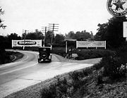
. Approaching Avondale, Baltimore Pike traffic bent southeast along Pennsylvania Avenue (PA 41), then Baltimore Pike split off after Avondale. In the town of Kennett Square, northbound US 1 ran along Cypress Street (southbound US 1 ran along State Street), and those streets were marked E-W, not N-S. After Kennett Square, the US 1 expressway ends and its traffic merges onto Baltimore Pike.
Except for the southernmost part of Baltimore Pike at Nottingham, the Chester County part of old US 1 is still driveable. There is the dead end mentioned above; also, a small part of Baltimore Pike is permanently blocked by the Herr's Snacks
company property.
Between Philadelphia and Trenton, US 1 is a part of the Lincoln Highway
, a cross-country road that ran from New York City
to San Francisco, California
. It was also a part of the Byberry and Bensalem Turnpike between Oakford
(Neshaminy Creek
) and Philadelphia.
From the Lancaster Turnpike, where the Lincoln Highway headed west along U.S. Route 30
, the Lincoln Highway originally headed east along Market Street
to Penn Square, where it turned north onto Broad Street
(Prior to the building of Roosevelt Boulevard, the main road followed Frankford Avenue to Bustleton Avenue from downtown.)
A bypass was added around downtown Philadelphia (in addition to the downtown route) in 1924, using Hunting Park Avenue, Ridge Avenue and City Avenue. This alignment is now used by U.S. 1, except that Hunting Park and Ridge Avenues are now bypassed by the Roosevelt Expressway and Schuylkill Expressway
.
From Broad Street, the Lincoln Highway then headed north on the Roosevelt Boulevard. By 1914, the Roosevelt Boulevard was completed to Rhawn Street, and the Lincoln Highway turned off the Boulevard there to reach Bustleton Avenue. The old alignment splits from Bustleton Avenue at Haldeman Avenue and then follows Roosevelt Boulevard. (A short piece of Old Bustleton Avenue southwest of Welsh Road was used, crossing Pennypack Creek
east of the current bridge.)
A 1920 extension took the Boulevard to Welsh Road, allowing traffic to turn off Bustleton Avenue there (that route is still Route 532), and a 1920s extension took it to the intersection with Old Lincoln Highway just north of the Poquessing Creek
bridge. North of there the present US 1 was completed in 1933 to the south end of the 1923 Langhorne bypass and in 1938 to Bellevue Avenue (Route 413) in downtown Langhorne.
 From near Hornig Road in Northeast Philadelphia, the old alignment heads through woods, closed to traffic, paralleling power lines, after which it was upgraded on the spot to become Roosevelt Boulevard. The original route is then gated at an 1805 stone bridge across Poquessing Creek
at the Philadelphia city line, just before crossing Roosevelt Boulevard
. After crossing Street Road, the Old Lincoln Highway then becomes one-way southbound past the Bristol Road intersection and crosses the Neshaminy Creek
. (This bridge itself was built in 1921 to replace a covered bridge
just to the west.)
The present route of Lincoln Highway and US 1 Business was built in 1923, bypassing Langhorne to the south and avoiding two railroad crossings. This crosses under the US 1 freeway just south of the railroad, where the older route had crossed the railroad. From Oakford, the Old Lincoln Highway heads northeast, no longer crossing SEPTA's West Trenton
line, as the US 1 freeway crosses just to the east. It then headed onto Maple Avenue (Route 213) to pass through Langhorne. Past Langhorne, the original route used what is presently known as Lincoln Highway (U.S. Route 1 Business).
At Fallsington, the original road crossed the Pennsylvania Railroad
's Trenton Cutoff on a bridge just east of the present bridge, built on a reverse curve
to shorten the span. It used Trenton Road and Main Street from the bridge to the intersection with Woolston, where Main Street is now cut. In 1917, an underpass under the railroad was built to the west on Woolston Drive; this became the main route by 1924.
It then headed toward Morrisville, where it first crossed the Delaware River
the Calhoun Street Bridge
, running along Trenton Avenue to Fallsington
. In 1920 it was moved to the Bridge Street Bridge, passing through downtown Morrisville.
U.S. Route 1
U.S. Route 1 is a major north–south U.S. Highway that serves the East Coast of the United States. It runs 2,377 miles from Fort Kent, Maine at the Canadian border south to Key West, Florida. U.S. 1 generally parallels Interstate 95, though it is significantly farther west between...
is a major north–south U.S. Highway, extending from the Florida Keys
Florida Keys
The Florida Keys are a coral archipelago in southeast United States. They begin at the southeastern tip of the Florida peninsula, about south of Miami, and extend in a gentle arc south-southwest and then westward to Key West, the westernmost of the inhabited islands, and on to the uninhabited Dry...
in the south to the Canadian
Canada
Canada is a North American country consisting of ten provinces and three territories. Located in the northern part of the continent, it extends from the Atlantic Ocean in the east to the Pacific Ocean in the west, and northward into the Arctic Ocean...
border in the north. In the U.S. state
U.S. state
A U.S. state is any one of the 50 federated states of the United States of America that share sovereignty with the federal government. Because of this shared sovereignty, an American is a citizen both of the federal entity and of his or her state of domicile. Four states use the official title of...
of Pennsylvania
Pennsylvania
The Commonwealth of Pennsylvania is a U.S. state that is located in the Northeastern and Mid-Atlantic regions of the United States. The state borders Delaware and Maryland to the south, West Virginia to the southwest, Ohio to the west, New York and Ontario, Canada, to the north, and New Jersey to...
, US 1 runs for 81 miles (130.4 km) from the Maryland
Maryland
Maryland is a U.S. state located in the Mid Atlantic region of the United States, bordering Virginia, West Virginia, and the District of Columbia to its south and west; Pennsylvania to its north; and Delaware to its east...
state line near Oxford to the New Jersey
New Jersey
New Jersey is a state in the Northeastern and Middle Atlantic regions of the United States. , its population was 8,791,894. It is bordered on the north and east by the state of New York, on the southeast and south by the Atlantic Ocean, on the west by Pennsylvania and on the southwest by Delaware...
state line near Trenton.
Maryland to Interstate 476
US 1 enters Pennsylvania in southwest Chester CountyChester County, Pennsylvania
-State parks:*French Creek State Park*Marsh Creek State Park*White Clay Creek Preserve-Demographics:As of the 2010 census, the county was 85.5% White, 6.1% Black or African American, 0.2% Native American or Alaskan Native, 3.9% Asian, 0.0% Native Hawaiian, 1.8% were two or more races, and 2.4% were...
. At the border it becomes the John H. Ware III
John H. Ware, III
John Haines Ware III was a Republican member of the U.S. House of Representatives from Pennsylvania. John H. Ware was born in Vineland, New Jersey. He graduated from the Wharton School of University of Pennsylvania in 1930. He was a public utility executive, and a burgess of the borough of Oxford...
Memorial Highway (formerly Kennett-Oxford Bypass) and widens to a 4 lane divided highway. A mile into Pennsylvania, the Ware Highway diverts north of Baltimore Pike
Baltimore Pike
thumb|[[SEPTA]]'s [[SEPTA Route 34|Route 34]] streetcar line runs through the 4500 block of Baltimore Avenue in [[West Philadelphia]]The Baltimore Pike was an auto trail in the United States, connecting Baltimore, Maryland with Philadelphia, Pennsylvania....
(former routing of US 1) and becomes a 4 lane limited access highway. At Kennett Square
Kennett Square, Pennsylvania
Kennett Square is a borough in Chester County, Pennsylvania, United States. It is known as the Mushroom Capital of the World because mushroom farming in the region produces over a million pounds of mushrooms a year...
it rejoins Baltimore Pike and becomes a 4 lane divided highway. It then passes by Longwood Gardens
Longwood Gardens
Longwood Gardens consists of over 1,077 acres of gardens, woodlands, and meadows in Kennett Square, Pennsylvania, United States in the Brandywine Creek Valley...
, a year-round botanical garden, at the PA 52
Pennsylvania Route 52
Pennsylvania Route 52 is a long state highway located in southeast Pennsylvania. The southern terminus of the route is at the Pennsylvania-Delaware state line near Kennett Square, where PA 52 continues as Delaware Route 52. The northern terminus is at U.S. Route 322 Business in West Chester. Near...
North junction and Brandywine Battlefield
Battle of Brandywine
The Battle of Brandywine, also known as the Battle of the Brandywine or the Battle of Brandywine Creek, was fought between the American army of Major General George Washington and the British-Hessian army of General Sir William Howe on September 11, 1777. The British defeated the Americans and...
, near where PA 52
Pennsylvania Route 52
Pennsylvania Route 52 is a long state highway located in southeast Pennsylvania. The southern terminus of the route is at the Pennsylvania-Delaware state line near Kennett Square, where PA 52 continues as Delaware Route 52. The northern terminus is at U.S. Route 322 Business in West Chester. Near...
splits off southward toward Wilmington, Delaware
Wilmington, Delaware
Wilmington is the largest city in the state of Delaware, United States, and is located at the confluence of the Christina River and Brandywine Creek, near where the Christina flows into the Delaware River. It is the county seat of New Castle County and one of the major cities in the Delaware Valley...
before intersecting with U.S. Highway 202 in Chadds Ford, Pennsylvania (at an intersection commonly known as "Painter's Crossing"). The road winds through Chadds Ford and Wawa, Pennsylvania
Wawa, Pennsylvania
Wawa is an unincorporated community located in Middletown Township in Delaware County, Pennsylvania. Named for the Ojibwe word for "goose" ,Wawa was originally known as Grubb's Bridge...
, wherein it provides an address to the Wawa Dairy Farms, which went on to create Wawa Food Markets
Wawa Food Markets
Wawa Inc. is a chain of convenience store/gas stations located in the Mid-Atlantic region of the United States. It operates in Pennsylvania, New Jersey, Delaware, Maryland, Virginia, and Florida. The company's corporate headquarters is located in Chester Heights, Pennsylvania, near the community...
, one of the most successful local convenience store chains in the United States
United States
The United States of America is a federal constitutional republic comprising fifty states and a federal district...
. Before arriving in Media, Pennsylvania
Media, Pennsylvania
The borough of Media is the county seat of Delaware County, Pennsylvania and is located west of Philadelphia. Media was incorporated in 1850 at the same time that it was named the county seat. The population was 5,533 at the 2000 census. Its school district is the Rose Tree Media School District...
, it exits from the Baltimore Pike and curves northeastward to become the "Media Bypass," a freeway that runs to the north of busy downtown Media. Baltimore Pike, meanwhile, becomes a local road, running parallel to, and south of, Route 1 through Media and Springfield, Pennsylvania
Springfield Township, Delaware County, Pennsylvania
Springfield Township, or simply Springfield, is a township and a Census Designated Place in Delaware County in the U.S. state of Pennsylvania. The population was 23,677 at the 2000 census...
before terminating in West Philadelphia
West Philadelphia
West Philadelphia, nicknamed West Philly, is a section of Philadelphia, Pennsylvania. Though there is no official definition of its boundaries, it is generally considered to reach from the western shore of the Schuylkill River, to City Line Avenue to the northwest, Cobbs Creek to the southwest, and...
as Route 13
U.S. Route 13
U.S. Route 13 is a north–south U.S. highway established in 1926 that runs for from Interstate 95 just north of Fayetteville, North Carolina to the northeastern suburbs of Philadelphia, Pennsylvania, in Morrisville. In all, it traverses five states in the Atlantic coastal plain region,...
near the University of Pennsylvania
University of Pennsylvania
The University of Pennsylvania is a private, Ivy League university located in Philadelphia, Pennsylvania, United States. Penn is the fourth-oldest institution of higher education in the United States,Penn is the fourth-oldest using the founding dates claimed by each institution...
.
Interstate 476 to Roosevelt Boulevard
After providing drivers access to Interstate 476Interstate 476
Interstate 476 is a auxiliary Interstate Highway in the U.S. state of Pennsylvania designated between Interstate 95 near Chester and Interstate 81 near Scranton, serving as the primary north–south Interstate corridor through eastern Pennsylvania....
by means of a three-level diamond interchange (this interchange is one of the busiest on I-476), the route becomes a local road again, first dubbed "State Road", then turns and becomes "Township Line Road" (after splitting with State Road), as it continues north through towns such as Springfield
Springfield Township, Delaware County, Pennsylvania
Springfield Township, or simply Springfield, is a township and a Census Designated Place in Delaware County in the U.S. state of Pennsylvania. The population was 23,677 at the 2000 census...
, Drexel Hill
Drexel Hill, Pennsylvania
Drexel Hill is a census-designated place in Upper Darby Township, Delaware County, Pennsylvania, United States. Drexel Hill is located southwest of Center City, Philadelphia and is part of the Philadelphia metropolitan area...
, and Upper Darby.
After intersecting PA Route 3 (West Chester Pike) in Upper Darby, Pennsylvania, not too far from the SEPTA transit system's 69th Street Terminal
69th Street Terminal
69th Street Transportation Center is a SEPTA terminal in Upper Darby, Pennsylvania. It is also the southwestern terminus of Philadelphia's EL, the Market-Frankford Line ....
, Route 1 drops the "Township Line Road" moniker at Cobbs Creek, which separates Philadelphia and Delaware counties. It is now "City Avenue" (locally known as "City Line Avenue") and acts as a border between the city of Philadelphia and the Montgomery County
Montgomery County, Pennsylvania
Montgomery County is a county located in the U.S. state of Pennsylvania, in the United States. As of 2010, the population was 799,874, making it the third most populous county in Pennsylvania . The county seat is Norristown.The county was created on September 10, 1784, out of land originally part...
suburbs of Bala Cynwyd, Merion Station, and Penn Wynne
Penn Wynne, Pennsylvania
Penn Wynne is a census-designated place in Montgomery County, Pennsylvania, United States. It is part of Lower Merion Township, and the mailing address is Wynnewood, Pennsylvania. The population was 5,697 at the 2010 census. It is mainly a residential area...
which are all located in Lower Merion Township
Lower Merion Township, Pennsylvania
Lower Merion Township is a township in Montgomery County, Pennsylvania and part of the Pennsylvania Main Line. As of the 2010 census, the township had a total population of 57,825...
. Saint Joseph's University
Saint Joseph's University
Saint Joseph's University is a private, coeducational Roman Catholic Jesuit university located partially in the Wynnefield section of Philadelphia and partially in Lower Merion Township and located in the Pennsylvania Main Line, Pennsylvania, United States.The school was founded in 1851 as Saint...
makes its home on this particular stretch of the route, as do Philadelphia television stations WPVI-TV
WPVI-TV
WPVI-TV, channel 6, is an owned-and-operated television station of the Walt Disney Company-owned American Broadcasting Company, located in Philadelphia, Pennsylvania, USA. WPVI has its studios located on the border between Philadelphia and Bala Cynwyd, and its transmitter is located in the...
and WCAU-TV, whose studios happen to be on opposite sides of the roadway. Many of the city's radio
Radio
Radio is the transmission of signals through free space by modulation of electromagnetic waves with frequencies below those of visible light. Electromagnetic radiation travels by means of oscillating electromagnetic fields that pass through the air and the vacuum of space...
stations are located just off City Avenue, mainly in Bala Cynwyd, Pennsylvania
Bala Cynwyd, Pennsylvania
Bala Cynwyd is a community in Lower Merion Township which is located on the Main Line in southeastern Pennsylvania, bordering the western edge of Philadelphia at US Route 1 . It was originally two separate towns, Bala and Cynwyd, but is commonly treated as a single community...
. As City Avenue, Route 1 intersects US 30
U.S. Route 30
U.S. Route 30 is an east–west main route of the system of United States Numbered Highways, with the highway traveling across the northern tier of the country. It is the third longest U.S. route, after U.S. Route 20 and U.S. Route 6. The western end of the highway is at Astoria, Oregon; the...
at the southwest corner of the St. Charles Borromeo Seminary
St. Charles Borromeo Seminary
St. Charles Borromeo Seminary is the seminary of the Roman Catholic Archdiocese of Philadelphia. Named for Charles Borromeo, it is located in Wynnewood, Pennsylvania,...
grounds, before reaching St. Joe's, the two television stations, and the Schuylkill River
Schuylkill River
The Schuylkill River is a river in Pennsylvania. It is a designated Pennsylvania Scenic River.The river is about long. Its watershed of about lies entirely within the state of Pennsylvania. The source of its eastern branch is in the Appalachian Mountains at Tuscarora Springs, near Tamaqua in...
.
City Avenue is also known as City Line Avenue, because the road lies on the border between Philadelphia and Montgomery Counties. Furthermore, the street was used as part of the dividing line when the 215 area code was split, with Philadelphia retaining 215 and the western suburbs becoming 610.
Some maps have this road as City Avenue, others, including the USGS topographic map
Topographic map
A topographic map is a type of map characterized by large-scale detail and quantitative representation of relief, usually using contour lines in modern mapping, but historically using a variety of methods. Traditional definitions require a topographic map to show both natural and man-made features...
s, have City Line Avenue. Google Maps lists both. The I-76 exit signs list City Avenue.
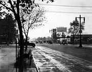
Roosevelt Boulevard to New Jersey
Interstate 76 (east)
Interstate 76 is an Interstate Highway in the United States, running 435 miles from an interchange with Interstate 71 west of Akron, Ohio, east to Interstate 295 near Camden, New Jersey....
(the Schuylkill Expressway
Schuylkill Expressway
The Schuylkill Expressway , locally known as the Schuylkill, is a freeway through southwestern Montgomery County and the city of Philadelphia, and the easternmost segment of Interstate 76 in the U.S. state of Pennsylvania...
portion). This, too, is one of the busiest interchanges in the region, witnessing traffic backups in all directions during morning and afternoon rush hour
Rush hour
A rush hour or peak hour is a part of the day during which traffic congestion on roads and crowding on public transport is at its highest. Normally, this happens twice a day—once in the morning and once in the evening, the times during when the most people commute...
s. Now completely within the Philadelphia city limits, it becomes the Roosevelt Expressway
Roosevelt Boulevard (Philadelphia)
Roosevelt Boulevard , often referred to simply as "the Boulevard," is a major traffic artery through North and Northeast Philadelphia...
upon crossing over the Schuylkill River.
At the end of the expressway, US 1 returns to grade level and becomes Roosevelt Boulevard
Roosevelt Boulevard (Philadelphia)
Roosevelt Boulevard , often referred to simply as "the Boulevard," is a major traffic artery through North and Northeast Philadelphia...
. This portion of Route 1 is the proverbial lifeline of those wishing to access Northeast Philadelphia
Northeast Philadelphia
Northeast Philadelphia, nicknamed Northeast Philly, the Northeast and the Great Northeast, is a section of the city of Philadelphia, Pennsylvania. According to the 2000 Census, the Northeast has a sizable percentage of the city's 1.547 million people — a population of between 300,000 and 450,000,...
and regularly sees traffic tie-ups at all of its major intersections. The Roosevelt Boulevard portion of Route 1 is separated into two sections in each direction (a parkway "inner drive" portion and a local road "outer drive" portion) and is home to the intersections of Northeast Philadelphia streets Red Lion Road and Grant Avenue, two of the top three most dangerous intersections in the United States
United States
The United States of America is a federal constitutional republic comprising fifty states and a federal district...
. Riders will also pass by the large outdoor Roosevelt Mall and the Northeast Philadelphia Airport
Northeast Philadelphia Airport
Northeast Philadelphia Airport is a public airport located just north of the intersection of Grant Avenue and Ashton Road in the Ashton-Woodenbridge neighborhood of Northeast Philadelphia. It is part of the Philadelphia Airport System along with Philadelphia International Airport, and is the...
before Route 1 junctions with the Pennsylvania Turnpike
Pennsylvania Turnpike
The Pennsylvania Turnpike is a toll highway system operated by the Pennsylvania Turnpike Commission in the Commonwealth of Pennsylvania, United States. The three sections of the turnpike system total . The main section extends from Ohio to New Jersey and is long...
interchange 351/Bensalem (former "Philadelphia" interchange) just across the Philadelphia/Bucks county line.
Bucks County, Pennsylvania
- Industry and commerce :The boroughs of Bristol and Morrisville were prominent industrial centers along the Northeast Corridor during World War II. Suburban development accelerated in Lower Bucks in the 1950s with the opening of Levittown, Pennsylvania, the second such "Levittown" designed by...
, Route 1 becomes Lincoln Highway
Lincoln Highway
The Lincoln Highway was the first road across the United States of America.Conceived and promoted by entrepreneur Carl G. Fisher, the Lincoln Highway spanned coast-to-coast from Times Square in New York City to Lincoln Park in San Francisco, originally through 13 states: New York, New Jersey,...
, an accident-prone freeway that ferries motorists to and from southeastern Bucks County towns such as Bensalem and Langhorne
Langhorne, Pennsylvania
Langhorne is a borough in Bucks County, Pennsylvania, United States. The population was 1,622 at the 2010 census.The name "Langhorne" is used broadly to describe the majority of surrounding Middletown Township, which for the most part uses Langhorne's zip code of 19047...
. The latter suburb is home to suburban Philadelphia landmarks Oxford Valley Mall
Oxford Valley Mall
The Oxford Valley Mall is a two-story shopping mall, owned by the Simon Property Group, that is located next to the popular amusement park Sesame Place in...
and the Sesame Place
Sesame Place
Sesame Place is an American theme park in Langhorne, Pennsylvania. It derives its theme from the Sesame Street television program and characters like Big Bird, Elmo, Cookie Monster, Ernie, and Bert. It includes a variety of rides, shows, and water attractions suited to very young children...
amusement park, based on characters from PBS' Sesame Street
Sesame Street
Sesame Street has undergone significant changes in its history. According to writer Michael Davis, by the mid-1970s the show had become "an American institution". The cast and crew expanded during this time, including the hiring of women in the crew and additional minorities in the cast. The...
program. Crossing Interstate 95
Interstate 95 in Pennsylvania
Interstate 95 is an Interstate highway running from Miami, Florida north to Houlton, Maine. In the U.S. state of Pennsylvania, the route is known by many as the Delaware Expressway, but is officially named The Vietnam Veterans Memorial Highway. and locally known as "95"...
, it proceeds through Morrisville, Pennsylvania
Morrisville, Bucks County, Pennsylvania
Morrisville is a borough in Bucks County, Pennsylvania, United States. The population was 8,728 at the 2010 census.-Geography:Morrisville is located at . It is situated on the Delaware River directly across from Trenton, New Jersey...
before crossing the Delaware River
Delaware River
The Delaware River is a major river on the Atlantic coast of the United States.A Dutch expedition led by Henry Hudson in 1609 first mapped the river. The river was christened the South River in the New Netherland colony that followed, in contrast to the North River, as the Hudson River was then...
on the Trenton-Morrisville Toll Bridge
Trenton-Morrisville Toll Bridge
The Trenton–Morrisville Toll Bridge is one of three road bridges connecting Trenton, New Jersey with Morrisville, Pennsylvania. Opened in 1952, it carries U.S. Route 1 and is owned and operated by the Delaware River Joint Toll Bridge Commission. This bridge's toll plaza was originally configured to...
into Trenton, New Jersey
Trenton, New Jersey
Trenton is the capital of the U.S. state of New Jersey and the county seat of Mercer County. As of the 2010 United States Census, Trenton had a population of 84,913...
.
History
In Chester County, before the US 1 expressway was built there, US 1 continued up Baltimore Pike (which now has a dead-end section in Nottingham where northbound US 1 veers away from the Baltimore Pike alignment onto the expressway). In Oxford, US 1 northbound ran on S. 3rd Street, then turned right on Market Street (PA 472) (N. 3rd Street is the beginning of PA 10), then very quickly turned left onto Lincoln Street, and after leaving Oxford the road ran by Lincoln UniversityLincoln University (Pennsylvania)
Lincoln University is the United States' first degree-granting historically black university. It is located near the town of Oxford in southern Chester County, Pennsylvania. The university also hosts a Center for Graduate Studies in the City of Philadelphia. Lincoln University provides...
. Approaching Avondale, Baltimore Pike traffic bent southeast along Pennsylvania Avenue (PA 41), then Baltimore Pike split off after Avondale. In the town of Kennett Square, northbound US 1 ran along Cypress Street (southbound US 1 ran along State Street), and those streets were marked E-W, not N-S. After Kennett Square, the US 1 expressway ends and its traffic merges onto Baltimore Pike.
Except for the southernmost part of Baltimore Pike at Nottingham, the Chester County part of old US 1 is still driveable. There is the dead end mentioned above; also, a small part of Baltimore Pike is permanently blocked by the Herr's Snacks
Herr's Snacks
Herr's is a Nottingham, Pennsylvania-based brand of snack foods, most notably potato chips. While their products are sold throughout the Eastern United States and Canada, their stronghold is the Mid-Atlantic region. -History:...
company property.
Between Philadelphia and Trenton, US 1 is a part of the Lincoln Highway
Lincoln Highway
The Lincoln Highway was the first road across the United States of America.Conceived and promoted by entrepreneur Carl G. Fisher, the Lincoln Highway spanned coast-to-coast from Times Square in New York City to Lincoln Park in San Francisco, originally through 13 states: New York, New Jersey,...
, a cross-country road that ran from New York City
New York City
New York is the most populous city in the United States and the center of the New York Metropolitan Area, one of the most populous metropolitan areas in the world. New York exerts a significant impact upon global commerce, finance, media, art, fashion, research, technology, education, and...
to San Francisco, California
San Francisco, California
San Francisco , officially the City and County of San Francisco, is the financial, cultural, and transportation center of the San Francisco Bay Area, a region of 7.15 million people which includes San Jose and Oakland...
. It was also a part of the Byberry and Bensalem Turnpike between Oakford
Oakford, Pennsylvania
Oakford is a neighborhood within the boundaries of both Bensalem Township and Lower Southampton Township. It is located in the northwestern section of Bensalem Township and in the south central section of Lower Southampton Township. The zip code is 19053....
(Neshaminy Creek
Neshaminy Creek
Neshaminy Creek is a stream that runs southeast through Bucks County, Pennsylvania. Neshaminy Creek proper rises south of the borough of Chalfont, where North Branch Neshaminy Creek and West Branch Neshaminy Creek meet. Neshaminy Creek flows lastly between Bristol Township and Bensalem Township...
) and Philadelphia.
From the Lancaster Turnpike, where the Lincoln Highway headed west along U.S. Route 30
U.S. Route 30 in Pennsylvania
In the U.S. state of Pennsylvania, U.S. Route 30 runs east–west across the southern part of the state, passing through Pittsburgh and Philadelphia on its way from the West Virginia state line east to the Benjamin Franklin Bridge over the Delaware River into New Jersey...
, the Lincoln Highway originally headed east along Market Street
Market Street (Philadelphia)
Market Street, originally known as High Street, is a major east–west street in Philadelphia, Pennsylvania. For the majority of its length, it serves as Pennsylvania Route 3....
to Penn Square, where it turned north onto Broad Street
Broad Street (Philadelphia)
Broad Street is a major arterial street in Philadelphia, Pennsylvania, and is nearly 13 miles long.It is Pennsylvania Route 611 along its entire length with the exception of its northernmost part between Old York Road and Pennsylvania Route 309 and the southernmost part south of Interstate 95...
(Prior to the building of Roosevelt Boulevard, the main road followed Frankford Avenue to Bustleton Avenue from downtown.)
A bypass was added around downtown Philadelphia (in addition to the downtown route) in 1924, using Hunting Park Avenue, Ridge Avenue and City Avenue. This alignment is now used by U.S. 1, except that Hunting Park and Ridge Avenues are now bypassed by the Roosevelt Expressway and Schuylkill Expressway
Schuylkill Expressway
The Schuylkill Expressway , locally known as the Schuylkill, is a freeway through southwestern Montgomery County and the city of Philadelphia, and the easternmost segment of Interstate 76 in the U.S. state of Pennsylvania...
.
From Broad Street, the Lincoln Highway then headed north on the Roosevelt Boulevard. By 1914, the Roosevelt Boulevard was completed to Rhawn Street, and the Lincoln Highway turned off the Boulevard there to reach Bustleton Avenue. The old alignment splits from Bustleton Avenue at Haldeman Avenue and then follows Roosevelt Boulevard. (A short piece of Old Bustleton Avenue southwest of Welsh Road was used, crossing Pennypack Creek
Pennypack Creek
Pennypack Creek is a creek in southeastern Pennsylvania in the United States. It runs southeast through eastern Montgomery County, lower Bucks County, and the northeast section of Philadelphia, before emptying into the Delaware River.-Name:...
east of the current bridge.)
A 1920 extension took the Boulevard to Welsh Road, allowing traffic to turn off Bustleton Avenue there (that route is still Route 532), and a 1920s extension took it to the intersection with Old Lincoln Highway just north of the Poquessing Creek
Poquessing Creek
Poquessing Creek is a creek, a right tributary of the Delaware River, that forms part of the boundary between Bucks County and the northeast section of Philadelphia, Pennsylvania. It has been part of the boundary between Bucks and Philadelphia counties since 1682.The creek arises in Trevose and...
bridge. North of there the present US 1 was completed in 1933 to the south end of the 1923 Langhorne bypass and in 1938 to Bellevue Avenue (Route 413) in downtown Langhorne.
Poquessing Creek
Poquessing Creek is a creek, a right tributary of the Delaware River, that forms part of the boundary between Bucks County and the northeast section of Philadelphia, Pennsylvania. It has been part of the boundary between Bucks and Philadelphia counties since 1682.The creek arises in Trevose and...
at the Philadelphia city line, just before crossing Roosevelt Boulevard
Roosevelt Boulevard
The following roads are called Roosevelt Boulevard:*Roosevelt Boulevard in Jacksonville, Florida*Roosevelt Boulevard between Marmora and Ocean City, New Jersey*Roosevelt Boulevard in Philadelphia, Pennsylvania...
. After crossing Street Road, the Old Lincoln Highway then becomes one-way southbound past the Bristol Road intersection and crosses the Neshaminy Creek
Neshaminy Creek
Neshaminy Creek is a stream that runs southeast through Bucks County, Pennsylvania. Neshaminy Creek proper rises south of the borough of Chalfont, where North Branch Neshaminy Creek and West Branch Neshaminy Creek meet. Neshaminy Creek flows lastly between Bristol Township and Bensalem Township...
. (This bridge itself was built in 1921 to replace a covered bridge
Covered bridge
A covered bridge is a bridge with enclosed sides and a roof, often accommodating only a single lane of traffic. Most covered bridges are wooden; some newer ones are concrete or metal with glass sides...
just to the west.)
The present route of Lincoln Highway and US 1 Business was built in 1923, bypassing Langhorne to the south and avoiding two railroad crossings. This crosses under the US 1 freeway just south of the railroad, where the older route had crossed the railroad. From Oakford, the Old Lincoln Highway heads northeast, no longer crossing SEPTA's West Trenton
West Trenton Line (SEPTA)
The West Trenton Line is a SEPTA Regional Rail line connecting Center City Philadelphia to West Trenton, New Jersey.-Route:The West Trenton Line connects Center City, Philadelphia with the West Trenton section of Ewing, New Jersey...
line, as the US 1 freeway crosses just to the east. It then headed onto Maple Avenue (Route 213) to pass through Langhorne. Past Langhorne, the original route used what is presently known as Lincoln Highway (U.S. Route 1 Business).
At Fallsington, the original road crossed the Pennsylvania Railroad
Pennsylvania Railroad
The Pennsylvania Railroad was an American Class I railroad, founded in 1846. Commonly referred to as the "Pennsy", the PRR was headquartered in Philadelphia, Pennsylvania....
's Trenton Cutoff on a bridge just east of the present bridge, built on a reverse curve
Reverse curve
In civil engineering, a reverse curve is a section of the horizontal alignment of a highway or railroad route in which a curve to the left or right is followed immediately by a curve in the opposite direction....
to shorten the span. It used Trenton Road and Main Street from the bridge to the intersection with Woolston, where Main Street is now cut. In 1917, an underpass under the railroad was built to the west on Woolston Drive; this became the main route by 1924.
It then headed toward Morrisville, where it first crossed the Delaware River
Delaware River
The Delaware River is a major river on the Atlantic coast of the United States.A Dutch expedition led by Henry Hudson in 1609 first mapped the river. The river was christened the South River in the New Netherland colony that followed, in contrast to the North River, as the Hudson River was then...
the Calhoun Street Bridge
Calhoun Street Bridge (Trenton)
The Calhoun Street Toll Supported Bridge is a historic bridge connecting Calhoun Street in Trenton, New Jersey across the Delaware River to East Trenton Avenue in Morrisville, Pennsylvania. It was constructed by the Phoenix Bridge Company of Phoenixville, Pennsylvania in 1884...
, running along Trenton Avenue to Fallsington
Fallsington, Pennsylvania
Fallsington is an unincorporated community in Falls Township, Bucks County, Pennsylvania, United States.-Geography:The latitude of Fallsington is 40.187N. The longitude is -74.819W.It is in the Eastern Standard time zone. Elevation is .-History:...
. In 1920 it was moved to the Bridge Street Bridge, passing through downtown Morrisville.
Major intersections
| County | Location | Mile | Destinations | Notes |
|---|---|---|---|---|
| Maryland Maryland Maryland is a U.S. state located in the Mid Atlantic region of the United States, bordering Virginia, West Virginia, and the District of Columbia to its south and west; Pennsylvania to its north; and Delaware to its east... state line |
||||
| Chester Chester County, Pennsylvania -State parks:*French Creek State Park*Marsh Creek State Park*White Clay Creek Preserve-Demographics:As of the 2010 census, the county was 85.5% White, 6.1% Black or African American, 0.2% Native American or Alaskan Native, 3.9% Asian, 0.0% Native Hawaiian, 1.8% were two or more races, and 2.4% were... |
Nottingham Nottingham, Pennsylvania Nottingham is an unincorporated community located in West Nottingham Township, Chester County, Pennsylvania. The community is located at the intersection of U.S. 1 and Pennsylvania Route 272 near the border with East Nottingham Township a short distance north of the Maryland border. It is home to... |
South end of expressway section | ||
| 2.07 | ||||
| Oxford Oxford, Pennsylvania Oxford is a borough in Chester County, Pennsylvania, United States. Oxford is the closest town to Lincoln University. The population was 4,315 at the 2000 census.-History:The borough was once called Oxford Crossing and Oxford Village.... |
5.06 | |||
| 7.10 | ||||
| Penn Township Penn Township, Chester County, Pennsylvania Penn Township is a township in Chester County, Pennsylvania, United States. The population was 5,364 at the 2010 census. It is home to the Nursery Capital of Pennsylvania and, formerly, was the site of Sunset Park, one of country music's most popular venues.... |
10.01 | |||
| West Grove West Grove, Pennsylvania West Grove is a borough in Chester County, Pennsylvania, United States. The population was 2,854 at the 2010 census.-History:The village of West Grove derived its name from the Friends Meeting House on Harmony Road built in 1787 several miles west of the Friends Meeting House in the village of... |
12.46 | |||
| 14.99 | ||||
| Avondale Avondale, Pennsylvania Avondale is a borough in Chester County, Pennsylvania, United States. The population was 1,265 at the 2010 census.-Geography:Avondale is located at .... |
16.30 | |||
| Toughkenamon Toughkenamon, Pennsylvania Toughkenamon is a census-designated place in New Garden Township, Chester County, Pennsylvania, United States. The population was 1,492 at the 2010 census.-Geography:Toughkenamon is located at .... |
18.32 | Toughkenamon, London Grove London Grove Township, Pennsylvania London Grove Township is a township in Chester County, Pennsylvania, United States. The population was 7,475 at the 2010 census.-Geography:According to the United States Census Bureau, the township has a total area of , of which 0.06% is water.... |
||
| Kennett Square Kennett Square, Pennsylvania Kennett Square is a borough in Chester County, Pennsylvania, United States. It is known as the Mushroom Capital of the World because mushroom farming in the region produces over a million pounds of mushrooms a year... |
21.13 | |||
| Kennett Square Kennett Square, Pennsylvania Kennett Square is a borough in Chester County, Pennsylvania, United States. It is known as the Mushroom Capital of the World because mushroom farming in the region produces over a million pounds of mushrooms a year... |
Southbound exit, northbound entrance | |||
| North end of expressway section | ||||
| Kennett Township Kennett Township, Pennsylvania Kennett Township is a township in Chester County, Pennsylvania, United States. It is the location of the famed Longwood Gardens conservatory and was the birthplace of Louise Brewer Shepard, the wife of the first American in space, Alan Shepard... |
23.87 | South end of PA 52 overlap | ||
| 24.54 | North end of PA 52 overlap | |||
| Delaware Delaware County, Pennsylvania Delaware County is a county located in the U.S. state of Pennsylvania. As of 2010, the population was 558,979, making it Pennsylvania's fifth most populous county, behind Philadelphia, Allegheny, Montgomery, and Bucks counties.... |
Painters Crossroads | 30.61 | South end of US 322 overlap | |
| Concordville Concordville, Pennsylvania Concordville is an unincorporated community in Concord Township, Delaware County, Pennsylvania, United States. It is located 20 miles west-southwest of Philadelphia, at the junction of U.S. Routes 1 and 322. This intersection can be traced back to two of the earliest roads in Pennsylvania,... |
31.62 | North end of US 322 overlap | ||
| Middletown Township Middletown Township, Delaware County, Pennsylvania Middletown Township is a township in Delaware County, Pennsylvania, United States. The population was 16,064 at the 2000 census. The Pennsylvania State University has an undergraduate satellite campus located in the north-central portion of the township, while Neumann College, a private... |
36.94 | |||
| 37.76 | Interchange | |||
| South end of expressway section | ||||
| Baltimore Pike Baltimore Pike thumb|[[SEPTA]]'s [[SEPTA Route 34|Route 34]] streetcar line runs through the 4500 block of Baltimore Avenue in [[West Philadelphia]]The Baltimore Pike was an auto trail in the United States, connecting Baltimore, Maryland with Philadelphia, Pennsylvania.... - Media Media, Pennsylvania The borough of Media is the county seat of Delaware County, Pennsylvania and is located west of Philadelphia. Media was incorporated in 1850 at the same time that it was named the county seat. The population was 5,533 at the 2000 census. Its school district is the Rose Tree Media School District... |
Northbound exit, southbound entrance | |||
| Upper Providence Township Upper Providence Township, Delaware County, Pennsylvania Upper Providence Township is a census-designated place and township in Delaware County, Pennsylvania, United States, located around and north of the borough of Media, between Ridley Creek and Crum Creek. The population was 10,509 at the 2000 census. Ridley Creek State Park is inside the... |
40.17 | |||
| 41.12 | State Road | Southbound exit, northbound entrance | ||
| Marple Township Marple Township, Pennsylvania Marple Township is a township in Delaware County, Pennsylvania, United States. The population was 23,737 at the 2000 census. ZIP codes include mainly 19008, but also partially 19064 and 19063.-Geography:... |
41.65 | Three-level diamond interchange | ||
| North end of expressway section | ||||
| Springfield Springfield Township, Delaware County, Pennsylvania Springfield Township, or simply Springfield, is a township and a Census Designated Place in Delaware County in the U.S. state of Pennsylvania. The population was 23,677 at the 2000 census... |
42.40 | Interchange | ||
| Haverford Haverford Township, Pennsylvania Haverford Township is a home rule township in Delaware County, near Philadelphia, in southeastern Pennsylvania, United States. It maintains its legal name as the Township of Haverford, presumably for historic reasons... -Upper Darby Upper Darby Township, Pennsylvania Upper Darby Township is a home rule township bordering West Philadelphia in Pennsylvania. Although it retains the term "Township" in its legal name, presumably for historic reasons, it is the largest municipality of any type in Delaware County. Upper Darby is also home to the Tower Theater, a... Township |
46.24 | |||
| Montgomery Montgomery County, Pennsylvania Montgomery County is a county located in the U.S. state of Pennsylvania, in the United States. As of 2010, the population was 799,874, making it the third most populous county in Pennsylvania . The county seat is Norristown.The county was created on September 10, 1784, out of land originally part... -Philadelphia Philadelphia County, Pennsylvania -History:Tribes of Lenape were the first known occupants in the area which became Philadelphia County. The first European settlers were Swedes and Finns who arrived in 1638. The Netherlands seized the area in 1655, but permanently lost control to England in 1674... |
Wynnewood Wynnewood, Pennsylvania Wynnewood, Pennsylvania is a suburban community located outside of Philadelphia in Lower Merion Township, Pennsylvania and Haverford Township, Pennsylvania, United States. Wynnewood was named in 1691 for Dr. Thomas Wynne, William Penn's physician and the first Speaker of the Pennsylvania General... -Philadelphia |
47.80 | Haverford Road/Haverford Avenue | |
| 48.79 | ||||
| Bala Cynwyd Bala Cynwyd, Pennsylvania Bala Cynwyd is a community in Lower Merion Township which is located on the Main Line in southeastern Pennsylvania, bordering the western edge of Philadelphia at US Route 1 . It was originally two separate towns, Bala and Cynwyd, but is commonly treated as a single community... -Philadelphia |
50.50 | |||
| South end of expressway section | ||||
| 51.55 | South end of I-76 overlap | |||
| Philadelphia | Philadelphia | 52.31 | North end of I-76 overlap | |
| 52.86 | Ridge Avenue/Kelly Drive Kelly Drive Kelly Drive, or more formally, John B. Kelly Drive, is a winding four-mile road along the Schuylkill River from Eakins Oval before the Philadelphia Museum of Art to the neighborhood of East Falls, Philadelphia, just south of Wissahickon Creek, where it connects with Lincoln Drive.-East River... |
Southbound exit | ||
| 53.33 | Fox Street/Henry Avenue | |||
| 53.53 | Wissahickon Avenue south - Hunting Park Avenue | Northbound exit | ||
| 54.01 | Wissahickon Avenue north - Germantown Avenue | |||
| 54.80 | ||||
| North end of expressway section | ||||
| 55.32 | South end of US 13 overlap | |||
| 58.87 | Interchange (Oxford Circle Oxford Circle, Philadelphia, Pennsylvania Oxford Circle is a neighborhood in the lower Northeast section of Philadelphia, Pennsylvania, United States. Its namesake is the much used traffic circle... ) |
|||
| 59.65 | northbound one-way pair One-way pair A one-way pair, one-way couple, or just couplet is a pair of parallel, usually one-way streets that carry opposite directions of a signed route or major traffic flow, or sometimes opposite directions of a bus or streetcar route.... |
|||
| 59.71 | southbound one-way pair North end of US 13 overlap |
|||
| 60.79 | ||||
| 63.14 | ||||
| 64.88 | South end of PA 63 overlap | |||
| 66.23 | Interchange. North end of PA 63 overlap | |||
| Bucks Bucks County, Pennsylvania - Industry and commerce :The boroughs of Bristol and Morrisville were prominent industrial centers along the Northeast Corridor during World War II. Suburban development accelerated in Lower Bucks in the 1950s with the opening of Levittown, Pennsylvania, the second such "Levittown" designed by... |
Trevose Trevose, Pennsylvania Trevose is a neighborhood of Bensalem and Lower Southampton in Pennsylvania, which is north of and borders northeastern Philadelphia. It shares a zip code with Feasterville-Trevose. It is not a municipality. U.S. 1 runs through the town as well as the Pennsylvania Turnpike, but Trevose's main road... |
South end of expressway section | ||
| 68.33 | ||||
| 68.59 | , New Jersey New Jersey New Jersey is a state in the Northeastern and Middle Atlantic regions of the United States. , its population was 8,791,894. It is bordered on the north and east by the state of New York, on the southeast and south by the Atlantic Ocean, on the west by Pennsylvania and on the southwest by Delaware... |
|||
| 69.15 | Neshaminy | |||
| Middletown Township Middletown Township, Bucks County, Pennsylvania Middletown Township is a township in Bucks County, Pennsylvania, United States. The population was 45,436 at the 2010 census. Many sections of Levittown, Pennsylvania, are located in the southern end of the township... |
69.81 | Northbound exit, southbound entrance | ||
| Langhorne Manor Langhorne Manor, Pennsylvania Langhorne Manor is a borough in Bucks County, Pennsylvania, United States. The population was 1,422 at the 2010 census, a 55.6% increase from the 2000 census... |
70.60 | Langhorne Manor | Northbound exit | |
| Langhorne Langhorne, Pennsylvania Langhorne is a borough in Bucks County, Pennsylvania, United States. The population was 1,622 at the 2010 census.The name "Langhorne" is used broadly to describe the majority of surrounding Middletown Township, which for the most part uses Langhorne's zip code of 19047... |
72.39 | |||
| 73.18 | ||||
| Middletown Township Middletown Township, Bucks County, Pennsylvania Middletown Township is a township in Bucks County, Pennsylvania, United States. The population was 45,436 at the 2010 census. Many sections of Levittown, Pennsylvania, are located in the southern end of the township... |
74.84 | |||
| 75.10 | - Trenton Trenton, New Jersey Trenton is the capital of the U.S. state of New Jersey and the county seat of Mercer County. As of the 2010 United States Census, Trenton had a population of 84,913... , Princeton Princeton, New Jersey Princeton is a community located in Mercer County, New Jersey, United States. It is best known as the location of Princeton University, which has been sited in the community since 1756... |
|||
| 75.75 | Oxford Valley Road, Sesame Place Sesame Place Sesame Place is an American theme park in Langhorne, Pennsylvania. It derives its theme from the Sesame Street television program and characters like Big Bird, Elmo, Cookie Monster, Ernie, and Bert. It includes a variety of rides, shows, and water attractions suited to very young children... |
|||
| Falls Township Falls Township, Bucks County, Pennsylvania Falls Township is a township in Bucks County, Pennsylvania, United States. The population was 34,300 at the 2010 census. Portions of Fairless Hills and Levittown, Pennsylvania, are located in the township... |
78.60 | Only signed as Tyburn Road/Trenton Avenue northbound | ||
| 78.92 | ||||
| 79.23 | Pine Grove Road north | Southbound exit | ||
| Morrisville Morrisville, Bucks County, Pennsylvania Morrisville is a borough in Bucks County, Pennsylvania, United States. The population was 8,728 at the 2010 census.-Geography:Morrisville is located at . It is situated on the Delaware River directly across from Trenton, New Jersey... |
79.53 | Former US 1 Bus. U.S. Route 1 Business (Trenton, New Jersey) U.S. Route 1 Business is a four-lane surface road that provides an alternate to the Trenton Freeway northeast of Trenton in Mercer County, New Jersey. The route is long and runs between US 1 in Trenton and Lawrence Township. On the border of Trenton and Lawrence Township, US 1 Business... |
||
| 80.73 | Pennsylvania Avenue - Morrisville | Separate north/south exits southbound | ||
| Trenton-Morrisville Toll Bridge Trenton-Morrisville Toll Bridge The Trenton–Morrisville Toll Bridge is one of three road bridges connecting Trenton, New Jersey with Morrisville, Pennsylvania. Opened in 1952, it carries U.S. Route 1 and is owned and operated by the Delaware River Joint Toll Bridge Commission. This bridge's toll plaza was originally configured to... over the Delaware River Delaware River The Delaware River is a major river on the Atlantic coast of the United States.A Dutch expedition led by Henry Hudson in 1609 first mapped the river. The river was christened the South River in the New Netherland colony that followed, in contrast to the North River, as the Hudson River was then... |
||||