

U.S. Route 13
Encyclopedia
U.S. Route 13 is a north–south U.S. highway established in 1926 that runs for 517 miles (832 km) from Interstate 95
just north of Fayetteville, North Carolina
to the northeastern suburbs of Philadelphia, Pennsylvania
, in Morrisville
. In all, it traverses five states in the Atlantic coastal plain
region, following the Atlantic
coast more closely than does the main north–south U.S. highway of the region, U.S. Route 1
. Its routing is largely rural, the notable exceptions being the Hampton Roads
area and the northern end of the highway in Delaware
and Pennsylvania
. It is also notable for being the main thoroughfare for the Delmarva Peninsula
and carrying the Chesapeake Bay Bridge-Tunnel
to it in Virginia
.
US 13's original plan in 1926 had the route serve no further south than the Delmarva Peninsula. However, it has been extended many times, connecting to the mainland via ferry service and eventually reaching North Carolina. This link across the mouth of the Chesapeake Bay became fixed in 1964 with a bridge. The entire route on the Delmarva Peninsula save a few sections in Accomack County, Virginia
have been dualized fully with four lanes, and further upgrades continue, such as a freeway section around the east side of Salisbury, Maryland
.
|NC
|185.52
|298.57
|-
|VA
|137.45
|221.20
|-
|MD
|42.01
|67.60
|-
|DE
|103.33
|166.29
|-
|PA
|49.50
|79.66
|-
|Total
|517.81
|833.33
|}
near Fayetteville
as a continuation of the Fayetteville Outer Loop
and heads northeast, intersecting U.S. Route 421
in Spivey's Corner and Interstate 40
and U.S. Route 701
in Newton Grove
. It then passes through the city of Goldsboro
, where it intersects U.S. Route 70
and U.S. Route 117
. US 13 continues northeast and shares a brief concurrency with U.S. Route 264
before passing through the city of Greenville
. US 13 then heads north from Greenville, following the limited-access U.S. Route 64
east between Bethel
and Williamston
and U.S. Route 17
north between Williamston and Windsor
. US 13 then heads north from Windsor towards the Virginia border.
_historical_marker.jpg)
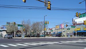
US 13 continues north, expanding to four lanes near Suffolk
and diverges onto the Suffolk Bypass. Here, one of the many business routes of US 13 passes straight through the city as the bypass passes the city to the west. It continues through the Hampton Roads
area on the Military Highway
and continues north to the Chesapeake Bay Bridge-Tunnel
, which the route uses to continue to the Eastern Shore of Virginia
. Here, US 13 is the main north–south route of the region, and connects to most cities and towns with four more business routes forming loops off the highway. North of New Church
, US 13 crosses the state border into Maryland
.
region of Maryland. It runs through Pocomoke City
in Worcester County
, where it meets the southern terminus of U.S. Route 113
. It continues north into Somerset County
, where it passes through the town of Princess Anne
. It then enters Wicomico County
, where it bypasses the city of Salisbury
and the town of Fruitland
to the east on the limited-access Salisbury Bypass with the former alignment signed as U.S. Route 13 Business
. On the northeastern part of the bypass, US 13 is concurrent with U.S. Route 50
, which bypasses Salisbury to the north. North of Salisbury, US 13 continues to the state line town of Delmar
.
and runs through western Sussex County
, intersecting U.S. Route 9
in Laurel
and passing through the city of Seaford
. It continues into Kent County
and heads north towards the state capital of Dover
. US 13 forms the commercial district of the city of Dover. Between Dover and Wilmington
in New Castle County
, US 13 is paralleled by the Delaware Route 1 turnpike. It crosses the Chesapeake and Delaware Canal
on the St. Georges Bridge
. US 13 continues towards Wilmington, sharing a concurrency with U.S. Route 40
in the New Castle
area. It bypasses the heart of Wilmington to the east, with U.S. Route 13 Business passing through the downtown area. US 13 parallels Interstate 495
between Wilmington and the Pennsylvania border.
parallel to Interstate 95 through Delaware County
. It then runs a southwest to northeast path through the city of Philadelphia. It traverses West Philadelphia
on many one-way pairs
and then passes by the Philadelphia Zoo
. US 13 then runs through North Philadelphia
and Northeast Philadelphia
by following Hunting Park Avenue, the Roosevelt Boulevard
(which is also U.S. Route 1
), and Frankford Avenue, where it crosses the oldest bridge in the United States
. US 13 then enters Bucks County
, again closely following I-95 and the Delaware River. It ends at an interchange with US 1 in Falls Township
, just west of Morrisville
.
The original 1925 U.S. highway plan, which never came to fruition, had provision for a U.S. Route 13 in North Carolina. It would have started in Wilmington
and run at least as far north as Elizabeth City
, following what would become US 17. Although US 13 was signed in most northern states by the late 1920s, it would not reach North Carolina until the early 1950s.
The route was proposed as one of the first four-laned highways in the United States of America to Pierre S. du Pont
by John J. Raskob
so as to run from Wilmington, Delaware to the State Capital, Dover. Du Pont wanted a two-laned highway--which were standard at the time, but Raskob suggested, with the growth and development of Northern Delaware, there will be a future need for a four-laned one. Du Pont agreed and, to honor Raskob for his insight, sought to name the route after him. However, Raskob declined. Du Pont checked with the U.S. registry of highways to see if any routes were named "13" and so named "Route 13" after the number of children John Raskob had. What was considered an "unlucky" number by most, instead honors the man whose idea for this route being four-laned from its very beginning.
Interstate 95 in North Carolina
Interstate 95 is a major Interstate Highway, running along the East Coast of the United States from Florida to Maine. In North Carolina, I-95 runs diagonally across the eastern third of the state, from Rowland in the southwest to Roanoke Rapids in the northeast of the Inner Banks.-Route...
just north of Fayetteville, North Carolina
Fayetteville, North Carolina
Fayetteville is a city located in Cumberland County, North Carolina, United States. It is the county seat of Cumberland County, and is best known as the home of Fort Bragg, a U.S. Army post located northwest of the city....
to the northeastern suburbs of Philadelphia, Pennsylvania
Pennsylvania
The Commonwealth of Pennsylvania is a U.S. state that is located in the Northeastern and Mid-Atlantic regions of the United States. The state borders Delaware and Maryland to the south, West Virginia to the southwest, Ohio to the west, New York and Ontario, Canada, to the north, and New Jersey to...
, in Morrisville
Morrisville, Bucks County, Pennsylvania
Morrisville is a borough in Bucks County, Pennsylvania, United States. The population was 8,728 at the 2010 census.-Geography:Morrisville is located at . It is situated on the Delaware River directly across from Trenton, New Jersey...
. In all, it traverses five states in the Atlantic coastal plain
Atlantic Coastal Plain
The Atlantic coastal plain has both low elevation and low relief, but it is also a relatively flat landform extending from the New York Bight southward to a Georgia/Florida section of the Eastern Continental Divide, which demarcates the plain from the ACF River Basin in the Gulf Coastal Plain to...
region, following the Atlantic
Atlantic Ocean
The Atlantic Ocean is the second-largest of the world's oceanic divisions. With a total area of about , it covers approximately 20% of the Earth's surface and about 26% of its water surface area...
coast more closely than does the main north–south U.S. highway of the region, U.S. Route 1
U.S. Route 1
U.S. Route 1 is a major north–south U.S. Highway that serves the East Coast of the United States. It runs 2,377 miles from Fort Kent, Maine at the Canadian border south to Key West, Florida. U.S. 1 generally parallels Interstate 95, though it is significantly farther west between...
. Its routing is largely rural, the notable exceptions being the Hampton Roads
Hampton Roads
Hampton Roads is the name for both a body of water and the Norfolk–Virginia Beach metropolitan area which surrounds it in southeastern Virginia, United States...
area and the northern end of the highway in Delaware
Delaware
Delaware is a U.S. state located on the Atlantic Coast in the Mid-Atlantic region of the United States. It is bordered to the south and west by Maryland, and to the north by Pennsylvania...
and Pennsylvania
Pennsylvania
The Commonwealth of Pennsylvania is a U.S. state that is located in the Northeastern and Mid-Atlantic regions of the United States. The state borders Delaware and Maryland to the south, West Virginia to the southwest, Ohio to the west, New York and Ontario, Canada, to the north, and New Jersey to...
. It is also notable for being the main thoroughfare for the Delmarva Peninsula
Delmarva Peninsula
The Delmarva Peninsula is a large peninsula on the East Coast of the United States, occupied by most of Delaware and portions of Maryland and Virginia...
and carrying the Chesapeake Bay Bridge-Tunnel
Chesapeake Bay Bridge-Tunnel
The Chesapeake Bay Bridge-Tunnel is a long fixed link crossing the mouth of the Chesapeake Bay and connecting the Delmarva Peninsula's Eastern Shore of Virginia with Virginia Beach and the metropolitan area of Hampton Roads, Virginia...
to it in Virginia
Virginia
The Commonwealth of Virginia , is a U.S. state on the Atlantic Coast of the Southern United States. Virginia is nicknamed the "Old Dominion" and sometimes the "Mother of Presidents" after the eight U.S. presidents born there...
.
US 13's original plan in 1926 had the route serve no further south than the Delmarva Peninsula. However, it has been extended many times, connecting to the mainland via ferry service and eventually reaching North Carolina. This link across the mouth of the Chesapeake Bay became fixed in 1964 with a bridge. The entire route on the Delmarva Peninsula save a few sections in Accomack County, Virginia
Accomack County, Virginia
As of the census of 2010, there were 33,164 people, 15,299 households, and 10,388 families residing in the county. The population density was 84 people per square mile . There were 19,550 housing units at an average density of 43 per square mile...
have been dualized fully with four lanes, and further upgrades continue, such as a freeway section around the east side of Salisbury, Maryland
Salisbury, Maryland
-Demographics:Salisbury is the principal city of the Salisbury-Ocean Pines CSA, a Combined Statistical Area that includes the Salisbury metropolitan area and the Ocean Pines micropolitan area , which had a combined population of 176,657 at the 2010 census.As of the census of 2000, there were...
.
Route description
|-|NC
U.S. Route 13 in North Carolina
The section of U.S. Route 13 in North Carolina is the largest, home to of its length. It runs southwest to northeast through eastern North Carolina, beginning at Interstate 95. Most of the routing is rural, serving only three cities of considerable size along the entire route; the rest passes...
|185.52
|298.57
|-
|VA
U.S. Route 13 in Virginia
U.S. Route 13 is a north–south U.S. highway established in 1926 that runs for from Interstate 95 just north of Fayetteville, North Carolina to the northeastern suburbs of Philadelphia, Pennsylvania, in Morrisville. In the U.S...
|137.45
|221.20
|-
|MD
U.S. Route 13 in Maryland
U.S. Route 13 is a U.S. Highway running from Fayetteville, North Carolina north to Morrisville, Pennsylvania. In the U.S. state of Maryland, the route runs from the Virginia border south of Pocomoke City in Worcester County north to the Delaware border in Delmar, Wicomico County, where the route...
|42.01
|67.60
|-
|DE
U.S. Route 13 in Delaware
U.S. Route 13 is the main north–south highway in the U.S. state of Delaware. It traverses the entire length of the state from the Maryland border in Delmar, Sussex County to the Pennsylvania border in Claymont, New Castle County. U.S. Route 13 connects many important cities and towns in...
|103.33
|166.29
|-
|PA
U.S. Route 13 in Pennsylvania
U.S. Route 13 passes through the Philadelphia metropolitan area in the U.S. state of Pennsylvania. The route enters the state from Delaware in Marcus Hook, Delaware County. It continues in a northeasterly direction through Delaware County, passes through Philadelphia, and continues into Bucks...
|49.50
|79.66
|-
|Total
|517.81
|833.33
|}
North Carolina
US 13 runs southwest to northeast through the eastern part of North Carolina. It begins at Interstate 95Interstate 95 in North Carolina
Interstate 95 is a major Interstate Highway, running along the East Coast of the United States from Florida to Maine. In North Carolina, I-95 runs diagonally across the eastern third of the state, from Rowland in the southwest to Roanoke Rapids in the northeast of the Inner Banks.-Route...
near Fayetteville
Fayetteville, North Carolina
Fayetteville is a city located in Cumberland County, North Carolina, United States. It is the county seat of Cumberland County, and is best known as the home of Fort Bragg, a U.S. Army post located northwest of the city....
as a continuation of the Fayetteville Outer Loop
Interstate 295 (North Carolina)
Interstate 295 , also known as the Fayetteville Outer Loop, when fully completed will be a Interstate Highway bypass around the western side of Fayetteville North Carolina, to be built to help relieve congestion through that city and to provide direct access from I-95 to Fort Bragg, North Carolina...
and heads northeast, intersecting U.S. Route 421
U.S. Route 421
U.S. Route 421 is a spur route of U.S. 21. It runs for from Michigan City, Indiana, at U.S. 20, to Fort Fisher in North Carolina. The highway goes through the cities of Indianapolis, Indiana, Lexington, Kentucky, Boone, North Carolina, Winston-Salem, North Carolina, Greensboro, North Carolina and...
in Spivey's Corner and Interstate 40
Interstate 40
Interstate 40 is the third-longest major east–west Interstate Highway in the United States, after I-90 and I-80. Its western end is at Interstate 15 in Barstow, California; its eastern end is at a concurrency of U.S. Route 117 and North Carolina Highway 132 in Wilmington, North Carolina...
and U.S. Route 701
U.S. Route 701
U.S. Route 701 is a spur of U.S. Route 1, although the two routes never intersect. However, using U.S. Route 301 or U.S. Route 501 would connect to U.S. Route 1. It runs 172 miles from Four Oaks, North Carolina at U.S. Route 301 to Georgetown, South Carolina at U.S. Route 17. It passes through...
in Newton Grove
Newton Grove, North Carolina
Newton Grove, chartered in 1879, is a town in Sampson County, North Carolina, United States. The population was 606 at the 2000 census.-Geography:Newton Grove is located at ....
. It then passes through the city of Goldsboro
Goldsboro, North Carolina
Goldsboro is a city in Wayne County, North Carolina, United States. The population was 37,597 at the 2008 census estimate. It is the principal city of and is included in the Goldsboro, North Carolina Metropolitan Statistical Area. The nearby town of Waynesboro was founded in 1787 and Goldsboro was...
, where it intersects U.S. Route 70
U.S. Route 70
U.S. Route 70 is an east–west United States highway that runs for 2,385 miles from eastern North Carolina to east-central Arizona. As can be derived from its number, it is a major east–west highway of the Southern and Southwestern United States...
and U.S. Route 117
U.S. Route 117
U.S. Route 117 was a north–south US Highway that ran for from Norlina, North Carolina to Virginia. Established in 1927, US 117 traveled from Norlina, through the towns of Warrenton, Roanoke Rapids, and Murfreesboro; from there it went north into Virginia. In 1932, US 117 was removed from this...
. US 13 continues northeast and shares a brief concurrency with U.S. Route 264
U.S. Route 264
U.S. Route 264 is an east–west United States highway that runs for from Raleigh to Manns Harbor, entirely in the U.S. state of North Carolina.-Route description:...
before passing through the city of Greenville
Greenville, North Carolina
Greenville is the county seat of Pitt County and principal city of the Greenville, North Carolina metropolitan area. Greenville is the health, entertainment, and educational hub of North Carolina's Tidewater and Coastal Plain and in 2008 was listed as the Tenth Largest City in North Carolina...
. US 13 then heads north from Greenville, following the limited-access U.S. Route 64
U.S. Route 64
U.S. Route 64 is an east–west United States highway that runs for 2,326 miles from eastern North Carolina to just southwest of the Four Corners in northeast Arizona. The western terminus is at U.S. Route 160 in Teec Nos Pos, Arizona. The highway's eastern terminus is at NC 12 and U.S. Route...
east between Bethel
Bethel, North Carolina
Bethel is a town in Pitt County, North Carolina, United States. The population was 1,743 at the 2008 census. In 2006, it was estimated the town's population was 1,690. The town is a part of the Greenville Metropolitan Area located in North Carolina's Inner Banks region...
and Williamston
Williamston, North Carolina
Williamston is a town in Martin County, North Carolina, United States. The population was 5,843 at the 2000 census. It is the county seat of Martin County. The closest major city is Greenville, approx. 28 mi to the southwest.-Geography:...
and U.S. Route 17
U.S. Route 17
U.S. Route 17 or U.S. Highway 17 is a north–south United States highway. The highway spans the southeastern United States and is close to the Atlantic Coast for much of its length. The highway's southern terminus is at Punta Gorda, Florida, at an intersection with U.S. Route 41...
north between Williamston and Windsor
Windsor, North Carolina
Windsor is a town in Bertie County, North Carolina, United States. The population was 2,283 at the 2000 census. It is the county seat of Bertie County...
. US 13 then heads north from Windsor towards the Virginia border.
Virginia
US 13 continues north, expanding to four lanes near Suffolk
Suffolk, Virginia
Suffolk is the largest city by area in Virginia, United States, and is located in the Hampton Roads metropolitan area. As of the 2010 census, the city had a total population of 84,585. Its median household income was $57,546.-History:...
and diverges onto the Suffolk Bypass. Here, one of the many business routes of US 13 passes straight through the city as the bypass passes the city to the west. It continues through the Hampton Roads
Hampton Roads
Hampton Roads is the name for both a body of water and the Norfolk–Virginia Beach metropolitan area which surrounds it in southeastern Virginia, United States...
area on the Military Highway
Military Highway
Military Highway is a four-lane roadway built in the South Hampton Roads region of eastern Virginia, USA during World War II.- Original construction :...
and continues north to the Chesapeake Bay Bridge-Tunnel
Chesapeake Bay Bridge-Tunnel
The Chesapeake Bay Bridge-Tunnel is a long fixed link crossing the mouth of the Chesapeake Bay and connecting the Delmarva Peninsula's Eastern Shore of Virginia with Virginia Beach and the metropolitan area of Hampton Roads, Virginia...
, which the route uses to continue to the Eastern Shore of Virginia
Eastern Shore of Virginia
The Eastern Shore of Virginia consists of two counties on the Atlantic coast of the Commonwealth of Virginia in the United States. The region is part of the Delmarva Peninsula and is separated from the rest of Virginia by the Chesapeake Bay. Its population was 45,553 as of 2010...
. Here, US 13 is the main north–south route of the region, and connects to most cities and towns with four more business routes forming loops off the highway. North of New Church
New Church, Virginia
New Church is a census-designated place in Accomack County, Virginia, United States. The population as of the 2010 Census was 205.-References:*...
, US 13 crosses the state border into Maryland
Maryland
Maryland is a U.S. state located in the Mid Atlantic region of the United States, bordering Virginia, West Virginia, and the District of Columbia to its south and west; Pennsylvania to its north; and Delaware to its east...
.
Maryland
US 13 passes through the lower Eastern ShoreEastern Shore of Maryland
The Eastern Shore of Maryland is a territorial part of the U.S. state of Maryland that lies predominately on the east side of the Chesapeake Bay and consists of nine counties. The origin of term Eastern Shore was derived to distinguish a territorial part of the State of Maryland from the Western...
region of Maryland. It runs through Pocomoke City
Pocomoke City, Maryland
Pocomoke City, dubbed "the friendliest town on the Eastern Shore", is a city in Worcester County, Maryland, United States. Although renamed in a burst of civic enthusiasm in 1878, the city is regularly referred to by its inhabitants simply as Pocomoke...
in Worcester County
Worcester County, Maryland
-2010:Whereas according to the 2010 U.S. Census Bureau:*82.0% White*13.6% Black*0.3% Native American*1.1% Asian*0.0% Native Hawaiian or Pacific Islander*1.7% Two or more races*1.3% Other races*3.2% Hispanic or Latino -2000:...
, where it meets the southern terminus of U.S. Route 113
U.S. Route 113
U.S. Route 113 is a spur of US 13 in the U.S. states of Maryland and Delaware. The U.S. Highway runs from US 13 in Pocomoke City, Maryland north to Delaware Route 1 in Milford, Delaware...
. It continues north into Somerset County
Somerset County, Maryland
-2010:Whereas according to the 2010 U.S. Census Bureau:*53.5% White*42.3% Black*0.3% Native American*0.7% Asian*0.0% Native Hawaiian or Pacific Islander*1.7% Two or more races*1.5% Other races*3.3% Hispanic or Latino -2000:...
, where it passes through the town of Princess Anne
Princess Anne, Maryland
Princess Anne is a town in Somerset County, Maryland, United States. The population was 2,313 at the 2000 census. It is the county seat of Somerset County.Princess Anne is included in the Salisbury, Maryland Metropolitan Statistical Area....
. It then enters Wicomico County
Wicomico County, Maryland
As of the census of 2010, there were 98,733 people, 37,220 households, and 24,172 families residing in the county. The population density was 261.7 people per square mile . There were 41,192 housing units at an average density of 109.2 per square mile...
, where it bypasses the city of Salisbury
Salisbury, Maryland
-Demographics:Salisbury is the principal city of the Salisbury-Ocean Pines CSA, a Combined Statistical Area that includes the Salisbury metropolitan area and the Ocean Pines micropolitan area , which had a combined population of 176,657 at the 2010 census.As of the census of 2000, there were...
and the town of Fruitland
Fruitland, Maryland
Fruitland is a city in Wicomico County, Maryland, United States. The population was 4,866 at the 2010 census. It is included in the Salisbury, Maryland Metropolitan Statistical Area.-Geography:Fruitland is located at ....
to the east on the limited-access Salisbury Bypass with the former alignment signed as U.S. Route 13 Business
U.S. Route 13 Business (Salisbury, Maryland)
U.S. Route 13 Business is a business route of U.S. Route 13 in the U.S. state of Maryland. The highway runs between US 13 south of Fruitland and US 13 and US 50 on the north side of Salisbury...
. On the northeastern part of the bypass, US 13 is concurrent with U.S. Route 50
U.S. Route 50
U.S. Route 50 is a major east–west route of the U.S. Highway system, stretching just over from Ocean City, Maryland on the Atlantic Ocean to West Sacramento, California. Until 1972, when it was replaced by Interstate Highways west of the Sacramento area, it extended to San Francisco, near...
, which bypasses Salisbury to the north. North of Salisbury, US 13 continues to the state line town of Delmar
Delmar, Maryland
Delmar is a town in Wicomico County, Maryland, United States. The population was 3,003 at the 2010 census. It is included in the Salisbury, Maryland Metropolitan Statistical Area. When the population is added to "twin city" Delmar, Delaware the town's total population is 4,600...
.
Delaware
US 13 runs through the entire north–south length of Delaware. It enters the state in DelmarDelmar, Delaware
As of the census of 2000, there were 1,407 people, 542 households, and 344 families residing in the town. The population density was 1,498.9 people per square mile . There were 595 housing units at an average density of 633.9 per square mile...
and runs through western Sussex County
Sussex County, Delaware
Sussex County is a county located in the southern part of the U.S. state of Delaware. As of 2010 the population was 197,145, an increase of 25.9% over the previous decade. The county seat is Georgetown. The Seaford Micropolitan Statistical Area includes all of Sussex County.Sussex County is...
, intersecting U.S. Route 9
U.S. Route 9
U.S. Route 9 is a north–south United States highway in the states of Delaware, New Jersey, and New York in the United States. It is one of only two U.S. highways with a ferry connection ; the other being US 10. US 9 is signed east–west in Delaware and north–south on the rest of...
in Laurel
Laurel, Delaware
As of the census of 2000, there were 3,668 people, 1,389 households, and 957 families residing in the town. The population density was 2,215.9 people per square mile . There were 1,561 housing units at an average density of 943.0 per square mile...
and passing through the city of Seaford
Seaford, Delaware
Seaford is a city located along the Nanticoke River in Sussex County, Delaware. According to the 2010 Census Bureau figures, the population of the city is 6,928, an increase of 3.4% from the 2000 census...
. It continues into Kent County
Kent County, Delaware
Kent County is a county located in the central part of the U.S. state of Delaware. It is coextensive with the Dover, Delaware, Metropolitan Statistical Area. As of 2010 the population was 162,310, a 28.1% increase over the previous decade. The county seat is Dover, the state capital...
and heads north towards the state capital of Dover
Dover, Delaware
The city of Dover is the capital and second largest city in the U.S. state of Delaware. It is also the county seat of Kent County, and the principal city of the Dover, Delaware Metropolitan Statistical Area, which encompasses all of Kent County. It is located on the St. Jones River in the Delaware...
. US 13 forms the commercial district of the city of Dover. Between Dover and Wilmington
Wilmington, Delaware
Wilmington is the largest city in the state of Delaware, United States, and is located at the confluence of the Christina River and Brandywine Creek, near where the Christina flows into the Delaware River. It is the county seat of New Castle County and one of the major cities in the Delaware Valley...
in New Castle County
New Castle County, Delaware
New Castle County is the northernmost of the three counties of the U.S. state of Delaware. As of 2010 its population was 538,479, an increase of 7.6% over the previous decade. The county seat is Wilmington. The center of population of Delaware is located in New Castle County, in the town of...
, US 13 is paralleled by the Delaware Route 1 turnpike. It crosses the Chesapeake and Delaware Canal
Chesapeake and Delaware Canal
The Chesapeake and Delaware Canal is a 14-mile long, 450-foot wide and 40-foot deep ship canal that cuts across the states of Maryland and Delaware, in the United States. It connects the waters of the Delaware River with those of the Chesapeake Bay and the Port of Baltimore...
on the St. Georges Bridge
St. Georges Bridge (Delaware)
The St. Georges Bridge is a steel truss bridge with a tied arch span that carries U.S. Route 13 across the Chesapeake & Delaware Canal in St. Georges, Delaware. Built by the U.S. Army Corps of Engineers and opened in 1942 as a high-level crossing, the bridge was the first four-lane, high-level...
. US 13 continues towards Wilmington, sharing a concurrency with U.S. Route 40
U.S. Route 40
U.S. Route 40 is an east–west United States highway. As with most routes whose numbers end in a zero, U.S. 40 once traversed the entire United States. It is one of the original 1920s U.S. Highways, and its first termini were San Francisco, California, and Atlantic City, New Jersey...
in the New Castle
New Castle, Delaware
New Castle is a city in New Castle County, Delaware, six miles south of Wilmington, situated on the Delaware River. In 1900, 3,380 people lived here; in 1910, 3,351...
area. It bypasses the heart of Wilmington to the east, with U.S. Route 13 Business passing through the downtown area. US 13 parallels Interstate 495
Interstate 495 (Delaware)
Interstate 495 in Delaware is a six-lane bypass of Interstate 95 around the city of Wilmington, Delaware. Built in the mid-1970s and opened as the "Wilmington Bypass", the highway became, between 1978 and 1982, the route of I-95 around Wilmington, while the original highway through the city,...
between Wilmington and the Pennsylvania border.
Pennsylvania
Upon entering the state of Pennsylvania from Delaware, US 13 runs along the banks of the Delaware RiverDelaware River
The Delaware River is a major river on the Atlantic coast of the United States.A Dutch expedition led by Henry Hudson in 1609 first mapped the river. The river was christened the South River in the New Netherland colony that followed, in contrast to the North River, as the Hudson River was then...
parallel to Interstate 95 through Delaware County
Delaware County, Pennsylvania
Delaware County is a county located in the U.S. state of Pennsylvania. As of 2010, the population was 558,979, making it Pennsylvania's fifth most populous county, behind Philadelphia, Allegheny, Montgomery, and Bucks counties....
. It then runs a southwest to northeast path through the city of Philadelphia. It traverses West Philadelphia
West Philadelphia
West Philadelphia, nicknamed West Philly, is a section of Philadelphia, Pennsylvania. Though there is no official definition of its boundaries, it is generally considered to reach from the western shore of the Schuylkill River, to City Line Avenue to the northwest, Cobbs Creek to the southwest, and...
on many one-way pairs
One-way pair
A one-way pair, one-way couple, or just couplet is a pair of parallel, usually one-way streets that carry opposite directions of a signed route or major traffic flow, or sometimes opposite directions of a bus or streetcar route....
and then passes by the Philadelphia Zoo
Philadelphia Zoo
The Philadelphia Zoo, located in Philadelphia, Pennsylvania, on the west bank of the Schuylkill River, was the first zoo in the United States. Chartered by the Commonwealth of Pennsylvania on March 21, 1859, its opening was delayed by the American Civil War until July 1, 1874...
. US 13 then runs through North Philadelphia
North Philadelphia, Pennsylvania
North Philadelphia, nicknamed North Philly, is a section of Philadelphia, Pennsylvania, in the United States. It is immediately north of Center City...
and Northeast Philadelphia
Northeast Philadelphia
Northeast Philadelphia, nicknamed Northeast Philly, the Northeast and the Great Northeast, is a section of the city of Philadelphia, Pennsylvania. According to the 2000 Census, the Northeast has a sizable percentage of the city's 1.547 million people — a population of between 300,000 and 450,000,...
by following Hunting Park Avenue, the Roosevelt Boulevard
Roosevelt Boulevard (Philadelphia)
Roosevelt Boulevard , often referred to simply as "the Boulevard," is a major traffic artery through North and Northeast Philadelphia...
(which is also U.S. Route 1
U.S. Route 1
U.S. Route 1 is a major north–south U.S. Highway that serves the East Coast of the United States. It runs 2,377 miles from Fort Kent, Maine at the Canadian border south to Key West, Florida. U.S. 1 generally parallels Interstate 95, though it is significantly farther west between...
), and Frankford Avenue, where it crosses the oldest bridge in the United States
Frankford Avenue Bridge
The Frankford Avenue Bridge, also known as the Pennypack Creek Bridge, the Pennypack Bridge, the Holmesburg Bridge, and the King's Highway Bridge, erected in 1697 or 1698 in the Holmesburg section of Northeast Philadelphia, Pennsylvania, is the oldest surviving roadway bridge in the United States...
. US 13 then enters Bucks County
Bucks County, Pennsylvania
- Industry and commerce :The boroughs of Bristol and Morrisville were prominent industrial centers along the Northeast Corridor during World War II. Suburban development accelerated in Lower Bucks in the 1950s with the opening of Levittown, Pennsylvania, the second such "Levittown" designed by...
, again closely following I-95 and the Delaware River. It ends at an interchange with US 1 in Falls Township
Falls Township, Bucks County, Pennsylvania
Falls Township is a township in Bucks County, Pennsylvania, United States. The population was 34,300 at the 2010 census. Portions of Fairless Hills and Levittown, Pennsylvania, are located in the township...
, just west of Morrisville
Morrisville, Bucks County, Pennsylvania
Morrisville is a borough in Bucks County, Pennsylvania, United States. The population was 8,728 at the 2010 census.-Geography:Morrisville is located at . It is situated on the Delaware River directly across from Trenton, New Jersey...
.
History
The original 1925 U.S. highway plan, which never came to fruition, had provision for a U.S. Route 13 in North Carolina. It would have started in Wilmington
Wilmington, North Carolina
Wilmington is a port city in and is the county seat of New Hanover County, North Carolina, United States. The population is 106,476 according to the 2010 Census, making it the eighth most populous city in the state of North Carolina...
and run at least as far north as Elizabeth City
Elizabeth City, North Carolina
Elizabeth City is a city in Pasquotank County and Camden County in the State of North Carolina. With a population of 18,683 at the 2010 census, Elizabeth City is the county seat of Pasquotank County....
, following what would become US 17. Although US 13 was signed in most northern states by the late 1920s, it would not reach North Carolina until the early 1950s.
The route was proposed as one of the first four-laned highways in the United States of America to Pierre S. du Pont
Pierre S. du Pont
Pierre Samuel du Pont was president of the E. I. du Pont de Nemours and Company from 1915 to 1919, and served on its Board of Directors until 1940...
by John J. Raskob
John J. Raskob
John Jakob Raskob, KCSG was a financial executive and businessman for DuPont and General Motors, and the builder of the Empire State Building. He was chairman of the Democratic National Committee from 1928 to 1932 and a key supporter of Alfred E. Smith's candidacy for President of the United...
so as to run from Wilmington, Delaware to the State Capital, Dover. Du Pont wanted a two-laned highway--which were standard at the time, but Raskob suggested, with the growth and development of Northern Delaware, there will be a future need for a four-laned one. Du Pont agreed and, to honor Raskob for his insight, sought to name the route after him. However, Raskob declined. Du Pont checked with the U.S. registry of highways to see if any routes were named "13" and so named "Route 13" after the number of children John Raskob had. What was considered an "unlucky" number by most, instead honors the man whose idea for this route being four-laned from its very beginning.
Auxiliary routes
- U.S. Route 113U.S. Route 113U.S. Route 113 is a spur of US 13 in the U.S. states of Maryland and Delaware. The U.S. Highway runs from US 13 in Pocomoke City, Maryland north to Delaware Route 1 in Milford, Delaware...
, the only surviving child route of US 13 - U.S. Route 213, replaced by US 50 and MD 213