

Springfield Township, Delaware County, Pennsylvania
Encyclopedia
Springfield Township, or simply Springfield, is a township
and a Census Designated Place
in Delaware County
in the U.S. state
of Pennsylvania
. The population was 23,677 at the 2000 census. Springfield is a suburb of Philadelphia, located about 10 miles (16.1 km) west of the city.
According to the United States Census Bureau
, the township has a total area of 6.4 square miles (16.5 km²), of which, 6.4 square miles (16.5 km²) of it is land and 0.16% is water.
of 2000, there were 23,677 people, 8,618 households, and 6,790 families residing in the township. The population density
was 3,723.0 people per square mile (1,437.4/km²). There were 8,800 housing units at an average density of 1,383.7/sq mi (534.2/km²). The racial makeup of the township was 94.6% White, 0.5% African American, 0.05% Native American, 4.2% Asian, 0.01% Pacific Islander, 0.12% from other races
, and 0.54% from two or more races. Hispanic or Latino of any race were 1.65% of the population.
There were 8,618 households out of which 32.7% had children under the age of 18 living with them, 67.3% were married couples
living together, 8.6% had a female householder with no husband present, and 21.2% were non-families. 19.3% of all households were made up of individuals and 11.9% had someone living alone who was 65 years of age or older. The average household size was 2.73 and the average family size was 3.14.
In the township the population was spread out with 24.0% under the age of 18, 6.2% from 18 to 24, 25.0% from 25 to 44, 24.5% from 45 to 64, and 20.3% who were 65 years of age or older. The median age was 42 years. For every 100 females there were 91.8 males. For every 100 females age 18 and over, there were 88.4 males.
The median income for a household in the township was $86,202, and the median income for a family was $99,375 estimate. Males had a median income of $52,376 versus $35,957 for females. The per capita income
for the township was $35,231. About 1.7% of families and 3.4% of the population were below the poverty line, including 5.3% of those under age 18 and 6.7% of those age 65 or over.
 Pupils in Springfield attend schools in the Springfield School District. This is not to be confused with Springfield Township School District, which is located in Springfield Township, Montgomery County.
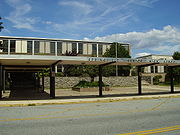
The public school system comprises two elementary schools: Scenic Hills and Sabold; one middle school: E. T. Richardson Middle School; and one high school: Springfield High School. In the fall of 2010, the Springfield School District will open a new school to be known as the Springfield Literacy Center. The Literacy Center will house all Kindergartens and First graders. These grades will move out of the two existing elementary schools. Additionally, 5th grade will move from E.T. Richardson back to the two elemantary schools. Springfield High School currently has 1,200 students enrolled.
There is one private, Catholic high school: Cardinal O'Hara High School
.
There are three private, Catholic grade schools: Holy Cross, St. Francis of Assisi, and St. Dorothy (located in Drexel Hill, PA).
, Springfield was first recognized as a governmental entity in 1686. The names of many of the streets in Springfield are named after former prominent citizens, including Powell, Kennerly, Lownes, Thomas, Levis, Foulke, Evans, Pancoast, Worrell, and Edge. After its founding, Springfield was primarily a farming town.
On December 9, 1687 the settlers began laying the road to Amosland as it was then called. This road is now known as Springfield Road. In 1701 construction began on the Baltimore Pike; the road was formed of sturdy oak planks, some of which still exist under the current Baltimore Pike. 1701 also marked the year that construction began on the first Quaker meeting house. The meeting house burned down in 1737 and was rebuilt. The current meeting house that stands in its spot today was constructed in 1851.
By the date of the signing of the Declaration of Independence in 1776 it is estimated from tax records that about 300 people resided in Springfield.
By the 19th century Springfield had become more industrialized. Taking advantage of its many creeks, the inhabitants erected many mills. However, the town was still primarily a farming town.
At the beginning of the 20th century Springfield's Baltimore Pike had become one of the busiest commercial areas outside of Philadelphia. The strip of Baltimore Pike in Springfield became known as "The Golden Mile". The Golden Mile is a unique corridor that is essentially a compact commercial strip that cuts directly through an established residential area on both sides. Lifelong residents of the community are currently pushing to improve the cluttered and dangerous Golden Mile, through the implementation of green initiatives, responsible traffic planning, and zoning improvements.
In the past century, all of Springfield's farmland was slowly bought up by developers who turned Springfield into the town it is today, that is, largely comprising developments of standard suburban single-family homes. One of the largest single developments was the Stoney Creek development. Construction began in 1949 and was completed in only 5 years. The huge development stretched from West Avenue to Providence Road and ran all the way up to Baltimore Pike. Over 75 homes were constructed in the development. Unlike most housing developments of their time, no two houses in Stoney Creek were built exactly the same. While all resemble each other with their stone fronts and common size, slight variations such as porches and window placement differed on each house, making each one slightly different.
Though all of the farmland of Springfield's past is gone, many of the woods and fields of the past still remain standing today in some of the many parks located throughout the community.
Currently, the bulk of Springfield's history lies recorded in the archives of the Heritage Society of Springfield, and the Springfield Township Public Library (a member of the Delaware County Library System).
Springfield is known locally for having the shortest term mayor in history. John George was elected Mayor and impeached 27 minutes later.
Current resident: Dr. Shannon J. Lamoureux, author of best-selling biography of Hildegard von Bingen, entitled "Nuns Can Have Talent Too: History of Bingen's Musical Career"
, a 590000 square feet (54,812.8 m²), two-level shopping mall. One of the first several suburban locations of Strawbridge & Clothier was located in Springfield. The old Strawbridge & Clothier has been reconstructed into a Target.
Civil township
A civil township is a widely used unit of local government in the United States, subordinate to, and geographic divisions of, a county. Specific responsibilities and the degree of autonomy vary based on each state. Civil townships are distinct from survey townships, but in states that have both,...
and a Census Designated Place
Census-designated place
A census-designated place is a concentration of population identified by the United States Census Bureau for statistical purposes. CDPs are delineated for each decennial census as the statistical counterparts of incorporated places such as cities, towns and villages...
in Delaware County
Delaware County, Pennsylvania
Delaware County is a county located in the U.S. state of Pennsylvania. As of 2010, the population was 558,979, making it Pennsylvania's fifth most populous county, behind Philadelphia, Allegheny, Montgomery, and Bucks counties....
in the U.S. state
U.S. state
A U.S. state is any one of the 50 federated states of the United States of America that share sovereignty with the federal government. Because of this shared sovereignty, an American is a citizen both of the federal entity and of his or her state of domicile. Four states use the official title of...
of Pennsylvania
Pennsylvania
The Commonwealth of Pennsylvania is a U.S. state that is located in the Northeastern and Mid-Atlantic regions of the United States. The state borders Delaware and Maryland to the south, West Virginia to the southwest, Ohio to the west, New York and Ontario, Canada, to the north, and New Jersey to...
. The population was 23,677 at the 2000 census. Springfield is a suburb of Philadelphia, located about 10 miles (16.1 km) west of the city.
Geography
Springfield is located at 39°55′37"N 75°20′7"W (39.926961, -75.335231).According to the United States Census Bureau
United States Census Bureau
The United States Census Bureau is the government agency that is responsible for the United States Census. It also gathers other national demographic and economic data...
, the township has a total area of 6.4 square miles (16.5 km²), of which, 6.4 square miles (16.5 km²) of it is land and 0.16% is water.
Adjacent Municipalities
- Haverford Township, Delaware CountyHaverford Township, PennsylvaniaHaverford Township is a home rule township in Delaware County, near Philadelphia, in southeastern Pennsylvania, United States. It maintains its legal name as the Township of Haverford, presumably for historic reasons...
- north - Upper Darby Township, Delaware CountyUpper Darby Township, PennsylvaniaUpper Darby Township is a home rule township bordering West Philadelphia in Pennsylvania. Although it retains the term "Township" in its legal name, presumably for historic reasons, it is the largest municipality of any type in Delaware County. Upper Darby is also home to the Tower Theater, a...
- east - Ridley Township, Delaware CountyRidley Township, PennsylvaniaRidley Township is a township in Delaware County, Pennsylvania, United States. The population was 30,791 at the 2000 census.Students residing within the district generally attend schools within the Ridley School District, although there are several Catholic schools located in the township as...
- south - Morton Borough, Delaware CountyMorton, PennsylvaniaMorton is a borough in Delaware County, Pennsylvania, United States. The population was 2,715 at the 2000 census.-Geography:Morton is located at ....
- south - Swarthmore Borough, Delaware CountySwarthmore, PennsylvaniaSwarthmore is a borough in Delaware County, Pennsylvania, United States. Swarthmore was originally named Westdale in honor of noted painter Benjamin West, who was one of the early residents of the town. The name was changed to Swarthmore after the establishment of Swarthmore College...
- southwest. (A small exclave of Springfield Township is located south of Swarthmore Boro (see map to right)). - Nether Providence Township, Delaware CountyNether Providence Township, PennsylvaniaNether Providence Township is a first class township in Delaware County, Pennsylvania, United States. Many residents refer to the township by the name of its largest community, Wallingford, because the Wallingford postal code is used for most of the township....
- southwest - Marple Township, Delaware CountyMarple Township, PennsylvaniaMarple Township is a township in Delaware County, Pennsylvania, United States. The population was 23,737 at the 2000 census. ZIP codes include mainly 19008, but also partially 19064 and 19063.-Geography:...
- northwest
Demographics
The United States Census Bureau has also defined the township as a census-designated place with an area exactly equivalent to the township. As of the censusCensus
A census is the procedure of systematically acquiring and recording information about the members of a given population. It is a regularly occurring and official count of a particular population. The term is used mostly in connection with national population and housing censuses; other common...
of 2000, there were 23,677 people, 8,618 households, and 6,790 families residing in the township. The population density
Population density
Population density is a measurement of population per unit area or unit volume. It is frequently applied to living organisms, and particularly to humans...
was 3,723.0 people per square mile (1,437.4/km²). There were 8,800 housing units at an average density of 1,383.7/sq mi (534.2/km²). The racial makeup of the township was 94.6% White, 0.5% African American, 0.05% Native American, 4.2% Asian, 0.01% Pacific Islander, 0.12% from other races
Race (United States Census)
Race and ethnicity in the United States Census, as defined by the Federal Office of Management and Budget and the United States Census Bureau, are self-identification data items in which residents choose the race or races with which they most closely identify, and indicate whether or not they are...
, and 0.54% from two or more races. Hispanic or Latino of any race were 1.65% of the population.
There were 8,618 households out of which 32.7% had children under the age of 18 living with them, 67.3% were married couples
Marriage
Marriage is a social union or legal contract between people that creates kinship. It is an institution in which interpersonal relationships, usually intimate and sexual, are acknowledged in a variety of ways, depending on the culture or subculture in which it is found...
living together, 8.6% had a female householder with no husband present, and 21.2% were non-families. 19.3% of all households were made up of individuals and 11.9% had someone living alone who was 65 years of age or older. The average household size was 2.73 and the average family size was 3.14.
In the township the population was spread out with 24.0% under the age of 18, 6.2% from 18 to 24, 25.0% from 25 to 44, 24.5% from 45 to 64, and 20.3% who were 65 years of age or older. The median age was 42 years. For every 100 females there were 91.8 males. For every 100 females age 18 and over, there were 88.4 males.
The median income for a household in the township was $86,202, and the median income for a family was $99,375 estimate. Males had a median income of $52,376 versus $35,957 for females. The per capita income
Per capita income
Per capita income or income per person is a measure of mean income within an economic aggregate, such as a country or city. It is calculated by taking a measure of all sources of income in the aggregate and dividing it by the total population...
for the township was $35,231. About 1.7% of families and 3.4% of the population were below the poverty line, including 5.3% of those under age 18 and 6.7% of those age 65 or over.
Education
The public school system comprises two elementary schools: Scenic Hills and Sabold; one middle school: E. T. Richardson Middle School; and one high school: Springfield High School. In the fall of 2010, the Springfield School District will open a new school to be known as the Springfield Literacy Center. The Literacy Center will house all Kindergartens and First graders. These grades will move out of the two existing elementary schools. Additionally, 5th grade will move from E.T. Richardson back to the two elemantary schools. Springfield High School currently has 1,200 students enrolled.
There is one private, Catholic high school: Cardinal O'Hara High School
Cardinal O'Hara High School
Cardinal O'Hara High School is a coeducational Catholic High School of the Archdiocese of Philadelphia. The school is named after John Francis O'Hara who was Archbishop of Philadelphia from 1951 to 1960. It is located in Springfield, Pennsylvania and was first opened in September 1963.- Academics...
.
There are three private, Catholic grade schools: Holy Cross, St. Francis of Assisi, and St. Dorothy (located in Drexel Hill, PA).
History
First settled before the year 1700 by Quakers who arrived in Pennsylvania with William PennWilliam Penn
William Penn was an English real estate entrepreneur, philosopher, and founder of the Province of Pennsylvania, the English North American colony and the future Commonwealth of Pennsylvania. He was an early champion of democracy and religious freedom, notable for his good relations and successful...
, Springfield was first recognized as a governmental entity in 1686. The names of many of the streets in Springfield are named after former prominent citizens, including Powell, Kennerly, Lownes, Thomas, Levis, Foulke, Evans, Pancoast, Worrell, and Edge. After its founding, Springfield was primarily a farming town.
On December 9, 1687 the settlers began laying the road to Amosland as it was then called. This road is now known as Springfield Road. In 1701 construction began on the Baltimore Pike; the road was formed of sturdy oak planks, some of which still exist under the current Baltimore Pike. 1701 also marked the year that construction began on the first Quaker meeting house. The meeting house burned down in 1737 and was rebuilt. The current meeting house that stands in its spot today was constructed in 1851.
By the date of the signing of the Declaration of Independence in 1776 it is estimated from tax records that about 300 people resided in Springfield.
By the 19th century Springfield had become more industrialized. Taking advantage of its many creeks, the inhabitants erected many mills. However, the town was still primarily a farming town.
At the beginning of the 20th century Springfield's Baltimore Pike had become one of the busiest commercial areas outside of Philadelphia. The strip of Baltimore Pike in Springfield became known as "The Golden Mile". The Golden Mile is a unique corridor that is essentially a compact commercial strip that cuts directly through an established residential area on both sides. Lifelong residents of the community are currently pushing to improve the cluttered and dangerous Golden Mile, through the implementation of green initiatives, responsible traffic planning, and zoning improvements.
In the past century, all of Springfield's farmland was slowly bought up by developers who turned Springfield into the town it is today, that is, largely comprising developments of standard suburban single-family homes. One of the largest single developments was the Stoney Creek development. Construction began in 1949 and was completed in only 5 years. The huge development stretched from West Avenue to Providence Road and ran all the way up to Baltimore Pike. Over 75 homes were constructed in the development. Unlike most housing developments of their time, no two houses in Stoney Creek were built exactly the same. While all resemble each other with their stone fronts and common size, slight variations such as porches and window placement differed on each house, making each one slightly different.
Though all of the farmland of Springfield's past is gone, many of the woods and fields of the past still remain standing today in some of the many parks located throughout the community.
Currently, the bulk of Springfield's history lies recorded in the archives of the Heritage Society of Springfield, and the Springfield Township Public Library (a member of the Delaware County Library System).
Springfield is known locally for having the shortest term mayor in history. John George was elected Mayor and impeached 27 minutes later.
Current resident: Dr. Shannon J. Lamoureux, author of best-selling biography of Hildegard von Bingen, entitled "Nuns Can Have Talent Too: History of Bingen's Musical Career"
Economy
The township is home to Springfield MallSpringfield Mall (Pennsylvania)
Springfield Mall is a regional shopping mall located approximately southwest of Philadelphia in Springfield Township, Delaware County, Pennsylvania. It is located just off of Interstate 476 along Baltimore Pike, near its busy intersection with Pennsylvania Route 320...
, a 590000 square feet (54,812.8 m²), two-level shopping mall. One of the first several suburban locations of Strawbridge & Clothier was located in Springfield. The old Strawbridge & Clothier has been reconstructed into a Target.