

U.S. Route 1
Encyclopedia
U.S. Route 1 is a major north–south U.S. Highway that serves the East Coast of the United States
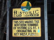
. It runs 2,377 miles (3,825 km) from Fort Kent, Maine
at the Canadian border south to Key West, Florida
. U.S. 1 generally parallels Interstate 95
, though it is significantly farther west (inland) between Jacksonville, Florida
and Petersburg, Virginia
. The highway connects most of the major cities of the east coast, including Miami, Florida
; Fort Lauderdale, Florida
; West Palm Beach, Florida
; Jacksonville, Florida
; Augusta, Georgia
; Columbia, South Carolina
; Raleigh, North Carolina
; Richmond, Virginia
; Washington, D.C.
; Baltimore, Maryland
; Philadelphia, Pennsylvania; Trenton, New Jersey
; New Brunswick, New Jersey
; Newark, New Jersey
; New York, New York
; New Haven, Connecticut
; New London, Connecticut
; Providence, Rhode Island
; Boston, Massachusetts; Portsmouth, New Hampshire
and Portland, Maine
.
U.S. 1 is the eastmost of the main north–south U.S. Highways, all of which end in one, but there are areas where it is not the eastmost route of the system, with large portions of US 9, US 13, US 17, and US 301 occupying corridors closer to the ocean. When the road system was laid out in the 1920s, U.S. 1 was mostly assigned to the existing Atlantic Highway, which followed the Fall Line
between the Piedmont
and the Atlantic Coastal Plain
north of Augusta. At the time, the highways farther east were of lower quality and did not serve the major population centers.
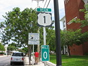
U.S. 1 travels along the east coast of Florida
, beginning at 490 Whitehead St. in Key West http://maps.google.com/maps?f=q&hl=en&geocode=&q=490+Whitehead+St,+Key+West,+FL+33040&sll=24.564454,-81.803019&sspn=0.009114,0.013819&layer=c&ie=UTF8&ll=24.559927,-81.803319&spn=0.009114,0.013819&z=16&cbll=24.555358,-81.804056&panoid=FI83lxPQwLIYR-9LZ7Y8rQ&cbp=1,20.256207176035787,,0,5 and passing through Miami, Fort Lauderdale, West Palm Beach, Fort Pierce, Melbourne, Titusville, Daytona Beach, Palm Coast, St. Augustine, and Jacksonville. The southernmost piece through the Florida Keys
, about 100 miles (150 km) long, is the two-lane Overseas Highway
, originally built in the 1930s after the Florida East Coast Railway
's Overseas Railroad
was ruined by the Labor Day Hurricane of 1935
. The rest of U.S. 1 in Florida is generally a four-lane divided highway
, despite the existence of the newer I-95
not far away. State Road A1A
is a continuous beachfront alternate to U.S. 1, cut only by assorted unbridged inlets and the Kennedy Space Center
. North of Jacksonville, U.S. 1 turns northwest in order to reach the Fall Line
at Augusta, Georgia
; US 17 becomes the coastal route into Virginia
, where US 13 takes over. In Florida until the 1990s, U.S. 1 used high-contrast markers (white text on a red background).
, as it shifts from the coastal alignment in Florida to the Fall Line alignment in South Carolina, is generally very rural, passing through marshes and former plantation
s between the towns and cities of Folkston
, Waycross
, Baxley
, Lyons
, Swainsboro
, and Augusta
. The Georgia Department of Transportation has long-range plans to widen all of US 1 to four lanes with bypasses. Currently, the highway is primarily a two-lane road with progress made in southern Georgia, around Lyons and from Augusta to Wrens. Into South Carolina
, U.S. 1 is paralleled by Interstate 20
along the Fall Line through Aiken
, Lexington
, and Columbia to Camden and Lugoff
. US 1 functions as a local two-lane road with occasional boulevard stretches. After Camden, U.S. 1 continues northeast away from any Interstate towards Bethune, Patrick, McBee and Cheraw
with no bypasses and four lane sections except around Cheraw through the US 52 and SC 9 multiplexes. After SC 9, it continues northward into North Carolina as a two-lane highway. SCDOT has no plans to widen or bypass any US 1 alignments northeast of Camden to the N.C. line. Between the S.C. line and the US 74 bypass is a two lane road but sees a considerable amount of truck and tourist traffic of people cutting through from the I-73/74 corridor attempting to reach points south and east. Through Rockingham, it goes through downtown with a bypass in the future plans. North of the NC 177 juncture, it becomes 4 lanes or greater. After Richmond County
, it goes into Moore County
with two Expressway bypasses in Southern Pines
, Vass
and Cameron
. U.S. 1 continues through Sanford, and on to Cary and Raleigh. US 1 runs concurrently with US 64
through most of Cary and the freeway recently underwent a major renovation and improvements that added lanes in both directions. North of Raleigh, U.S. 1 (known as Capital Boulevard in northern Wake County) crosses Interstate 540
and then again becomes a four-lane divided arterial to Interstate 85
near Henderson. The North Carolina Department of Transportation has begun a corridor study for section of US 1. Moreover, NCDOT is planning to finish four laning US 1 in Richmond County past NC 177 with a Rockingham bypass to the east. There are no plans from SCDOT to widen US 1 from the state line. From Henderson into Virginia, U.S. 1 runs parallel with I-85 as a two-lane local road until the state line where Virginia hosts a continuous third center lane for alternate passing towards US Highway 58 before South Hill.
Through Virginia
, U.S. 1 is paralleled by Interstates: the remainder of Interstate 85 to Petersburg, Interstate 95 through Richmond and Fredericksburg to Alexandria
, and Interstate 395 into Arlington
. Within Virginia, U.S. 1 is called Jefferson Davis Highway
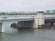
by state law, although local communities have renamed it without consequence. It is best known as "Jeff Davis Highway". U.S. 1 crosses the Potomac River
with I-395 on the 14th Street Bridges, and splits to follow mainly 14th Street
and Rhode Island Avenue through the District of Columbia. US 1 is at the minimum a 3 lane (with alternate passing) from the N.C. line to Petersburg with occasional four lane divided sections. North of Petersburg is a four lane undivided roadway at the minimum to the D.C. line. After exiting the District into Maryland
, U.S. 1 follows the Baltimore-Washington Boulevard, the first of several modern highways built along the Baltimore-Washington corridor; I-95 is the newest, after the Baltimore-Washington Parkway
. The route bypasses downtown Baltimore on North Avenue and exits the city to the northeast on Belair Road, gradually leaving the I-95 corridor, which passes through Wilmington, Delaware
, for a straighter path towards Philadelphia. Around and beyond Bel Air
, U.S. 1 is a two-lane road, crossing the Susquehanna River
over the top of the Conowingo Dam
before entering Pennsylvania. (U.S. 1 bypasses Delaware
, unlike I-95.)
The two-lane US 1 becomes a four-lane freeway, officially known as the John H. Ware III Memorial Highway, just after crossing into Pennsylvania
. This bypass extends around Oxford and Kennett Square, merging into the four-lane divided Baltimore Pike
just beyond the latter. At Media, US 1 again becomes a freeway - the Media Bypass - ending just beyond Interstate 476
. After several name changes, the road becomes City Avenue, the western city limit of Philadelphia, at the end of which a short overlap with the Schuylkill Expressway
(I-76) leads to the Roosevelt Expressway and then the twelve-lane Roosevelt Boulevard
. US 1 again becomes a freeway after leaving the city, bypassing Penndel and Morrisville
and crossing the Delaware River
into New Jersey on the Trenton-Morrisville Toll Bridge
.
After crossing into New Jersey
in Mercer County, US 1 continues on the Trenton Freeway through the city of Trenton and Lawrence as a four lane freeway. As the freeway ends, the four lane divided highway
upgrades to six lanes after I-95/I-295 passing through the Penns Neck section of West Windsor Township. Through Penns Neck is a series of traffic signals. NJDOT is looking to revamp the highway through this area by removing traffic signals with grade separations. The highway enters Middlesex County through Plainsboro and South Brunswick. By Forrestal Village, the highway downgrades from 6 to 4 lanes until after Finnegans Lane in North Brunswick. Northward, it continues through New Brunswick as a short jersey-freeway until the CR 529/Plainfield Avenue traffic signal in Edison. Through Edison and Woodbridge has a mix of boulevard and jersey freeway segments and continues to do so after the US 9 juncture in the Avenel section of Woodbridge. US 1/9 concurrency
continues through the rest of the state. The six lane divided highway remains through Rahway in Union County and Elizabeth, until it reaches the Newark Airport
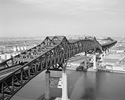
, where it becomes a dual carriageway freeway around downtown Newark in Essex County with a 2-2-2-2 configuration. The historic Pulaski Skyway
takes US 1/9 into Jersey City, and the route exits the freeway at Tonnele Circle
to head north into Bergen County. US 1/9 turns onto US 46 as a jersey-freeway, the three routes run northeast to the George Washington Bridge Plaza
, where they merge into I-95. US 46 ends in the middle of the bridge, which crosses the Hudson River
into New York
, and US 9 exits just beyond onto Broadway in Manhattan
, but US 1 stays with I-95 onto the Cross-Bronx Expressway
, exiting in the Bronx
onto Webster Avenue. Two turns take US 1 via Fordham Road
to Boston Road, which it follows northeast out of the city to the state line, never straying far from I-95.. As it enters Greenwich, Connecticut, it continues as a two lane local road.
in Connecticut
, parallel to I-95. Beyond New Haven, the highway travels east–west, and some signs in the state indicate this rather than the standard north–south. While I-95 in Rhode Island
takes a diagonal path to Providence, U.S. 1 continues east along the coast through Westerly to Wakefield, where it turns north and follows Narragansett Bay
. Most of this part is a four-lane divided highway
, providing access to Route 138
towards Newport. After Route 4
splits as a mostly-freeway connection to I-95, U.S. 1 becomes a lower-speed surface road, passing through Warwick, Providence, and Pawtucket. The route parallels I-95 again through Providence and Pawtucket and into Massachusetts
, traveling towards Boston
as a four-lane road. When it reaches Dedham, U.S. 1 turns east, overlapping Route 128
and I-93 east to Braintree and north through Downtown Boston. The Tobin Bridge
and Northeast Expressway
take US 1 out of Boston, after which it again parallels I-95 through Newburyport to the New Hampshire state line.
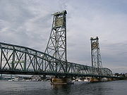
The short portion of US 1 in New Hampshire
follows the historic Lafayette Road, staying close to I-95
, before leaving the city of Portsmouth on the Memorial Bridge
over the Piscataqua River
. Within Maine
, US 1 begins as a parallel route to I-95 near the Atlantic Ocean
. At Portland
, I-95 splits off to the north, and I-295 heads northeast paralleling US 1 to Brunswick. There US 1 turns east as a mostly two-lane road along the coast to Calais
; much of this portion is advertised as the "Coastal Route" on signs. North from Calais, US 1 follows the Canadian border, crossing I-95 in Houlton and eventually turning west and southwest to its "north" end at the Clair-Fort Kent Bridge in Fort Kent. The short Route 161
extends north on the New Brunswick
(Canada) side of the bridge to Route 120
, a secondary east–west route from Edmundston, New Brunswick
west to Saint-Alexandre, Quebec
.
 The direct predecessor to US 1 was the Atlantic Highway, an auto trail
established in 1911 as the Quebec-Miami International Highway. In 1915 it was renamed the Atlantic Highway, and the northern terminus was changed to Calais, Maine
. Due to the overlapping of auto trail designations, portions of the route had other names that remain in common use, such as the Boston Post Road
between Boston and New York, the Lincoln Highway
between New York and Philadelphia, Baltimore Pike between Philadelphia and Baltimore
, and the Dixie Highway
in and south of eastern Georgia
. North of Augusta, Georgia
, the highway generally followed the Fall Line
, rather than a more easterly route through the swamp
s of the Atlantic Coastal Plain
. Brickell Avenue
is the name given to the stretch of U.S. Route 1 in Miami, Florida
just south of the Miami River
.
When the New England road marking system was established in 1922, the Atlantic Highway within New England
was signed as Route 1, with a Route 24 continuing north to Madawaska
; New York
extended the number to New York City
in 1924 with its own Route 1. Other states adopted their own systems of numbering, and by 1926 all states but Maryland
had signed the Atlantic Highway as various routes, usually changing numbers at the state line. In 1925, the Joint Board on Interstate Highways created a preliminary list of interstate routes to be marked by the states, including Route 1 along the Atlantic. This highway began at Fort Kent, Maine
and followed the existing Route 24 to Houlton and Route 15 to Bangor, beyond which it generally followed the Atlantic Highway to Miami. In all states but Georgia
that had numbered their state highway
s, Route 1 followed only one or two numbers across the state. The only significant deviation from the Atlantic Highway was between Augusta, Georgia
and Jacksonville, Florida
, where Route 1 was assigned to a more inland route, rather than following the Atlantic Highway via Savannah
.
One of the many changes made to the system before the final numbering was adopted in 1926 involved US 1 in Maine. The 1925 plan had assigned Route 1 to the shorter inland route (Route 15) between Houlton and Bangor, while Route 2
followed the longer coastal route via Calais. In the system as adopted in 1926, US 2 instead took the inland route, while US 1 followed the coast, absorbing all of the former Routes 24 and 1 in New England. Many local and regional relocations, often onto parallel superhighways, were made in the early days of US 1; this included the four-lane divided Route 25
in New Jersey
, completed in 1932 with the opening of the Pulaski Skyway
, and a bypass of Bangor involving the Waldo-Hancock Bridge
, opened in 1931. The Overseas Highway
from Miami to Key West was completed in 1938, and soon became a southern extension of US 1.
With the construction of the Interstate Highway System
in and after the 1950s, much of US 1 from Houlton to Miami was bypassed by Interstate 95
. Between Houlton and Brunswick, Maine
, I-95 took a shorter inland route, much of it paralleling US 2 on the alignment proposed for US 1 in 1925. Between Philadelphia and Baltimore
, I-95 leaves US 1 to pass through Wilmington. Most notably, I-95 and US 1 follow different corridors between Petersburg, Virginia
and Jacksonville, Florida
; while US 1 followed the Fall Line west of the coastal plain, I-95 takes a more direct route through the plain and its swamps. Although some of this part of US 1 was followed by other Interstates - I-85 between Petersburg and Henderson, North Carolina
, and I-20 between Camden, South Carolina
and Augusta, Georgia
- the rest remains an independent route that has been four-laned in many places. By the late 1970s, most of I-95 had been completed, replacing US 1 as the main corridor of the east coast and relegating most of it to local road status.
, which runs along the Pacific coast from California
to Washington state, is not a part of the US 1 "family".
East Coast of the United States
The East Coast of the United States, also known as the Eastern Seaboard, refers to the easternmost coastal states in the United States, which touch the Atlantic Ocean and stretch up to Canada. The term includes the U.S...
. It runs 2,377 miles (3,825 km) from Fort Kent, Maine
Fort Kent, Maine
Fort Kent is a town in Aroostook County, Maine, United States. The population was 4,097 in the 2010 census. Fort Kent is home to an Olympic biathlete training center, an annual CAN-AM dogsled race, and the Fort Kent Blockhouse, built in reaction to the Aroostook War and in modern times designated...
at the Canadian border south to Key West, Florida
Key West, Florida
Key West is a city in Monroe County, Florida, United States. The city encompasses the island of Key West, the part of Stock Island north of U.S. 1 , Sigsbee Park , Fleming Key , and Sunset Key...
. U.S. 1 generally parallels Interstate 95
Interstate 95
Interstate 95 is the main highway on the East Coast of the United States, running parallel to the Atlantic Ocean from Maine to Florida and serving some of the most populated urban areas in the country, including Boston, Providence, New Haven, New York City, Newark, Philadelphia, Baltimore,...
, though it is significantly farther west (inland) between Jacksonville, Florida
Jacksonville, Florida
Jacksonville is the largest city in the U.S. state of Florida in terms of both population and land area, and the largest city by area in the contiguous United States. It is the county seat of Duval County, with which the city government consolidated in 1968...
and Petersburg, Virginia
Petersburg, Virginia
Petersburg is an independent city in Virginia, United States located on the Appomattox River and south of the state capital city of Richmond. The city's population was 32,420 as of 2010, predominantly of African-American ethnicity...
. The highway connects most of the major cities of the east coast, including Miami, Florida
Miami, Florida
Miami is a city located on the Atlantic coast in southeastern Florida and the county seat of Miami-Dade County, the most populous county in Florida and the eighth-most populous county in the United States with a population of 2,500,625...
; Fort Lauderdale, Florida
Fort Lauderdale, Florida
Fort Lauderdale is a city in the U.S. state of Florida, on the Atlantic coast. It is the county seat of Broward County. As of the 2010 census, the city had a population of 165,521. It is a principal city of the South Florida metropolitan area, which was home to 5,564,635 people at the 2010...
; West Palm Beach, Florida
West Palm Beach, Florida
West Palm Beach, is a city located on the Atlantic coast in southeastern Florida and is the most populous city in and county seat of Palm Beach County, the third most populous county in Florida with a 2010 population of 1,320,134. The city is also the oldest incorporated municipality in South Florida...
; Jacksonville, Florida
Jacksonville, Florida
Jacksonville is the largest city in the U.S. state of Florida in terms of both population and land area, and the largest city by area in the contiguous United States. It is the county seat of Duval County, with which the city government consolidated in 1968...
; Augusta, Georgia
Augusta, Georgia
Augusta is a consolidated city in the U.S. state of Georgia, located along the Savannah River. As of the 2010 census, the Augusta–Richmond County population was 195,844 not counting the unconsolidated cities of Hephzibah and Blythe.Augusta is the principal city of the Augusta-Richmond County...
; Columbia, South Carolina
Columbia, South Carolina
Columbia is the state capital and largest city in the U.S. state of South Carolina. The population was 129,272 according to the 2010 census. Columbia is the county seat of Richland County, but a portion of the city extends into neighboring Lexington County. The city is the center of a metropolitan...
; Raleigh, North Carolina
Raleigh, North Carolina
Raleigh is the capital and the second largest city in the state of North Carolina as well as the seat of Wake County. Raleigh is known as the "City of Oaks" for its many oak trees. According to the U.S. Census Bureau, the city's 2010 population was 403,892, over an area of , making Raleigh...
; Richmond, Virginia
Richmond, Virginia
Richmond is the capital of the Commonwealth of Virginia, in the United States. It is an independent city and not part of any county. Richmond is the center of the Richmond Metropolitan Statistical Area and the Greater Richmond area...
; Washington, D.C.
Washington, D.C.
Washington, D.C., formally the District of Columbia and commonly referred to as Washington, "the District", or simply D.C., is the capital of the United States. On July 16, 1790, the United States Congress approved the creation of a permanent national capital as permitted by the U.S. Constitution....
; Baltimore, Maryland
Baltimore
Baltimore is the largest independent city in the United States and the largest city and cultural center of the US state of Maryland. The city is located in central Maryland along the tidal portion of the Patapsco River, an arm of the Chesapeake Bay. Baltimore is sometimes referred to as Baltimore...
; Philadelphia, Pennsylvania; Trenton, New Jersey
Trenton, New Jersey
Trenton is the capital of the U.S. state of New Jersey and the county seat of Mercer County. As of the 2010 United States Census, Trenton had a population of 84,913...
; New Brunswick, New Jersey
New Brunswick, New Jersey
New Brunswick is a city in Middlesex County, New Jersey, USA. It is the county seat and the home of Rutgers University. The city is located on the Northeast Corridor rail line, southwest of Manhattan, on the southern bank of the Raritan River. At the 2010 United States Census, the population of...
; Newark, New Jersey
Newark, New Jersey
Newark is the largest city in the American state of New Jersey, and the seat of Essex County. As of the 2010 United States Census, Newark had a population of 277,140, maintaining its status as the largest municipality in New Jersey. It is the 68th largest city in the U.S...
; New York, New York
New York City
New York is the most populous city in the United States and the center of the New York Metropolitan Area, one of the most populous metropolitan areas in the world. New York exerts a significant impact upon global commerce, finance, media, art, fashion, research, technology, education, and...
; New Haven, Connecticut
New Haven, Connecticut
New Haven is the second-largest city in Connecticut and the sixth-largest in New England. According to the 2010 Census, New Haven's population increased by 5.0% between 2000 and 2010, a rate higher than that of the State of Connecticut, and higher than that of the state's five largest cities, and...
; New London, Connecticut
New London, Connecticut
New London is a seaport city and a port of entry on the northeast coast of the United States.It is located at the mouth of the Thames River in New London County, southeastern Connecticut....
; Providence, Rhode Island
Providence, Rhode Island
Providence is the capital and most populous city of Rhode Island and was one of the first cities established in the United States. Located in Providence County, it is the third largest city in the New England region...
; Boston, Massachusetts; Portsmouth, New Hampshire
Portsmouth, New Hampshire
Portsmouth is a city in Rockingham County, New Hampshire in the United States. It is the largest city but only the fourth-largest community in the county, with a population of 21,233 at the 2010 census...
and Portland, Maine
Portland, Maine
Portland is the largest city in Maine and is the county seat of Cumberland County. The 2010 city population was 66,194, growing 3 percent since the census of 2000...
.
U.S. 1 is the eastmost of the main north–south U.S. Highways, all of which end in one, but there are areas where it is not the eastmost route of the system, with large portions of US 9, US 13, US 17, and US 301 occupying corridors closer to the ocean. When the road system was laid out in the 1920s, U.S. 1 was mostly assigned to the existing Atlantic Highway, which followed the Fall Line
Fall line
A fall line is a geomorphologic unconformity between an upland region of relatively hard crystalline basement rock and a coastal plain of softer sedimentary rock. A fall line is typically prominent when crossed by a river, for there will often be rapids or waterfalls...
between the Piedmont
Piedmont (United States)
The Piedmont is a plateau region located in the eastern United States between the Atlantic Coastal Plain and the main Appalachian Mountains, stretching from New Jersey in the north to central Alabama in the south. The Piedmont province is a physiographic province of the larger Appalachian division...
and the Atlantic Coastal Plain
Atlantic Coastal Plain
The Atlantic coastal plain has both low elevation and low relief, but it is also a relatively flat landform extending from the New York Bight southward to a Georgia/Florida section of the Eastern Continental Divide, which demarcates the plain from the ACF River Basin in the Gulf Coastal Plain to...
north of Augusta. At the time, the highways farther east were of lower quality and did not serve the major population centers.
Florida
U.S. 1 travels along the east coast of Florida
Florida
Florida is a state in the southeastern United States, located on the nation's Atlantic and Gulf coasts. It is bordered to the west by the Gulf of Mexico, to the north by Alabama and Georgia and to the east by the Atlantic Ocean. With a population of 18,801,310 as measured by the 2010 census, it...
, beginning at 490 Whitehead St. in Key West http://maps.google.com/maps?f=q&hl=en&geocode=&q=490+Whitehead+St,+Key+West,+FL+33040&sll=24.564454,-81.803019&sspn=0.009114,0.013819&layer=c&ie=UTF8&ll=24.559927,-81.803319&spn=0.009114,0.013819&z=16&cbll=24.555358,-81.804056&panoid=FI83lxPQwLIYR-9LZ7Y8rQ&cbp=1,20.256207176035787,,0,5 and passing through Miami, Fort Lauderdale, West Palm Beach, Fort Pierce, Melbourne, Titusville, Daytona Beach, Palm Coast, St. Augustine, and Jacksonville. The southernmost piece through the Florida Keys
Florida Keys
The Florida Keys are a coral archipelago in southeast United States. They begin at the southeastern tip of the Florida peninsula, about south of Miami, and extend in a gentle arc south-southwest and then westward to Key West, the westernmost of the inhabited islands, and on to the uninhabited Dry...
, about 100 miles (150 km) long, is the two-lane Overseas Highway
Overseas Highway
The Overseas Highway is a highway carrying U.S. Route 1 through the Florida Keys. Large parts of it were built on the former right-of-way of the Overseas Railroad, the Key West Extension of the Florida East Coast Railway. Completed in 1912, the Overseas Railroad was heavily damaged and partially...
, originally built in the 1930s after the Florida East Coast Railway
Florida East Coast Railway
The Florida East Coast Railway is a Class II railroad operating in the U.S. state of Florida; in the past, it has been a Class I railroad.Built primarily in the last quarter of the 19th century and the first decade of the 20th century, the FEC was a project of Standard Oil principal Henry Morrison...
's Overseas Railroad
Overseas Railroad
The Overseas Railroad was an extension of the Florida East Coast Railway to Key West, a city of almost 30,000 inhabitants located 128 miles beyond the end of the Florida peninsula...
was ruined by the Labor Day Hurricane of 1935
Labor Day Hurricane of 1935
The 1935 Labor Day Hurricane was the strongest tropical cyclone of the 1935 Atlantic hurricane season, and one of the most intense hurricanes to make landfall in the United States in recorded history...
. The rest of U.S. 1 in Florida is generally a four-lane divided highway
Divided Highway
Divided Highway is a compilation album by American rock band The Doobie Brothers, released in 2003. . All tracks are taken from the albums Cycles and Brotherhood .-Track listing:...
, despite the existence of the newer I-95
Interstate 95 in Florida
Interstate 95 is the main Interstate Highway on the east coast of the United States; it serves the Atlantic coast of Florida. It begins at a partial interchange with U.S. Highway 1 just south of downtown Miami, and heads north past Daytona Beach and Jacksonville to the Georgia state line at the St...
not far away. State Road A1A
State Road A1A (Florida)
State Road A1A is a Florida State Road that runs mostly along the Atlantic Ocean, with sections from Key West at the southern tip of Florida, to Callahan, just south of Georgia. It is the main road through most oceanfront towns. SR A1A is designated the A1A Scenic and Historic Coastal Highway, a...
is a continuous beachfront alternate to U.S. 1, cut only by assorted unbridged inlets and the Kennedy Space Center
Kennedy Space Center
The John F. Kennedy Space Center is the NASA installation that has been the launch site for every United States human space flight since 1968. Although such flights are currently on hiatus, KSC continues to manage and operate unmanned rocket launch facilities for America's civilian space program...
. North of Jacksonville, U.S. 1 turns northwest in order to reach the Fall Line
Fall line
A fall line is a geomorphologic unconformity between an upland region of relatively hard crystalline basement rock and a coastal plain of softer sedimentary rock. A fall line is typically prominent when crossed by a river, for there will often be rapids or waterfalls...
at Augusta, Georgia
Augusta, Georgia
Augusta is a consolidated city in the U.S. state of Georgia, located along the Savannah River. As of the 2010 census, the Augusta–Richmond County population was 195,844 not counting the unconsolidated cities of Hephzibah and Blythe.Augusta is the principal city of the Augusta-Richmond County...
; US 17 becomes the coastal route into Virginia
Virginia
The Commonwealth of Virginia , is a U.S. state on the Atlantic Coast of the Southern United States. Virginia is nicknamed the "Old Dominion" and sometimes the "Mother of Presidents" after the eight U.S. presidents born there...
, where US 13 takes over. In Florida until the 1990s, U.S. 1 used high-contrast markers (white text on a red background).
Georgia, South Carolina, and North Carolina
The part of U.S. 1 in GeorgiaGeorgia (U.S. state)
Georgia is a state located in the southeastern United States. It was established in 1732, the last of the original Thirteen Colonies. The state is named after King George II of Great Britain. Georgia was the fourth state to ratify the United States Constitution, on January 2, 1788...
, as it shifts from the coastal alignment in Florida to the Fall Line alignment in South Carolina, is generally very rural, passing through marshes and former plantation
Plantations in the American South
Plantations were an important aspect of the history of the American South, particularly the antebellum .-Planter :The owner of a plantation was called a planter...
s between the towns and cities of Folkston
Folkston, Georgia
Folkston is a city in and the county seat of Charlton County, Georgia, United States. The population was 2,178 at the 2000 census.-History:...
, Waycross
Waycross, Georgia
Waycross is the county seat of, and only incorporated city in, Ware County in the U.S. state of Georgia. The population was 14,725 at the 2010 Census. A small portion of the city extends into Pierce County. According the U.S...
, Baxley
Baxley, Georgia
As of the census of 2000, there were 4,150 people, 1,567 households, and 1,048 families residing in the city. The population density was 580.7 people per square mile . There were 1,866 housing units at an average density of 261.1 per square mile...
, Lyons
Lyons, Georgia
Lyons is a city in Toombs County, Georgia, United States. The population was 4,169 at the 2000 census. The city is the county seat of Toombs County.Lyons is part of the Vidalia Micropolitan Statistical Area.-Geography:...
, Swainsboro
Swainsboro, Georgia
Swainsboro is a city located in Emanuel County, Georgia. As of the 2000 census, the city had a total population of 6,943. The city is the county seat of Emanuel County.-Geography:...
, and Augusta
Augusta, Georgia
Augusta is a consolidated city in the U.S. state of Georgia, located along the Savannah River. As of the 2010 census, the Augusta–Richmond County population was 195,844 not counting the unconsolidated cities of Hephzibah and Blythe.Augusta is the principal city of the Augusta-Richmond County...
. The Georgia Department of Transportation has long-range plans to widen all of US 1 to four lanes with bypasses. Currently, the highway is primarily a two-lane road with progress made in southern Georgia, around Lyons and from Augusta to Wrens. Into South Carolina
South Carolina
South Carolina is a state in the Deep South of the United States that borders Georgia to the south, North Carolina to the north, and the Atlantic Ocean to the east. Originally part of the Province of Carolina, the Province of South Carolina was one of the 13 colonies that declared independence...
, U.S. 1 is paralleled by Interstate 20
Interstate 20 in South Carolina
Interstate 20 is a major thoroughfare cutting across the state of South Carolina, linking the state with important transportation and business hubs to the north, west and south, including Atlanta, Georgia, Charlotte, North Carolina , Savannah, Georgia and Washington, D.C...
along the Fall Line through Aiken
Aiken, South Carolina
Aiken is a city in and the county seat of Aiken County, South Carolina, United States. With Augusta, Georgia, it is one of the two largest cities of the Central Savannah River Area. It is part of the Augusta-Richmond County Metropolitan Statistical Area. Aiken is home to the University of South...
, Lexington
Lexington, South Carolina
Lexington is a town in and the county seat of Lexington County, South Carolina, United States. The population was 17,870 at the 2010 census.-Geography:Lexington is located at ....
, and Columbia to Camden and Lugoff
Columbia
Columbia may refer to:-Places:* Columbia , a poetic name for the Americas, and the feminine personification of the United States of America* District of Columbia, the federal district in which the capital of the United States is located...
. US 1 functions as a local two-lane road with occasional boulevard stretches. After Camden, U.S. 1 continues northeast away from any Interstate towards Bethune, Patrick, McBee and Cheraw
Cheraw, South Carolina
Cheraw is a town on the Pee Dee River in Chesterfield County, South Carolina, United States. The population was 5,524 at the 2000 census and center of an urban cluster with a total population of 9,069. It has been nicknamed "The Prettiest Town in Dixie." The harbor tub USS Cheraw was named in the...
with no bypasses and four lane sections except around Cheraw through the US 52 and SC 9 multiplexes. After SC 9, it continues northward into North Carolina as a two-lane highway. SCDOT has no plans to widen or bypass any US 1 alignments northeast of Camden to the N.C. line. Between the S.C. line and the US 74 bypass is a two lane road but sees a considerable amount of truck and tourist traffic of people cutting through from the I-73/74 corridor attempting to reach points south and east. Through Rockingham, it goes through downtown with a bypass in the future plans. North of the NC 177 juncture, it becomes 4 lanes or greater. After Richmond County
Richmond County, North Carolina
-Demographics:As of the census of 2000, there were 46,564 people, 17,873 households, and 12,582 families residing in the county. The population density was 98 people per square mile . There were 19,886 housing units at an average density of 42 per square mile...
, it goes into Moore County
Moore County, North Carolina
Moore County is a county located in the U.S. state of North Carolina. As of 2000, the population was 74,769. Its county seat is Carthage.- History :The county was formed in 1784 from Cumberland County...
with two Expressway bypasses in Southern Pines
Southern Pines, North Carolina
Southern Pines is a town in Moore County, North Carolina, United States. The population was 10,918 at the 2000 census.-Geography:Southern Pines is located at ....
, Vass
Vass, North Carolina
Vass is a town in Moore County, North Carolina in the United States. The population was 750 at the 2000 census. Vass grew up along the railroad in the late 19th century. It was originally named Bynum and later Winder before being established as Vass in 1892...
and Cameron
Cameron, North Carolina
Cameron is a town in Moore County, North Carolina in the United States. The population was 151 at the 2000 census.-History:Cameron grew up around a plank road that was followed in later years by a railroad. The town was planned in 1875 and incorporated in 1876. Cameron was at the end of the Raleigh...
. U.S. 1 continues through Sanford, and on to Cary and Raleigh. US 1 runs concurrently with US 64
U.S. Route 64
U.S. Route 64 is an east–west United States highway that runs for 2,326 miles from eastern North Carolina to just southwest of the Four Corners in northeast Arizona. The western terminus is at U.S. Route 160 in Teec Nos Pos, Arizona. The highway's eastern terminus is at NC 12 and U.S. Route...
through most of Cary and the freeway recently underwent a major renovation and improvements that added lanes in both directions. North of Raleigh, U.S. 1 (known as Capital Boulevard in northern Wake County) crosses Interstate 540
Interstate 540
Interstate 540 may mean:*Interstate 540 , a spur to Fort Smith, Arkansas and Bentonville, Arkansas*Interstate 540 , an incomplete loop route in Raleigh, North Carolina...
and then again becomes a four-lane divided arterial to Interstate 85
Interstate 85 in North Carolina
In the U.S. state of North Carolina, Interstate 85 scales the state for from the South Carolina border to the Virginia border. As the second-longest interstate in the state , it provides an important link between the cities of Atlanta, Georgia, Charlotte, Greensboro, Richmond, Virginia and...
near Henderson. The North Carolina Department of Transportation has begun a corridor study for section of US 1. Moreover, NCDOT is planning to finish four laning US 1 in Richmond County past NC 177 with a Rockingham bypass to the east. There are no plans from SCDOT to widen US 1 from the state line. From Henderson into Virginia, U.S. 1 runs parallel with I-85 as a two-lane local road until the state line where Virginia hosts a continuous third center lane for alternate passing towards US Highway 58 before South Hill.
Virginia, Washington D.C., and Maryland
Through Virginia
Virginia
The Commonwealth of Virginia , is a U.S. state on the Atlantic Coast of the Southern United States. Virginia is nicknamed the "Old Dominion" and sometimes the "Mother of Presidents" after the eight U.S. presidents born there...
, U.S. 1 is paralleled by Interstates: the remainder of Interstate 85 to Petersburg, Interstate 95 through Richmond and Fredericksburg to Alexandria
Alexandria, Virginia
Alexandria is an independent city in the Commonwealth of Virginia. As of 2009, the city had a total population of 139,966. Located along the Western bank of the Potomac River, Alexandria is approximately six miles south of downtown Washington, D.C.Like the rest of northern Virginia, as well as...
, and Interstate 395 into Arlington
Arlington County, Virginia
Arlington County is a county in the Commonwealth of Virginia. The land that became Arlington was originally donated by Virginia to the United States government to form part of the new federal capital district. On February 27, 1801, the United States Congress organized the area as a subdivision of...
. Within Virginia, U.S. 1 is called Jefferson Davis Highway
Jefferson Davis Highway
The Jefferson Davis Memorial Highway was a planned transcontinental highway in the United States in the 1910s and 1920s that began in Washington, D.C. and extended south and west to San Diego, California; it was named for Jefferson Davis, who, in addition to being the first and only President of...
by state law, although local communities have renamed it without consequence. It is best known as "Jeff Davis Highway". U.S. 1 crosses the Potomac River
Potomac River
The Potomac River flows into the Chesapeake Bay, located along the mid-Atlantic coast of the United States. The river is approximately long, with a drainage area of about 14,700 square miles...
with I-395 on the 14th Street Bridges, and splits to follow mainly 14th Street
14th Street
14th Street may refer to several locations in the United States:*14th Street , New York City*14th Street Northwest and Southwest *Broad Street *14th Street Bridge *14th Street...
and Rhode Island Avenue through the District of Columbia. US 1 is at the minimum a 3 lane (with alternate passing) from the N.C. line to Petersburg with occasional four lane divided sections. North of Petersburg is a four lane undivided roadway at the minimum to the D.C. line. After exiting the District into Maryland
Maryland
Maryland is a U.S. state located in the Mid Atlantic region of the United States, bordering Virginia, West Virginia, and the District of Columbia to its south and west; Pennsylvania to its north; and Delaware to its east...
, U.S. 1 follows the Baltimore-Washington Boulevard, the first of several modern highways built along the Baltimore-Washington corridor; I-95 is the newest, after the Baltimore-Washington Parkway
Baltimore-Washington Parkway
The Baltimore–Washington Parkway is a highway in the U.S. state of Maryland, running southwest from Baltimore to Washington, D.C. The road begins at an interchange with U.S. Route 50 and Maryland Route 201 near Cheverly in Prince George's County at the D.C...
. The route bypasses downtown Baltimore on North Avenue and exits the city to the northeast on Belair Road, gradually leaving the I-95 corridor, which passes through Wilmington, Delaware
Wilmington, Delaware
Wilmington is the largest city in the state of Delaware, United States, and is located at the confluence of the Christina River and Brandywine Creek, near where the Christina flows into the Delaware River. It is the county seat of New Castle County and one of the major cities in the Delaware Valley...
, for a straighter path towards Philadelphia. Around and beyond Bel Air
Bel Air, Harford County, Maryland
The town of Bel Air is the county seat of Harford County, Maryland, United States. According to the 2000 census the population of the town was 10,080. In 2009 the town's estimated population was 10,368...
, U.S. 1 is a two-lane road, crossing the Susquehanna River
Susquehanna River
The Susquehanna River is a river located in the northeastern United States. At long, it is the longest river on the American east coast that drains into the Atlantic Ocean, and with its watershed it is the 16th largest river in the United States, and the longest river in the continental United...
over the top of the Conowingo Dam
Conowingo Dam
The Conowingo Dam is a large hydroelectric dam in the Lower Susquehanna River. The dam, one of the largest non-federal hydroelectric dams in the US, is classified as a medium height, masonry gravity type dam...
before entering Pennsylvania. (U.S. 1 bypasses Delaware
Delaware
Delaware is a U.S. state located on the Atlantic Coast in the Mid-Atlantic region of the United States. It is bordered to the south and west by Maryland, and to the north by Pennsylvania...
, unlike I-95.)
Pennsylvania
The two-lane US 1 becomes a four-lane freeway, officially known as the John H. Ware III Memorial Highway, just after crossing into Pennsylvania
Pennsylvania
The Commonwealth of Pennsylvania is a U.S. state that is located in the Northeastern and Mid-Atlantic regions of the United States. The state borders Delaware and Maryland to the south, West Virginia to the southwest, Ohio to the west, New York and Ontario, Canada, to the north, and New Jersey to...
. This bypass extends around Oxford and Kennett Square, merging into the four-lane divided Baltimore Pike
Baltimore Pike
thumb|[[SEPTA]]'s [[SEPTA Route 34|Route 34]] streetcar line runs through the 4500 block of Baltimore Avenue in [[West Philadelphia]]The Baltimore Pike was an auto trail in the United States, connecting Baltimore, Maryland with Philadelphia, Pennsylvania....
just beyond the latter. At Media, US 1 again becomes a freeway - the Media Bypass - ending just beyond Interstate 476
Interstate 476
Interstate 476 is a auxiliary Interstate Highway in the U.S. state of Pennsylvania designated between Interstate 95 near Chester and Interstate 81 near Scranton, serving as the primary north–south Interstate corridor through eastern Pennsylvania....
. After several name changes, the road becomes City Avenue, the western city limit of Philadelphia, at the end of which a short overlap with the Schuylkill Expressway
Schuylkill Expressway
The Schuylkill Expressway , locally known as the Schuylkill, is a freeway through southwestern Montgomery County and the city of Philadelphia, and the easternmost segment of Interstate 76 in the U.S. state of Pennsylvania...
(I-76) leads to the Roosevelt Expressway and then the twelve-lane Roosevelt Boulevard
Roosevelt Boulevard (Philadelphia)
Roosevelt Boulevard , often referred to simply as "the Boulevard," is a major traffic artery through North and Northeast Philadelphia...
. US 1 again becomes a freeway after leaving the city, bypassing Penndel and Morrisville
Morrisville, Bucks County, Pennsylvania
Morrisville is a borough in Bucks County, Pennsylvania, United States. The population was 8,728 at the 2010 census.-Geography:Morrisville is located at . It is situated on the Delaware River directly across from Trenton, New Jersey...
and crossing the Delaware River
Delaware River
The Delaware River is a major river on the Atlantic coast of the United States.A Dutch expedition led by Henry Hudson in 1609 first mapped the river. The river was christened the South River in the New Netherland colony that followed, in contrast to the North River, as the Hudson River was then...
into New Jersey on the Trenton-Morrisville Toll Bridge
Trenton-Morrisville Toll Bridge
The Trenton–Morrisville Toll Bridge is one of three road bridges connecting Trenton, New Jersey with Morrisville, Pennsylvania. Opened in 1952, it carries U.S. Route 1 and is owned and operated by the Delaware River Joint Toll Bridge Commission. This bridge's toll plaza was originally configured to...
.
New Jersey and New York
After crossing into New Jersey
New Jersey
New Jersey is a state in the Northeastern and Middle Atlantic regions of the United States. , its population was 8,791,894. It is bordered on the north and east by the state of New York, on the southeast and south by the Atlantic Ocean, on the west by Pennsylvania and on the southwest by Delaware...
in Mercer County, US 1 continues on the Trenton Freeway through the city of Trenton and Lawrence as a four lane freeway. As the freeway ends, the four lane divided highway
Divided Highway
Divided Highway is a compilation album by American rock band The Doobie Brothers, released in 2003. . All tracks are taken from the albums Cycles and Brotherhood .-Track listing:...
upgrades to six lanes after I-95/I-295 passing through the Penns Neck section of West Windsor Township. Through Penns Neck is a series of traffic signals. NJDOT is looking to revamp the highway through this area by removing traffic signals with grade separations. The highway enters Middlesex County through Plainsboro and South Brunswick. By Forrestal Village, the highway downgrades from 6 to 4 lanes until after Finnegans Lane in North Brunswick. Northward, it continues through New Brunswick as a short jersey-freeway until the CR 529/Plainfield Avenue traffic signal in Edison. Through Edison and Woodbridge has a mix of boulevard and jersey freeway segments and continues to do so after the US 9 juncture in the Avenel section of Woodbridge. US 1/9 concurrency
Concurrency (road)
A concurrency, overlap, or coincidence in a road network is an instance of one physical road bearing two or more different highway, motorway, or other route numbers...
continues through the rest of the state. The six lane divided highway remains through Rahway in Union County and Elizabeth, until it reaches the Newark Airport
Newark Liberty International Airport
Newark Liberty International Airport , first named Newark Metropolitan Airport and later Newark International Airport, is an international airport within the city limits of both Newark and Elizabeth, New Jersey, United States...
, where it becomes a dual carriageway freeway around downtown Newark in Essex County with a 2-2-2-2 configuration. The historic Pulaski Skyway
Pulaski Skyway
The General Pulaski Skyway is a four-lane freeway composed of connected bridges in the northeastern part of the U.S. state of New Jersey, carrying the designation of U.S. Route 1/9 for most of its length. The landmark structure has a total length of with the longest bridge spanning...
takes US 1/9 into Jersey City, and the route exits the freeway at Tonnele Circle
Tonnele Circle
The Tonnele Circle is an intersection in Jersey City, New Jersey, United States. It is named after Tonnele Avenue, the north-south road that runs through it. Entrances and exits are, listed clockwise from north:*Tonnele Avenue north...
to head north into Bergen County. US 1/9 turns onto US 46 as a jersey-freeway, the three routes run northeast to the George Washington Bridge Plaza
George Washington Bridge Plaza
GWB Plaza, or Bridge Plaza, is the section of Fort Lee, New Jersey at the western terminus of the George Washington Bridge. Located north of and parallel to Main Street, it dissects the northern part of the borough...
, where they merge into I-95. US 46 ends in the middle of the bridge, which crosses the Hudson River
Hudson River
The Hudson is a river that flows from north to south through eastern New York. The highest official source is at Lake Tear of the Clouds, on the slopes of Mount Marcy in the Adirondack Mountains. The river itself officially begins in Henderson Lake in Newcomb, New York...
into New York
New York
New York is a state in the Northeastern region of the United States. It is the nation's third most populous state. New York is bordered by New Jersey and Pennsylvania to the south, and by Connecticut, Massachusetts and Vermont to the east...
, and US 9 exits just beyond onto Broadway in Manhattan
Manhattan
Manhattan is the oldest and the most densely populated of the five boroughs of New York City. Located primarily on the island of Manhattan at the mouth of the Hudson River, the boundaries of the borough are identical to those of New York County, an original county of the state of New York...
, but US 1 stays with I-95 onto the Cross-Bronx Expressway
Cross-Bronx Expressway
The Cross Bronx Expressway is a major expressway in the New York City borough of the Bronx, conceived by Robert Moses and built between 1948 and 1972. It carries traffic on Interstate 95 through the city, and serves as a portion of Interstate 295 toward Long Island; a portion is also designated U.S...
, exiting in the Bronx
The Bronx
The Bronx is the northernmost of the five boroughs of New York City. It is also known as Bronx County, the last of the 62 counties of New York State to be incorporated...
onto Webster Avenue. Two turns take US 1 via Fordham Road
Fordham Road
Fordham Road is a major street in The Bronx borough of New York City. It runs east-west from the Harlem River to Bronx Park.This street runs through the neighborhood of University Heights, divides Fordham from Fordham-Bedford and finally runs along the northern border of Belmont...
to Boston Road, which it follows northeast out of the city to the state line, never straying far from I-95.. As it enters Greenwich, Connecticut, it continues as a two lane local road.
Connecticut, Rhode Island, and Massachusetts
U.S. 1 serves the shore of the Long Island SoundLong Island Sound
Long Island Sound is an estuary of the Atlantic Ocean, located in the United States between Connecticut to the north and Long Island, New York to the south. The mouth of the Connecticut River at Old Saybrook, Connecticut, empties into the sound. On its western end the sound is bounded by the Bronx...
in Connecticut
Connecticut
Connecticut is a state in the New England region of the northeastern United States. It is bordered by Rhode Island to the east, Massachusetts to the north, and the state of New York to the west and the south .Connecticut is named for the Connecticut River, the major U.S. river that approximately...
, parallel to I-95. Beyond New Haven, the highway travels east–west, and some signs in the state indicate this rather than the standard north–south. While I-95 in Rhode Island
Rhode Island
The state of Rhode Island and Providence Plantations, more commonly referred to as Rhode Island , is a state in the New England region of the United States. It is the smallest U.S. state by area...
takes a diagonal path to Providence, U.S. 1 continues east along the coast through Westerly to Wakefield, where it turns north and follows Narragansett Bay
Narragansett Bay
Narragansett Bay is a bay and estuary on the north side of Rhode Island Sound. Covering 147 mi2 , the Bay forms New England's largest estuary, which functions as an expansive natural harbor, and includes a small archipelago...
. Most of this part is a four-lane divided highway
Divided Highway
Divided Highway is a compilation album by American rock band The Doobie Brothers, released in 2003. . All tracks are taken from the albums Cycles and Brotherhood .-Track listing:...
, providing access to Route 138
Route 138 (Rhode Island)
Route 138 is a numbered State Highway running in Rhode Island. It runs from the Connecticut state line to the Massachusetts state line and is the only state-numbered route that traverses the entire state.-Route description:...
towards Newport. After Route 4
Route 4 (Rhode Island)
Route 4, also known as the Colonel Rodman Highway, is a long numbered state highway located in Washington County and southern Kent County, Rhode Island, United States...
splits as a mostly-freeway connection to I-95, U.S. 1 becomes a lower-speed surface road, passing through Warwick, Providence, and Pawtucket. The route parallels I-95 again through Providence and Pawtucket and into Massachusetts
Massachusetts
The Commonwealth of Massachusetts is a state in the New England region of the northeastern United States of America. It is bordered by Rhode Island and Connecticut to the south, New York to the west, and Vermont and New Hampshire to the north; at its east lies the Atlantic Ocean. As of the 2010...
, traveling towards Boston
Boston
Boston is the capital of and largest city in Massachusetts, and is one of the oldest cities in the United States. The largest city in New England, Boston is regarded as the unofficial "Capital of New England" for its economic and cultural impact on the entire New England region. The city proper had...
as a four-lane road. When it reaches Dedham, U.S. 1 turns east, overlapping Route 128
Route 128 (Massachusetts)
Route 128, also known as the Yankee Division Highway , and originally the Circumferential Highway, is a partial beltway around Boston, Massachusetts, United States. The majority of the highway is built to freeway standards, and about 3/5 of it is part of the Interstate Highway System...
and I-93 east to Braintree and north through Downtown Boston. The Tobin Bridge
Tobin Bridge
The Maurice J. Tobin Memorial Bridge is a cantilever truss bridge that spans more than two miles from Charlestown to Chelsea over the Mystic River in Massachusetts. The bridge is the largest in New England...
and Northeast Expressway
Northeast Expressway (Boston)
The Northeast Expressway consists of the elevated expressway from the junction of Interstate 93 and U.S. Route 1 in Charlestown, through Charlestown, crossing the Mystic River, through Chelsea, Revere. The highway becomes a surface expressway in northern Chelsea. It terminates at the Revere-Saugus...
take US 1 out of Boston, after which it again parallels I-95 through Newburyport to the New Hampshire state line.
New Hampshire and Maine
The short portion of US 1 in New Hampshire
New Hampshire
New Hampshire is a state in the New England region of the northeastern United States of America. The state was named after the southern English county of Hampshire. It is bordered by Massachusetts to the south, Vermont to the west, Maine and the Atlantic Ocean to the east, and the Canadian...
follows the historic Lafayette Road, staying close to I-95
Interstate 95 in New Hampshire
Interstate 95, the main Interstate Highway on the east coast of the United States, cuts through the Seacoast Region of New Hampshire. The majority of it, from the Massachusetts border to the Portsmouth Circle in Portsmouth, is the 14.29-mile Blue Star Turnpike or New Hampshire Turnpike, a toll...
, before leaving the city of Portsmouth on the Memorial Bridge
Memorial Bridge (Portsmouth, New Hampshire)
The Memorial Bridge is a through truss lift bridge that carried U.S. 1 across the Piscataqua River between Portsmouth, New Hampshire and Badger's Island in Kittery, Maine USA. The bridge was closed permanently to vehicle traffic on July 27, 2011, with a replacement to be built by 2014.The lift span...
over the Piscataqua River
Piscataqua River
The Piscataqua River, in the northeastern United States, is a long tidal estuary formed by the confluence of the Salmon Falls and Cocheco rivers...
. Within Maine
Maine
Maine is a state in the New England region of the northeastern United States, bordered by the Atlantic Ocean to the east and south, New Hampshire to the west, and the Canadian provinces of Quebec to the northwest and New Brunswick to the northeast. Maine is both the northernmost and easternmost...
, US 1 begins as a parallel route to I-95 near the Atlantic Ocean
Atlantic Ocean
The Atlantic Ocean is the second-largest of the world's oceanic divisions. With a total area of about , it covers approximately 20% of the Earth's surface and about 26% of its water surface area...
. At Portland
Portland, Maine
Portland is the largest city in Maine and is the county seat of Cumberland County. The 2010 city population was 66,194, growing 3 percent since the census of 2000...
, I-95 splits off to the north, and I-295 heads northeast paralleling US 1 to Brunswick. There US 1 turns east as a mostly two-lane road along the coast to Calais
Calais, Maine
Calais is a city in Washington County, Maine, United States. The city has three United States border crossings or also known as a Port of entry with the busiest being on the St. Croix River bordering St. Stephen, New Brunswick, Canada...
; much of this portion is advertised as the "Coastal Route" on signs. North from Calais, US 1 follows the Canadian border, crossing I-95 in Houlton and eventually turning west and southwest to its "north" end at the Clair-Fort Kent Bridge in Fort Kent. The short Route 161
New Brunswick Route 161
Route 161 is a New Brunswick highway that runs for 5.0 kilometers from a junction with Route 120 at Caron Brook, to the International Bridge at Clair; in Madawaska County. The route connects to U.S. Route 1 across the Saint John River in Fort Kent, Maine....
extends north on the New Brunswick
New Brunswick
New Brunswick is one of Canada's three Maritime provinces and is the only province in the federation that is constitutionally bilingual . The provincial capital is Fredericton and Saint John is the most populous city. Greater Moncton is the largest Census Metropolitan Area...
(Canada) side of the bridge to Route 120
New Brunswick Route 120
Route 120 is a New Brunswick highway in Madawaska County that runs from a junction with Quebec Route 289 at Saint-Jean-de-la-Lande, Quebec, to New Brunswick Route 2 in Edmundston.-Communities:* Lac-Baker* Portage-du-Lac* Caron Brook* Baker Brook...
, a secondary east–west route from Edmundston, New Brunswick
New Brunswick
New Brunswick is one of Canada's three Maritime provinces and is the only province in the federation that is constitutionally bilingual . The provincial capital is Fredericton and Saint John is the most populous city. Greater Moncton is the largest Census Metropolitan Area...
west to Saint-Alexandre, Quebec
Saint-Alexandre, Quebec
Saint-Alexandre is a municipality in the province of Quebec, Canada, located in the Regional County Municipality of Le Haut-Richelieu. The population as of the Canada 2006 Census was 2,340...
.
History
Auto trail
The system of auto trails was an informal network of marked routes that existed in the United States and Canada in the early part of the 20th century. Marked with colored bands on telephone poles, the trails were intended to help travellers in the early days of the automobile.Auto trails were...
established in 1911 as the Quebec-Miami International Highway. In 1915 it was renamed the Atlantic Highway, and the northern terminus was changed to Calais, Maine
Calais, Maine
Calais is a city in Washington County, Maine, United States. The city has three United States border crossings or also known as a Port of entry with the busiest being on the St. Croix River bordering St. Stephen, New Brunswick, Canada...
. Due to the overlapping of auto trail designations, portions of the route had other names that remain in common use, such as the Boston Post Road
Boston Post Road
The Boston Post Road was a system of mail-delivery routes between New York City and Boston, Massachusetts that evolved into the first major highways in the United States.The three major alignments were the Lower Post Road The Boston Post Road was a system of mail-delivery routes between New York...
between Boston and New York, the Lincoln Highway
Lincoln Highway
The Lincoln Highway was the first road across the United States of America.Conceived and promoted by entrepreneur Carl G. Fisher, the Lincoln Highway spanned coast-to-coast from Times Square in New York City to Lincoln Park in San Francisco, originally through 13 states: New York, New Jersey,...
between New York and Philadelphia, Baltimore Pike between Philadelphia and Baltimore
Baltimore
Baltimore is the largest independent city in the United States and the largest city and cultural center of the US state of Maryland. The city is located in central Maryland along the tidal portion of the Patapsco River, an arm of the Chesapeake Bay. Baltimore is sometimes referred to as Baltimore...
, and the Dixie Highway
Dixie Highway
The Dixie Highway was a United States automobile highway, first planned in 1914 to connect the US Midwest with the Southern United States. It was part of the National Auto Trail system, and grew out of an earlier Miami to Montreal highway. The final result is better understood as a small network of...
in and south of eastern Georgia
Georgia (U.S. state)
Georgia is a state located in the southeastern United States. It was established in 1732, the last of the original Thirteen Colonies. The state is named after King George II of Great Britain. Georgia was the fourth state to ratify the United States Constitution, on January 2, 1788...
. North of Augusta, Georgia
Augusta, Georgia
Augusta is a consolidated city in the U.S. state of Georgia, located along the Savannah River. As of the 2010 census, the Augusta–Richmond County population was 195,844 not counting the unconsolidated cities of Hephzibah and Blythe.Augusta is the principal city of the Augusta-Richmond County...
, the highway generally followed the Fall Line
Fall line
A fall line is a geomorphologic unconformity between an upland region of relatively hard crystalline basement rock and a coastal plain of softer sedimentary rock. A fall line is typically prominent when crossed by a river, for there will often be rapids or waterfalls...
, rather than a more easterly route through the swamp
Swamp
A swamp is a wetland with some flooding of large areas of land by shallow bodies of water. A swamp generally has a large number of hammocks, or dry-land protrusions, covered by aquatic vegetation, or vegetation that tolerates periodical inundation. The two main types of swamp are "true" or swamp...
s of the Atlantic Coastal Plain
Atlantic Coastal Plain
The Atlantic coastal plain has both low elevation and low relief, but it is also a relatively flat landform extending from the New York Bight southward to a Georgia/Florida section of the Eastern Continental Divide, which demarcates the plain from the ACF River Basin in the Gulf Coastal Plain to...
. Brickell Avenue
Brickell Avenue
Brickell Avenue is the name given to the stretch of U.S. Route 1 in Miami, Florida just south of the Miami River. North of the Brickell Avenue Bridge, US Route 1 is known as Biscayne Boulevard...
is the name given to the stretch of U.S. Route 1 in Miami, Florida
Miami, Florida
Miami is a city located on the Atlantic coast in southeastern Florida and the county seat of Miami-Dade County, the most populous county in Florida and the eighth-most populous county in the United States with a population of 2,500,625...
just south of the Miami River
Miami River (Florida)
The Miami River is a river in the United States state of Florida that drains out of the Everglades and runs through the Downtown and the city of Miami. The long river flows from the terminus of the Miami Canal at Miami International Airport to Biscayne Bay...
.
When the New England road marking system was established in 1922, the Atlantic Highway within New England
New England
New England is a region in the northeastern corner of the United States consisting of the six states of Maine, New Hampshire, Vermont, Massachusetts, Rhode Island, and Connecticut...
was signed as Route 1, with a Route 24 continuing north to Madawaska
Madawaska, Maine
Madawaska is a town in Aroostook County, Maine, United States. The population was 4,035 at the 2010 census. Madawaska is opposite Edmundston in Madawaska County in New Brunswick, Canada, to which it is connected by the Edmundston-Madawaska Bridge. Today many of its residents speak French; 83.4% of...
; New York
New York
New York is a state in the Northeastern region of the United States. It is the nation's third most populous state. New York is bordered by New Jersey and Pennsylvania to the south, and by Connecticut, Massachusetts and Vermont to the east...
extended the number to New York City
New York City
New York is the most populous city in the United States and the center of the New York Metropolitan Area, one of the most populous metropolitan areas in the world. New York exerts a significant impact upon global commerce, finance, media, art, fashion, research, technology, education, and...
in 1924 with its own Route 1. Other states adopted their own systems of numbering, and by 1926 all states but Maryland
Maryland
Maryland is a U.S. state located in the Mid Atlantic region of the United States, bordering Virginia, West Virginia, and the District of Columbia to its south and west; Pennsylvania to its north; and Delaware to its east...
had signed the Atlantic Highway as various routes, usually changing numbers at the state line. In 1925, the Joint Board on Interstate Highways created a preliminary list of interstate routes to be marked by the states, including Route 1 along the Atlantic. This highway began at Fort Kent, Maine
Fort Kent, Maine
Fort Kent is a town in Aroostook County, Maine, United States. The population was 4,097 in the 2010 census. Fort Kent is home to an Olympic biathlete training center, an annual CAN-AM dogsled race, and the Fort Kent Blockhouse, built in reaction to the Aroostook War and in modern times designated...
and followed the existing Route 24 to Houlton and Route 15 to Bangor, beyond which it generally followed the Atlantic Highway to Miami. In all states but Georgia
Georgia (U.S. state)
Georgia is a state located in the southeastern United States. It was established in 1732, the last of the original Thirteen Colonies. The state is named after King George II of Great Britain. Georgia was the fourth state to ratify the United States Constitution, on January 2, 1788...
that had numbered their state highway
State highway
State highway, state road or state route can refer to one of three related concepts, two of them related to a state or provincial government in a country that is divided into states or provinces :#A...
s, Route 1 followed only one or two numbers across the state. The only significant deviation from the Atlantic Highway was between Augusta, Georgia
Augusta, Georgia
Augusta is a consolidated city in the U.S. state of Georgia, located along the Savannah River. As of the 2010 census, the Augusta–Richmond County population was 195,844 not counting the unconsolidated cities of Hephzibah and Blythe.Augusta is the principal city of the Augusta-Richmond County...
and Jacksonville, Florida
Jacksonville, Florida
Jacksonville is the largest city in the U.S. state of Florida in terms of both population and land area, and the largest city by area in the contiguous United States. It is the county seat of Duval County, with which the city government consolidated in 1968...
, where Route 1 was assigned to a more inland route, rather than following the Atlantic Highway via Savannah
Savannah, Georgia
Savannah is the largest city and the county seat of Chatham County, in the U.S. state of Georgia. Established in 1733, the city of Savannah was the colonial capital of the Province of Georgia and later the first state capital of Georgia. Today Savannah is an industrial center and an important...
.
One of the many changes made to the system before the final numbering was adopted in 1926 involved US 1 in Maine. The 1925 plan had assigned Route 1 to the shorter inland route (Route 15) between Houlton and Bangor, while Route 2
U.S. Route 2
U.S. Route 2 is an east–west U.S. Highway spanning across the northern continental United States. US 2 consists of two segments connected by various roadways in southern Canada...
followed the longer coastal route via Calais. In the system as adopted in 1926, US 2 instead took the inland route, while US 1 followed the coast, absorbing all of the former Routes 24 and 1 in New England. Many local and regional relocations, often onto parallel superhighways, were made in the early days of US 1; this included the four-lane divided Route 25
Route 25 (New Jersey)
Route 25 was a major state highway in New Jersey, United States prior to the 1953 renumbering, running from the Benjamin Franklin Bridge in Camden to the Holland Tunnel in Jersey City. The number was retired in the renumbering, as the whole road was followed by various U.S. Routes - U.S...
in New Jersey
New Jersey
New Jersey is a state in the Northeastern and Middle Atlantic regions of the United States. , its population was 8,791,894. It is bordered on the north and east by the state of New York, on the southeast and south by the Atlantic Ocean, on the west by Pennsylvania and on the southwest by Delaware...
, completed in 1932 with the opening of the Pulaski Skyway
Pulaski Skyway
The General Pulaski Skyway is a four-lane freeway composed of connected bridges in the northeastern part of the U.S. state of New Jersey, carrying the designation of U.S. Route 1/9 for most of its length. The landmark structure has a total length of with the longest bridge spanning...
, and a bypass of Bangor involving the Waldo-Hancock Bridge
Waldo-Hancock Bridge
The Waldo–Hancock Bridge was the first long-span suspension bridge erected in Maine, as well as the first permanent bridge across the Penobscot River below Bangor. The name comes from connecting Waldo and Hancock counties...
, opened in 1931. The Overseas Highway
Overseas Highway
The Overseas Highway is a highway carrying U.S. Route 1 through the Florida Keys. Large parts of it were built on the former right-of-way of the Overseas Railroad, the Key West Extension of the Florida East Coast Railway. Completed in 1912, the Overseas Railroad was heavily damaged and partially...
from Miami to Key West was completed in 1938, and soon became a southern extension of US 1.
With the construction of the Interstate Highway System
Interstate Highway System
The Dwight D. Eisenhower National System of Interstate and Defense Highways, , is a network of limited-access roads including freeways, highways, and expressways forming part of the National Highway System of the United States of America...
in and after the 1950s, much of US 1 from Houlton to Miami was bypassed by Interstate 95
Interstate 95
Interstate 95 is the main highway on the East Coast of the United States, running parallel to the Atlantic Ocean from Maine to Florida and serving some of the most populated urban areas in the country, including Boston, Providence, New Haven, New York City, Newark, Philadelphia, Baltimore,...
. Between Houlton and Brunswick, Maine
Brunswick, Maine
Brunswick is a town in Cumberland County, Maine, United States. The population was 20,278 at the 2010 census. It is part of the Portland-South Portland-Biddeford metropolitan area. Brunswick is home to Bowdoin College, the Bowdoin College Museum of Art, the Peary-MacMillan Arctic Museum, , and the...
, I-95 took a shorter inland route, much of it paralleling US 2 on the alignment proposed for US 1 in 1925. Between Philadelphia and Baltimore
Baltimore
Baltimore is the largest independent city in the United States and the largest city and cultural center of the US state of Maryland. The city is located in central Maryland along the tidal portion of the Patapsco River, an arm of the Chesapeake Bay. Baltimore is sometimes referred to as Baltimore...
, I-95 leaves US 1 to pass through Wilmington. Most notably, I-95 and US 1 follow different corridors between Petersburg, Virginia
Petersburg, Virginia
Petersburg is an independent city in Virginia, United States located on the Appomattox River and south of the state capital city of Richmond. The city's population was 32,420 as of 2010, predominantly of African-American ethnicity...
and Jacksonville, Florida
Jacksonville, Florida
Jacksonville is the largest city in the U.S. state of Florida in terms of both population and land area, and the largest city by area in the contiguous United States. It is the county seat of Duval County, with which the city government consolidated in 1968...
; while US 1 followed the Fall Line west of the coastal plain, I-95 takes a more direct route through the plain and its swamps. Although some of this part of US 1 was followed by other Interstates - I-85 between Petersburg and Henderson, North Carolina
Henderson, North Carolina
Henderson, with a population of 16,095 at the 2000 census, is the county seat of Vance County, North Carolina, United States.The city was named in honor of former North Carolina Supreme Court Chief Justice Leonard Henderson, who lived nearby and was a friend of early settler Lewis Reavis...
, and I-20 between Camden, South Carolina
Camden, South Carolina
Camden is the fourth oldest city in the U.S. state of South Carolina and is also the county seat of Kershaw County, South Carolina, United States. The population was an estimated 7,103 in 2009...
and Augusta, Georgia
Augusta, Georgia
Augusta is a consolidated city in the U.S. state of Georgia, located along the Savannah River. As of the 2010 census, the Augusta–Richmond County population was 195,844 not counting the unconsolidated cities of Hephzibah and Blythe.Augusta is the principal city of the Augusta-Richmond County...
- the rest remains an independent route that has been four-laned in many places. By the late 1970s, most of I-95 had been completed, replacing US 1 as the main corridor of the east coast and relegating most of it to local road status.
Related U.S. Routes
Note: US 101U.S. Route 101
U.S. Route 101, or U.S. Highway 101, is an important north–south U.S. highway that runs through the states of California, Oregon, and Washington, on the West Coast of the United States...
, which runs along the Pacific coast from California
California
California is a state located on the West Coast of the United States. It is by far the most populous U.S. state, and the third-largest by land area...
to Washington state, is not a part of the US 1 "family".
Related state highways
- Florida State Road A1AFlorida State Road A1AState Road A1A is a Florida State Road that runs mostly along the Atlantic Ocean, with sections from Key West at the southern tip of Florida, to Callahan, just south of Georgia. It is the main road through most oceanfront towns. SR A1A is designated the A1A Scenic and Historic Coastal Highway, a...
- Massachusetts Route 1AMassachusetts Route 1ARoute 1A is a south–north state highway in Massachusetts. It is an alternate route to U.S. 1 with three signed sections and two unsigned sections where the highway is concurrent with its parent...
- New York State Route 1ANew York State Route 1ANew York State Route 1A was a state highway in New York City, running from the Holland Tunnel to U.S. Route 1 . It existed from 1934, when routes were first marked in New York City, until the 1960s.-History:...