

West Philadelphia
Encyclopedia
Pennsylvania
The Commonwealth of Pennsylvania is a U.S. state that is located in the Northeastern and Mid-Atlantic regions of the United States. The state borders Delaware and Maryland to the south, West Virginia to the southwest, Ohio to the west, New York and Ontario, Canada, to the north, and New Jersey to...
. Though there is no official definition of its boundaries, it is generally considered to reach from the western shore of the Schuylkill River
Schuylkill River
The Schuylkill River is a river in Pennsylvania. It is a designated Pennsylvania Scenic River.The river is about long. Its watershed of about lies entirely within the state of Pennsylvania. The source of its eastern branch is in the Appalachian Mountains at Tuscarora Springs, near Tamaqua in...
, to City Line Avenue to the northwest, Cobbs Creek
Cobbs Creek
Cobbs Creek is an tributary of Darby Creek in Delaware County, Pennsylvania in the United States. It forms an approximate border between Montgomery County and Delaware County. After Cobbs Creek passes underneath Township Line Road , it forms the border between Philadelphia County and Delaware County...
to the southwest, and the SEPTA Media/Elwyn Line
Media/Elwyn Line
The Media/Elwyn Line is a SEPTA Regional Rail line running from Center City Philadelphia west to Elwyn in Delaware County.Originally known as the Media/West Chester Branch, service was truncated on September 19, 1986 from West Chester to its current terminus at Elwyn. Service expansion beyond Elwyn...
to the south.
An alternate definition includes all city land west of the Schuylkill; this would also include Southwest Philadelphia
Southwest Philadelphia
Southwest Philadelphia is a section of Philadelphia, Pennsylvania, United States. The section can be described as extending from the western side of the Schuylkill River to the city line, with the SEPTA Media/Elwyn Line serving as the northern border...
and its neighborhoods.
Topography
The topography of West Philadelphia is composed of rolling hills rising slowly from the Schuylkill River
Schuylkill River
The Schuylkill River is a river in Pennsylvania. It is a designated Pennsylvania Scenic River.The river is about long. Its watershed of about lies entirely within the state of Pennsylvania. The source of its eastern branch is in the Appalachian Mountains at Tuscarora Springs, near Tamaqua in...
toward Cobbs Creek
Cobbs Creek
Cobbs Creek is an tributary of Darby Creek in Delaware County, Pennsylvania in the United States. It forms an approximate border between Montgomery County and Delaware County. After Cobbs Creek passes underneath Township Line Road , it forms the border between Philadelphia County and Delaware County...
in the west and toward Belmont Plateau in the northwest. This gradual elevation makes the skyline of Center City visible from many points in West Philadelphia. The Wynnefield neighborhood is a location frequently used by photographers and organizers of civic events.
Demographics
According to the 2010 census, 250,433 people live among the ZIP codes of 19104, 19131, 19139, 19143 and 19151. (Map)Racial demographics
Italics are other demographic estimates.- Black or African-American: 193,083 (77.1%) 70-75%.
May include Black Latinos (i.e. Dominican American
Dominican American
A Dominican American is any American who has origins in the Dominican Republic.Immigration records of Dominicans in the United States date from the late 19th century, and New York City has had a Dominican community since the 1930s...
s).
- Non-Hispanic White/European: 27,547 (11.0%) 10-12%.
- Asian: 8,765 (3.5%) 5-8% (i.e. Chinese AmericanChinese AmericanChinese Americans represent Americans of Chinese descent. Chinese Americans constitute one group of overseas Chinese and also a subgroup of East Asian Americans, which is further a subgroup of Asian Americans...
s). - Two or more races: 6,761 (2.7%) 2-3%, many are Barbadians.
- Hispanic or Latino: 6,511 (2.6%) 5-10% (i.e. Mexicans).
- American Indian or Alaska Native: 5,759 (2.3%) 3-5%.
- Other race: 1,753 (0.7%) 1-2% (i.e. Arab AmericanArab AmericanAn Arab American is a United States citizen or resident of Arab ethnic, cultural and linguistic heritage or identity, who identifies themselves as Arab. Arab Americans trace ancestry to any of the various waves of immigrants of the countries comprising the Arab World...
s). - Native Hawaiian or Other Pacific Islander: 250 (0.1%).
West Philadelphia was once home to large numbers of White ethnics or descendants of European immigrants starting with the first wave of Irish
Irish American
Irish Americans are citizens of the United States who can trace their ancestry to Ireland. A total of 36,278,332 Americans—estimated at 11.9% of the total population—reported Irish ancestry in the 2008 American Community Survey conducted by the U.S. Census Bureau...
immigrants in the early 19th century. Then it became a mostly African American
African American
African Americans are citizens or residents of the United States who have at least partial ancestry from any of the native populations of Sub-Saharan Africa and are the direct descendants of enslaved Africans within the boundaries of the present United States...
community beginning with the arrival of Blacks from the Southern States in the 1880s' to be completed by the pattern of white flight
White flight
White flight has been a term that originated in the United States, starting in the mid-20th century, and applied to the large-scale migration of whites of various European ancestries from racially mixed urban regions to more racially homogeneous suburban or exurban regions. It was first seen as...
in the early 1960s. And now becoming more racially integrated by the process of gentrification
Gentrification
Gentrification and urban gentrification refer to the changes that result when wealthier people acquire or rent property in low income and working class communities. Urban gentrification is associated with movement. Consequent to gentrification, the average income increases and average family size...
since the 1980s and has formed one of the country's largest Latino
Latino
The demonyms Latino and Latina , are defined in English language dictionaries as:* "a person of Latin-American descent."* "A Latin American."* "A person of Hispanic, especially Latin-American, descent, often one living in the United States."...
and Asian American
Asian American
Asian Americans are Americans of Asian descent. The U.S. Census Bureau definition of Asians as "Asian” refers to a person having origins in any of the original peoples of the Far East, Southeast Asia, or the Indian subcontinent, including, for example, Cambodia, China, India, Indonesia, Japan,...
populations by recent large-scale immigration from East Asia
East Asia
East Asia or Eastern Asia is a subregion of Asia that can be defined in either geographical or cultural terms...
and Latin America
Latin America
Latin America is a region of the Americas where Romance languages – particularly Spanish and Portuguese, and variably French – are primarily spoken. Latin America has an area of approximately 21,069,500 km² , almost 3.9% of the Earth's surface or 14.1% of its land surface area...
. The community has a fair number of Afro-Caribbean
Afro-Caribbean
The term Afro-Caribbean applies to Caribbean people of African descent. It may also refer to:*British African-Caribbean community*Afro-Caribbean music*Caribbean Australian*Caribbean Brazilian*West Indian American...
/Caribbean American residents, such as from the Barbados
Barbados
Barbados is an island country in the Lesser Antilles. It is in length and as much as in width, amounting to . It is situated in the western area of the North Atlantic and 100 kilometres east of the Windward Islands and the Caribbean Sea; therein, it is about east of the islands of Saint...
and West Indies.
Interestingly, Native Americans from the Urban Indian
Urban Indian
Urban Indians are Native Americans in the United States who live in urban areas. Urban Indians represent a growing proportion of the Native population in the United States...
relocation program sent tens of thousands of people from the Cherokee
Cherokee
The Cherokee are a Native American people historically settled in the Southeastern United States . Linguistically, they are part of the Iroquoian language family...
, Creek
Creek
Creek may refer to:*Creek, a small stream* Creek , an inlet of the sea, narrower than a cove * Creek, a narrow channel/small stream between islands in the Florida Keys*Muscogee , a native American people...
, Delaware
Delaware
Delaware is a U.S. state located on the Atlantic Coast in the Mid-Atlantic region of the United States. It is bordered to the south and west by Maryland, and to the north by Pennsylvania...
, Iroquois
Iroquois
The Iroquois , also known as the Haudenosaunee or the "People of the Longhouse", are an association of several tribes of indigenous people of North America...
, Lakota and Shawnee
Shawnee
The Shawnee, Shaawanwaki, Shaawanooki and Shaawanowi lenaweeki, are an Algonquian-speaking people native to North America. Historically they inhabited the areas of Ohio, Virginia, West Virginia, Western Maryland, Kentucky, Indiana, and Pennsylvania...
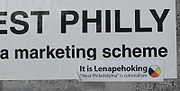
tribes into the oldest West Philadelphia neighborhood. Some of the American Indian activists named their section Lenapehoking
Lenapehoking
Lenapehoking is a term for the lands historically inhabited by the Native American people known as the Lenape in what is now the Northeastern United States...
the indigenous Lenape name of the region, but encompassed the entire Delaware Valley
Delaware Valley
The Delaware Valley is a term used to refer to the valley where the Delaware River flows, along with the surrounding communities. This includes the metropolitan area centered on the city of Philadelphia. Such educational institutions as Delaware Valley Regional High School in Alexandria Township...
when the first white Europeans arrived in the late 16th century.
History
The Woodlands Cemetery
The Woodlands is a National Historic Landmark District on the western banks of the Schuylkill River in Philadelphia, Pennsylvania. It includes a magnificent federal style mansion, a matching carriage house and stable, and a garden landscape that in 1840 was transformed into a Victorian rural...
, which is located near the west bank of the Schuylkill River, was originally the estate of Andrew Hamilton
Andrew Hamilton (lawyer)
Andrew Hamilton was a Scottish lawyer in Colonial America, best known for his legal victory on behalf of printer and newspaper publisher John Peter Zenger. This 1735 decision helped to establish that truth is a defense to an accusation of libel...
who bought the property in 1735. In 1840, the property was transformed into a cemetery with an arboretum of over 1,000 trees. It holds the graves of many famous Philadelphians.
Satterlee Hospital
Satterlee Hospital
Satterlee U.S.A. General Hospital, which existed from 1862 to 1865 in Philadelphia, Pennsylvania, was one of the largest Union Army hospitals of the Civil War....
, one of the largest Union Army hospitals of the Civil War, operated from 1862 to 1865; part of its grounds are now the northern section of Clark Park
Clark Park
Clark Park is a municipal park in the Spruce Hill section of West Philadelphia in Philadelphia, Pennsylvania. Its are bordered by 43rd and 45th streets, and by Baltimore and Woodland Avenues....
.
West Philadelphia's population expanded in the late 19th and early 20th centuries, thanks in large part to horsecars, then streetcars, and Schuylkill River
Schuylkill River
The Schuylkill River is a river in Pennsylvania. It is a designated Pennsylvania Scenic River.The river is about long. Its watershed of about lies entirely within the state of Pennsylvania. The source of its eastern branch is in the Appalachian Mountains at Tuscarora Springs, near Tamaqua in...
bridges that allowed middle-class breadwinners to commute into the Central Business District a few miles to the east. West Philadelphia was among the early streetcar suburbs, and a portion of it is listed on the National Register of Historic Places
National Register of Historic Places
The National Register of Historic Places is the United States government's official list of districts, sites, buildings, structures, and objects deemed worthy of preservation...
as the West Philadelphia Streetcar Suburb Historic District
West Philadelphia Streetcar Suburb Historic District
The West Philadelphia Streetcar Suburb Historic District is an area of West Philadelphia listed on the National Register of Historic Places because it represents the transformation of Philadelphia's rural farmland into urban residential development, made possible by the streetcar, which provided...
.
The western portion of the neighborhood was once home to some of the most expensive real estate in the country (and much striking Victorian-era architecture remains). The area has declined in prominence over the last 50 years, thanks in part to increasing crime and the migration of many middle and upper-class residents to suburbs and other sections of the city.
In recent years, parts of West Philadelphia have undergone "Penntrification," a term that reflects the University of Pennsylvania
University of Pennsylvania
The University of Pennsylvania is a private, Ivy League university located in Philadelphia, Pennsylvania, United States. Penn is the fourth-oldest institution of higher education in the United States,Penn is the fourth-oldest using the founding dates claimed by each institution...
's role in gentrification
Gentrification
Gentrification and urban gentrification refer to the changes that result when wealthier people acquire or rent property in low income and working class communities. Urban gentrification is associated with movement. Consequent to gentrification, the average income increases and average family size...
of the neighborhood; including a campaign to rename part of the area University City
University City, Philadelphia, Pennsylvania
University City is the easternmost region of West Philadelphia.The University of Pennsylvania has long been the dominant institution in the area and was instrumental in coining the name University City as part of a 1950s urban-renewal effort...
(the designation now appears on maps as well as public street signs and government listings). Many young professionals and families have moved into the area.
West Philadelphia drew national attention in 1978 and 1985 for violent clashes between police and an Afro-centric, back-to-nature group called MOVE
MOVE
MOVE or the MOVE Organization is a Philadelphia-based black liberation group founded by John Africa. MOVE was described by CNN as "a loose-knit, mostly black group whose members all adopted the surname Africa, advocated a "back-to-nature" lifestyle and preached against technology." The group...
. During the latter confrontation, police firebombed the group's headquarters, killing 11 and destroying an entire block of Osage Avenue and Pine Street.
Housing

Terraced house
In architecture and city planning, a terrace house, terrace, row house, linked house or townhouse is a style of medium-density housing that originated in Great Britain in the late 17th century, where a row of identical or mirror-image houses share side walls...
, although there are areas of semi-detached
Semi-detached
Semi-detached housing consists of pairs of houses built side by side as units sharing a party wall and usually in such a way that each house's layout is a mirror image of its twin...
and detached houses. The earliest developments began in 1850 and the final period of mass construction ended in 1930. Development was enabled by the creation of the horsecar
Horsecar
A horsecar or horse-drawn tram is an animal-powered streetcar or tram.These early forms of public transport developed out of industrial haulage routes that had long been in existence, and from the omnibus routes that first ran on public streets in the 1820s, using the newly improved iron or steel...
, which pushed development to about 43rd Street, and, after the arrival of the electrified streetcar in 1892, accelerated to the west and southwest. (See West Philadelphia Streetcar Suburb Historic District
West Philadelphia Streetcar Suburb Historic District
The West Philadelphia Streetcar Suburb Historic District is an area of West Philadelphia listed on the National Register of Historic Places because it represents the transformation of Philadelphia's rural farmland into urban residential development, made possible by the streetcar, which provided...
and the Market Street Line
Market-Frankford Line
The Market–Frankford Line is a rapid transit line in Philadelphia, Pennsylvania, United States, operated by the Southeastern Pennsylvania Transportation Authority .-Route:The Market–Frankford Line begins at 69th Street Transportation Center, in Upper Darby...
.)
Largely commissioned by speculative developers and designed by some of the city's most prolific architects, they were purchased by industrial managers and other professionals who led the first movement of upper and middle class
Middle class
The middle class is any class of people in the middle of a societal hierarchy. In Weberian socio-economic terms, the middle class is the broad group of people in contemporary society who fall socio-economically between the working class and upper class....
from the more crowded city center. Developers found they could increase profits by catering to this emerging group, shrinking lot sizes, and building more compact, less ornate houses.


Setback
Setback may have the following meanings:* Setback , the distance a structure must be from the edge of a lot* Setback , making upper storeys of a high-rise building further back than the lower ones for aesthetic, structural, or land-use restriction reasons* Pitch , a card game related to All Fours*A...
of these houses was 25 feet, allowing generous front yards.
Another development on Locust Street, a project by banker and West Philly resident Clarence Howard Clark
Clarence Howard Clark
Clarence Howard Clark, Sr. was an influential banker, land owner, and developer in Philadelphia, Pennsylvania. In 1916, ten years after his death, the New York Times called him one of the city's "most prominent men of his day."...
, was composed of three-story, two-bay, brick, restrained Queen Anne
Queen Anne Style architecture
The Queen Anne Style in Britain means either the English Baroque architectural style roughly of the reign of Queen Anne , or a revived form that was popular in the last quarter of the 19th century and the early decades of the 20th century...
rowhouses. The street was unified by front yards, and enclosed by decorative iron fences. The houses melded the suburban principles of front porches and greenspace with the urban rowhouse form, producing profitable, yet desirable, middle-class suburban housing. Other developments introduced urban density and architectural uniformity: the Queen Anne style with columned porches and decorative spindlework, brickwork and corbelling; steeply pitched gables with fishscale slate shingles; turrets; balconies; and windows with a single pane surrounded by small panes. These houses are typical of the early 20th-century developments in West Philadelphia, and are unified by rhythmic patterning of porch and gable features. The second story, projecting, semi-hexagonal bay is incorporated into this design, an element which defines the later rowhouses.
The western reaches of West Philadelphia included miles of two-story rowhouses with bay windows above classical columned front porches. What resulted was a collection of Colonial Revival houses with Arts and Crafts
Arts and Crafts movement
Arts and Crafts was an international design philosophy that originated in England and flourished between 1860 and 1910 , continuing its influence until the 1930s...
influences, which reflect the sophisticated tastes of post-World War I
World War I
World War I , which was predominantly called the World War or the Great War from its occurrence until 1939, and the First World War or World War I thereafter, was a major war centred in Europe that began on 28 July 1914 and lasted until 11 November 1918...
Philadelphians. For the first time in West Philadelphia, houses had garages. Later Tudor and Spanish Revival houses, and the Art Deco influenced apartment houses also filled in available lot spaces between developments and made it possible for more middle-class Philadelphians to move to the area.
Elevated Rail
One of West Philadelphia's most prominent features is the "El", or SEPTA's Market-Frankford LineMarket-Frankford Line
The Market–Frankford Line is a rapid transit line in Philadelphia, Pennsylvania, United States, operated by the Southeastern Pennsylvania Transportation Authority .-Route:The Market–Frankford Line begins at 69th Street Transportation Center, in Upper Darby...
or Blue Line. Completed in 1907, this elevated subway line linked West Philadelphia, Millbourne
Millbourne (MFL station)
Millbourne Station is a ground-level stop on the Market-Frankford Line, near the intersection of Millbourne Avenue and Market Street in Millbourne, Pennsylvania....
and Upper Darby to Center City and then later to Frankford.

Market Street (Philadelphia)
Market Street, originally known as High Street, is a major east–west street in Philadelphia, Pennsylvania. For the majority of its length, it serves as Pennsylvania Route 3....
, this transportation link is one of Philadelphia's two major transit lines that transport hundreds of thousands of students and workers daily into and around the city. The El once powered the economic engine of West Philadelphia.
Retail districts lined every street where there was a station as well as along Market Street. Most recently many of these retail districts with the exception of 52nd Street
52nd Street (SEPTA station)
52nd Street Station is an elevated stop on the Market-Frankford Line, above the intersection of 52nd Street and Market Street in Philadelphia, Pennsylvania. The station lies at the junction of four neighborhoods. Haddington is to the northwest, Dunlap to the northeast, Walnut Hill lies to the...
have been converted to largely residential areas. One of the aggravating factors in this change has been the recent reconstruction of the EL which, due to detours of the "number streets" or numbered North-South thoroughfares and closure of large portions of Market Street, have led to many remaining businesses failing.
Light Rail
SEPTA Subway-Surface Trolley Lines
The Subway–Surface Trolley Lines or Green Lines are five SEPTA trolley lines that operate on street-level tracks in West Philadelphia and Delaware County, Pennsylvania, and in a shared subway with rapid transit trains in Philadelphia's Center City....
, often called the Green Lines for their representation on SEPTA route maps. These include five of Philadelphia's remaining six streetcar lines. Combined, these trolley routes convey more than 150,000 passengers daily, and operate 24-hour schedules, even in blizzards.
The Route 10
SEPTA Route 10
SEPTA's Subway-Surface Trolley Route 10 is a trolley line operated by the Southeastern Pennsylvania Transportation Authority that connects the 13th Street in downtown Philadelphia, Pennsylvania, to the Overbrook Loop station in Overbrook section of West Philadelphia...
trolley runs along Lancaster Avenue from 63rd and Malvern Avenue through to 36th and Ludlow Streets where a portal allows access to the subway tunnel into Center City. The Route 34
SEPTA Route 34
SEPTA's Subway-Surface Trolley Route 34, also called the Baltimore Avenue-Subway Line, is a trolley line operated by the Southeastern Pennsylvania Transportation Authority that connects the 13th Street in downtown Philadelphia, Pennsylvania, to the Angora Loop station in the Angora neighborhood of...
trolley runs along Baltimore Avenue
Baltimore Pike
thumb|[[SEPTA]]'s [[SEPTA Route 34|Route 34]] streetcar line runs through the 4500 block of Baltimore Avenue in [[West Philadelphia]]The Baltimore Pike was an auto trail in the United States, connecting Baltimore, Maryland with Philadelphia, Pennsylvania....
from Cobbs Creek
Cobbs Creek
Cobbs Creek is an tributary of Darby Creek in Delaware County, Pennsylvania in the United States. It forms an approximate border between Montgomery County and Delaware County. After Cobbs Creek passes underneath Township Line Road , it forms the border between Philadelphia County and Delaware County...
at 61st Street to the transit tunnel at 40th Street in University City
University City, Philadelphia, Pennsylvania
University City is the easternmost region of West Philadelphia.The University of Pennsylvania has long been the dominant institution in the area and was instrumental in coining the name University City as part of a 1950s urban-renewal effort...
. The Route 13
SEPTA Route 13
SEPTA's Subway-Surface Trolley Route 13 is a trolley line operated by the Southeastern Pennsylvania Transportation Authority that connects the 13th Street in downtown Philadelphia, Pennsylvania, to the Yeadon Loop station in Yeadon, Pennsylvania, although limited service is available to the Darby...
trolley runs along Chester Avenue from the transit tunnel at 40th Street and Baltimore Avenue to 67th Street where it turns off Chester Avenue and continues along PA Route 13 into Yeadon, Delaware County
Yeadon, Pennsylvania
Yeadon is a borough in Delaware County, Pennsylvania, United States. It borders the City of Philadelphia. The population was 11,762 at the 2000 census.-Geography:Yeadon is located at ....
on to its terminus at Green Lane. The Route 11
SEPTA Route 11
SEPTA's Subway-Surface Trolley Route 11 is a trolley line operated by the Southeastern Pennsylvania Transportation Authority that connects the 13th Street in downtown Philadelphia, Pennsylvania, to Darby Transportation Center in Darby, Pennsylvania...
trolley runs long Woodland Avenue from the transit tunnel at 40th street through to the city line at Cobbs Creek
Cobbs Creek
Cobbs Creek is an tributary of Darby Creek in Delaware County, Pennsylvania in the United States. It forms an approximate border between Montgomery County and Delaware County. After Cobbs Creek passes underneath Township Line Road , it forms the border between Philadelphia County and Delaware County...
and continues into Darby Borough
Darby, Pennsylvania
Darby is a borough in Delaware County, Pennsylvania, United States, along Darby Creek southwest of downtown Philadelphia. It has a public library founded in 1743 and a cemetery more than 300 years old. The Quakers lived there early in the colonial era. Darby was settled about 1660 and was...
. The final Green Line is the Route 36
SEPTA Route 36
SEPTA's Subway-Surface Trolley Route 36 is a trolley line operated by the Southeastern Pennsylvania Transportation Authority that connects the 13th Street in downtown Philadelphia, Pennsylvania, to the Eastwick Loop station in Eastwick section of Southwest Philadelphia, although limited service...
trolley, the longest and furthest south. The 36 trolley leaves the transit tunnel, runs along Woodland Avenue to 49th Street, and turns south to continue along Lindbergh Boulevard until 55th Street when it splits off with Elmwood Avenue. It continues westbound on Elmwood until it turns south on Island Avenue west of 73rd Street, and continues south until its terminus in Penrose Plaza in Southwest Philadelphia
Southwest Philadelphia
Southwest Philadelphia is a section of Philadelphia, Pennsylvania, United States. The section can be described as extending from the western side of the Schuylkill River to the city line, with the SEPTA Media/Elwyn Line serving as the northern border...
, near the Philadelphia International Airport
Philadelphia International Airport
Philadelphia International Airport is a major airport in Philadelphia, Pennsylvania, United States, and is the largest airport in the Delaware Valley region and in Pennsylvania...
.
Initially, two other trolley lines, the Route 38 trolley which ran from Wynnefield to Center City via Belmont Avenue and Mantua, and the Route 31 trolley, which ran from the city line in
Overbrook Park via Haverford Avenue and Market Street into Center City we to be diverted into the transit tunnel at Ludlow Street. But after National City Lines
National City Lines
National City Lines, Inc. , was a controversial company founded in Minnesota, United States in 1920 as a modest local transport company operating two buses which was reorganized into a holding company in 1936 with equity funding from General Motors, Firestone Tire, Standard Oil of California and...
took over the Philadelphia Transit Company, those plans were scrapped and the routes converted to diesel buses. As well, Route 38 was expanded into newly developed neighborhoods in Bala Cynwyd, and the Route 31 diverted into a circuitous route through West Philadelphia and Mantua.
Regional Rail
SEPTA Regional Rail
The SEPTA Regional Rail system consists of commuter rail service on thirteen branches to over 150 active stations in Philadelphia, Pennsylvania, United States and its suburbs. Service on most lines runs from 5:30 AM to midnight...
, which transport thousands of commuters daily to and from of Center City and University City, and provide a quick and inexpensive link to the Philadelphia International Airport. The Airport Line serves University City at University City Station in the University of Pennsylvania, going on to southern-most Southwest Philadelphia and the airport. The Media/Elwyn Line
Media/Elwyn Line
The Media/Elwyn Line is a SEPTA Regional Rail line running from Center City Philadelphia west to Elwyn in Delaware County.Originally known as the Media/West Chester Branch, service was truncated on September 19, 1986 from West Chester to its current terminus at Elwyn. Service expansion beyond Elwyn...
also serves University City and portions of Southwest Philadelphia before continuing to Media
Media, Pennsylvania
The borough of Media is the county seat of Delaware County, Pennsylvania and is located west of Philadelphia. Media was incorporated in 1850 at the same time that it was named the county seat. The population was 5,533 at the 2000 census. Its school district is the Rose Tree Media School District...
and points beyond. The Paoli/Thorndale line serves Overbrook and Wynnefield, and continues to the "Main Line"
Pennsylvania Main Line
The Main Line is an unofficial historical and socio-cultural region of suburban Philadelphia, Pennsylvania, comprising a collection of affluent towns built along the old Main Line of the Pennsylvania Railroad which ran northwest from downtown Philadelphia parallel to Lancaster Avenue , a road...
communities and Paoli. However, the Paoli/Thorndale does not stop anywhere between 30th street and City Line Avenue, instead bypassing most of West Philadelphia ever since the closure of 52nd Street Station
52nd Street (Pennsylvania Railroad station)
52nd Street is a closed railroad station in the West Philadelphia section of Philadelphia, Pennsylvania. It was built by the Pennsylvania Railroad at the junction of its Main Line and its Schuylkill Branch...
. The Cynwyd Line
Cynwyd Line
The Cynwyd Line is a SEPTA Regional Rail line running from Center City Philadelphia to Cynwyd in Montgomery County.Originally known as the Ivy Ridge Branch, service was truncated on October 25, 1986 from Ivy Ridge to its current terminus at Cynwyd....
is a limited-service express line from Center City to the Bala Cynwyd neighborhood of Lower Merion Township.
Most of these passenger trips originate outside of the city, but more West Philly residents are using SEPTA's multi-ride "Transpass", which allows unlimited rides on SEPTA vehicles within the city limits.
Community groups have called on SEPTA to reopen closed Regional Rail stations in areas further away from the Market-Frankford Line and the Broad Street Line.
Streets
West Philadelphia's streets are laid out in a modified "grid" pattern. Market StreetMarket Street (Philadelphia)
Market Street, originally known as High Street, is a major east–west street in Philadelphia, Pennsylvania. For the majority of its length, it serves as Pennsylvania Route 3....
is the central main thoroughfare running East and West, with "tree" streets above and below, also running East to West. The North-South streets are numbered consecutively starting with 30th street at the Schuylkill River
Schuylkill River
The Schuylkill River is a river in Pennsylvania. It is a designated Pennsylvania Scenic River.The river is about long. Its watershed of about lies entirely within the state of Pennsylvania. The source of its eastern branch is in the Appalachian Mountains at Tuscarora Springs, near Tamaqua in...
through to 77th street on the far Western edge in Overbrook near Cobbs Creek
Cobbs Creek
Cobbs Creek is an tributary of Darby Creek in Delaware County, Pennsylvania in the United States. It forms an approximate border between Montgomery County and Delaware County. After Cobbs Creek passes underneath Township Line Road , it forms the border between Philadelphia County and Delaware County...
, and extending to 90th Street in Southwest Philly near the airport, which is only one block long and is not in a residential area. However, 58th Street is the highest numbered street to run any considerable distance contiguously, as it runs from the northern frontier of West Philadelphia at City Ave all the way south to the Schuylkill River. 77th and 86th streets runs only a few blocks due to the tapering of the city map; if they were to continue further, then they would run into the suburbs (84th street becomes Hook Rd when it crosses into Sharon Hill). The 77th street in Overbrook is not contiguous with the 77th street in the column of streets that ends with 90th street in the Southwest. The two 77th streets (as well as all numbered streets after 58th) are miles apart. Additionally, while the street grid ends at Cobbs Creek Park along with the western political boundary of Philadelphia, many of the street names and a roughly similar street grid (it begins to degrade outside the city) continue beyond the city limits into Upper Darby Township, into which Market Street runs uninterrupted to 69th street at the El terminal, where it turns into West Chester Pike and runs through Delaware County and into Chester County. With the exception of Market St, these streets can be regarded as being "named after" the streets in West Phila, as opposed to being continuations, as they are cut off by the park. The numbering pattern is impure, as one driving down Market Street into Upper Darby would cross 62nd Street, then Cobbs Creek Parkway/63rd St, then several named streets until finally they would arrive at 69th street, skipping 64-68.
| East-West Tree Streets | Lanes | Direction |
|---|---|---|
| Ludlow Street | 1 lane | Alternates |
| Chestnut Street | 3 lanes | Eastbound |
| Sansom Street | 1 lane | Westbound |
| Walnut Street | 2 lanes | Westbound |
| Locust Street | 2 lanes | Two-way |
| Spruce Street | 2 lanes | Two-way |
| Pine Street | 2 lanes | Two-way |
| Osage Avenue | 1 lane | One-way/alternates |
| Larchwood Street | 1 or 2 lanes | Alternates |
| Hazel Avenue | 2 lanes | Two-way |
| Cedar Avenue | 2 lanes | Two-way |
Chestnut
Chestnut Street (Philadelphia)
Chestnut Street is a major historic street in Philadelphia, Pennsylvania. Originally named Wynne Street because Thomas Wynne's home was there. William Penn renamed it Chestnut Street in 1684. It runs east–west from the Delaware River waterfront in downtown Philadelphia through Center City and West...
and Walnut
Walnut Street (Philadelphia)
Walnut Street is located in downtown Philadelphia and extends from the city's Delaware River waterfront through Center City and West Philadelphia. Walnut Street has been characterized as "the city's premier shopping district"...
Streets are wide thoroughfares that form Pennsylvania Route 3
Pennsylvania Route 3
Pennsylvania Route 3 is a state highway located in the southeastern portion of Pennsylvania. The route connects West Chester with Philadelphia. The divided highway that comprises much of its route is the West Chester Pike, built as a turnpike by the Philadelphia and West Chester Turnpike Company...
. These two streets constitute one of the major commuter routes into and out of Philadelphia from surrounding Delaware and Chester Counties. Thousands of cars, trucks and buses travel Chestnut and Walnut street daily. In the sixties and seventies these roads even boasted illuminated signs announcing the optimal speed to travel the 4.3 miles trip into Center City without stopping for a red light. Once lined with actual American Chestnut
Chestnut
Chestnut , some species called chinkapin or chinquapin, is a genus of eight or nine species of deciduous trees and shrubs in the beech family Fagaceae, native to temperate regions of the Northern Hemisphere. The name also refers to the edible nuts they produce.-Species:The chestnut belongs to the...
and Walnut
Walnut
Juglans is a plant genus of the family Juglandaceae, the seeds of which are known as walnuts. They are deciduous trees, 10–40 meters tall , with pinnate leaves 200–900 millimetres long , with 5–25 leaflets; the shoots have chambered pith, a character shared with the wingnuts , but not the hickories...
trees that touched across the five lanes of roadway, due to Chestnut blight
Chestnut blight
The pathogenic fungus Cryphonectria parasitica is a member of the ascomycota category, and is the main cause of chestnut blight, a devastating disease of the American chestnut tree that caused a mass extinction in the early 1900s of this once plentiful tree from its historic range in the eastern...
many of these trees were removed and replaced with a mix of Sycamore and Poplar trees. City officials found these species much more tolerant of the urban environment and disease resistant, although a handful of Chestnut trees remain near Cobbs Creek.
Another notable street is Lancaster Avenue which begins at 34th street near Drexel University
Drexel University
Drexel University is a private research university with the main campus located in Philadelphia, Pennsylvania, USA. It was founded in 1891 by Anthony J. Drexel, a noted financier and philanthropist. Drexel offers 70 full-time undergraduate programs and accelerated degrees...
and runs through to the city line at City Avenue, and continues on as U.S. Route 30
U.S. Route 30
U.S. Route 30 is an east–west main route of the system of United States Numbered Highways, with the highway traveling across the northern tier of the country. It is the third longest U.S. route, after U.S. Route 20 and U.S. Route 6. The western end of the highway is at Astoria, Oregon; the...
to Lancaster, Pennsylvania
Lancaster, Pennsylvania
Lancaster is a city in the south-central part of the Commonwealth of Pennsylvania. It is the county seat of Lancaster County and one of the older inland cities in the United States, . With a population of 59,322, it ranks eighth in population among Pennsylvania's cities...
, Pittsburgh
Pittsburgh, Pennsylvania
Pittsburgh is the second-largest city in the US Commonwealth of Pennsylvania and the county seat of Allegheny County. Regionally, it anchors the largest urban area of Appalachia and the Ohio River Valley, and nationally, it is the 22nd-largest urban area in the United States...
and the West Virginia
West Virginia
West Virginia is a state in the Appalachian and Southeastern regions of the United States, bordered by Virginia to the southeast, Kentucky to the southwest, Ohio to the northwest, Pennsylvania to the northeast and Maryland to the east...
border. Lancaster Avenue is also one of the major retail strips in West Philadelphia. Shops and restaurants line the entirety of Lancaster Avenue through to 64th street in the Wynnefield neighborhood. In addition, one of Philadelphia's six remaining streetcar lines, the Route 10 Green Line
Green Line
- Geographic demarcations :* Green Line, a name for the Gothic Line or "Linea Gotica", a German defensive line in Italy during World War II, renamed the "Green Line" in June 1944...
, transports commuters and students daily along Lancaster Avenue from 36th and Ludlow streets to 63rd and Malvern Avenue in Wynnefield.
Crime
The intersection of 52nd Street and Market Street in West Philadelphia was listed number eight in a 2007 list of the city's top ten recreational drug corners according to an article by Philadelphia WeeklyPhiladelphia Weekly
Philadelphia Weekly , is an award-winning alternative newspaper in Philadelphia, Pennsylvania, published every Wednesday.The paper was founded in 1971 as a sister publication to the South Philadelphia Press. In 1995, the paper became Philadelphia Weekly...
reporter Steve Volk.
The Philadelphia Police Department
Philadelphia Police Department
The Philadelphia Police Department is the police agency responsible for law enforcement and investigations within the City of Philadelphia, Pennsylvania...
divides West Philadelphia into four patrol districts: the 16th, 18th, 19th, and 92nd.
Schools
Public schools
The area's public schools are operated by the School District of PhiladelphiaSchool District of Philadelphia
The School District of Philadelphia is a school district based in the School District of Philadelphia Education Center in Philadelphia, Pennsylvania, that includes all public schools in the city of Philadelphia. Established in 1818, it is the eighth largest school district in the nation.The School...
.
West Philadelphia High School
West Philadelphia High School
West Philadelphia High School is a secondary school located in the West Philadelphia section of Philadelphia, Pennsylvania.The school was completed on November 1, 1912. and occupies an entire city block between 47th and 48th streets, between Walnut Street and Locust Street...
was one of the biggest and most diverse schools in state when it was opened in 1911. The students of "West" were the children of middle-class blacks, as well as of Irish, Jewish, Polish and other immigrant groups.
Other high schools include University City High School
University City High School
University City High School can refer to:*University City High School *University City High School *University City High School...
; William L. Sayre High School, formerly Sayre Middle School; Robert E. Lamberton High School
Robert E. Lamberton High School
Robert E. Lamberton High School is an American high school located in the Overbrook Park section of Philadelphia. Lamberton HS has 350 students...
; Mastery Charter Shoemaker Campus, formerly William Shoemaker Middle School; and Overbrook High School
Overbrook High School (Philadelphia)
Overbrook High School is an inner-city, public, four-year secondary school in the Overbrook section of West Philadelphia, Philadelphia, Pennsylvania, United States.-School:...
.
Elementary schools include Morton McMichael Elementary School and Lea Elementary School.
Private schools
Blocks away from "West" were the West Philadelphia Catholic High Schools for Girls at 46th Street and Boys at 48th Street, now consolidated into West Philadelphia Catholic High SchoolWest Philadelphia Catholic High School
West Philadelphia Catholic High School is a co-educational Catholic high school in the Archdiocese of Philadelphia. It is located in Philadelphia, Pennsylvania, at 45th and Chestnut Streets, the University City neighborhood of West Philadelphia.- Mission :...
in the building at 46th Street. St. Thomas More High School for Boys at 47th and Wyalusing Avenue was closed in 1975 and now houses the Sr Clara Muhammad School.
Colleges and universities
West Philadelphia is the home to several universities, including the University of PennsylvaniaUniversity of Pennsylvania
The University of Pennsylvania is a private, Ivy League university located in Philadelphia, Pennsylvania, United States. Penn is the fourth-oldest institution of higher education in the United States,Penn is the fourth-oldest using the founding dates claimed by each institution...
, Drexel University
Drexel University
Drexel University is a private research university with the main campus located in Philadelphia, Pennsylvania, USA. It was founded in 1891 by Anthony J. Drexel, a noted financier and philanthropist. Drexel offers 70 full-time undergraduate programs and accelerated degrees...
, the University of the Sciences in Philadelphia
University of the Sciences in Philadelphia
University of the Sciences , officially known as University of the Sciences in Philadelphia , located in Philadelphia, Pennsylvania, offers bachelor's, master's, and doctoral degrees in pharmacy and a variety of other health-related disciplines.-History:The history of the University of the Sciences...
, and Saint Joseph's University
Saint Joseph's University
Saint Joseph's University is a private, coeducational Roman Catholic Jesuit university located partially in the Wynnefield section of Philadelphia and partially in Lower Merion Township and located in the Pennsylvania Main Line, Pennsylvania, United States.The school was founded in 1851 as Saint...
.
Destinations
West Philadelphia has about 75 of Philadelphia's 196 blue historic markers, which note historically important birthplaces, homes, business and other places.
Philadelphia Zoo
The Philadelphia Zoo, located in Philadelphia, Pennsylvania, on the west bank of the Schuylkill River, was the first zoo in the United States. Chartered by the Commonwealth of Pennsylvania on March 21, 1859, its opening was delayed by the American Civil War until July 1, 1874...
, has exhibitions and educational programs. Nestled in the center of Fairmount Park, it is near Memorial Hall
Memorial Hall (Philadelphia)
Memorial Hall, designed by Herman J. Schwarzmann for the 1876 Centennial Exposition in Philadelphia, Pennsylvania, is an early example of monumental Beaux-Arts architecture in the United States. Schwarzmann, the chief engineer of the Fairmount Park Commission, also designed the temporary...
(the current home of the Please Touch Museum
Please Touch Museum
The Please Touch Museum is a children's museum located in Philadelphia, Pennsylvania, USA. The museum focuses on teaching children through interactive exhibits and special events, mostly aimed at children seven years old and younger.-History:...
), Kelly Pool, The Carousel House, and the new Microsoft
Microsoft
Microsoft Corporation is an American public multinational corporation headquartered in Redmond, Washington, USA that develops, manufactures, licenses, and supports a wide range of products and services predominantly related to computing through its various product divisions...
partner high school, the "School of the Future".
Cultural venues include the Mann Music Center of the Performing Arts and the Bushfire Theater of the Performing Arts on 52nd Street.
West Philadelphia in the media
The area gained some fame through the theme song to the NBCNBC
The National Broadcasting Company is an American commercial broadcasting television network and former radio network headquartered in the GE Building in New York City's Rockefeller Center with additional major offices near Los Angeles and in Chicago...
sitcom The Fresh Prince of Bel-Air
The Fresh Prince of Bel-Air
The Fresh Prince of Bel-Air is an American television sitcom that originally aired on NBC from September 10, 1990 to May 20, 1996. The show stars Will Smith as a fictionalized version of himself, a street-smart teenager from West Philadelphia who is sent to move in with his aunt and uncle in their...
in which Wynnefield native Will Smith
Will Smith
Willard Christopher "Will" Smith, Jr. , also known by his stage name The Fresh Prince, is an American actor, producer, and rapper. He has enjoyed success in television, film and music. In April 2007, Newsweek called him the most powerful actor in Hollywood...
raps, "In West Philadelphia, born and raised . . . "
The NBC drama American Dreams
American Dreams
American Dreams is an American television comedy-drama program broadcast on the NBC television network, produced by Once A Frog and Dick Clark Productions in association with Universal Network Television and NBC Studios...
is set in West Philadelphia in the mid-1960s.
West Philadelphia was also the home of American Bandstand
American Bandstand
American Bandstand is an American music-performance show that aired in various versions from 1952 to 1989 and was hosted from 1956 until its final season by Dick Clark, who also served as producer...
. The popular dance show and career starter for host Dick Clark was produced at television station WFIL-TV (Channel 6, now WPVI-TV
WPVI-TV
WPVI-TV, channel 6, is an owned-and-operated television station of the Walt Disney Company-owned American Broadcasting Company, located in Philadelphia, Pennsylvania, USA. WPVI has its studios located on the border between Philadelphia and Bala Cynwyd, and its transmitter is located in the...
) in "Studio 'B'", which was located in their just-completed addition at 4548 Market Street. The show featured local high school students, turning some into teen idols. The former television station is now home to the West Philadelphia Enterprise Center, although the large satellite dish on the roof still remains.
See also
- National Register of Historic Places listings in West PhiladelphiaNational Register of Historic Places listings in West PhiladelphiaThis is a list of the National Register of Historic Places listings in West Philadelphia.This is intended to be a complete list of the properties and districts on the National Register of Historic Places in West Philadelphia, Pennsylvania, United States...
External links
- University City Historical District - history of the area now known as West Philadelphia
- WestPhillyNews.com West Philly News - Local news & information. Home of the West Philly Forum, a community bulletin board.
- WestPhillyLocal.com West Philly Local - A local, independent website that covers West Philadelphia and University City.
- City government's West Philadelphia page: statistics, links
- West Philadelphia Data and Information Resources - University of Pennsylvania
- Historical Maps of West Philadelphia, archived at U. Penn.
- Lancaster Avenue photographs of Lancaster Avenue, West Philadelphia