
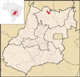
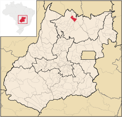
Trombas
Encyclopedia
| Trombas | |
|---|---|
| State | Goiás Goiás Goiás is a state of Brazil, located in the central part of the country. The name Goiás comes from the name of an indigenous community... |
| Area: | 799.1 km² |
| Population: | 3,537 (IBGE 2007) |
| Elevation: | 355m above sea level |
| Postcode (CEP): | 76460-000 |
| IBGE statistical microregion: | Porangatu Microregion Porangatu Microregion The Porangatu Microregion is a statistical region created by IBGE in north-central Goiás state, Brazil. The most important city is Porangatu... |
| Became a city: | 1989 |
| Distance to Goiânia Goiânia -Climate:The city has a tropical wet and dry climate with an average temperature of . There's a wet season, from October to April, and a dry one, from May to September. Annual rainfall is around 1,520 mm.... : |
424 km. |
| Website: | none |
Municipality
A municipality is essentially an urban administrative division having corporate status and usually powers of self-government. It can also be used to mean the governing body of a municipality. A municipality is a general-purpose administrative subdivision, as opposed to a special-purpose district...
in north Goiás
Goiás
Goiás is a state of Brazil, located in the central part of the country. The name Goiás comes from the name of an indigenous community...
state, Brazil
Brazil
Brazil , officially the Federative Republic of Brazil , is the largest country in South America. It is the world's fifth largest country, both by geographical area and by population with over 192 million people...
.
Location
Trombas is located in the extreme north of the state, between FormosoFormoso
Formoso is a small town and municipality in north Goiás state, Brazil. The population was 5,241 in a total area of 844 km².Highway connections from Goiânia are made by GO-080 / Nerópolis / São Francisco de Goiás / BR-153 / Jaraguá / GO-080 / Goianésia / Barro Alto / GO-342 / BR-080 / BR-153 /...
and Montividiu do Norte
Montividiu do Norte
Montividiu do Norte is a small town and municipality in Goiás state, Brazil. It is a part of the Porangatu Microregion. It had a population in 2007 of 4,395. It became a municipality in 1993.-Location:...
. It is east of the regional center, Porangatu
Porangatu
Parangatu is a town in Goiás state, Brazil-Geography:Parangatu is in its own microregion, Porangatu Microregion, of 226,766 inhabitants in an area of 35.287 km²; 426 km from the state capital, Goiânia. This microregion serves as a nucleus for eighteen municipalities in the north of Goiás state...
.
The distance to Goiânia
Goiânia
-Climate:The city has a tropical wet and dry climate with an average temperature of . There's a wet season, from October to April, and a dry one, from May to September. Annual rainfall is around 1,520 mm....
is 424 km. Highway connections are made by GO-080 / Nerópolis
Nerópolis
Nerópolis is a small city and municipality in central Goiás state, Brazil.-Location:The municipality is part of the metropolitan region of Goiânia, which is 42 kilometers to the west. It is nationally known as the city of garlic and sweets...
/ São Francisco de Goiás
São Francisco de Goiás
São Francisco de Goiás is a small town and municipality in central Goiás state, Brazil.Municipal boundaries:*North: Jaraguá*South: Petrolina de Goiás*East: Pirenópolis*West: Jesúpolis and Jaraguá...
/ BR-153 / Jaraguá / GO-080 / Goianésia
Goianésia
Goianésia is a municipality in the state of Goiás, Brazil. It is a large producer of sugarcane for production of alcohol used as a source of fuel.-Location:...
/ Barro Alto
Barro Alto
Barro Alto is a small town and municipality in northern Goiás state, Brazil, famous for its nickel mine and production of rubber. The population was 6,446 in 2007 and the total area of the municipality was 1,231.8 km².-Location:...
/ GO-342 / BR-080 / BR-153 / Uruaçu
Uruaçu
Uruaçu is a small city and municipality in north Goiás state, Brazil.-Geography:Uruaçu is located north of Anápolis and Goiânia on the important interstate highway BR-153, which links Brasília to Belém. It is 269 km. from Goiânia and 244 km. from Brasília...
/ Santa Tereza de Goiás
Santa Tereza de Goiás
Santa Tereza de Goias is a small town and municipality in north Goiás state, Brazil. Santa Tereza de Goiás is often spelled ""Santa Teresa de Goiás"".-Location:Santa Tereza is located in the extreme north of the state 35 km. south of Porangatu...
/ GO-241 / Formoso
Formoso
Formoso is a small town and municipality in north Goiás state, Brazil. The population was 5,241 in a total area of 844 km².Highway connections from Goiânia are made by GO-080 / Nerópolis / São Francisco de Goiás / BR-153 / Jaraguá / GO-080 / Goianésia / Barro Alto / GO-342 / BR-080 / BR-153 /...
/ GO-142.
Trombas is a small municipality surrounded by the following municipalities:
- north: Montividiu do NorteMontividiu do NorteMontividiu do Norte is a small town and municipality in Goiás state, Brazil. It is a part of the Porangatu Microregion. It had a population in 2007 of 4,395. It became a municipality in 1993.-Location:...
- south: FormosoFormosoFormoso is a small town and municipality in north Goiás state, Brazil. The population was 5,241 in a total area of 844 km².Highway connections from Goiânia are made by GO-080 / Nerópolis / São Francisco de Goiás / BR-153 / Jaraguá / GO-080 / Goianésia / Barro Alto / GO-342 / BR-080 / BR-153 /...
, CampinorteCampinorteCampinorte is a small city and municipality in north-central Goiás state, Brazil. The population was 9,697 in a total area of 1,068 km².-Location:...
and CampinaçuCampinaçuCampinaçu is a small town and municipality in north Goiás state, Brazil.-Location:Campinaçu is surrounded by the following municipalities:*north: Minaçu*east: Colinas do Sul*west: Campinorte and Uruaçu*south: Niquelândia... - east: MinaçuMinaçuMinaçu is a small city and municipality in the north of the state of Goiás, Brazil. There is a large asbestos mine in the municipality.-Location and climate:...
- west: Santa Tereza de GoiásSanta Tereza de GoiásSanta Tereza de Goias is a small town and municipality in north Goiás state, Brazil. Santa Tereza de Goiás is often spelled ""Santa Teresa de Goiás"".-Location:Santa Tereza is located in the extreme north of the state 35 km. south of Porangatu...
and PorangatuPorangatuParangatu is a town in Goiás state, Brazil-Geography:Parangatu is in its own microregion, Porangatu Microregion, of 226,766 inhabitants in an area of 35.287 km²; 426 km from the state capital, Goiânia. This microregion serves as a nucleus for eighteen municipalities in the north of Goiás state...
Political Information and Demographics
In January 2005 the mayor was Elson Carlos da Silva. There were 9 members on the city council and 2,864 eligible voters in December 2007.In 2007 the population density was 4.43 inhab/km². In 2007 there were 2,267 people living in the urban area and 1,270 living in the rural area. The population has decreased by almost 3,500 people since 1991.
The Economy
The economy is based on cattle raising, agriculture, services, and government employment. In 2007 there were 2 industrial units and 28 retail units.- Farms: 474
- Total agricultural Area: 55,760 hectares
- Permanent Planted Area: 127 hectares
- Temporary Planted Area: 1,125 hectares
- Natural Pasture: 34,880 hectares
- Woodland and Forest: 17,933 hectares
- Workers related to the farm owner: 1,131
- Workers not related to the farm owner: 64 (IBGE)
- Cattle herd: 46,700 head (2006)
- Main crops: rice (400 hectares) corn (500 hectares), and soybeans (500 hectares).
Education and Health
In the educational sector there were 4 schools with 1,079 students in 2006. The adult literacy rate was 83.2% (2000) (national average was 86.4%)The town was served by one hospital with 15 beds. The infant mortality rate was 16.72 (2000) (national average was 33.0)
- Municipal Human Development IndexHuman Development IndexThe Human Development Index is a composite statistic used to rank countries by level of "human development" and separate "very high human development", "high human development", "medium human development", and "low human development" countries...
: Trombas occupies a middle level position in the state, 96 out of 242 municipalities. The MHDI was 0.743
with a state ranking of 96 (out of 242 municipalities) and a national ranking of 2,074 (out of 5,507 municipalities)
- Seplan Economic Development Index: The ranking was 215 out of 246 municipalities. See Seplan
- Seplan Social Development Index: The ranking was 201 out of 246 municipalities. See Seplan