
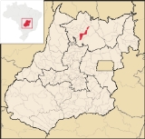
Campinorte
Encyclopedia
| Campinorte | |
|---|---|
| State | Goiás Goiás Goiás is a state of Brazil, located in the central part of the country. The name Goiás comes from the name of an indigenous community... |
| Area: | 1,068 km² |
| Population: | 9,697(IBGE 2007) |
| Elevation: | 537 m above sea level |
| Postcode (CEP): | 76440-000 |
| Became a city: | 1963 |
| Mayor: | Francisco Correa Sobrinho |
| Distance to Goiânia Goiânia -Climate:The city has a tropical wet and dry climate with an average temperature of . There's a wet season, from October to April, and a dry one, from May to September. Annual rainfall is around 1,520 mm.... : |
315 km. |
| IBGE statistical microregion: | Porangatu Microregion Porangatu Microregion The Porangatu Microregion is a statistical region created by IBGE in north-central Goiás state, Brazil. The most important city is Porangatu... |
| Website: | none |
City
A city is a relatively large and permanent settlement. Although there is no agreement on how a city is distinguished from a town within general English language meanings, many cities have a particular administrative, legal, or historical status based on local law.For example, in the U.S...
and municipality
Municipality
A municipality is essentially an urban administrative division having corporate status and usually powers of self-government. It can also be used to mean the governing body of a municipality. A municipality is a general-purpose administrative subdivision, as opposed to a special-purpose district...
in north-central Goiás
Goiás
Goiás is a state of Brazil, located in the central part of the country. The name Goiás comes from the name of an indigenous community...
state, Brazil
Brazil
Brazil , officially the Federative Republic of Brazil , is the largest country in South America. It is the world's fifth largest country, both by geographical area and by population with over 192 million people...
. The population was 9,697(2007) in a total area of 1,068 km².
Location
Campinorte is located on the important BelémBelém
Belém is a Brazilian city, the capital and largest city of state of Pará, in the country's north region. It is the entrance gate to the Amazon with a busy port, airport and bus/coach station...
-Brasília
Brasília
Brasília is the capital city of Brazil. The name is commonly spelled Brasilia in English. The city and its District are located in the Central-West region of the country, along a plateau known as Planalto Central. It has a population of about 2,557,000 as of the 2008 IBGE estimate, making it the...
, BR-153, and is 315 kilometers from the state capital, Goiânia
Goiânia
-Climate:The city has a tropical wet and dry climate with an average temperature of . There's a wet season, from October to April, and a dry one, from May to September. Annual rainfall is around 1,520 mm....
. It is 22 kilometers north of Uruaçu
Uruaçu
Uruaçu is a small city and municipality in north Goiás state, Brazil.-Geography:Uruaçu is located north of Anápolis and Goiânia on the important interstate highway BR-153, which links Brasília to Belém. It is 269 km. from Goiânia and 244 km. from Brasília...
and just west of the great artificial lake of Serra da Mesa. Anápolis
Anápolis
Anápolis is the third largest city in the State of Goiás in Brazil. It lies in the center of a rich agricultural region and has become a leader in food processing and pharmaceutical plants.-Location and population:...
, the second most important city in the state, is 276 kilometers to the south. Campinorte belongs to the Porangatu Microregion
Porangatu Microregion
The Porangatu Microregion is a statistical region created by IBGE in north-central Goiás state, Brazil. The most important city is Porangatu...
.
Municipal boundaries are with:
- North: Mara RosaMara RosaMara Rosa is a small town and municipality in north-central Goiás state, Brazil.-Location:Mara Rosa is located 356 kilometers north of Goiânia in the Porangatu Microregion. It is 11 kilometers east of the Belém-Brasília highway, between the basins of the Araguaia River and the Tocantins River...
- South: UruaçuUruaçuUruaçu is a small city and municipality in north Goiás state, Brazil.-Geography:Uruaçu is located north of Anápolis and Goiânia on the important interstate highway BR-153, which links Brasília to Belém. It is 269 km. from Goiânia and 244 km. from Brasília...
- East: UruaçuUruaçuUruaçu is a small city and municipality in north Goiás state, Brazil.-Geography:Uruaçu is located north of Anápolis and Goiânia on the important interstate highway BR-153, which links Brasília to Belém. It is 269 km. from Goiânia and 244 km. from Brasília...
and CampinaçuCampinaçuCampinaçu is a small town and municipality in north Goiás state, Brazil.-Location:Campinaçu is surrounded by the following municipalities:*north: Minaçu*east: Colinas do Sul*west: Campinorte and Uruaçu*south: Niquelândia... - West: Nova Iguaçu de GoiásNova Iguaçu de GoiásNova Iguaçu de Goiás is a small town and municipality in north Goiás state, Brazil.-Location:Nova Iguaçu de Goiás is located in the extreme north of the state and is 136 km from the regional center of Porangatu. Other towns nearby are Campinorte, 28 km. to the east; Alto Horizonte,...
and Mara RosaMara RosaMara Rosa is a small town and municipality in north-central Goiás state, Brazil.-Location:Mara Rosa is located 356 kilometers north of Goiânia in the Porangatu Microregion. It is 11 kilometers east of the Belém-Brasília highway, between the basins of the Araguaia River and the Tocantins River...
Demographics
The population density in 2007 was 9.08 inhab/km² while the population growth rate for 2000-2007 was 0.08.%. The urban population was 7,448 and the rural population was 2,249.History
The origins of Campinorte go back to 1918. It was called Campinas. In 1935 the first school was built in the region. Next a settler donated land to build the first chapel to pay homage to Saint Sebastian, patron saint of the town. When the government began to build the new highway nearby, in 1948, the settlers moved their primitive houses to the edge of the route. Campinas died and a new town, Campinorte, came to life. At first it was a district of UruaçuUruaçu
Uruaçu is a small city and municipality in north Goiás state, Brazil.-Geography:Uruaçu is located north of Anápolis and Goiânia on the important interstate highway BR-153, which links Brasília to Belém. It is 269 km. from Goiânia and 244 km. from Brasília...
, but in 1953 it became a separate municipality.
The economy
Main economic activities are cattle raising (43,000 head) and agriculture, with plantations of corn, rice, and beans. There are 479 rural properties in the region with 7,131 hectares of planted area. There were approximately 1,500 persons connected to the farming sector. Pasture land made up 171,000 hectares in 2006. The industrial sector is represented by some small producers of bricks, lumber, and dairy products. The main agricultural products were rice, corn, and soybeans (9,000 hectares).- Industrial units: 14
- Retail units: 128
- Financial institutions: Banco do Brasil, S.A.
- Dairy: Cooperativa Agropecuária Regional de Campinorte
- Automobiles in 2007: 803
Health and education
The infant mortality rate was 14.08 (2000) while the literacy rate was 83.8. There was one hospital with 17 beds and 13 schools with 2,891 students. The score on the Municipal Human Development IndexHuman Development Index
The Human Development Index is a composite statistic used to rank countries by level of "human development" and separate "very high human development", "high human development", "medium human development", and "low human development" countries...
was 0.750.
- State ranking: 76 (out of 242 municipalities)
- National ranking: 1,872 (out of 5,507 municipalities) See Frigoletto
- Tourism is centered on the Serra da Mesa lake, which is beginning to offer boating, water skiing, and windsurf.