
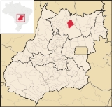
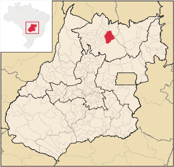
Campinaçu
Encyclopedia
| Campinaçu | |
|---|---|
| State | Goiás Goiás Goiás is a state of Brazil, located in the central part of the country. The name Goiás comes from the name of an indigenous community... |
| Area: | 1,974 km² |
| Population: | 3,765 (IBGE 2007) |
| Elevation: | 690 m above sea level |
| Postcode (CEP): | 76440-000 |
| Became a city: | 1982 |
| Distance to Goiânia Goiânia -Climate:The city has a tropical wet and dry climate with an average temperature of . There's a wet season, from October to April, and a dry one, from May to September. Annual rainfall is around 1,520 mm.... : |
462 km. |
| IBGE statistical microregion: | Porangatu Microregion Porangatu Microregion The Porangatu Microregion is a statistical region created by IBGE in north-central Goiás state, Brazil. The most important city is Porangatu... |
| Website: | none |
Town
A town is a human settlement larger than a village but smaller than a city. The size a settlement must be in order to be called a "town" varies considerably in different parts of the world, so that, for example, many American "small towns" seem to British people to be no more than villages, while...
and municipality
Municipality
A municipality is essentially an urban administrative division having corporate status and usually powers of self-government. It can also be used to mean the governing body of a municipality. A municipality is a general-purpose administrative subdivision, as opposed to a special-purpose district...
in north Goiás
Goiás
Goiás is a state of Brazil, located in the central part of the country. The name Goiás comes from the name of an indigenous community...
state, Brazil
Brazil
Brazil , officially the Federative Republic of Brazil , is the largest country in South America. It is the world's fifth largest country, both by geographical area and by population with over 192 million people...
.
Location
Campinaçu is surrounded by the following municipalities:- north: MinaçuMinaçuMinaçu is a small city and municipality in the north of the state of Goiás, Brazil. There is a large asbestos mine in the municipality.-Location and climate:...
- east: Colinas do SulColinas do SulColinas do Sul is a small town and municipality in north-central Goiás state, Brazil.-Location:Colinas is located in the Chapada dos Veadeiros statistical micro-region and is almost directly north of Brasília, to which it is connected by G0-327 as far as Alto Paraíso de Goiás then by G0-118 south...
- west: CampinorteCampinorteCampinorte is a small city and municipality in north-central Goiás state, Brazil. The population was 9,697 in a total area of 1,068 km².-Location:...
and UruaçuUruaçuUruaçu is a small city and municipality in north Goiás state, Brazil.-Geography:Uruaçu is located north of Anápolis and Goiânia on the important interstate highway BR-153, which links Brasília to Belém. It is 269 km. from Goiânia and 244 km. from Brasília... - south: NiquelândiaNiquelândiaNiquelândia is a small city and municipality in northern Goiás state, Brazil. It is the largest municipality in the state in area and is an important producer of minerals.-Geography:...
- Distance to GoiâniaGoiânia-Climate:The city has a tropical wet and dry climate with an average temperature of . There's a wet season, from October to April, and a dry one, from May to September. Annual rainfall is around 1,520 mm....
: 462 km. - Highway connections from GoiâniaGoiânia-Climate:The city has a tropical wet and dry climate with an average temperature of . There's a wet season, from October to April, and a dry one, from May to September. Annual rainfall is around 1,520 mm....
: GO-080 / NerópolisNerópolisNerópolis is a small city and municipality in central Goiás state, Brazil.-Location:The municipality is part of the metropolitan region of Goiânia, which is 42 kilometers to the west. It is nationally known as the city of garlic and sweets...
/ São Francisco de GoiásSão Francisco de GoiásSão Francisco de Goiás is a small town and municipality in central Goiás state, Brazil.Municipal boundaries:*North: Jaraguá*South: Petrolina de Goiás*East: Pirenópolis*West: Jesúpolis and Jaraguá...
/ BR-153 / Jaraguá / GO-080 / GoianésiaGoianésiaGoianésia is a municipality in the state of Goiás, Brazil. It is a large producer of sugarcane for production of alcohol used as a source of fuel.-Location:...
/ Barro AltoBarro AltoBarro Alto is a small town and municipality in northern Goiás state, Brazil, famous for its nickel mine and production of rubber. The population was 6,446 in 2007 and the total area of the municipality was 1,231.8 km².-Location:...
/ GO-342 / BR-080 / BR-153 / UruaçuUruaçuUruaçu is a small city and municipality in north Goiás state, Brazil.-Geography:Uruaçu is located north of Anápolis and Goiânia on the important interstate highway BR-153, which links Brasília to Belém. It is 269 km. from Goiânia and 244 km. from Brasília...
/ Santa Tereza de GoiásSanta Tereza de GoiásSanta Tereza de Goias is a small town and municipality in north Goiás state, Brazil. Santa Tereza de Goiás is often spelled ""Santa Teresa de Goiás"".-Location:Santa Tereza is located in the extreme north of the state 35 km. south of Porangatu...
/ GO-241 / FormosoFormosoFormoso is a small town and municipality in north Goiás state, Brazil. The population was 5,241 in a total area of 844 km².Highway connections from Goiânia are made by GO-080 / Nerópolis / São Francisco de Goiás / BR-153 / Jaraguá / GO-080 / Goianésia / Barro Alto / GO-342 / BR-080 / BR-153 /...
.
Demographics
In 2007 the population density was 1.91 inhab/km². The population growth rate for 2000/2007 was 0.22.%. The urban population in 2007 was 2,119 while the rural population was 1,646.The economy
The main economic activities are cattle raising with 64,500 head (IBGE 2006) and plantations of rice, corn, manioc, and sugar cane. In 2006 there were 545 farms with 21,660 hectares of cropland and 75,511 of pasture. There were approximately 1,600 persons connected to agriculture, the vast majority members of the farm owner's family.- Retail units: 33
- Financial institutions: none
- Automobiles in 2007: 116
Health and education
The infant mortality rate (2000) was 14.32 while the literacy rate was 80.5%. In 2007 there was one hospital with 19 beds.- public health clinics: 02
- hospitals: 01 with 19 beds
With a score of 0.733 Campinaçu occupies 132nd place out of 242 municipalities in the state on the Municipal Human Development Index
Human Development Index
The Human Development Index is a composite statistic used to rank countries by level of "human development" and separate "very high human development", "high human development", "medium human development", and "low human development" countries...
.
- State ranking: 132 (out of 242 municipalities)
- National ranking: 2,345 (out of 5,505 municipalities)
See also
- List of municipalities in Goiás
- Microregions of Goiás