
Nerópolis
Encyclopedia
| Nerópolis | |
|---|---|
| State | Goiás Goiás Goiás is a state of Brazil, located in the central part of the country. The name Goiás comes from the name of an indigenous community... |
| Area: | 204.2 km² |
| Population: | 19,382 (IBGE 2007) |
| Elevation: | 832 m above sea level |
| Postcode (CEP): | 75460-000 |
| Became a city: | 1948 |
| Distance to Goiânia Goiânia -Climate:The city has a tropical wet and dry climate with an average temperature of . There's a wet season, from October to April, and a dry one, from May to September. Annual rainfall is around 1,520 mm.... : |
42 km. |
| IBGE statistical microregion: | Goiânia Microregion Goiânia Microregion The Goiânia Microregion is a region in central Goiás state, Brazil. It includes 17 municipalities with a population of 2,032,305 in a total area of 6,848.00 km².... |
| Website: | none |
City
A city is a relatively large and permanent settlement. Although there is no agreement on how a city is distinguished from a town within general English language meanings, many cities have a particular administrative, legal, or historical status based on local law.For example, in the U.S...
and municipality
Municipality
A municipality is essentially an urban administrative division having corporate status and usually powers of self-government. It can also be used to mean the governing body of a municipality. A municipality is a general-purpose administrative subdivision, as opposed to a special-purpose district...
in central Goiás
Goiás
Goiás is a state of Brazil, located in the central part of the country. The name Goiás comes from the name of an indigenous community...
state, Brazil
Brazil
Brazil , officially the Federative Republic of Brazil , is the largest country in South America. It is the world's fifth largest country, both by geographical area and by population with over 192 million people...
.
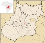
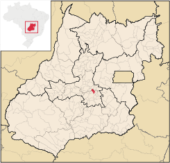
Location
The municipality is part of the metropolitan region of GoiâniaGoiânia
-Climate:The city has a tropical wet and dry climate with an average temperature of . There's a wet season, from October to April, and a dry one, from May to September. Annual rainfall is around 1,520 mm....
, which is 42 kilometers to the west. It is nationally known as the city of garlic and sweets. Strategically located, it is crossed by highways GO-080 and GO-222, with connections to Belém
Belém
Belém is a Brazilian city, the capital and largest city of state of Pará, in the country's north region. It is the entrance gate to the Amazon with a busy port, airport and bus/coach station...
, Mato Grosso
Mato Grosso
Mato Grosso is one of the states of Brazil, the third largest in area, located in the western part of the country.Neighboring states are Rondônia, Amazonas, Pará, Tocantins, Goiás and Mato Grosso do Sul. It also borders Bolivia to the southwest...
, and is near the national capital of Brasília
Brasília
Brasília is the capital city of Brazil. The name is commonly spelled Brasilia in English. The city and its District are located in the Central-West region of the country, along a plateau known as Planalto Central. It has a population of about 2,557,000 as of the 2008 IBGE estimate, making it the...
and the state capital of Goiânia
Goiânia
-Climate:The city has a tropical wet and dry climate with an average temperature of . There's a wet season, from October to April, and a dry one, from May to September. Annual rainfall is around 1,520 mm....
. Besides these advantages it is located in a region of high agricultural productivity, a factor that has attracted large industres to the town, such as Quero Indústrias Alimentícias; national leader in tomato paste, peas and canned corn, which employs 1,200 workers.
History
The region was part of the municipality of PirenópolisPirenópolis
Pirenópolis is a town located in the Brazilian state of Goiás. It is well known for its waterfalls and colonial architecture, and a popular festival involving mounted horses called Festa do Divino Espírito Santo which takes place 45 days after Easter....
until 1892 when it became part of Santana das Antas, present-day Anápolis
Anápolis
Anápolis is the third largest city in the State of Goiás in Brazil. It lies in the center of a rich agricultural region and has become a leader in food processing and pharmaceutical plants.-Location and population:...
. In 1894 Joaquim Taveira established himself with his family to cut down the trees and plant crops. He attracted other families and soon a settlement arose with the name Matinha dos Taveiras. In 1904 this name was changed to Campo Alegre. In 1918 the name was changed again to Cerrado, and then in 1930 to Nerópolis, a tribute to Senator Nero Macedo, an early twentieth century politician who had promised to bring the railroad to the region. It became a municipality in 1948.
Political Information
In January 2005 the Mayor was Wilmar Martins Teixeira. There were 9 council members on the city council and the number of eligible voters was 15,767 in 2004.Demographic Information
In 2007 the population density was 94.96 inhab/km². In 2007 the urban population was 18,220 and the rural population was 1,172. The population has more than doubled since 1980, when it was 9,368. From 2000 to 2007 the geometric population growth was 0.61.%.Economic Information
From the 1970s to the 1990s Nerópolis was one of the largest producers of garlic in the country. With a drop in the price in eastern Asia, its production fell drastically. Today the city is still one of the largest importers and distributors of garlic in the country. The economic sector is also characterized by brickworks, coffee growing, and fruit and vegetables for the Goiânia market. There are several sweets factories and its products are well-known all over the country.In 2007 there were 60 industrial establishments and 202 retail establishments. There were 2 financial institutions: Banco do Brasil S.A and Banco Itaú S.A. The economic sectors employing most of the population were: transformation industries; transport; and commerce.
The cattle herd is large considering the small dimensions of the municipality. There were 37,000 head in 2006, including 4,750 milking cows. The poultry industry is well developed with 192,400 head in 2006.
The main agricultural products in 2006 were bananas, coffee, figs, guavas, oranges, pineapple, garlic, rice, corn, and tomatoes. None exceeded 200 hectares in planted area.
Health and education
In 2007 there was 1 hospital with 115 beds and 6 walk-in units. The infant mortality rate was 10.74, well below the national average of 35.0 in 2000.In 2005 the school system had 14 schools, 105 classrooms, 242 teachers, and 6,398 students. There were 2 public secondary schools. In 2000 the adult literacy rate was 87.7%, higher than the national average of 86.4 in the same year.
Municipal Human Development Index
- MHDI: 0.785
- State ranking: 20 (out of 242 municipalities in 2000)
- National ranking: 934 (out of 5,507 municipalities in 2000)
For the complete list see Frigoletto.com
Sources of Data
See also List of municipalities in Goiás