
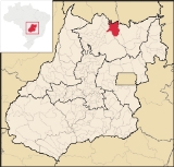
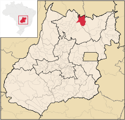
Minaçu
Encyclopedia
| Minaçu | |
|---|---|
| State | Goiás Goiás Goiás is a state of Brazil, located in the central part of the country. The name Goiás comes from the name of an indigenous community... |
| Area: | 2,860.7 km² |
| Population: | 31,041 (IBGE 2007) |
| Elevation: | 351m above sea level |
| Postcode (CEP): | 76450-000 |
| Became a city: | 1976 |
| Distance to Goiânia Goiânia -Climate:The city has a tropical wet and dry climate with an average temperature of . There's a wet season, from October to April, and a dry one, from May to September. Annual rainfall is around 1,520 mm.... : |
513 km. |
| IBGE statistical microregion: | Porangatu Microregion Porangatu Microregion The Porangatu Microregion is a statistical region created by IBGE in north-central Goiás state, Brazil. The most important city is Porangatu... |
| Website: | n/a |
City
A city is a relatively large and permanent settlement. Although there is no agreement on how a city is distinguished from a town within general English language meanings, many cities have a particular administrative, legal, or historical status based on local law.For example, in the U.S...
and municipality
Municipality
A municipality is essentially an urban administrative division having corporate status and usually powers of self-government. It can also be used to mean the governing body of a municipality. A municipality is a general-purpose administrative subdivision, as opposed to a special-purpose district...
in the north of the state of Goiás
Goiás
Goiás is a state of Brazil, located in the central part of the country. The name Goiás comes from the name of an indigenous community...
, Brazil
Brazil
Brazil , officially the Federative Republic of Brazil , is the largest country in South America. It is the world's fifth largest country, both by geographical area and by population with over 192 million people...
. There is a large asbestos mine in the municipality.
Location and climate
It is located on the shores of the artificial lake, Cana Brava, created after a dam was constructed on the Tocantins RiverTocantins River
The Tocantins is a river in Brazil, the central fluvial artery of the country. In the Tupi language, its name means "toucan's beak" . It runs from south to north for about 2,640 km. It is not really a branch of the Amazon River, although usually so considered, since its waters flow into the...
. This important river, a tributary of the Amazon, flows out of the lake in a northerly direction. The distance to the state capital, Goiânia, is 513 km. A paved road links Minaçu with the important Belém-Brasília highway (BR 153) and the cities of the more populated southern region of the state.
The climate is tropical humid with two well defined seasons (rainy and dry. The average annual temperature is 26.6 °C.
Demographic information
The population density was 10.85 inhabitants/km² in 2007. The population has increased gradually since 1980 when it was 28,371. The rural population has diminished from 9,762 in 1980 to 4,404 in 2007. From 1996 to 2007 the population decreased -1.24.%. In recent years the population has been decreasing with the gradual phasing out of the mines and the completion of the hydroelectric power plant.Economy
The economy is based on small industry, mining, and the hydroelectric plant of Cana Brava. This supplies the south of GoiásGoiás
Goiás is a state of Brazil, located in the central part of the country. The name Goiás comes from the name of an indigenous community...
with energy and contributes needed taxes to the municipality. Agriculture is limited due to the irregular terrain marked by the Serra Dourada
Serra Dourada
Serra Dourada is a municipality in the Brazilian state of Bahia....
mountains.
Asbestos mine
Minaçu is the seat of one of the world's largest chrysotile asbestos mines. The Cana Brava mine, located on the left bank of the Tocantins River, occupies a total area of 45 kmª. Asbestos has made Minaçu one of the richest municipalities in the state of Goiás. The industrial zone has capacity to produce ten percent of all the chrysotile asbestos fiber sold in the world. It is the largest mine in Brazil and the third in the world, after mines in Russia and Canada. On the Seplan Index of Economic Development (2000) Minaçu ranked 13 out of 146 municipalities in the state. See SeplanIn 2007 there were 43 industrial units and 259 retail units. There were 3 bank branches: Banco do Brasil S.A., Banco Itaú S.A., and BRADESCO S.A. The main sectors employing the population were: industry--159 workers--and commerce--838 workers.
In 2006 there were 107,300 head of cattle, of which 9,600 were dairy cows. The main agricultural products in planted area were rice and corn. There was modest production of banana, sugarcane, and manioc. In 2006 there were 1,478 farms with a total area of 196,000 hectares, of which 5,597 were cropland and 12,128 were pasture. Approximately 4,300 people were connected to agriculture. (IBGE 2006)
Health and education
In 2003 there were 2 hospitals in the city with 53 beds. There were also 12 walk-in health clinics. There were 45 doctors, 6 nurses and 8 dentists. The infant mortality rate was 20.88 for every 1,000 live births in 2000.In 2005 the school system had 27 schools, 266 classrooms, 577 teachers, and 11,437 students. Higher education was represented by a campus of the State University of Goiás--Unidade Universitária da UEG. The adult literacy rate was 86.9% in 2000.
- MHDI: 0.750
- State ranking: 78 (out of 242 municipalities)
- National ranking: 1,894 (out of 5,507 municipalities)
On the Seplan Index of Social Development Minaçu ranked 79 out of 146 municipalities in 2001. See Seplan