

Transportation of California
Encyclopedia
California
California is a state located on the West Coast of the United States. It is by far the most populous U.S. state, and the third-largest by land area...
's transportation system is complex and dynamic. Although known for its car culture and extensive network of freeways and roads, the state also has a vast array of rail, sea, and air transport. However, in a state with over 37 million people, rapid population expansion, and diverse terrain and weather, that system is under pressure to stay ahead of population growth and transportation needs.
Overview
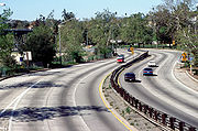
Traffic congestion
Traffic congestion is a condition on road networks that occurs as use increases, and is characterized by slower speeds, longer trip times, and increased vehicular queueing. The most common example is the physical use of roads by vehicles. When traffic demand is great enough that the interaction...
. California has some of the worst roads in the United States.
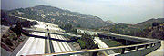
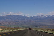
California's vast terrain is connected by an extensive system of freeways, expressway
Limited-access road
A limited-access road known by various terms worldwide, including limited-access highway, dual-carriageway and expressway, is a highway or arterial road for high-speed traffic which has many or most characteristics of a controlled-access highway , including limited or no access to adjacent...
s, and highway
Highway
A highway is any public road. In American English, the term is common and almost always designates major roads. In British English, the term designates any road open to the public. Any interconnected set of highways can be variously referred to as a "highway system", a "highway network", or a...
s, all maintained by the California Department of Transportation
California Department of Transportation
The California Department of Transportation is a government department in the U.S. state of California. Its mission is to improve mobility across the state. It manages the state highway system and is actively involved with public transportation systems throughout the state...
(Caltrans) and patrolled by the California Highway Patrol
California Highway Patrol
The California Highway Patrol is a law enforcement agency of the U.S. state of California. The CHP has patrol jurisdiction over all California highways and also acts as the state police....
(CHP), except for the numbered expressways in Santa Clara County
Santa Clara County, California
Santa Clara County is a county located at the southern end of the San Francisco Bay Area in the U.S. state of California. As of 2010 it had a population of 1,781,642. The county seat is San Jose. The highly urbanized Santa Clara Valley within Santa Clara County is also known as Silicon Valley...
which were built and maintained by the county itself. The main north-south arteries are U.S. Route 101, which runs close to the coast from the state's border with Oregon
Oregon
Oregon is a state in the Pacific Northwest region of the United States. It is located on the Pacific coast, with Washington to the north, California to the south, Nevada on the southeast and Idaho to the east. The Columbia and Snake rivers delineate much of Oregon's northern and eastern...
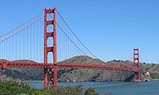
, across the Golden Gate Bridge
Golden Gate Bridge
The Golden Gate Bridge is a suspension bridge spanning the Golden Gate, the opening of the San Francisco Bay into the Pacific Ocean. As part of both U.S. Route 101 and California State Route 1, the structure links the city of San Francisco, on the northern tip of the San Francisco Peninsula, to...
, to downtown Los Angeles
Los Ángeles
Los Ángeles is the capital of the province of Biobío, in the commune of the same name, in Region VIII , in the center-south of Chile. It is located between the Laja and Biobío rivers. The population is 123,445 inhabitants...
, and Interstate 5, which runs inland from the Oregon to Mexico
Mexico
The United Mexican States , commonly known as Mexico , is a federal constitutional republic in North America. It is bordered on the north by the United States; on the south and west by the Pacific Ocean; on the southeast by Guatemala, Belize, and the Caribbean Sea; and on the east by the Gulf of...
borders, bisecting the entire state. In addition, a major north-south artery is State Highway 99
California State Route 99
California State Route 99 , commonly known as Highway 99 or, simply, as 99 , is a north–south state highway in the U.S. state of California, stretching almost the entire length of the Central Valley...
, which runs from near Red Bluff
Red Bluff, California
Red Bluff is a city in and the county seat of Tehama County, California, United States. The population was 14,076 at the 2010 census, up from 13,147 at the 2000 census....
to near Bakersfield
Bakersfield, California
Bakersfield is a city near the southern end of the San Joaquin Valley in Kern County, California. It is roughly equidistant between Fresno and Los Angeles, to the north and south respectively....
; Highway 99 is largely parallel to Interstate 5, and connects the Central Valley cities not connected by Interstate 5.
Perhaps it is a testament to California's sheer size that although it has one of the most extensive freeway systems in the United States, it contains many of the largest cities in the United States not served by an Interstate Highway, including the two largest, Fresno
Fresno, California
Fresno is a city in central California, United States, the county seat of Fresno County. As of the 2010 census, the city's population was 510,365, making it the fifth largest city in California, the largest inland city in California, and the 34th largest in the nation...
(pop. 471,479) and Bakersfield
Bakersfield, California
Bakersfield is a city near the southern end of the San Joaquin Valley in Kern County, California. It is roughly equidistant between Fresno and Los Angeles, to the north and south respectively....
(pop. 247,057). These cities, along with Modesto
Modesto, California
Modesto is a city in, and is the county seat of, Stanislaus County, California. With a population of approximately 201,165 at the 2010 census, Modesto ranks as the 18th largest city in the state of California....
and Visalia
Visalia, California
Visalia is a Central California city situated in the heart of California’s agricultural San Joaquin Valley, approximately southeast of San Francisco and north of Los Angeles...
, are passed by as Interstate 5 veers west to avoid the congestion of the populated eastern side of the Central Valley as it connects Sacramento
Sacramento
Sacramento is the capital of the state of California, in the United States of America.Sacramento may also refer to:- United States :*Sacramento County, California*Sacramento, Kentucky*Sacramento – San Joaquin River Delta...
and Los Angeles
Los Ángeles
Los Ángeles is the capital of the province of Biobío, in the commune of the same name, in Region VIII , in the center-south of Chile. It is located between the Laja and Biobío rivers. The population is 123,445 inhabitants...
.
Almost all California highways are non-toll roads. However, there are four toll roads in Southern California
Southern California
Southern California is a megaregion, or megapolitan area, in the southern area of the U.S. state of California. Large urban areas include Greater Los Angeles and Greater San Diego. The urban area stretches along the coast from Ventura through the Southland and Inland Empire to San Diego...
, and eight toll bridges in the San Francisco Bay Area
San Francisco Bay Area
The San Francisco Bay Area, commonly known as the Bay Area, is a populated region that surrounds the San Francisco and San Pablo estuaries in Northern California. The region encompasses metropolitan areas of San Francisco, Oakland, and San Jose, along with smaller urban and rural areas...
. These toll facilities, along with several high occupancy toll lanes
High occupancy/toll and express toll lanes
High occupancy/toll lanes is a road pricing scheme that gives motorists in single-occupant vehicles access to high-occupancy vehicle lanes . Sometimes, entire roads are designated for the use of HOVs. Tolls are collected either by manned toll booths, automatic number plate recognition, or...
, use the statewide electronic toll collection system known as FasTrak
FasTrak
FasTrak is the electronic toll collection system used in the state of California in the United States. The system is used statewide on all of the toll roads, toll bridges, and high occupancy/toll and express toll lanes along the California Freeway and Expressway System.As with other ETC systems,...
. The state's most famous highway bridge is the Golden Gate Bridge
Golden Gate Bridge
The Golden Gate Bridge is a suspension bridge spanning the Golden Gate, the opening of the San Francisco Bay into the Pacific Ocean. As part of both U.S. Route 101 and California State Route 1, the structure links the city of San Francisco, on the northern tip of the San Francisco Peninsula, to...
, though there are a number of major non-toll bridges elsewhere in Sacramento
Sacramento
Sacramento is the capital of the state of California, in the United States of America.Sacramento may also refer to:- United States :*Sacramento County, California*Sacramento, Kentucky*Sacramento – San Joaquin River Delta...
, Los Angeles, and San Diego.
The state's freeway network has expanded every since the Arroyo Seco Parkway, the first freeway in the Western United States, connecting Los Angeles and Pasadena
Pasadena, California
Pasadena is a city in Los Angeles County, California, United States. Although famous for hosting the annual Rose Bowl football game and Tournament of Roses Parade, Pasadena is the home to many scientific and cultural institutions, including the California Institute of Technology , the Jet...
, opened in 1940. However, the state is not immune to freeway revolts, such as those that have prevented a freeway in San Francisco between the Golden Gate Bridge and the San Francisco – Oakland Bay Bridge, and an expansion of Interstate 710
Interstate 710
Interstate 710 is a major north–south interstate freeway running for 23 miles through Los Angeles County, California...
through South Pasadena
South Pasadena, California
South Pasadena is a city in Los Angeles County, California, United States. As of the 2010 census, it had a population of 25,619, up from 24,292 at the 2000 census. It is located in in the West San Gabriel Valley...
.
In March 2011, California ranked as second best state in the American State Litter Scorecard (after Washington State), for overall effectiveness and quality of its public space cleanliness from state and related litter/debris removal efforts.
Interstate Highways
.svg.png) Interstate 5Interstate 5Interstate 5 is the main Interstate Highway on the West Coast of the United States, running largely parallel to the Pacific Ocean coastline from Canada to Mexico . It serves some of the largest cities on the U.S...
Interstate 5Interstate 5Interstate 5 is the main Interstate Highway on the West Coast of the United States, running largely parallel to the Pacific Ocean coastline from Canada to Mexico . It serves some of the largest cities on the U.S...
: Bisects the state from the Mexican border to OregonOregonOregon is a state in the Pacific Northwest region of the United States. It is located on the Pacific coast, with Washington to the north, California to the south, Nevada on the southeast and Idaho to the east. The Columbia and Snake rivers delineate much of Oregon's northern and eastern...
, linking the major cities of San Diego, Santa AnaSanta Ana, CaliforniaSanta Ana is the county seat and second most populous city in Orange County, California, and with a population of 324,528 at the 2010 census, Santa Ana is the 57th-most populous city in the United States....
, Los AngelesLos ÁngelesLos Ángeles is the capital of the province of Biobío, in the commune of the same name, in Region VIII , in the center-south of Chile. It is located between the Laja and Biobío rivers. The population is 123,445 inhabitants...
, StocktonStockton, CaliforniaStockton, California, the seat of San Joaquin County, is the fourth-largest city in the Central Valley of the U.S. state of California. With a population of 291,707 at the 2010 census, Stockton ranks as this state's 13th largest city...
, SacramentoSacramento, CaliforniaSacramento is the capital city of the U.S. state of California and the county seat of Sacramento County. It is located at the confluence of the Sacramento River and the American River in the northern portion of California's expansive Central Valley. With a population of 466,488 at the 2010 census,...
, and ReddingRedding, CaliforniaRedding is a city in far-Northern California. It is the county seat of Shasta County, California, USA. With a population of 89,861, according to the 2010 Census...
..svg.png) Interstate 8Interstate 8Interstate 8 is an Interstate Highway in the southwestern United States. It runs from the southern edge of Mission Bay at Sunset Cliffs Blvd, in San Diego, California, almost at the Pacific Ocean, to the junction with Interstate 10, just southeast of Casa Grande, Arizona...
Interstate 8Interstate 8Interstate 8 is an Interstate Highway in the southwestern United States. It runs from the southern edge of Mission Bay at Sunset Cliffs Blvd, in San Diego, California, almost at the Pacific Ocean, to the junction with Interstate 10, just southeast of Casa Grande, Arizona...
: Runs east from San Diego to the Imperial Valley before crossing into ArizonaArizonaArizona ; is a state located in the southwestern region of the United States. It is also part of the western United States and the mountain west. The capital and largest city is Phoenix...
west of YumaYuma, ArizonaYuma is a city in and the county seat of Yuma County, Arizona, United States. It is located in the southwestern corner of the state, and the population of the city was 77,515 at the 2000 census, with a 2008 Census Bureau estimated population of 90,041....
..svg.png) Interstate 10Interstate 10Interstate 10 is the fourth-longest Interstate Highway in the United States, after I-90, I-80, and I-40. It is the southernmost east–west, coast-to-coast Interstate Highway, although I-4 and I-8 are further south. It stretches from the Pacific Ocean at State Route 1 in Santa Monica,...
Interstate 10Interstate 10Interstate 10 is the fourth-longest Interstate Highway in the United States, after I-90, I-80, and I-40. It is the southernmost east–west, coast-to-coast Interstate Highway, although I-4 and I-8 are further south. It stretches from the Pacific Ocean at State Route 1 in Santa Monica,...
: Heads east from Santa MonicaSanta Monica, CaliforniaSanta Monica is a beachfront city in western Los Angeles County, California, US. Situated on Santa Monica Bay, it is surrounded on three sides by the city of Los Angeles — Pacific Palisades on the northwest, Brentwood on the north, West Los Angeles on the northeast, Mar Vista on the east, and...
through Los Angeles, San BernardinoSan Bernardino, CaliforniaSan Bernardino is a city located in the Riverside-San Bernardino metropolitan area , and serves as the county seat of San Bernardino County, California, United States...
, and the Coachella ValleyCoachella ValleyCoachella Valley is a large valley landform in Southern California. The valley extends for approximately 45 miles in Riverside County southeast from the San Bernardino Mountains to the saltwater Salton Sea, the largest lake in California...
to Arizona..svg.png) Interstate 15Interstate 15Interstate 15 is the fourth-longest north–south Interstate Highway in the United States, traveling through the states of California, Nevada, Arizona, Utah, Idaho, and Montana from San Diego to the Canadian border...
Interstate 15Interstate 15Interstate 15 is the fourth-longest north–south Interstate Highway in the United States, traveling through the states of California, Nevada, Arizona, Utah, Idaho, and Montana from San Diego to the Canadian border...
: Originating from San Diego, serves as the major route from Southern California to Las Vegas, NevadaLas Vegas, NevadaLas Vegas is the most populous city in the U.S. state of Nevada and is also the county seat of Clark County, Nevada. Las Vegas is an internationally renowned major resort city for gambling, shopping, and fine dining. The city bills itself as The Entertainment Capital of the World, and is famous...
..svg.png) Interstate 40Interstate 40Interstate 40 is the third-longest major east–west Interstate Highway in the United States, after I-90 and I-80. Its western end is at Interstate 15 in Barstow, California; its eastern end is at a concurrency of U.S. Route 117 and North Carolina Highway 132 in Wilmington, North Carolina...
Interstate 40Interstate 40Interstate 40 is the third-longest major east–west Interstate Highway in the United States, after I-90 and I-80. Its western end is at Interstate 15 in Barstow, California; its eastern end is at a concurrency of U.S. Route 117 and North Carolina Highway 132 in Wilmington, North Carolina...
: Heads east from BarstowBarstow, CaliforniaBarstow is a city in San Bernardino County, California, United States. The population was 22,639 at the 2010 census, up from 21,119 at the 2000 census. Barstow is located north of San Bernardino....
across the Mojave DesertMojave DesertThe Mojave Desert occupies a significant portion of southeastern California and smaller parts of central California, southern Nevada, southwestern Utah and northwestern Arizona, in the United States...
to NeedlesNeedles, CaliforniaNeedles is a city located in the Mojave Desert on the western banks of the Colorado River in San Bernardino County, California. It is located in the Mohave Valley, which straddles the California–Arizona border. The city is accessible via Interstate 40 and U.S. Route 95...
before entering into Arizona..svg.png) Interstate 80Interstate 80Interstate 80 is the second-longest Interstate Highway in the United States, following Interstate 90. It is a transcontinental artery running from downtown San Francisco, California to Teaneck, New Jersey in the New York City Metropolitan Area...
Interstate 80Interstate 80Interstate 80 is the second-longest Interstate Highway in the United States, following Interstate 90. It is a transcontinental artery running from downtown San Francisco, California to Teaneck, New Jersey in the New York City Metropolitan Area...
: Runs northwest from San Francisco through SacramentoSacramento, CaliforniaSacramento is the capital city of the U.S. state of California and the county seat of Sacramento County. It is located at the confluence of the Sacramento River and the American River in the northern portion of California's expansive Central Valley. With a population of 466,488 at the 2010 census,...
and over the Sierra Nevada mountain range before crossing into NevadaNevadaNevada is a state in the western, mountain west, and southwestern regions of the United States. With an area of and a population of about 2.7 million, it is the 7th-largest and 35th-most populous state. Over two-thirds of Nevada's people live in the Las Vegas metropolitan area, which contains its...
west of the RenoReno, NevadaReno is the county seat of Washoe County, Nevada, United States. The city has a population of about 220,500 and is the most populous Nevada city outside of the Las Vegas metropolitan area...
.
A number of auxiliary (three-digit) Interstates are located in the Bay Area, Greater Los Angeles area, and San Diego.
U.S. Routes
United States Numbered Highways
The system of United States Numbered Highways is an integrated system of roads and highways in the United States numbered within a nationwide grid...
in California:
.svg.png) U.S. Route 6U.S. Route 6U.S. Route 6 , also called the Grand Army of the Republic Highway, a name that honors an American Civil War veterans association, is a main route of the U.S. Highway system, running east-northeast from Bishop, California to Provincetown, Massachusetts. Until 1964, it continued south from Bishop to...
U.S. Route 6U.S. Route 6U.S. Route 6 , also called the Grand Army of the Republic Highway, a name that honors an American Civil War veterans association, is a main route of the U.S. Highway system, running east-northeast from Bishop, California to Provincetown, Massachusetts. Until 1964, it continued south from Bishop to...
: Runs from BishopBishop, CaliforniaBishop is a city in Inyo County, California, United States. Though Bishop is the only city and the largest populated place in Inyo County, the county seat is Independence. Bishop is located near the northern end of the Owens Valley, at an elevation of 4147 feet . The population was 3,879 at the...
east to Central Nevada..svg.png) U.S. Route 50U.S. Route 50U.S. Route 50 is a major east–west route of the U.S. Highway system, stretching just over from Ocean City, Maryland on the Atlantic Ocean to West Sacramento, California. Until 1972, when it was replaced by Interstate Highways west of the Sacramento area, it extended to San Francisco, near...
U.S. Route 50U.S. Route 50U.S. Route 50 is a major east–west route of the U.S. Highway system, stretching just over from Ocean City, Maryland on the Atlantic Ocean to West Sacramento, California. Until 1972, when it was replaced by Interstate Highways west of the Sacramento area, it extended to San Francisco, near...
: Heads east from the Sacramento area through the South Lake TahoeSouth Lake Tahoe, CaliforniaSouth Lake Tahoe is the most populous city in El Dorado County, California, in the Sierra Nevada Mountains. The population was 21,403 at the 2010 census, down from 23,609 at the 2000 census...
area before crossing into Nevada en route to Carson CityCarson City, NevadaThe Consolidated Municipality of Carson City is the capital of the state of Nevada. The words Consolidated Municipality refer to a series of changes in 1969 which abolished Ormsby County and merged all the settlements contained within its borders into Carson City. Since that time Carson City has...
..svg.png) U.S. Route 95U.S. Route 95U.S. Route 95 is a north–south U.S. highway in the western United States. Unlike many other US highways, it has not seen deletion or replacement on most of its length by an encroaching Interstate highway corridor, due to its mostly rural course...
U.S. Route 95U.S. Route 95U.S. Route 95 is a north–south U.S. highway in the western United States. Unlike many other US highways, it has not seen deletion or replacement on most of its length by an encroaching Interstate highway corridor, due to its mostly rural course...
: Enters into California from Arizona through a concurrency with Interstate 10. US 95 then splits from I-10 in BlytheBlythe, CaliforniaBlythe is a city in Riverside County, California, United States, in the "Palo Verde Valley" of the Lower Colorado River Valley region, an agricultural area and part of the Colorado Desert along the Colorado River. Blythe was named after Thomas Blythe, a gold prospector who established primary...
, then runs north to NeedlesNeedles, CaliforniaNeedles is a city located in the Mojave Desert on the western banks of the Colorado River in San Bernardino County, California. It is located in the Mohave Valley, which straddles the California–Arizona border. The city is accessible via Interstate 40 and U.S. Route 95...
before crossing into Nevada en route to Las Vegas.svg.png) U.S. Route 97U.S. Route 97U.S. Route 97 is a major north–south United States highway in the western United States. It begins at a junction with Interstate 5 at Weed, California, and travels north, ending in Okanogan County, Washington, at the Canadian Border, across from Osoyoos, British Columbia, becoming British...
U.S. Route 97U.S. Route 97U.S. Route 97 is a major north–south United States highway in the western United States. It begins at a junction with Interstate 5 at Weed, California, and travels north, ending in Okanogan County, Washington, at the Canadian Border, across from Osoyoos, British Columbia, becoming British...
: Serves as the primary connection from the City of WeedWeed, CaliforniaWeed is a city located in Siskiyou County, California. As of the 2010 Census, the town had a total population of 2,967, down from 2,979 at the 2000 census. There are several unincorporated communities adjacent to, or just outside Weed proper. These include Edgewood, Carrick, Lake Shastina, Rancho...
to Klamath Falls, OregonKlamath Falls, OregonKlamath Falls is a city in Klamath County, Oregon, United States. Originally called Linkville when George Nurse founded the town in 1867, after the Link River on whose falls this city sat, although no falls currently exist; the name was changed to Klamath Falls in 1892...
..svg.png) U.S. Route 101U.S. Route 101U.S. Route 101, or U.S. Highway 101, is an important north–south U.S. highway that runs through the states of California, Oregon, and Washington, on the West Coast of the United States...
U.S. Route 101U.S. Route 101U.S. Route 101, or U.S. Highway 101, is an important north–south U.S. highway that runs through the states of California, Oregon, and Washington, on the West Coast of the United States...
: The primary north-south U.S. Highway in California, connecting Los Angeles with the Central Coast, the San Francisco Bay, and the North Coast..svg.png) U.S. Route 199U.S. Route 199U.S. Route 199 is a U.S. highway in the U.S. states of California and Oregon. The highway was established in 1926 as a spur of U.S. Route 99, which has since been replaced by Interstate 5. US 199 stretches from U.S. Route 101 near Crescent City, California northeast to Interstate 5 in Grants...
U.S. Route 199U.S. Route 199U.S. Route 199 is a U.S. highway in the U.S. states of California and Oregon. The highway was established in 1926 as a spur of U.S. Route 99, which has since been replaced by Interstate 5. US 199 stretches from U.S. Route 101 near Crescent City, California northeast to Interstate 5 in Grants...
: Serves as the primary connection from the Crescent CityCrescent City, CaliforniaCrescent City is the county seat and only incorporated city in Del Norte County, California. Named for the crescent-shaped stretch of sandy beach south of the city, Crescent City had a total population of 7,643 in the 2010 census, up from 4,006 in the 2000 census...
area to Grants Pass, OregonGrants Pass, Oregon-Rogue River:The Rogue River runs through Grants Pass.-Demographics:As of the census of 2000, there were 23,003 people, 9,376 households, and 5,925 families residing in the city. The population density was . There were 9,885 housing units at an average density of 1,303.3 per square mile . By 2008,...
..svg.png) U.S. Route 395U.S. Route 395U.S. Route 395 is a U.S. Route in the western United States. The southern terminus of the route is in the Mojave Desert at Interstate 15 near Hesperia. The northern terminus is at the Canadian border near Laurier, where the road becomes Highway 395 upon entering British Columbia. At one time, the...
U.S. Route 395U.S. Route 395U.S. Route 395 is a U.S. Route in the western United States. The southern terminus of the route is in the Mojave Desert at Interstate 15 near Hesperia. The northern terminus is at the Canadian border near Laurier, where the road becomes Highway 395 upon entering British Columbia. At one time, the...
: A major north-south route in the eastern areas of the state, connecting the Mojave DesertMojave DesertThe Mojave Desert occupies a significant portion of southeastern California and smaller parts of central California, southern Nevada, southwestern Utah and northwestern Arizona, in the United States...
with the Owens ValleyOwens ValleyOwens Valley is the arid valley of the Owens River in eastern California in the United States, to the east of the Sierra Nevada and west of the White Mountains and Inyo Mountains on the west edge of the Great Basin section...
and the Eastern Sierra Nevada. The route then clips into NevadaNevadaNevada is a state in the western, mountain west, and southwestern regions of the United States. With an area of and a population of about 2.7 million, it is the 7th-largest and 35th-most populous state. Over two-thirds of Nevada's people live in the Las Vegas metropolitan area, which contains its...
to pass through Carson City and Reno, before returning to California to serve the Honey LakeHoney LakeHoney Lake is an endorheic sink within the Honey Lake Valley located in northeastern California, near the Nevada border. Summer evaporation reduces the lake to a lower level of 12 km² and creates an alkali flat....
and Modoc PlateauModoc PlateauThe Modoc Plateau lies in the northeast corner of California as well as parts of Oregon and Nevada. It is a mile-high expanse of lava flows with cinder cones, juniper flats, pine forests, and seasonal lakes. The plateau is thought to have been formed approximately 25 million years ago...
areas.
State Routes
State highway
State highway, state road or state route can refer to one of three related concepts, two of them related to a state or provincial government in a country that is divided into states or provinces :#A...
s in California range from one-lane rural roads to full urban freeways. Each state highway is assigned a Route (officially State Highway Route) number in the Streets and Highways Code (Sections 300-635). However, the state is also currently relinquishing a number of non-freeway segments, especially in urban area
Urban area
An urban area is characterized by higher population density and vast human features in comparison to areas surrounding it. Urban areas may be cities, towns or conurbations, but the term is not commonly extended to rural settlements such as villages and hamlets.Urban areas are created and further...
s, and turning them over to local control.
Rail and bus travel
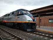
Amtrak California
Amtrak California is a brand name used by the Caltrans Division of Rail for all state-supported Amtrak rail routes within the U.S. State of California...
, which manages the three busiest intercity rail lines in the US outside the Northeast Corridor
Northeast Corridor
The Northeast Corridor is a fully electrified railway line owned primarily by Amtrak serving the Northeast megalopolis of the United States from Boston in the north, via New York to Washington, D.C. in the south, with branches serving other cities...
. The Capitol Corridor
Capitol Corridor
The Capitol Corridor is a 168-mile passenger train route operated by Amtrak in California. Because it is fully supported by the state, the Capitol Corridor operates under Amtrak California. It runs from the San Francisco Bay Area to Sacramento, roughly parallel to Interstate 80...
connects the San Francisco Bay Area to Sacramento. The Pacific Surfliner
Pacific Surfliner
The Pacific Surfliner is a Amtrak regional passenger train route serving communities on the coast of Southern California between San Diego and San Luis Obispo....
runs along the coast of Southern California from San Diego to San Luis Obispo. And the San Joaquin connects the major cities of the Central Valley.
National Amtrak lines include the California Zephyr
California Zephyr
The California Zephyr is a long passenger train route operated by Amtrak in the midwestern and western United States.It runs from Chicago, Illinois, in the east to Emeryville, California, in the west, passing through the states of Illinois, Iowa, Nebraska, Colorado, Utah, Nevada, and California...
from Emeryville
Emeryville, California
Emeryville is a small city located in Alameda County, California, in the United States. It is located in a corridor between the cities of Berkeley and Oakland, extending to the shore of San Francisco Bay. Its proximity to San Francisco, the Bay Bridge, the University of California, Berkeley, and...
to Chicago, Illinois; the Coast Starlight
Coast Starlight
The Coast Starlight is a passenger train operated by Amtrak on the West Coast of the United States. It runs from King Street Station in Seattle, Washington, to Union Station in Los Angeles, California. The train's name was formed as a merging of two of Southern Pacific's train names, the Coast...
from Los Angeles to Seattle, Washington
Seattle, Washington
Seattle is the county seat of King County, Washington. With 608,660 residents as of the 2010 Census, Seattle is the largest city in the Northwestern United States. The Seattle metropolitan area of about 3.4 million inhabitants is the 15th largest metropolitan area in the country...
; the Southwest Chief
Southwest Chief
The Southwest Chief is a passenger train operated by Amtrak on a 2256-mile BNSF route through the Midwestern and Southwestern United States. It runs from Chicago, Illinois, to Los Angeles, California, passing through Illinois, Iowa, Missouri, Kansas, Colorado, New Mexico, Arizona, and California...
and the Texas Eagle
Texas Eagle
The Texas Eagle is a 1306-mile passenger train route operated by Amtrak in the central and western United States. Trains run daily between Chicago, Illinois, and San Antonio, Texas, and continue to Los Angeles, California, 2728 miles total, three days a week...
from Los Angeles to Chicago; and the Sunset Limited
Sunset Limited
The Sunset Limited is a passenger train that for most of its history has run between New Orleans, Louisiana and Los Angeles, California, and that from early 1993 through late August 2005 also ran east of New Orleans to Jacksonville, Florida, making it during that time the only true transcontinental...
from Los Angeles to New Orleans, Louisiana
New Orleans, Louisiana
New Orleans is a major United States port and the largest city and metropolitan area in the state of Louisiana. The New Orleans metropolitan area has a population of 1,235,650 as of 2009, the 46th largest in the USA. The New Orleans – Metairie – Bogalusa combined statistical area has a population...
.
Integrated subway
Rapid transit
A rapid transit, underground, subway, elevated railway, metro or metropolitan railway system is an electric passenger railway in an urban area with a high capacity and frequency, and grade separation from other traffic. Rapid transit systems are typically located either in underground tunnels or on...
and light rail
Light rail
Light rail or light rail transit is a form of urban rail public transportation that generally has a lower capacity and lower speed than heavy rail and metro systems, but higher capacity and higher speed than traditional street-running tram systems...
networks are found in Los Angeles (Metro Rail) and San Francisco (BART
Bay Area Rapid Transit
Bay Area Rapid Transit is a rapid transit system serving the San Francisco Bay Area. The heavy-rail public transit and subway system connects San Francisco with cities in the East Bay and suburbs in northern San Mateo County. BART operates five lines on of track with 44 stations in four counties...
and MUNI Metro
San Francisco Municipal Railway
The San Francisco Municipal Railway is the public transit system for the city and county of San Francisco, California. In 2006, it served with an operating budget of about $700 million...
). Light rail systems are also found in San Jose (VTA
Santa Clara VTA Light-rail
VTA Light Rail is a light rail system serving San Jose, California and its suburbs in Silicon Valley. It is operated by the Santa Clara Valley Transportation Authority, or VTA, and consists of of standard-gauge track on two main lines and a spur line...
), San Diego (San Diego Trolley
San Diego Trolley
The San Diego Trolley is a light rail system operating in the metropolitan area of San Diego. The operator, San Diego Trolley, Inc. , is a subsidiary of the San Diego Metropolitan Transit System ...
), Sacramento (RT Light Rail
Sacramento Regional Transit District
The Sacramento Regional Transit District, commonly referred to as RT, is the agency responsible for public transportation in the Sacramento, California area. It was established on April 1, 1973, as a result of the acquisition of the Sacramento Transit Authority...
), and Northern San Diego County (Sprinter). Furthermore, commuter rail networks serve the San Francisco Bay Area (Caltrain
Caltrain
Caltrain is a California commuter rail line on the San Francisco Peninsula and in the Santa Clara Valley in the United States. The northern terminus of the rail line is in San Francisco, at 4th and King streets; its southern terminus is in Gilroy...
, ACE
Altamont Commuter Express
The Altamont Commuter Express is a regional rail service in California connecting Stockton with San Jose....
), Greater Los Angeles (Metrolink
Metrolink (Southern California)
Metrolink is a commuter rail system serving Los Angeles and the surrounding area of Southern California; it currently consists of six lines and 55 stations using of track....
), and San Diego County (Coaster
San Diego Coaster
The San Diego Coast Express Rail, or Coaster , is a commuter rail service that operates in the Central and Northern coastal regions of San Diego County, California, United States. The service is operated by TransitAmerica Services on contract with North County Transit District . The service has...
).
Nearly all counties operate bus lines, and many cities operate their own bus lines as well. Intercity bus travel is provided by Greyhound
Greyhound Lines
Greyhound Lines, Inc., based in Dallas, Texas, is an intercity common carrier of passengers by bus serving over 3,700 destinations in the United States, Canada and Mexico, operating under the well-known logo of a leaping greyhound. It was founded in Hibbing, Minnesota, USA, in 1914 and...
and Amtrak Thruway Motorcoach
Amtrak Thruway Motorcoach
Thruway Motorcoach is Amtrak's system of Amtrak-owned intercity coaches, locally contracted transit buses, through-ticketed local bus routes and taxi services to connect Amtrak train stations to areas not served by its railroads...
.
Air travel
Los Angeles International AirportLos Angeles International Airport
Los Angeles International Airport is the primary airport serving the Greater Los Angeles Area, the second-most populated metropolitan area in the United States. It is most often referred to by its IATA airport code LAX, with the letters pronounced individually...
and San Francisco International Airport
San Francisco International Airport
San Francisco International Airport is a major international airport located south of downtown San Francisco, California, United States, near the cities of Millbrae and San Bruno in unincorporated San Mateo County. It is often referred to as SFO...
are major hubs for trans-Pacific and transcontinental traffic. There are about a dozen important commercial airports and many more general aviation
General aviation
General aviation is one of the two categories of civil aviation. It refers to all flights other than military and scheduled airline and regular cargo flights, both private and commercial. General aviation flights range from gliders and powered parachutes to large, non-scheduled cargo jet flights...
airports throughout the state's 58 counties.
Seaports and harbors
California also has several important seaports. The giant seaport complex formed by the Port of Los AngelesPort of Los Angeles
The Port of Los Angeles, also called Los Angeles Harbor and WORLDPORT L.A, is a port complex that occupies of land and water along of waterfront. The port is located on San Pedro Bay in the San Pedro neighborhood of Los Angeles, approximately south of downtown...
and the Port of Long Beach
Port of Long Beach
The Port of Long Beach, also known as Long Beach’s Harbor Department, is the 2nd busiest container port in the USA. It adjoins the separate Port of Los Angeles. Acting as a major gateway for U.S.-Asian trade, the port occupies of land with of waterfront in the city of Long Beach, California...
in Southern California is the largest in the country and responsible for handling about a fourth of all container cargo traffic in the United States. The Port of Oakland
Port of Oakland
The Port of Oakland was the first major port on the Pacific Coast of the United States to build terminals for container ships. It is now the fifth busiest container port in the United States, behind Long Beach, Los Angeles, Newark, and Savannah...
handles most of the ocean containers passing through Northern California. The Port of Redwood City
Port of Redwood City
The Port of Redwood City is a marine freight terminal on the western side of the southern San Francisco Bay, on the West Coast of the United States. This marine terminal is situated within the city of Redwood City, California. The port was developed from a natural deepwater channel discovered in...
, the Port of Richmond, and the Port of San Diego
Port of San Diego
The Port of San Diego is a self-supporting public benefit corporation established in 1962 by an act of the California State Legislature. In 2007, The U.S. Bureau of Transportation Statistics ranked the Port of San Diego as one of America's top 30 U.S. containership ports bringing in nearly of...
are also significant ports for freight shipments. The Port of Sacramento
Port of Sacramento
The Port of Sacramento is an inland port located northeast of San Francisco, and is centered in one of the richest agricultural regions in the world. Cargo ships access the Port of Sacramento through San Francisco Bay and passage up the Sacramento River and the Sacramento deep water channel...
and the Port of Stockton
Port of Stockton
The Port of Stockton is a major inland deepwater port in Stockton, California located on the San Joaquin River before it joins the Sacramento River to empty into Suisun Bay, eighty miles inland. The port sits on about , and occupies an island in the San Joaquin Delta, and a portion of a...
are two major inland deepwater ports located in the Central Valley
California Central Valley
California's Central Valley is a large, flat valley that dominates the central portion of California. It is home to California's most productive agricultural efforts. The valley stretches approximately from northwest to southeast inland and parallel to the Pacific Ocean coast. Its northern half is...
, and thus only accessible via the Sacramento – San Joaquin River Delta.
A number of ferry services take commuters across San Francisco Bay from San Francisco to other communities in the Bay Area. Ferry service is also available for commuters crossing San Diego Bay
San Diego Bay
San Diego Bay is a natural harbor and deepwater port adjacent to San Diego, California. It is 12 mi/19 km long, 1 mi/1.6 km–3 mi/4.8 km wide...
from San Diego to Coronado
Coronado, California
Coronado, also known as Coronado Island, is an affluent resort city located in San Diego County, California, 5.2 miles from downtown San Diego. Its population was 24,697 at the 2010 census, up from 24,100 at the 2000 census. U.S. News and World Report lists Coronado as one of the most expensive...
. Passenger ferries also serve the offshore city of Avalon
Avalon, California
Avalon, or Avalon Bay, is the only incorporated city on Santa Catalina Island of the California Channel Islands, and the southernmost city in Los Angeles County. Besides Avalon, the only other center of population on the island is the small unincorporated town of Two Harbors...
on Santa Catalina Island
Santa Catalina Island, California
Santa Catalina Island, often called Catalina Island, or just Catalina, is a rocky island off the coast of the U.S. state of California. The island is long and across at its greatest width. The island is located about south-southwest of Los Angeles, California. The highest point on the island is...
. There is no regular vehicle ferry service to Avalon, however, since the city restricts the use of cars and trucks within its borders.
Numerous local harbors are spread out across the Pacific Coast, San Francisco Bay, San Diego Bay, and the Sacramento – San Joaquin River Delta for commercial fishing or recreational use.
Future issues
Because of the state's population growth, many settlements that were once small or rural communities about half a century ago, when much of California's transportation infrastructure was original designed, are now thriving suburbs and exurbs. According to a 2011 study by ForbesForbes
Forbes is an American publishing and media company. Its flagship publication, the Forbes magazine, is published biweekly. Its primary competitors in the national business magazine category are Fortune, which is also published biweekly, and Business Week...
, the cities of Lake Elsinore
Lake Elsinore, California
For the lake see Lake Elsinore.Lake Elsinore or LE is a city in western Riverside County, California. The population was 51,821 at the 2010 census...
, Los Banos
Los Banos, California
Los Banos is a city in Merced County, California, near the junction of State Route 152 and Interstate 5. Los Banos is located southwest of Merced, at an elevation of 118 feet . The population was 35,972 at the 2010 census, up from 25,869 at the 2000 census...
, Adelanto
Adelanto, California
Adelanto is a city in San Bernardino County, California about northwest of Victorville. The population was 31,765 at the 2010 census, up from 18,130 at the 2000 census.-Name:...
, and Brentwood
Brentwood, California
Brentwood is a city in Contra Costa County, California, United States. It is located in the East Bay region of the San Francisco Bay Area. The population is 51,481 as of 2010....
were ranked as the top four longest commutes in the country. A regularly recurring issue in California politics is whether the state should continue to aggressively expand its freeway network or concentrate on improving mass transit networks in urban areas.
The California High Speed Rail Authority was created in 1996 by the state to implement an extensive 700 mile (1127 km) rail system. Voters approved Proposition 1A
California Proposition 1A (2008)
Proposition 1A is a law that was approved by California voters in the November, 2008 state elections. It was a ballot proposition and bond measure, that allocated funds for the California High-Speed Rail Authority...
in November 2008, approving a $9 billion state bond. The system would provide a TGV
TGV
The TGV is France's high-speed rail service, currently operated by SNCF Voyages, the long-distance rail branch of SNCF, the French national rail operator....
-style high-speed link between the state's four major metropolitan areas, and would allow travel between Los Angeles' Union Station
Union Station (Los Angeles)
Los Angeles Union Station is the main railway station in Los Angeles, California. The station has rail services by Amtrak and Amtrak California and Metrolink; light rail/subways are the Metro Rail Red Line, Purple Line, Gold Line. Bus rapid transport runs on the Silver Line...
and the San Francisco Transbay Terminal
San Francisco Transbay Terminal
San Francisco Transbay Transit Terminal, or simply Transbay Terminal, was a transportation complex in San Francisco, California, USA, located roughly in the center of the rectangle bounded north–south by Mission Street and Howard Street, and east–west by Beale Street and 2nd Street...
in two and a half hours.
See also
- Plug-in hybrids in CaliforniaPlug-in hybrids in CaliforniaCalifornia is a main territory in the world promoting plug-in hybrids.- CalCars :CalCars is a charitable, non-profit organization founded in 2002 to promote plug-in hybrid electric vehicles as a key to addressing global warming both nationally and internationally...
Transportation by region
- Transportation in the Inland Empire
- Transportation in Los Angeles
- Transportation in San Diego County
- Transportation in the San Francisco Bay AreaTransportation in the San Francisco Bay Area-Airports:The following airports are served by commercial airlines. In addition there are many general aviation airports in the region.*San Francisco International Airport...