
Sierra Highway
Encyclopedia
Sierra Highway or El Camino Sierra is a road in Southern California
, United States
. El Camino Sierra refers to the full length of a trail formed in the 19th century, rebuilt as highways in the early 20th century, that ran from Los Angeles
to Lake Tahoe
following parts of modern State Route 14
, U.S. Route 395
and State Route 89
. Two portions of this road are currently signed as Sierra Highway. The first is an old alignment of SR 14/U.S. Route 6
from Los Angeles to Mojave
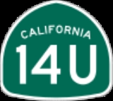
. This road is also signed with the unusual designation of State Route 14U through the city of Santa Clarita
. The second part signed as Sierra Highway is a portion of US 395 in Bishop
.
Traversing the extremes of California, from the Mojave Desert
to the Sierra Nevada
, El Camino Sierra has been advertised to the world as a highway to showcase the natural beauty of California as far back as 1910. Though most of Sierra Highway was bypassed in the early 1970s with freeways, the road is still well known. The portion through the San Gabriel Mountains
is noted as the primary filming location for the film Duel.
 El Camino Sierra connects Los Angeles
with Lake Tahoe
along the eastern edge of California, serving the counties of Los Angeles
, Kern
, Inyo
, Mono
, Alpine
and El Dorado
. The highway exists as a roadway now called Sierra Highway from Los Angeles to Mojave
. North of Mojave, El Camino Sierra is better known by the numbered designations in current use. While traversing the state, the highway crosses several mountain pass
es. The highway crests the San Gabriel Mountains
via Soledad Pass. While in the Sierra Nevada
the highway crosses Sherwin Summit
, Deadman Summit
, Conway Summit
, Devil's Gate Pass
, Monitor Pass
and Luther Pass
.
. This junction was historically the intersection of U.S. Route 99 and U.S. Route 6
. It is located adjacent to the intersection of the replacement freeways, the Newhall Pass interchange
of Interstate 5
and State Route 14
.
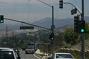
The highway serves as one of the main thoroughfares of Santa Clarita
. Through the city, Route 14 was moved to a freeway alignment in 1971; however, the process to decommission the old alignment of Route 14 is not complete. As a result, this portion is signed California State Route 14U, the U signifying "un-relinquished". While formal specifications for Route 14U are not published on Caltrans logs, SR 14U is at least 7.33 miles (11.8 km) long, as highway bridge maintenance logs list bridges related to SR 14U from postmile 24.28 (bridge carrying the new Route 14 over the old) north to postmile 31.61 (flyover ramp from Route 14 over 14U to a street named Via Princessa).
 Sierra Highway, modern Route 14, and a main line of the Union Pacific Railroad
all cross the San Gabriel Mountains
, cresting the mountains at Soledad Pass (elevation 3179 feet (969 m)). The three transportation arteries use different paths up the mountains, separating at Santa Clarita and converging near Acton
. Sierra Highway uses Mint Canyon, the railroad uses Soledad Canyon
and the modern Route 14 is a hybrid route using the ridges and side canyons between the two older routes. These canyons are formed by the Santa Clara River
and its tributaries.
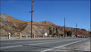
Upon exiting the mountains, Sierra Highway enters the Antelope Valley
and serves as one of the main streets of Palmdale
, Lancaster
, and Rosamond
. The highway runs parallel to the modern Route 14 and the railroad. Just shy of Mojave
the freeway portion of Route 14 ends, and Sierra Highway shares the active routing of SR 14 passing through downtown Mojave.
 North of Mojave the alignments of State Routes 14 and 89
, and U.S. Route 395
have not significantly changed since first paved, and are called El Camino Sierra. Significant portions have been upgraded to a divided highway
; however, most of the upgrades used the same alignment as the old two lane road. The highway cuts across Red Rock Canyon State Park
to follow a series of valleys along the crest of the Sierra Nevada
. While traversing the Owens Valley
, the Sierra Highway passes Mount Whitney
, the highest point in the contiguous United States
, 10000 feet (3,048 m) above the highway. As of 2009, the only other signed section of Sierra Highway is a portion of U.S. 395 past the separation with U.S. 6 in Bishop
.
U.S. 395 was rebuilt on a new alignment on the ascent to Sherwin Summit
and around Crowley Lake
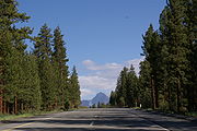
. Unlike the highway relocation in southern California, the old alignments have been renamed, now called Lower Rock Creek Road, Old Sherwin Grade, and Crowley Creek Road; not Sierra Highway. From here to Lake Tahoe
, the highway crosses mountainous terrain inside the Sierra Nevada, giving the highway its name. While in the Sierra Nevada, the road passes by attractions such as Mammoth Mountain
, Yosemite National Park
and Mono Lake
. El Camino Sierra separates from U.S. 395, just prior to the Nevada
state line at Topaz Lake
, following SR 89. This is the only portion of the route not used year-round, as Caltrans closes Route 89 over Monitor Pass
during winter months. Motorists destined for Lake Tahoe during the winter closures can continue along US 395 into Nevada
, and return to California via Nevada State Route 88
or Nevada State Route 207
.
in 1826. The trail was in common use by prospectors
passing through the area because of the California Gold Rush
and Comstock Lode
. While still mostly a dirt road, several people began promoting El Camino Sierra as a scenic route. In 1910, the Los Angeles Times
announced that Governor Gillet
had announced funding to construct a new road to connect El Camino Real
with Yosemite National Park
. When finished, a new "wonderful circuit" route would be complete and El Camino Sierra would become "one of the most beautiful scenic routes in the world." In 1912, the Southern Pacific Railroad
published an article called "Two Mules and a Motorist" in which the author's trip down El Camino Sierra was detailed, promoting the trail as a scenic side trip, via pack mules, from its rail lines. In 1915, the California Teachers Association distributed a promotional book to the annual convention of the National Education Association
. This book contained an article that sung the praises of this "soon-to-be-world-famous highway" called El Camino Sierra. While noting that it was still mostly an unimproved trail, the article assured the readers that county and state officials were working frantically to upgrade the route and, with the aid of convict labor, this would soon be a "boulevard the entire distance from Los Angeles to Lake Tahoe." The article concluded by stating El Camino Sierra was "a highway with a hundred by-ways, each by-way with a hundred wonders". The article also implored the state legislature to extend El Camino Sierra to Truckee
, Quincy
and Susanville
using a route similar to modern State Route 89
, SR 70
returning to US 395
.
By 1918, El Camino Sierra had been included in the Blue Book, an early road atlas of the United States. The Los Angeles Times declared El Camino Sierra complete on Feb 19, 1931, announcing that the portion from Mojave to Owens Valley
was now paved, and would be dedicated the following Sunday.
 During the 1930s, two U.S. Highways, both formed in 1926, were extended into California using El Camino Sierra. The southern terminus of U.S. 395 was extended from Spokane, Washington
to San Diego, using El Camino Sierra from near what is now Topaz Lake
to Inyokern
, by 1935. By 1937, U.S. Route 6
was extended from Colorado
, mostly along the Midland Trail
, to Long Beach
using El Camino Sierra south of Bishop. As part of the 1964 state highway renumbering
US 6 was truncated to Bishop, and the southern portion of Sierra Highway was renumbered SR 14.
Though during the 1970s most of Sierra Highway was bypassed by freeways and expressways, the old two lane road remained a famous roadway. In 1971, Steven Spielberg
made his first feature length film, Duel, along Sierra Highway, near Acton
. The movie is about an unseen truck driver that stalks and attempts to kill an innocent motorist trapped in the truck's game. The film prominently shows the desert portions of Sierra Highway. With the film's status, one of the trucks used in the movie is still on the road and in the process of being restored. The current owner has driven the truck along Sierra Highway for nostalgia, enjoying the terrified looks he receives from passing motorists who recognize it. Other movies have since been filmed in the vicinity, including scenes of The Terminator
.
Southern California
Southern California is a megaregion, or megapolitan area, in the southern area of the U.S. state of California. Large urban areas include Greater Los Angeles and Greater San Diego. The urban area stretches along the coast from Ventura through the Southland and Inland Empire to San Diego...
, United States
United States
The United States of America is a federal constitutional republic comprising fifty states and a federal district...
. El Camino Sierra refers to the full length of a trail formed in the 19th century, rebuilt as highways in the early 20th century, that ran from Los Angeles
Los Ángeles
Los Ángeles is the capital of the province of Biobío, in the commune of the same name, in Region VIII , in the center-south of Chile. It is located between the Laja and Biobío rivers. The population is 123,445 inhabitants...
to Lake Tahoe
Lake Tahoe
Lake Tahoe is a large freshwater lake in the Sierra Nevada of the United States. At a surface elevation of , it is located along the border between California and Nevada, west of Carson City. Lake Tahoe is the largest alpine lake in North America. Its depth is , making it the USA's second-deepest...
following parts of modern State Route 14
California State Route 14
State Route 14 is a north–south state highway in the U.S. state of California, largely in the Mojave Desert. The southern portion of the highway is signed as the Antelope Valley Freeway. The route connects Interstate 5, or Golden State Freeway, near Santa Clarita and with U.S. Route 395 near...
, U.S. Route 395
U.S. Route 395 in California
In the U.S. state of California, U.S. Route 395 is a route which traverses from Interstate 15 near the southern city limits of Hesperia, north to the Oregon state line in Modoc County near Goose Lake...
and State Route 89
California State Route 89
State Route 89 is a California State Highway that travels in the north–south direction, and is the major thoroughfare for many mountain communities. It starts from U.S. Route 395 near Topaz Lake, winding its way up to the Monitor Pass, down to the Carson River, and up again over the Luther...
. Two portions of this road are currently signed as Sierra Highway. The first is an old alignment of SR 14/U.S. Route 6
U.S. Route 6 in California
U.S. Route 6, or US 6, is a transcontinental highway from the U.S. state of California to Massachusetts. In California, the highway lies in the eastern portion of the state from Bishop in the Owens Valley north to the Nevada state line in Esmeralda County...
from Los Angeles to Mojave
Mojave, California
Mojave is a census-designated place in Kern County, California, United States. Mojave is located east of Bakersfield, at an elevation of 2762 feet...
. This road is also signed with the unusual designation of State Route 14U through the city of Santa Clarita
Santa Clarita, California
Santa Clarita is the fourth largest city in Los Angeles County, California, United States and the twenty-fourth largest city in the state of California. The 2010 US Census reported the city's population grew 16.7% from the year 2000 to 176,320 residents. It is located about northwest of downtown...
. The second part signed as Sierra Highway is a portion of US 395 in Bishop
Bishop, California
Bishop is a city in Inyo County, California, United States. Though Bishop is the only city and the largest populated place in Inyo County, the county seat is Independence. Bishop is located near the northern end of the Owens Valley, at an elevation of 4147 feet . The population was 3,879 at the...
.
Traversing the extremes of California, from the Mojave Desert
Mojave Desert
The Mojave Desert occupies a significant portion of southeastern California and smaller parts of central California, southern Nevada, southwestern Utah and northwestern Arizona, in the United States...
to the Sierra Nevada
Sierra Nevada (US)
The Sierra Nevada is a mountain range in the U.S. states of California and Nevada, between the California Central Valley and the Basin and Range Province. The Sierra runs north-to-south, and is approximately across east-to-west...
, El Camino Sierra has been advertised to the world as a highway to showcase the natural beauty of California as far back as 1910. Though most of Sierra Highway was bypassed in the early 1970s with freeways, the road is still well known. The portion through the San Gabriel Mountains
San Gabriel Mountains
The San Gabriel Mountains Range is located in northern Los Angeles County and western San Bernardino County, California, United States. The mountain range lies between the Los Angeles Basin and the Mojave Desert, with Interstate 5 to the west and Interstate 15 to the east...
is noted as the primary filming location for the film Duel.
Route description
Los Ángeles
Los Ángeles is the capital of the province of Biobío, in the commune of the same name, in Region VIII , in the center-south of Chile. It is located between the Laja and Biobío rivers. The population is 123,445 inhabitants...
with Lake Tahoe
Lake Tahoe
Lake Tahoe is a large freshwater lake in the Sierra Nevada of the United States. At a surface elevation of , it is located along the border between California and Nevada, west of Carson City. Lake Tahoe is the largest alpine lake in North America. Its depth is , making it the USA's second-deepest...
along the eastern edge of California, serving the counties of Los Angeles
Los Angeles County, California
Los Angeles County is a county in the U.S. state of California. As of 2010 U.S. Census, the county had a population of 9,818,605, making it the most populous county in the United States. Los Angeles County alone is more populous than 42 individual U.S. states...
, Kern
Kern County, California
Spreading across the southern end of the California Central Valley, Kern County is the fifth-largest county by population in California. Its economy is heavily linked to agriculture and to petroleum extraction, and there is a strong aviation and space presence. Politically, it has generally...
, Inyo
Inyo County, California
-National protected areas:* Death Valley National Park * Inyo National Forest * Manzanar National Historic Site-Major highways:* U.S. Route 6* U.S. Route 395* State Route 127* State Route 136* State Route 168* State Route 178...
, Mono
Mono County, California
Mono County is a county located in the east central portion of the U.S. state of California, to the east of the Sierra Nevada between Yosemite National Park and Nevada. As of the 2010 census, the population was 14,202, up from 12,853 at the 2000 census...
, Alpine
Alpine County, California
Alpine County is the smallest county, by population, in the U.S. state of California. As of 2010, it had a population of 1,175, all rural. There are no incorporated cities in the county. The county seat is Markleeville...
and El Dorado
El Dorado, California
El Dorado , not to be confused with the nearby El Dorado Hills, is an unincorporated community in El Dorado County, California. It is located southwest of Placerville, at an elevation of 1608 feet . The population was 4,096 at the 2000 census...
. The highway exists as a roadway now called Sierra Highway from Los Angeles to Mojave
Mojave, California
Mojave is a census-designated place in Kern County, California, United States. Mojave is located east of Bakersfield, at an elevation of 2762 feet...
. North of Mojave, El Camino Sierra is better known by the numbered designations in current use. While traversing the state, the highway crosses several mountain pass
Mountain pass
A mountain pass is a route through a mountain range or over a ridge. If following the lowest possible route, a pass is locally the highest point on that route...
es. The highway crests the San Gabriel Mountains
San Gabriel Mountains
The San Gabriel Mountains Range is located in northern Los Angeles County and western San Bernardino County, California, United States. The mountain range lies between the Los Angeles Basin and the Mojave Desert, with Interstate 5 to the west and Interstate 15 to the east...
via Soledad Pass. While in the Sierra Nevada
Sierra Nevada (US)
The Sierra Nevada is a mountain range in the U.S. states of California and Nevada, between the California Central Valley and the Basin and Range Province. The Sierra runs north-to-south, and is approximately across east-to-west...
the highway crosses Sherwin Summit
Sherwin Summit
Sherwin Summit is a mountain pass on U.S. Highway 395.It is located south of Tom's Place and Crowley Lake in the eastern part of the Sierra Nevada range. South of the summit, the road starts on its long 2,400 foot descent into the high Owens Valley. The Owens River generally follows the road...
, Deadman Summit
Deadman Summit
Deadman Summit is a mountain pass in the Sierra Nevada in Mono County, California. It crosses the northern rim of the Long Valley Caldera, connecting the northern end of the Owens River watershed with Mono Lake via U.S...
, Conway Summit
Conway Summit
Conway Summit is a mountain pass in Mono County, California. It is traversed by U.S. Highway 395, which connects Bridgeport and the East Walker River on the north side of the pass to Mono Lake and Lee Vining to the south. It marks the highest point on U.S...
, Devil's Gate Pass
Devil's Gate Pass
Devil's Gate Pass is a mountain pass in Mono County, California, traversed by U.S. Route 395. The pass is named for the Devils Gate, a granitic formation located west of the summit of the pass.-Location:...
, Monitor Pass
Monitor Pass
Monitor Pass is a high mountain pass in California in the Sierra Nevada southeast of Lake Tahoe. It connects the basins of the West Walker River and Carson River, and is traversed by State Route 89 near that highway's southern terminus at U.S...
and Luther Pass
Luther Pass
Luther Pass is a mountain pass in California in the Sierra Nevada, between the Carson River basin and Lake Tahoe. It is traversed by State Route 89 and lies on the boundary between Alpine County and El Dorado County...
.
Southern California
Sierra Highway begins at Tunnel Station near the north limit of the City of Los Angeles, where it intersects with San Fernando RoadSan Fernando Road
San Fernando Road is a major street in the city and county of Los Angeles. It starts off in Castaic as The Old Road, passing through Santa Clarita and the Newhall Pass, whereupon its intersection with Sierra Highway near the junction of the Golden State and the Antelope Valley Freeways, it...
. This junction was historically the intersection of U.S. Route 99 and U.S. Route 6
U.S. Route 6 in California
U.S. Route 6, or US 6, is a transcontinental highway from the U.S. state of California to Massachusetts. In California, the highway lies in the eastern portion of the state from Bishop in the Owens Valley north to the Nevada state line in Esmeralda County...
. It is located adjacent to the intersection of the replacement freeways, the Newhall Pass interchange
Newhall Pass interchange
The Newhall Pass Interchange is a highway interchange at Newhall Pass, north of Sylmar in Southern California, United States. It connects Interstate 5 with State Route 14 , and includes truck bypass roadways...
of Interstate 5
Interstate 5 in California
Interstate 5 is a major north–south route of the Interstate Highway System in the U.S. state of California. It begins at the Mexico – United States border at the San Ysidro crossing, goes north across the length of California and crosses into Oregon south of the Medford-Ashland metropolitan...
and State Route 14
California State Route 14
State Route 14 is a north–south state highway in the U.S. state of California, largely in the Mojave Desert. The southern portion of the highway is signed as the Antelope Valley Freeway. The route connects Interstate 5, or Golden State Freeway, near Santa Clarita and with U.S. Route 395 near...
.
The highway serves as one of the main thoroughfares of Santa Clarita
Santa Clarita, California
Santa Clarita is the fourth largest city in Los Angeles County, California, United States and the twenty-fourth largest city in the state of California. The 2010 US Census reported the city's population grew 16.7% from the year 2000 to 176,320 residents. It is located about northwest of downtown...
. Through the city, Route 14 was moved to a freeway alignment in 1971; however, the process to decommission the old alignment of Route 14 is not complete. As a result, this portion is signed California State Route 14U, the U signifying "un-relinquished". While formal specifications for Route 14U are not published on Caltrans logs, SR 14U is at least 7.33 miles (11.8 km) long, as highway bridge maintenance logs list bridges related to SR 14U from postmile 24.28 (bridge carrying the new Route 14 over the old) north to postmile 31.61 (flyover ramp from Route 14 over 14U to a street named Via Princessa).
Union Pacific Railroad
The Union Pacific Railroad , headquartered in Omaha, Nebraska, is the largest railroad network in the United States. James R. Young is president, CEO and Chairman....
all cross the San Gabriel Mountains
San Gabriel Mountains
The San Gabriel Mountains Range is located in northern Los Angeles County and western San Bernardino County, California, United States. The mountain range lies between the Los Angeles Basin and the Mojave Desert, with Interstate 5 to the west and Interstate 15 to the east...
, cresting the mountains at Soledad Pass (elevation 3179 feet (969 m)). The three transportation arteries use different paths up the mountains, separating at Santa Clarita and converging near Acton
Acton, California
Acton was founded in 1887 by gold miners who were working in the Red Rover Mine. It was named after Acton, Massachusetts by one of the miners. Two of the best-known gold mines located in Acton were the Red Rover mine and the Governors mine. Mining of gold, copper, and titanium ore continued into...
. Sierra Highway uses Mint Canyon, the railroad uses Soledad Canyon
Soledad Canyon
Soledad Canyon is a long narrow canyon / valley located in Los Angeles County, California between the cities of Palmdale and Santa Clarita. Soledad Canyon contains the localities of Vincent, Acton, Ravenna, Russ, and Agua Dulce....
and the modern Route 14 is a hybrid route using the ridges and side canyons between the two older routes. These canyons are formed by the Santa Clara River
Santa Clara River (California)
The Santa Clara River is approximately long, located in southern California in the United States. It drains an area of the coastal mountains north of Los Angeles. The Santa Clara is one of the largest river systems along the coast of Southern California and one of only a few remaining river...
and its tributaries.
Upon exiting the mountains, Sierra Highway enters the Antelope Valley
Antelope Valley
The Antelope Valley in California, United States, is located in northern Los Angeles County and the southeastern portion of Kern County, California, and constitutes the western tip of the Mojave Desert...
and serves as one of the main streets of Palmdale
Palmdale, California
Palmdale is a city located in the center of northern Los Angeles County, California, United States.Palmdale was the first community within the Antelope Valley to incorporate as a city on August 24, 1962; 47 years later, voters approved creating a charter city in November, 2009. Palmdale is...
, Lancaster
Lancaster, California
Lancaster is a charter city in northern Los Angeles County, in the high desert, near the Kern County line. Lancaster currently ranks as the 30th largest city in California, and the 148th largest city in the United States. Lancaster is the principal city within the Antelope Valley...
, and Rosamond
Rosamond, California
Rosamond is a census-designated place in Kern County, California, USA, north of Palmdale, in the Antelope Valley, the westernmost desert valley of the Mojave Desert. Rosamond is also south of Mojave, , and north of Lancaster at an elevation of 2342 feet...
. The highway runs parallel to the modern Route 14 and the railroad. Just shy of Mojave
Mojave, California
Mojave is a census-designated place in Kern County, California, United States. Mojave is located east of Bakersfield, at an elevation of 2762 feet...
the freeway portion of Route 14 ends, and Sierra Highway shares the active routing of SR 14 passing through downtown Mojave.
U.S. Route 395 and State Route 89
California State Route 89
State Route 89 is a California State Highway that travels in the north–south direction, and is the major thoroughfare for many mountain communities. It starts from U.S. Route 395 near Topaz Lake, winding its way up to the Monitor Pass, down to the Carson River, and up again over the Luther...
, and U.S. Route 395
U.S. Route 395 in California
In the U.S. state of California, U.S. Route 395 is a route which traverses from Interstate 15 near the southern city limits of Hesperia, north to the Oregon state line in Modoc County near Goose Lake...
have not significantly changed since first paved, and are called El Camino Sierra. Significant portions have been upgraded to a divided highway
Divided Highway
Divided Highway is a compilation album by American rock band The Doobie Brothers, released in 2003. . All tracks are taken from the albums Cycles and Brotherhood .-Track listing:...
; however, most of the upgrades used the same alignment as the old two lane road. The highway cuts across Red Rock Canyon State Park
Red Rock Canyon State Park (California)
Red Rock Canyon State Park features scenic desert cliffs, buttes and spectacular rock formations. The park is located where the southernmost tip of the Sierra Nevada converges with the El Paso Mountains....
to follow a series of valleys along the crest of the Sierra Nevada
Sierra Nevada (US)
The Sierra Nevada is a mountain range in the U.S. states of California and Nevada, between the California Central Valley and the Basin and Range Province. The Sierra runs north-to-south, and is approximately across east-to-west...
. While traversing the Owens Valley
Owens Valley
Owens Valley is the arid valley of the Owens River in eastern California in the United States, to the east of the Sierra Nevada and west of the White Mountains and Inyo Mountains on the west edge of the Great Basin section...
, the Sierra Highway passes Mount Whitney
Mount Whitney
Mount Whitney is the highest summit in the contiguous United States with an elevation of . It is on the boundary between California's Inyo and Tulare counties, west-northwest of the lowest point in North America at Badwater in Death Valley National Park...
, the highest point in the contiguous United States
Contiguous United States
The contiguous United States are the 48 U.S. states on the continent of North America that are south of Canada and north of Mexico, plus the District of Columbia....
, 10000 feet (3,048 m) above the highway. As of 2009, the only other signed section of Sierra Highway is a portion of U.S. 395 past the separation with U.S. 6 in Bishop
Bishop, California
Bishop is a city in Inyo County, California, United States. Though Bishop is the only city and the largest populated place in Inyo County, the county seat is Independence. Bishop is located near the northern end of the Owens Valley, at an elevation of 4147 feet . The population was 3,879 at the...
.
U.S. 395 was rebuilt on a new alignment on the ascent to Sherwin Summit
Sherwin Summit
Sherwin Summit is a mountain pass on U.S. Highway 395.It is located south of Tom's Place and Crowley Lake in the eastern part of the Sierra Nevada range. South of the summit, the road starts on its long 2,400 foot descent into the high Owens Valley. The Owens River generally follows the road...
and around Crowley Lake
Crowley Lake
Crowley Lake is a reservoir on the upper Owens River in southern Mono County, California in the United States. It was created in 1941 by the Los Angeles Department of Water and Power as storage for the Los Angeles Aqueduct and for flood control...
. Unlike the highway relocation in southern California, the old alignments have been renamed, now called Lower Rock Creek Road, Old Sherwin Grade, and Crowley Creek Road; not Sierra Highway. From here to Lake Tahoe
Lake Tahoe
Lake Tahoe is a large freshwater lake in the Sierra Nevada of the United States. At a surface elevation of , it is located along the border between California and Nevada, west of Carson City. Lake Tahoe is the largest alpine lake in North America. Its depth is , making it the USA's second-deepest...
, the highway crosses mountainous terrain inside the Sierra Nevada, giving the highway its name. While in the Sierra Nevada, the road passes by attractions such as Mammoth Mountain
Mammoth Mountain
Mammoth Mountain is a lava dome complex west of the town of Mammoth Lakes, California in the Inyo National Forest of Madera County and Mono County. It is home to a large ski area on the Mono County side....
, Yosemite National Park
Yosemite National Park
Yosemite National Park is a United States National Park spanning eastern portions of Tuolumne, Mariposa and Madera counties in east central California, United States. The park covers an area of and reaches across the western slopes of the Sierra Nevada mountain chain...
and Mono Lake
Mono Lake
Mono Lake is a large, shallow saline lake in Mono County, California, formed at least 760,000 years ago as a terminal lake in a basin that has no outlet to the ocean...
. El Camino Sierra separates from U.S. 395, just prior to the Nevada
Nevada
Nevada is a state in the western, mountain west, and southwestern regions of the United States. With an area of and a population of about 2.7 million, it is the 7th-largest and 35th-most populous state. Over two-thirds of Nevada's people live in the Las Vegas metropolitan area, which contains its...
state line at Topaz Lake
Topaz Lake
Topaz Lake is a reservoir located on the California-Nevada border, about south of Reno.The lake was formed by diverting waters from the West Walker River into a nearby basin that had previously contained a smaller, natural lake. The initial construction took place in 1922, resulting in a...
, following SR 89. This is the only portion of the route not used year-round, as Caltrans closes Route 89 over Monitor Pass
Monitor Pass
Monitor Pass is a high mountain pass in California in the Sierra Nevada southeast of Lake Tahoe. It connects the basins of the West Walker River and Carson River, and is traversed by State Route 89 near that highway's southern terminus at U.S...
during winter months. Motorists destined for Lake Tahoe during the winter closures can continue along US 395 into Nevada
Nevada
Nevada is a state in the western, mountain west, and southwestern regions of the United States. With an area of and a population of about 2.7 million, it is the 7th-largest and 35th-most populous state. Over two-thirds of Nevada's people live in the Las Vegas metropolitan area, which contains its...
, and return to California via Nevada State Route 88
Nevada State Route 88
State Route 88 is a state highway in Douglas County, Nevada. It runs from California State Route 88 at the California state line along Woodfords Road to U.S. Route 395 in Minden. Prior to 1957, the highway existed as State Route 37...
or Nevada State Route 207
Nevada State Route 207
State Route 207 is a state highway in Douglas County, Nevada. Commonly known as the Kingsbury Grade, it is one of three Nevada highways that connects the western edge of the state to the Lake Tahoe region. The route was part of State Route 19 prior to 1976.-Route description:State Route 207 begins...
.
El Camino Sierra
The first recorded journey along what would become El Camino Sierra was by Jedediah SmithJedediah Smith
Jedediah Strong Smith was a hunter, trapper, fur trader, trailblazer, author, cartographer, cattleman, and explorer of the Rocky Mountains, the American West Coast and the Southwest during the 19th century...
in 1826. The trail was in common use by prospectors
Prospecting
Prospecting is the physical search for minerals, fossils, precious metals or mineral specimens, and is also known as fossicking.Prospecting is a small-scale form of mineral exploration which is an organised, large scale effort undertaken by mineral resource companies to find commercially viable ore...
passing through the area because of the California Gold Rush
California Gold Rush
The California Gold Rush began on January 24, 1848, when gold was found by James W. Marshall at Sutter's Mill in Coloma, California. The first to hear confirmed information of the gold rush were the people in Oregon, the Sandwich Islands , and Latin America, who were the first to start flocking to...
and Comstock Lode
Comstock Lode
The Comstock Lode was the first major U.S. discovery of silver ore, located under what is now Virginia City, Nevada, on the eastern slope of Mount Davidson, a peak in the Virginia Range. After the discovery was made public in 1859, prospectors rushed to the area and scrambled to stake their claims...
. While still mostly a dirt road, several people began promoting El Camino Sierra as a scenic route. In 1910, the Los Angeles Times
Los Angeles Times
The Los Angeles Times is a daily newspaper published in Los Angeles, California, since 1881. It was the second-largest metropolitan newspaper in circulation in the United States in 2008 and the fourth most widely distributed newspaper in the country....
announced that Governor Gillet
James Gillett
James Norris Gillett was an American lawyer and politician. A Republican involved in federal and state politics, Gillett was elected both a member of the U.S...
had announced funding to construct a new road to connect El Camino Real
El Camino Real (California)
El Camino Real and sometimes associated with Calle Real usually refers to the 600-mile California Mission Trail, connecting the former Alta California's 21 missions , 4 presidios, and several pueblos, stretching from Mission San Diego de Alcalá in San Diego...
with Yosemite National Park
Yosemite National Park
Yosemite National Park is a United States National Park spanning eastern portions of Tuolumne, Mariposa and Madera counties in east central California, United States. The park covers an area of and reaches across the western slopes of the Sierra Nevada mountain chain...
. When finished, a new "wonderful circuit" route would be complete and El Camino Sierra would become "one of the most beautiful scenic routes in the world." In 1912, the Southern Pacific Railroad
Southern Pacific Railroad
The Southern Pacific Transportation Company , earlier Southern Pacific Railroad and Southern Pacific Company, and usually simply called the Southern Pacific or Espee, was an American railroad....
published an article called "Two Mules and a Motorist" in which the author's trip down El Camino Sierra was detailed, promoting the trail as a scenic side trip, via pack mules, from its rail lines. In 1915, the California Teachers Association distributed a promotional book to the annual convention of the National Education Association
National Education Association
The National Education Association is the largest professional organization and largest labor union in the United States, representing public school teachers and other support personnel, faculty and staffers at colleges and universities, retired educators, and college students preparing to become...
. This book contained an article that sung the praises of this "soon-to-be-world-famous highway" called El Camino Sierra. While noting that it was still mostly an unimproved trail, the article assured the readers that county and state officials were working frantically to upgrade the route and, with the aid of convict labor, this would soon be a "boulevard the entire distance from Los Angeles to Lake Tahoe." The article concluded by stating El Camino Sierra was "a highway with a hundred by-ways, each by-way with a hundred wonders". The article also implored the state legislature to extend El Camino Sierra to Truckee
Truckee, California
Truckee is an incorporated town in Nevada County, California, United States. The population was 16,180 at the 2010 census, up from 13,864 at the 2000 census.-Name:...
, Quincy
Quincy, California
Quincy is a census-designated place and the county seat of Plumas County, California. The population was 1,728 at the 2010 census, down from 1,879 at the 2000 census. Quincy is named after the city of Quincy, Illinois...
and Susanville
Susanville, California
Susanville is the county seat of Lassen County, California, United States. Susanville is located on the Susan River in the south-central part of the county, at an elevation of 4186 feet . The population was 17,974 at the 2010 census, up from 13,541 at the 2000 census...
using a route similar to modern State Route 89
California State Route 89
State Route 89 is a California State Highway that travels in the north–south direction, and is the major thoroughfare for many mountain communities. It starts from U.S. Route 395 near Topaz Lake, winding its way up to the Monitor Pass, down to the Carson River, and up again over the Luther...
, SR 70
California State Route 70
State Route 70 is a state highway in the U.S. state of California. Connecting Sacramento with U.S. Route 395 near Beckwourth Pass via the Feather River Canyon, it was formerly known as U.S. Route 40 Alternate, crossing the Sierra Nevada at a lower elevation than Donner Pass on U.S. Route 40...
returning to US 395
U.S. Route 395 in California
In the U.S. state of California, U.S. Route 395 is a route which traverses from Interstate 15 near the southern city limits of Hesperia, north to the Oregon state line in Modoc County near Goose Lake...
.
By 1918, El Camino Sierra had been included in the Blue Book, an early road atlas of the United States. The Los Angeles Times declared El Camino Sierra complete on Feb 19, 1931, announcing that the portion from Mojave to Owens Valley
Owens Valley
Owens Valley is the arid valley of the Owens River in eastern California in the United States, to the east of the Sierra Nevada and west of the White Mountains and Inyo Mountains on the west edge of the Great Basin section...
was now paved, and would be dedicated the following Sunday.
Sierra Highway
Spokane, Washington
Spokane is a city located in the Northwestern United States in the state of Washington. It is the largest city of Spokane County of which it is also the county seat, and the metropolitan center of the Inland Northwest region...
to San Diego, using El Camino Sierra from near what is now Topaz Lake
Topaz Lake
Topaz Lake is a reservoir located on the California-Nevada border, about south of Reno.The lake was formed by diverting waters from the West Walker River into a nearby basin that had previously contained a smaller, natural lake. The initial construction took place in 1922, resulting in a...
to Inyokern
Inyokern, California
Inyokern is a census-designated place in Kern County, California, United States. Inyokern is located west of Ridgecrest, at an elevation of 2434 feet . Located in the Indian Wells Valley. The population was 1,099 at the 2010 census, up from 984 at the 2000 census...
, by 1935. By 1937, U.S. Route 6
U.S. Route 6
U.S. Route 6 , also called the Grand Army of the Republic Highway, a name that honors an American Civil War veterans association, is a main route of the U.S. Highway system, running east-northeast from Bishop, California to Provincetown, Massachusetts. Until 1964, it continued south from Bishop to...
was extended from Colorado
Colorado
Colorado is a U.S. state that encompasses much of the Rocky Mountains as well as the northeastern portion of the Colorado Plateau and the western edge of the Great Plains...
, mostly along the Midland Trail
Midland Trail
For the trail's section in West Virginia see: The Midland Trail in West Virginia.The Midland Trail, also called the Roosevelt Midland Trail, was a national auto trail spanning the United States from Washington, D.C...
, to Long Beach
Long Beach, California
Long Beach is a city situated in Los Angeles County in Southern California, on the Pacific coast of the United States. The city is the 36th-largest city in the nation and the seventh-largest in California. As of 2010, its population was 462,257...
using El Camino Sierra south of Bishop. As part of the 1964 state highway renumbering
1964 state highway renumbering (California)
In 1963 and 1964, the California Division of Highways implemented a major renumbering of its state highways. The majority of sign routes — those marked for the public — kept their numbers; the main changes were to the legislative routes, which had their numbers changed to match the sign routes...
US 6 was truncated to Bishop, and the southern portion of Sierra Highway was renumbered SR 14.
Though during the 1970s most of Sierra Highway was bypassed by freeways and expressways, the old two lane road remained a famous roadway. In 1971, Steven Spielberg
Steven Spielberg
Steven Allan Spielberg KBE is an American film director, screenwriter, producer, video game designer, and studio entrepreneur. In a career of more than four decades, Spielberg's films have covered many themes and genres. Spielberg's early science-fiction and adventure films were seen as an...
made his first feature length film, Duel, along Sierra Highway, near Acton
Acton, California
Acton was founded in 1887 by gold miners who were working in the Red Rover Mine. It was named after Acton, Massachusetts by one of the miners. Two of the best-known gold mines located in Acton were the Red Rover mine and the Governors mine. Mining of gold, copper, and titanium ore continued into...
. The movie is about an unseen truck driver that stalks and attempts to kill an innocent motorist trapped in the truck's game. The film prominently shows the desert portions of Sierra Highway. With the film's status, one of the trucks used in the movie is still on the road and in the process of being restored. The current owner has driven the truck along Sierra Highway for nostalgia, enjoying the terrified looks he receives from passing motorists who recognize it. Other movies have since been filmed in the vicinity, including scenes of The Terminator
The Terminator
The Terminator is a 1984 science fiction action film directed by James Cameron, co-written by Cameron and William Wisher Jr., and starring Arnold Schwarzenegger, Michael Biehn, and Linda Hamilton. The film was produced by Hemdale Film Corporation and distributed by Orion Pictures, and filmed in Los...
.
Major intersections
| County | Location | Mile | Destinations | Notes |
|---|---|---|---|---|
| Los Angeles Los Angeles County, California Los Angeles County is a county in the U.S. state of California. As of 2010 U.S. Census, the county had a population of 9,818,605, making it the most populous county in the United States. Los Angeles County alone is more populous than 42 individual U.S. states... |
Los Angeles Los Angeles, California Los Angeles , with a population at the 2010 United States Census of 3,792,621, is the most populous city in California, USA and the second most populous in the United States, after New York City. It has an area of , and is located in Southern California... |
0.0 | San Fernando Road San Fernando Road San Fernando Road is a major street in the city and county of Los Angeles. It starts off in Castaic as The Old Road, passing through Santa Clarita and the Newhall Pass, whereupon its intersection with Sierra Highway near the junction of the Golden State and the Antelope Valley Freeways, it... , The Old Road |
Continuation beyond I-5 |
| 0.1 | Interchange; exit from I-5 south and SR 14 south only, entrance to I-5 north and SR 14 north only | |||
| Santa Clarita Santa Clarita, California Santa Clarita is the fourth largest city in Los Angeles County, California, United States and the twenty-fourth largest city in the state of California. The 2010 US Census reported the city's population grew 16.7% from the year 2000 to 176,320 residents. It is located about northwest of downtown... |
2.5 |  Newhall Avenue to SR 14 Newhall Avenue to SR 14California State Route 14 State Route 14 is a north–south state highway in the U.S. state of California, largely in the Mojave Desert. The southern portion of the highway is signed as the Antelope Valley Freeway. The route connects Interstate 5, or Golden State Freeway, near Santa Clarita and with U.S. Route 395 near... south (Antelope Valley Freeway) – Los Angeles Los Angeles, California Los Angeles , with a population at the 2010 United States Census of 3,792,621, is the most populous city in California, USA and the second most populous in the United States, after New York City. It has an area of , and is located in Southern California... , Newhall, Saugus, Valencia |
Former SR 126 California State Route 126 State Route 126 is a highway in Ventura and Los Angeles counties, California. The route runs from U.S. Route 101 in Ventura to Interstate 5 in Santa Clarita... west, San Fernando Road San Fernando Road San Fernando Road is a major street in the city and county of Los Angeles. It starts off in Castaic as The Old Road, passing through Santa Clarita and the Newhall Pass, whereupon its intersection with Sierra Highway near the junction of the Golden State and the Antelope Valley Freeways, it... |
|
| 3.6 | Placerita Canyon Road to SR 14 California State Route 14 State Route 14 is a north–south state highway in the U.S. state of California, largely in the Mojave Desert. The southern portion of the highway is signed as the Antelope Valley Freeway. The route connects Interstate 5, or Golden State Freeway, near Santa Clarita and with U.S. Route 395 near... north (Antelope Valley Freeway) – Palmdale Palmdale, California Palmdale is a city located in the center of northern Los Angeles County, California, United States.Palmdale was the first community within the Antelope Valley to incorporate as a city on August 24, 1962; 47 years later, voters approved creating a charter city in November, 2009. Palmdale is... |
|||
| Interchange | ||||
| 5.0 | Golden Valley Road | |||
| 6.3 | Via Princessa to SR 14 California State Route 14 State Route 14 is a north–south state highway in the U.S. state of California, largely in the Mojave Desert. The southern portion of the highway is signed as the Antelope Valley Freeway. The route connects Interstate 5, or Golden State Freeway, near Santa Clarita and with U.S. Route 395 near... south (Antelope Valley Freeway) – Los Angeles Los Angeles, California Los Angeles , with a population at the 2010 United States Census of 3,792,621, is the most populous city in California, USA and the second most populous in the United States, after New York City. It has an area of , and is located in Southern California... |
|||
| 7.3 | Soledad Canyon Road | |||
| Agua Dulce Agua Dulce, California Agua Dulce is a census-designated place located in Los Angeles County, California. It lies at an elevation of 2,526 feet . Agua Dulce is located just north of Santa Clarita. The town has a population of about 4,000. It is located at and covers a geographic area of about... |
18.8 | Agua Dulce Canyon Road | ||
| 24.9 | Interchange | |||
| Acton Acton, California Acton was founded in 1887 by gold miners who were working in the Red Rover Mine. It was named after Acton, Massachusetts by one of the miners. Two of the best-known gold mines located in Acton were the Red Rover mine and the Governors mine. Mining of gold, copper, and titanium ore continued into... |
26.7 | Crown Valley Road – Acton Acton, California Acton was founded in 1887 by gold miners who were working in the Red Rover Mine. It was named after Acton, Massachusetts by one of the miners. Two of the best-known gold mines located in Acton were the Red Rover mine and the Governors mine. Mining of gold, copper, and titanium ore continued into... |
||
| 28.9 | Santiago Road | |||
| 30.4 | Interchange | |||
| 32.5 | Interchange | |||
| 33.7 | Pearblossom Highway – Littlerock Littlerock, California Littlerock is a census-designated place in Los Angeles County, California, United States. The population was 1,377 at the 2010 census, down from 1,402 at the 2000 census... , Victorville Victorville, California Victorville is a city located in the Victor Valley of southwestern San Bernardino County, California. According to the U.S. Census Bureau's 2010 census, the city had a population of 115,903, up from 64,030 at the 2000 census.-Geography and climate:... |
|||
| Palmdale Palmdale, California Palmdale is a city located in the center of northern Los Angeles County, California, United States.Palmdale was the first community within the Antelope Valley to incorporate as a city on August 24, 1962; 47 years later, voters approved creating a charter city in November, 2009. Palmdale is... |
36.4 | Avenue S | ||
| 37.9 | ||||
| 39.5 | Rancho Vista Boulevard (Avenue P) | Serves LA/Palmdale Regional Airport | ||
| 41.6 | Avenue N | |||
| 42.6 | Columbia Way (Avenue M) | |||
| Lancaster Lancaster, California Lancaster is a charter city in northern Los Angeles County, in the high desert, near the Kern County line. Lancaster currently ranks as the 30th largest city in California, and the 148th largest city in the United States. Lancaster is the principal city within the Antelope Valley... |
43.6 | Avenue L | Interchange | |
| 44.6 | Avenue K | |||
| 45.6 | ||||
| 46.6 | Avenue I | |||
| 47.7 | Avenue H | Interchange; southbound entrance only; other access is via Avenue G-12 and 7th Street West | ||
| 48.7 | Avenue G | |||
| 49.7 | Avenue F | |||
| 51.8 | ||||
| 54.8 | Avenue A | |||
| Kern Kern County, California Spreading across the southern end of the California Central Valley, Kern County is the fifth-largest county by population in California. Its economy is heavily linked to agriculture and to petroleum extraction, and there is a strong aviation and space presence. Politically, it has generally... |
||||
| Rosamond Rosamond, California Rosamond is a census-designated place in Kern County, California, USA, north of Palmdale, in the Antelope Valley, the westernmost desert valley of the Mojave Desert. Rosamond is also south of Mojave, , and north of Lancaster at an elevation of 2342 feet... |
57.8 | Rosamond Boulevard – Rosamond Rosamond, California Rosamond is a census-designated place in Kern County, California, USA, north of Palmdale, in the Antelope Valley, the westernmost desert valley of the Mojave Desert. Rosamond is also south of Mojave, , and north of Lancaster at an elevation of 2342 feet... , Edwards AFB Edwards Air Force Base Edwards Air Force Base is a United States Air Force base located on the border of Kern County, Los Angeles County, and San Bernardino County, California, in the Antelope Valley. It is southwest of the central business district of North Edwards, California and due east of Rosamond.It is named in... |
||
| 64.1 | Backus Road | |||
| 67.3 | ||||
| Route continues along State Route 14 | ||||
External links
- Floodgap Roadgap by Cameron Kaiser
- Camino Sierra by Lloyd L. Chambers; hosted by Ray Delea
- Roadside Heritage by ESICE