

North-South Expressway
Encyclopedia
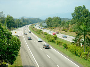
The North–South Expressway (NSE) ((simplified Chinese: 南北高速公路)) is the longest expressway in Malaysia with the total length of 966 km (600.2 mi) running from Bukit Kayu Hitam
in Kedah
near the Malaysian-Thai border
(connects with Phetkasem Road (Route 4) in Thailand
) to Johor Bahru
at the southern portion of Peninsular Malaysia
and to Singapore. The expressway links many major cities and towns in western Peninsular Malaysia, acting as the 'backbone' of the west coast of the peninsula. It is also known as PLUS Expressway, named after the highway's concessionaire, Projek Lebuhraya Utara Selatan Berhad (North South Expressway Project; abbreviated as PLUS).
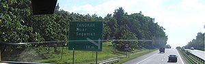
This expressway passes through 7 states on the peninsula: Johor
, Malacca
, Negeri Sembilan
, Selangor
, Perak
, Penang
and Kedah
. It provides a faster alternative to the old Federal Route
, thus reducing travelling time between various towns & cities.
to Kuala Lumpur
) which also incorporates the Penang Bridge
, (southern route from Kuala Lumpur
to Johor Bahru
). The New Klang Valley Expressway
(NKVE), part of the route, starts from Bukit Raja
, Klang
to Jalan Duta
exit in Kuala Lumpur
. The North–South Expressway Central Link (ELITE) , opened in 1997, is a highway built to bypass Kuala Lumpur. It starts from the Shah Alam interchange on the NKVE , past Subang Jaya
, Putrajaya
and Kuala Lumpur International Airport
, and ends at the Nilai Utara interchange on the . The is the Second Link Expressway
(Linkedua), which is connected to Malaysia-Singapore Second Link
, starting at Senai Airport and ends in Tanjung Kupang before crossing. PLUS also obtained the Seremban-Port Dickson Highway
, , which starts at Mambau
in Seremban
with an interchange at Lukut
and ending near the town centre in Port Dickson
and Butterworth–Kulim Expressway, which starts from Butterworth
, Penang
to Kulim
in Kedah
.
and end in Kuala Lumpur
. The from the North becomes the New Klang Valley Expressway which further links into the NSE Central Link or for people travelling to Kuala Lumpur exit at the Jalan Duta Toll Plaza which links to the Sprint Expressway
and the Kuala Lumpur Middle Ring Road 1
(MRR1) . The from the South ends in Sungai Besi which then changes into the Kuala Lumpur-Seremban Expressway
with interchanges to the Federal Highway Route
via Salak Expressway , Sungai Besi Expressway
and heads towards the city centre.
started in the mid-1970s. In 1977, the Malaysian Ministry of Works received official instructions to draw plans of an expressway from the Malaysia-Thailand border (Bukit Kayu Hitam) to the Johor Causeway. In 1980, the Malaysian Highway Authority
was established to monitor all the work progress of the first national expressway.
At that time, all construction works of the expressway between 1982 to 1988 was solely administered by Malaysian Highway Authority
before being transferred to Projek Lebuhraya Utara-Selatan Berhad (PLUS) in 1988. As the construction works continued, segments of the highway were opened to traffic as they were finished to help fund the construction works. PLUS continued all the construction works from 1988 until completion in 1994, 15 months earlier than scheduled. The expressway was officially opened on September 8, 1994 by Malaysian prime minister
at that time, Tun Dr. Mahathir bin Mohamad
.
– Jitra
section (both in Kedah
), which was initially a part of the Federal Route
, opened in 1 April 1985.
The pioneer route for North–South Expressway Southern Route was Kuala Lumpur-Seremban Expressway
, opened on 16 June 1982. However, the section from Razak Mansion to Sungai Besi toll plaza was not acquired by PLUS Expressway Berhad but rather by MetaCorp – as a result, the section was not included in the southern route.
to Tanjung Malim
, Tanjung Malim
to Rawang (Northern route), Seremban
to Senawang
, and Senawang
to Ayer Keroh
(Southern route) was approved by the government for better traffic flow. It was completed in 2007.
. This is achieved through the construction of two local-express lanes
for each side, which are only accessible via Ipoh South Exit (for northbound traffic) and Ipoh North Exit (for southbound traffic). The toll plazas in Ipoh are therefore relocated at each ends of the local-express lanes.
The decision to demolish both toll plazas was made as a result of accidents which happened at Jelapang toll plaza. Since the toll plaza was opened in 28 September 1987, there were many accident cases which involved brake failure in heavy vehicles due to hard braking when proceeding downhill to the toll plaza. On 7 June 2008, the new Ipoh North toll plaza (South bound) replacing old Jelapang toll plaza opened to traffic, followed by north bound on 15 August 2008. Beginning 11:00 am on 14 July 2009, the Kuala Lumpur-Penang through traffic is now opened to traffic. With the opening of the 14.7 kilometres (9.1 mi) between Ipoh North (Jelapang) and Ipoh South stretch, highway users are no longer required to stop for toll transactions at the Ipoh North and Ipoh South Toll Plazas.
to Jalan Duta
, from Shah Alam to Rawang and from Nilai (North)
to Seremban
. It is unknown when the construction is expected to begin.
There are some exceptions to this; the following are stretches with 6 lanes (3 each way):
 Most heavy vehicles are only allowed to travel 80–90 km/h by law. Considering that two lanes are inadequate for smooth traffic flow, the expressway is being widened as a result of the increasing number of fatal accidents along this highway.
It has been recently decided that the two-lane 110 km/h highway will be upgraded to a three-lane 110 km/h highway. The highway widening project has been underway since 2006 as an accident-reducing measure.
 The North–South Expressway is a toll expressway with two toll systems:-
There are three toll incentive packages of the PLUS Travel Incentive Program which will be enjoyed by the customers on the PLUS and ELITE highways which are:-
Incentive One
Incentive Two
Incentive Three
Bukit Kayu Hitam
Bukit Kayu Hitam is Kedah's main border town on the Malaysia-Thailand Border. It marks the end of the North-South Expressway and Malaysia Federal Route 1, the longest Malaysian road which runs from Johor Bahru, Johor in the south till the border at Bukit Kayu Hitam pass. The checkpoint and duty...
in Kedah
Kedah
Kedah is a state of Malaysia, located in the northwestern part of Peninsular Malaysia. The state covers a total area of over 9,000 km², and it consists of the mainland and Langkawi. The mainland has a relatively flat terrain, which is used to grow rice...
near the Malaysian-Thai border
Malaysia-Thailand border
The Malaysia-Thailand border consists of both a land boundary across the Malay Peninsula and maritime boundaries in the Straits of Malacca and the Gulf of Thailand/South China Sea. Malaysia lies to the south of the border while Thailand lies to the north...
(connects with Phetkasem Road (Route 4) in Thailand
Thailand
Thailand , officially the Kingdom of Thailand , formerly known as Siam , is a country located at the centre of the Indochina peninsula and Southeast Asia. It is bordered to the north by Burma and Laos, to the east by Laos and Cambodia, to the south by the Gulf of Thailand and Malaysia, and to the...
) to Johor Bahru
Johor Bahru
Johor Bahru is the capital city of Johor in southern Malaysia. Johor Bahru is the southernmost city of the Eurasian mainland...
at the southern portion of Peninsular Malaysia
Peninsular Malaysia
Peninsular Malaysia , also known as West Malaysia , is the part of Malaysia which lies on the Malay Peninsula. Its area is . It shares a land border with Thailand in the north. To the south is the island of Singapore. Across the Strait of Malacca to the west lies the island of Sumatra...
and to Singapore. The expressway links many major cities and towns in western Peninsular Malaysia, acting as the 'backbone' of the west coast of the peninsula. It is also known as PLUS Expressway, named after the highway's concessionaire, Projek Lebuhraya Utara Selatan Berhad (North South Expressway Project; abbreviated as PLUS).
This expressway passes through 7 states on the peninsula: Johor
Johor
Johor is a Malaysian state, located in the southern portion of Peninsular Malaysia. It is one of the most developed states in Malaysia. The state capital city and royal city of Johor is Johor Bahru, formerly known as Tanjung Puteri...
, Malacca
Malacca
Malacca , dubbed The Historic State or Negeri Bersejarah among locals) is the third smallest Malaysian state, after Perlis and Penang. It is located in the southern region of the Malay Peninsula, on the Straits of Malacca. It borders Negeri Sembilan to the north and the state of Johor to the south...
, Negeri Sembilan
Negeri Sembilan
Negeri Sembilan, one of the 13 states that constitutes Malaysia, lies on the western coast of Peninsular Malaysia, just south of Kuala Lumpur and borders Selangor on the north, Pahang in the east, and Malacca and Johor to the south....
, Selangor
Selangor
Selangor also known by its Arabic honorific, Darul Ehsan, or "Abode of Sincerity") is one of the 13 states of Malaysia. It is on the west coast of Peninsular Malaysia and is bordered by Perak to the north, Pahang to the east, Negeri Sembilan to the south and the Strait of Malacca to the west...
, Perak
Perak
Perak , one of the 13 states of Malaysia, is the second largest state in the Peninsular Malaysia bordering Kedah and Yala Province of Thailand to the north, Penang to the northwest, Kelantan and Pahang to the east, Selangor the Strait of Malacca to the south and west.Perak means silver in Malay...
, Penang
Penang
Penang is a state in Malaysia and the name of its constituent island, located on the northwest coast of Peninsular Malaysia by the Strait of Malacca. It is bordered by Kedah in the north and east, and Perak in the south. Penang is the second smallest Malaysian state in area after Perlis, and the...
and Kedah
Kedah
Kedah is a state of Malaysia, located in the northwestern part of Peninsular Malaysia. The state covers a total area of over 9,000 km², and it consists of the mainland and Langkawi. The mainland has a relatively flat terrain, which is used to grow rice...
. It provides a faster alternative to the old Federal Route
Malaysia Federal Route 1
Federal Route 1 is the first federal road in Malaysia, and among the oldest federal roads in Malaysia, having been constructed by the British government during colonial times...
, thus reducing travelling time between various towns & cities.
Overview
It is divided into a few main routes; (northern route from Bukit Kayu HitamBukit Kayu Hitam
Bukit Kayu Hitam is Kedah's main border town on the Malaysia-Thailand Border. It marks the end of the North-South Expressway and Malaysia Federal Route 1, the longest Malaysian road which runs from Johor Bahru, Johor in the south till the border at Bukit Kayu Hitam pass. The checkpoint and duty...
to Kuala Lumpur
Kuala Lumpur
Kuala Lumpur is the capital and the second largest city in Malaysia by population. The city proper, making up an area of , has a population of 1.4 million as of 2010. Greater Kuala Lumpur, also known as the Klang Valley, is an urban agglomeration of 7.2 million...
) which also incorporates the Penang Bridge
Penang Bridge
Penang Bridge is a dual carriageway toll bridge connects Gelugor on the island of Penang and Seberang Prai on the mainland of Malaysia on the Malay Peninsula. The bridge is also linked to the North-South Expressway in Prai and Tun Dr Lim Chong Eu Expressway in Penang. It was officially opened to...
, (southern route from Kuala Lumpur
Kuala Lumpur
Kuala Lumpur is the capital and the second largest city in Malaysia by population. The city proper, making up an area of , has a population of 1.4 million as of 2010. Greater Kuala Lumpur, also known as the Klang Valley, is an urban agglomeration of 7.2 million...
to Johor Bahru
Johor Bahru
Johor Bahru is the capital city of Johor in southern Malaysia. Johor Bahru is the southernmost city of the Eurasian mainland...
). The New Klang Valley Expressway
New Klang Valley Expressway
The New Klang Valley Expressway, or the NKVE refers to a stretch of the North-South Expressway in Peninsular Malaysia which starts from Bukit Raja near Klang town, and ends at Jalan Duta in Kuala Lumpur. It is a busiest expressway in Klang Valley during rush hour from/to Kuala Lumpur...
(NKVE), part of the route, starts from Bukit Raja
Bukit Raja
Bukit Raja is an estate town in the Klang district of Selangor, Malaysia....
, Klang
Klang
Klang , formerly known as Kelang, is the royal city and former capital of the state of Selangor, Malaysia. It is located within the Klang District in Klang Valley. It is located about 32 km to the west of Kuala Lumpur and 6 km east of Port Klang...
to Jalan Duta
Jalan Duta
Jalan Duta is a major road in Kuala Lumpur, Malaysia which spans from the adjoining roundabout of Jalan Kuching, which the high flyover would take traffic straight into Jalan Ipoh and ends at the Parliament where it adjoins Jalan Mahameru...
exit in Kuala Lumpur
Kuala Lumpur
Kuala Lumpur is the capital and the second largest city in Malaysia by population. The city proper, making up an area of , has a population of 1.4 million as of 2010. Greater Kuala Lumpur, also known as the Klang Valley, is an urban agglomeration of 7.2 million...
. The North–South Expressway Central Link (ELITE) , opened in 1997, is a highway built to bypass Kuala Lumpur. It starts from the Shah Alam interchange on the NKVE , past Subang Jaya
Subang Jaya
Subang Jaya is a suburban city in the Klang Valley, Selangor, Malaysia. It comprises the southern third of the district of Petaling, and is home to a third of the district population of 1.78 million. Subang Jaya comprises , Bandar Sunway, UEP Subang Jaya, Putra Heights and Batu Tiga...
, Putrajaya
Putrajaya
Putrajaya is a planned city, located 25km south of Kuala Lumpur, that serves as the federal administrative centre of Malaysia. The seat of government was shifted in 1999 from Kuala Lumpur to Putrajaya, due to the overcrowding and congestion in the Kuala Lumpur areas...
and Kuala Lumpur International Airport
Kuala Lumpur International Airport
Kuala Lumpur International Airport , or KLIA serves the capital city of Malaysia, Kuala Lumpur, and is one of Southeast Asia's largest airports. It is also Malaysia's main international airport. It is situated in the Sepang district, in the south of the state of Selangor, about from Kuala Lumpur...
, and ends at the Nilai Utara interchange on the . The is the Second Link Expressway
Second Link Expressway
Second Link Expressway , is the expressway which links Senai North at North-South Expressway, Senai Airport and Taman Perling, Johor Bahru via its extension known as Pontian-Johor Bahru Parkway to the Malaysia-Singapore Second Link.Usually, travelling along the second link is much faster than...
(Linkedua), which is connected to Malaysia-Singapore Second Link
Malaysia-Singapore Second Link
Malaysia–Singapore Second Link is a bridge connecting Singapore and Johor, Malaysia. In Singapore, it is officially known as the Tuas Second Link. The bridge was built to reduce the traffic congestion at the Johor–Singapore Causeway, and was opened to traffic on 2 January 1998...
, starting at Senai Airport and ends in Tanjung Kupang before crossing. PLUS also obtained the Seremban-Port Dickson Highway
Seremban-Port Dickson Highway
Seremban-Port Dickson Highway, SPDH, is an expressways in Negeri Sembilan, Malaysia. It was built to shorten the traveling distance from Seremban to Port Dickson and acts as an alternative route for Federal route which has dangerous corners along the route...
, , which starts at Mambau
Mambau
Mambau is a small town in Negeri Sembilan, Malaysia. It is considered part of the state capital of Seremban. Mambau area includes Mambau old town, Kg Baru Mambau, Rumah Murah Rakyat Mambau, Kg Batu 3, Kg Kayu Ara, Kg Mambau, Taman Kelab Tuanku and Anak Air Garam.Mambau is a transit point for...
in Seremban
Seremban
Seremban is the capital of the Malaysian state of Negeri Sembilan, located within the district of Seremban, one of the seven districts of Negeri Sembilan. The town's administration is run by the Seremban Municipal Council or Majlis Perbandaran Seremban...
with an interchange at Lukut
Lukut
Lukut is a small town in Negeri Sembilan, Malaysia. Lukut is situated within the parliamentary constituency of Teluk Kemang. The historical Kota Lukut is located here and also Sekolah Menengah Teknik Port Dickson...
and ending near the town centre in Port Dickson
Port Dickson
Port Dickson or PD to locals is a beach and holiday destination situated about 32 km from Seremban and 90 km from Kuala Lumpur. It is located in the state of Negeri Sembilan in Peninsular Malaysia...
and Butterworth–Kulim Expressway, which starts from Butterworth
Butterworth
- People with the surname :* Arthur Butterworth , English composer* Bob Butterworth, former Florida attorney general* Brad Butterworth , yachtsman from New Zealand...
, Penang
Penang
Penang is a state in Malaysia and the name of its constituent island, located on the northwest coast of Peninsular Malaysia by the Strait of Malacca. It is bordered by Kedah in the north and east, and Perak in the south. Penang is the second smallest Malaysian state in area after Perlis, and the...
to Kulim
Kulim
Kulim is the third largest town in Kedah after Alor Star and Sungai Petani is located at the South East of Kedah state and East of Penang state in Malaysia. Kulim is a district consist of 15 smaller sub-districts also known as "mukim"...
in Kedah
Kedah
Kedah is a state of Malaysia, located in the northwestern part of Peninsular Malaysia. The state covers a total area of over 9,000 km², and it consists of the mainland and Langkawi. The mainland has a relatively flat terrain, which is used to grow rice...
.
and end in Kuala Lumpur
Kuala Lumpur
Kuala Lumpur is the capital and the second largest city in Malaysia by population. The city proper, making up an area of , has a population of 1.4 million as of 2010. Greater Kuala Lumpur, also known as the Klang Valley, is an urban agglomeration of 7.2 million...
. The from the North becomes the New Klang Valley Expressway which further links into the NSE Central Link or for people travelling to Kuala Lumpur exit at the Jalan Duta Toll Plaza which links to the Sprint Expressway
Sprint Expressway
Sprint Expressway is the main expressway network in Klang Valley, Malaysia. The of expressway is divided into three sections. This sections included the Kerinchi Link, Damansara Link and Penchala Link...
and the Kuala Lumpur Middle Ring Road 1
Kuala Lumpur Middle Ring Road 1
Kuala Lumpur Middle Ring Road 1 is an urban and municipal main ring road in Kuala Lumpur. It is also known as Kuala Lumpur-Petaling Jaya Traffic Dispersal Scheme, Jalan Tun Razak, Lebuhraya Mahameru, Jalan Damansara, Jalan Istana and Jalan Lapangan Terbang by Malaysian Public Works Department . It...
(MRR1) . The from the South ends in Sungai Besi which then changes into the Kuala Lumpur-Seremban Expressway
Kuala Lumpur-Seremban Expressway
The Kuala Lumpur – Seremban Expressway is a main expressway in Kuala Lumpur, Malaysia. This expressway linking Kuala Lumpur in the north to Seremban, Negeri Sembilan in the south....
with interchanges to the Federal Highway Route
Federal Highway, Malaysia
Federal Highway, or Lebuhraya Persekutuan in Malay is a Malaysian highway connecting the capital city of Kuala Lumpur, and Klang, Selangor. The highway starts from Seputeh in Kuala Lumpur to Klang, Selangor...
via Salak Expressway , Sungai Besi Expressway
Sungai Besi Expressway
Sungai Besi Expressway, SBE, or Besraya Expressway is an expressway in the Klang Valley region of Malaysia connecting Kuala Lumpur to UPM Interchange...
and heads towards the city centre.
 |
 |
History
The planning of the national expresswayMalaysian Expressway System
The Malaysian Expressway System , which begins with the North-South Expressway , is currently in the process of being substantially developed...
started in the mid-1970s. In 1977, the Malaysian Ministry of Works received official instructions to draw plans of an expressway from the Malaysia-Thailand border (Bukit Kayu Hitam) to the Johor Causeway. In 1980, the Malaysian Highway Authority
Malaysian Highway Authority
The Malaysian Highway Authority or Lembaga Lebuhraya Malaysia is a government agency under the Malaysian Ministry of Works...
was established to monitor all the work progress of the first national expressway.
At that time, all construction works of the expressway between 1982 to 1988 was solely administered by Malaysian Highway Authority
Malaysian Highway Authority
The Malaysian Highway Authority or Lembaga Lebuhraya Malaysia is a government agency under the Malaysian Ministry of Works...
before being transferred to Projek Lebuhraya Utara-Selatan Berhad (PLUS) in 1988. As the construction works continued, segments of the highway were opened to traffic as they were finished to help fund the construction works. PLUS continued all the construction works from 1988 until completion in 1994, 15 months earlier than scheduled. The expressway was officially opened on September 8, 1994 by Malaysian prime minister
Prime Minister of Malaysia
The Prime Minister of Malaysia is the indirectly elected head of government of Malaysia. He is officially appointed by the Yang di-Pertuan Agong, the head of state, who in HM's judgment is likely to command the confidence of the majority of the members of that House of Representatives , the...
at that time, Tun Dr. Mahathir bin Mohamad
Mahathir bin Mohamad
Tun Dr. Mahathir bin Mohamad . is a Malaysian politician who was the fourth Prime Minister of Malaysia. He held the post for 22 years from 1981 to 2003, making him Malaysia's longest serving Prime Minister. His political career spanned almost 40 years.Born and raised in Alor Setar, Kedah, Mahathir...
.
Pioneer routes
The pioneer route for North–South Expressway Northern Route was the Bukit Kayu HitamBukit Kayu Hitam
Bukit Kayu Hitam is Kedah's main border town on the Malaysia-Thailand Border. It marks the end of the North-South Expressway and Malaysia Federal Route 1, the longest Malaysian road which runs from Johor Bahru, Johor in the south till the border at Bukit Kayu Hitam pass. The checkpoint and duty...
– Jitra
Jitra
Jitra is a town in Kedah, Malaysia. It is located in the Kubang Pasu district.It is the fourth largest town in Kedah after Alor Setar, Sungai Petani and Kulim....
section (both in Kedah
Kedah
Kedah is a state of Malaysia, located in the northwestern part of Peninsular Malaysia. The state covers a total area of over 9,000 km², and it consists of the mainland and Langkawi. The mainland has a relatively flat terrain, which is used to grow rice...
), which was initially a part of the Federal Route
Malaysia Federal Route 1
Federal Route 1 is the first federal road in Malaysia, and among the oldest federal roads in Malaysia, having been constructed by the British government during colonial times...
, opened in 1 April 1985.
The pioneer route for North–South Expressway Southern Route was Kuala Lumpur-Seremban Expressway
Kuala Lumpur-Seremban Expressway
The Kuala Lumpur – Seremban Expressway is a main expressway in Kuala Lumpur, Malaysia. This expressway linking Kuala Lumpur in the north to Seremban, Negeri Sembilan in the south....
, opened on 16 June 1982. However, the section from Razak Mansion to Sungai Besi toll plaza was not acquired by PLUS Expressway Berhad but rather by MetaCorp – as a result, the section was not included in the southern route.
Six-lane widening works
Plans to upgrade the stretches from Slim RiverSlim River
Slim River is a small town in Perak, Malaysia. It is about 100 km from Kuala Lumpur. It is situated in the southern part of Perak and is 20 km north of Tanjung Malim. It is about 100 km from Ipoh. Slim River is the second biggest town in Tanjung Malim district...
to Tanjung Malim
Tanjung Malim
Tanjung Malim is a town in the state of Perak, Malaysia. It is approximately north of Kuala Lumpur via the North-South Expressway. It lies on the Perak-Selangor state border, with Sungai Bernam serving as the natural divider....
, Tanjung Malim
Tanjung Malim
Tanjung Malim is a town in the state of Perak, Malaysia. It is approximately north of Kuala Lumpur via the North-South Expressway. It lies on the Perak-Selangor state border, with Sungai Bernam serving as the natural divider....
to Rawang (Northern route), Seremban
Seremban
Seremban is the capital of the Malaysian state of Negeri Sembilan, located within the district of Seremban, one of the seven districts of Negeri Sembilan. The town's administration is run by the Seremban Municipal Council or Majlis Perbandaran Seremban...
to Senawang
Senawang
Senawang is a satellite town located in the district of Seremban, Negeri Sembilan, Malaysia.-Geography:Senawang is situated about 7 kilometres from Seremban town. It is located in a higher level flat terrain than other towns in Seremban. The terrain is suitable for industrial.-Demographics:Bahasa...
, and Senawang
Senawang
Senawang is a satellite town located in the district of Seremban, Negeri Sembilan, Malaysia.-Geography:Senawang is situated about 7 kilometres from Seremban town. It is located in a higher level flat terrain than other towns in Seremban. The terrain is suitable for industrial.-Demographics:Bahasa...
to Ayer Keroh
Ayer Keroh
Ayer Keroh is a town situated in the state of Malacca, Malaysia.The town is a major tourist spot of the state, apart from the old Malacca Town, due to its recent hosting of various interesting attractions. The Mini Malaysia and Mini ASEAN Park is situated in the town...
(Southern route) was approved by the government for better traffic flow. It was completed in 2007.
Kuala Lumpur-Penang Through Traffic (Ipoh North (Jelapang) – Ipoh South)
The Jelapang and Ipoh South toll plazas were demolished in 2009 to make a non-stop route across IpohIpoh
Ipoh is the capital city of Perak state, Malaysia. It is approximately 200 km north of Kuala Lumpur on the North-South Expressway....
. This is achieved through the construction of two local-express lanes
Local-express lanes
A Local-express lane system is an arrangement of roadways within a major highway providing one of more roadways for express lanes with a limited number of entrances and exits and also separate roadways for local or collector lanes which provide access to all interchanges...
for each side, which are only accessible via Ipoh South Exit (for northbound traffic) and Ipoh North Exit (for southbound traffic). The toll plazas in Ipoh are therefore relocated at each ends of the local-express lanes.
The decision to demolish both toll plazas was made as a result of accidents which happened at Jelapang toll plaza. Since the toll plaza was opened in 28 September 1987, there were many accident cases which involved brake failure in heavy vehicles due to hard braking when proceeding downhill to the toll plaza. On 7 June 2008, the new Ipoh North toll plaza (South bound) replacing old Jelapang toll plaza opened to traffic, followed by north bound on 15 August 2008. Beginning 11:00 am on 14 July 2009, the Kuala Lumpur-Penang through traffic is now opened to traffic. With the opening of the 14.7 kilometres (9.1 mi) between Ipoh North (Jelapang) and Ipoh South stretch, highway users are no longer required to stop for toll transactions at the Ipoh North and Ipoh South Toll Plazas.
Fourth Lane additions
On July 2010, the operator PLUS Expressways Berhad announced that the government has awarded contracts to build a fourth lane on certain stretches of the highway, namely from Shah AlamShah Alam
Shah Alam is the state capital of Selangor, Malaysia situated within the Petaling District and a small portion of the neighboring Klang District. It is located about west of the country's capital, Kuala Lumpur. Shah Alam replaced Kuala Lumpur as the capital city of the state of Selangor in 1978...
to Jalan Duta
Jalan Duta
Jalan Duta is a major road in Kuala Lumpur, Malaysia which spans from the adjoining roundabout of Jalan Kuching, which the high flyover would take traffic straight into Jalan Ipoh and ends at the Parliament where it adjoins Jalan Mahameru...
, from Shah Alam to Rawang and from Nilai (North)
Nilai
Nilai is a town located in Negeri Sembilan, Malaysia. Due to its proximity, and connection through the KTM to Kuala Lumpur, Putrajaya, and Kuala Lumpur International Airport, it is a rapidly growing town. Development projects can be seen as one drives around Nilai...
to Seremban
Seremban
Seremban is the capital of the Malaysian state of Negeri Sembilan, located within the district of Seremban, one of the seven districts of Negeri Sembilan. The town's administration is run by the Seremban Municipal Council or Majlis Perbandaran Seremban...
. It is unknown when the construction is expected to begin.
Highways of PLUS
| Codes | Highways |
|---|---|
| and (both ) |
North–South Expressway (NSE) |
| Butterworth–Kulim Expressway | |
| North–South Expressway Central Link (NSECL/ELITE) | |
| Second Link Expressway Second Link Expressway Second Link Expressway , is the expressway which links Senai North at North-South Expressway, Senai Airport and Taman Perling, Johor Bahru via its extension known as Pontian-Johor Bahru Parkway to the Malaysia-Singapore Second Link.Usually, travelling along the second link is much faster than... (MSSC/LINKEDUA) |
|
| Seremban-Port Dickson Highway Seremban-Port Dickson Highway Seremban-Port Dickson Highway, SPDH, is an expressways in Negeri Sembilan, Malaysia. It was built to shorten the traveling distance from Seremban to Port Dickson and acts as an alternative route for Federal route which has dangerous corners along the route... (SPDH) |
|
| New Klang Valley Expressway New Klang Valley Expressway The New Klang Valley Expressway, or the NKVE refers to a stretch of the North-South Expressway in Peninsular Malaysia which starts from Bukit Raja near Klang town, and ends at Jalan Duta in Kuala Lumpur. It is a busiest expressway in Klang Valley during rush hour from/to Kuala Lumpur... (Part of NSE) |
|
| Skudai Highway Skudai Highway Skudai Highway , also known as Senai Highway Jalan Tun Abdul Razak or Jalan Skudai, Federal route is a 29 kilometre partial-access highway in Johor, Malaysia, from the town of Senai to the Johor-Singapore Causeway, which connects Malaysia and... (until 1 March 2004 only) and Johor-Singapore Causeway Johor-Singapore Causeway The Johor–Singapore Causeway is a 1,056-metre causeway that links the city of Johor Bahru in Malaysia across the Straits of Johor to the town of Woodlands in Singapore. It serves as a road, rail, and pedestrian link, as well as water piping into Singapore.The causeway is connected to the... |
|
| Federal Highway Route 2 Federal Highway, Malaysia Federal Highway, or Lebuhraya Persekutuan in Malay is a Malaysian highway connecting the capital city of Kuala Lumpur, and Klang, Selangor. The highway starts from Seputeh in Kuala Lumpur to Klang, Selangor... (FHR2) |
Carriageways
Generally the expressway consists of 4 lanes, 2 for each direction.There are some exceptions to this; the following are stretches with 6 lanes (3 each way):
- North–South Expressway Southern Route (Sungai BesiSungai BesiSungai Besi is a township in the Federal Territory of Kuala Lumpur. The deepest tin mine in Malaysia is located here. Sungai Besi was a historical mining town with many heavy industries such as steelworks, waste steel plants and other steel industries...
to Ayer KerohLebuh Ayer KerohLebuh Ayer Keroh, Federal Route , also known as Lebuhraya Ayer Keroh or Ayer Keroh Highway is the main dual-carriageway that connects the city of Melaka, Malaysia to the North-South Expressway via Ayer Keroh Interchange. Ayer Keroh, the main satellite town of Melaka is located along the road...
) - New Klang Valley ExpresswayNew Klang Valley ExpresswayThe New Klang Valley Expressway, or the NKVE refers to a stretch of the North-South Expressway in Peninsular Malaysia which starts from Bukit Raja near Klang town, and ends at Jalan Duta in Kuala Lumpur. It is a busiest expressway in Klang Valley during rush hour from/to Kuala Lumpur...
- North–South Expressway Northern Route (Bukit Lanjan to Slim River)
- North–South Expressway Northern Route (Sungai Dua to Juru located at PenangPenangPenang is a state in Malaysia and the name of its constituent island, located on the northwest coast of Peninsular Malaysia by the Strait of Malacca. It is bordered by Kedah in the north and east, and Perak in the south. Penang is the second smallest Malaysian state in area after Perlis, and the...
) - North–South Expressway Central Link, (Shah Alam to Nilai North)
- Second Link ExpresswaySecond Link ExpresswaySecond Link Expressway , is the expressway which links Senai North at North-South Expressway, Senai Airport and Taman Perling, Johor Bahru via its extension known as Pontian-Johor Bahru Parkway to the Malaysia-Singapore Second Link.Usually, travelling along the second link is much faster than...
(Pulai to Ayer Rajah ExpresswayAyer Rajah ExpresswayThe Ayer Rajah Expressway extends from the western end of the East Coast Parkway in the south of Singapore to Tuas in the west near the Tuas Second Link to Malaysia...
(TuasTuasTuas is largely an industrial zone located in the western part of Singapore. The Tuas Planning Area is located within the West Region, and is bounded by Tengeh Reservoir to the north, Strait of Johor to the west, Straits of Singapore to the south, and the Pan Island Expressway to the east.It is...
, SingaporeSingaporeSingapore , officially the Republic of Singapore, is a Southeast Asian city-state off the southern tip of the Malay Peninsula, north of the equator. An island country made up of 63 islands, it is separated from Malaysia by the Straits of Johor to its north and from Indonesia's Riau Islands by the...
))
Speed limit
North–South Expressway is designed as a high-speed long distance expressway therefore the default speed limit on the expressway is 110 km/h (68 mph), but there are some exceptions in some places for several reasons, including:-- 1 km before every toll plaza: 60 km/h (to help the traffic to slow down)
- Bukit Kayu Hitam-Jitra stretch : 90 km/h (expressway section with at-grade junctions) (Kedah)
- Sungai Dua-Juru : 90 km/h (due to heavy traffic at Penang Bridge) (Penang)
- Kuala Kangsar-Jelapang stretch : 80 km/h (highland stretch with dangerous corners) (Perak)
- Jelapang – Ipoh South stretch : 90 km/h for main carriageways; 70 km/h for toll-free local-express lanes (to control the traffic flow of the non-stop main carriageways and the toll-free local-express lanes) (Perak)
- Gua Tempurung stretch : 90 km/h (highland stretch) (Perak)
- Bukit Lanjan Interchange : 80 km/h (to control traffic flow of NKVE and the main link of northern route to avoid accidents) (Selangor)
- Bukit Lanjan-Jalan Duta stretch : 90 km/h (steep uphill/downhill stretch) (Kuala Lumpur)
- Sungai Besi-Bangi : 90 km/h (due to high traffic capacity) (Kuala Lumpur- Selangor)
- Simpang Ampat-Ayer Keroh : 90 km/h (due to high traffic capacity/crosswind) (Malacca)
Notable incidents
- On March 9, 2007, 6 passengers were killed in a bus crash near Menora TunnelMenora TunnelThe Menora Tunnel is the highway tunnel in Perak, Malaysia. It is an 800-metre tunnel on the North-South Expressway Northern Route near Jelapang....
, PerakPerakPerak , one of the 13 states of Malaysia, is the second largest state in the Peninsular Malaysia bordering Kedah and Yala Province of Thailand to the north, Penang to the northwest, Kelantan and Pahang to the east, Selangor the Strait of Malacca to the south and west.Perak means silver in Malay...
.
- On August 13, 2007, 20 people were killed in a bus crash near Changkat JeringChangkat JeringChangkat Jering is a small town in Perak, Malaysia. It is near the larger town of Taiping. It connects Taiping to the North-South Expressway via the southern exit. Changkat Jering is famed for its big weekly evening market on Saturdays. Changkat Jering is situated within the parliamentary...
, PerakPerakPerak , one of the 13 states of Malaysia, is the second largest state in the Peninsular Malaysia bordering Kedah and Yala Province of Thailand to the north, Penang to the northwest, Kelantan and Pahang to the east, Selangor the Strait of Malacca to the south and west.Perak means silver in Malay...
.
- On March 27, 2008, A Singaporean family of 4 killed in accident along North–South Expressway near TangkakTangkakTangkak is a district capital of Ledang, in the state of Johor, Malaysia. It lies close to the neighbouring state of Melaka, especially to Jasin town and district of the state and about half an hour drive from Melaka city centre. The town is nicknamed "Fabric Town" or "Syurga Kain" in honor of its...
, JohorJohorJohor is a Malaysian state, located in the southern portion of Peninsular Malaysia. It is one of the most developed states in Malaysia. The state capital city and royal city of Johor is Johor Bahru, formerly known as Tanjung Puteri...
, leaving behind a 2-month-old baby.
- On December 2, 2008 at about 0315 hrs, a SingaporeanSingaporeSingapore , officially the Republic of Singapore, is a Southeast Asian city-state off the southern tip of the Malay Peninsula, north of the equator. An island country made up of 63 islands, it is separated from Malaysia by the Straits of Johor to its north and from Indonesia's Riau Islands by the...
biker, who was returning from a riding trip from Hat YaiHat YaiHat Yai is a city in southern Thailand near the Malaysian border. Located at , it has a population of 157,359 in the city itself and about 800,000 in the greater Hat Yai area. Hat Yai is the largest city of Songkhla Province, the largest metropolitan area in Southern, and third largest...
, Thailand was killed after crashing his bike into an overturned lorry near Simpang EmpatSimpang EmpatSimpang Empat or Simpang Ampat or Sempang Ampat may refer to:In Malaysia:*Simpang Empat, Kedah*Simpang Ampat, Kedah*Simpang Ampat, Melaka*Simpang Ampat, Penang*Simpang Empat , Perak*Simpang Empat, Perak*Simpang Empat, Perlis...
, Melaka.
- On December 7, 2008, 10 passengers were killed in a bus crash at km 146.8 of the North–South Expressway between TangkakTangkakTangkak is a district capital of Ledang, in the state of Johor, Malaysia. It lies close to the neighbouring state of Melaka, especially to Jasin town and district of the state and about half an hour drive from Melaka city centre. The town is nicknamed "Fabric Town" or "Syurga Kain" in honor of its...
and PagohPagohPagoh is a town in the Muar district of Johor, Malaysia. Pagoh is accessible via one of the main interchanges on the North-South Expressway, the major expressway on the west coast of Peninsular Malaysia...
, JohorJohorJohor is a Malaysian state, located in the southern portion of Peninsular Malaysia. It is one of the most developed states in Malaysia. The state capital city and royal city of Johor is Johor Bahru, formerly known as Tanjung Puteri...
.
- On 13 April 2009, Six people were killed in double decker express bus crash at km 443 of the North–South Expressway near Rawang, SelangorSelangorSelangor also known by its Arabic honorific, Darul Ehsan, or "Abode of Sincerity") is one of the 13 states of Malaysia. It is on the west coast of Peninsular Malaysia and is bordered by Perak to the north, Pahang to the east, Negeri Sembilan to the south and the Strait of Malacca to the west...
.
- 26 December 2009, Ten passengers were killed and two injured after a double-decker Express bus skidded and hit the road divider at Km 272.8 of the North–South Expressway as it was heading north, about 8 km from the Ipoh South toll plaza near IpohIpohIpoh is the capital city of Perak state, Malaysia. It is approximately 200 km north of Kuala Lumpur on the North-South Expressway....
, PerakPerakPerak , one of the 13 states of Malaysia, is the second largest state in the Peninsular Malaysia bordering Kedah and Yala Province of Thailand to the north, Penang to the northwest, Kelantan and Pahang to the east, Selangor the Strait of Malacca to the south and west.Perak means silver in Malay...
.
- 10 October 2010, Twelve people were killed and more than 50 others injured in an highway crash involving two buses, three cars and a van at Km 223 of the North–South Expressway, near the Simpang Ampat Interchange, Melaka.
Measures taken to reduce accidents
It has been recently decided that the two-lane 110 km/h highway will be upgraded to a three-lane 110 km/h highway. The highway widening project has been underway since 2006 as an accident-reducing measure.
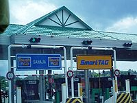
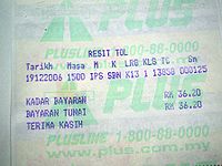
Toll system
- Open system – Users only have to pay at certain toll plazas within the open system range for a fixed amount. "Open system" is used in the following stretches of the North–South expressway:
- Batu TigaShah AlamShah Alam is the state capital of Selangor, Malaysia situated within the Petaling District and a small portion of the neighboring Klang District. It is located about west of the country's capital, Kuala Lumpur. Shah Alam replaced Kuala Lumpur as the capital city of the state of Selangor in 1978...
and Sungai RasauKlangKlang , formerly known as Kelang, is the royal city and former capital of the state of Selangor, Malaysia. It is located within the Klang District in Klang Valley. It is located about 32 km to the west of Kuala Lumpur and 6 km east of Port Klang...
, (Selangor) - Bukit Kayu HitamBukit Kayu HitamBukit Kayu Hitam is Kedah's main border town on the Malaysia-Thailand Border. It marks the end of the North-South Expressway and Malaysia Federal Route 1, the longest Malaysian road which runs from Johor Bahru, Johor in the south till the border at Bukit Kayu Hitam pass. The checkpoint and duty...
, (Kedah) - JitraJitraJitra is a town in Kedah, Malaysia. It is located in the Kubang Pasu district.It is the fourth largest town in Kedah after Alor Setar, Sungai Petani and Kulim....
, (Kedah) - KempasKempasKempas is a suburb of Johor Bahru, Johor. The Kempas Medical Centre is located in Kempas. It is situated within the parliamentary constituency of Pulai....
, (Johor) - Johor-Singapore CausewayJohor-Singapore CausewayThe Johor–Singapore Causeway is a 1,056-metre causeway that links the city of Johor Bahru in Malaysia across the Straits of Johor to the town of Woodlands in Singapore. It serves as a road, rail, and pedestrian link, as well as water piping into Singapore.The causeway is connected to the...
, - LukutLukutLukut is a small town in Negeri Sembilan, Malaysia. Lukut is situated within the parliamentary constituency of Teluk Kemang. The historical Kota Lukut is located here and also Sekolah Menengah Teknik Port Dickson...
and MambauMambauMambau is a small town in Negeri Sembilan, Malaysia. It is considered part of the state capital of Seremban. Mambau area includes Mambau old town, Kg Baru Mambau, Rumah Murah Rakyat Mambau, Kg Batu 3, Kg Kayu Ara, Kg Mambau, Taman Kelab Tuanku and Anak Air Garam.Mambau is a transit point for...
, (Negri Sembilan) - Tanjung KupangTanjung KupangNot to be confused with Kupang in East Nusa Tenggara and Tanjung Pinang in Riau IslandsTanjung Kupang is a small village near Nusajaya in Gelang Patah, Johor, Malaysia.-Malaysia Airlines Flight 653:...
, Taman PerlingTaman PerlingTaman Perling is a main township in Johor Bahru, Malaysia. A development project of the company Pelangi Berhad, it covers and contains close to 10,000 housing units.The main landmark of the housing area is Perling Mall,which has 2 floor of almost 100 shops. It is located twenty minutes from Johor...
and Lima KedaiLima KedaiLima Kedai is a small town in Johor Bahru District, Johor, Malaysia. It is located between Skudai and Gelang Patah. Lima Kedai is an important transit town for travelers on the Second Link Expressway....
(Johor).
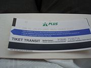
- Closed system – Users collect toll tickets or PLUSTransit cards before entering the expressway at respective toll plazas and pay an amount of toll at the exit toll plaza plus the distance from the plaza to the Limit of Maintenance Responsibility (LMR).
PLUS Travel Incentive Program
Effective 1 January 2009, Class 1 highway users traveling on the expressway (NSE) and North–South Expressway Central Link (ELITE) between 12:00 midnight and 7:00 am will be able to enjoy 10 percent toll discount. This is part of the PLUS’ initiatives to offer added value to its customers on both highways.There are three toll incentive packages of the PLUS Travel Incentive Program which will be enjoyed by the customers on the PLUS and ELITE highways which are:-
Incentive One
- Users of Class 1 vehicles using the highway between 12:00 midnight and 7:00 am will enjoy 10 percent toll discount.
- Duration : 1 January 2009 until 31 December 2010.
Incentive Two
- Additional 10 percent toll discount will be given to highway users (Class 1 vehicles only) traveling between 12.00 midnight to 7.00 am on selected six days during Hari Raya Aidilfitri, Chinese New Year, Deepavali and Christmas festive seasons.
- Duration : 1 January 2009 until 31 December 2010.
Incentive Three
- Electronic Toll Payment users spending monthly cummulative minimum amount of RM200 will enjoy 5 percent rebate (for usage on PLUS and ELITE highways only)
- This offer is given to users who are registered with the PLUS Loyalty Program which will be launched later.
- Duration : Beginning 1 January 2009
Toll rate classes for every PLUS Expressways Networks
| Class | Type of vehicles | Payment | Notes |
|---|---|---|---|
| 0 | Motorcycles, bicycles or vehicles with 2 or less wheels | Free | Except Tanjung Kupang toll plaza on the Malaysia-Singapore Second Link Malaysia-Singapore Second Link Malaysia–Singapore Second Link is a bridge connecting Singapore and Johor, Malaysia. In Singapore, it is officially known as the Tuas Second Link. The bridge was built to reduce the traffic congestion at the Johor–Singapore Causeway, and was opened to traffic on 2 January 1998... |
| 1 | Vehicles with 2 axles and 3 or 4 wheels excluding taxis | ||
| 2 | Vehicles with 2 axles and 5 or 6 wheels excluding buses | ||
| 3 | Vehicles with 3 or more axles | Cash only | |
| 4 | Taxis | Cash only, paid by passengers only. | |
| 5 | Buses | Cash only |
Toll Abbreviation
- For toll rates, see also Toll rates of the North–South Expressway
Abbreviation Exits Name of Interchanges AHT AYER HITAM AKH AYER KEROH ASS ALOR SETAR SELATAN Jalan SultanahJalan Sultanah is a major highway bypass in Kedah, Malaysia.-List of junctions:...ASU ALOR SETAR UTARA Alor Setar BypassAlor Setar Bypass, Federal Route , also known as Sultanah Bahiyah Highway is a major highway bypass in Alor Star, Kedah, Malaysia.- List of junctions and towns :...BBR BANDAR BAHARU BDR BIDOR BGS BANGI BKB BUKIT BERUNTUNG BKH BUKIT KAYU HITAM Bukit Kayu HitamBukit Kayu Hitam is Kedah's main border town on the Malaysia-Thailand Border. It marks the end of the North-South Expressway and Malaysia Federal Route 1, the longest Malaysian road which runs from Johor Bahru, Johor in the south till the border at Bukit Kayu Hitam pass. The checkpoint and duty...
BKM BUKIT MERAH BKR BUKIT RAJA BRG BEHRANG BRT BERTAM BSP BANDAR SAUJANA PUTRA BTS BUKIT TAMBUN SELATAN BTU BUKIT TAMBUN UTARA BTT BATU TIGA Batu TigaBatu Tiga is a township in Subang Jaya, Selangor, Malaysia. It is located at the border between Subang Jaya and Shah Alam. However, it is nearer to Shah Alam than the city centre of Subang Jaya...BTR BUKIT TAGAR CKJ CHANGKAT JERING DMR DAMANSARA EBN EBOR UTARA EBS EBOR SELATAN GPG GOPENG GRN GURUN HKG HUTAN KAMPUNG HSB HOSPITAL SUNGAI BULOH IPU IPOH UTARA
(JELAPANG)IPS IPOH SELATAN JBC JOHOR BAHRU CAUSEWAY Johor-Singapore CausewayThe Johor–Singapore Causeway is a 1,056-metre causeway that links the city of Johor Bahru in Malaysia across the Straits of Johor to the town of Woodlands in Singapore. It serves as a road, rail, and pedestrian link, as well as water piping into Singapore.The causeway is connected to the...
JLD JALAN DUTA Jalan Duta InterchangeThe following roads are named Jalan Duta Interchange:*Jalan Duta Interchange on the New Klang Valley Expressway*Jalan Duta Interchange on the Duta-Ulu Klang Expressway*Jalan Duta Interchange on the Sprint Expressway...
JRU JURU JSN JASIN JTR JITRA JitraJitra is a town in Kedah, Malaysia. It is located in the Kubang Pasu district.It is the fourth largest town in Kedah after Alor Setar, Sungai Petani and Kulim....
JWI JAWI KDR KOTA DAMANSARA KJG KAJANG KKS KUALA KANGSAR KLA KLIA AIRPORT KLI KULAIJAYA KPS KEMPAS KempasKempas is a suburb of Johor Bahru, Johor. The Kempas Medical Centre is located in Kempas. It is situated within the parliamentary constituency of Pulai....
LBB LEMBAH BERINGIN LKT LUKUT MAC MACHAP MBU MAMBAU MambauMambau is a small town in Negeri Sembilan, Malaysia. It is considered part of the state capital of Seremban. Mambau area includes Mambau old town, Kg Baru Mambau, Rumah Murah Rakyat Mambau, Kg Batu 3, Kg Kayu Ara, Kg Mambau, Taman Kelab Tuanku and Anak Air Garam.Mambau is a transit point for...NLI NILAI PBSB PENANG BRIDGE Penang BridgePenang Bridge is a dual carriageway toll bridge connects Gelugor on the island of Penang and Seberang Prai on the mainland of Malaysia on the Malay Peninsula. The bridge is also linked to the North-South Expressway in Prai and Tun Dr Lim Chong Eu Expressway in Penang. It was officially opened to...PDG PENDANG PDN PORT DICKSON UTARA PDS PORT DICKSON SELATAN PGH PAGOH PLI PEDAS/LINGGI PPM PUTRA MAHKOTA PSR SLIM RIVER PTH PUTRA HEIGHTS PTJ PUTRAJAYA RAW RAWANG RWS RAWANG SELATAN SAT SIMPANG AMPAT SBG SUBANG SBI SUNGAI BESI Sungai BesiSungai Besi is a township in the Federal Territory of Kuala Lumpur. The deepest tin mine in Malaysia is located here. Sungai Besi was a historical mining town with many heavy industries such as steelworks, waste steel plants and other steel industries...
SBN SEREMBAN SDK SEDENAK SEA SEAFIELD SGB SUNGAI BULOH SGD SUNGAI DUA SGR SUNGAI RASAU SHA SHAH ALAM SKD SKUDAI SKI SUNGKAI SNU SENAI UTARA SPP SIMPANG PULAI SPR SIMPANG RENGGAM SPS SUNGAI PETANI SELATAN SPU SUNGAI PETANI UTARA STA SETIA ALAM SWG SENAWANG TGK TANGKAK TGM TANJUNG MALIM TPH TAPAH TPU TAIPING UTARA TBN TAMBUN TLK TOL LIMA KEDAI Lima KedaiLima Kedai is a small town in Johor Bahru District, Johor, Malaysia. It is located between Skudai and Gelang Patah. Lima Kedai is an important transit town for travelers on the Second Link Expressway....
TTK TOL TANJUNG KUPANG Tanjung KupangNot to be confused with Kupang in East Nusa Tenggara and Tanjung Pinang in Riau IslandsTanjung Kupang is a small village near Nusajaya in Gelang Patah, Johor, Malaysia.-Malaysia Airlines Flight 653:...TTP TOL TAMAN PERLING Taman PerlingTaman Perling is a main township in Johor Bahru, Malaysia. A development project of the company Pelangi Berhad, it covers and contains close to 10,000 housing units.The main landmark of the housing area is Perling Mall,which has 2 floor of almost 100 shops. It is located twenty minutes from Johor...UPM UPM
(UNIVERSITI PUTRA MALAYSIAUniversiti Putra MalaysiaUniversiti Putra Malaysia , or UPM, is a leading research intensive public university located in central Peninsular Malaysia, close to the capital city, Kuala Lumpur. It was formerly known as Universiti Pertanian Malaysia or Agricultural University of Malaysia...
)USJ USJ
(ULU SUBANG JAYAUEP Subang JayaUEP Subang Jaya is an affluent major residential township in Subang Jaya, Selangor, Malaysia. It is one of the most prestigious addresses in the Klang Valley. It is located in the Mukim of Damansara, district of Petaling and the state of Selangor. USJ has a population of over 1,200,000 in 2010...
)YPS YONG PENG SELATAN YPU YONG PENG UTARA
- For more information see also Toll rates of the North–south Expressway
Facilities along the expressway
- Rest and service areas located about 60 km from each other
- Layby parking areas are located approximately every two junctions
- Emergency phones every 2 km
- PLUSLINE hotline number
- PLUS Ronda (PLUS patrol) service to assist drivers in the event of vehicle problems on the expressway
- PLUS helicopter patrol unit to monitored along PLUS expressways
Records
- North–South Expressway is Malaysia's first long-distance expresswayControlled-access highwayA controlled-access highway is a highway designed exclusively for high-speed vehicular traffic, with all traffic flow and ingress/egress regulated...
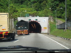
as well as Malaysia's longest expressway. - Menora TunnelMenora TunnelThe Menora Tunnel is the highway tunnel in Perak, Malaysia. It is an 800-metre tunnel on the North-South Expressway Northern Route near Jelapang....
, an 800 m (2,624.7 ft) tunnel on the North–South Expressway Northern Route near Jelapang, was once Malaysia's longest highway tunnelTunnelA tunnel is an underground passageway, completely enclosed except for openings for egress, commonly at each end.A tunnel may be for foot or vehicular road traffic, for rail traffic, or for a canal. Some tunnels are aqueducts to supply water for consumption or for hydroelectric stations or are sewers...
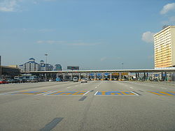
at the time of its construction. - Sungai Besi toll plaza is the widest toll plaza in Malaysia with over 18 lanes (excluding additional toll booths).
- The longest bridge along the expressway is Sungai Perak Bridge (Jambatan Sultan Azlan Shah) with the length of 300 m (984.3 ft).
- North–South Expressway is the first expressway in Malaysia that provides overhead bridge restaurants.
- The longest flyover bridge along the NSE network is Batu Tiga flyover in the North–South Expressway Central Link.
- The most expensive section of the expressway is the Gopeng-Tapah section. At RM200 million, it translate to RM 20 million per kilometre. Embankment strengthening is the major contributor for this escalating cost.
- The PLUS Speedway (formerly ELITE Speedway) in USJ Rest and Service Area on North–South Expressway Central Link is the first highway go-kart circuit in Malaysia.
- North–South Expressway forms 80% of Malaysian part of the Asian Highway NetworkAsian Highway NetworkThe Asian Highway project, also known as the Great Asian Highway, is a cooperative project among countries in Asia and Europe and the United Nations Economic and Social Commission for Asia and the Pacific , to improve the highway systems in Asia...
, specifically Asian Highway Network 2 . The other expressways in Malaysia included in the route are Skudai HighwaySkudai HighwaySkudai Highway , also known as Senai Highway Jalan Tun Abdul Razak or Jalan Skudai, Federal route is a 29 kilometre partial-access highway in Johor, Malaysia, from the town of Senai to the Johor-Singapore Causeway, which connects Malaysia and...
, Kuala Lumpur Middle Ring Road 1Kuala Lumpur Middle Ring Road 1Kuala Lumpur Middle Ring Road 1 is an urban and municipal main ring road in Kuala Lumpur. It is also known as Kuala Lumpur-Petaling Jaya Traffic Dispersal Scheme, Jalan Tun Razak, Lebuhraya Mahameru, Jalan Damansara, Jalan Istana and Jalan Lapangan Terbang by Malaysian Public Works Department . It...
and Johor Causeway. - The Nilai Memorial ParkNilai Memorial ParkNilai Memorial Park is a public memorial park in Nilai, Negeri Sembilan, Malaysia. It is situated along the "Nilai Layby" of the North-South Expressway Southern Route and become the first closed tolled expressway public memorial park in Malaysia....
near Nilai Layby on North–South Expressway Southern Route is the first closed tolled expressway public memorial park in Malaysia. - The PLUS Art Gallery in Ayer KerohAyer KerohAyer Keroh is a town situated in the state of Malacca, Malaysia.The town is a major tourist spot of the state, apart from the old Malacca Town, due to its recent hosting of various interesting attractions. The Mini Malaysia and Mini ASEAN Park is situated in the town...
Overhead Bridge Restaurant (OBR) is the first highway art gallery in Malaysia. - Kempas HighwayKempas HighwayKempas Highway or Jalan Kempas is a major highway in Johor Bahru, Johor, Malaysia. It is the only state road in Malaysia constructed as a 2-lane highway by an expressway concessionaire company, PLUS Expressway Berhad as a part of the North-South Expressway project...
(Johor State Route ) is the only state routeMalaysian State Roads systemMalaysian state roads are the secondary roads in Malaysia. The construction of state roads in Malaysia are funded by Malaysian Public Works Department of each states...
ever built by an expressway concessionaire company (PLUS Expressway Berhad). - The Machap Rest and Service Area (north bound) at the North–South Expressway Southern Route is the first fully air-conditioned rest areaRest areaA rest area, travel plaza, rest stop, or service area is a public facility, located next to a large thoroughfare such as a highway, expressway, or freeway at which drivers and passengers can rest, eat, or refuel without exiting on to secondary roads...
in Malaysia, after it was renovated during mid-2008. - The Sungai Perak Rest and Service Area (south bound) at the North–South Expressway Northern Route in PerakPerakPerak , one of the 13 states of Malaysia, is the second largest state in the Peninsular Malaysia bordering Kedah and Yala Province of Thailand to the north, Penang to the northwest, Kelantan and Pahang to the east, Selangor the Strait of Malacca to the south and west.Perak means silver in Malay...
is the first rest and service area in the Malaysian expressway to have an eco-management theme known as "The Green Trail" or "Jejak Hijau". - PLUSMiles is the first and only toll rebate loyalty programme in the Malaysian expressways.
- The longest closed toll collection system coverage in Malaysia is from Juru toll plaza to Skudai toll plaza (previously Ipoh South toll plaza to Skudai toll plaza), which runs through the North–South Expressway Northern Route , New Klang Valley ExpresswayNew Klang Valley ExpresswayThe New Klang Valley Expressway, or the NKVE refers to a stretch of the North-South Expressway in Peninsular Malaysia which starts from Bukit Raja near Klang town, and ends at Jalan Duta in Kuala Lumpur. It is a busiest expressway in Klang Valley during rush hour from/to Kuala Lumpur...
, North–South Expressway Central Link and North–South Expressway Southern Route . - The North–South Expressway Northern Route is the first and currently the only expressway in Malaysia to have a runaway truck rampRunaway truck rampA runaway truck ramp, runaway truck lane, emergency escape ramp or truck arrester bed is a traffic device that enables vehicles that are having braking problems to safely stop. It is typically a long, sand or gravel-filled lane adjacent to a road with a steep grade, and is designed to accommodate...
near Jelapang, Ipoh.
List of interchanges
- See also North–South Expressway Northern Route North–South Expressway Southern Route New Klang Valley ExpresswayNew Klang Valley ExpresswayThe New Klang Valley Expressway, or the NKVE refers to a stretch of the North-South Expressway in Peninsular Malaysia which starts from Bukit Raja near Klang town, and ends at Jalan Duta in Kuala Lumpur. It is a busiest expressway in Klang Valley during rush hour from/to Kuala Lumpur...
North–South Expressway Central Link Second Link ExpresswaySecond Link ExpresswaySecond Link Expressway , is the expressway which links Senai North at North-South Expressway, Senai Airport and Taman Perling, Johor Bahru via its extension known as Pontian-Johor Bahru Parkway to the Malaysia-Singapore Second Link.Usually, travelling along the second link is much faster than...
Seremban-Port Dickson HighwaySeremban-Port Dickson HighwaySeremban-Port Dickson Highway, SPDH, is an expressways in Negeri Sembilan, Malaysia. It was built to shorten the traveling distance from Seremban to Port Dickson and acts as an alternative route for Federal route which has dangerous corners along the route...
Butterworth-Kulim ExpresswayButterworth-Kulim ExpresswayButterworth–Kulim Expressway, BKE is an expressway in Malaysia. The expressway connects Butterworth, Penang in the west to Kulim, Kedah in the east...