
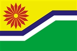
Mpumalanga
Encyclopedia
Mpumalanga is a province of South Africa
. The name means east or literally "the place where the sun rises" in Swazi, Xhosa, Ndebele and Zulu. Mpumalanga lies in eastern South Africa, north of KwaZulu-Natal
and bordering Swaziland
and Mozambique
. It constitutes 6.5% of South Africa's land area. In the north it borders on Limpopo
, to the west Gauteng
, to the southwest the Free State and to the south KwaZulu-Natal
. The capital is Nelspruit
(recently renamed to Mbombela). Prior to 1994, Mpumalanga was part of Transvaal Province
.
Escarpment divides Mpumalanga into a westerly half consisting mainly of high-altitude grassland
called the Highveld
and an eastern half situated in low altitude subtropical Lowveld/Bushveld
, mostly savanna
habitat. The southern half of the Kruger National Park
is situated in the latter region. The Drakensberg
exceeds heights of 2000m in most places with this central region of Mpumalanga being very mountainous. These regions have alpine grasslands and small pockets of Afromontane Forest
. The Lowveld is relatively flat with interspersed rocky outcrops. The Lebombo Mountains
form a low range in the far east forming the border with Mozambique
.
Some of the oldest rocks on earth are to be found in the Barberton
area and these ancient greenstones
and metamorphosed granites form the Crocodile River Mountains in the south-east of the province. The Lowveld is underlaid by African Cratonic Basement rocks of ages in excess of 2 billion years. The Highveld
is mostly Karoo Sequence sedimentary rocks of a younger, Carboniferous
to Permian
age.
Mpumalanga is the only province of South Africa to border two provinces
of Mozambique
or to border all four districts
of Swaziland
.
is comparatively much cooler, due to its altitude of 2300m to 1700m above sea level. The Drakensberg
Escarpment
receives the most precipitation
, with all other areas being moderately well-watered by mostly summer thunderstorms. The Highveld
often experiences severe frost, whilst the Lowveld is mostly frost-free. Winter rainfall is rare, except for some drizzle on the escarpment
. The differences in climate are demonstrated below by the capital, Nelspruit
, which is in the Lowveld, located just an hour from Belfast
on the Highveld
.
region, with its cold winters, and the hot, humid Lowveld allow for a variety of agricultural activities. More than 68% of Mpumalanga is utilised by agriculture. Crops include maize, wheat, sorghum
, barley
, sunflower seed
, soybean
s, groundnuts, sugar cane
, vegetables, coffee, tea, cotton, tobacco, citrus
, subtropical and deciduous fruit.
Forestry
is extensive around Sabie
in the far north of the province. Located near the forests, Ngodwana is the site of one of South Africa's largest paper mill
s (Sappi).
Natural grazing covers approximately 14% of Mpumalanga. The main products are beef, mutton, wool
, poultry and dairy.
group metals, Silica, Chromite
, Vanadiferous Magnetite
, Argentiferous Zinc
, Antimony
, Cobalt
, Copper, Iron, Manganese
, Tin
, Coal, Andalusite
, Chrysotile Asbestos
, Kieselguhr, Limestone
, Magnesite
, Talc
and Shale
.
Gold was first discovered in Mpumalanga province in 1883 by Auguste Roberts in the mountains surrounding what is now Barberton. Gold is still mined in the Barberton area today.
Mpumalanga accounts for 83% of South Africa's coal production. 90% of South Africa's coal consumption is used for electricity generation and the synthetic fuel industry. Coal power station
s are in proximity to the coal deposits. A coal liquefaction
plant in Secunda (Secunda CTL) is one of the country's two petroleum-from-coal extraction plants, which is operated by the synthetic fuel
company Sasol
.
, established in 1898 for the protection of Lowveld wildlife, covering 20000 square kilometres (7,722 sq mi), is a popular destination. The other major tourist attractions include the Sudwala Caves
and the Blyde River Canyon
.
The various towns in the region have much to offer, like the African Silk farm near Graskop, The coffee farm nearby. Many activities including The big jump, mountain and quad biking, horse trails, river rafting and big game viewing are endemic to the region. This is Big 5 territory. The towns in the Lowveld, comprise of Barberton
, Mbombela, White River
, Sabie
, Graskop
. Hazyview
, Malelane
, Pilgrim's Rest, Lydenburg
and Nkomazi.
In 2008 a Haute Cuisine
route was formed, trickling from Mbombela down to Hazyview, the Lowveld Gourmet Route covers the four top fine dining restaurants the area has to offer. The restaurants include Summerfields Kitchen, Oliver’s Restaurant, Orange and Salt.
, with 26% speaking isiZulu and 12% isiNdebele.
Provinces of South Africa
South Africa is currently divided into nine provinces. On the eve of the 1994 general election, South Africa's former homelands, also known as Bantustans, were reintegrated and the four existing provinces were divided into nine. The twelfth, thirteenth and sixteenth amendments to the constitution...
. The name means east or literally "the place where the sun rises" in Swazi, Xhosa, Ndebele and Zulu. Mpumalanga lies in eastern South Africa, north of KwaZulu-Natal
KwaZulu-Natal
KwaZulu-Natal is a province of South Africa. Prior to 1994, the territory now known as KwaZulu-Natal was made up of the province of Natal and the homeland of KwaZulu....
and bordering Swaziland
Swaziland
Swaziland, officially the Kingdom of Swaziland , and sometimes called Ngwane or Swatini, is a landlocked country in Southern Africa, bordered to the north, south and west by South Africa, and to the east by Mozambique...
and Mozambique
Mozambique
Mozambique, officially the Republic of Mozambique , is a country in southeastern Africa bordered by the Indian Ocean to the east, Tanzania to the north, Malawi and Zambia to the northwest, Zimbabwe to the west and Swaziland and South Africa to the southwest...
. It constitutes 6.5% of South Africa's land area. In the north it borders on Limpopo
Limpopo
Limpopo is the northernmost province of South Africa. The capital is Polokwane, formerly named Pietersburg. The province was formed from the northern region of Transvaal Province in 1994, and initially named Northern Transvaal...
, to the west Gauteng
Gauteng
Gauteng is one of the nine provinces of South Africa. It was formed from part of the old Transvaal Province after South Africa's first all-race elections on 27 April 1994...
, to the southwest the Free State and to the south KwaZulu-Natal
KwaZulu-Natal
KwaZulu-Natal is a province of South Africa. Prior to 1994, the territory now known as KwaZulu-Natal was made up of the province of Natal and the homeland of KwaZulu....
. The capital is Nelspruit
Nelspruit
Nelspruit is a city of more than 500,000 people situated in northeastern South Africa. It is the capital of the Mpumalanga province . Located on the Crocodile River, Nelspruit lies about west of the Mozambique border and east of Johannesburg. The towns of Nelspruit are Kanyamazane and Pienaar...
(recently renamed to Mbombela). Prior to 1994, Mpumalanga was part of Transvaal Province
Transvaal Province
Transvaal Province was a province of the Union of South Africa from 1910 to 1961, and of its successor, the Republic of South Africa, from 1961 until the end of apartheid in 1994 when a new constitution subdivided it.-History:...
.
Geography
The DrakensbergDrakensberg
The Drakensberg is the highest mountain range in Southern Africa, rising to in height. In Zulu, it is referred to as uKhahlamba , and in Sesotho as Maluti...
Escarpment divides Mpumalanga into a westerly half consisting mainly of high-altitude grassland
Grassland
Grasslands are areas where the vegetation is dominated by grasses and other herbaceous plants . However, sedge and rush families can also be found. Grasslands occur naturally on all continents except Antarctica...
called the Highveld
Highveld
The Highveld is a high plateau region of inland South Africa which is largely home to the largest metropolitan area in the country, the Gauteng City Region, which accounts for one-third of South Africa's population.-Location and description:...
and an eastern half situated in low altitude subtropical Lowveld/Bushveld
Bushveld
The Bushveld is a sub-tropical woodland ecoregion of Southern Africa that encompasses most of Limpopo Province and a small part of the North West Province of South Africa, the Central and North-East Districts of Botswana and the Matabeleland South and part of th Matabeleland North provinces of...
, mostly savanna
Savanna
A savanna, or savannah, is a grassland ecosystem characterized by the trees being sufficiently small or widely spaced so that the canopy does not close. The open canopy allows sufficient light to reach the ground to support an unbroken herbaceous layer consisting primarily of C4 grasses.Some...
habitat. The southern half of the Kruger National Park
Kruger National Park
Kruger National Park is one of the largest game reserves in Africa. It covers and extends from north to south and from east to west.To the west and south of the Kruger National Park are the two South African provinces of Limpopo and Mpumalanga. In the north is Zimbabwe, and to the east is...
is situated in the latter region. The Drakensberg
Drakensberg
The Drakensberg is the highest mountain range in Southern Africa, rising to in height. In Zulu, it is referred to as uKhahlamba , and in Sesotho as Maluti...
exceeds heights of 2000m in most places with this central region of Mpumalanga being very mountainous. These regions have alpine grasslands and small pockets of Afromontane Forest
Knysna-Amatole montane forests
The Knysna-Amatole montane forests ecoregion, of the Tropical and subtropical moist broadleaf forests Biome, is in South Africa. It covers an Afromontane area of in South Africa's Eastern Cape and Western Cape provinces.-Setting:...
. The Lowveld is relatively flat with interspersed rocky outcrops. The Lebombo Mountains
Lebombo Mountains
The Lebombo Mountains, also called Lubombo Mountains, are an 800km long, narrow range of mountains in Southern Africa stretching from Hluhluwe in KwaZulu-Natal in the south to Punda Maria in the Limpopo Province in South Africa in the north. Part of the mountains are found in South Africa,...
form a low range in the far east forming the border with Mozambique
Mozambique
Mozambique, officially the Republic of Mozambique , is a country in southeastern Africa bordered by the Indian Ocean to the east, Tanzania to the north, Malawi and Zambia to the northwest, Zimbabwe to the west and Swaziland and South Africa to the southwest...
.
Some of the oldest rocks on earth are to be found in the Barberton
Barberton, Mpumalanga
Barberton is a town in the Mpumalanga province of South Africa, which has its origin in the 1880s gold rush in the region. It is situated in the De Kaap Valley and is fringed by the Mkhonjwa Mountains...
area and these ancient greenstones
Greenstone belt
Greenstone belts are zones of variably metamorphosed mafic to ultramafic volcanic sequences with associated sedimentary rocks that occur within Archaean and Proterozoic cratons between granite and gneiss bodies....
and metamorphosed granites form the Crocodile River Mountains in the south-east of the province. The Lowveld is underlaid by African Cratonic Basement rocks of ages in excess of 2 billion years. The Highveld
Highveld
The Highveld is a high plateau region of inland South Africa which is largely home to the largest metropolitan area in the country, the Gauteng City Region, which accounts for one-third of South Africa's population.-Location and description:...
is mostly Karoo Sequence sedimentary rocks of a younger, Carboniferous
Carboniferous
The Carboniferous is a geologic period and system that extends from the end of the Devonian Period, about 359.2 ± 2.5 Mya , to the beginning of the Permian Period, about 299.0 ± 0.8 Mya . The name is derived from the Latin word for coal, carbo. Carboniferous means "coal-bearing"...
to Permian
Permian
The PermianThe term "Permian" was introduced into geology in 1841 by Sir Sir R. I. Murchison, president of the Geological Society of London, who identified typical strata in extensive Russian explorations undertaken with Edouard de Verneuil; Murchison asserted in 1841 that he named his "Permian...
age.
- Gaza Province, MozambiqueGaza ProvinceGaza is a province of Mozambique. It has an area of 75,709 km² and a population of 1,333,106 .Xai-Xai is the capital of the province. Inhambane Province is to the east, Manica Province to the north, Maputo Province to the south, South Africa to the west, and Zimbabwe to the...
– northeast - Maputo Province, MozambiqueMaputo ProvinceMaputo is a province of Mozambique; the province excludes the city of Maputo . The province has an area of 26,058 km² and a population of 1,072,086 .Matola is the capital of the province....
– east - Lubombo District, Swaziland – east, southwest of Maputo Province
- Hhohho District, SwazilandHhohhoHhohho is a district of Swaziland, located in the northwest of the country. It has an area of 3,569 km² and a population of 270,000 , and is divided into 14 tinkhundla. The administrative center is the national capital of Mbabane. It borders Lubombo District in the southeast and Manzini District...
– east, northwest of Lubombo - Manzini District, SwazilandManzini DistrictManzini is a district of Swaziland, located in the center-west of the country. It has an area of 5,068 km² and a population of 292,000 , and is divided into 16 tinkhundla. Its administrative center is Manzini. It borders all three other districts: Hhohho in the north, Lubombo in the east, and...
– east, south of Hhohho - Shiselweni District, SwazilandShiselweniShiselweni is a district of Swaziland, located in the southwest of the country. It has an area of 3,790 km² and a population of 217,000 , and is divided into 14 tinkhundla. Its administrative center is Nhlangano. It borders Lubombo District in the northeast and Manzini District in the northwest....
– southeast, south of Manzini
Mpumalanga is the only province of South Africa to border two provinces
Provinces of Mozambique
||Mozambique is divided into 10 provinces and 1 capital city with provincial status:#Cabo Delgado Province#Gaza Province#Inhambane Province#Manica Province#Maputo City#Maputo Province#Nampula Province#Niassa Province...
of Mozambique
Mozambique
Mozambique, officially the Republic of Mozambique , is a country in southeastern Africa bordered by the Indian Ocean to the east, Tanzania to the north, Malawi and Zambia to the northwest, Zimbabwe to the west and Swaziland and South Africa to the southwest...
or to border all four districts
Districts of Swaziland
||Swaziland is divided into four districts:# Hhohho# Lubombo# Manzini# ShiselweniThese districts are subdivided into 55 tinkhundla. These, in turn, are divided into umphakatsi.-See also:*ISO 3166-2:SZ...
of Swaziland
Swaziland
Swaziland, officially the Kingdom of Swaziland , and sometimes called Ngwane or Swatini, is a landlocked country in Southern Africa, bordered to the north, south and west by South Africa, and to the east by Mozambique...
.
Climate
The Lowveld is subtropical, due to its proximity to the warm Indian Ocean and latitude. The HighveldHighveld
The Highveld is a high plateau region of inland South Africa which is largely home to the largest metropolitan area in the country, the Gauteng City Region, which accounts for one-third of South Africa's population.-Location and description:...
is comparatively much cooler, due to its altitude of 2300m to 1700m above sea level. The Drakensberg
Drakensberg
The Drakensberg is the highest mountain range in Southern Africa, rising to in height. In Zulu, it is referred to as uKhahlamba , and in Sesotho as Maluti...
Escarpment
Escarpment
An escarpment is a steep slope or long cliff that occurs from erosion or faulting and separates two relatively level areas of differing elevations.-Description and variants:...
receives the most precipitation
Precipitation (meteorology)
In meteorology, precipitation In meteorology, precipitation In meteorology, precipitation (also known as one of the classes of hydrometeors, which are atmospheric water phenomena is any product of the condensation of atmospheric water vapor that falls under gravity. The main forms of precipitation...
, with all other areas being moderately well-watered by mostly summer thunderstorms. The Highveld
Highveld
The Highveld is a high plateau region of inland South Africa which is largely home to the largest metropolitan area in the country, the Gauteng City Region, which accounts for one-third of South Africa's population.-Location and description:...
often experiences severe frost, whilst the Lowveld is mostly frost-free. Winter rainfall is rare, except for some drizzle on the escarpment
Escarpment
An escarpment is a steep slope or long cliff that occurs from erosion or faulting and separates two relatively level areas of differing elevations.-Description and variants:...
. The differences in climate are demonstrated below by the capital, Nelspruit
Nelspruit
Nelspruit is a city of more than 500,000 people situated in northeastern South Africa. It is the capital of the Mpumalanga province . Located on the Crocodile River, Nelspruit lies about west of the Mozambique border and east of Johannesburg. The towns of Nelspruit are Kanyamazane and Pienaar...
, which is in the Lowveld, located just an hour from Belfast
Belfast, Mpumalanga
Belfast, now also known as eMakhazeni, is a small town in Mpumalanga Province, South Africa ....
on the Highveld
Highveld
The Highveld is a high plateau region of inland South Africa which is largely home to the largest metropolitan area in the country, the Gauteng City Region, which accounts for one-third of South Africa's population.-Location and description:...
.
- NelspruitNelspruitNelspruit is a city of more than 500,000 people situated in northeastern South Africa. It is the capital of the Mpumalanga province . Located on the Crocodile River, Nelspruit lies about west of the Mozambique border and east of Johannesburg. The towns of Nelspruit are Kanyamazane and Pienaar...
averages: January maximum: 29 °C (min: 19 °C), July maximum: 23 °C (min: 6 °C), annual precipitation: 767 mm - BelfastBelfast, MpumalangaBelfast, now also known as eMakhazeni, is a small town in Mpumalanga Province, South Africa ....
averages: January maximum: 23 °C (min: 12 °C), June maximum: 15 °C (min: 1 °C), annual precipitation: 878 mm
Fauna and flora
The diverse and special flora and fauna of the province enjoys protection in a range of nature reserves, including:- Blyderivierspoort Nature Reserve
- Great Limpopo Transfrontier ParkGreat Limpopo Transfrontier ParkGreat Limpopo Transfrontier Park is a 35,000 km² peace park that is in the process of being formed. It will link the Limpopo National Park in Mozambique, Kruger National Park in South Africa, Gonarezhou National Park, Manjinji Pan Sanctuary and Malipati Safari Area in Zimbabwe, as well as the...
, previously known as Gaza-Kruger-Gonarezhou Transfrontier Park. This international game park brings together some of the best and most established wildlife areas in southern Africa. The park is managed as an integrated unit across an unprecedented three international boundaries which includes the Kruger National ParkKruger National ParkKruger National Park is one of the largest game reserves in Africa. It covers and extends from north to south and from east to west.To the west and south of the Kruger National Park are the two South African provinces of Limpopo and Mpumalanga. In the north is Zimbabwe, and to the east is...
(South Africa), Limpopo National ParkLimpopo National ParkThe Limpopo National Park was born when the status of Coutada 16 Wildlife Utilisation Area in Gaza Province, Mozambique, was changed from a hunting concession to a protected area....
(MozambiqueMozambiqueMozambique, officially the Republic of Mozambique , is a country in southeastern Africa bordered by the Indian Ocean to the east, Tanzania to the north, Malawi and Zambia to the northwest, Zimbabwe to the west and Swaziland and South Africa to the southwest...
) and Gonarezhou National ParkGonarezhou National ParkGonarezhou National Park is a National Park located in south-eastern Zimbabwe. It is situated in a relatively remote corner of Masvingo Province, south of Chimanimani along the Mozambique border. The park is a lowveld region of baobabs, scrublands and sandstone cliffs...
(ZimbabweZimbabweZimbabwe is a landlocked country located in the southern part of the African continent, between the Zambezi and Limpopo rivers. It is bordered by South Africa to the south, Botswana to the southwest, Zambia and a tip of Namibia to the northwest and Mozambique to the east. Zimbabwe has three...
). - Sabi-Sand Game Reserve, which is built up of numerous private reserves: Idube Safari Lodge, Chitwa Chitwa Game Lodge, Djuma Game Reserve, Exeter Game Lodge, Inyati Private Game Reserve, Leopard Hills Private Game Reserve, Lion Sands Private Game Reserve, Londolozi Game Reserve, Mala Mala Game Reserve, Savanna Private Game Reserve and Ulusaba Game Lodge.
Law and government
The Mpumalanga Province's legislation is an amalgam of national and regional legislation promulgated prior to the establishment of the province on 27 April 1994, and legislation which it has itself promulgated since it came into existence. Lists of and the original texts of this legislation are available through various South African governmental websites, and amended and updated versions of the legislation is available through commercial vendors on subscription and at a price. See External links for more information.Municipalities
Mpumalanga Province is divided into three municipal districts, which are further subdivided into 17 local municipalities:
|
Nkangala District Municipality Nkangala is one of the 3 districts of Mpumalanga province of South Africa. The seat of Nkangala is Middelburg. The Nkangala District Municipality consists of 160 towns and villages. The most spoken language of its 1 020 592 people is IsiNdebele...
|
Ehlanzeni District Municipality Ehlanzeni is one of the 3 districts of Mpumalanga province of South Africa. The seat of Ehlanzeni is Nelspruit. The majority of its 944 665 people speak SiSwati...
|
Agriculture
The climatic contrasts between the drier HighveldHighveld
The Highveld is a high plateau region of inland South Africa which is largely home to the largest metropolitan area in the country, the Gauteng City Region, which accounts for one-third of South Africa's population.-Location and description:...
region, with its cold winters, and the hot, humid Lowveld allow for a variety of agricultural activities. More than 68% of Mpumalanga is utilised by agriculture. Crops include maize, wheat, sorghum
Sorghum
Sorghum is a genus of numerous species of grasses, one of which is raised for grain and many of which are used as fodder plants either cultivated or as part of pasture. The plants are cultivated in warmer climates worldwide. Species are native to tropical and subtropical regions of all continents...
, barley
Barley
Barley is a major cereal grain, a member of the grass family. It serves as a major animal fodder, as a base malt for beer and certain distilled beverages, and as a component of various health foods...
, sunflower seed
Sunflower
Sunflower is an annual plant native to the Americas. It possesses a large inflorescence . The sunflower got its name from its huge, fiery blooms, whose shape and image is often used to depict the sun. The sunflower has a rough, hairy stem, broad, coarsely toothed, rough leaves and circular heads...
, soybean
Soybean
The soybean or soya bean is a species of legume native to East Asia, widely grown for its edible bean which has numerous uses...
s, groundnuts, sugar cane
Sugar
Sugar is a class of edible crystalline carbohydrates, mainly sucrose, lactose, and fructose, characterized by a sweet flavor.Sucrose in its refined form primarily comes from sugar cane and sugar beet...
, vegetables, coffee, tea, cotton, tobacco, citrus
Citrus
Citrus is a common term and genus of flowering plants in the rue family, Rutaceae. Citrus is believed to have originated in the part of Southeast Asia bordered by Northeastern India, Myanmar and the Yunnan province of China...
, subtropical and deciduous fruit.
Forestry
Forestry
Forestry is the interdisciplinary profession embracing the science, art, and craft of creating, managing, using, and conserving forests and associated resources in a sustainable manner to meet desired goals, needs, and values for human benefit. Forestry is practiced in plantations and natural stands...
is extensive around Sabie
Sabie
Sabie is a forestry town situated on the banks of the Sabie River in Mpumalanga, South Africa. Once the Sabie River was teeming with crocodiles and the local Shangaan people dubbed it uluSaba or ...
in the far north of the province. Located near the forests, Ngodwana is the site of one of South Africa's largest paper mill
Paper mill
A paper mill is a factory devoted to making paper from vegetable fibres such as wood pulp, old rags and other ingredients using a Fourdrinier machine or other type of paper machine.- History :...
s (Sappi).
Natural grazing covers approximately 14% of Mpumalanga. The main products are beef, mutton, wool
Wool
Wool is the textile fiber obtained from sheep and certain other animals, including cashmere from goats, mohair from goats, qiviut from muskoxen, vicuña, alpaca, camel from animals in the camel family, and angora from rabbits....
, poultry and dairy.
Mining
Extensive mining is done and the minerals found include: Gold, PlatinumPlatinum
Platinum is a chemical element with the chemical symbol Pt and an atomic number of 78. Its name is derived from the Spanish term platina del Pinto, which is literally translated into "little silver of the Pinto River." It is a dense, malleable, ductile, precious, gray-white transition metal...
group metals, Silica, Chromite
Chromite
Chromite is an iron chromium oxide: FeCr2O4. It is an oxide mineral belonging to the spinel group. Magnesium can substitute for iron in variable amounts as it forms a solid solution with magnesiochromite ; substitution of aluminium occurs leading to hercynite .-Occurrence:Chromite is found in...
, Vanadiferous Magnetite
Magnetite
Magnetite is a ferrimagnetic mineral with chemical formula Fe3O4, one of several iron oxides and a member of the spinel group. The chemical IUPAC name is iron oxide and the common chemical name is ferrous-ferric oxide. The formula for magnetite may also be written as FeO·Fe2O3, which is one part...
, Argentiferous Zinc
Zinc
Zinc , or spelter , is a metallic chemical element; it has the symbol Zn and atomic number 30. It is the first element in group 12 of the periodic table. Zinc is, in some respects, chemically similar to magnesium, because its ion is of similar size and its only common oxidation state is +2...
, Antimony
Antimony
Antimony is a toxic chemical element with the symbol Sb and an atomic number of 51. A lustrous grey metalloid, it is found in nature mainly as the sulfide mineral stibnite...
, Cobalt
Cobalt
Cobalt is a chemical element with symbol Co and atomic number 27. It is found naturally only in chemically combined form. The free element, produced by reductive smelting, is a hard, lustrous, silver-gray metal....
, Copper, Iron, Manganese
Manganese
Manganese is a chemical element, designated by the symbol Mn. It has the atomic number 25. It is found as a free element in nature , and in many minerals...
, Tin
Tin
Tin is a chemical element with the symbol Sn and atomic number 50. It is a main group metal in group 14 of the periodic table. Tin shows chemical similarity to both neighboring group 14 elements, germanium and lead and has two possible oxidation states, +2 and the slightly more stable +4...
, Coal, Andalusite
Andalusite
Andalusite is an aluminium nesosilicate mineral with the chemical formula Al2SiO5.The variety chiastolite commonly contains dark inclusions of carbon or clay which form a checker-board pattern when shown in cross-section....
, Chrysotile Asbestos
Asbestos
Asbestos is a set of six naturally occurring silicate minerals used commercially for their desirable physical properties. They all have in common their eponymous, asbestiform habit: long, thin fibrous crystals...
, Kieselguhr, Limestone
Limestone
Limestone is a sedimentary rock composed largely of the minerals calcite and aragonite, which are different crystal forms of calcium carbonate . Many limestones are composed from skeletal fragments of marine organisms such as coral or foraminifera....
, Magnesite
Magnesite
Magnesite is magnesium carbonate, MgCO3. Iron substitutes for magnesium with a complete solution series with siderite, FeCO3. Calcium, manganese, cobalt, and nickel may also occur in small amounts...
, Talc
Talc
Talc is a mineral composed of hydrated magnesium silicate with the chemical formula H2Mg34 or Mg3Si4O102. In loose form, it is the widely-used substance known as talcum powder. It occurs as foliated to fibrous masses, its crystals being so rare as to be almost unknown...
and Shale
Shale
Shale is a fine-grained, clastic sedimentary rock composed of mud that is a mix of flakes of clay minerals and tiny fragments of other minerals, especially quartz and calcite. The ratio of clay to other minerals is variable. Shale is characterized by breaks along thin laminae or parallel layering...
.
Gold was first discovered in Mpumalanga province in 1883 by Auguste Roberts in the mountains surrounding what is now Barberton. Gold is still mined in the Barberton area today.
Mpumalanga accounts for 83% of South Africa's coal production. 90% of South Africa's coal consumption is used for electricity generation and the synthetic fuel industry. Coal power station
Power station
A power station is an industrial facility for the generation of electric energy....
s are in proximity to the coal deposits. A coal liquefaction
Coal liquefaction
-Methods:The liquefaction processes are classified as direct conversion to liquids processes and indirect conversion to liquids processeses. Direct processes are carbonization and hydrogenation.-Pyrolysis and carbonization processes:...
plant in Secunda (Secunda CTL) is one of the country's two petroleum-from-coal extraction plants, which is operated by the synthetic fuel
Synthetic fuel
Synthetic fuel or synfuel is a liquid fuel obtained from coal, natural gas, oil shale, or biomass. It may also refer to fuels derived from other solids such as plastics or rubber waste. It may also refer to gaseous fuels produced in a similar way...
company Sasol
Sasol
Sasol Ltd. is a South African company involved in mining, energy, chemicals and synfuels. In particular, they produce petrol and diesel profitably from coal and natural gas using Fischer-Tropsch process...
.
Tourism
Mpumalanga is also a popular tourism destination. Kruger National ParkKruger National Park
Kruger National Park is one of the largest game reserves in Africa. It covers and extends from north to south and from east to west.To the west and south of the Kruger National Park are the two South African provinces of Limpopo and Mpumalanga. In the north is Zimbabwe, and to the east is...
, established in 1898 for the protection of Lowveld wildlife, covering 20000 square kilometres (7,722 sq mi), is a popular destination. The other major tourist attractions include the Sudwala Caves
Sudwala Caves
The Sudwala Caves in Mpumalanga, South Africa, are set in Precambrian dolomite rock, which was first laid down about 3800 million years ago, when Africa was still part of Gondwanaland...
and the Blyde River Canyon
Blyde River Canyon
The Blyde River Canyon is a significant natural feature of South Africa, located in Mpumalanga, and forming the northern part of the Drakensberg escarpment. It is in length and is, on average, around deep. The Dam itself, when full, is at an altitude of 665m . The Canyon consists mostly of red...
.
The various towns in the region have much to offer, like the African Silk farm near Graskop, The coffee farm nearby. Many activities including The big jump, mountain and quad biking, horse trails, river rafting and big game viewing are endemic to the region. This is Big 5 territory. The towns in the Lowveld, comprise of Barberton
Barberton, Mpumalanga
Barberton is a town in the Mpumalanga province of South Africa, which has its origin in the 1880s gold rush in the region. It is situated in the De Kaap Valley and is fringed by the Mkhonjwa Mountains...
, Mbombela, White River
White River, Mpumalanga
White River is a small holiday and farming town situated just north of Nelspruit in Mpumalanga, South Africa. The farms in the region produce tropical fruits, vegetables, flowers and timber. After the Boer War the British demarcated land on the Emanzimhlope River, a tributary of the Limpopo River....
, Sabie
Sabie
Sabie is a forestry town situated on the banks of the Sabie River in Mpumalanga, South Africa. Once the Sabie River was teeming with crocodiles and the local Shangaan people dubbed it uluSaba or ...
, Graskop
Graskop
Graskop is a small town in Mpumalanga province, South Africa. It was set up in the 1880s as a gold mining camp but it now serves as a timber industry and milling centre. The name is Afrikaans for grassy peak. “God’s Window”, a breathtaking view from the escarpment of the Lowveld below, is located...
. Hazyview
Hazyview
Hazyview is a small farming town in Mpumalanga, South Africa and is renowned for its banana industry. Close to Kruger National Park, the town's name is derived from the shimmering haze that occurs during the heat of summer. Most of Mpumalanga's private game reserves are found just east of...
, Malelane
Malelane
Malalane is a farming town in Mpumalanga, South Africa situated on the N4 national highway. The farms in the region produce sugarcane, subtropical fruit and winter vegetables. The town was proclaimed in 1949 after which it was named. The origin of the name is disputed but was corrupted from the...
, Pilgrim's Rest, Lydenburg
Lydenburg
Lydenburg is a town in Mpumalanga, South Africa. The town is slated to be renamed Mashishing, according to an announcement made on June 30, 2006 by the South African Minister of Arts and Culture, Pallo Jordan. Lydenburg is situated on the Sterkspruit/Dorps River tributary of the Olifants River at...
and Nkomazi.
In 2008 a Haute Cuisine
Haute cuisine
Haute cuisine or grande cuisine was characterised by French cuisine in elaborate preparations and presentations served in small and numerous courses that were produced by large and hierarchical staffs at the grand restaurants and hotels of Europe.The 17th century chef and writer La Varenne...
route was formed, trickling from Mbombela down to Hazyview, the Lowveld Gourmet Route covers the four top fine dining restaurants the area has to offer. The restaurants include Summerfields Kitchen, Oliver’s Restaurant, Orange and Salt.
Demographics
Some 30% of the people speak siSwati, the language of neighbouring SwazilandSwaziland
Swaziland, officially the Kingdom of Swaziland , and sometimes called Ngwane or Swatini, is a landlocked country in Southern Africa, bordered to the north, south and west by South Africa, and to the east by Mozambique...
, with 26% speaking isiZulu and 12% isiNdebele.