

List of islands of Thailand
Encyclopedia
Thailand
Thailand , officially the Kingdom of Thailand , formerly known as Siam , is a country located at the centre of the Indochina peninsula and Southeast Asia. It is bordered to the north by Burma and Laos, to the east by Laos and Cambodia, to the south by the Gulf of Thailand and Malaysia, and to the...
.
Thailand has hundreds of islands both in the Gulf of Siam and in the Andaman Sea
Andaman Sea
The Andaman Sea or Burma Sea is a body of water to the southeast of the Bay of Bengal, south of Burma, west of Thailand and east of the Andaman Islands, India; it is part of the Indian Ocean....
. All of the islands of Thailand are coastal islands. The central area of the Gulf of Siam is free of islands, so that Thailand has no islands located in the open sea far from the coast. Formerly most of the islands in Thailand were uninhabited, but in recent times many have been developed as tourist resorts.
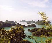
Some of the island groups in Thailand come in clusters of numerous individual islands; Phang Nga bay
Phang Nga Bay
Phang Nga Bay is a 400 km² bay in the Andaman Sea between the island of Phuket and the mainland of the Malay peninsula of southern Thailand. Since 1981, an extensive section of the bay has been protected as the Ao Phang Nga National Park...
has 67, the Mu Ko Chang National Park
Mu Ko Chang National Park
Mu Ko Chang National Park is located in Ko Chang District, Trat Province, eastern Thailand. It is a marine national park with an area of , covering more than 52 islands. The most notable island within the archipelago is Ko Chang. Established in 1982, it is an IUCN Category II protected area with...
has 52, Tarutao National Marine Park
Tarutao National Marine Park
Tarutao National Marine Park consists of 51 islands located in the Andaman Sea, off the coast of Satun Province of Southern Thailand. The Tarutao National Marine Park consists of two island groups: Tarutao and Adang-Rawi , which are scattered from 20 to 70 kilometers distance from the...
has 51, and Mu Ko Ang Thong National Park
Mu Ko Ang Thong National Park
Mu Ko Ang Thong is a marine national park in the Gulf of Thailand, at the shore of the Surat Thani Province. It covers 42 islands in a total area of 102 km², of which only 18 km² are land...
has 42. Owing to the large amount of islands in Thailand the list below is not all-inclusive.
Notes:
- 1. In ThaiThai languageThai , also known as Central Thai and Siamese, is the national and official language of Thailand and the native language of the Thai people, Thailand's dominant ethnic group. Thai is a member of the Tai group of the Tai–Kadai language family. Historical linguists have been unable to definitively...
, the names of islands are usually preceded with the word Ko (ThaiThai alphabetThai script , is used to write the Thai language and other, minority, languages in Thailand. It has forty-four consonants , fifteen vowel symbols that combine into at least twenty-eight vowel forms, and four tone marks ....
เกาะ), the Thai word for island. This word is often alternately romanized as Koh, Go or Goh. Thus English languageEnglish languageEnglish is a West Germanic language that arose in the Anglo-Saxon kingdoms of England and spread into what was to become south-east Scotland under the influence of the Anglian medieval kingdom of Northumbria...
references to the names of the Thai islands should not have an additional island in their name, or else the Ko should be left out. For example, "Ko Phi Phi Island" would be redundant, since Ko Phi Phi already means "Phi Phi Island" - 2. Various mapsMAPSMaps is the plural of map, a visual representation of an area.As an acronym, MAPS may refer to:* Mail Abuse Prevention System, an organisation that provides anti-spam support...
commonly spell Thai names differently, using different transliterationTransliterationTransliteration is a subset of the science of hermeneutics. It is a form of translation, and is the practice of converting a text from one script into another...
s. For example, Ko Mak may be seen as Koh Mak, Koh Maak or even Koh Mark. This list gives precedence to the Royal Thai General System of TranscriptionRoyal Thai General System of TranscriptionThe Royal Thai General System of Transcription is the official system for rendering Thai language words in the Latin alphabet, published by the Royal Institute of Thailand...
favored by the Government of Thailand, for the English-based Thai transcription is now becoming obsolete.
To help in using search engines, the list also contains alternative names (used on some maps) either in the "Alternate spellings" column, or in parentheses.
List of larger, more well-known, Thai Islands
| Name | Thai Name | Alternate spellings | Province | Coordinates |
|---|---|---|---|---|
| Ko Chang Ko Chang Ko Chang is the third largest island of Thailand , located on the Thai east coast 310 km away from Bangkok near the border to Cambodia in the Gulf of Thailand. The name means Elephant Island. Ko Chang was named for the elephant shape of its headland, although elephants are not indigenous to... |
เกาะช้าง | Trat Trat Province Trat is a province of Thailand. It is located in the east of Thailand, and has borders with Chanthaburi Province to the northwest, Cambodia to the east, and the Gulf of Thailand to the south.Trat is most famous for gemstone mining and trading.... |
12.06°N 102.33°E | |
| Ko Kut Ko Kut Ko Kut is a district of Trat Province, eastern Thailand, consisting of a group of islands. With a population of about 2000 it is the district with the lowest population of all Thailand.-History:... |
เกาะกูด | Kood | Trat Trat Province Trat is a province of Thailand. It is located in the east of Thailand, and has borders with Chanthaburi Province to the northwest, Cambodia to the east, and the Gulf of Thailand to the south.Trat is most famous for gemstone mining and trading.... |
11.66°N 102.57°E |
| Ko Lanta Yai Ko Lanta Yai Ko Lanta Yai is located in the Andaman Sea off the west coast of Thailand, between the Phi Phi Islands islands and the mainland. They are politically part of Krabi Province, most of which is on the mainland.... |
เกาะลันตาใหญ่ | Krabi Krabi Province Krabi is one of the southern provinces of Thailand, at the shore of the Andaman Sea. Neighbouring provinces are Phang Nga, Surat Thani, Nakhon Si Thammarat and Trang. The Phuket province to the west is also neighbouring, but without any land boundary... |
7°35′N 99°03′E | |
| Ko Mak Ko Mak Ko Mak is a small island of Trat Province, Thailand. This island is named after the Areca nut .-Geography:Ko Mak has 27 km coastline, many long sand beaches, a few hills and it is about 16 km² in area.... |
เกาะหมาก | Ko Mark, Koh Mark | Trat Trat Province Trat is a province of Thailand. It is located in the east of Thailand, and has borders with Chanthaburi Province to the northwest, Cambodia to the east, and the Gulf of Thailand to the south.Trat is most famous for gemstone mining and trading.... |
11.819°N 102.480°E |
| Ko Pha Ngan Ko Pha Ngan Ko Pha Ngan is an island in the Gulf of Thailand in South East Thailand. It is famous for its full moon party at Haad Rin Beach and as a backpackers destination. Ko Pha Ngan has two sister islands: the larger Ko Samui to the south and the smaller Ko Tao to the north.* Area: about 168 km²*... |
เกาะพะงัน | Surat Thani Surat Thani Province Surat Thani is the largest of the southern provinces of Thailand, on the eastern shore of the Gulf of Thailand. Surat Thani means City of Good People, the title given to the city by King Vajiravudh .... |
9°45′N 100°02′E | |
| Ko Phi Phi Lee Ko Phi Phi Lee Koh Phi Phi Leh or Ko Phi Phi Ley is an island of the Phi Phi archipelago, in the Andaman Sea. It belongs to the Krabi province of Thailand.-Geography:... |
เกาะพีพีเล | Phi Phi Leh | Krabi Krabi Province Krabi is one of the southern provinces of Thailand, at the shore of the Andaman Sea. Neighbouring provinces are Phang Nga, Surat Thani, Nakhon Si Thammarat and Trang. The Phuket province to the west is also neighbouring, but without any land boundary... |
7.68°N 98.768°E |
| Ko Phi Phi Don Ko Phi Phi Don Ko Phi Phi Don is the largest of the Phi Phi Islands, in Thailand. It is the only island in the group with permanent inhabitants.Like the other islands in the group, Ko Phi Phi Don is a non-volcanic island largely made of limestone. It is almost separated into two islands, but a strand of flat... |
เกาะพีพีดอน | Krabi Krabi Province Krabi is one of the southern provinces of Thailand, at the shore of the Andaman Sea. Neighbouring provinces are Phang Nga, Surat Thani, Nakhon Si Thammarat and Trang. The Phuket province to the west is also neighbouring, but without any land boundary... |
7.741°N 98.780°E | |
| Ko Rang Ko Rang Ko Rang is an island in the southwestern part of the Ko Chang archipelago on the southeastern edge of the Gulf of Thailand. The island rises up out of 60m of water in most places and has few beaches. The southeastern corner of the island offers a reasonable anchorage and the Thai Coast Guard has... |
เกาะรัง | Ko Rung, Koh Rung | Trat Trat Province Trat is a province of Thailand. It is located in the east of Thailand, and has borders with Chanthaburi Province to the northwest, Cambodia to the east, and the Gulf of Thailand to the south.Trat is most famous for gemstone mining and trading.... |
11.80°N 102.387°E |
| Ko Samet Ko Samet Ko Samet , is one of the Eastern Seaboard Islands of Thailand. It is located in the Gulf of Thailand off the coastline of the Thai province of Rayong, approximately southeast of Bangkok. Ko Samet is part of the Phe Subdistrict of the Amphoe Mueang Rayong , of Rayong province... |
เกาะเสม็ด | Ko Samed, Koh Samed | Rayong Rayong Province Rayong province is a province of Thailand. Neighboring provinces are Chon Buri and Chanthaburi. To the south is the Gulf of Thailand.-History:... |
12.565°N 101.45°E |
| Ko Samui Ko Samui Ko Samui island of Surat Thani Province , or often, simply Samui as it is referred to by locals, is an island off the east coast of the Kra Isthmus in Thailand, close to the mainland Surat Thani town. It is Thailand's second largest island, with an area of 228.7 km2 and a population of over... |
เกาะสมุย | Surat Thani Surat Thani Province Surat Thani is the largest of the southern provinces of Thailand, on the eastern shore of the Gulf of Thailand. Surat Thani means City of Good People, the title given to the city by King Vajiravudh .... |
9.50°N 100.00°E | |
| Ko Tao Ko Tao Ko Tao is an island in Thailand located near the western shore of the Gulf of Thailand. It covers an area of about 21 km². Administratively it forms a tambon within the district Ko Pha Ngan of Surat Thani Province. As of 2006 its official population is 1382... |
เกาะเต่า | Surat Thani Surat Thani Province Surat Thani is the largest of the southern provinces of Thailand, on the eastern shore of the Gulf of Thailand. Surat Thani means City of Good People, the title given to the city by King Vajiravudh .... |
10.09°N 99.838°E | |
| Ko Tapu | เกาะตะปู | Phang Nga Phang Nga Province Phang Nga is one of the southern provinces of Thailand, on the shore to the Andaman Sea. Neighboring provinces are Ranong, Surat Thani and Krabi. To the south is the Phuket province, but without land boundary to Phang Nga.... |
8°16′31.36"N 98°30′02.02"E | |
| Phuket Phuket City Phuket is a city located in the southeast of Phuket Island, Thailand. It is the capital of the Phuket Province, covering all of the island. As of 2007 the city has a population of 75,573 people... |
ภูเก็ต | Phuket Phuket Province Phuket , formerly known as Thalang and, in Western sources, Junk Ceylon , is one of the southern provinces of Thailand... |
7°58′N 98°20′E | |
| Similan Islands Similan Islands The Similan Islands is a group of islands in the Andaman Sea off the coast of Phang Nga Province, southern Thailand. It is a national park which was established in 1982.... |
เกาะสิมิลัน | Phang Nga Phang Nga Province Phang Nga is one of the southern provinces of Thailand, on the shore to the Andaman Sea. Neighboring provinces are Ranong, Surat Thani and Krabi. To the south is the Phuket province, but without land boundary to Phang Nga.... |
8.65°N 97.65°E | |
| Ko Tarutao | เกาะตะรุเตา | Satun Satun Province Satun is one of the southern provinces of Thailand. Neighboring provinces are Trang, Phatthalung and Songkhla... |
6°35′N 99°38′E | |
Eastern SeaboardEastern Seaboard of ThailandThe Eastern Seaboard of Thailand is an emerging economic region, and plays a key role in Thailand's economy. Its importance lies in the fact that it is Thailand's center for export oriented industries. High value goods, such as Japanese branded automobiles, which are manufactured there and...
Islands
| Name | Thai Name | Alternate spellings | Province | Island Chain, Group, Archipelago | Coordinates |
|---|---|---|---|---|---|
| Ko Sichang | เกาะสีชัง | Chon Buri | 13.145°N 100.813°E | ||
| Ko Kham Yai | เกาะขามใหญ่ | Chon Buri | Sichang group | 13.167°N 100.824°E | |
| Ko Kham Noi | เกาะขามน้อย | Chon Buri | Sichang group | 13.1744°N 100.8301°E | |
| Ko Ram Dok Mai | เกาะร้ามดอกไม้ | Ko Lam Dokmai | Chon Buri | Sichang group | 13.1528°N 100.8342°E |
| Ko Khang Khao | เกาะค้างคาว | Chon Buri | Sichang group | 13.114°N 100.808°E | |
| Ko Prong | เกาะปรง | Chon Buri | Sichang group | 13.1652°N 100.8330°E | |
| Ko Yai Thao | Chon Buri | Sichang group | 13.1234°N 100.8093°E | ||
| Ko Thaai Tamuen | Chon Buri | Sichang group | 13.1088°N 100.8033°E | ||
| Ko Nok | เกาะนอก | Chon Buri | Rocky islet off Pattaya Bay | 13.006°N 100.8033°E | |
| Ko Chun | Chon Buri | Rocky islet with a lighthouse and a single bush off Pattaya Bay | 12.930°N 100.81°E | ||
| Ko Lan Ko Lan Ko Lan is one of the Eastern Seaboard islands of Thailand.-Geography:Ko Lan is the largest of the "Near Islands", off south Pattaya. It is located at the SE end of the Bay of Bangkok, on the eastern side of the Gulf of Siam... |
เกาะล้าน | Chon Buri | "Near Islands", off Pattaya Pattaya Pattaya is a city in Thailand, located on the east coast of the Gulf of Thailand, about 165 km southeast of Bangkok located within but not part of Amphoe Bang Lamung in the province of Chonburi.... |
12.92°N 100.78°E | |
| Ko Sak Ko Lan Ko Lan is one of the Eastern Seaboard islands of Thailand.-Geography:Ko Lan is the largest of the "Near Islands", off south Pattaya. It is located at the SE end of the Bay of Bangkok, on the eastern side of the Gulf of Siam... |
เกาะสาก | Chon Buri | "Near Islands", off Pattaya Pattaya Pattaya is a city in Thailand, located on the east coast of the Gulf of Thailand, about 165 km southeast of Bangkok located within but not part of Amphoe Bang Lamung in the province of Chonburi.... |
12.9275°N 100.7920°E | |
| Ko Krok Ko Lan Ko Lan is one of the Eastern Seaboard islands of Thailand.-Geography:Ko Lan is the largest of the "Near Islands", off south Pattaya. It is located at the SE end of the Bay of Bangkok, on the eastern side of the Gulf of Siam... |
เกาะครก | Krok | Chon Buri | "Near Islands", off Pattaya Pattaya Pattaya is a city in Thailand, located on the east coast of the Gulf of Thailand, about 165 km southeast of Bangkok located within but not part of Amphoe Bang Lamung in the province of Chonburi.... |
12.9434°N 100.8057°E |
| Ko Luam Ko Phai Ko Phai is the largest island in Mu Ko Phai , a small uninhabited archipelago belonging to the Eastern Seaboard Islands of Thailand. It is located about 21 km to the west of Pattaya. It is also mentioned as "Bamboo Island", the meaning of its name in Thai, in tourist guides... |
เกาะเหลื่อม | Chon Buri | "Far Islands", off Pattaya Pattaya Pattaya is a city in Thailand, located on the east coast of the Gulf of Thailand, about 165 km southeast of Bangkok located within but not part of Amphoe Bang Lamung in the province of Chonburi.... |
12.9581°N 100.6506°E | |
| Ko Luam Noi Ko Phai Ko Phai is the largest island in Mu Ko Phai , a small uninhabited archipelago belonging to the Eastern Seaboard Islands of Thailand. It is located about 21 km to the west of Pattaya. It is also mentioned as "Bamboo Island", the meaning of its name in Thai, in tourist guides... |
เกาะเหลื่อมน้อย | Ko Lueam Noi | Chon Buri | "Far Islands", off Pattaya Pattaya Pattaya is a city in Thailand, located on the east coast of the Gulf of Thailand, about 165 km southeast of Bangkok located within but not part of Amphoe Bang Lamung in the province of Chonburi.... |
12.9566°N 100.6573°E |
| Ko Phai Ko Phai Ko Phai is the largest island in Mu Ko Phai , a small uninhabited archipelago belonging to the Eastern Seaboard Islands of Thailand. It is located about 21 km to the west of Pattaya. It is also mentioned as "Bamboo Island", the meaning of its name in Thai, in tourist guides... |
เกาะไผ่ | Koh Pai | Chon Buri | "Far Islands", off Pattaya Pattaya Pattaya is a city in Thailand, located on the east coast of the Gulf of Thailand, about 165 km southeast of Bangkok located within but not part of Amphoe Bang Lamung in the province of Chonburi.... |
12.934°N 100.675°E |
| Ko Hu Chang Ko Phai Ko Phai is the largest island in Mu Ko Phai , a small uninhabited archipelago belonging to the Eastern Seaboard Islands of Thailand. It is located about 21 km to the west of Pattaya. It is also mentioned as "Bamboo Island", the meaning of its name in Thai, in tourist guides... |
เกาะหูช้าง | Hoo Chang | Chon Buri | "Far Islands", off Pattaya Pattaya Pattaya is a city in Thailand, located on the east coast of the Gulf of Thailand, about 165 km southeast of Bangkok located within but not part of Amphoe Bang Lamung in the province of Chonburi.... |
12.9105°N 100.6775°E |
| Ko Klung Badan Ko Phai Ko Phai is the largest island in Mu Ko Phai , a small uninhabited archipelago belonging to the Eastern Seaboard Islands of Thailand. It is located about 21 km to the west of Pattaya. It is also mentioned as "Bamboo Island", the meaning of its name in Thai, in tourist guides... |
เกาะกรุงบาดาล | Krung badan | Chon Buri | "Far Islands", off Pattaya Pattaya Pattaya is a city in Thailand, located on the east coast of the Gulf of Thailand, about 165 km southeast of Bangkok located within but not part of Amphoe Bang Lamung in the province of Chonburi.... |
12.9026°N 100.6796°E |
| Ko Man Wichai Ko Phai Ko Phai is the largest island in Mu Ko Phai , a small uninhabited archipelago belonging to the Eastern Seaboard Islands of Thailand. It is located about 21 km to the west of Pattaya. It is also mentioned as "Bamboo Island", the meaning of its name in Thai, in tourist guides... |
เกาะมารวิชัย | Mun Wichai | Chon Buri | "Far Islands", off Pattaya Pattaya Pattaya is a city in Thailand, located on the east coast of the Gulf of Thailand, about 165 km southeast of Bangkok located within but not part of Amphoe Bang Lamung in the province of Chonburi.... |
12.8763°N 100.6742°E |
| Ko Rin | เกาะริน | Chon Buri | south of "Far Islands", off Pattaya Pattaya Pattaya is a city in Thailand, located on the east coast of the Gulf of Thailand, about 165 km southeast of Bangkok located within but not part of Amphoe Bang Lamung in the province of Chonburi.... |
||
| Ko Hin Khao | เกาะหินแก้ว | Hin Khao | Chon Buri | south of "Far Islands", off Pattaya Pattaya Pattaya is a city in Thailand, located on the east coast of the Gulf of Thailand, about 165 km southeast of Bangkok located within but not part of Amphoe Bang Lamung in the province of Chonburi.... |
|
| Hin Ton Mai | Chon Buri | a rock south of "Far Islands", off Pattaya Pattaya Pattaya is a city in Thailand, located on the east coast of the Gulf of Thailand, about 165 km southeast of Bangkok located within but not part of Amphoe Bang Lamung in the province of Chonburi.... |
|||
| Ko Kram | เกาะคราม | Khram | Chon Buri | 12.70°N 100.79°E | |
| Ko Kram Noi | เกาะครามน้อย | Chon Buri | Ko Kram group | 12.727°N 100.798°E | |
| Ko Era | I Ra | Chon Buri | Ko Kram group | 12.676°N 100.823°E | |
| Ko Kram (UID) | เกาะคราม | Kram | Chon Buri | Ko Kram group | 12.761°N 100.845°E |
| Ko Samaesan | เกาะแสมสาร | Samae San | Chon Buri | 12.573°N 100.95°E | |
| Ko Kham (Chonburi) | เกาะขาม | Chon Buri | Ko Samaesan group | 12.573°N 100.934°E | |
| Ko Raet | เกาะแรด | Rat, Rad | Chon Buri | Ko Samaesan group | 12.585°N 100.964°E |
| Ko Chang Kluea | Changkluea | Chon Buri | Ko Samaesan group | 12.550°N 100.971°E | |
| Ko Chuang | เกาะช่วง | Chon Buri | Ko Samaesan group | 12.520°N 100.96°E | |
| Ko Chan | Chon Buri | Ko Samaesan group | 12.521°N 100.970°E | ||
| Ko Rong Nang | Chon Buri | Ko Samaesan group | 12.53437°N 100.95870°E | ||
| Ko Rong Khon | Chon Buri | Ko Samaesan group | 12.53169°N 100.95972°E | ||
| Ko Samet Ko Samet Ko Samet , is one of the Eastern Seaboard Islands of Thailand. It is located in the Gulf of Thailand off the coastline of the Thai province of Rayong, approximately southeast of Bangkok. Ko Samet is part of the Phe Subdistrict of the Amphoe Mueang Rayong , of Rayong province... |
เกาะเสม็ด | Rayong Rayong Province Rayong province is a province of Thailand. Neighboring provinces are Chon Buri and Chanthaburi. To the south is the Gulf of Thailand.-History:... |
12.565°N 101.45°E | ||
| Ko Platin | Rayong Rayong Province Rayong province is a province of Thailand. Neighboring provinces are Chon Buri and Chanthaburi. To the south is the Gulf of Thailand.-History:... |
Ko Samet group | 12.6019°N 101.5148°E | ||
| Ko Kraui | Rayong Rayong Province Rayong province is a province of Thailand. Neighboring provinces are Chon Buri and Chanthaburi. To the south is the Gulf of Thailand.-History:... |
Ko Samet group | 12.5932°N 101.5108°E | ||
| Ko Kudi | Kudee | Rayong Rayong Province Rayong province is a province of Thailand. Neighboring provinces are Chon Buri and Chanthaburi. To the south is the Gulf of Thailand.-History:... |
Ko Samet group | 12.5839°N 101.5101°E | |
| Ko Khangkhao | Rayong Rayong Province Rayong province is a province of Thailand. Neighboring provinces are Chon Buri and Chanthaburi. To the south is the Gulf of Thailand.-History:... |
Ko Samet group | 12.5796°N 101.5104°E | ||
| Ko Kham Ko Kham Ko Kham is a small island near Ko Mak, on Trat Province, Thailand.It can be reached with a sea kayak from Ko Mak or by walking during low tide. Ko Kham has nice places to snorkel, depending on the direction of wind. Especially the south beach has a calm sea, nice sand dune, black lava rocks with... |
เกาะเสม็ด | Rayong Rayong Province Rayong province is a province of Thailand. Neighboring provinces are Chon Buri and Chanthaburi. To the south is the Gulf of Thailand.-History:... |
Ko Samet group | 12.5945°N 101.509°E | |
| Ko Yangklao | Yungklao | Rayong Rayong Province Rayong province is a province of Thailand. Neighboring provinces are Chon Buri and Chanthaburi. To the south is the Gulf of Thailand.-History:... |
Ko Samet group | 12.5578°N 101.5691°E | |
| Ko Thalu | Rayong Rayong Province Rayong province is a province of Thailand. Neighboring provinces are Chon Buri and Chanthaburi. To the south is the Gulf of Thailand.-History:... |
Ko Samet group | 12.5557°N 101.5695°E | ||
| Ko Man Nai | เกาะมันใน | Man Nai | Rayong Rayong Province Rayong province is a province of Thailand. Neighboring provinces are Chon Buri and Chanthaburi. To the south is the Gulf of Thailand.-History:... |
Ko Samet group, East | 12.6114°N 101.688°E |
| Ko Man Khlang | เกาะมันกลาง | Man Glang | Rayong Rayong Province Rayong province is a province of Thailand. Neighboring provinces are Chon Buri and Chanthaburi. To the south is the Gulf of Thailand.-History:... |
Ko Samet group, East | 12.5975°N 101.692°E |
| Ko Man Nok | เกาะมันนอก | Mun Nok, Mun Nawk | Rayong Rayong Province Rayong province is a province of Thailand. Neighboring provinces are Chon Buri and Chanthaburi. To the south is the Gulf of Thailand.-History:... |
Ko Samet group, East | 12.5841°N 101.697°E |
Islands near Cambodia
| Name | Thai Name | Alternate spellings | Province | Island Chain, Group, Archipelago | Coordinates |
|---|---|---|---|---|---|
| Ko Chang Ko Chang Ko Chang is the third largest island of Thailand , located on the Thai east coast 310 km away from Bangkok near the border to Cambodia in the Gulf of Thailand. The name means Elephant Island. Ko Chang was named for the elephant shape of its headland, although elephants are not indigenous to... |
เกาะช้าง | Trat Trat Province Trat is a province of Thailand. It is located in the east of Thailand, and has borders with Chanthaburi Province to the northwest, Cambodia to the east, and the Gulf of Thailand to the south.Trat is most famous for gemstone mining and trading.... |
12.06°N 102.33°E | ||
| Ko Ngam | เกาะง่าม | Trat Trat Province Trat is a province of Thailand. It is located in the east of Thailand, and has borders with Chanthaburi Province to the northwest, Cambodia to the east, and the Gulf of Thailand to the south.Trat is most famous for gemstone mining and trading.... |
Ko Chang Marine National Park | 11.951°N 102.443°E | |
| Ko Phrao Nai | เกาะพร้าวใน | Trat Trat Province Trat is a province of Thailand. It is located in the east of Thailand, and has borders with Chanthaburi Province to the northwest, Cambodia to the east, and the Gulf of Thailand to the south.Trat is most famous for gemstone mining and trading.... |
Ko Chang Marine National Park | 11.982°N 102.387°E | |
| Ko Phrao Nok | เกาะพร้าวนอก | Trat Trat Province Trat is a province of Thailand. It is located in the east of Thailand, and has borders with Chanthaburi Province to the northwest, Cambodia to the east, and the Gulf of Thailand to the south.Trat is most famous for gemstone mining and trading.... |
Ko Chang Marine National Park | 11.973°N 102.392°E | |
| Ko Chang Noi | เกาะช้างน้อย | Trat Trat Province Trat is a province of Thailand. It is located in the east of Thailand, and has borders with Chanthaburi Province to the northwest, Cambodia to the east, and the Gulf of Thailand to the south.Trat is most famous for gemstone mining and trading.... |
Ko Chang Marine National Park | ||
| Ko Yuak | Trat Trat Province Trat is a province of Thailand. It is located in the east of Thailand, and has borders with Chanthaburi Province to the northwest, Cambodia to the east, and the Gulf of Thailand to the south.Trat is most famous for gemstone mining and trading.... |
Ko Chang Marine National Park | |||
| Ko Man Nai | เกาะมันใน | Trat Trat Province Trat is a province of Thailand. It is located in the east of Thailand, and has borders with Chanthaburi Province to the northwest, Cambodia to the east, and the Gulf of Thailand to the south.Trat is most famous for gemstone mining and trading.... |
Ko Chang Marine National Park | ||
| Ko Man Nok | เกาะมันนอก | Mun Nok | Trat Trat Province Trat is a province of Thailand. It is located in the east of Thailand, and has borders with Chanthaburi Province to the northwest, Cambodia to the east, and the Gulf of Thailand to the south.Trat is most famous for gemstone mining and trading.... |
Ko Chang Marine National Park | |
| Ko Klum | เกาะคลุ้ม | Kloom | Trat Trat Province Trat is a province of Thailand. It is located in the east of Thailand, and has borders with Chanthaburi Province to the northwest, Cambodia to the east, and the Gulf of Thailand to the south.Trat is most famous for gemstone mining and trading.... |
Ko Chang Marine National Park | 11.914°N 102.354°E |
| Mu Ko Lao Ya | หมู่เกาะเหลายา | Moo Koh Lao Ya | Trat Trat Province Trat is a province of Thailand. It is located in the east of Thailand, and has borders with Chanthaburi Province to the northwest, Cambodia to the east, and the Gulf of Thailand to the south.Trat is most famous for gemstone mining and trading.... |
Island pair in Ko Chang MNP | 11.942°N 102.407°E |
| Ko Lao Ya Nai | เกาะเหลายาใน | Trat Trat Province Trat is a province of Thailand. It is located in the east of Thailand, and has borders with Chanthaburi Province to the northwest, Cambodia to the east, and the Gulf of Thailand to the south.Trat is most famous for gemstone mining and trading.... |
Ko Chang Marine National Park | 11.942°N 102.407°E | |
| Ko Lao Ya Nok | เกาะเหลายานอก | Trat Trat Province Trat is a province of Thailand. It is located in the east of Thailand, and has borders with Chanthaburi Province to the northwest, Cambodia to the east, and the Gulf of Thailand to the south.Trat is most famous for gemstone mining and trading.... |
Ko Chang Marine National Park | 11.931°N 102.411°E | |
| Ko Wai | เกาะหวาย | Trat Trat Province Trat is a province of Thailand. It is located in the east of Thailand, and has borders with Chanthaburi Province to the northwest, Cambodia to the east, and the Gulf of Thailand to the south.Trat is most famous for gemstone mining and trading.... |
Ko Chang Marine National Park | 11.900°N 102.405°E | |
| Mu Ko Mai Si | Moo Koh Mai See | Trat Trat Province Trat is a province of Thailand. It is located in the east of Thailand, and has borders with Chanthaburi Province to the northwest, Cambodia to the east, and the Gulf of Thailand to the south.Trat is most famous for gemstone mining and trading.... |
Island pair in Ko Chang MNP | 11.946°N 102.475°E | |
| Ko Mai Si Yai | Trat Trat Province Trat is a province of Thailand. It is located in the east of Thailand, and has borders with Chanthaburi Province to the northwest, Cambodia to the east, and the Gulf of Thailand to the south.Trat is most famous for gemstone mining and trading.... |
Ko Chang MNP | 11.946°N 102.475°E | ||
| Ko Mai Si Lek | Trat Trat Province Trat is a province of Thailand. It is located in the east of Thailand, and has borders with Chanthaburi Province to the northwest, Cambodia to the east, and the Gulf of Thailand to the south.Trat is most famous for gemstone mining and trading.... |
Ko Chang MNP | 11.955°N 102.497°E | ||
| Ko Bai Dang | เกาะไปแดง | Trat Trat Province Trat is a province of Thailand. It is located in the east of Thailand, and has borders with Chanthaburi Province to the northwest, Cambodia to the east, and the Gulf of Thailand to the south.Trat is most famous for gemstone mining and trading.... |
Ko Chang Marine National Park | 11.898°N 102.451°E | |
| Ko Chan | Trat Trat Province Trat is a province of Thailand. It is located in the east of Thailand, and has borders with Chanthaburi Province to the northwest, Cambodia to the east, and the Gulf of Thailand to the south.Trat is most famous for gemstone mining and trading.... |
Ko Chang Marine National Park | 11.916°N 102.473°E | ||
| Ko Kut Ko Kut Ko Kut is a district of Trat Province, eastern Thailand, consisting of a group of islands. With a population of about 2000 it is the district with the lowest population of all Thailand.-History:... |
เกาะกูด | Ko Kuut, Koh Koot | Trat Trat Province Trat is a province of Thailand. It is located in the east of Thailand, and has borders with Chanthaburi Province to the northwest, Cambodia to the east, and the Gulf of Thailand to the south.Trat is most famous for gemstone mining and trading.... |
Ko Chang Marine National Park | 11.66°N 102.57°E |
| Ko Mak Ko Mak Ko Mak is a small island of Trat Province, Thailand. This island is named after the Areca nut .-Geography:Ko Mak has 27 km coastline, many long sand beaches, a few hills and it is about 16 km² in area.... |
เกาะหมาก | Ko Maak | Trat Trat Province Trat is a province of Thailand. It is located in the east of Thailand, and has borders with Chanthaburi Province to the northwest, Cambodia to the east, and the Gulf of Thailand to the south.Trat is most famous for gemstone mining and trading.... |
Ko Chang Marine National Park | 11.819°N 102.480°E |
| Ko Phi Ko Phi Ko Phi is a small unoccupied island near Ko Mak, in Trat Province, Thailand.It can be reached with a sea kayak from Ko Mak. Ko Phi has places to snorkel, depending on the direction of wind.... |
เกาะพี | Trat Trat Province Trat is a province of Thailand. It is located in the east of Thailand, and has borders with Chanthaburi Province to the northwest, Cambodia to the east, and the Gulf of Thailand to the south.Trat is most famous for gemstone mining and trading.... |
Ko Chang Marine National Park | ||
| Ko Kham Ko Kham Ko Kham is a small island near Ko Mak, on Trat Province, Thailand.It can be reached with a sea kayak from Ko Mak or by walking during low tide. Ko Kham has nice places to snorkel, depending on the direction of wind. Especially the south beach has a calm sea, nice sand dune, black lava rocks with... |
เกาะขาม | Trat Trat Province Trat is a province of Thailand. It is located in the east of Thailand, and has borders with Chanthaburi Province to the northwest, Cambodia to the east, and the Gulf of Thailand to the south.Trat is most famous for gemstone mining and trading.... |
Ko Chang Marine National Park | ||
| Ko Rayang Nok | Trat Trat Province Trat is a province of Thailand. It is located in the east of Thailand, and has borders with Chanthaburi Province to the northwest, Cambodia to the east, and the Gulf of Thailand to the south.Trat is most famous for gemstone mining and trading.... |
Ko Chang Marine National Park | 11.798°N 102.451°E | ||
| Ko Kradat | เกาะกระดาษ | Trat Trat Province Trat is a province of Thailand. It is located in the east of Thailand, and has borders with Chanthaburi Province to the northwest, Cambodia to the east, and the Gulf of Thailand to the south.Trat is most famous for gemstone mining and trading.... |
Ko Chang Marine National Park | 11.840°N 102.5275°E | |
| Mu Ko Rang | หมู่เกาะรัง | Moo Ko Rang | Trat Trat Province Trat is a province of Thailand. It is located in the east of Thailand, and has borders with Chanthaburi Province to the northwest, Cambodia to the east, and the Gulf of Thailand to the south.Trat is most famous for gemstone mining and trading.... |
12-island group in Ko Chang MNP | 11.80°N 102.387°E |
| Ko Rang Ko Rang Ko Rang is an island in the southwestern part of the Ko Chang archipelago on the southeastern edge of the Gulf of Thailand. The island rises up out of 60m of water in most places and has few beaches. The southeastern corner of the island offers a reasonable anchorage and the Thai Coast Guard has... |
เกาะรัง | Trat Trat Province Trat is a province of Thailand. It is located in the east of Thailand, and has borders with Chanthaburi Province to the northwest, Cambodia to the east, and the Gulf of Thailand to the south.Trat is most famous for gemstone mining and trading.... |
Ko Chang Marine National Park | 11.80°N 102.387°E | |
| Ko Tun | Trat Trat Province Trat is a province of Thailand. It is located in the east of Thailand, and has borders with Chanthaburi Province to the northwest, Cambodia to the east, and the Gulf of Thailand to the south.Trat is most famous for gemstone mining and trading.... |
Ko Chang Marine National Park | 11.774°N 102.393°E | ||
West CoastPrachuap Khiri Khan ProvincePrachuap Khiri Khan is one of the central provinces of Thailand. Neighboring provinces are Phetchaburi in the north and Chumphon in the south. To the west it borders Tanintharyi Division of Myanmar....
Islands
| Name | Thai Name | Alternate spellings | Province | Island Chain, Group, Archipelago | Coordinates |
|---|---|---|---|---|---|
| Ko Sai Ko Sai Ko Sai is one of the West Coast Islands of Thailand. This island lies off the western side of the Gulf of Siam, about 2 km away from the shore.... |
เกาะทราย | Ko Singto (Lion Island) | Prachuap Khiri Khan Prachuap Khiri Khan Province Prachuap Khiri Khan is one of the central provinces of Thailand. Neighboring provinces are Phetchaburi in the north and Chumphon in the south. To the west it borders Tanintharyi Division of Myanmar.... |
Pran Rocks (Islands off Hua Hin) | 12.483°N 100.000°E |
| Ko Sadao Ko Sai Ko Sai is one of the West Coast Islands of Thailand. This island lies off the western side of the Gulf of Siam, about 2 km away from the shore.... |
เกาะสะเดา | Ko Tao | Prachuap Khiri Khan Prachuap Khiri Khan Province Prachuap Khiri Khan is one of the central provinces of Thailand. Neighboring provinces are Phetchaburi in the north and Chumphon in the south. To the west it borders Tanintharyi Division of Myanmar.... |
Pran Rocks (Islands off Hua Hin) | 12.466°N 100.000°E |
| Ko Khi Nok Ko Sai Ko Sai is one of the West Coast Islands of Thailand. This island lies off the western side of the Gulf of Siam, about 2 km away from the shore.... |
เกาะขี้นก | Ko Nok | Prachuap Khiri Khan Prachuap Khiri Khan Province Prachuap Khiri Khan is one of the central provinces of Thailand. Neighboring provinces are Phetchaburi in the north and Chumphon in the south. To the west it borders Tanintharyi Division of Myanmar.... |
Pran Rocks (Islands off Hua Hin) | 12.483°N 100.000°E |
| Ko Kolam | Koh Kolum | Prachuap Khiri Khan Prachuap Khiri Khan Province Prachuap Khiri Khan is one of the central provinces of Thailand. Neighboring provinces are Phetchaburi in the north and Chumphon in the south. To the west it borders Tanintharyi Division of Myanmar.... |
Prachuap Khiri Khan Coast | 12.233°N 100.016°E | |
| Ko Kolam Sao | Prachuap Khiri Khan Prachuap Khiri Khan Province Prachuap Khiri Khan is one of the central provinces of Thailand. Neighboring provinces are Phetchaburi in the north and Chumphon in the south. To the west it borders Tanintharyi Division of Myanmar.... |
Prachuap Khiri Khan Coast | 12.231°N 100.016°E | ||
| Ko Sattakut | Prachuap Khiri Khan Prachuap Khiri Khan Province Prachuap Khiri Khan is one of the central provinces of Thailand. Neighboring provinces are Phetchaburi in the north and Chumphon in the south. To the west it borders Tanintharyi Division of Myanmar.... |
Prachuap Khiri Khan Coast | 12.200°N 100.016°E | ||
| Ko Rom Thale | Prachuap Khiri Khan Prachuap Khiri Khan Province Prachuap Khiri Khan is one of the central provinces of Thailand. Neighboring provinces are Phetchaburi in the north and Chumphon in the south. To the west it borders Tanintharyi Division of Myanmar.... |
Prachuap Khiri Khan Coast | 12.183°N 100.016°E | ||
| Ko Sing | Prachuap Khiri Khan Prachuap Khiri Khan Province Prachuap Khiri Khan is one of the central provinces of Thailand. Neighboring provinces are Phetchaburi in the north and Chumphon in the south. To the west it borders Tanintharyi Division of Myanmar.... |
Prachuap Khiri Khan Coast | 11.050°N 99.533°E | ||
| Ko Talu | Prachuap Khiri Khan Prachuap Khiri Khan Province Prachuap Khiri Khan is one of the central provinces of Thailand. Neighboring provinces are Phetchaburi in the north and Chumphon in the south. To the west it borders Tanintharyi Division of Myanmar.... |
Prachuap Khiri Khan Coast | |||
Southern Islands (Gulf of ThailandGulf of ThailandThe Gulf of Thailand , also known in to Malays as Teluk Siam literally meant Gulf of Siam, is a shallow arm of the South China Sea.-Geography:...
)
| Name | Thai Name | Alternate spellings | Province | Island Chain, Group, Archipelago | Coordinates |
|---|---|---|---|---|---|
| Ko Kra | Chumphon Chumphon Province Chumphon ) is one of the southern provinces of Thailand, at the shore of the Gulf of Thailand. Neighboring provinces are Prachuap Khiri Khan, Surat Thani and Ranong... |
Mu Koh Chumphon | 10.25°N 99.25°E | ||
| Ko Ran Gai | Chumphon Chumphon Province Chumphon ) is one of the southern provinces of Thailand, at the shore of the Gulf of Thailand. Neighboring provinces are Prachuap Khiri Khan, Surat Thani and Ranong... |
Mu Koh Chumphon | |||
| Ko Ran Bod | Chumphon Chumphon Province Chumphon ) is one of the southern provinces of Thailand, at the shore of the Gulf of Thailand. Neighboring provinces are Prachuap Khiri Khan, Surat Thani and Ranong... |
Mu Koh Chumphon | |||
| Ko Jarakae | เกาะจรเข้ | Chumphon Chumphon Province Chumphon ) is one of the southern provinces of Thailand, at the shore of the Gulf of Thailand. Neighboring provinces are Prachuap Khiri Khan, Surat Thani and Ranong... |
Mu Koh Chumphon | ||
| Ko Ngam Yai | เกาะงามใหญ่ | Chumphon Chumphon Province Chumphon ) is one of the southern provinces of Thailand, at the shore of the Gulf of Thailand. Neighboring provinces are Prachuap Khiri Khan, Surat Thani and Ranong... |
Mu Koh Chumphon | ||
| Ko Ngam Noi | เกาะงามน้อย | Chumphon Chumphon Province Chumphon ) is one of the southern provinces of Thailand, at the shore of the Gulf of Thailand. Neighboring provinces are Prachuap Khiri Khan, Surat Thani and Ranong... |
Mu Koh Chumphon | ||
| Ko Lak Ngam | Chumphon Chumphon Province Chumphon ) is one of the southern provinces of Thailand, at the shore of the Gulf of Thailand. Neighboring provinces are Prachuap Khiri Khan, Surat Thani and Ranong... |
Mu Koh Chumphon | |||
| Ko Samet (Chumphon) | Chumphon Chumphon Province Chumphon ) is one of the southern provinces of Thailand, at the shore of the Gulf of Thailand. Neighboring provinces are Prachuap Khiri Khan, Surat Thani and Ranong... |
Mu Koh Chumphon | |||
| Ko Matra | Chumphon Chumphon Province Chumphon ) is one of the southern provinces of Thailand, at the shore of the Gulf of Thailand. Neighboring provinces are Prachuap Khiri Khan, Surat Thani and Ranong... |
Mu Koh Chumphon | |||
| Ko Mapow | Chumphon Chumphon Province Chumphon ) is one of the southern provinces of Thailand, at the shore of the Gulf of Thailand. Neighboring provinces are Prachuap Khiri Khan, Surat Thani and Ranong... |
Mu Koh Chumphon | |||
| Ko Lawa | Chumphon Chumphon Province Chumphon ) is one of the southern provinces of Thailand, at the shore of the Gulf of Thailand. Neighboring provinces are Prachuap Khiri Khan, Surat Thani and Ranong... |
Mu Koh Chumphon | |||
| Ko Thalu | Chumphon Chumphon Province Chumphon ) is one of the southern provinces of Thailand, at the shore of the Gulf of Thailand. Neighboring provinces are Prachuap Khiri Khan, Surat Thani and Ranong... |
Mu Koh Chumphon | |||
| Ko Kalok | Chumphon Chumphon Province Chumphon ) is one of the southern provinces of Thailand, at the shore of the Gulf of Thailand. Neighboring provinces are Prachuap Khiri Khan, Surat Thani and Ranong... |
Mu Koh Chumphon | |||
| Ko Rangkajiw | Chumphon Chumphon Province Chumphon ) is one of the southern provinces of Thailand, at the shore of the Gulf of Thailand. Neighboring provinces are Prachuap Khiri Khan, Surat Thani and Ranong... |
Mu Koh Chumphon | |||
| Ko Lak Raet | Chumphon Chumphon Province Chumphon ) is one of the southern provinces of Thailand, at the shore of the Gulf of Thailand. Neighboring provinces are Prachuap Khiri Khan, Surat Thani and Ranong... |
Mu Koh Chumphon | |||
| Ko Kula | Chumphon Chumphon Province Chumphon ) is one of the southern provinces of Thailand, at the shore of the Gulf of Thailand. Neighboring provinces are Prachuap Khiri Khan, Surat Thani and Ranong... |
Mu Koh Chumphon | 10.25°N 99.25°E | ||
| Ko Klaep | Chumphon Chumphon Province Chumphon ) is one of the southern provinces of Thailand, at the shore of the Gulf of Thailand. Neighboring provinces are Prachuap Khiri Khan, Surat Thani and Ranong... |
Mu Koh Chumphon | |||
| Ko Khram | Chumphon Chumphon Province Chumphon ) is one of the southern provinces of Thailand, at the shore of the Gulf of Thailand. Neighboring provinces are Prachuap Khiri Khan, Surat Thani and Ranong... |
Mu Koh Chumphon | |||
| Ko Samui Ko Samui Ko Samui island of Surat Thani Province , or often, simply Samui as it is referred to by locals, is an island off the east coast of the Kra Isthmus in Thailand, close to the mainland Surat Thani town. It is Thailand's second largest island, with an area of 228.7 km2 and a population of over... |
เกาะสมุย | Surat Thani Surat Thani Province Surat Thani is the largest of the southern provinces of Thailand, on the eastern shore of the Gulf of Thailand. Surat Thani means City of Good People, the title given to the city by King Vajiravudh .... |
Samui-Pha Ngan-Tao | 9.50°N 100.00°E | |
| Ko Pha Ngan Ko Pha Ngan Ko Pha Ngan is an island in the Gulf of Thailand in South East Thailand. It is famous for its full moon party at Haad Rin Beach and as a backpackers destination. Ko Pha Ngan has two sister islands: the larger Ko Samui to the south and the smaller Ko Tao to the north.* Area: about 168 km²*... |
เกาะพะงัน | Surat Thani Surat Thani Province Surat Thani is the largest of the southern provinces of Thailand, on the eastern shore of the Gulf of Thailand. Surat Thani means City of Good People, the title given to the city by King Vajiravudh .... |
Samui-Pha Ngan-Tao | 9°45′N 100°02′E | |
| Ko Nang Yuan | Surat Thani Surat Thani Province Surat Thani is the largest of the southern provinces of Thailand, on the eastern shore of the Gulf of Thailand. Surat Thani means City of Good People, the title given to the city by King Vajiravudh .... |
Samui-Pha Ngan-Tao | |||
| Ko Tao Ko Tao Ko Tao is an island in Thailand located near the western shore of the Gulf of Thailand. It covers an area of about 21 km². Administratively it forms a tambon within the district Ko Pha Ngan of Surat Thani Province. As of 2006 its official population is 1382... |
เกาะเต่า | Surat Thani Surat Thani Province Surat Thani is the largest of the southern provinces of Thailand, on the eastern shore of the Gulf of Thailand. Surat Thani means City of Good People, the title given to the city by King Vajiravudh .... |
Samui-Pha Ngan-Tao | 10.09°N 99.838°E | |
| Ko Phaluai | Surat Thani Surat Thani Province Surat Thani is the largest of the southern provinces of Thailand, on the eastern shore of the Gulf of Thailand. Surat Thani means City of Good People, the title given to the city by King Vajiravudh .... |
Angthong Marine Park (S.) | |||
| Ko Tu | Surat Thani Surat Thani Province Surat Thani is the largest of the southern provinces of Thailand, on the eastern shore of the Gulf of Thailand. Surat Thani means City of Good People, the title given to the city by King Vajiravudh .... |
Angthong Marine Park (S.) | |||
| Ko Khluai | Surat Thani Surat Thani Province Surat Thani is the largest of the southern provinces of Thailand, on the eastern shore of the Gulf of Thailand. Surat Thani means City of Good People, the title given to the city by King Vajiravudh .... |
Angthong Marine Park (S.) | |||
| Ko Lak | Surat Thani Surat Thani Province Surat Thani is the largest of the southern provinces of Thailand, on the eastern shore of the Gulf of Thailand. Surat Thani means City of Good People, the title given to the city by King Vajiravudh .... |
Angthong Marine Park (S.) | |||
| Ko Mu Dang | Ko Moo Dang | Surat Thani Surat Thani Province Surat Thani is the largest of the southern provinces of Thailand, on the eastern shore of the Gulf of Thailand. Surat Thani means City of Good People, the title given to the city by King Vajiravudh .... |
Angthong Marine Park (S.) | ||
| Ko Tao Pun | Surat Thani Surat Thani Province Surat Thani is the largest of the southern provinces of Thailand, on the eastern shore of the Gulf of Thailand. Surat Thani means City of Good People, the title given to the city by King Vajiravudh .... |
Angthong Marine Park (S.) | |||
| Ko Kang Tak | Surat Thani Surat Thani Province Surat Thani is the largest of the southern provinces of Thailand, on the eastern shore of the Gulf of Thailand. Surat Thani means City of Good People, the title given to the city by King Vajiravudh .... |
Angthong Marine Park (S.) | |||
| Ko Pai Luek | Surat Thani Surat Thani Province Surat Thani is the largest of the southern provinces of Thailand, on the eastern shore of the Gulf of Thailand. Surat Thani means City of Good People, the title given to the city by King Vajiravudh .... |
Angthong Marine Park (E.) | |||
| Ko Wua Te | Surat Thani Surat Thani Province Surat Thani is the largest of the southern provinces of Thailand, on the eastern shore of the Gulf of Thailand. Surat Thani means City of Good People, the title given to the city by King Vajiravudh .... |
Angthong Marine Park (E.) | |||
| Ko Chae | Surat Thani Surat Thani Province Surat Thani is the largest of the southern provinces of Thailand, on the eastern shore of the Gulf of Thailand. Surat Thani means City of Good People, the title given to the city by King Vajiravudh .... |
Angthong Marine Park (E.) | |||
| Ko Wua Talah | Surat Thani Surat Thani Province Surat Thani is the largest of the southern provinces of Thailand, on the eastern shore of the Gulf of Thailand. Surat Thani means City of Good People, the title given to the city by King Vajiravudh .... |
Angthong Marine Park (N.) | |||
| Ko Phi | Koh Pee | Surat Thani Surat Thani Province Surat Thani is the largest of the southern provinces of Thailand, on the eastern shore of the Gulf of Thailand. Surat Thani means City of Good People, the title given to the city by King Vajiravudh .... |
Angthong Marine Park (N.) | ||
| Ko Mae Koh | Surat Thani Surat Thani Province Surat Thani is the largest of the southern provinces of Thailand, on the eastern shore of the Gulf of Thailand. Surat Thani means City of Good People, the title given to the city by King Vajiravudh .... |
Angthong Marine Park (N.) | |||
| Ko Hin Tak | Surat Thani Surat Thani Province Surat Thani is the largest of the southern provinces of Thailand, on the eastern shore of the Gulf of Thailand. Surat Thani means City of Good People, the title given to the city by King Vajiravudh .... |
Angthong Marine Park (N.) | |||
| Ko Sam Sao | Surat Thani Surat Thani Province Surat Thani is the largest of the southern provinces of Thailand, on the eastern shore of the Gulf of Thailand. Surat Thani means City of Good People, the title given to the city by King Vajiravudh .... |
Angthong Marine Park (N.) | |||
| Ko Ao Rad | Surat Thani Surat Thani Province Surat Thani is the largest of the southern provinces of Thailand, on the eastern shore of the Gulf of Thailand. Surat Thani means City of Good People, the title given to the city by King Vajiravudh .... |
Angthong Marine Park (N.) | |||
| Ko Pae Yat | Surat Thani Surat Thani Province Surat Thani is the largest of the southern provinces of Thailand, on the eastern shore of the Gulf of Thailand. Surat Thani means City of Good People, the title given to the city by King Vajiravudh .... |
Angthong Marine Park (N.) | |||
| Ko Pra | Surat Thani Surat Thani Province Surat Thani is the largest of the southern provinces of Thailand, on the eastern shore of the Gulf of Thailand. Surat Thani means City of Good People, the title given to the city by King Vajiravudh .... |
Angthong Marine Park (N.) | |||
| Ko Wua Kantang | Surat Thani Surat Thani Province Surat Thani is the largest of the southern provinces of Thailand, on the eastern shore of the Gulf of Thailand. Surat Thani means City of Good People, the title given to the city by King Vajiravudh .... |
Angthong Marine Park (N.) | |||
| Ko Chang Trom | Surat Thani Surat Thani Province Surat Thani is the largest of the southern provinces of Thailand, on the eastern shore of the Gulf of Thailand. Surat Thani means City of Good People, the title given to the city by King Vajiravudh .... |
Angthong Marine Park (N.) | |||
| Ko Sano Ban | Surat Thani Surat Thani Province Surat Thani is the largest of the southern provinces of Thailand, on the eastern shore of the Gulf of Thailand. Surat Thani means City of Good People, the title given to the city by King Vajiravudh .... |
Angthong Marine Park (N.) | |||
| Ko Lae | Surat Thani Surat Thani Province Surat Thani is the largest of the southern provinces of Thailand, on the eastern shore of the Gulf of Thailand. Surat Thani means City of Good People, the title given to the city by King Vajiravudh .... |
Angthong Marine Park (N.) | |||
| Ko Wa Noi | Surat Thani Surat Thani Province Surat Thani is the largest of the southern provinces of Thailand, on the eastern shore of the Gulf of Thailand. Surat Thani means City of Good People, the title given to the city by King Vajiravudh .... |
Angthong Marine Park (N.) | |||
| Ko Wa Yai | Surat Thani Surat Thani Province Surat Thani is the largest of the southern provinces of Thailand, on the eastern shore of the Gulf of Thailand. Surat Thani means City of Good People, the title given to the city by King Vajiravudh .... |
Angthong Marine Park (N.) | |||
| Ko Hin Dap | Surat Thani Surat Thani Province Surat Thani is the largest of the southern provinces of Thailand, on the eastern shore of the Gulf of Thailand. Surat Thani means City of Good People, the title given to the city by King Vajiravudh .... |
Angthong Marine Park (N.) | |||
| Ko Nai Put | Surat Thani Surat Thani Province Surat Thani is the largest of the southern provinces of Thailand, on the eastern shore of the Gulf of Thailand. Surat Thani means City of Good People, the title given to the city by King Vajiravudh .... |
Angthong Marine Park (N.) | |||
| Ko Ka | Surat Thani Surat Thani Province Surat Thani is the largest of the southern provinces of Thailand, on the eastern shore of the Gulf of Thailand. Surat Thani means City of Good People, the title given to the city by King Vajiravudh .... |
Angthong Marine Park (N.) | |||
| Ko Rod | Surat Thani Surat Thani Province Surat Thani is the largest of the southern provinces of Thailand, on the eastern shore of the Gulf of Thailand. Surat Thani means City of Good People, the title given to the city by King Vajiravudh .... |
Angthong Marine Park (N.) | |||
| Ko Ngam | Surat Thani Surat Thani Province Surat Thani is the largest of the southern provinces of Thailand, on the eastern shore of the Gulf of Thailand. Surat Thani means City of Good People, the title given to the city by King Vajiravudh .... |
Angthong Marine Park (N.) | |||
| Ko Tai Plao | Surat Thani Surat Thani Province Surat Thani is the largest of the southern provinces of Thailand, on the eastern shore of the Gulf of Thailand. Surat Thani means City of Good People, the title given to the city by King Vajiravudh .... |
Angthong Marine Park (N.) | |||
Southern Islands (AndamanAndaman SeaThe Andaman Sea or Burma Sea is a body of water to the southeast of the Bay of Bengal, south of Burma, west of Thailand and east of the Andaman Islands, India; it is part of the Indian Ocean....
Coast)
| Name | Thai Name | Alternate spellings | Province | Island Chain, Group, Archipelago | Coordinates |
|---|---|---|---|---|---|
| Ko Chang (Ranong) | Ranong Ranong Province Ranong is one of the southern provinces of Thailand, on the coast of the Andaman Sea. It is the province with the fewest citizens. Neighboring provinces are Chumphon, Surat Thani and Phang Nga... |
Ko Chang (Andaman) Archipelago | |||
| Ko Sin Hai | Ranong Ranong Province Ranong is one of the southern provinces of Thailand, on the coast of the Andaman Sea. It is the province with the fewest citizens. Neighboring provinces are Chumphon, Surat Thani and Phang Nga... |
Ko Chang (Andaman) Archipelago | |||
| Ko Dom | Ranong Ranong Province Ranong is one of the southern provinces of Thailand, on the coast of the Andaman Sea. It is the province with the fewest citizens. Neighboring provinces are Chumphon, Surat Thani and Phang Nga... |
Ko Chang (Andaman) Archipelago | |||
| Ko Plai | Ranong Ranong Province Ranong is one of the southern provinces of Thailand, on the coast of the Andaman Sea. It is the province with the fewest citizens. Neighboring provinces are Chumphon, Surat Thani and Phang Nga... |
Ko Chang (Andaman) Archipelago | |||
| Ko Talu (Rayong) | Ranong Ranong Province Ranong is one of the southern provinces of Thailand, on the coast of the Andaman Sea. It is the province with the fewest citizens. Neighboring provinces are Chumphon, Surat Thani and Phang Nga... |
Ko Chang (Andaman) Archipelago | |||
| Ko Phayam | เกาะพยาม | Payam | Ranong Ranong Province Ranong is one of the southern provinces of Thailand, on the coast of the Andaman Sea. It is the province with the fewest citizens. Neighboring provinces are Chumphon, Surat Thani and Phang Nga... |
||
| Ko Kang Khao | เกาะค้างคาว | Ranong Ranong Province Ranong is one of the southern provinces of Thailand, on the coast of the Andaman Sea. It is the province with the fewest citizens. Neighboring provinces are Chumphon, Surat Thani and Phang Nga... |
|||
| Mu Ko Kom | หมู่เกาะกำ | Moo Ko Kam | Ranong Ranong Province Ranong is one of the southern provinces of Thailand, on the coast of the Andaman Sea. It is the province with the fewest citizens. Neighboring provinces are Chumphon, Surat Thani and Phang Nga... |
||
| Ko Kam | เกาะกำ | Ko Kom | Ranong Ranong Province Ranong is one of the southern provinces of Thailand, on the coast of the Andaman Sea. It is the province with the fewest citizens. Neighboring provinces are Chumphon, Surat Thani and Phang Nga... |
Mu Ko Khom group | |
| Ko Kam Tok | เกาะกำตก | Ko Kom Tok | Ranong Ranong Province Ranong is one of the southern provinces of Thailand, on the coast of the Andaman Sea. It is the province with the fewest citizens. Neighboring provinces are Chumphon, Surat Thani and Phang Nga... |
Mu Ko Khom group | |
| Ko Kam Yai | Ko Kom Yai | Ranong Ranong Province Ranong is one of the southern provinces of Thailand, on the coast of the Andaman Sea. It is the province with the fewest citizens. Neighboring provinces are Chumphon, Surat Thani and Phang Nga... |
Mu Ko Khom group | ||
| Ko Kam Nui | Ko Kom Nui | Ranong Ranong Province Ranong is one of the southern provinces of Thailand, on the coast of the Andaman Sea. It is the province with the fewest citizens. Neighboring provinces are Chumphon, Surat Thani and Phang Nga... |
Mu Ko Khom group | ||
| Koh Surin Nua | Phang Nga Phang Nga Province Phang Nga is one of the southern provinces of Thailand, on the shore to the Andaman Sea. Neighboring provinces are Ranong, Surat Thani and Krabi. To the south is the Phuket province, but without land boundary to Phang Nga.... |
Surin Island Surin Island The Surin Islands is an archipelago of five islands of the Andaman Sea, located 55 km from the Thai mainland. Administratively, the islands are part of Tambon Ko Phra Thong, Amphoe Khura Buri, in the Phang Nga Province of Thailand.... s group |
|||
| Koh Surin Tai | Phang Nga Phang Nga Province Phang Nga is one of the southern provinces of Thailand, on the shore to the Andaman Sea. Neighboring provinces are Ranong, Surat Thani and Krabi. To the south is the Phuket province, but without land boundary to Phang Nga.... |
Surin Island Surin Island The Surin Islands is an archipelago of five islands of the Andaman Sea, located 55 km from the Thai mainland. Administratively, the islands are part of Tambon Ko Phra Thong, Amphoe Khura Buri, in the Phang Nga Province of Thailand.... s group |
|||
| Koh Ri | Phang Nga Phang Nga Province Phang Nga is one of the southern provinces of Thailand, on the shore to the Andaman Sea. Neighboring provinces are Ranong, Surat Thani and Krabi. To the south is the Phuket province, but without land boundary to Phang Nga.... |
Surin Island Surin Island The Surin Islands is an archipelago of five islands of the Andaman Sea, located 55 km from the Thai mainland. Administratively, the islands are part of Tambon Ko Phra Thong, Amphoe Khura Buri, in the Phang Nga Province of Thailand.... s group |
|||
| Koh Kai | Phang Nga Phang Nga Province Phang Nga is one of the southern provinces of Thailand, on the shore to the Andaman Sea. Neighboring provinces are Ranong, Surat Thani and Krabi. To the south is the Phuket province, but without land boundary to Phang Nga.... |
Surin Island Surin Island The Surin Islands is an archipelago of five islands of the Andaman Sea, located 55 km from the Thai mainland. Administratively, the islands are part of Tambon Ko Phra Thong, Amphoe Khura Buri, in the Phang Nga Province of Thailand.... s group |
|||
| Koh Klang Koh klang Koh Klang Island tambol Klong Prasong , Muang , Krabi provinceThailand.-Localisation:Koh Klang is on the west coast of southern Thailand, at the mouth of Krabi River into the Andaman Sea. It is the closest island of Krabi town, just on the right side of the Krabi River... |
Phang Nga Phang Nga Province Phang Nga is one of the southern provinces of Thailand, on the shore to the Andaman Sea. Neighboring provinces are Ranong, Surat Thani and Krabi. To the south is the Phuket province, but without land boundary to Phang Nga.... |
Surin Island Surin Island The Surin Islands is an archipelago of five islands of the Andaman Sea, located 55 km from the Thai mainland. Administratively, the islands are part of Tambon Ko Phra Thong, Amphoe Khura Buri, in the Phang Nga Province of Thailand.... s group |
|||
| Ko Similan | เกาะสิมิลัน | Phang Nga Phang Nga Province Phang Nga is one of the southern provinces of Thailand, on the shore to the Andaman Sea. Neighboring provinces are Ranong, Surat Thani and Krabi. To the south is the Phuket province, but without land boundary to Phang Nga.... |
8.65°N 97.65°E | ||
| Ko Bangu | Phang Nga Phang Nga Province Phang Nga is one of the southern provinces of Thailand, on the shore to the Andaman Sea. Neighboring provinces are Ranong, Surat Thani and Krabi. To the south is the Phuket province, but without land boundary to Phang Nga.... |
Similan Islands Similan Islands The Similan Islands is a group of islands in the Andaman Sea off the coast of Phang Nga Province, southern Thailand. It is a national park which was established in 1982.... |
8.654°N 97.650°E | ||
| Ko Payu | Phang Nga Phang Nga Province Phang Nga is one of the southern provinces of Thailand, on the shore to the Andaman Sea. Neighboring provinces are Ranong, Surat Thani and Krabi. To the south is the Phuket province, but without land boundary to Phang Nga.... |
Similan Islands Similan Islands The Similan Islands is a group of islands in the Andaman Sea off the coast of Phang Nga Province, southern Thailand. It is a national park which was established in 1982.... |
8.590°N 97.638°E | ||
| Ko Miang | Phang Nga Phang Nga Province Phang Nga is one of the southern provinces of Thailand, on the shore to the Andaman Sea. Neighboring provinces are Ranong, Surat Thani and Krabi. To the south is the Phuket province, but without land boundary to Phang Nga.... |
Similan Islands Similan Islands The Similan Islands is a group of islands in the Andaman Sea off the coast of Phang Nga Province, southern Thailand. It is a national park which was established in 1982.... |
8.600°N 97.637°E | ||
| Ko Payang | Phang Nga Phang Nga Province Phang Nga is one of the southern provinces of Thailand, on the shore to the Andaman Sea. Neighboring provinces are Ranong, Surat Thani and Krabi. To the south is the Phuket province, but without land boundary to Phang Nga.... |
Similan Islands Similan Islands The Similan Islands is a group of islands in the Andaman Sea off the coast of Phang Nga Province, southern Thailand. It is a national park which was established in 1982.... |
8.498°N 97.646°E | ||
| Ko Huyang | Phang Nga Phang Nga Province Phang Nga is one of the southern provinces of Thailand, on the shore to the Andaman Sea. Neighboring provinces are Ranong, Surat Thani and Krabi. To the south is the Phuket province, but without land boundary to Phang Nga.... |
Similan Islands Similan Islands The Similan Islands is a group of islands in the Andaman Sea off the coast of Phang Nga Province, southern Thailand. It is a national park which was established in 1982.... |
8.479°N 97.650°E | ||
| Ko Tachai | Phang Nga Phang Nga Province Phang Nga is one of the southern provinces of Thailand, on the shore to the Andaman Sea. Neighboring provinces are Ranong, Surat Thani and Krabi. To the south is the Phuket province, but without land boundary to Phang Nga.... |
Similan Islands Similan Islands The Similan Islands is a group of islands in the Andaman Sea off the coast of Phang Nga Province, southern Thailand. It is a national park which was established in 1982.... |
|||
| Ko Born | Ko Bon | Phang Nga Phang Nga Province Phang Nga is one of the southern provinces of Thailand, on the shore to the Andaman Sea. Neighboring provinces are Ranong, Surat Thani and Krabi. To the south is the Phuket province, but without land boundary to Phang Nga.... |
Similan Islands Similan Islands The Similan Islands is a group of islands in the Andaman Sea off the coast of Phang Nga Province, southern Thailand. It is a national park which was established in 1982.... |
||
| Ko Ra | Phang Nga Phang Nga Province Phang Nga is one of the southern provinces of Thailand, on the shore to the Andaman Sea. Neighboring provinces are Ranong, Surat Thani and Krabi. To the south is the Phuket province, but without land boundary to Phang Nga.... |
Phang Nga N Coast | |||
| Ko Kad | Ko Khat | Phang Nga Phang Nga Province Phang Nga is one of the southern provinces of Thailand, on the shore to the Andaman Sea. Neighboring provinces are Ranong, Surat Thani and Krabi. To the south is the Phuket province, but without land boundary to Phang Nga.... |
Phang Nga N Coast | ||
| Ko Ko Khao | Phang Nga Phang Nga Province Phang Nga is one of the southern provinces of Thailand, on the shore to the Andaman Sea. Neighboring provinces are Ranong, Surat Thani and Krabi. To the south is the Phuket province, but without land boundary to Phang Nga.... |
Phang Nga N Coast | |||
Southern Islands (Phang Nga BayPhang Nga BayPhang Nga Bay is a 400 km² bay in the Andaman Sea between the island of Phuket and the mainland of the Malay peninsula of southern Thailand. Since 1981, an extensive section of the bay has been protected as the Ao Phang Nga National Park...
)
| Name | Thai Name | Alternate spellings | Province | Island Chain, Group, Archipelago | Coordinates |
|---|---|---|---|---|---|
| Ko Nom Sao Ko Nom Sao Ko Nom Sao are twin islands located in the Phang Nga Bay, and are part of the Ko Panyi subdistrict , Phang Nga Province, Thailand.-General:... |
เกาะนมสาว | Ko Ok Meri | Phang Nga Phang Nga Province Phang Nga is one of the southern provinces of Thailand, on the shore to the Andaman Sea. Neighboring provinces are Ranong, Surat Thani and Krabi. To the south is the Phuket province, but without land boundary to Phang Nga.... |
Phang Nga Bay | |
| Ko Raya Ring | Phang Nga Phang Nga Province Phang Nga is one of the southern provinces of Thailand, on the shore to the Andaman Sea. Neighboring provinces are Ranong, Surat Thani and Krabi. To the south is the Phuket province, but without land boundary to Phang Nga.... |
Phang Nga Bay | |||
| Ko Ping Kan | เกาะเขาพิงกัน | Phang Nga Phang Nga Province Phang Nga is one of the southern provinces of Thailand, on the shore to the Andaman Sea. Neighboring provinces are Ranong, Surat Thani and Krabi. To the south is the Phuket province, but without land boundary to Phang Nga.... |
Phang Nga Bay | ||
| Ko Mak | Phang Nga Phang Nga Province Phang Nga is one of the southern provinces of Thailand, on the shore to the Andaman Sea. Neighboring provinces are Ranong, Surat Thani and Krabi. To the south is the Phuket province, but without land boundary to Phang Nga.... |
Phang Nga Bay | |||
| Ko Na Khae | Phang Nga Phang Nga Province Phang Nga is one of the southern provinces of Thailand, on the shore to the Andaman Sea. Neighboring provinces are Ranong, Surat Thani and Krabi. To the south is the Phuket province, but without land boundary to Phang Nga.... |
Phang Nga Bay | |||
| Ko Tapu | เกาะตะปู | "James Bond Island" | Phang Nga Phang Nga Province Phang Nga is one of the southern provinces of Thailand, on the shore to the Andaman Sea. Neighboring provinces are Ranong, Surat Thani and Krabi. To the south is the Phuket province, but without land boundary to Phang Nga.... |
8°16′31.36"N 98°30′02.02"E | |
| Ko Hong | Phang Nga Phang Nga Province Phang Nga is one of the southern provinces of Thailand, on the shore to the Andaman Sea. Neighboring provinces are Ranong, Surat Thani and Krabi. To the south is the Phuket province, but without land boundary to Phang Nga.... |
Phang Nga Bay | |||
| Ko Yai | Phang Nga Phang Nga Province Phang Nga is one of the southern provinces of Thailand, on the shore to the Andaman Sea. Neighboring provinces are Ranong, Surat Thani and Krabi. To the south is the Phuket province, but without land boundary to Phang Nga.... |
Phang Nga Bay | |||
| Ko Batang | Phang Nga Phang Nga Province Phang Nga is one of the southern provinces of Thailand, on the shore to the Andaman Sea. Neighboring provinces are Ranong, Surat Thani and Krabi. To the south is the Phuket province, but without land boundary to Phang Nga.... |
Phang Nga Bay | |||
| Ko Rai | Phang Nga Phang Nga Province Phang Nga is one of the southern provinces of Thailand, on the shore to the Andaman Sea. Neighboring provinces are Ranong, Surat Thani and Krabi. To the south is the Phuket province, but without land boundary to Phang Nga.... |
Phang Nga Bay | |||
| Ko Boi Noi | Phang Nga Phang Nga Province Phang Nga is one of the southern provinces of Thailand, on the shore to the Andaman Sea. Neighboring provinces are Ranong, Surat Thani and Krabi. To the south is the Phuket province, but without land boundary to Phang Nga.... |
Phang Nga Bay | |||
| Ko Boi Yai | Phang Nga Phang Nga Province Phang Nga is one of the southern provinces of Thailand, on the shore to the Andaman Sea. Neighboring provinces are Ranong, Surat Thani and Krabi. To the south is the Phuket province, but without land boundary to Phang Nga.... |
Phang Nga Bay | |||
| Ko Dang | Phang Nga Phang Nga Province Phang Nga is one of the southern provinces of Thailand, on the shore to the Andaman Sea. Neighboring provinces are Ranong, Surat Thani and Krabi. To the south is the Phuket province, but without land boundary to Phang Nga.... |
Phang Nga Bay | |||
| Ko Kudu Yai | Phang Nga Phang Nga Province Phang Nga is one of the southern provinces of Thailand, on the shore to the Andaman Sea. Neighboring provinces are Ranong, Surat Thani and Krabi. To the south is the Phuket province, but without land boundary to Phang Nga.... |
Phang Nga Bay | |||
| Ko Nui | Phang Nga Phang Nga Province Phang Nga is one of the southern provinces of Thailand, on the shore to the Andaman Sea. Neighboring provinces are Ranong, Surat Thani and Krabi. To the south is the Phuket province, but without land boundary to Phang Nga.... |
Phang Nga Bay | |||
| Ko Sup | Phang Nga Phang Nga Province Phang Nga is one of the southern provinces of Thailand, on the shore to the Andaman Sea. Neighboring provinces are Ranong, Surat Thani and Krabi. To the south is the Phuket province, but without land boundary to Phang Nga.... |
Phang Nga Bay | |||
| Ko Panyi Ko Panyi Ko Panyi is a fishing village in Phang Nga Province, Thailand notable for being built on stilts by Indonesian fishermen... |
Ko Panyee | Phang Nga Phang Nga Province Phang Nga is one of the southern provinces of Thailand, on the shore to the Andaman Sea. Neighboring provinces are Ranong, Surat Thani and Krabi. To the south is the Phuket province, but without land boundary to Phang Nga.... |
Phang Nga Bay | ||
| Ko Panak | Koh Panas | Phang Nga Phang Nga Province Phang Nga is one of the southern provinces of Thailand, on the shore to the Andaman Sea. Neighboring provinces are Ranong, Surat Thani and Krabi. To the south is the Phuket province, but without land boundary to Phang Nga.... |
Phang Nga Bay | ||
| Ko Yao Yai | เกาะยาวใหญ่ | Phang Nga Phang Nga Province Phang Nga is one of the southern provinces of Thailand, on the shore to the Andaman Sea. Neighboring provinces are Ranong, Surat Thani and Krabi. To the south is the Phuket province, but without land boundary to Phang Nga.... |
Phang Nga Bay | ||
| Ko Yao Noi Amphoe Ko Yao Ko Yao is a district in the province Phang Nga in the south of Thailand.-History:The minor district Ko Yao was established in 1903 as a subordinate of Mueang Phang Nga district... |
เกาะยาวน้อย | Phang Nga Phang Nga Province Phang Nga is one of the southern provinces of Thailand, on the shore to the Andaman Sea. Neighboring provinces are Ranong, Surat Thani and Krabi. To the south is the Phuket province, but without land boundary to Phang Nga.... |
Phang Nga Bay | ||
| Ko Rung Nok | Phang Nga Phang Nga Province Phang Nga is one of the southern provinces of Thailand, on the shore to the Andaman Sea. Neighboring provinces are Ranong, Surat Thani and Krabi. To the south is the Phuket province, but without land boundary to Phang Nga.... |
Phang Nga Bay | |||
| Mu Ko Phi Phi Phi Phi Islands The Phi Phi Islands are located in Thailand, between the large island of Phuket and the western Andaman Sea coast of the mainland. The islands are administratively part of Krabi province... |
หมู่เกาะพีพี | Krabi Krabi Province Krabi is one of the southern provinces of Thailand, at the shore of the Andaman Sea. Neighbouring provinces are Phang Nga, Surat Thani, Nakhon Si Thammarat and Trang. The Phuket province to the west is also neighbouring, but without any land boundary... |
6-island group "Phi Phi Islands" | ||
| Ko Phi Phi Don Ko Phi Phi Don Ko Phi Phi Don is the largest of the Phi Phi Islands, in Thailand. It is the only island in the group with permanent inhabitants.Like the other islands in the group, Ko Phi Phi Don is a non-volcanic island largely made of limestone. It is almost separated into two islands, but a strand of flat... |
เกาะพีพีดอน | Krabi Krabi Province Krabi is one of the southern provinces of Thailand, at the shore of the Andaman Sea. Neighbouring provinces are Phang Nga, Surat Thani, Nakhon Si Thammarat and Trang. The Phuket province to the west is also neighbouring, but without any land boundary... |
Phi Phi Islands Phi Phi Islands The Phi Phi Islands are located in Thailand, between the large island of Phuket and the western Andaman Sea coast of the mainland. The islands are administratively part of Krabi province... |
||
| Ko Phi Phi Leh | เกาะพีพีเล | Krabi Krabi Province Krabi is one of the southern provinces of Thailand, at the shore of the Andaman Sea. Neighbouring provinces are Phang Nga, Surat Thani, Nakhon Si Thammarat and Trang. The Phuket province to the west is also neighbouring, but without any land boundary... |
Phi Phi Islands Phi Phi Islands The Phi Phi Islands are located in Thailand, between the large island of Phuket and the western Andaman Sea coast of the mainland. The islands are administratively part of Krabi province... |
||
| Ko Bida Nok | เกาะปิดะนอก | Krabi Krabi Province Krabi is one of the southern provinces of Thailand, at the shore of the Andaman Sea. Neighbouring provinces are Phang Nga, Surat Thani, Nakhon Si Thammarat and Trang. The Phuket province to the west is also neighbouring, but without any land boundary... |
Phi Phi Islands Phi Phi Islands The Phi Phi Islands are located in Thailand, between the large island of Phuket and the western Andaman Sea coast of the mainland. The islands are administratively part of Krabi province... |
||
| Ko Bida Noi | เกาะปิดะใน | Krabi Krabi Province Krabi is one of the southern provinces of Thailand, at the shore of the Andaman Sea. Neighbouring provinces are Phang Nga, Surat Thani, Nakhon Si Thammarat and Trang. The Phuket province to the west is also neighbouring, but without any land boundary... |
Phi Phi Islands Phi Phi Islands The Phi Phi Islands are located in Thailand, between the large island of Phuket and the western Andaman Sea coast of the mainland. The islands are administratively part of Krabi province... |
||
| Ko Mai Phai | เกาะไม้ไฟ่ | Ko Mai Pai | Krabi Krabi Province Krabi is one of the southern provinces of Thailand, at the shore of the Andaman Sea. Neighbouring provinces are Phang Nga, Surat Thani, Nakhon Si Thammarat and Trang. The Phuket province to the west is also neighbouring, but without any land boundary... |
North Krabi | |
| Ko Phai | เกาะไฟ่ | Ko Pai | Krabi Krabi Province Krabi is one of the southern provinces of Thailand, at the shore of the Andaman Sea. Neighbouring provinces are Phang Nga, Surat Thani, Nakhon Si Thammarat and Trang. The Phuket province to the west is also neighbouring, but without any land boundary... |
North Krabi | |
| Ko Yoong | เกาะยูง | Krabi Krabi Province Krabi is one of the southern provinces of Thailand, at the shore of the Andaman Sea. Neighbouring provinces are Phang Nga, Surat Thani, Nakhon Si Thammarat and Trang. The Phuket province to the west is also neighbouring, but without any land boundary... |
North Krabi | ||
| Ko Chong Lat | Krabi Krabi Province Krabi is one of the southern provinces of Thailand, at the shore of the Andaman Sea. Neighbouring provinces are Phang Nga, Surat Thani, Nakhon Si Thammarat and Trang. The Phuket province to the west is also neighbouring, but without any land boundary... |
North Krabi | |||
| Ko Phudu Yai | Krabi Krabi Province Krabi is one of the southern provinces of Thailand, at the shore of the Andaman Sea. Neighbouring provinces are Phang Nga, Surat Thani, Nakhon Si Thammarat and Trang. The Phuket province to the west is also neighbouring, but without any land boundary... |
North Krabi | |||
| Ko Pak Bia | Krabi Krabi Province Krabi is one of the southern provinces of Thailand, at the shore of the Andaman Sea. Neighbouring provinces are Phang Nga, Surat Thani, Nakhon Si Thammarat and Trang. The Phuket province to the west is also neighbouring, but without any land boundary... |
North Krabi | |||
| Ko Hong (Krabi) | Krabi Krabi Province Krabi is one of the southern provinces of Thailand, at the shore of the Andaman Sea. Neighbouring provinces are Phang Nga, Surat Thani, Nakhon Si Thammarat and Trang. The Phuket province to the west is also neighbouring, but without any land boundary... |
North Krabi | |||
| Ko Ngang | Krabi Krabi Province Krabi is one of the southern provinces of Thailand, at the shore of the Andaman Sea. Neighbouring provinces are Phang Nga, Surat Thani, Nakhon Si Thammarat and Trang. The Phuket province to the west is also neighbouring, but without any land boundary... |
North Krabi | |||
| Ko Pu | เกาะปู | Koh Pu / Koh Poo | Krabi Krabi Krabi is a town on the west coast of southern Thailand at the mouth of the Krabi River where it empties in Phangnga Bay. As of 2005 the town has a population of 24,986. The town is the capital of Krabi Province and Krabi district... |
Mid Krabi | 7°58′N 98°20′E |
| Ko Kai | Koh Gai / Chicken Island | Krabi Krabi Krabi is a town on the west coast of southern Thailand at the mouth of the Krabi River where it empties in Phangnga Bay. As of 2005 the town has a population of 24,986. The town is the capital of Krabi Province and Krabi district... |
Mid Krabi | 7°58′N 98°20′E | |
| Ko Poda | Krabi Krabi Krabi is a town on the west coast of southern Thailand at the mouth of the Krabi River where it empties in Phangnga Bay. As of 2005 the town has a population of 24,986. The town is the capital of Krabi Province and Krabi district... |
Mid Krabi | 7°58′N 98°20′E | ||
| Ko Lanta Yai Ko Lanta Yai Ko Lanta Yai is located in the Andaman Sea off the west coast of Thailand, between the Phi Phi Islands islands and the mainland. They are politically part of Krabi Province, most of which is on the mainland.... |
เกาะลันตาใหญ่ | Krabi Krabi Province Krabi is one of the southern provinces of Thailand, at the shore of the Andaman Sea. Neighbouring provinces are Phang Nga, Surat Thani, Nakhon Si Thammarat and Trang. The Phuket province to the west is also neighbouring, but without any land boundary... |
Lanta Islands | 7°35′N 99°03′E | |
| Ko Lanta Noi | เกาะลันตาน้อย | Krabi Krabi Province Krabi is one of the southern provinces of Thailand, at the shore of the Andaman Sea. Neighbouring provinces are Phang Nga, Surat Thani, Nakhon Si Thammarat and Trang. The Phuket province to the west is also neighbouring, but without any land boundary... |
Lanta Islands | 7°35′N 99°03′E | |
| Ko Bu Bu | Krabi Krabi Province Krabi is one of the southern provinces of Thailand, at the shore of the Andaman Sea. Neighbouring provinces are Phang Nga, Surat Thani, Nakhon Si Thammarat and Trang. The Phuket province to the west is also neighbouring, but without any land boundary... |
Lanta Islands | 7°35′N 99°03′E | ||
| Ko Po | Krabi Krabi Province Krabi is one of the southern provinces of Thailand, at the shore of the Andaman Sea. Neighbouring provinces are Phang Nga, Surat Thani, Nakhon Si Thammarat and Trang. The Phuket province to the west is also neighbouring, but without any land boundary... |
Lanta Islands | 7°35′N 99°03′E | ||
| Ko Klang (Krabi) | Krabi Krabi Province Krabi is one of the southern provinces of Thailand, at the shore of the Andaman Sea. Neighbouring provinces are Phang Nga, Surat Thani, Nakhon Si Thammarat and Trang. The Phuket province to the west is also neighbouring, but without any land boundary... |
Lanta Islands | 7°35′N 99°03′E | ||
| Ko Ma | Krabi Krabi Province Krabi is one of the southern provinces of Thailand, at the shore of the Andaman Sea. Neighbouring provinces are Phang Nga, Surat Thani, Nakhon Si Thammarat and Trang. The Phuket province to the west is also neighbouring, but without any land boundary... |
Lanta Islands | 7°35′N 99°03′E | ||
| Ko Ha | Krabi Krabi Province Krabi is one of the southern provinces of Thailand, at the shore of the Andaman Sea. Neighbouring provinces are Phang Nga, Surat Thani, Nakhon Si Thammarat and Trang. The Phuket province to the west is also neighbouring, but without any land boundary... |
Lanta Islands | 7°35′N 99°03′E | ||
| Phuket Phuket City Phuket is a city located in the southeast of Phuket Island, Thailand. It is the capital of the Phuket Province, covering all of the island. As of 2007 the city has a population of 75,573 people... |
ภูเก็ต | Phuket Phuket Province Phuket , formerly known as Thalang and, in Western sources, Junk Ceylon , is one of the southern provinces of Thailand... |
7°58′N 98°20′E | ||
| Ko Lon | เกาะ??? | Phuket Phuket Province Phuket , formerly known as Thalang and, in Western sources, Junk Ceylon , is one of the southern provinces of Thailand... |
7°58′N 98°20′E | ||
| Ko Mai Thon | เกาะไม้ท่อน | Phuket Phuket Province Phuket , formerly known as Thalang and, in Western sources, Junk Ceylon , is one of the southern provinces of Thailand... ??? |
7°58′N 98°20′E | ||
| Ko Maphrao | เกาะมะพร้าว | Phuket Phuket Province Phuket , formerly known as Thalang and, in Western sources, Junk Ceylon , is one of the southern provinces of Thailand... ??? |
7°58′N 98°20′E | ||
| Ko Ngam (Phuket) | Phuket Phuket Province Phuket , formerly known as Thalang and, in Western sources, Junk Ceylon , is one of the southern provinces of Thailand... |
7°58′N 98°20′E | |||
| Ko Naka Yai | Phuket Phuket Province Phuket , formerly known as Thalang and, in Western sources, Junk Ceylon , is one of the southern provinces of Thailand... |
7°58′N 98°20′E | |||
| Ko Naka Noi | Phuket Phuket Province Phuket , formerly known as Thalang and, in Western sources, Junk Ceylon , is one of the southern provinces of Thailand... |
7°58′N 98°20′E | |||
| Ko Raet | Phuket Phuket Province Phuket , formerly known as Thalang and, in Western sources, Junk Ceylon , is one of the southern provinces of Thailand... |
7°58′N 98°20′E | |||
| Ko Siray | Phuket Phuket Province Phuket , formerly known as Thalang and, in Western sources, Junk Ceylon , is one of the southern provinces of Thailand... |
7°58′N 98°20′E | |||
| Ko Rang Yai | Phuket Phuket Province Phuket , formerly known as Thalang and, in Western sources, Junk Ceylon , is one of the southern provinces of Thailand... |
7°58′N 98°20′E | |||
| Ko Rang Noi | Phuket Phuket Province Phuket , formerly known as Thalang and, in Western sources, Junk Ceylon , is one of the southern provinces of Thailand... |
7°58′N 98°20′E | |||
| Ko Tapao | Phuket Phuket Province Phuket , formerly known as Thalang and, in Western sources, Junk Ceylon , is one of the southern provinces of Thailand... |
7°58′N 98°20′E | |||
| Ko Kaeo Yai | เกาะ??? | Phuket Phuket Province Phuket , formerly known as Thalang and, in Western sources, Junk Ceylon , is one of the southern provinces of Thailand... |
7°58′N 98°20′E | ||
| Ko Kaeo | เกาะ??? | Phuket Phuket Province Phuket , formerly known as Thalang and, in Western sources, Junk Ceylon , is one of the southern provinces of Thailand... |
7°58′N 98°20′E | ||
| Ko Bon | เกาะ??? | Phuket Phuket Province Phuket , formerly known as Thalang and, in Western sources, Junk Ceylon , is one of the southern provinces of Thailand... |
7°58′N 98°20′E | ||
| Ko Hae | เกาะ??? | Coral Island | Phuket Phuket Province Phuket , formerly known as Thalang and, in Western sources, Junk Ceylon , is one of the southern provinces of Thailand... |
7°58′N 98°20′E | |
| Ko Aeo | เกาะ??? | Phuket Phuket Province Phuket , formerly known as Thalang and, in Western sources, Junk Ceylon , is one of the southern provinces of Thailand... |
7°58′N 98°20′E | ||
Far Southern Islands
| Name | Thai Name | Alternate spellings | Province | Island Chain, Group, Archipelago | Coordinates |
|---|---|---|---|---|---|
| Ko Hin Muang | เกาะหินม่วง | ||||
| Ko Hin Daeng | เกาะหินแดง | ||||
| Ko Rok Nok | |||||
| Ko Rok Nai | |||||
| Ko Ngai | เกาะ??? | Trang Trang Trang is the capital of Trang Province, Thailand. The city has a population of 59,637 and covers the whole tambon Thap Thiang of Mueang Trang district.... |
7.414811° 99.204858° | ||
| Ko Kradan | เกาะกระดาน | Trang Trang Trang is the capital of Trang Province, Thailand. The city has a population of 59,637 and covers the whole tambon Thap Thiang of Mueang Trang district.... |
7.308577° 99.255441° | ||
| Ko Muk | เกาะ??? | Koh Mook | Trang Trang Trang is the capital of Trang Province, Thailand. The city has a population of 59,637 and covers the whole tambon Thap Thiang of Mueang Trang district.... |
7.373312° 99.295516° | |
| Ko Racha Yai | เกาะราชาใหญ่ | Koh Racha | 7.598466° 98.366353° | ||
| Ko Sukhon | เกาะ??? | ||||
| Ko Talibong | |||||
| Ko Tarutao | เกาะตะรุเตา | Satun Satun Province Satun is one of the southern provinces of Thailand. Neighboring provinces are Trang, Phatthalung and Songkhla... |
Tarutao - Tarutao Archipelago | ||
| Ko Klang (Satun) | เกาะกลาง | Satun Satun Province Satun is one of the southern provinces of Thailand. Neighboring provinces are Trang, Phatthalung and Songkhla... |
Tarutao - Tarutao Archipelago | ||
| Ko Lek | เกาะเหล็ก | Satun Satun Province Satun is one of the southern provinces of Thailand. Neighboring provinces are Trang, Phatthalung and Songkhla... |
Tarutao - Tarutao Archipelago | ||
| Ko Adang | เกาะอาดัง | Satun Satun Province Satun is one of the southern provinces of Thailand. Neighboring provinces are Trang, Phatthalung and Songkhla... |
Tarutao - Adang-Rawi Archipelago | ||
| Ko Rawi | เกาะราวี | Satun Satun Province Satun is one of the southern provinces of Thailand. Neighboring provinces are Trang, Phatthalung and Songkhla... |
Tarutao - Adang-Rawi Archipelago | ||
| Ko Lipe Ko Lipe Koh Lipe is an island in the Adang-Rawi Archipelago in the Satun Province of Thailand.Koh Lipe is a tiny island in the Andaman Sea located 70 km off the southwest coast of Thailand near the Malaysian border. The Thai name is transliterated many different ways into English. The most common... |
เกาะหลีเป๊ะ | Satun Satun Province Satun is one of the southern provinces of Thailand. Neighboring provinces are Trang, Phatthalung and Songkhla... |
Tarutao - Adang-Rawi Archipelago | ||
| Ko Dong | เกาะดง | Satun Satun Province Satun is one of the southern provinces of Thailand. Neighboring provinces are Trang, Phatthalung and Songkhla... |
Tarutao - Adang-Rawi Archipelago | ||
Islands in rivers and lakes
| Name | Thai Name | Alternate spellings | Province | River, Lake | Coordinates |
|---|---|---|---|---|---|
| Ko Lamphu Ko Lamphu 'Ko Lamphu' is a small island in the Tapi River, Thailand. This island is located about 9 km from the river mouth, near the town center of Surat Thani. It is connected by bridge to the city at the Pillar Shrine.... |
เกาะลำพู | Surat Thani Province Surat Thani Province Surat Thani is the largest of the southern provinces of Thailand, on the eastern shore of the Gulf of Thailand. Surat Thani means City of Good People, the title given to the city by King Vajiravudh .... |
Tapi River Tapi River, Thailand The Tapi river is the longest river in southern Thailand. The river originates at the Khao Luang, and has a wide estuary into the Gulf of Thailand at Bandon Bay near the town of Surat Thani. It has a length of 230 km.... |
09.135°N 99.301°E | |
| Ko Lamphu Rai | เกาะลำพูราย | Trat Trat Trat is a town in Thailand, capital of Trat Province and the Mueang Trat district. The town is located in the east of Thailand, at the mouth of the Trat River, near the border with Cambodia.-Travel and Accommodation:... |
Trat River mouth | 12.2°N 102.583°E | |
| Ko Kret Ko Kret Ko Kret is an island in the Chao Phraya river, to the north of Bangkok, Thailand, and belongs to Amphoe Pak Kret. The island is only reachable by boat, usually from the Wat Sanam Nau Pier. There are also boat tours around the island.... |
Nonthaburi Nonthaburi Nonthaburi may refer to:*Nonthaburi Province, Thailand*Amphoe Mueang Nonthaburi, the capital district of the Province*Nonthaburi , city of Nonthaburi... |
Chao Phraya River Chao Phraya River The Chao Phraya is a major river in Thailand, with its low alluvial plain forming the centre of the country. It runs through Bangkok, the capital city, and then empties into the Gulf of Thailand.-Etymology:... |
Other Thai Islands and Island Groups
- Ko Lim
- Ko Mun
- Ko Pli
- Ko Rom
- Ko Rayang Nai
- Ko Rayang Nok
- Ko Salak
- Ko Suwan
- Ko Yuak
- Ko Tasai
- Ko Payang
- Ko Racha Yai
- Ko KraKo Kra, Nakhon Si Thammarat ProvinceKo Kra is a group of small rocky islets in the southern area of the Gulf of Siam.It is under the administration of Nakhon Si Thammarat Province of Thailand.-Geography:...
- Ko Lek
- Ko LosinKo LosinKo Losin is a small rocky islet in the southern area of the Gulf of Siam. It is under the Sai Buri District of the Pattani Province of Thailand....
- Ko Phra ThongKo Phra ThongKoh Phra Thong is an island in Khura Buri district, Phang Nga Province, southern Thailand in the Andaman Sea. It has an area of 88 km² and is separated from the mainland by a 7 metres deep canal...
- Ko Nan
- Ko Thong
- Ko Nakaya
- Ko Nakae
- Ko Kapang
- Ko Yi
- Ko Kaya
- Ko Si boya
- Ko Lapu Le
- Ko A Dang
- Koh Bulon
Gallery
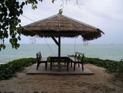 | 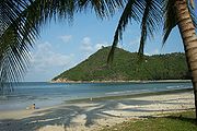 | 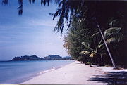 |
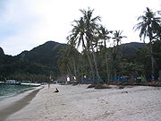 | 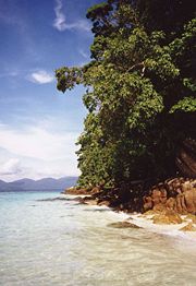 | 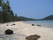 |