

Ko Sai
Encyclopedia
Thailand
Thailand , officially the Kingdom of Thailand , formerly known as Siam , is a country located at the centre of the Indochina peninsula and Southeast Asia. It is bordered to the north by Burma and Laos, to the east by Laos and Cambodia, to the south by the Gulf of Thailand and Malaysia, and to the...
. This island lies off the western side of the Gulf of Siam, about 2 km away from the shore.
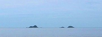
Ko Sai is the largest of a small group of three rocky islets also known as "Pran Rocks", located off the fishing village of Khao Takiab, just south of Hua Hin
Hua Hin
Hua Hin is a famous beach resort town in Thailand, in the northern part of the Malay Peninsula, some 200 km south of Bangkok. It has a population of 84,883 in an area of 911 km², and is one of eight districts of the Prachuap Khiri Khan province.Hua Hin is closely associated with the...
. All this area belongs administratively to the Prachuap Khiri Khan Province
Prachuap Khiri Khan Province
Prachuap Khiri Khan is one of the central provinces of Thailand. Neighboring provinces are Phetchaburi in the north and Chumphon in the south. To the west it borders Tanintharyi Division of Myanmar....
.
Ko Sai has a maximum length of 0.4 km and its highest point reaches 35 m. Ko Sai vaguely looks like a sitting lion when seen from the shore. Local tour operators call it "Lion Island" (Ko Singto) and organize regular sightseeing and snorkeling excursions to visit this island group.
Two smaller islets are located close to Ko Sai:
- Ko Sadao (เกาะสะเดา), it is located south of Ko Sai. Highest point 15m. This island is called "Ko Tao" (Turtle Island) by the travel agencies in the area, but it should not be confused with Ko TaoKo TaoKo Tao is an island in Thailand located near the western shore of the Gulf of Thailand. It covers an area of about 21 km². Administratively it forms a tambon within the district Ko Pha Ngan of Surat Thani Province. As of 2006 its official population is 1382...
in Surat Thani ProvinceSurat Thani ProvinceSurat Thani is the largest of the southern provinces of Thailand, on the eastern shore of the Gulf of Thailand. Surat Thani means City of Good People, the title given to the city by King Vajiravudh ....
.
- Ko Khi Nok (เกาะขี้นก), is the smallest of the group. It is located just a few hundred metres to the east of Ko Sadao. This is the lowest island and its name in Thai means "GuanoGuanoGuano is the excrement of seabirds, cave dwelling bats, and seals. Guano manure is an effective fertilizer due to its high levels of phosphorus and nitrogen and also its lack of odor. It was an important source of nitrates for gunpowder...
Island". Its highest point is only 3 m and, unlike the other two islets, it barely has any vegetation. Ko Khi Nok is called "Ko Nok" (Bird Island) by the local tour organizers, but like the other alternative names above, it is not to be found in any official document.