
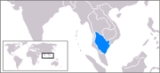
Gulf of Thailand
Encyclopedia


South China Sea
The South China Sea is a marginal sea that is part of the Pacific Ocean, encompassing an area from the Singapore and Malacca Straits to the Strait of Taiwan of around...
.
Geography
The Gulf of Thailand is bordered by CambodiaCambodia
Cambodia , officially known as the Kingdom of Cambodia, is a country located in the southern portion of the Indochina Peninsula in Southeast Asia...
, Thailand
Thailand
Thailand , officially the Kingdom of Thailand , formerly known as Siam , is a country located at the centre of the Indochina peninsula and Southeast Asia. It is bordered to the north by Burma and Laos, to the east by Laos and Cambodia, to the south by the Gulf of Thailand and Malaysia, and to the...
and Vietnam
Vietnam
Vietnam – sometimes spelled Viet Nam , officially the Socialist Republic of Vietnam – is the easternmost country on the Indochina Peninsula in Southeast Asia. It is bordered by China to the north, Laos to the northwest, Cambodia to the southwest, and the South China Sea –...
. The northern tip of the gulf is the Bay of Bangkok
Bay of Bangkok
The Bay of Bangkok , also known as the Bight of Bangkok, is the northernmost part of the Gulf of Thailand, roughly extending from Hua Hin to the west and Sattahip to the east...
at the mouth of the Chao Phraya River
Chao Phraya River
The Chao Phraya is a major river in Thailand, with its low alluvial plain forming the centre of the country. It runs through Bangkok, the capital city, and then empties into the Gulf of Thailand.-Etymology:...
. The gulf covers roughly 320,000 km². The boundary of the gulf is defined by the line from Cape Bai Bung
Ca Mau Province
Cà Mau is a province of Vietnam, named after its capital city. It is located in the Mekong Delta of southern Vietnam, and is the southernmost of Vietnam's 58 provinces...
in southern Vietnam (just south of the mouth of the Mekong
Mekong
The Mekong is a river that runs through China, Burma, Laos, Thailand, Cambodia and Vietnam. It is the world's 10th-longest river and the 7th-longest in Asia. Its estimated length is , and it drains an area of , discharging of water annually....
river) to the city Kota Baru on the Malaysian coast. At the height of the last ice age
Ice age
An ice age or, more precisely, glacial age, is a generic geological period of long-term reduction in the temperature of the Earth's surface and atmosphere, resulting in the presence or expansion of continental ice sheets, polar ice sheets and alpine glaciers...
the Gulf of Thailand did not exist, due to the lower sea level, the location being part of the Chao Phraya river valley.
The Gulf of Thailand is relatively shallow: its mean depth is 45 m, and the maximum depth only 80 m. This makes water exchange slow, and the strong water inflow from the rivers make the Gulf low in salinity
Salinity
Salinity is the saltiness or dissolved salt content of a body of water. It is a general term used to describe the levels of different salts such as sodium chloride, magnesium and calcium sulfates, and bicarbonates...
(3.05-3.25%) and rich in sediment
Sediment
Sediment is naturally occurring material that is broken down by processes of weathering and erosion, and is subsequently transported by the action of fluids such as wind, water, or ice, and/or by the force of gravity acting on the particle itself....
s. Only at the greater depths does water with a higher salinity (3.4%) flow into the gulf from the South China sea
South China Sea
The South China Sea is a marginal sea that is part of the Pacific Ocean, encompassing an area from the Singapore and Malacca Straits to the Strait of Taiwan of around...
and fills the central depression below a depth of 50 m. The main rivers which empty into the gulf are the Chao Phraya (including its distributary Tha Chin River
Tha Chin River
The Tha Chin river is a distributary of the Chao Phraya river, Thailand. It splits near the province of Chainat and then flows westerly from the Chao Phraya through the central plains, until it mouths into the Gulf of Thailand at the province of Samut Sakhon....
), Mae Klong
Mae Klong
The Mae Klong is a river in western Thailand. The river begins at the confluence of the Khwae Noi or Khwae Sai Yok and the Khwae Yai River or Khwae Si Sawat in Kanchanaburi, pass Ratchaburi Province and empties into the Gulf of Thailand in Samut Songkhram....
and Bang Pakong Rivers at the Bay of Bangkok
Bay of Bangkok
The Bay of Bangkok , also known as the Bight of Bangkok, is the northernmost part of the Gulf of Thailand, roughly extending from Hua Hin to the west and Sattahip to the east...
, and to a lesser degree the Tapi River
Tapi River, Thailand
The Tapi river is the longest river in southern Thailand. The river originates at the Khao Luang, and has a wide estuary into the Gulf of Thailand at Bandon Bay near the town of Surat Thani. It has a length of 230 km....
into Bandon Bay
Bandon Bay
Bandon Bay is a bay in the Gulf of Thailand in the Surat Thani Province, extending from the Sui cape in Chaiya district in the northwest to the Kanchanadit district to the east. The total coastline is about 100 km. The bay is dominated by the estuary of the rivers Tapi and Phum Duang...
in the southwest of the gulf.
Extent
The International Hydrographic OrganizationInternational Hydrographic Organization
The International Hydrographic Organization is the inter-governmental organisation representing the hydrographic community. It enjoys observer status at the UN and is the recognised competent authority on hydrographic surveying and nautical charting...
defines the southern limit of the Gulf of Thailand as "A line running from the Western extreme of Cambodia
Cambodia
Cambodia , officially known as the Kingdom of Cambodia, is a country located in the southern portion of the Indochina Peninsula in Southeast Asia...
or Camau Point
Cape of Camau
Cape of Camau, in Vietnam, is the most southern point of Indochina mainland....
(8°36'N) [Note: this point is actually in Vietnam
Vietnam
Vietnam – sometimes spelled Viet Nam , officially the Socialist Republic of Vietnam – is the easternmost country on the Indochina Peninsula in Southeast Asia. It is bordered by China to the north, Laos to the northwest, Cambodia to the southwest, and the South China Sea –...
] to the Northern extreme of the point on the East side of the estuary of the Kelantan River
Kelantan River
The Kelantan River is the major river in Kelantan, Malaysia. It drains a catchment area of about 11900 km²...
(6°14′N 102°15′E)".
Tourism
The Gulf of Thailand harbours many coralCoral
Corals are marine animals in class Anthozoa of phylum Cnidaria typically living in compact colonies of many identical individual "polyps". The group includes the important reef builders that inhabit tropical oceans and secrete calcium carbonate to form a hard skeleton.A coral "head" is a colony of...
reefs, and thus several diving resorts. Due to the tropical warmth of the water, it is popular with tourists. Some of the most important tourist destinations in the Gulf of Thailand are the islands of Ko Samui
Ko Samui
Ko Samui island of Surat Thani Province , or often, simply Samui as it is referred to by locals, is an island off the east coast of the Kra Isthmus in Thailand, close to the mainland Surat Thani town. It is Thailand's second largest island, with an area of 228.7 km2 and a population of over...
and Ko Pha Ngan
Ko Pha Ngan
Ko Pha Ngan is an island in the Gulf of Thailand in South East Thailand. It is famous for its full moon party at Haad Rin Beach and as a backpackers destination. Ko Pha Ngan has two sister islands: the larger Ko Samui to the south and the smaller Ko Tao to the north.* Area: about 168 km²*...
in Surat Thani province
Surat Thani Province
Surat Thani is the largest of the southern provinces of Thailand, on the eastern shore of the Gulf of Thailand. Surat Thani means City of Good People, the title given to the city by King Vajiravudh ....
, Pattaya
Pattaya
Pattaya is a city in Thailand, located on the east coast of the Gulf of Thailand, about 165 km southeast of Bangkok located within but not part of Amphoe Bang Lamung in the province of Chonburi....
in Chonburi province
Chonburi Province
Chonburi is a province of Thailand. Neighboring provinces are Chachoengsao, Chanthaburi and Rayong. To the west is the Gulf of Thailand. The eastern seaboard is heavily industrialized and underpinned by shipping, transportation, tourism, and manufacturing industries, and second to only Bangkok...
, Cha-am in Phetchaburi Province
Phetchaburi Province
Phetchaburi is one of the central provinces of Thailand. Neighboring provinces are Ratchaburi, Samut Songkhram and Prachuap Khiri Khan...
, Hua Hin
Hua Hin
Hua Hin is a famous beach resort town in Thailand, in the northern part of the Malay Peninsula, some 200 km south of Bangkok. It has a population of 84,883 in an area of 911 km², and is one of eight districts of the Prachuap Khiri Khan province.Hua Hin is closely associated with the...
in Prachuap Khiri Khan Province
Prachuap Khiri Khan Province
Prachuap Khiri Khan is one of the central provinces of Thailand. Neighboring provinces are Phetchaburi in the north and Chumphon in the south. To the west it borders Tanintharyi Division of Myanmar....
, Ko Samet
Ko Samet
Ko Samet , is one of the Eastern Seaboard Islands of Thailand. It is located in the Gulf of Thailand off the coastline of the Thai province of Rayong, approximately southeast of Bangkok. Ko Samet is part of the Phe Subdistrict of the Amphoe Mueang Rayong , of Rayong province...
in Rayong Province
Rayong Province
Rayong province is a province of Thailand. Neighboring provinces are Chon Buri and Chanthaburi. To the south is the Gulf of Thailand.-History:...
,and Ko Chang
Ko Chang
Ko Chang is the third largest island of Thailand , located on the Thai east coast 310 km away from Bangkok near the border to Cambodia in the Gulf of Thailand. The name means Elephant Island. Ko Chang was named for the elephant shape of its headland, although elephants are not indigenous to...
in Trat Province
Trat Province
Trat is a province of Thailand. It is located in the east of Thailand, and has borders with Chanthaburi Province to the northwest, Cambodia to the east, and the Gulf of Thailand to the south.Trat is most famous for gemstone mining and trading....
Ko Tao
Ko Tao
Ko Tao is an island in Thailand located near the western shore of the Gulf of Thailand. It covers an area of about 21 km². Administratively it forms a tambon within the district Ko Pha Ngan of Surat Thani Province. As of 2006 its official population is 1382...
is a center of the diving tourism.
Territorial disputes
There are territorial disputes in the area between Malaysia, Thailand, Cambodia and Vietnam.- Malaysia and Thailand in particular have chosen to jointly develop the disputed areas, which include the islands of Ko KraKo Kra, Nakhon Si Thammarat ProvinceKo Kra is a group of small rocky islets in the southern area of the Gulf of Siam.It is under the administration of Nakhon Si Thammarat Province of Thailand.-Geography:...
and Ko LosinKo LosinKo Losin is a small rocky islet in the southern area of the Gulf of Siam. It is under the Sai Buri District of the Pattani Province of Thailand....
.
- A long-standing dispute between Cambodia and Vietnam in the Gulf of Siam concerns mainly the island of Phú Quốc, which is located off the Cambodian coast. Cambodia also claims 48,000 km2 of shelf areaContinental shelfThe continental shelf is the extended perimeter of each continent and associated coastal plain. Much of the shelf was exposed during glacial periods, but is now submerged under relatively shallow seas and gulfs, and was similarly submerged during other interglacial periods. The continental margin,...
.