

List of civil parishes in Greater Manchester
Encyclopedia
England
England is a country that is part of the United Kingdom. It shares land borders with Scotland to the north and Wales to the west; the Irish Sea is to the north west, the Celtic Sea to the south west, with the North Sea to the east and the English Channel to the south separating it from continental...
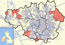
. There are 15 civil parishes in the ceremonial county of Greater Manchester
Greater Manchester
Greater Manchester is a metropolitan county in North West England, with a population of 2.6 million. It encompasses one of the largest metropolitan areas in the United Kingdom and comprises ten metropolitan boroughs: Bolton, Bury, Oldham, Rochdale, Stockport, Tameside, Trafford, Wigan, and the...
, most of the county being unparished
Unparished area
In England, an unparished area is an area that is not covered by a civil parish. Most urbanised districts of England are either entirely or partly unparished. Many towns and some cities in otherwise rural districts are also unparished areas and therefore no longer have a town council or city...
; Bury
Metropolitan Borough of Bury
The Metropolitan Borough of Bury is a metropolitan borough of Greater Manchester, in North West England. Lying to the north of the City of Manchester, the borough is composed of six towns: Bury, Ramsbottom, Tottington, Radcliffe, Whitefield and Prestwich, and has a population of 181,900...
, Rochdale
Metropolitan Borough of Rochdale
The Metropolitan Borough of Rochdale is a metropolitan borough of Greater Manchester in North West England. It is named after its largest town, Rochdale, but spans a far larger area which includes the towns of Middleton, Heywood, Littleborough and Milnrow, and the village of Wardle.The borough was...
, and Salford
City of Salford
The City of Salford is a city and metropolitan borough of Greater Manchester, England. It is named after its largest settlement, Salford, but covers a far larger area which includes the towns of Eccles, Swinton-Pendlebury, Walkden and Irlam which apart from Irlam each have a population of over...
are completely unparished. At the 2001 census, there were 129,325 people living in the 15 civil parishes, accounting for 5.2% of the county's population.
History
Parishes arose from Church of EnglandChurch of England
The Church of England is the officially established Christian church in England and the Mother Church of the worldwide Anglican Communion. The church considers itself within the tradition of Western Christianity and dates its formal establishment principally to the mission to England by St...
divisions, and were originally purely ecclesiastical divisions. Over time they acquired civil administration powers.
The Highways Act 1555
Highways Act 1555
The Highways Act 1555 , sometimes the First Statute of Highways, was an Act of Parliament of the Parliament of England passed in 1555...
made parishes responsible for the upkeep of roads. Every adult inhabitant of the parish was obliged to work four days a year on the roads, providing their own tools, carts and horses; the work was overseen by an unpaid local appointee, the Surveyor of Highways.
The poor were looked after by the monasteries
Monastery
Monastery denotes the building, or complex of buildings, that houses a room reserved for prayer as well as the domestic quarters and workplace of monastics, whether monks or nuns, and whether living in community or alone .Monasteries may vary greatly in size – a small dwelling accommodating only...
, until their dissolution
Dissolution of the Monasteries
The Dissolution of the Monasteries, sometimes referred to as the Suppression of the Monasteries, was the set of administrative and legal processes between 1536 and 1541 by which Henry VIII disbanded monasteries, priories, convents and friaries in England, Wales and Ireland; appropriated their...
. In 1572, magistrates were given power to 'survey the poor' and impose taxes for their relief. This system was made more formal by the Poor Law Act 1601
Elizabethan Poor Law (1601)
The Act for the Relief of the Poor 1601, popularly known as the "Elizabethan Poor Law", "43rd Elizabeth" or the "Old Poor Law" was an Act of Parliament passed in 1601 which created a national poor law system for England and Wales....
, which made parishes responsible for administering the Poor Law
Poor Law
The English Poor Laws were a system of poor relief which existed in England and Wales that developed out of late-medieval and Tudor-era laws before being codified in 1587–98...
; overseers were appointed to charge a rate
Rates (tax)
Rates are a type of property tax system in the United Kingdom, and in places with systems deriving from the British one, the proceeds of which are used to fund local government...
to support the poor of the parish. The 19th century saw an increase in the responsibility of parishes, although the Poor Law powers were transferred to Poor Law Unions. The Public Health Act 1872
Sanitary district
Sanitary districts were established in England and Wales in 1875 and in Ireland in 1878. The districts were of two types, based on existing structures:*Urban sanitary districts in towns with existing local government bodies...
grouped parishes into Rural Sanitary Districts, based on the Poor Law Unions; these subsequently formed the basis for Rural District
Rural district
Rural districts were a type of local government area – now superseded – established at the end of the 19th century in England, Wales, and Ireland for the administration of predominantly rural areas at a level lower than that of the administrative counties.-England and Wales:In England...
s.
Parishes were run by vestries
Vestry
A vestry is a room in or attached to a church or synagogue in which the vestments, vessels, records, etc., are kept , and in which the clergy and choir robe or don their vestments for divine service....
, meeting annually to appoint officials, and were generally identical to ecclesiastical parishes, although some township
Township (England)
In England, a township is a local division or district of a large parish containing a village or small town usually having its own church...
s in large parishes administered the Poor Law themselves; under the Divided Parishes and Poor Law Amendment Act 1882
Divided Parishes and Poor Law Amendment Act 1882
Divided Parishes and Poor Law Amendment Act 1882 was an Act of Parliament in Britain which gave the Local Government Board increased powers relating to dissolving and creating Poor Law Unions. It followed the Divided Parishes and Poor Law Amendment Act 1876 ....
, all extra-parochial area
Extra-parochial area
In the United Kingdom, an extra-parochial area or extra-parochial place was an area considered to be outside any parish. They were therefore exempt from payment of any poor or church rate and usually tithe...
s and township
Township (England)
In England, a township is a local division or district of a large parish containing a village or small town usually having its own church...
s that levied a separate rate became independent civil parishes.
Civil parishes in their modern sense date from the Local Government Act 1894
Local Government Act 1894
The Local Government Act 1894 was an Act of the Parliament of the United Kingdom that reformed local government in England and Wales outside the County of London. The Act followed the reforms carried out at county level under the Local Government Act 1888...
, which abolished vestries
Vestry
A vestry is a room in or attached to a church or synagogue in which the vestments, vessels, records, etc., are kept , and in which the clergy and choir robe or don their vestments for divine service....
; established elected parish councils in all rural parishes with more than 300 electors; grouped rural parishes into Rural Districts; and aligned parish boundaries with county and borough boundaries. Urban civil parishes continued to exist, and were generally coterminous with the Urban District
Urban district
In the England, Wales and Ireland, an urban district was a type of local government district that covered an urbanised area. Urban districts had an elected Urban District Council , which shared local government responsibilities with a county council....
, Municipal Borough
Municipal borough
Municipal boroughs were a type of local government district which existed in England and Wales between 1835 and 1974, in Northern Ireland from 1840 to 1973 and in the Republic of Ireland from 1840 to 2002...
or County Borough
County borough
County borough is a term introduced in 1889 in the United Kingdom of Great Britain and Ireland , to refer to a borough or a city independent of county council control. They were abolished by the Local Government Act 1972 in England and Wales, but continue in use for lieutenancy and shrievalty in...
in which they were situated; many large towns contained a number of parishes, and these were usually merged into one. Parish councils were not formed in urban areas, and the only function of the parish was to elect guardians to Poor Law Unions; with the abolition of the Poor Law system in 1930 the parishes had only a nominal existence.
The Local Government Act 1972
Local Government Act 1972
The Local Government Act 1972 is an Act of Parliament in the United Kingdom that reformed local government in England and Wales on 1 April 1974....
retained civil parishes in rural areas, and many former Urban District
Urban district
In the England, Wales and Ireland, an urban district was a type of local government district that covered an urbanised area. Urban districts had an elected Urban District Council , which shared local government responsibilities with a county council....
s and Municipal Borough
Municipal borough
Municipal boroughs were a type of local government district which existed in England and Wales between 1835 and 1974, in Northern Ireland from 1840 to 1973 and in the Republic of Ireland from 1840 to 2002...
s that were being abolished, were replaced by new successor parishes; urban areas that were considered too large to be single parishes became unparished area
Unparished area
In England, an unparished area is an area that is not covered by a civil parish. Most urbanised districts of England are either entirely or partly unparished. Many towns and some cities in otherwise rural districts are also unparished areas and therefore no longer have a town council or city...
s.
.png)
The current position
Recent governments have encouraged the formation of town and parish councils in unparished areas, and the Local Government and Rating Act 1997Local Government and Rating Act 1997
The Local Government and Rating Act 1997 allows a community at the village, neighbourhood, town or similar level beneath a district or borough council to demand its own elected parish or town council. This right only applies to communities within England and outside of Greater London...
gave local residents the right to demand the creation of a new civil parish.
A parish council can become a town council unilaterally, simply by resolution; and a civil parish can also gain city status
City status in the United Kingdom
City status in the United Kingdom is granted by the British monarch to a select group of communities. The holding of city status gives a settlement no special rights other than that of calling itself a "city". Nonetheless, this appellation carries its own prestige and, consequently, competitions...
, but only if that is granted by the Crown
British monarchy
The monarchy of the United Kingdom is the constitutional monarchy of the United Kingdom and its overseas territories. The present monarch, Queen Elizabeth II, has reigned since 6 February 1952. She and her immediate family undertake various official, ceremonial and representational duties...
. The chairman of a town or city council is called a mayor. The Local Government and Public Involvement in Health Act 2007
Local Government and Public Involvement in Health Act 2007
The Local Government and Public Involvement in Health Act 2007 is an Act of the Parliament of the United Kingdom.The Act allows for the implementation of many provisions outlined in the Government white paper Strong and Prosperous Communities including changes to local government in England...
introduced alternative names: a parish council can now choose to be called a community; village; or neighbourhood council.
List of civil parishes and unparished areas
| Image | Name | Status | Population | District | Former local authority | Refs |
|---|---|---|---|---|---|---|
 |
Blackrod Blackrod Blackrod is a settlement and civil parish of the Metropolitan Borough of Bolton, in Greater Manchester, England. It is north-northeast of Wigan and west of Bolton and, according to the United Kingdom Census 2001, has a population of 5,300.... |
Town | 5,300 | Bolton Metropolitan Borough of Bolton The Metropolitan Borough of Bolton is a metropolitan borough of Greater Manchester, England. It is named after its largest settlement, Bolton, but covers a far larger area which includes Blackrod, Farnworth, Horwich, Kearsley and Westhoughton, and a suburban and rural element from the West Pennine... |
Blackrod Urban District Blackrod Blackrod is a settlement and civil parish of the Metropolitan Borough of Bolton, in Greater Manchester, England. It is north-northeast of Wigan and west of Bolton and, according to the United Kingdom Census 2001, has a population of 5,300.... |
|
 |
Bolton Bolton Bolton is a town in Greater Manchester, in the North West of England. Close to the West Pennine Moors, it is north west of the city of Manchester. Bolton is surrounded by several smaller towns and villages which together form the Metropolitan Borough of Bolton, of which Bolton is the... |
Unparished area | 142,249 | Bolton Metropolitan Borough of Bolton The Metropolitan Borough of Bolton is a metropolitan borough of Greater Manchester, England. It is named after its largest settlement, Bolton, but covers a far larger area which includes Blackrod, Farnworth, Horwich, Kearsley and Westhoughton, and a suburban and rural element from the West Pennine... |
Bolton County Borough County Borough of Bolton Bolton was, from 1838 to 1974, a local government district in the northwest of England, conterminate with the town of Bolton.-History:Bolton was created a free borough in 1253 when William de Ferrers, 5th Earl of Derby granted a charter. However the borough did not develop into a self-governing... |
|
 |
Farnworth Farnworth Farnworth is within the Metropolitan Borough of Bolton in Greater Manchester, England. It is located southeast of Bolton, 6 miles south-west of Bury , and northwest of Manchester.... |
Unparished area | 24,062 | Bolton Metropolitan Borough of Bolton The Metropolitan Borough of Bolton is a metropolitan borough of Greater Manchester, England. It is named after its largest settlement, Bolton, but covers a far larger area which includes Blackrod, Farnworth, Horwich, Kearsley and Westhoughton, and a suburban and rural element from the West Pennine... |
Farnworth Municipal Borough Municipal Borough of Farnworth The Municipal Borough of Farnworth was a local government district centred on the town of Farnworth in the administrative county of Lancashire, England.... |
|
 |
Horwich Horwich Horwich is a town and civil parish within the Metropolitan Borough of Bolton, in Greater Manchester, England. It is southeast of Chorley, northwest of Bolton and northwest from the city of Manchester. It lies at the southern edge of the West Pennine Moors with the M61 motorway close to the... |
Town | 19,312 | Bolton Metropolitan Borough of Bolton The Metropolitan Borough of Bolton is a metropolitan borough of Greater Manchester, England. It is named after its largest settlement, Bolton, but covers a far larger area which includes Blackrod, Farnworth, Horwich, Kearsley and Westhoughton, and a suburban and rural element from the West Pennine... |
Horwich Urban District Horwich Horwich is a town and civil parish within the Metropolitan Borough of Bolton, in Greater Manchester, England. It is southeast of Chorley, northwest of Bolton and northwest from the city of Manchester. It lies at the southern edge of the West Pennine Moors with the M61 motorway close to the... |
|
 |
Kearsley Kearsley Kearsley is a town within the Metropolitan Borough of Bolton, in Greater Manchester, England. Historically within Lancashire, it lies about 7½ miles northwest of Manchester,5.5 miles south-west of Bury, and about 3¾ miles south of Bolton.It is bounded on the west by Walkden, the east by... |
Unparished area | 11,747 | Bolton Metropolitan Borough of Bolton The Metropolitan Borough of Bolton is a metropolitan borough of Greater Manchester, England. It is named after its largest settlement, Bolton, but covers a far larger area which includes Blackrod, Farnworth, Horwich, Kearsley and Westhoughton, and a suburban and rural element from the West Pennine... |
Kearsley Urban District Kearsley Kearsley is a town within the Metropolitan Borough of Bolton, in Greater Manchester, England. Historically within Lancashire, it lies about 7½ miles northwest of Manchester,5.5 miles south-west of Bury, and about 3¾ miles south of Bolton.It is bounded on the west by Walkden, the east by... |
|
 |
Little Lever Little Lever Little Lever is a large village within the Metropolitan Borough of Bolton in Greater Manchester, England. Historically a part of Lancashire, it is southeast of Bolton, west of Radcliffe, and west-southwest of Bury.... |
Unparished area | 10,712 | Bolton Metropolitan Borough of Bolton The Metropolitan Borough of Bolton is a metropolitan borough of Greater Manchester, England. It is named after its largest settlement, Bolton, but covers a far larger area which includes Blackrod, Farnworth, Horwich, Kearsley and Westhoughton, and a suburban and rural element from the West Pennine... |
Little Lever Urban District Little Lever Little Lever is a large village within the Metropolitan Borough of Bolton in Greater Manchester, England. Historically a part of Lancashire, it is southeast of Bolton, west of Radcliffe, and west-southwest of Bury.... |
|
| South Turton South Turton South Turton is an unparished area of the Metropolitan Borough of Bolton, in Greater Manchester, England. Historically a part of Lancashire, it lies on the southern slopes of the West Pennine Moors, and has a population of 25,067.... |
Unparished area | 24,599 | Bolton Metropolitan Borough of Bolton The Metropolitan Borough of Bolton is a metropolitan borough of Greater Manchester, England. It is named after its largest settlement, Bolton, but covers a far larger area which includes Blackrod, Farnworth, Horwich, Kearsley and Westhoughton, and a suburban and rural element from the West Pennine... |
Turton Urban District |
|
|
 |
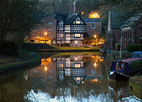
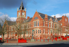
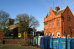
Westhoughton Westhoughton Westhoughton is a town and civil parish of the Metropolitan Borough of Bolton in Greater Manchester, England. It is southwest of Bolton, east of Wigan and northwest of Manchester.... |
Town | 23,056 | Bolton Metropolitan Borough of Bolton The Metropolitan Borough of Bolton is a metropolitan borough of Greater Manchester, England. It is named after its largest settlement, Bolton, but covers a far larger area which includes Blackrod, Farnworth, Horwich, Kearsley and Westhoughton, and a suburban and rural element from the West Pennine... |
Westhoughton Urban District Westhoughton Westhoughton is a town and civil parish of the Metropolitan Borough of Bolton in Greater Manchester, England. It is southwest of Bolton, east of Wigan and northwest of Manchester.... |
|
.jpg) |
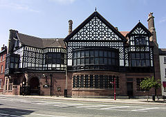
Bury Bury Bury is a town in Greater Manchester, England. It lies on the River Irwell, east of Bolton, west-southwest of Rochdale, and north-northwest of the city of Manchester... |
Unparished area | 64,534 | Bury Metropolitan Borough of Bury The Metropolitan Borough of Bury is a metropolitan borough of Greater Manchester, in North West England. Lying to the north of the City of Manchester, the borough is composed of six towns: Bury, Ramsbottom, Tottington, Radcliffe, Whitefield and Prestwich, and has a population of 181,900... |
Bury County Borough County Borough of Bury Bury was a local government district centred on Bury in the northwest of England from 1846 to 1974.Under the Bury Improvement Act 1846 a board of twenty-seven improvement commissioners was formed for Bury. The Improvement Commissioners District was enlarged in 1872... |
|
 |
Prestwich Prestwich Prestwich is a town within the Metropolitan Borough of Bury, in Greater Manchester, England. It lies close to the River Irwell, north of Manchester city centre, north of Salford and south of Bury.... |
Unparished area | 33,446 | Bury Metropolitan Borough of Bury The Metropolitan Borough of Bury is a metropolitan borough of Greater Manchester, in North West England. Lying to the north of the City of Manchester, the borough is composed of six towns: Bury, Ramsbottom, Tottington, Radcliffe, Whitefield and Prestwich, and has a population of 181,900... |
Prestwich Municipal Borough Prestwich Prestwich is a town within the Metropolitan Borough of Bury, in Greater Manchester, England. It lies close to the River Irwell, north of Manchester city centre, north of Salford and south of Bury.... |
|
| Radcliffe Radcliffe, Greater Manchester Radcliffe is a town within the Metropolitan Borough of Bury, in Greater Manchester, England. It lies on undulating ground in the Irwell Valley, along the course of the River Irwell, south-west of Bury and north-northwest of Manchester. Radcliffe is contiguous with the town of Whitefield to the... |
Unparished area | 33,994 | Bury Metropolitan Borough of Bury The Metropolitan Borough of Bury is a metropolitan borough of Greater Manchester, in North West England. Lying to the north of the City of Manchester, the borough is composed of six towns: Bury, Ramsbottom, Tottington, Radcliffe, Whitefield and Prestwich, and has a population of 181,900... |
Radcliffe Municipal Borough Radcliffe, Greater Manchester Radcliffe is a town within the Metropolitan Borough of Bury, in Greater Manchester, England. It lies on undulating ground in the Irwell Valley, along the course of the River Irwell, south-west of Bury and north-northwest of Manchester. Radcliffe is contiguous with the town of Whitefield to the... |
|
|
 |
Ramsbottom Ramsbottom Ramsbottom is a town in the Metropolitan Borough of Bury, Greater Manchester, England. It is situated on the course of the River Irwell, in the West Pennine Moors. Historically within Lancashire, it is located north-northwest of Bury, and north-northwest of Manchester... |
Unparished area | 14,635 | Bury Metropolitan Borough of Bury The Metropolitan Borough of Bury is a metropolitan borough of Greater Manchester, in North West England. Lying to the north of the City of Manchester, the borough is composed of six towns: Bury, Ramsbottom, Tottington, Radcliffe, Whitefield and Prestwich, and has a population of 181,900... |
Ramsbottom Urban District Ramsbottom Urban District Ramsbottom Urban District was, from 1894 to 1974, a local government district of the administrative county of Lancashire, England. Its area was coterminate with Ramsbottom, spanning an area of the Rossendale Valley north of the County Borough of Bury.... |
|
| Tottington Tottington, Greater Manchester Tottington is a town within the Metropolitan Borough of Bury, in Greater Manchester, England.Historically a part of Lancashire, Tottington's early history is marked by its status as an important Medieval fee, a type of Royal Manor which encompassed several townships... |
Unparished area | 12,511 | Bury Metropolitan Borough of Bury The Metropolitan Borough of Bury is a metropolitan borough of Greater Manchester, in North West England. Lying to the north of the City of Manchester, the borough is composed of six towns: Bury, Ramsbottom, Tottington, Radcliffe, Whitefield and Prestwich, and has a population of 181,900... |
Tottington Urban District Tottington, Greater Manchester Tottington is a town within the Metropolitan Borough of Bury, in Greater Manchester, England.Historically a part of Lancashire, Tottington's early history is marked by its status as an important Medieval fee, a type of Royal Manor which encompassed several townships... |
|
|
| Whitefield Whitefield, Greater Manchester Whitefield is a town within the Metropolitan Borough of Bury, in Greater Manchester, England. It lies on undulating ground in the Irwell Valley, along the south bank of the River Irwell, south-southeast of Bury, and to the north-northwest of the city of Manchester... |
Unparished area | 21,488 | Bury Metropolitan Borough of Bury The Metropolitan Borough of Bury is a metropolitan borough of Greater Manchester, in North West England. Lying to the north of the City of Manchester, the borough is composed of six towns: Bury, Ramsbottom, Tottington, Radcliffe, Whitefield and Prestwich, and has a population of 181,900... |
Whitefield Urban District Whitefield, Greater Manchester Whitefield is a town within the Metropolitan Borough of Bury, in Greater Manchester, England. It lies on undulating ground in the Irwell Valley, along the south bank of the River Irwell, south-southeast of Bury, and to the north-northwest of the city of Manchester... |
|
|
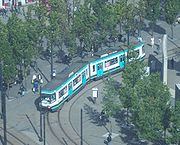 |
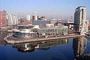
Manchester Manchester Manchester is a city and metropolitan borough in Greater Manchester, England. According to the Office for National Statistics, the 2010 mid-year population estimate for Manchester was 498,800. Manchester lies within one of the UK's largest metropolitan areas, the metropolitan county of Greater... |
Unparished area | 392,713 | Manchester Manchester Manchester is a city and metropolitan borough in Greater Manchester, England. According to the Office for National Statistics, the 2010 mid-year population estimate for Manchester was 498,800. Manchester lies within one of the UK's largest metropolitan areas, the metropolitan county of Greater... |
Manchester County Borough Manchester Manchester is a city and metropolitan borough in Greater Manchester, England. According to the Office for National Statistics, the 2010 mid-year population estimate for Manchester was 498,800. Manchester lies within one of the UK's largest metropolitan areas, the metropolitan county of Greater... |
|
| Ringway | Civil parish | 106 | Manchester Manchester Manchester is a city and metropolitan borough in Greater Manchester, England. According to the Office for National Statistics, the 2010 mid-year population estimate for Manchester was 498,800. Manchester lies within one of the UK's largest metropolitan areas, the metropolitan county of Greater... |
Bucklow Rural District Bucklow Rural District Bucklow Rural District was, from 1894 to 1974, a local government district in the north of the administrative county of Cheshire, England. Following the Local Government Act 1972, this rural district was split between the new Greater Manchester boroughs of Trafford and Manchester, and Macclesfield,... |
|
|
 |
Chadderton Chadderton Chadderton is a town within the Metropolitan Borough of Oldham, in Greater Manchester, England, historically a part of Lancashire... |
Unparished area | 31,114 | Oldham Metropolitan Borough of Oldham The Metropolitan Borough of Oldham is a metropolitan borough of Greater Manchester, England. It has a population of 219,600, and spans . The borough is named after its largest town, Oldham, but also includes the outlying towns of Chadderton, Failsworth, Royton and Shaw and Crompton, the village of... |
Chadderton Urban District Chadderton Urban District Chadderton Urban District was, from 1894 to 1974, a local government district of the administrative county of Lancashire, England. It was centred on the town of Chadderton.... |
|
| Failsworth Failsworth At Failsworth lies north-northwest of London. It shares common boundaries with Manchester and Oldham, on its west and northeast respectively. Failsworth is traversed by the A62 road, from Manchester to Oldham, the heavy rail line of the Oldham Loop and the Rochdale Canal, which crosses the... |
Unparished area | 20,555 | Oldham Metropolitan Borough of Oldham The Metropolitan Borough of Oldham is a metropolitan borough of Greater Manchester, England. It has a population of 219,600, and spans . The borough is named after its largest town, Oldham, but also includes the outlying towns of Chadderton, Failsworth, Royton and Shaw and Crompton, the village of... |
Failsworth Urban District Failsworth At Failsworth lies north-northwest of London. It shares common boundaries with Manchester and Oldham, on its west and northeast respectively. Failsworth is traversed by the A62 road, from Manchester to Oldham, the heavy rail line of the Oldham Loop and the Rochdale Canal, which crosses the... |
|
|
 |
Lees Lees, Greater Manchester The village consists of a small cluster of shops and businesses on either side of the A669 Lees Road, surrounded by some terraced houses and some small estates... |
Unparished area | 4,616 | Oldham Metropolitan Borough of Oldham The Metropolitan Borough of Oldham is a metropolitan borough of Greater Manchester, England. It has a population of 219,600, and spans . The borough is named after its largest town, Oldham, but also includes the outlying towns of Chadderton, Failsworth, Royton and Shaw and Crompton, the village of... |
Lees Urban District Lees Urban District Lees was from 1894 to 1974, a local government district in the administrative county of Lancashire, England.It was created an urban district in 1894 by the Local Government Act 1894 and included the civil parish of Lees and part of the Crossbank hamlet... |
|
 |
Oldham Oldham Oldham is a large town in Greater Manchester, England. It lies amid the Pennines on elevated ground between the rivers Irk and Medlock, south-southeast of Rochdale, and northeast of the city of Manchester... |
Unparished area | 93,955 | Oldham Metropolitan Borough of Oldham The Metropolitan Borough of Oldham is a metropolitan borough of Greater Manchester, England. It has a population of 219,600, and spans . The borough is named after its largest town, Oldham, but also includes the outlying towns of Chadderton, Failsworth, Royton and Shaw and Crompton, the village of... |
Oldham County Borough County Borough of Oldham Oldham was, from 1849 to 1974, a local government district in the northwest of England coterminate with the town of Oldham.-Improvement Commissioners:... |
|
 |
Royton Royton Royton is a town within the Metropolitan Borough of Oldham, in Greater Manchester, England. It lies by the source of the River Irk, on undulating land at the foothills of the Pennines, north-northwest of Oldham, south-southeast of Rochdale and northeast of the city of Manchester.Historically a... |
Unparished area | 20,961 | Oldham Metropolitan Borough of Oldham The Metropolitan Borough of Oldham is a metropolitan borough of Greater Manchester, England. It has a population of 219,600, and spans . The borough is named after its largest town, Oldham, but also includes the outlying towns of Chadderton, Failsworth, Royton and Shaw and Crompton, the village of... |
Royton Urban District Royton Urban District Royton was, from 1863 to 1974, a local government district in Lancashire, England which covered the modern-day town of Royton, and its suburbs and districts.... |
|
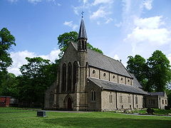
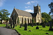
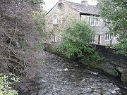
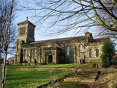
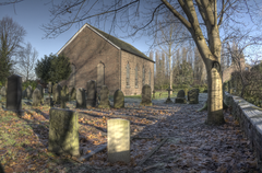
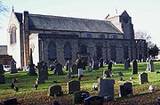
| Saddleworth Saddleworth Saddleworth is a civil parish of the Metropolitan Borough of Oldham in Greater Manchester, England. It comprises several villages and hamlets amongst the west side of the Pennine hills: Uppermill, Greenfield, Dobcross, Delph, Diggle and others... |
Civil parish | 24,351 | Oldham Metropolitan Borough of Oldham The Metropolitan Borough of Oldham is a metropolitan borough of Greater Manchester, England. It has a population of 219,600, and spans . The borough is named after its largest town, Oldham, but also includes the outlying towns of Chadderton, Failsworth, Royton and Shaw and Crompton, the village of... |
Saddleworth Urban District Saddleworth Saddleworth is a civil parish of the Metropolitan Borough of Oldham in Greater Manchester, England. It comprises several villages and hamlets amongst the west side of the Pennine hills: Uppermill, Greenfield, Dobcross, Delph, Diggle and others... |
|
|
| Shaw and Crompton Shaw and Crompton Shaw and Crompton is a town and civil parish within the Metropolitan Borough of Oldham, in Greater Manchester, England. It lies on the River Beal at the foothills of the South Pennines, north of Oldham, southeast of Rochdale, and to the northeast of the city of Manchester... |
Civil parish | 21,721 | Oldham Metropolitan Borough of Oldham The Metropolitan Borough of Oldham is a metropolitan borough of Greater Manchester, England. It has a population of 219,600, and spans . The borough is named after its largest town, Oldham, but also includes the outlying towns of Chadderton, Failsworth, Royton and Shaw and Crompton, the village of... |
Crompton Urban District |
|
|
| Heywood Heywood, Greater Manchester Heywood is a town within the Metropolitan Borough of Rochdale, in Greater Manchester, England. It lies on the south bank of the River Roch and is east of Bury, west-southwest of Rochdale, and north of the city of Manchester. The town of Middleton lies to the south, whilst to the north is the... |
Unparished area | 29,240 | Rochdale Metropolitan Borough of Rochdale The Metropolitan Borough of Rochdale is a metropolitan borough of Greater Manchester in North West England. It is named after its largest town, Rochdale, but spans a far larger area which includes the towns of Middleton, Heywood, Littleborough and Milnrow, and the village of Wardle.The borough was... |
Heywood Municipal Borough Municipal Borough of Heywood The Municipal Borough of Heywood was, from 1881 to 1974, a local government district in the administrative county of Lancashire, England, with borough status and coterminate with the town of Heywood.-Civic history:... |
|
|
| Littleborough | Unparished area | 13,315 | Rochdale Metropolitan Borough of Rochdale The Metropolitan Borough of Rochdale is a metropolitan borough of Greater Manchester in North West England. It is named after its largest town, Rochdale, but spans a far larger area which includes the towns of Middleton, Heywood, Littleborough and Milnrow, and the village of Wardle.The borough was... |
Littleborough Urban District |
|
|
| Middleton Middleton, Greater Manchester Middleton is a town within the Metropolitan Borough of Rochdale, in Greater Manchester, England. It stands on the River Irk, south-southwest of Rochdale, and north-northeast of the city of Manchester... |
Unparished area | 45,688 | Rochdale Metropolitan Borough of Rochdale The Metropolitan Borough of Rochdale is a metropolitan borough of Greater Manchester in North West England. It is named after its largest town, Rochdale, but spans a far larger area which includes the towns of Middleton, Heywood, Littleborough and Milnrow, and the village of Wardle.The borough was... |
Middleton Municipal Borough Municipal Borough of Middleton The Municipal Borough of Middleton was, from 1886 to 1974, a municipal borough in the administrative county of Lancashire, England, coterminate with the town of Middleton.-Civic history:... |
|
|
 |
Milnrow Milnrow Milnrow is a suburban town within the Metropolitan Borough of Rochdale, in Greater Manchester, England. It lies on the River Beal at the foothills of the South Pennines, and forms a continuous urban area with Rochdale... |
Unparished area | 11,561 | Rochdale Metropolitan Borough of Rochdale The Metropolitan Borough of Rochdale is a metropolitan borough of Greater Manchester in North West England. It is named after its largest town, Rochdale, but spans a far larger area which includes the towns of Middleton, Heywood, Littleborough and Milnrow, and the village of Wardle.The borough was... |
Milnrow Urban District Milnrow Urban District Milnrow Urban District was, from 1894 to 1974, a local government district of the administrative county of Lancashire, in northwest England. It covered an area to the east and southeast of the County Borough of Rochdale, and included the town of Milnrow, the village of New Hey, and the Piethorne... |
|
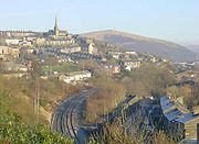
| Rochdale Rochdale Rochdale is a large market town in Greater Manchester, England. It lies amongst the foothills of the Pennines on the River Roch, north-northwest of Oldham, and north-northeast of the city of Manchester. Rochdale is surrounded by several smaller settlements which together form the Metropolitan... |
Unparished area | 97,433 | Rochdale Metropolitan Borough of Rochdale The Metropolitan Borough of Rochdale is a metropolitan borough of Greater Manchester in North West England. It is named after its largest town, Rochdale, but spans a far larger area which includes the towns of Middleton, Heywood, Littleborough and Milnrow, and the village of Wardle.The borough was... |
Rochdale County Borough County Borough of Rochdale Rochdale was, from 1856 to 1974, a local government district coterminate with the town of Rochdale in the northwest of England.-Municipal borough:... |
|
|
| Wardle | Unparished area | 8,120 | Rochdale Metropolitan Borough of Rochdale The Metropolitan Borough of Rochdale is a metropolitan borough of Greater Manchester in North West England. It is named after its largest town, Rochdale, but spans a far larger area which includes the towns of Middleton, Heywood, Littleborough and Milnrow, and the village of Wardle.The borough was... |
Wardle Urban District |
|
|
 |
Eccles Eccles, Greater Manchester Eccles is a town in the City of Salford, a metropolitan borough of Greater Manchester in North West England, west of Salford and west of Manchester city centre... |
Unparished area | 34,599 | Salford City of Salford The City of Salford is a city and metropolitan borough of Greater Manchester, England. It is named after its largest settlement, Salford, but covers a far larger area which includes the towns of Eccles, Swinton-Pendlebury, Walkden and Irlam which apart from Irlam each have a population of over... |
Eccles Municipal Borough Eccles, Greater Manchester Eccles is a town in the City of Salford, a metropolitan borough of Greater Manchester in North West England, west of Salford and west of Manchester city centre... |
|
| Irlam Irlam Irlam is a suburban town and unparished area within the City of Salford in Greater Manchester, England. At the 2001 census it had a population of 18,504. The town lies on flat ground on the south side of the M62 motorway and the north bank of the Manchester Ship Canal, and is west-southwest of... |
Unparished area | 19,125 | Salford City of Salford The City of Salford is a city and metropolitan borough of Greater Manchester, England. It is named after its largest settlement, Salford, but covers a far larger area which includes the towns of Eccles, Swinton-Pendlebury, Walkden and Irlam which apart from Irlam each have a population of over... |
Irlam Urban District Irlam Irlam is a suburban town and unparished area within the City of Salford in Greater Manchester, England. At the 2001 census it had a population of 18,504. The town lies on flat ground on the south side of the M62 motorway and the north bank of the Manchester Ship Canal, and is west-southwest of... |
|
|
 |
Salford | Unparished area | 72,721 | Salford City of Salford The City of Salford is a city and metropolitan borough of Greater Manchester, England. It is named after its largest settlement, Salford, but covers a far larger area which includes the towns of Eccles, Swinton-Pendlebury, Walkden and Irlam which apart from Irlam each have a population of over... |
Salford County Borough County Borough of Salford Salford was, from 1844 to 1974, a local government district in the northwest of England, coterminate with Salford. It was granted city status in 1926.-Free Borough and Police Commissioners:... |
|
 |
Swinton and Pendlebury Swinton and Pendlebury Swinton and Pendlebury was a local government district of the administrative county of Lancashire, England. It was created in 1894 as an urban district and enlarged in 1934, gaining the status of municipal borough.-Constituent civil parishes:... |
Unparished area | 36,928 | Salford City of Salford The City of Salford is a city and metropolitan borough of Greater Manchester, England. It is named after its largest settlement, Salford, but covers a far larger area which includes the towns of Eccles, Swinton-Pendlebury, Walkden and Irlam which apart from Irlam each have a population of over... |
Swinton and Pendlebury Municipal Borough Swinton and Pendlebury Swinton and Pendlebury was a local government district of the administrative county of Lancashire, England. It was created in 1894 as an urban district and enlarged in 1934, gaining the status of municipal borough.-Constituent civil parishes:... |
|
 |
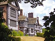
Worsley Worsley Worsley is a town in the metropolitan borough of the City of Salford, in Greater Manchester, England. It lies along the course of Worsley Brook, west of Manchester. The M60 motorway bisects the area.... |
Unparished area | 52,730 | Salford City of Salford The City of Salford is a city and metropolitan borough of Greater Manchester, England. It is named after its largest settlement, Salford, but covers a far larger area which includes the towns of Eccles, Swinton-Pendlebury, Walkden and Irlam which apart from Irlam each have a population of over... |
Worsley Urban District Worsley Worsley is a town in the metropolitan borough of the City of Salford, in Greater Manchester, England. It lies along the course of Worsley Brook, west of Manchester. The M60 motorway bisects the area.... |
|
| Bredbury and Romiley Bredbury and Romiley Bredbury and Romiley was an urban district in the administrative county of Cheshire, England from 1894 to 1974, which covered the Civil Parishes of Bredbury, Compstall and Romiley.... |
Unparished area | 28,829 | Stockport Metropolitan Borough of Stockport The Metropolitan Borough of Stockport is a metropolitan borough of Greater Manchester, in north west England, centred around the town of Stockport. It has a population of about 280,600 and includes the outyling areas of Cheadle and Cheadle Hulme, Marple, Bredbury, Reddish and Romiley... |
Bredbury and Romiley Urban District Bredbury and Romiley Bredbury and Romiley was an urban district in the administrative county of Cheshire, England from 1894 to 1974, which covered the Civil Parishes of Bredbury, Compstall and Romiley.... |
|
|
| Cheadle and Gatley | Unparished area | 57,224 | Stockport Metropolitan Borough of Stockport The Metropolitan Borough of Stockport is a metropolitan borough of Greater Manchester, in north west England, centred around the town of Stockport. It has a population of about 280,600 and includes the outyling areas of Cheadle and Cheadle Hulme, Marple, Bredbury, Reddish and Romiley... |
Cheadle and Gatley Urban District |
|
|
 |
Hazel Grove and Bramhall Hazel Grove and Bramhall Hazel Grove and Bramhall was a civil parish and urban district in north east Cheshire, England from 1900 to 1974.It was created in 1900 covering, from Stockport Rural District, the former area of the civil parishes of:*Bosden*Bramhall*Norbury*Offerton... |
Unparished area | 41,202 | Stockport Metropolitan Borough of Stockport The Metropolitan Borough of Stockport is a metropolitan borough of Greater Manchester, in north west England, centred around the town of Stockport. It has a population of about 280,600 and includes the outyling areas of Cheadle and Cheadle Hulme, Marple, Bredbury, Reddish and Romiley... |
Hazel Grove and Bramhall Urban District Hazel Grove and Bramhall Hazel Grove and Bramhall was a civil parish and urban district in north east Cheshire, England from 1900 to 1974.It was created in 1900 covering, from Stockport Rural District, the former area of the civil parishes of:*Bosden*Bramhall*Norbury*Offerton... |
|
| Marple Marple, Greater Manchester Marple is a small town within the Metropolitan Borough of Stockport, in Greater Manchester, England. It lies on the River Goyt southeast of Stockport.Historically part of Cheshire, Marple has a population of 23,480 .-Toponymy:... |
Unparished area | 23,480 | Stockport Metropolitan Borough of Stockport The Metropolitan Borough of Stockport is a metropolitan borough of Greater Manchester, in north west England, centred around the town of Stockport. It has a population of about 280,600 and includes the outyling areas of Cheadle and Cheadle Hulme, Marple, Bredbury, Reddish and Romiley... |
Marple Urban District Marple, Greater Manchester Marple is a small town within the Metropolitan Borough of Stockport, in Greater Manchester, England. It lies on the River Goyt southeast of Stockport.Historically part of Cheshire, Marple has a population of 23,480 .-Toponymy:... |
|
|
| Offerton Park | Civil parish | 3,762 | Stockport Metropolitan Borough of Stockport The Metropolitan Borough of Stockport is a metropolitan borough of Greater Manchester, in north west England, centred around the town of Stockport. It has a population of about 280,600 and includes the outyling areas of Cheadle and Cheadle Hulme, Marple, Bredbury, Reddish and Romiley... |
Stockport County Borough County Borough of Stockport Stockport was a local government district centred on Stockport in the northwest of England from 1835 to 1974.The district was created by the Municipal Corporations Act 1835 when the existing Borough of Stockport was reformed as a municipal borough. Until 1835 the town was governed by a charter... |
|
|
| Stockport Stockport Stockport is a town in Greater Manchester, England. It lies on elevated ground southeast of Manchester city centre, at the point where the rivers Goyt and Tame join and create the River Mersey. Stockport is the largest settlement in the metropolitan borough of the same name... |
Unparished area | 130,031 | Stockport Metropolitan Borough of Stockport The Metropolitan Borough of Stockport is a metropolitan borough of Greater Manchester, in north west England, centred around the town of Stockport. It has a population of about 280,600 and includes the outyling areas of Cheadle and Cheadle Hulme, Marple, Bredbury, Reddish and Romiley... |
Stockport County Borough County Borough of Stockport Stockport was a local government district centred on Stockport in the northwest of England from 1835 to 1974.The district was created by the Municipal Corporations Act 1835 when the existing Borough of Stockport was reformed as a municipal borough. Until 1835 the town was governed by a charter... |
|
|
 |
Ashton under Lyne Ashton-under-Lyne Ashton-under-Lyne is a market town in the Metropolitan Borough of Tameside, Greater Manchester, England. Historically a part of Lancashire, it lies on the north bank of the River Tame, on undulating land at the foothills of the Pennines... |
Unparished area | 43,526 | Tameside Tameside The Metropolitan Borough of Tameside is a metropolitan borough of Greater Manchester in North West England. It is named after the River Tame which flows through the borough and spans the towns of Ashton-under-Lyne, Audenshaw, Denton, Droylsden, Dukinfield, Hyde, Mossley and Stalybridge. Its western... |
Ashton under Lyne Municipal Borough Ashton-under-Lyne Ashton-under-Lyne is a market town in the Metropolitan Borough of Tameside, Greater Manchester, England. Historically a part of Lancashire, it lies on the north bank of the River Tame, on undulating land at the foothills of the Pennines... |
|
| Audenshaw Audenshaw Audenshaw is a town within the Metropolitan Borough of Tameside, in Greater Manchester, England. It is located on the east side of the River Tame, along the course of both the M60 motorway and the Ashton Canal, southwest of Ashton-under-Lyne and east of the city of Manchester... |
Unparished area | 12,790 | Tameside Tameside The Metropolitan Borough of Tameside is a metropolitan borough of Greater Manchester in North West England. It is named after the River Tame which flows through the borough and spans the towns of Ashton-under-Lyne, Audenshaw, Denton, Droylsden, Dukinfield, Hyde, Mossley and Stalybridge. Its western... |
Audenshaw Urban District Audenshaw Audenshaw is a town within the Metropolitan Borough of Tameside, in Greater Manchester, England. It is located on the east side of the River Tame, along the course of both the M60 motorway and the Ashton Canal, southwest of Ashton-under-Lyne and east of the city of Manchester... |
|
|
| Denton Denton, Greater Manchester Denton is a town within the Metropolitan Borough of Tameside, in Greater Manchester, England. It is five miles to the east of Manchester city centre, and has a population of 26,866.... |
Unparished area | 34,280 | Tameside Tameside The Metropolitan Borough of Tameside is a metropolitan borough of Greater Manchester in North West England. It is named after the River Tame which flows through the borough and spans the towns of Ashton-under-Lyne, Audenshaw, Denton, Droylsden, Dukinfield, Hyde, Mossley and Stalybridge. Its western... |
Denton Urban District Denton Urban District Denton Urban District was a local government district in England from 1894 to 1974.Denton was originally a township in the ancient parish of Manchester in the Salford Hundred of Lancashire. In 1866 it became a civil parish in its own right. The Denton parish was expanded on 31 December 1894 by... |
|
|
 |
Droylsden Droylsden Droylsden is a town within the Metropolitan Borough of Tameside, in Greater Manchester, England. It is to the east of Manchester city centre, and west-southwest of Ashton-under-Lyne, it has a population of 23,172.... |
Unparished area | 23,172 | Tameside Tameside The Metropolitan Borough of Tameside is a metropolitan borough of Greater Manchester in North West England. It is named after the River Tame which flows through the borough and spans the towns of Ashton-under-Lyne, Audenshaw, Denton, Droylsden, Dukinfield, Hyde, Mossley and Stalybridge. Its western... |
Droylsden Urban District Droylsden Droylsden is a town within the Metropolitan Borough of Tameside, in Greater Manchester, England. It is to the east of Manchester city centre, and west-southwest of Ashton-under-Lyne, it has a population of 23,172.... |
|
 |
Dukinfield Dukinfield Dukinfield is a small town within the Metropolitan Borough of Tameside, in Greater Manchester, England. It lies in central Tameside on the south bank of the River Tame, opposite Ashton-under-Lyne, and is east of the city of Manchester... |
Unparished area | 19,278 | Tameside Tameside The Metropolitan Borough of Tameside is a metropolitan borough of Greater Manchester in North West England. It is named after the River Tame which flows through the borough and spans the towns of Ashton-under-Lyne, Audenshaw, Denton, Droylsden, Dukinfield, Hyde, Mossley and Stalybridge. Its western... |
Dukinfield Municipal Borough Dukinfield Dukinfield is a small town within the Metropolitan Borough of Tameside, in Greater Manchester, England. It lies in central Tameside on the south bank of the River Tame, opposite Ashton-under-Lyne, and is east of the city of Manchester... |
|
| Hyde Hyde, Greater Manchester Hyde is a town in the Metropolitan Borough of Tameside, Greater Manchester, England. As of the 2001 census, the town had a population of 31,253. Historically part of Cheshire, it is northeast of Stockport, west of Glossop and east of Manchester.... |
Unparished area | 34,602 | Tameside Tameside The Metropolitan Borough of Tameside is a metropolitan borough of Greater Manchester in North West England. It is named after the River Tame which flows through the borough and spans the towns of Ashton-under-Lyne, Audenshaw, Denton, Droylsden, Dukinfield, Hyde, Mossley and Stalybridge. Its western... |
Hyde Municipal Borough Hyde, Greater Manchester Hyde is a town in the Metropolitan Borough of Tameside, Greater Manchester, England. As of the 2001 census, the town had a population of 31,253. Historically part of Cheshire, it is northeast of Stockport, west of Glossop and east of Manchester.... |
|
|
| Longdendale Longdendale Longdendale is a valley in the north of England, north of Glossop and south east of Holmfirth. The name means "long wooded valley".- Geography :... |
Unparished area | 9,733 | Tameside Tameside The Metropolitan Borough of Tameside is a metropolitan borough of Greater Manchester in North West England. It is named after the River Tame which flows through the borough and spans the towns of Ashton-under-Lyne, Audenshaw, Denton, Droylsden, Dukinfield, Hyde, Mossley and Stalybridge. Its western... |
Longdendale Urban District Longendale Urban District Longendale Urban District was, from 1936 to 1974, a local government district in the administrative county of Cheshire, England... |
|
|
 |
Mossley Mossley Mossley is a small town and civil parish within the Metropolitan Borough of Tameside, in Greater Manchester, England. The town is located in the upper section of the Tame valley in the foothills of the Pennines, northeast of Ashton-under-Lyne and east of Manchester.Mossley has the distinction of... |
Town | 9,856 | Tameside Tameside The Metropolitan Borough of Tameside is a metropolitan borough of Greater Manchester in North West England. It is named after the River Tame which flows through the borough and spans the towns of Ashton-under-Lyne, Audenshaw, Denton, Droylsden, Dukinfield, Hyde, Mossley and Stalybridge. Its western... |
Mossley Municipal Borough Mossley Mossley is a small town and civil parish within the Metropolitan Borough of Tameside, in Greater Manchester, England. The town is located in the upper section of the Tame valley in the foothills of the Pennines, northeast of Ashton-under-Lyne and east of Manchester.Mossley has the distinction of... |
|
 |
Stalybridge Stalybridge Stalybridge is a town in the Metropolitan Borough of Tameside in Greater Manchester, England, with a population of 22,568. Historically a part of Cheshire, it is east of Manchester city centre and northwest of Glossop. With the construction of a cotton mill in 1776, Stalybridge became one of... |
Unparished area | 25,806 | Tameside Tameside The Metropolitan Borough of Tameside is a metropolitan borough of Greater Manchester in North West England. It is named after the River Tame which flows through the borough and spans the towns of Ashton-under-Lyne, Audenshaw, Denton, Droylsden, Dukinfield, Hyde, Mossley and Stalybridge. Its western... |
Stalybridge Municipal Borough Stalybridge Stalybridge is a town in the Metropolitan Borough of Tameside in Greater Manchester, England, with a population of 22,568. Historically a part of Cheshire, it is east of Manchester city centre and northwest of Glossop. With the construction of a cotton mill in 1776, Stalybridge became one of... |
|
 |
Altrincham Altrincham Altrincham is a market town within the Metropolitan Borough of Trafford, in Greater Manchester, England. It lies on flat ground south of the River Mersey about southwest of Manchester city centre, south-southwest of Sale and east of Warrington... |
Unparished area | 40,376 | Trafford Trafford The Metropolitan Borough of Trafford is a metropolitan borough of Greater Manchester, England. It has a population of 211,800, covers , and includes the towns of Altrincham, Partington, Sale, Stretford, and Urmston... |
Altrincham Municipal Borough Altrincham Altrincham is a market town within the Metropolitan Borough of Trafford, in Greater Manchester, England. It lies on flat ground south of the River Mersey about southwest of Manchester city centre, south-southwest of Sale and east of Warrington... |
|
 |
Bowdon Bowdon, Greater Manchester Bowdon is a suburban village and electoral ward in the Altrincham area of the Metropolitan Borough of Trafford, in Greater Manchester, England.-History:... |
Unparished area | 6,079 | Trafford Trafford The Metropolitan Borough of Trafford is a metropolitan borough of Greater Manchester, England. It has a population of 211,800, covers , and includes the towns of Altrincham, Partington, Sale, Stretford, and Urmston... |
Bowdon Urban District Bowdon, Greater Manchester Bowdon is a suburban village and electoral ward in the Altrincham area of the Metropolitan Borough of Trafford, in Greater Manchester, England.-History:... |
|
 |
Carrington Carrington, Greater Manchester Carrington is a village and civil parish in the Metropolitan Borough of Trafford, Greater Manchester, England. Historically a part of Cheshire, the village is west of Greater Manchester Urban Area, and is the site of a large gas and chemical works, which produce gases by fractional distillation of... |
Civil parish | 396 | Trafford Trafford The Metropolitan Borough of Trafford is a metropolitan borough of Greater Manchester, England. It has a population of 211,800, covers , and includes the towns of Altrincham, Partington, Sale, Stretford, and Urmston... |
Bucklow Rural District Bucklow Rural District Bucklow Rural District was, from 1894 to 1974, a local government district in the north of the administrative county of Cheshire, England. Following the Local Government Act 1972, this rural district was split between the new Greater Manchester boroughs of Trafford and Manchester, and Macclesfield,... |
|
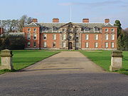 |
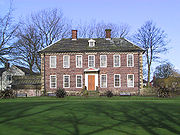
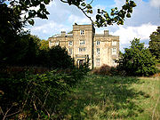
Dunham Massey Dunham Massey Dunham Massey is a civil parish in the Metropolitan Borough of Trafford, Greater Manchester, England. The parish includes the villages of Sinderland Green, Dunham Woodhouse and Dunham Town, along with Dunham Massey Park, formerly the home of the last Earl of Stamford and owned by the National Trust... |
Civil parish | 475 | Trafford Trafford The Metropolitan Borough of Trafford is a metropolitan borough of Greater Manchester, England. It has a population of 211,800, covers , and includes the towns of Altrincham, Partington, Sale, Stretford, and Urmston... |
Bucklow Rural District Bucklow Rural District Bucklow Rural District was, from 1894 to 1974, a local government district in the north of the administrative county of Cheshire, England. Following the Local Government Act 1972, this rural district was split between the new Greater Manchester boroughs of Trafford and Manchester, and Macclesfield,... |
|
 |
Hale Hale, Greater Manchester Hale is a village and electoral ward within the Metropolitan Borough of Trafford, in Greater Manchester, England. It is contiguous with the southeast of Altrincham, approximately southwest of the city of Manchester.... |
Unparished area | 15,316 | Trafford Trafford The Metropolitan Borough of Trafford is a metropolitan borough of Greater Manchester, England. It has a population of 211,800, covers , and includes the towns of Altrincham, Partington, Sale, Stretford, and Urmston... |
Hale Urban District Hale, Greater Manchester Hale is a village and electoral ward within the Metropolitan Borough of Trafford, in Greater Manchester, England. It is contiguous with the southeast of Altrincham, approximately southwest of the city of Manchester.... |
|
 |
Partington | Town | 7,327 | Trafford Trafford The Metropolitan Borough of Trafford is a metropolitan borough of Greater Manchester, England. It has a population of 211,800, covers , and includes the towns of Altrincham, Partington, Sale, Stretford, and Urmston... |
Bucklow Rural District Bucklow Rural District Bucklow Rural District was, from 1894 to 1974, a local government district in the north of the administrative county of Cheshire, England. Following the Local Government Act 1972, this rural district was split between the new Greater Manchester boroughs of Trafford and Manchester, and Macclesfield,... |
|
| Sale Sale, Greater Manchester Sale is a town within the Metropolitan Borough of Trafford, in Greater Manchester, England. Historically part of Cheshire, the town lies on flat ground on the south bank of the River Mersey, south of Stretford, northeast of Altrincham, and southwest of the city of Manchester... |
Unparished area | 56,823 | Trafford Trafford The Metropolitan Borough of Trafford is a metropolitan borough of Greater Manchester, England. It has a population of 211,800, covers , and includes the towns of Altrincham, Partington, Sale, Stretford, and Urmston... |
Sale Municipal Borough Municipal Borough of Sale Sale was, from 1867 to 1974, a district in Cheshire, England. The district had in turn the status of local government district, urban district and municipal borough.-Local Board and Urban District:... |
|
|
 |
Stretford Stretford Stretford is a town within the Metropolitan Borough of Trafford, in Greater Manchester, England. Lying on flat ground between the River Mersey and the Manchester Ship Canal, it is to the southwest of Manchester city centre, south-southwest of Salford and northeast of Altrincham... |
Unparished area | 42,103 | Trafford Trafford The Metropolitan Borough of Trafford is a metropolitan borough of Greater Manchester, England. It has a population of 211,800, covers , and includes the towns of Altrincham, Partington, Sale, Stretford, and Urmston... |
Stretford Municipal Borough Municipal Borough of Stretford Stretford was, from 1868 to 1974, a local government district coterminate with the town of Stretford in the then county of Lancashire, England.-Local Board and Urban District:... |
|
| Urmston Urmston Urmston is a town within the Metropolitan Borough of Trafford, in Greater Manchester, England, with a population of around 41,000. Historically a part of Lancashire, it lies about six miles to the southwest of Manchester city centre. The southern boundary is marked by the River Mersey and the... |
Unparished area | 40,964 | Trafford Trafford The Metropolitan Borough of Trafford is a metropolitan borough of Greater Manchester, England. It has a population of 211,800, covers , and includes the towns of Altrincham, Partington, Sale, Stretford, and Urmston... |
Urmston Urban District Urmston Urban District Urmston Urban District was, from 1894 to 1974, a local government district in the administrative county of Lancashire, England which covered the modern-day district of Urmston.The Urban District was created by the Local Government Act 1894... |
|
|
 |
Warburton Warburton, Greater Manchester Warburton is a village and civil parish within the Metropolitan Borough of Trafford in Greater Manchester, England. Historically a part of Cheshire, Warburton lies on the south bank of the River Mersey between the borough of Warrington and Greater Manchester. Today, the village remains... |
Civil parish | 286 | Trafford Trafford The Metropolitan Borough of Trafford is a metropolitan borough of Greater Manchester, England. It has a population of 211,800, covers , and includes the towns of Altrincham, Partington, Sale, Stretford, and Urmston... |
Bucklow Rural District Bucklow Rural District Bucklow Rural District was, from 1894 to 1974, a local government district in the north of the administrative county of Cheshire, England. Following the Local Government Act 1972, this rural district was split between the new Greater Manchester boroughs of Trafford and Manchester, and Macclesfield,... |
|
 |
Abram Abram, Greater Manchester Abram is a village and electoral ward within the Metropolitan Borough of Wigan, in Greater Manchester, England. It lies on flat land on the northeast bank of the Leeds and Liverpool Canal, west of Leigh, southeast of Wigan, and west of Manchester... |
Unparished area | 13,706 | Wigan Metropolitan Borough of Wigan The Metropolitan Borough of Wigan is a metropolitan borough of Greater Manchester, in North West England. It is named after its largest component town, Wigan and also includes the towns of Leigh, Ashton-in-Makerfield, Ince-in-Makerfield, and Hindley. The borough was formed in 1974 and is an... |
Abram Urban District Abram, Greater Manchester Abram is a village and electoral ward within the Metropolitan Borough of Wigan, in Greater Manchester, England. It lies on flat land on the northeast bank of the Leeds and Liverpool Canal, west of Leigh, southeast of Wigan, and west of Manchester... |
|
| Ashton in Makerfield Ashton-in-Makerfield Ashton-in-Makerfield is a town in the Metropolitan Borough of Wigan, Greater Manchester. It is situated south of Wigan, north-northwest of Warrington and west of the city of Manchester. In 2001 it had a population of 28,505.... |
Unparished area | 23,431 | Wigan Metropolitan Borough of Wigan The Metropolitan Borough of Wigan is a metropolitan borough of Greater Manchester, in North West England. It is named after its largest component town, Wigan and also includes the towns of Leigh, Ashton-in-Makerfield, Ince-in-Makerfield, and Hindley. The borough was formed in 1974 and is an... |
Ashton in Makerfield Urban District Ashton-in-Makerfield Ashton-in-Makerfield is a town in the Metropolitan Borough of Wigan, Greater Manchester. It is situated south of Wigan, north-northwest of Warrington and west of the city of Manchester. In 2001 it had a population of 28,505.... |
|
|
 |
Aspull | Unparished area | 5,522 | Wigan Metropolitan Borough of Wigan The Metropolitan Borough of Wigan is a metropolitan borough of Greater Manchester, in North West England. It is named after its largest component town, Wigan and also includes the towns of Leigh, Ashton-in-Makerfield, Ince-in-Makerfield, and Hindley. The borough was formed in 1974 and is an... |
Aspull Urban District |
|
 |
Atherton Atherton, Greater Manchester Atherton is a town within the Metropolitan Borough of Wigan, in Greater Manchester, England, historically a part of Lancashire. It is east of Wigan, north-northeast of Leigh, and northwest of Manchester... |
Unparished area | 18,876 | Wigan Metropolitan Borough of Wigan The Metropolitan Borough of Wigan is a metropolitan borough of Greater Manchester, in North West England. It is named after its largest component town, Wigan and also includes the towns of Leigh, Ashton-in-Makerfield, Ince-in-Makerfield, and Hindley. The borough was formed in 1974 and is an... |
Atherton Urban District Atherton, Greater Manchester Atherton is a town within the Metropolitan Borough of Wigan, in Greater Manchester, England, historically a part of Lancashire. It is east of Wigan, north-northeast of Leigh, and northwest of Manchester... |
|
 |
Billinge Higher End and Winstanley Billinge and Winstanley Urban District Billinge was, from 1894 to 1974, a local government district in the administrative county of Lancashire, England.... |
Unparished area | 6,731 | Wigan Metropolitan Borough of Wigan The Metropolitan Borough of Wigan is a metropolitan borough of Greater Manchester, in North West England. It is named after its largest component town, Wigan and also includes the towns of Leigh, Ashton-in-Makerfield, Ince-in-Makerfield, and Hindley. The borough was formed in 1974 and is an... |
Billinge and Winstanley Urban District Billinge and Winstanley Urban District Billinge was, from 1894 to 1974, a local government district in the administrative county of Lancashire, England.... |
|
| Golborne Golborne Golborne is a town within the Metropolitan Borough of Wigan, in Greater Manchester, England.It lies south-southeast of Wigan, northeast of Warrington and to the west of the city of Manchester. It has a population of 23,119.... |
Unparished area | 23,214 | Wigan Metropolitan Borough of Wigan The Metropolitan Borough of Wigan is a metropolitan borough of Greater Manchester, in North West England. It is named after its largest component town, Wigan and also includes the towns of Leigh, Ashton-in-Makerfield, Ince-in-Makerfield, and Hindley. The borough was formed in 1974 and is an... |
Golborne Urban District Golborne Golborne is a town within the Metropolitan Borough of Wigan, in Greater Manchester, England.It lies south-southeast of Wigan, northeast of Warrington and to the west of the city of Manchester. It has a population of 23,119.... |
|
|
 |
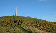
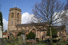
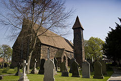
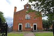
Haigh Haigh, Greater Manchester Haigh is a village and civil parish of the Metropolitan Borough of Wigan in Greater Manchester, England. Historically a part of Lancashire, it is located next to the village of Aspull. The western boundary is the River Douglas which separates the township from Wigan. To the north a small brook... |
Civil parish | 594 | Wigan Metropolitan Borough of Wigan The Metropolitan Borough of Wigan is a metropolitan borough of Greater Manchester, in North West England. It is named after its largest component town, Wigan and also includes the towns of Leigh, Ashton-in-Makerfield, Ince-in-Makerfield, and Hindley. The borough was formed in 1974 and is an... |
Wigan Rural District Wigan Rural District Wigan was a rural district in Lancashire, England from 1894 to 1974. It comprised an area to the north, but did not include the town Wigan.The district was created by the Local Government Act 1894 as the successor to the Wigan Rural Sanitary District.... |
|
.jpg) |
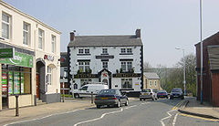
Hindley Hindley, Greater Manchester Hindley is a town within the Metropolitan Borough of Wigan in Greater Manchester, England. Lying three miles east of Wigan it covers an area of 1044 hectares. Historically a part of Lancashire, Hindley which includes Hindley Green borders the towns of Ince-in-Makerfield and Leigh within Wigan... |
Unparished area | 22,769 | Wigan Metropolitan Borough of Wigan The Metropolitan Borough of Wigan is a metropolitan borough of Greater Manchester, in North West England. It is named after its largest component town, Wigan and also includes the towns of Leigh, Ashton-in-Makerfield, Ince-in-Makerfield, and Hindley. The borough was formed in 1974 and is an... |
Hindley Urban District Hindley, Greater Manchester Hindley is a town within the Metropolitan Borough of Wigan in Greater Manchester, England. Lying three miles east of Wigan it covers an area of 1044 hectares. Historically a part of Lancashire, Hindley which includes Hindley Green borders the towns of Ince-in-Makerfield and Leigh within Wigan... |
|
| Ince in Makerfield Ince-in-Makerfield Ince-in-Makerfield, usually known just as Ince is a district of the Metropolitan Borough of Wigan, in Greater Manchester, England.Ince is contiguous to Wigan and serves as a residential suburb of Wigan, Being divided locally by a train line into two separate areas - Higher Ince and Lower Ince,... |
Unparished area | 10,184 | Wigan Metropolitan Borough of Wigan The Metropolitan Borough of Wigan is a metropolitan borough of Greater Manchester, in North West England. It is named after its largest component town, Wigan and also includes the towns of Leigh, Ashton-in-Makerfield, Ince-in-Makerfield, and Hindley. The borough was formed in 1974 and is an... |
Ince in Makerfield Urban District Ince-in-Makerfield Ince-in-Makerfield, usually known just as Ince is a district of the Metropolitan Borough of Wigan, in Greater Manchester, England.Ince is contiguous to Wigan and serves as a residential suburb of Wigan, Being divided locally by a train line into two separate areas - Higher Ince and Lower Ince,... |
|
|
 |
Leigh Leigh, Greater Manchester Leigh is a town within the Metropolitan Borough of Wigan, in Greater Manchester, England. It is southeast of Wigan, and west of Manchester. Leigh is situated on low lying land to the north west of Chat Moss.... |
Unparished area | 44,436 | Wigan Metropolitan Borough of Wigan The Metropolitan Borough of Wigan is a metropolitan borough of Greater Manchester, in North West England. It is named after its largest component town, Wigan and also includes the towns of Leigh, Ashton-in-Makerfield, Ince-in-Makerfield, and Hindley. The borough was formed in 1974 and is an... |
Leigh Municipal Borough Municipal Borough of Leigh The Municipal Borough of Leigh was, from 1894 to 1974, a local government district of the administrative county of Lancashire, England, consisting of the townships of Pennington, Westleigh, Bedford and part of the township of Atherton and named after the ancient Parish of Leigh... |
|
| Orrell Orrell, Greater Manchester Orrell is an area of the Metropolitan Borough of Wigan, Greater Manchester, England. The area is contiguous to the town of Wigan itself and the centre of the district is situated to the west of the town centre... |
Unparished area | 11,988 | Wigan Metropolitan Borough of Wigan The Metropolitan Borough of Wigan is a metropolitan borough of Greater Manchester, in North West England. It is named after its largest component town, Wigan and also includes the towns of Leigh, Ashton-in-Makerfield, Ince-in-Makerfield, and Hindley. The borough was formed in 1974 and is an... |
Orrell Urban District Orrell Urban District Orrell Urban District was, from 1894 to 1974, a local government district in the administrative county of Lancashire, England. Its boundaries were centred on Orrell, but also included parts of Upholland.... |
|
|
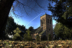
| Shevington Shevington Shevington is a village and civil parish within the Metropolitan Borough of Wigan, in Greater Manchester, England.Lying within the historic county boundaries of Lancashire, Shevington lies approximately from Wigan town centre and at the 2001 census had a population of 9,786.-Topynomy:Shevington, a... |
Civil parish | 9,786 | Wigan Metropolitan Borough of Wigan The Metropolitan Borough of Wigan is a metropolitan borough of Greater Manchester, in North West England. It is named after its largest component town, Wigan and also includes the towns of Leigh, Ashton-in-Makerfield, Ince-in-Makerfield, and Hindley. The borough was formed in 1974 and is an... |
Wigan Rural District Wigan Rural District Wigan was a rural district in Lancashire, England from 1894 to 1974. It comprised an area to the north, but did not include the town Wigan.The district was created by the Local Government Act 1894 as the successor to the Wigan Rural Sanitary District.... |
|
|
| Standish with Langtree Standish, Greater Manchester Standish is a village within the Metropolitan Borough of Wigan, in Greater Manchester, England. It is located on the A49 road between the towns of Chorley and Wigan, a short distance from Junction 27 of the M6 motorway.... |
Unparished area | 13,309 | Wigan Metropolitan Borough of Wigan The Metropolitan Borough of Wigan is a metropolitan borough of Greater Manchester, in North West England. It is named after its largest component town, Wigan and also includes the towns of Leigh, Ashton-in-Makerfield, Ince-in-Makerfield, and Hindley. The borough was formed in 1974 and is an... |
Standish with Langtree Urban District Standish-with-Langtree Standish-with-Langtree was, and to a limited extent remains, the name of a local government district centred on Standish, Greater Manchester, in North West England. Historically the name applied to an ancient township in the hundred of West Derby and county of Lancashire... |
|
|
 |
Tyldesley Tyldesley Tyldesley is a town within the Metropolitan Borough of Wigan, in Greater Manchester, England. It occupies an area north of Chat Moss near the foothills of the West Pennine Moors, east-southeast of Wigan and west-northwest of the city of Manchester... |
Unparished area | 24,371 | Wigan Metropolitan Borough of Wigan The Metropolitan Borough of Wigan is a metropolitan borough of Greater Manchester, in North West England. It is named after its largest component town, Wigan and also includes the towns of Leigh, Ashton-in-Makerfield, Ince-in-Makerfield, and Hindley. The borough was formed in 1974 and is an... |
Tyldesley Urban District Tyldesley Tyldesley is a town within the Metropolitan Borough of Wigan, in Greater Manchester, England. It occupies an area north of Chat Moss near the foothills of the West Pennine Moors, east-southeast of Wigan and west-northwest of the city of Manchester... |
|
| Wigan Wigan Wigan is a town in Greater Manchester, England. It stands on the River Douglas, south-west of Bolton, north of Warrington and west-northwest of Manchester. Wigan is the largest settlement in the Metropolitan Borough of Wigan and is its administrative centre. The town of Wigan had a total... |
Unparished area | 72,363 | Wigan Metropolitan Borough of Wigan The Metropolitan Borough of Wigan is a metropolitan borough of Greater Manchester, in North West England. It is named after its largest component town, Wigan and also includes the towns of Leigh, Ashton-in-Makerfield, Ince-in-Makerfield, and Hindley. The borough was formed in 1974 and is an... |
Wigan County Borough County Borough of Wigan The County Borough of Wigan was, from 1889 to 1974, a local government district centred on Wigan in the northwest of England. It was alternatively known as Wigan County Borough.... |
|
|
| Worthington Worthington, Greater Manchester Worthington is a civil parish within the Metropolitan Borough of Wigan, in Greater Manchester, England, about north of Wigan. The parish is very sparsely populated, at the 2001 census having a population of 135, and does not have an active parish council or parish meeting.It used to have a... |
Civil parish | 135 | Wigan Metropolitan Borough of Wigan The Metropolitan Borough of Wigan is a metropolitan borough of Greater Manchester, in North West England. It is named after its largest component town, Wigan and also includes the towns of Leigh, Ashton-in-Makerfield, Ince-in-Makerfield, and Hindley. The borough was formed in 1974 and is an... |
Wigan Rural District Wigan Rural District Wigan was a rural district in Lancashire, England from 1894 to 1974. It comprised an area to the north, but did not include the town Wigan.The district was created by the Local Government Act 1894 as the successor to the Wigan Rural Sanitary District.... |
|